Notes: Brief exposed 4th class scrambling along ridge. Confirm caribou restriction dates before entering the area.
Trip Report
Geraldine Peak can be done as a day trip if preferred, but the idyllic campsite is relatively easy to find a vacancy for and is worthy of a stay. Plus, backcountry reservations are cheaper than frontcountry reservations. Go on, treat yourself.
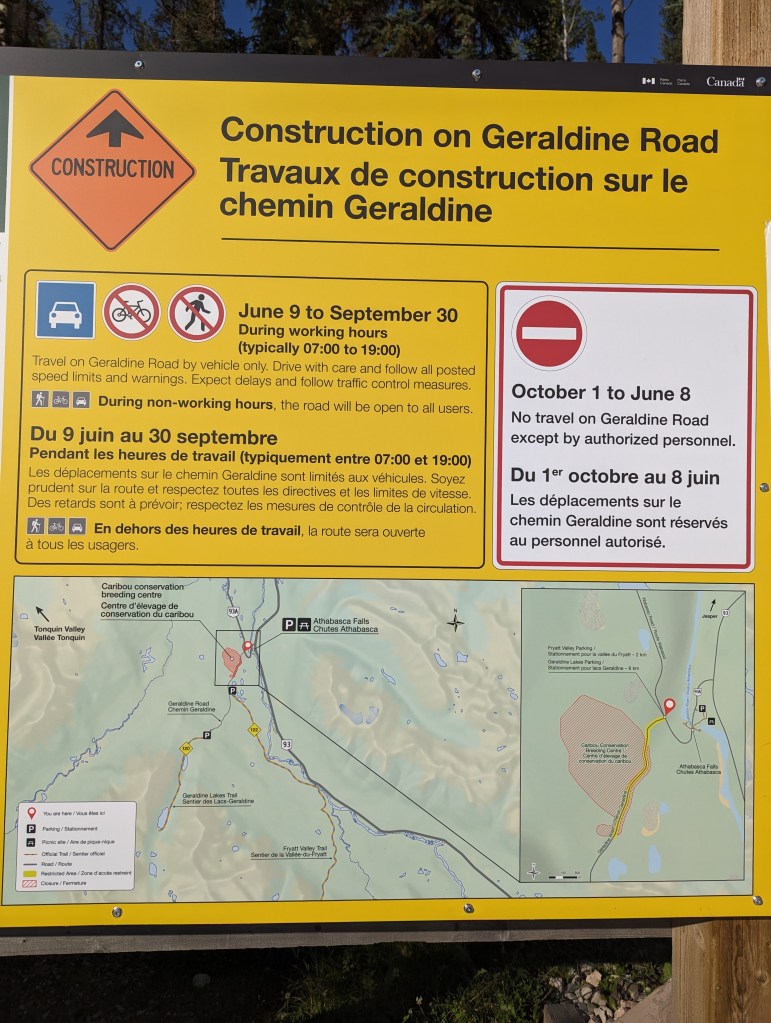
As of 2023, Geraldine Road is part of a construction zone to create a caribou conservation center. Construction will continue in 2024. To enter the area, simply stop at the gate (off to the side, out of the way of equipment) and follow the instructions to radio for an escort through the active zone. The wait is less than 15 min. Once past the construction zone, your escort will close another gate behind you. From here there is still a good length of road to drive. The road is getting a bit bumpy, but is still doable in dry conditions with 2WD – Just watch where you position your wheels to avoid bottoming out.
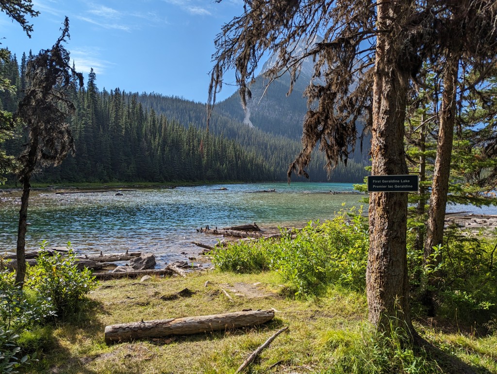
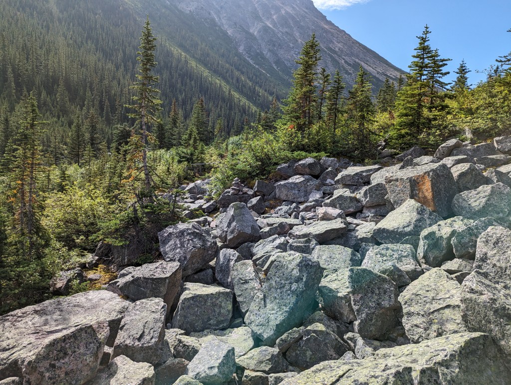
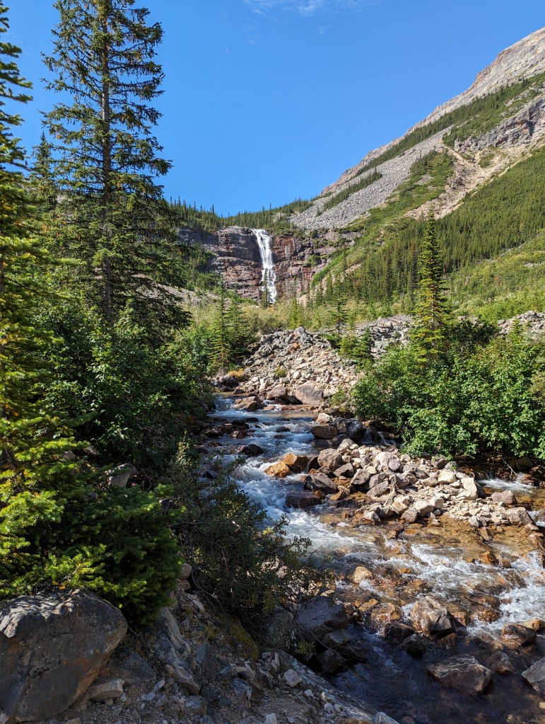
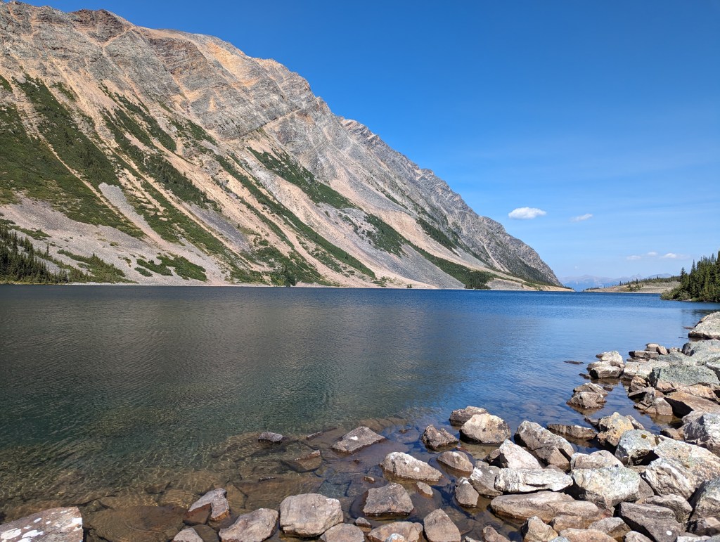
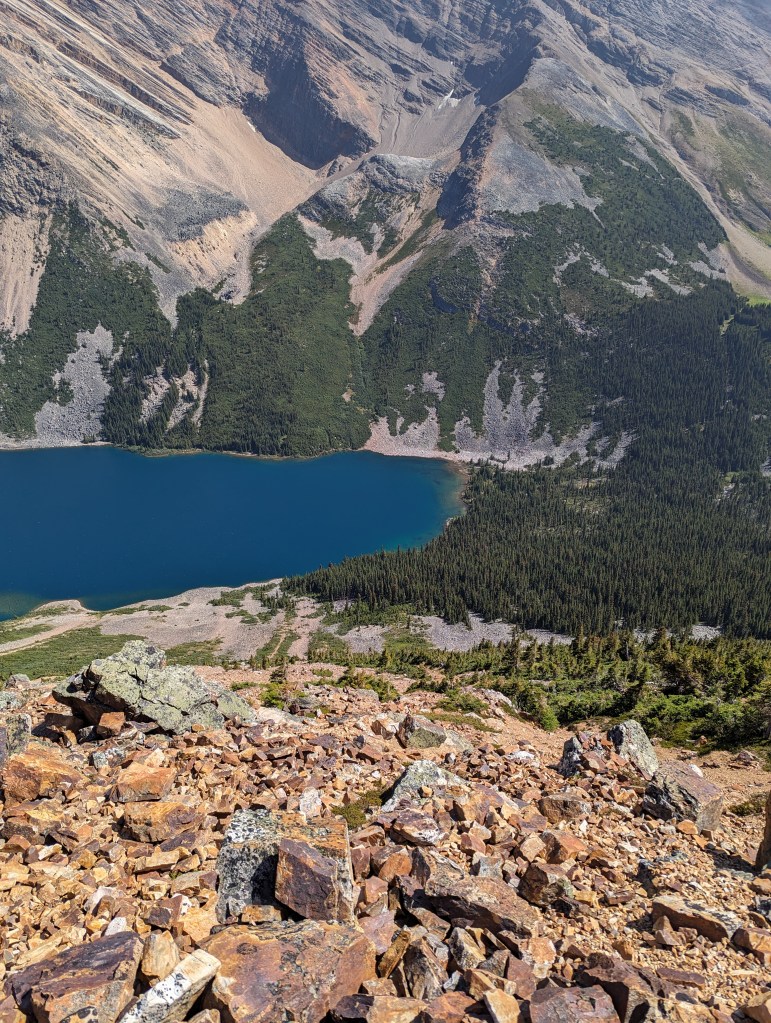
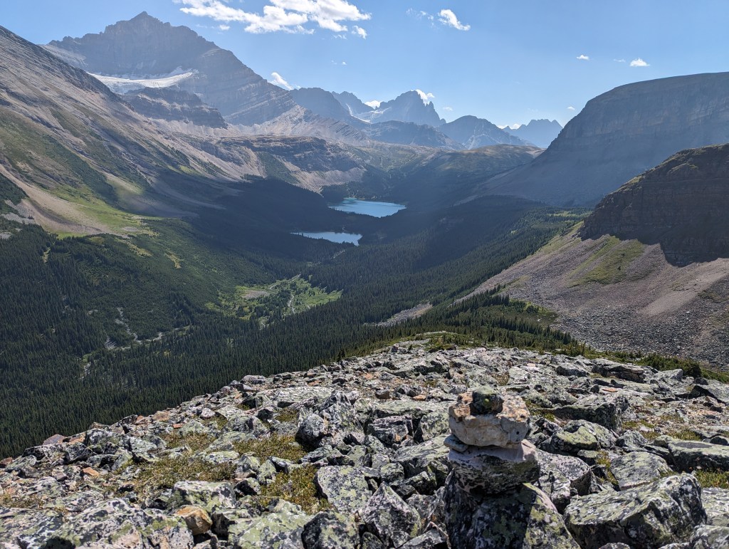
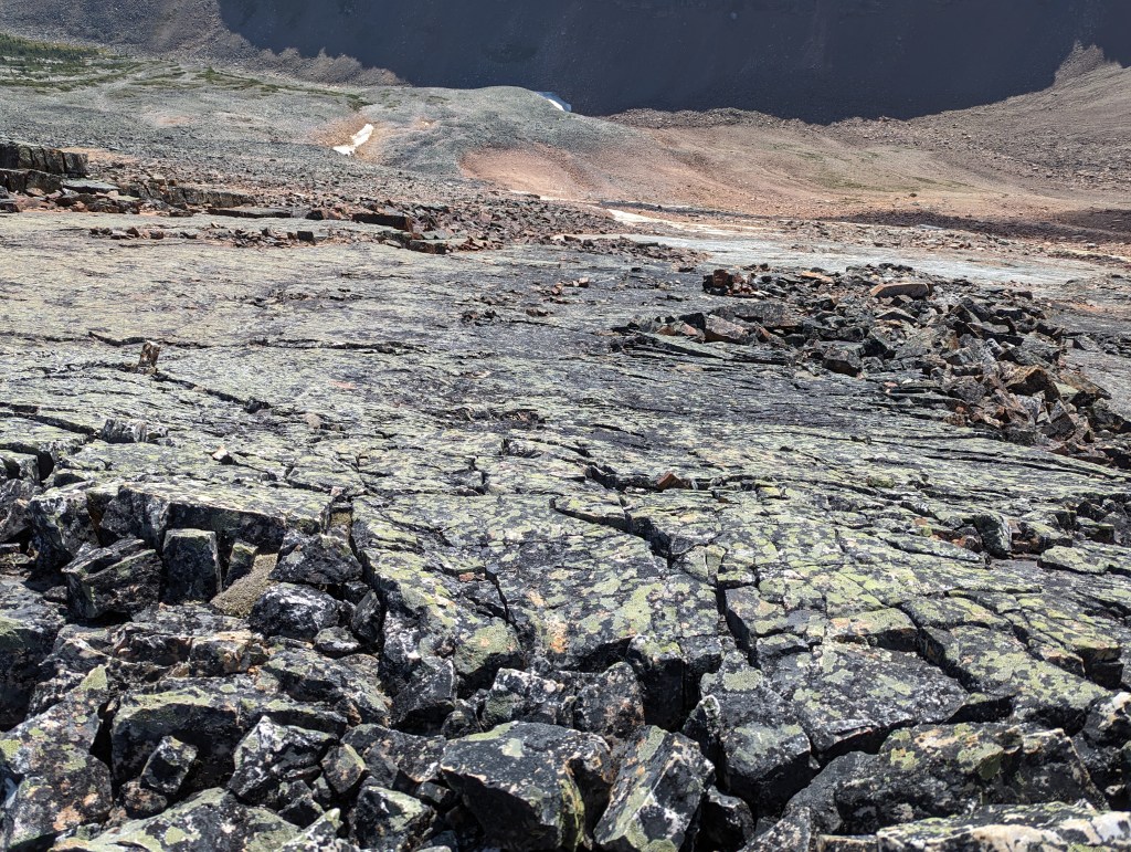
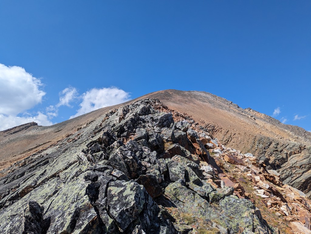
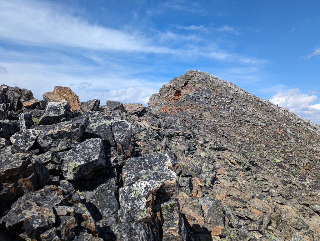
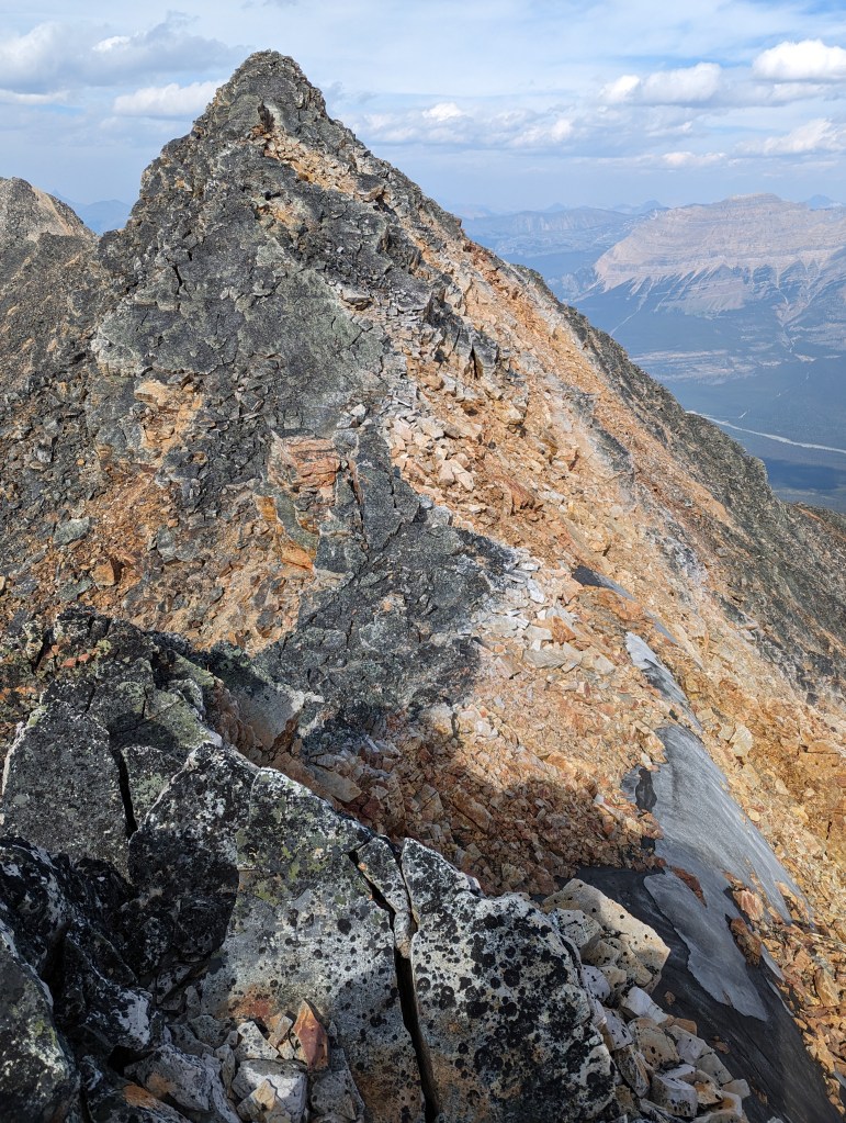
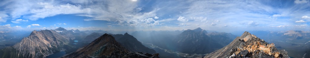
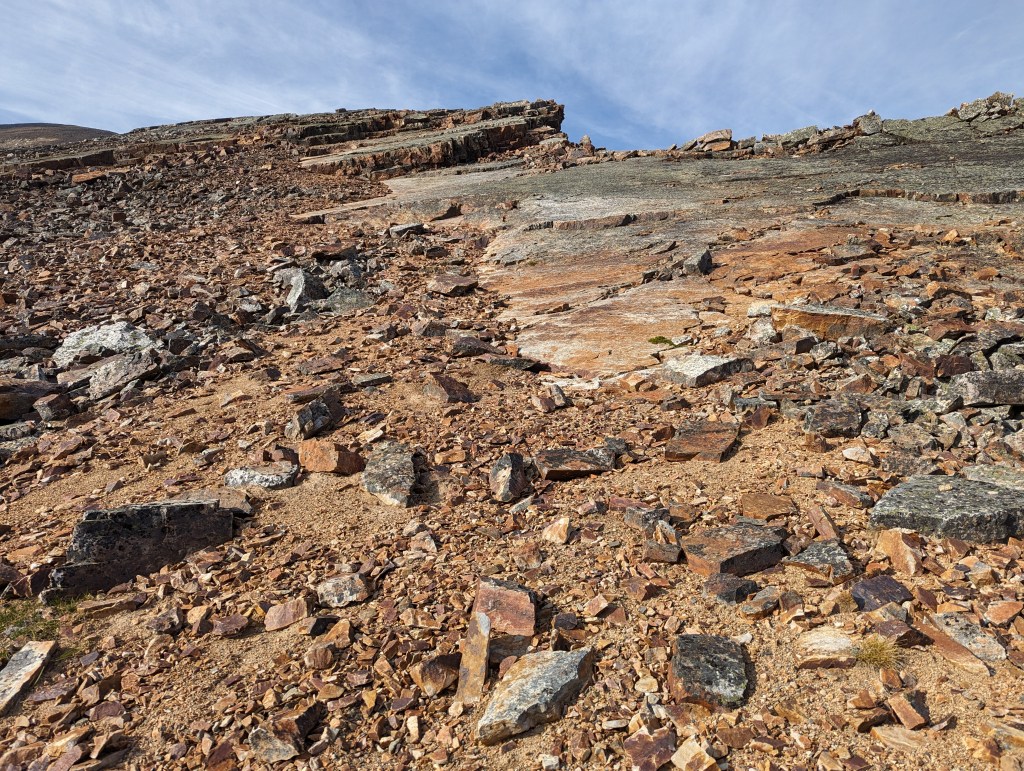
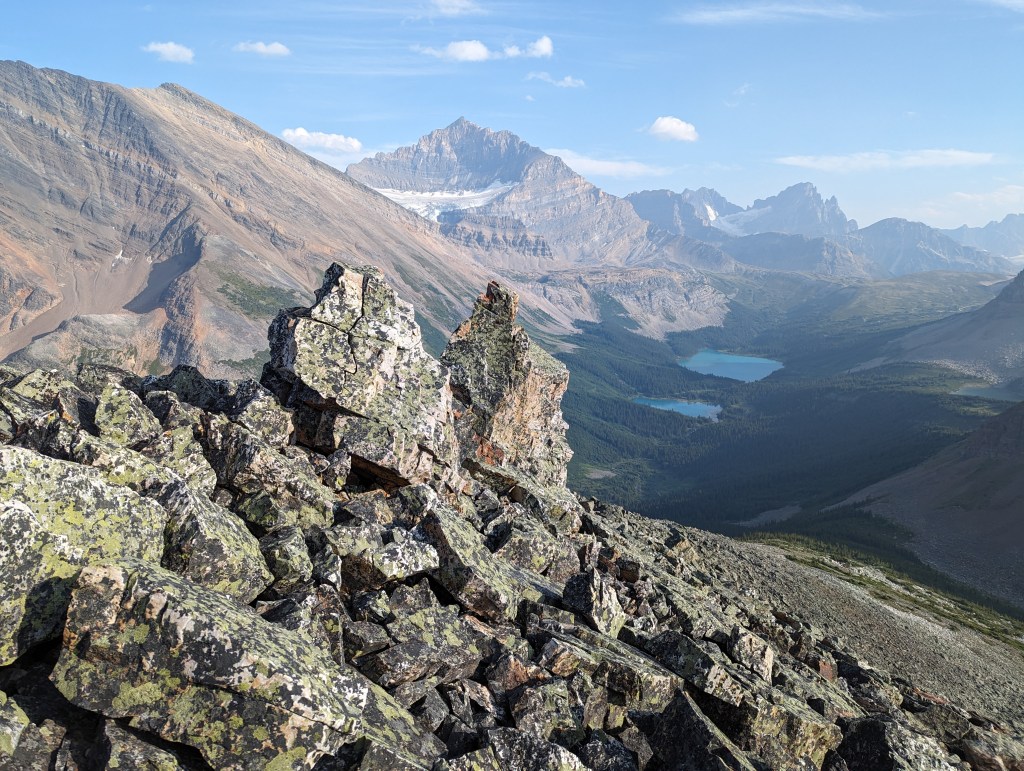
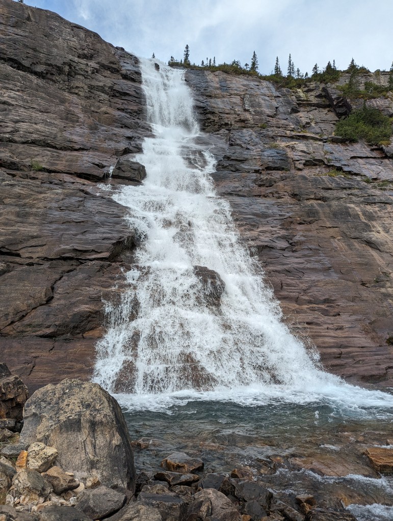
For 2023-2024 the area in red/pink is a gated construction zone with radio booths at each side. In addition, all of Geraldine Road is closed every winter to protect caribou. Exact closure dates may change from year to year, so it’s best to check with Parks Canada.From the parking lot, it’s a short, easy hike to the first lake. Muddy sections of trail have logs placed to hop across and downed trees have been cleared.This is typical of the condition of the trail up to the first lake – roots and rocks, but no bushwhacking. Beyond the first lake many boulder fields are encountered. None are particularly difficult, but this would grow tedious if done as a day trip.Nearingburg and Coulthard refer to this as the second lake and describe it as “more of a pond, given its size.” Parks Canada literature does not identify this as a lake. What Parks refers to as the second lake is what the authors refer to as the third lake. This caused me brief confusion when booking the campsite.The headwall of the second/third Geraldine Lake and Geraldine Falls. At this point the easy trail changes into steep switch-backs.One happy scrambler! The campsite is at the far end of this lake. There is still a great deal of boulder-hopping to get to it.Nearing the campsite, looking up at Geraldine Peak.Looking across the lake at the possible ascent routes. Once at the edge of the trees, one simply picks their favourite line and heads straight up. Spoiler Alert: They are all loose and terrible! But, some more easily zig-zag through the cliff band seen 2/3 of the way up. The rock on the way up is extraordinarily loose, not something I would tackle with a group.At the campsite I set up my bivy and left some heavier food in a bear bin. As tempting as it was to go for a swim and soak in the sunshine on the beach, I forced myself to continue on around the lake.At the edge of the trees, a few paths up can be seen. They are all about the same and they are all very loose. As tempting as it is to head left into the greenery, the cliff band is trickier to navigate here and the krummholz quickly becomes tedious. The “easiest” route through the cliff band seemed pretty much straight up. But, I definitely wouldn’t want to be below another scrambler here.Looking back down at the ascent route. The campsite is along the rightmost shoreline.Once atop the ridge, a cairn indicated that I was not the first to come this way. Further up the valley two more lakes can be seen. Beautiful Mount Fryatt (left) steals the photo.Slabs appeared along the ridge as I continued towards the peak. I now know that my goal is to stay below the slabs until after a large notch in the ridge. Past this notch the slabs get much bigger and feel a bit airy. But, a solid ledge forms behind the ridge, allowing for easier travel. There is a nice, moderate path up the slab to gain the ridge, just past the notch.Looking down towards the larger slabs. It’s easiest to gain the ridge before these. Yes, it’s as airy as it looks.From below one expects the slabs to top out in a shear drop-off. In reality there is a nice shelf to follow.Looking back towards the shelf and the ascent ridge.Looking forward to one of many false summits.A few false summits are passed on the way to here. Up to this point tricky parts can be bypassed to either side and the scrambling is never more than moderate. Nearingburg and Coulthard recommend bringing an ice axe for a snow crossing before the summit, which would usually be at this spot. Without the snow though, you have to downclimb an exposed spine. This short section is difficult scrambling.From below the cruxy downclimb, looking back. To the left is a steep snow slope and to the right would be a good fall. The pink-orange rock feels too loose to trust, considering the fall potential. The black and white spine felt the most solid, but it’s 4th class scrambling for the top 10 feet. For this reason, I would bump this peak up to a rating of Difficult scramble.At the peak and feeling delighted!Looking across the Athabasca River to Mount Kerkeslin.Summit panorama.On the way back I made a point of building cairns to mark the path I found easiest to gain the ridge. Consider options and evaluate for yourself though, and do not attempt if wet.A couple of neat rocks.Passing Geraldine falls again on the hike out the next morning.
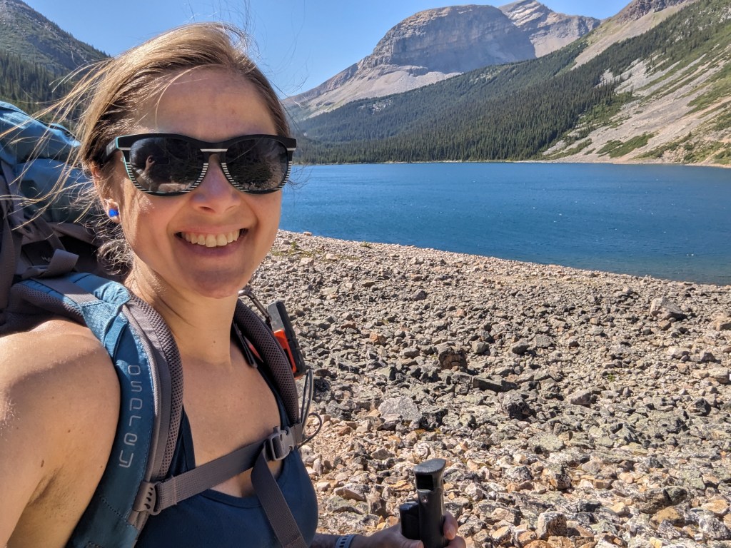
I spent the evening at the Geraldine campsite: Socializing with backpackers, listening to loons on the lake, and watching the waves lap against the shore at my tent pad. I slept like a baby. It was absolute heaven.
In the morning I hiked back out to my car. The hike out is no faster than the hike in and I can see how others have felt frustrated by the never-ending boulder hopping when trying to do this as a day trip. My overall durations were 2 hrs 45 min to hike to the campsite, 7 hrs to scramble the peak, and then 3 hrs out from the campsite in the morning (Includes a photo break at the waterfall). When driving out through the construction zone, I had no problems radioing for an escort and following them back to the highway again.