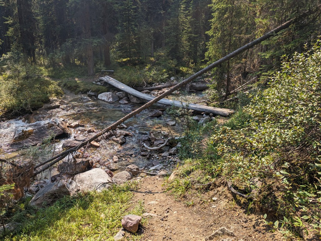
Notes: Bridges in disrepair – Plan for creek crossings. Bikes are allowed on the main trail along Poboktan Creek (This would shave off 12 km total of hiking).
Trip Report
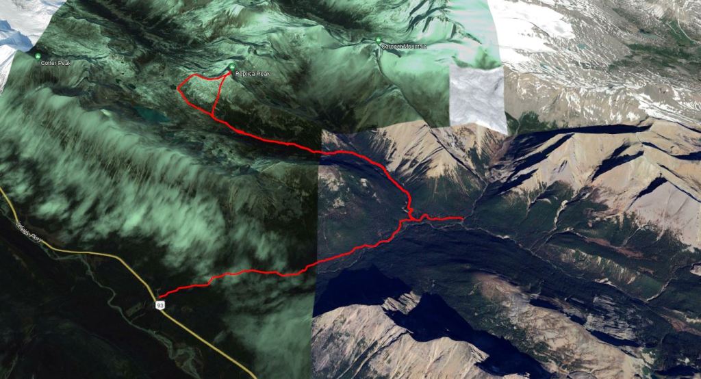
I was surprised at how much I enjoyed this peak. I had been dreading the long trudge. But, stunning Maligne Pass left me too enamored to really notice the distance. This peak is possible as a day hike, but becomes much more appealing as a day trip if the trail along Poboktan Creek is biked.
The trailhead is next to the warden station at Poboktan Creek. The parking lot is on the same side of the highway, but on the other side of the creek from the station. A few meters of walking on the highway shoulder is required to get to the trailhead after parking.
I wasn’t able to secure a booking at Avalanche backcountry campsite, but Poboktan Creek campsite is close enough and is generally easy to book, so I grabbed this instead. I hiked to Poboktan Creek campsite the evening prior – An easy 7.8 km in just under 2 hrs. I set off for Maligne Pass early the next morning. To avoid carrying my backpacking gear the whole day, I stowed a few heavier items at Avalanche campsite as I passed.
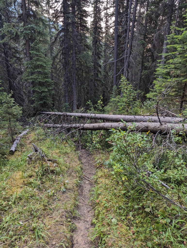
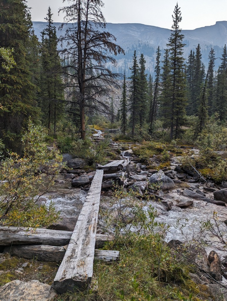
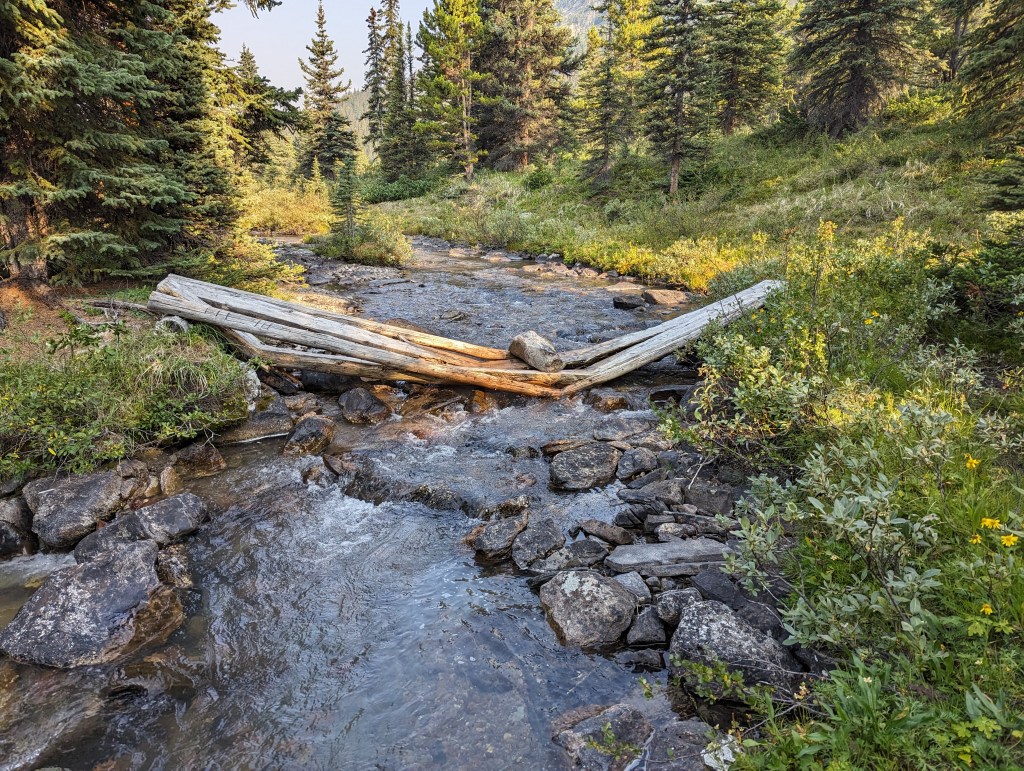
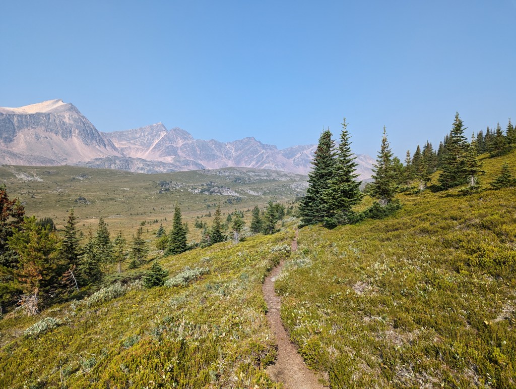
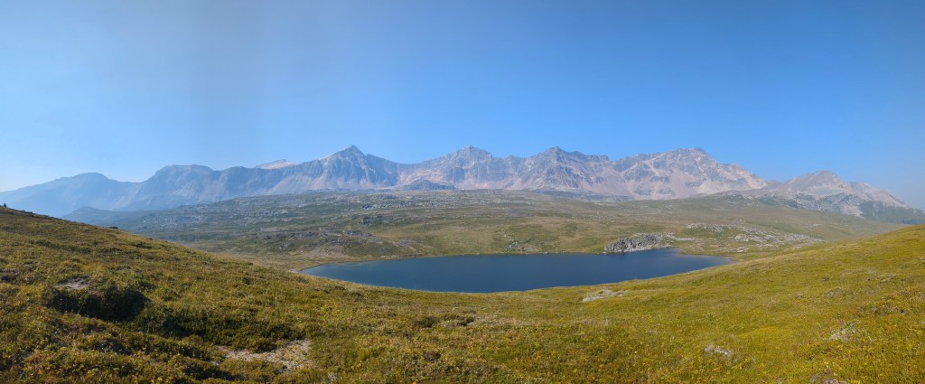
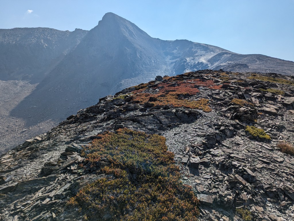
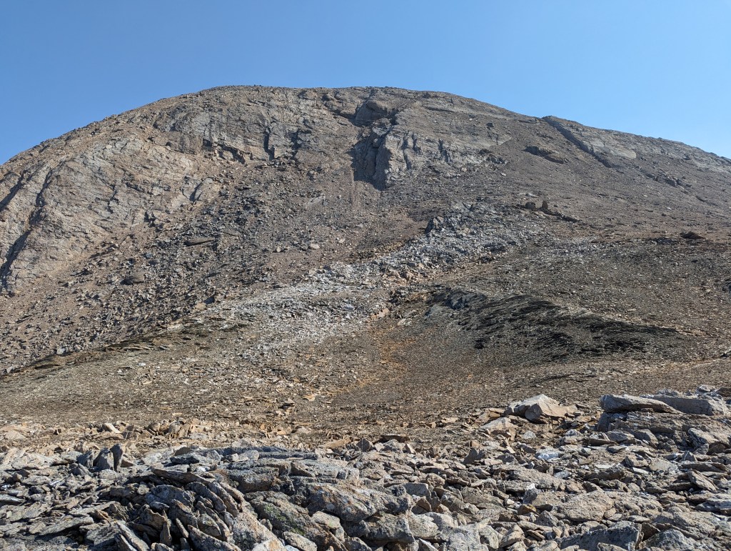
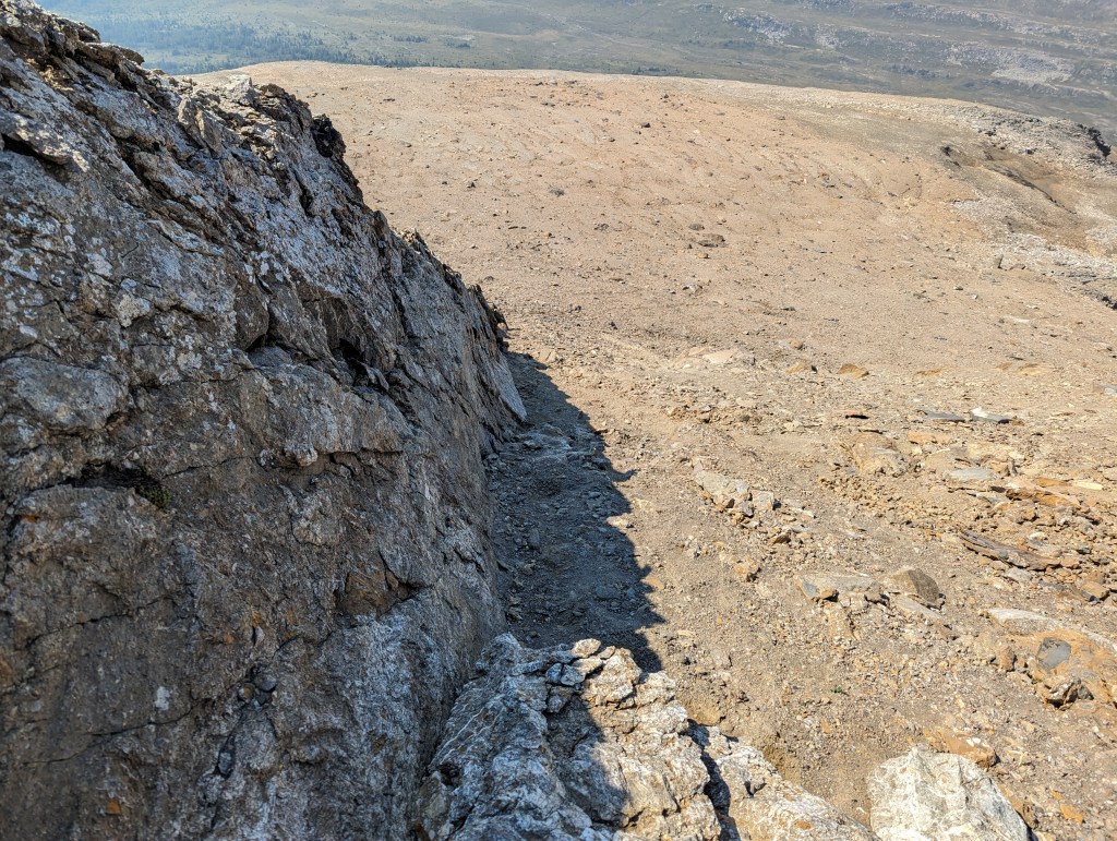
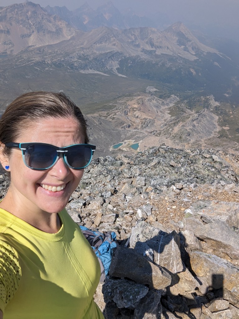
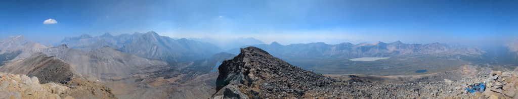
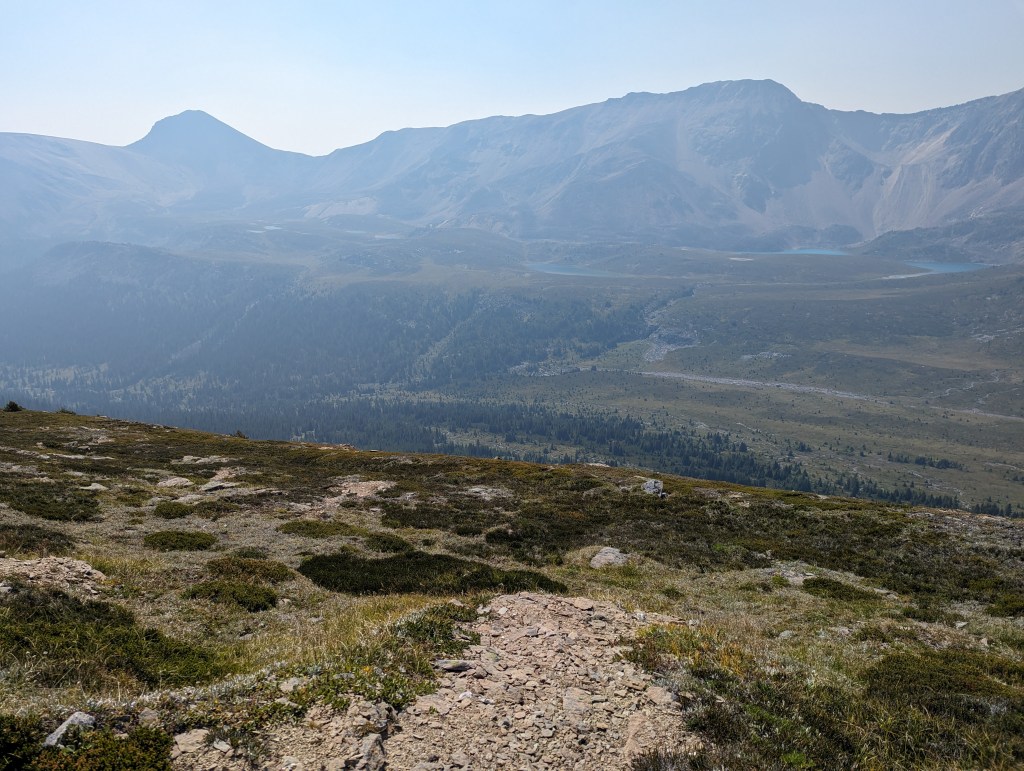
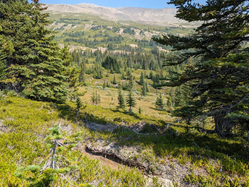
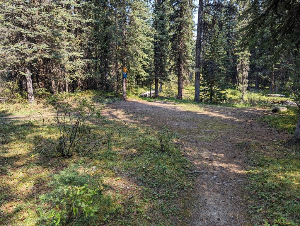
The main trail along Poboktan Creek is wider and in good repair. The trail in this photo is past the turn off for Maligne Pass, where the trail has been decommissioned and is no longer maintained. This is about as bad as it got for fallen trees on the trail (As of 2023).The bridges along Maligne Pass have fallen into disrepair. They seemed to get more and more creative as the day progressed. As of 2023 the bridges all held me, though I expect the next heavy flood year will sweep away a few of them. It would be prudent to plan for walking through the creek about 15 times.This was my favourite of the “technically still functional” bridges. This bridge is steps from Avalanche campsite.Once past Avalanche campsite, the warm morning sun beamed down as alpine meadows opened all around me. I was in full Julie Andrews mode, singing “The Sound of Music” and oblivious to where my turn-off might be.I eventually noticed I had missed my turn, but couldn’t resist continuing a bit further to a marvelous alpine tarn. From the tarn pictured above, rather than seek the missed turn, I found a low spot in the ridge behind the viewer. A short climb along grassy slopes gave way to a gentle shoulder that can be followed back to the start of the summit block of Replica Peak.Following the shoulder back to towards the peak.The crux of the peak, and the only scrambling in the trip, is this final push to the summit. The gully-type line at the right of this photo worked to gain the summit.Looking down the gully. The feet are a bit loose, but the hands are good. This cruxy bit is quite short, too.Looking East from Replica Peak.Summit selfie with Maligne Pass in the background. If hiking on through the pass, the trail continues off to the right of this photo. I stopped to chat with some backbackers coming the opposite direction and they mentioned some sections are becoming quite a bushwhack.Summit panorama.In the interest of time, I chose the more direct path back down the mountain. This line is easy too.Back on the trail. Maligne Pass trail is in the foreground, Replica Peak is in the background. From here the most direct path to Replica Peak is straight up. The small stands of trees provided no difficulties for navigation.Almost back at Poboktan Creek and the main trail, I couldn’t resist one last bridge photo (I’m no civil engineer, but that looks like a structural boulder!)Back at the intersection with the main trail. Good signage marks the turn-off for Maligne Pass. If you cross Poboktan Creek, you’ve gone too far.Hiking back out along Poboktan Creek, nearly at the warden station. My feet were starting to feel the day’s distance by this point. It’s hard to be bothered by sore feet on days as picturesque as this, however!
My overall trip was 11 hrs 20 min (2 hrs of hiking the previous evening plus 9 hrs 20 min on this day). I added a few scenic detours to the trip, increasing my distance from the 26 km quoted in the book to an actual distance of 35.4 km (7.8 km the previous evening plus 27.6 km this day). I genuinely enjoyed this trip and would recommend it for beginner scramblers that have decent navigation skills. Saving time on the approach by biking the section along Poboktan Creek would make this even more appealing to the budding peak-bagger.


One thought on “Replica Peak (2794 m)”