Notes: My route includes difficult scrambling along the ridge – A moderate bypass is possible but requires elevation loss/gain. A bike helps on the fire road. The fire road up to Signal campsite was impacted by the Jasper Wildfire in 2024.
Trip Report
Mount Tekarra is one of the more prominent peaks seen from Marmot Basin and my eye can’t help but linger on it whenever I’m there. It’s been on my bucket list for a while but has been tricky to secure camping for. The crux of any trip involving Skyline Trail in Jasper is scoring a campsite. In 2020 I booked on opening day and was only able to get one night at Curator for mid-July. 2020 turned out to have unprecedentedly late snowpack and it poured rain for the whole trip too! We had no views and didn’t bother bagging any peaks in 2020.
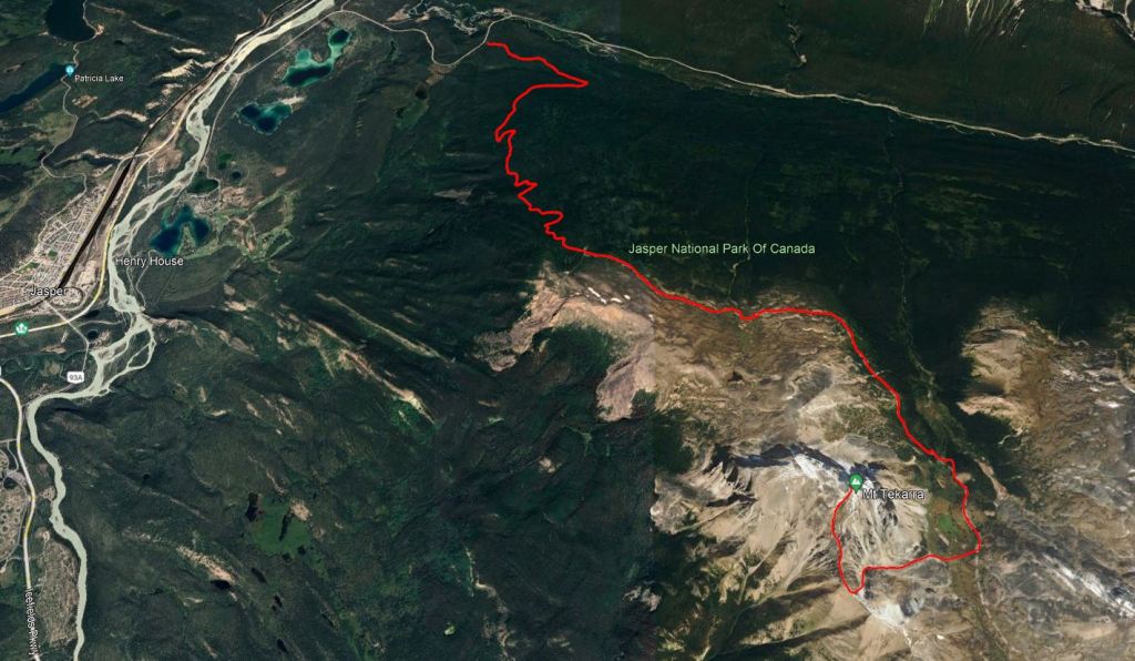
In 2023, I happened upon a last-minute vacancy at Tekarra Campsite for a Saturday night. The forecast showed temperatures hovering around freezing overnight, but perfect clear skies during the day. I pounced on the booking! Instead of hiking in from the Maligne Lake side, I simply started and ended at Maligne Canyon. The parking lot for this end of Skyline Trail is across the street from Maligne Canyon, is very small, and is always full.
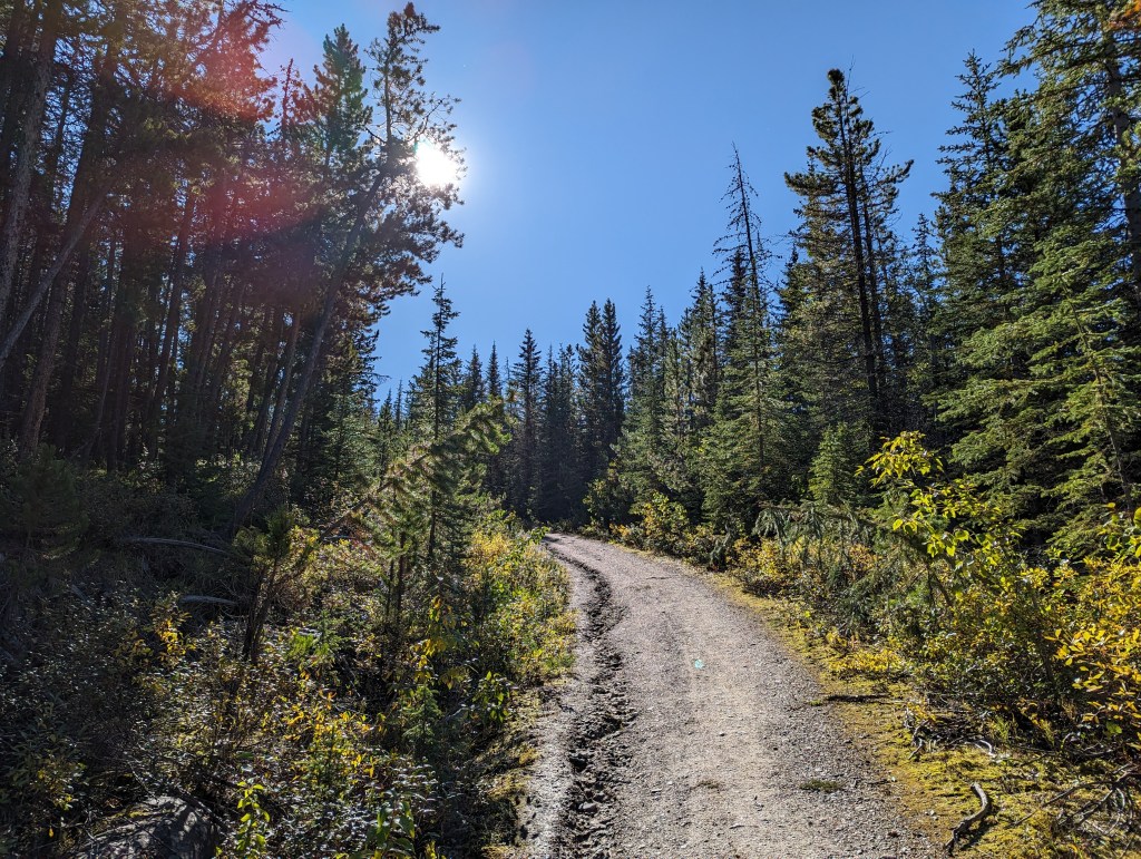
The first 8.4 km of the hike leading to Signal Campsite is on an old fire road. Bikes are permitted on this section of the trail and a bike rack is provided just past Signal Campsite, at the turn-off to the lookout. The road is a steep slog and, with a heavy backpacking pack, I chose to just push my bike the entire way up.
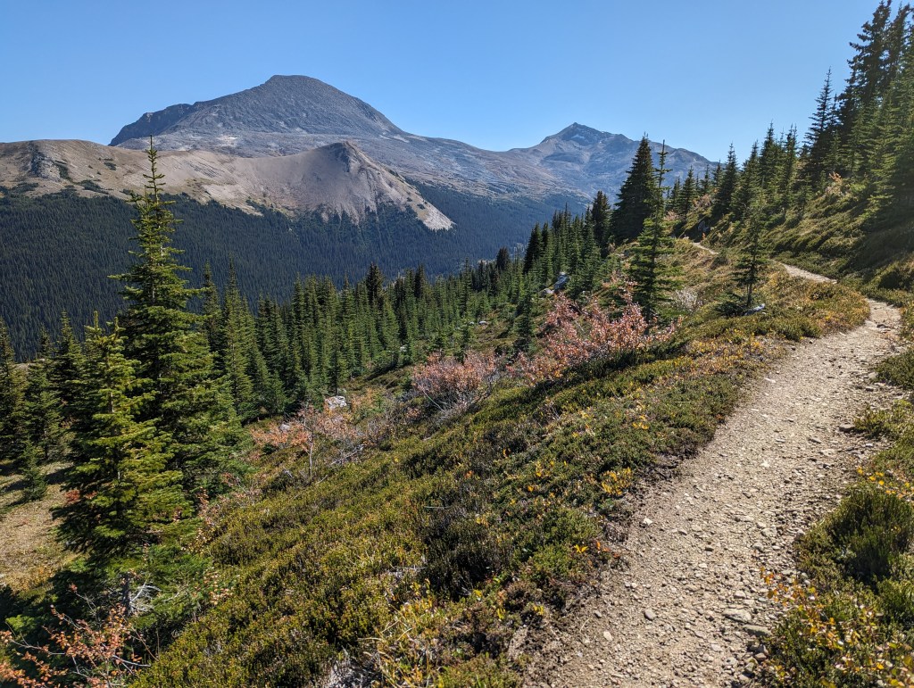
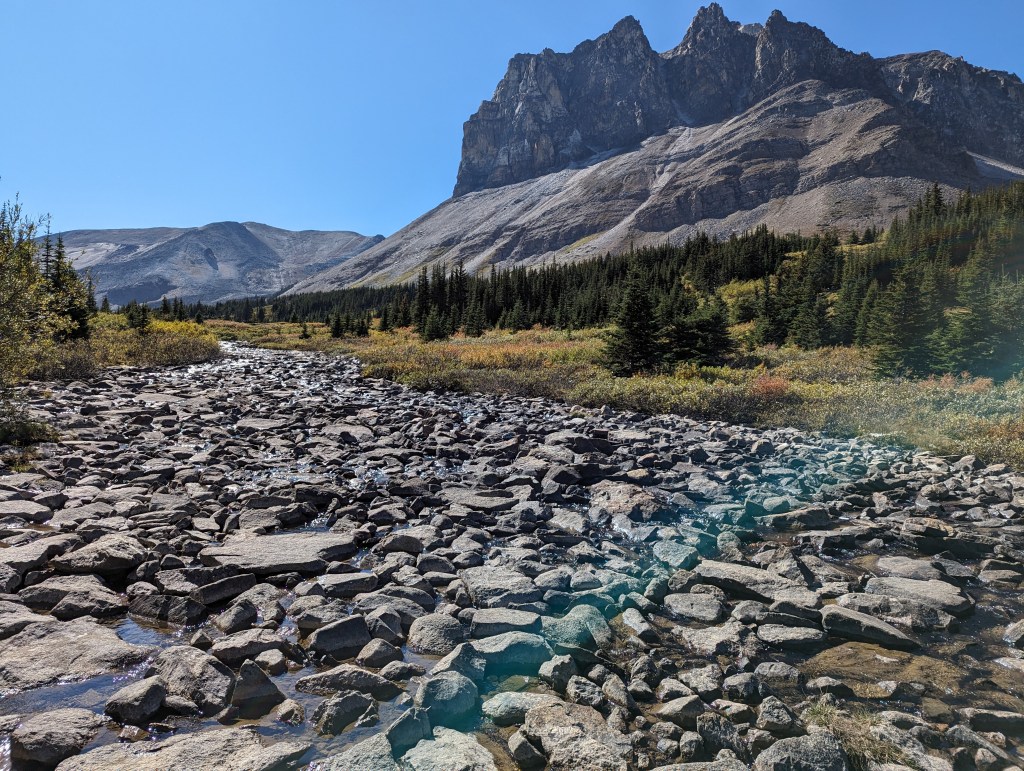
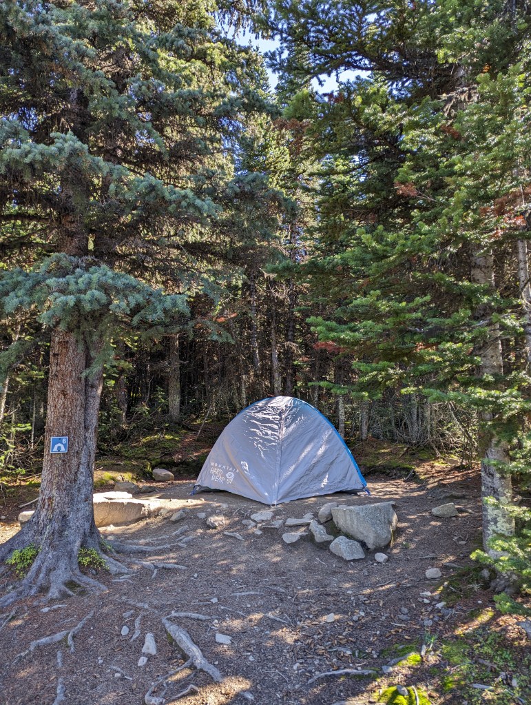
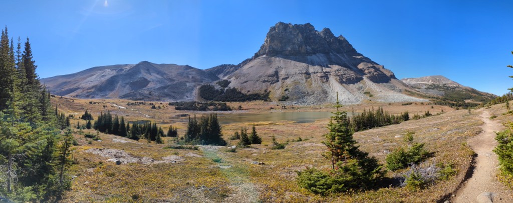
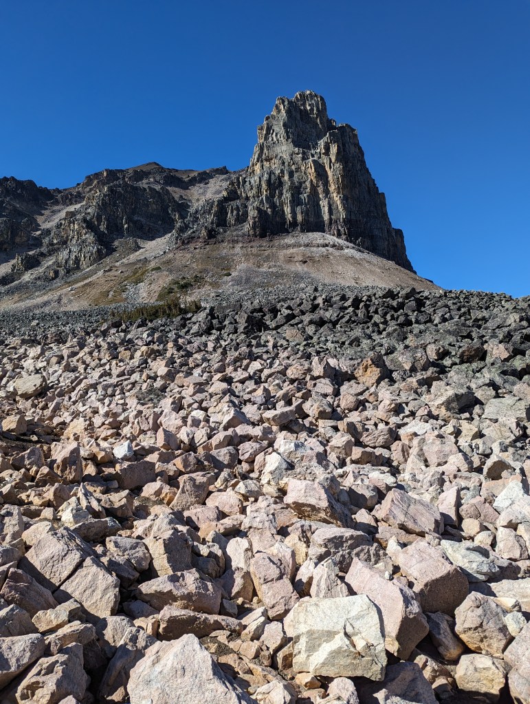
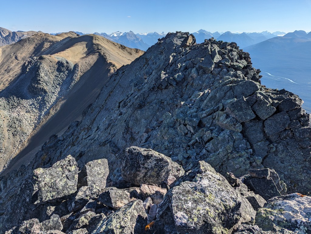
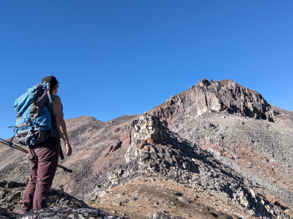
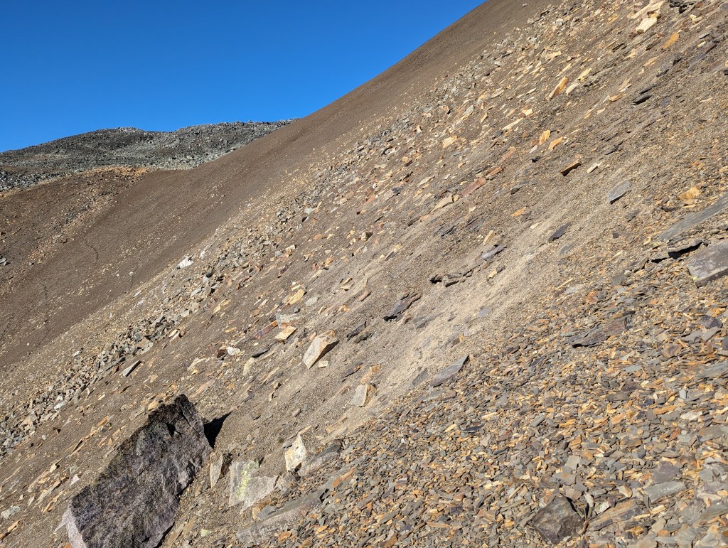
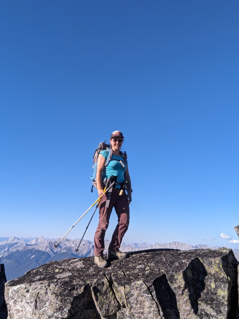
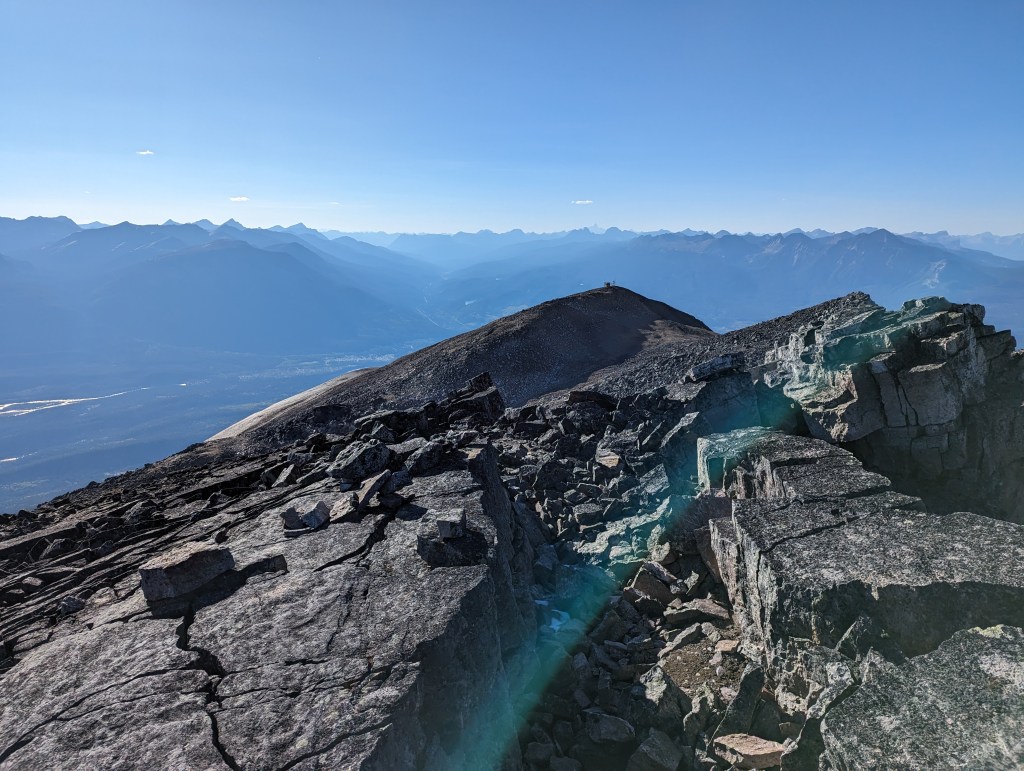
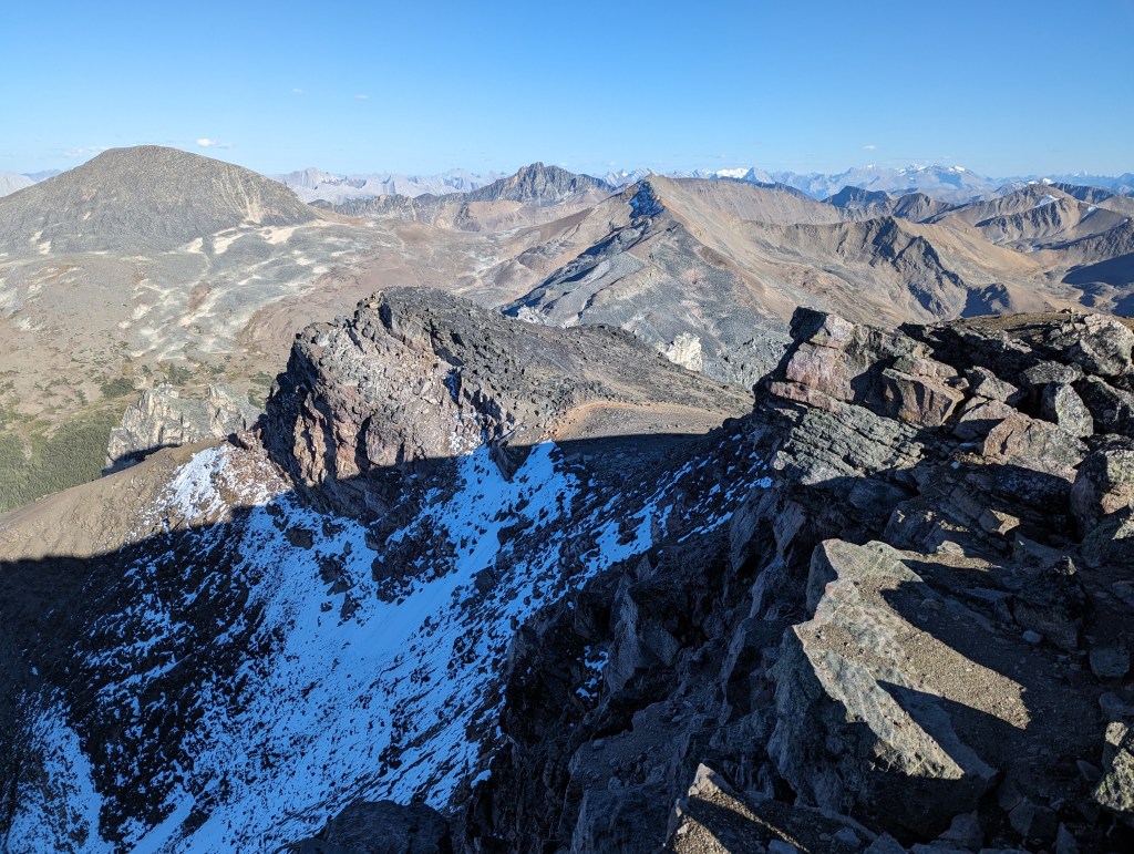
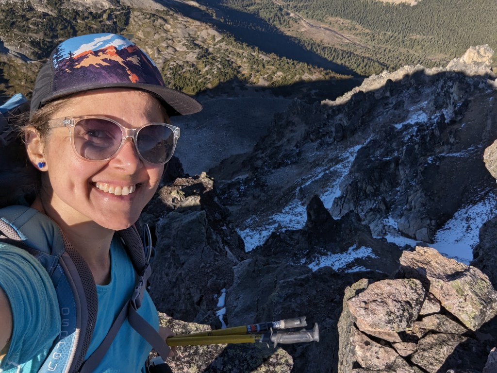
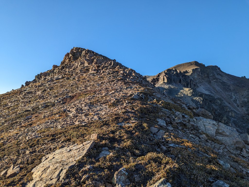
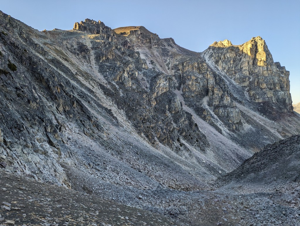
Typical travel up the fire road leading to Signal Campsite.Once past Signal campsite, the path narrows to a conventional trail. Skyline Trail is well maintained and never very steep.Nearing Tekarra Campsite, directly below Mount Excelsior. The hike from Signal to Tekarra Campsite is only 6 km.Arriving at Tekarra Campsite. In July 2020 this crossing was a wade through ankle/calf-deep water. On this trip, in September 2023, it was an easy walk across dry rocks.I set up camp and stashed food in the bear bin before heading out for Mount Tekarra.After leaving the campsite, Skyline Trail is followed South for another 1 km. To the left of this pond I cut through the meadow and aimed for the large gully to the left of Mount Tekarra. The gully turns to the left leading to a low spot in the ridge.Looking up at Mount Tekarra as I passed through the gully. Heading straight up this line was tempting. But, the longer I stared at it, the steeper and looser it looked.Finally gaining the ridge. Looking across the Icefields Parkway at Mount Edith Cavell (Center). There is cell coverage on the ridge.Continuing along the ridge towards Tekarra and looking back. Nearingburg and Coulthard’s directions are to bypass this jagged section by descending down the backside of the ridge and losing, then gaining elevation. Ignoring these directions as I did bumps this up to a difficult scramble. It’ll go, but the ridge is not solid and I did not enjoy this section.Past the jagged ridge section, looking forward. Further ahead, at the cliff band, the route jogs over to the left.Coming from the bypass route for the jagged ridge would lead to the zig-zagging path seen at the left. My approach from the ridge left me higher up and needing to side-hill over to it.The last push to the summit is a brief scree slog, fairly straight-forward. The reward at the summit is a stunning view across to the Colin Range.Obligatory timed selfie.Looking Northwest at some communications equipment on a lesser summit of Tekarra. Jasper Townsite is hidden behind this smaller summit.Looking South along the Icefields Parkway to Hardisty (Center) and Kerkeslin (Center-Right).The view East is of Mount Excelsior (Left) and Centre Mountain (Center). The Watchtower is visible behind and left of Centre Mountain.Feeling cute – The North face of Tekarra!On the return trip I bypassed to the back of the ridge. But, I only forfeited a bit of elevation, and the result was still fairly technical terrain. I suspect that much more elevation loss/gain was required to be on the true moderate bypass route. This photo is looking back at the cliffs I had to navigate through.Back at the top of the ascent gully, looking back at the jagged ridge section – The start looks deceptively easy. This is where I should have bypassed to the left and lost elevation on the way in.Descending the gully, heading back to camp. The jagged ridge section is cut out of the left of this photo. The dramatic cliff face seen from camp is at the right.Reaching the bottom of the gully and looking back up. The jagged ridge section is in the center of this photo. It looked tempting to bypass it by gaining a chute to the right, but I didn’t feel a need to head back up to the summit on this day.
From here I hiked back to Tekarra Campsite for a late dinner. My heavy pack paid off and I slept well with many layers insulating me from the freezing temperatures. The colder temperatures are a worthwhile trade-off for the gorgeous autumn colours and snow-free conditions. I’ve decided that September is my new favourite month for Skyline Trail. My backpack into Tekarra campsite was 4 hrs 20 min and my round trip ascent of Mount Tekarra was 5 hrs from the Campsite. Tomorrow my backpack out from the campsite would be 2 hrs 40 min, with my bike helping significantly. Before heading out, though, I would make a loop over Excelsior Mountain, Centre Mountain, and Amber Mountain.


2 thoughts on “Mount Tekarra (2694 m)”