Notes: The Bow Valley Parkway (Hwy 1A) is often closed to vehicles but can still be biked. This is mostly an easy scramble with only a few moves of moderate scrambling.
Trip Report
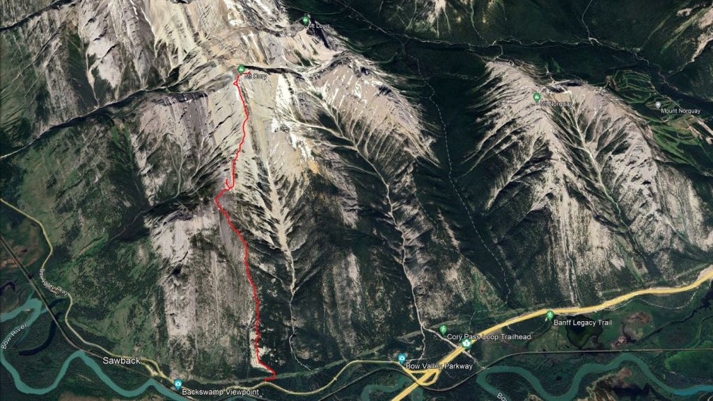
Mount Cory has fantastic views over the Bow Valley and high quality rock. It’s no surprise that this peak is even more popular with climbers than it is with scramblers. Climbers have a decent pull-out for parking below Guide’s Rock (Listed on mapping as Backswamp Viewpoint). I expected more of a parking lot for the scramble route too, but this wasn’t the case. There is a wider spot in the road where we pulled off to the side, taking care not to block a driveway used for accessing a utility corridor. The route starts at the driveway and then jogs right for about 70m along the utility corridor before continuing up into the trees. There was a faint trail to follow.
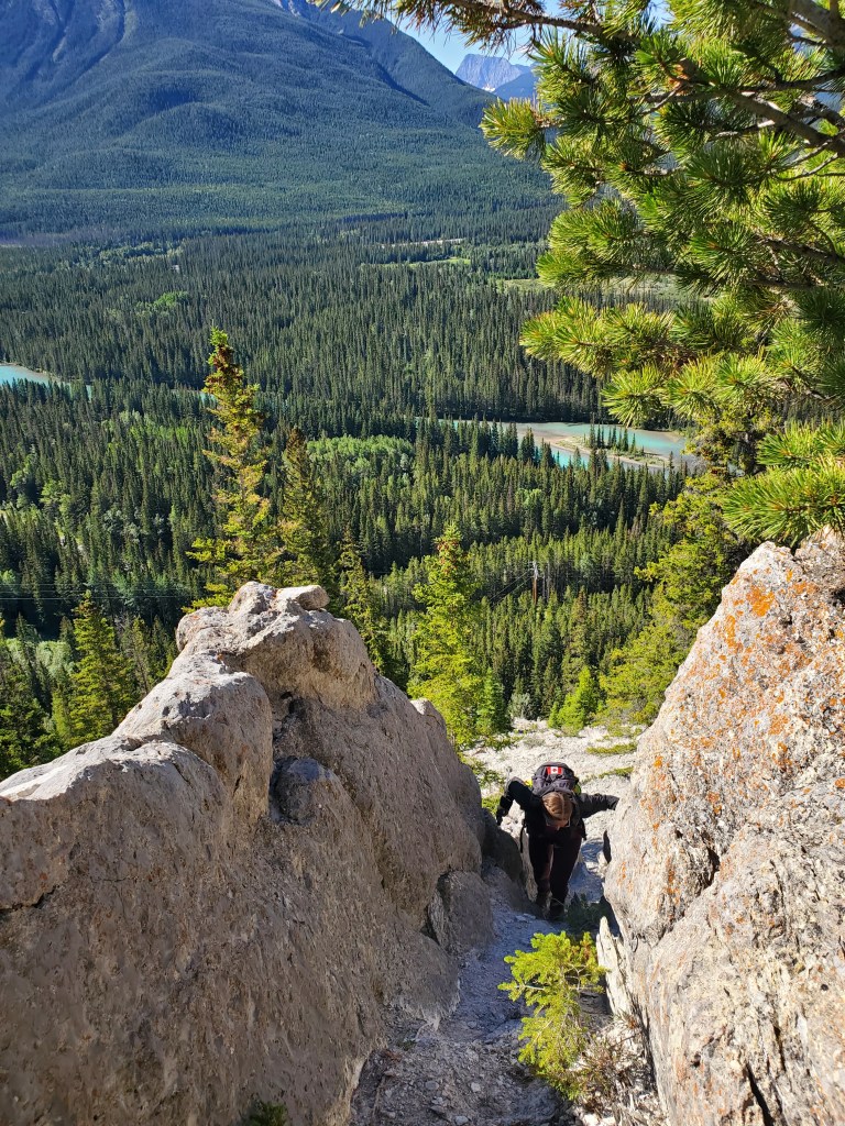
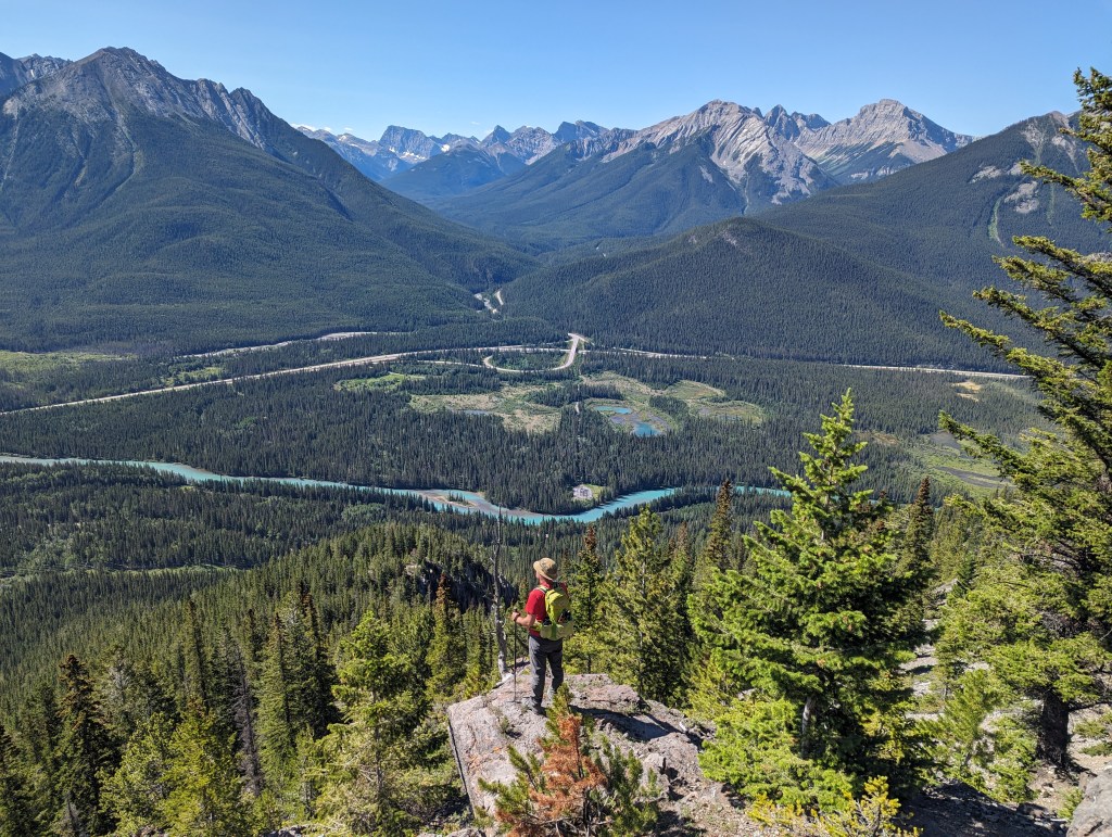
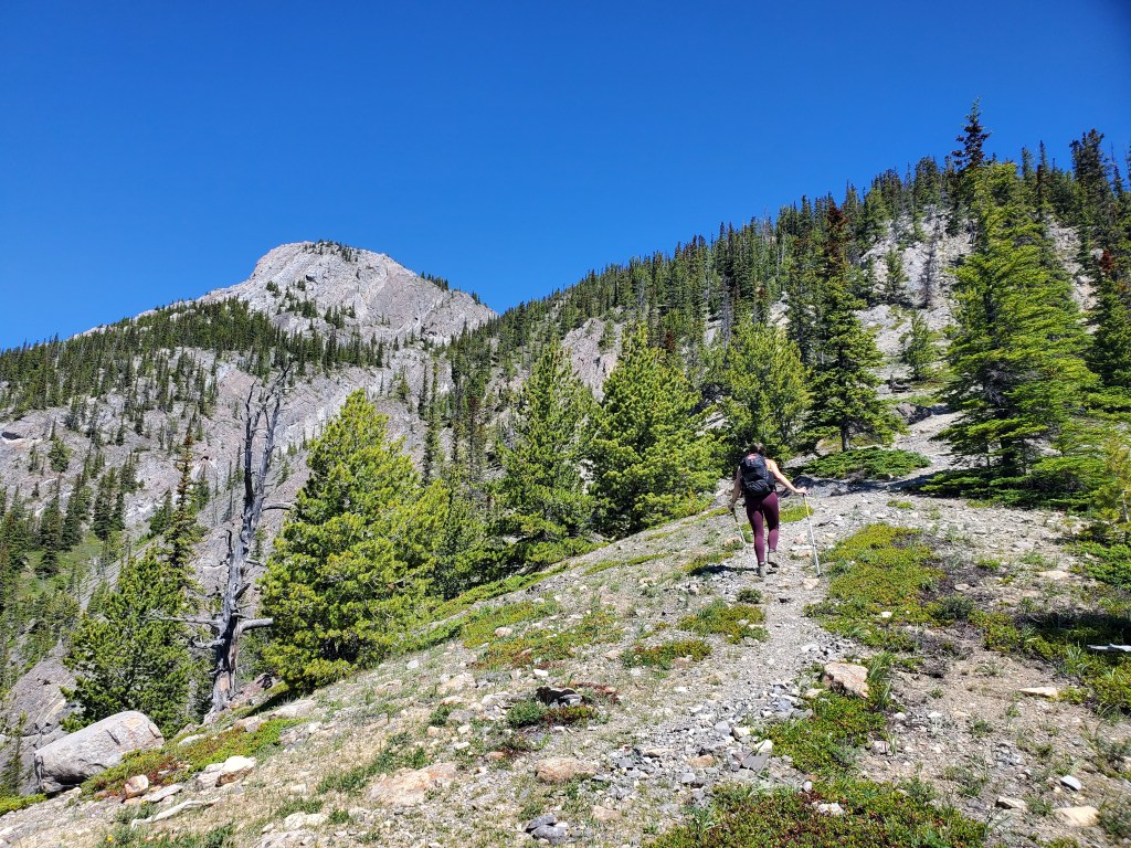
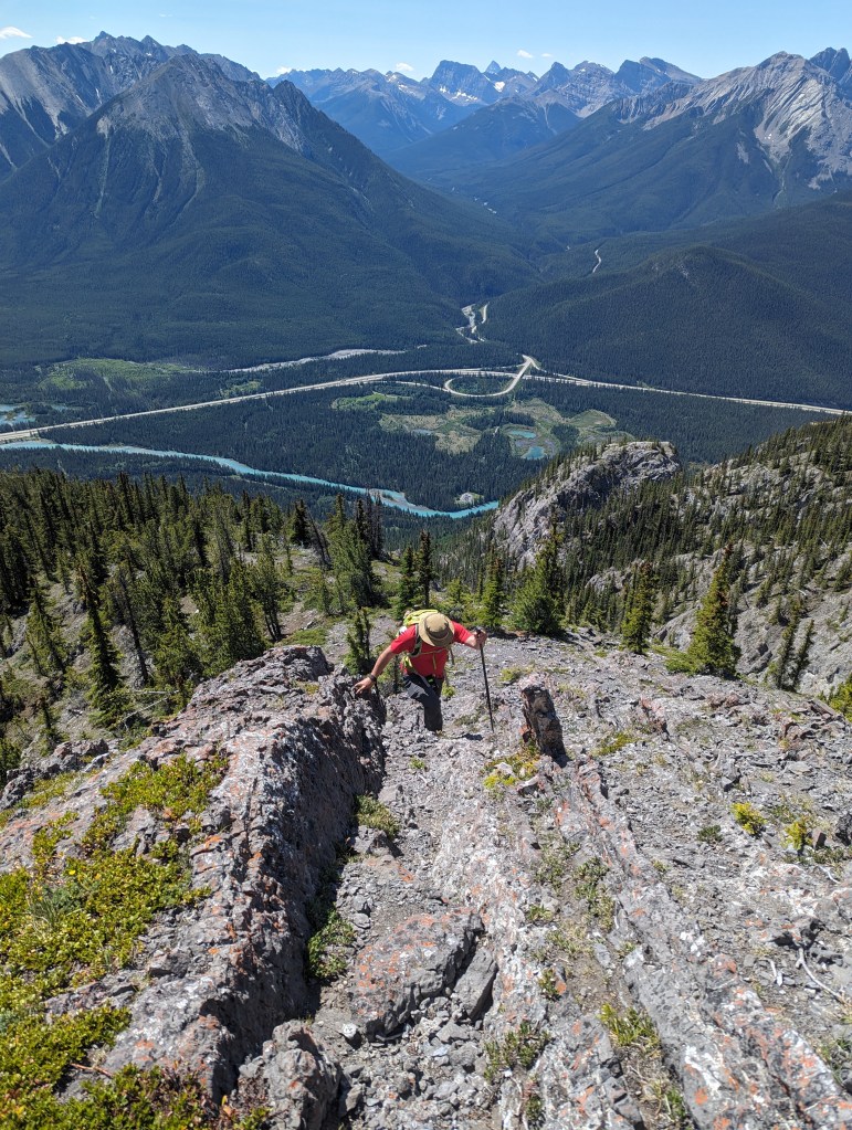
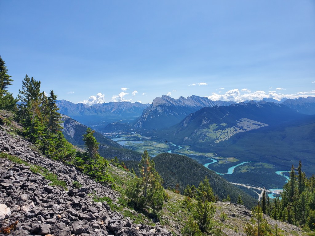
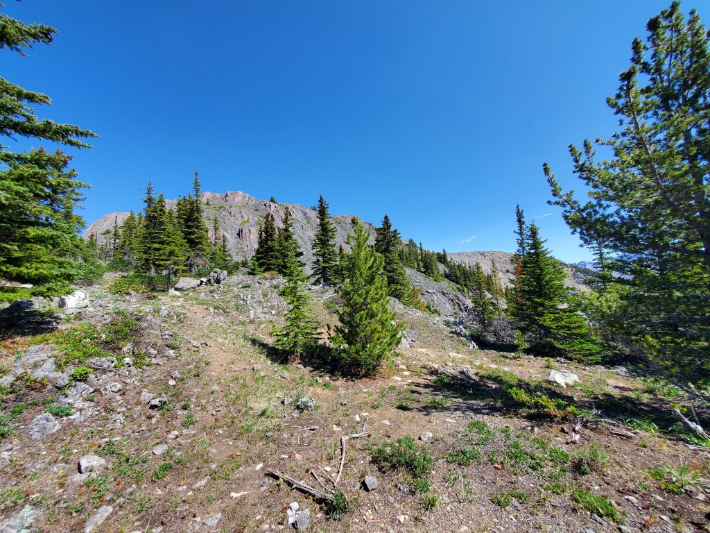
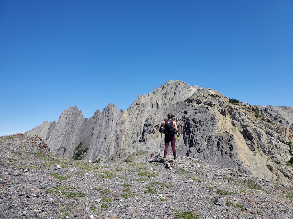
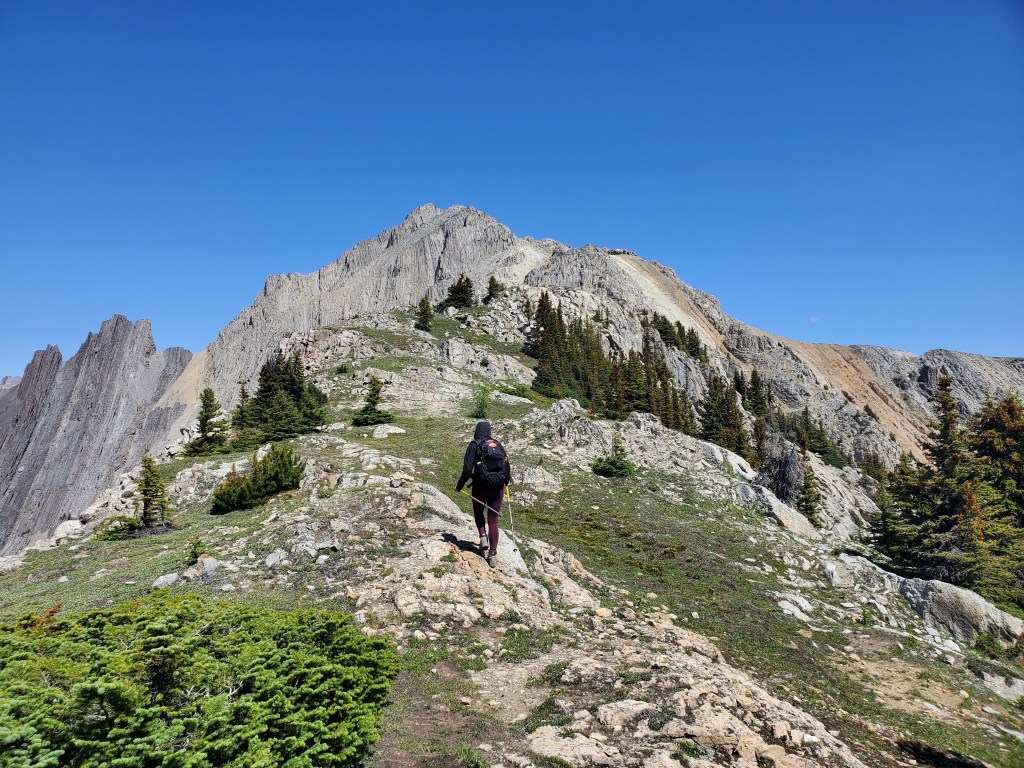
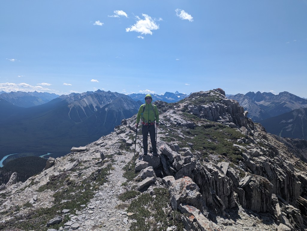
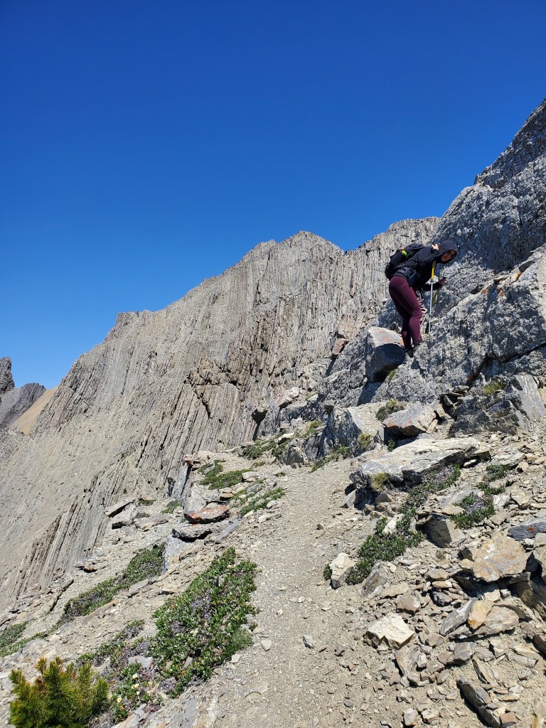
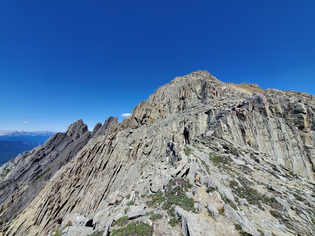
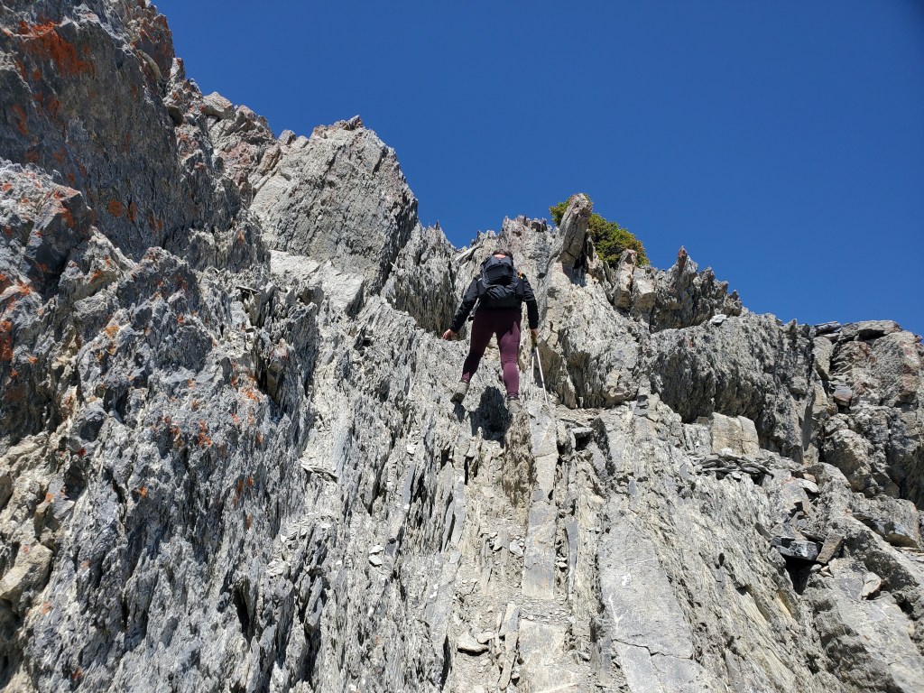
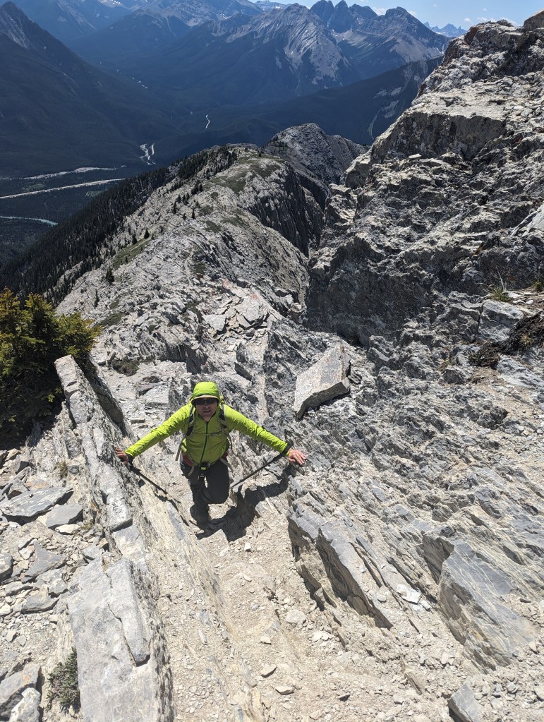
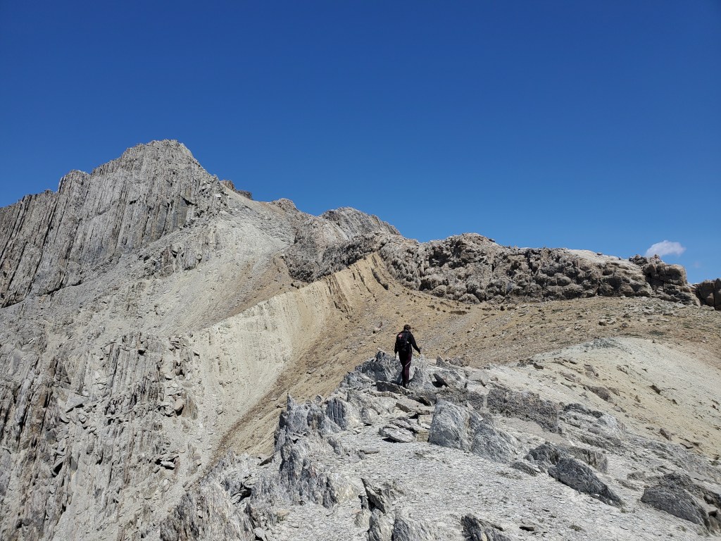
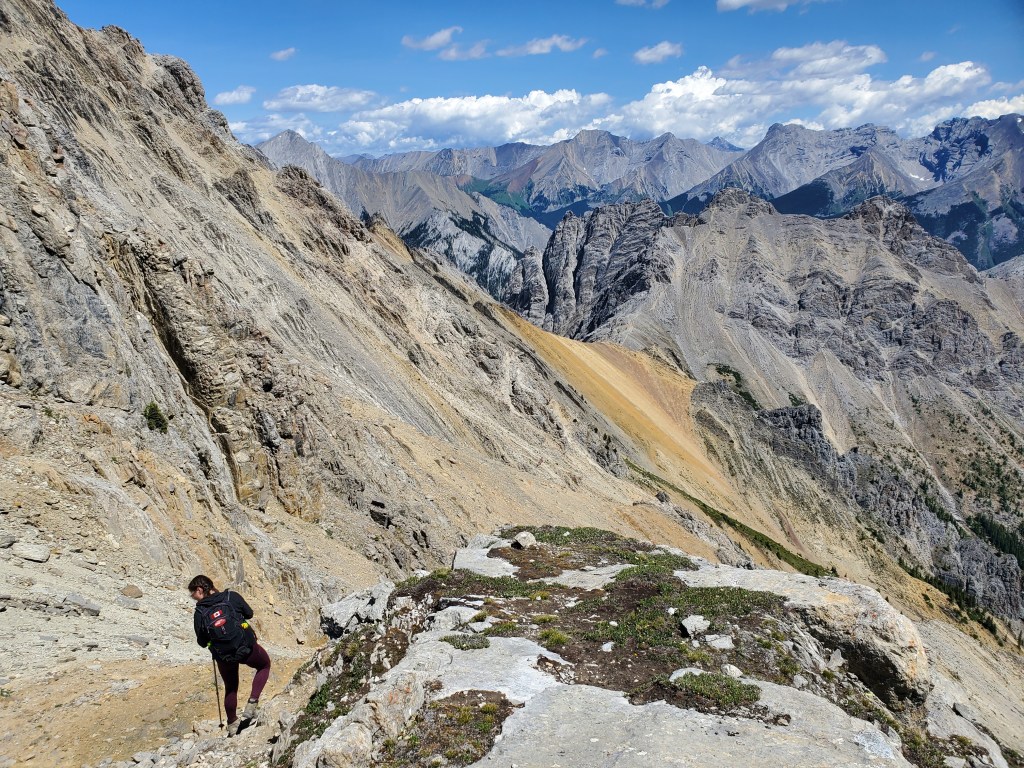
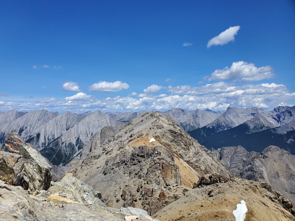
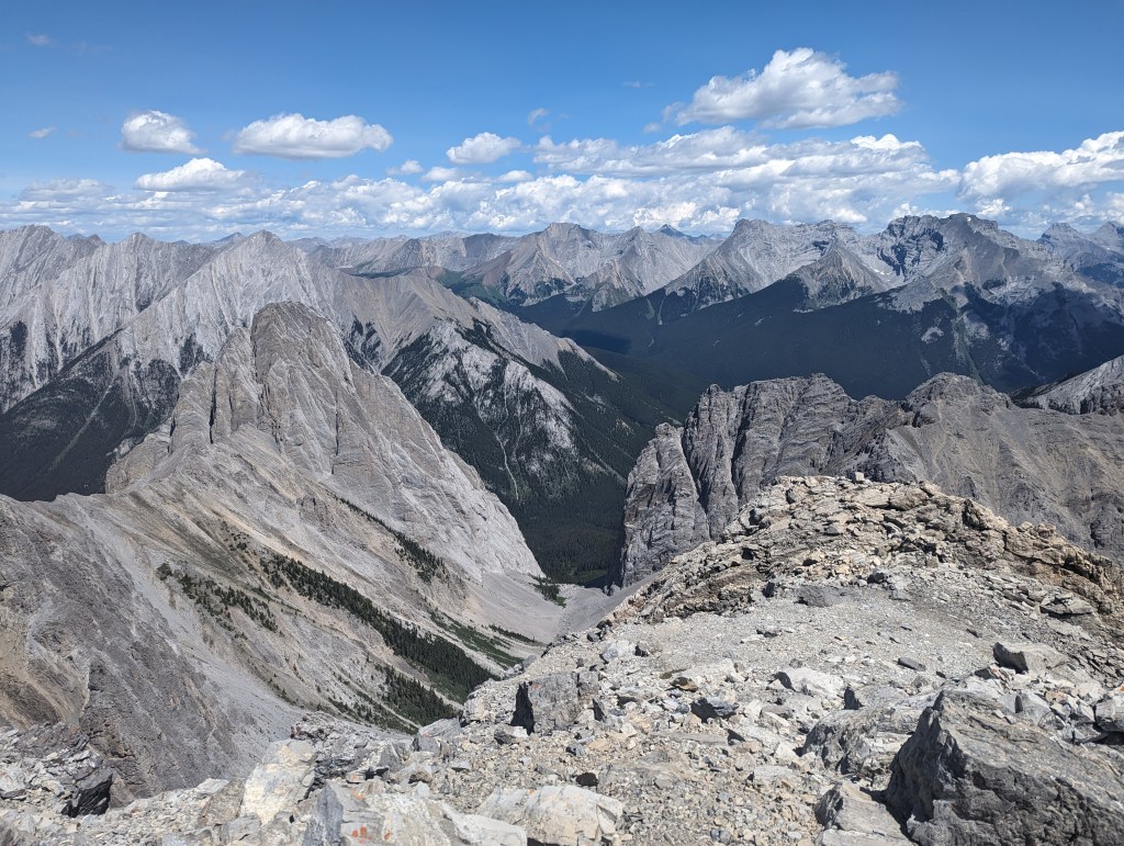
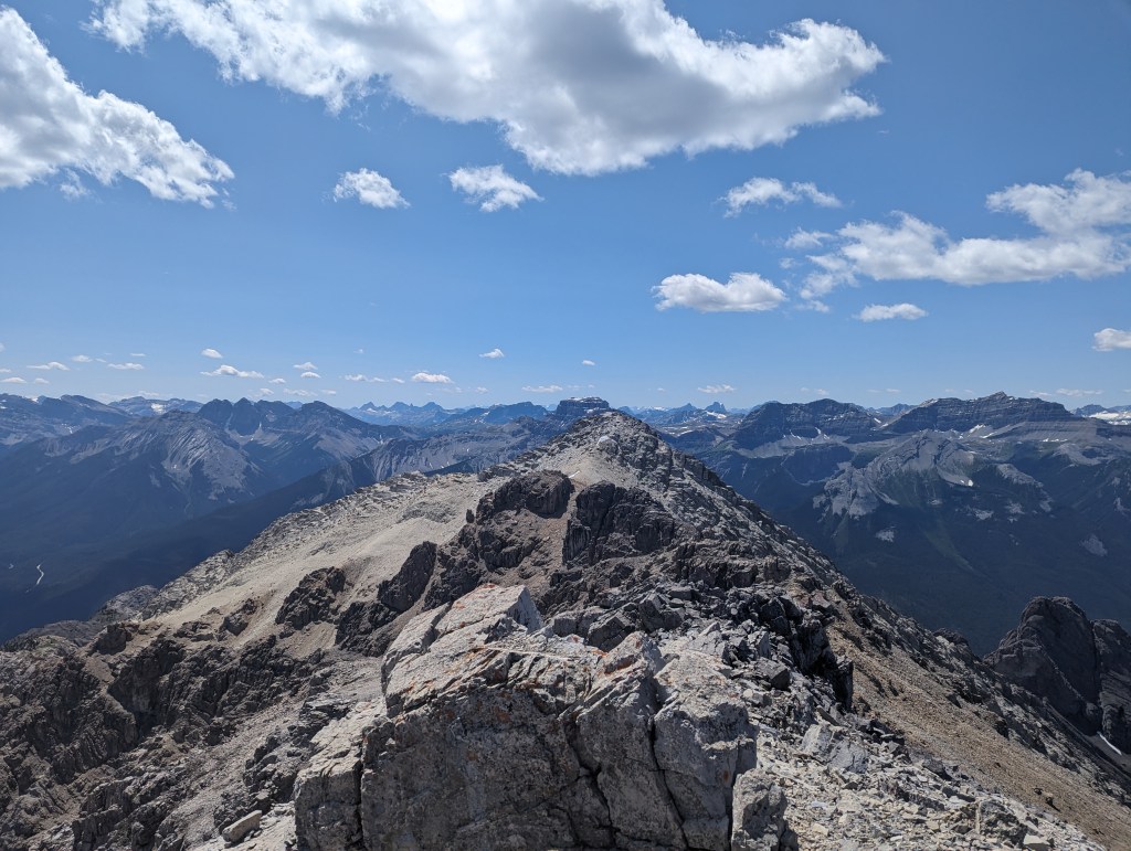
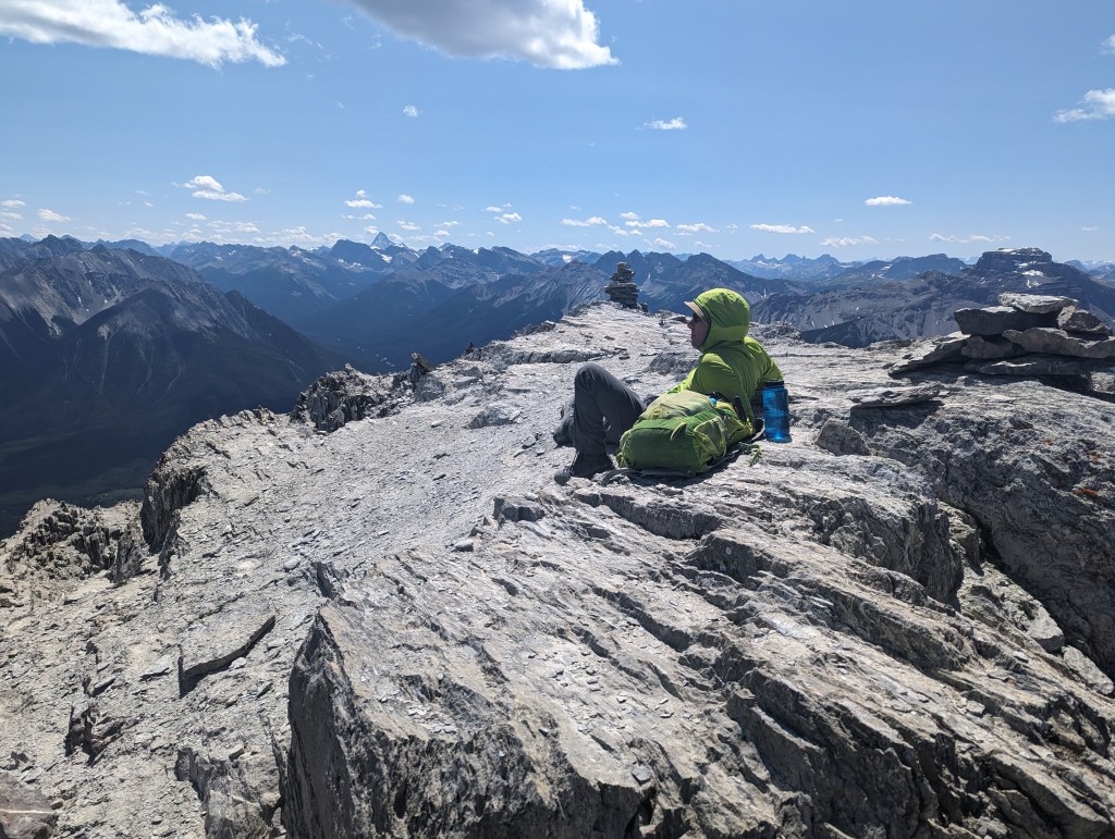
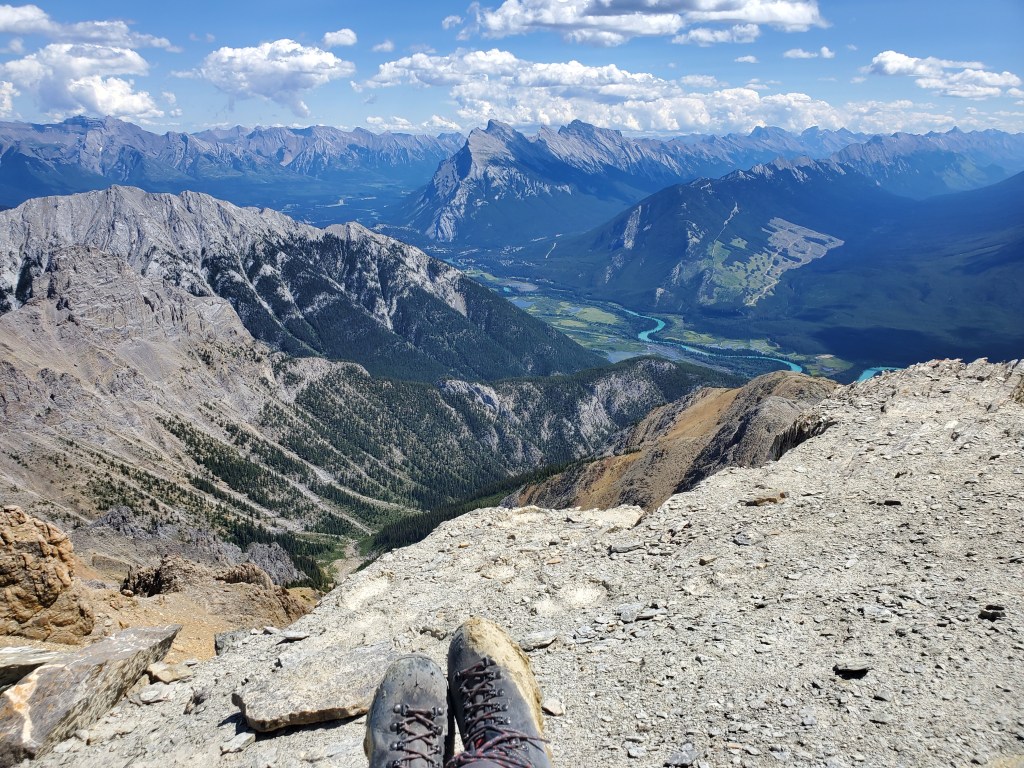
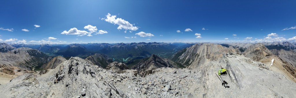
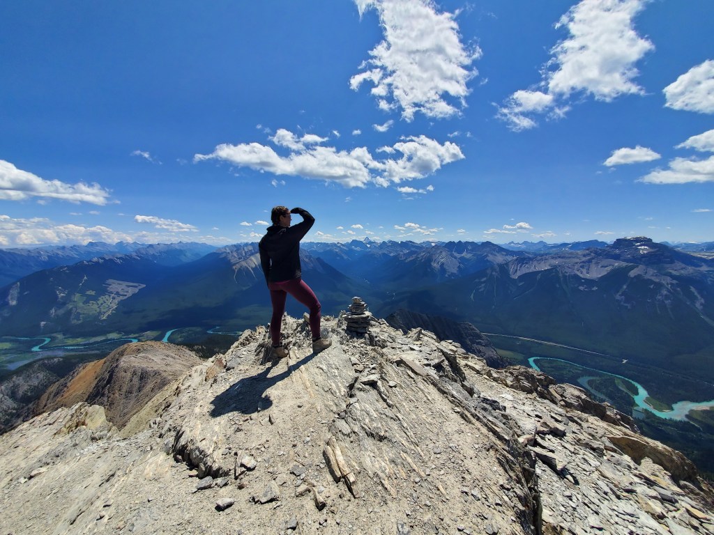
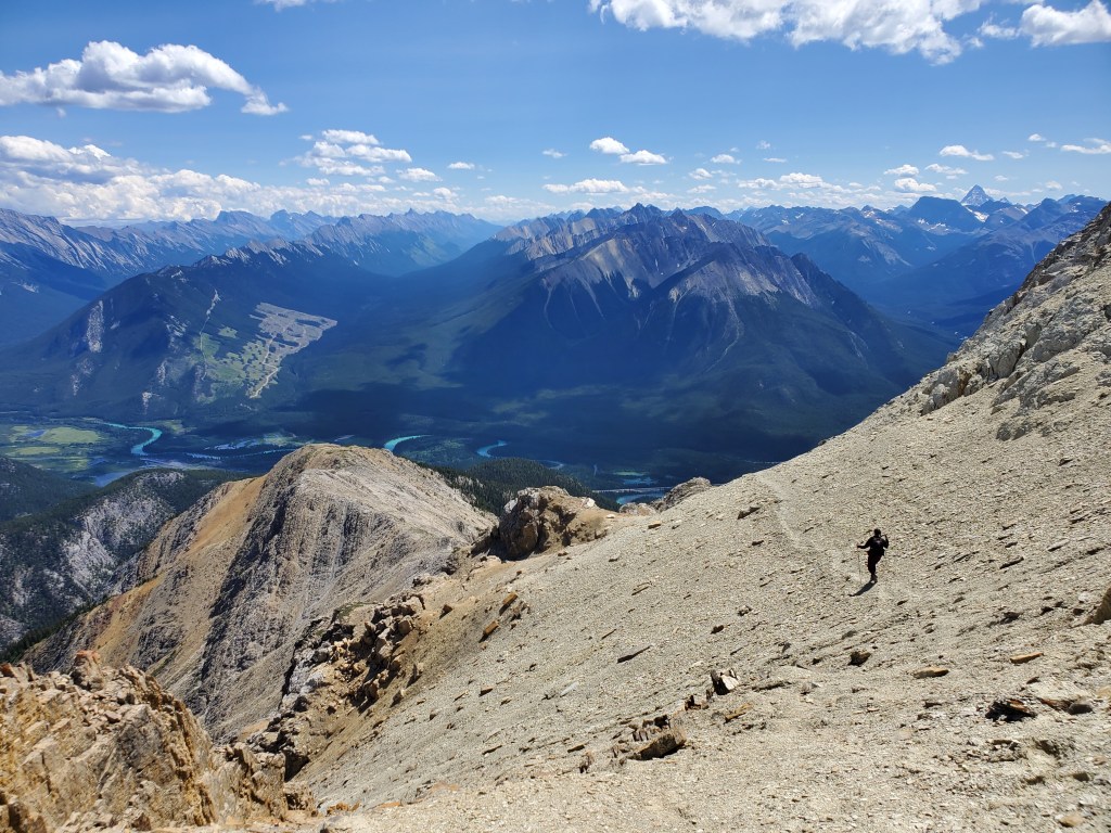
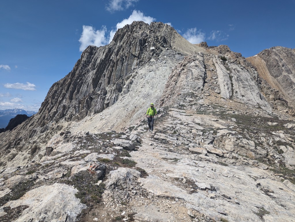
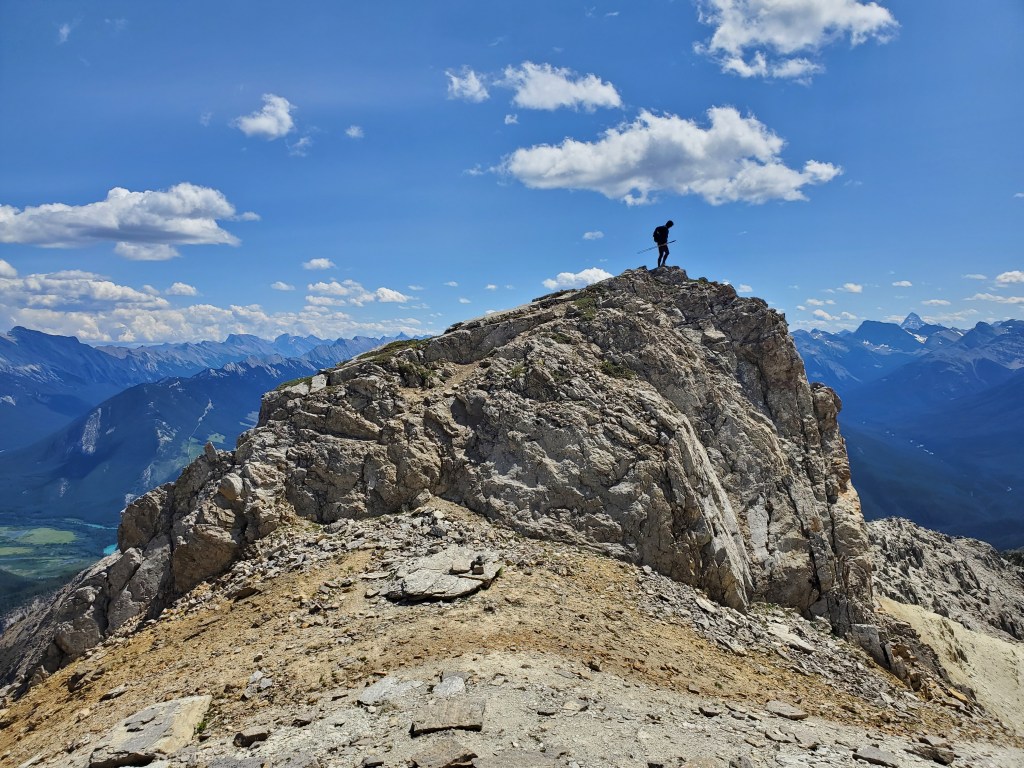
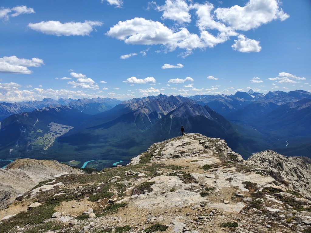
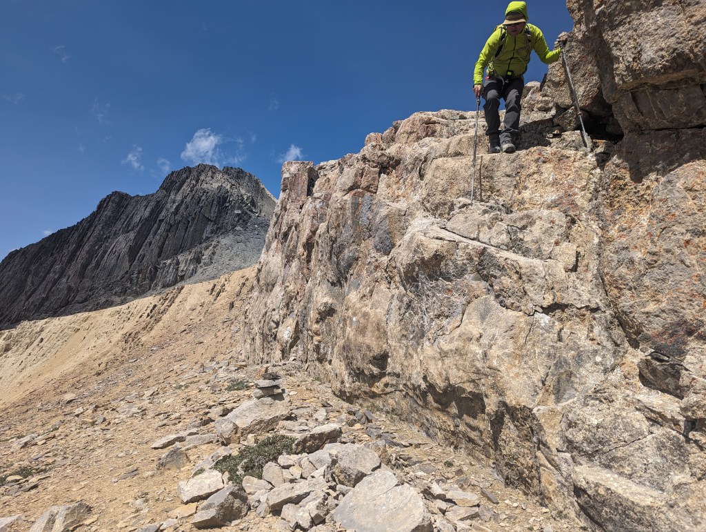
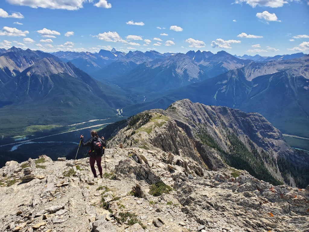
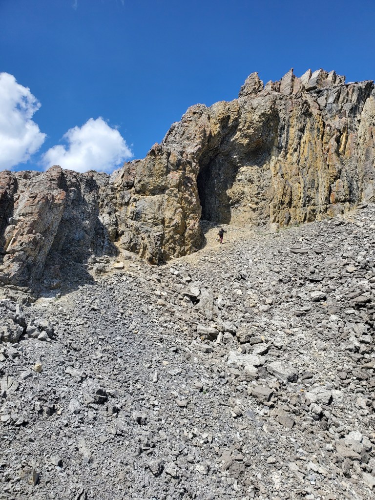
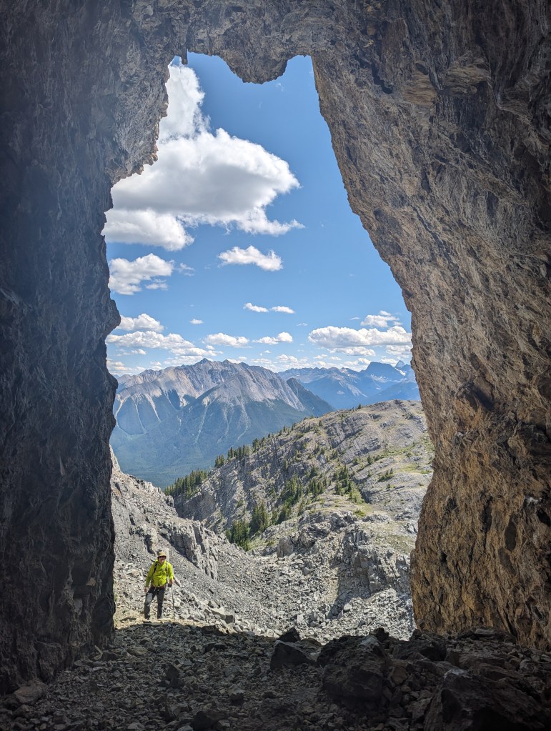
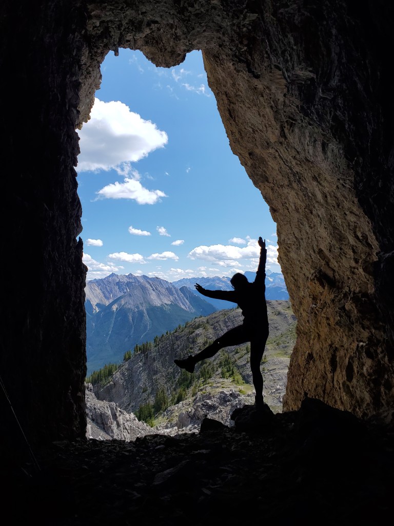
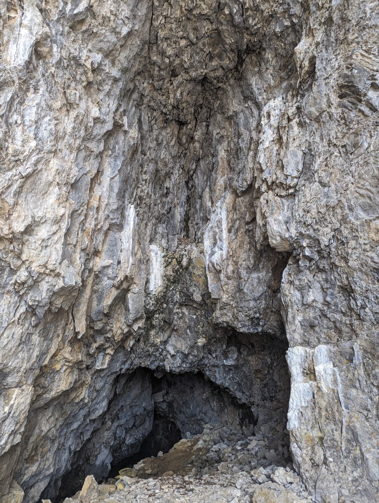
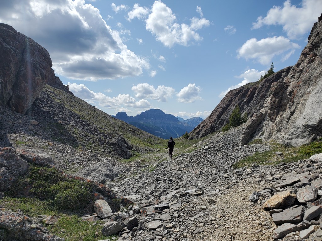
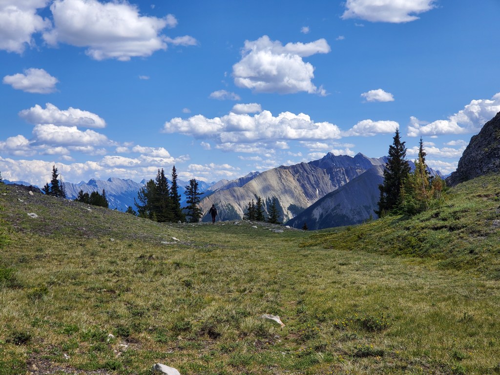
After crossing under the powerline (pictured), a short steep trail leads to the start of the ridge. We were above the trees within minutes.Gazing over the sublime bright blue waters of the Bow River. Directly across the river is the Trans-Canada Highway and then Sunshine Rock climbing crag.Continuing up easy terrain. The high point to the left is not part of the route. We’ll be continuing along the ridge to the right.The initial trudge to gain the ridge seemed to go on forever. We were starting to question how out-of-shape we’d really gotten over winter!Looking East down the Bow Valley to Sulphur Mountain and Mount Rundle.Finally reaching the ridge and pausing at a grassy plateau. The hump ahead can be bypassed around the left to avoid unnecessarily gaining and losing elevation. It’s easy either way though.Getting around the hump, the rest of the route comes into view. The route turns into more of a scramble from here, but it’s nowhere near as bad as it looks.As is often true, the terrain becomes much easier once up close. A decent trail can be followed for most of the ridge. The route zig-zags through the tricky bits and only a couple of spots required moderate scrambling moves.Looking back along the ridge. Mount Assiniboine towers over its peers in the distance.Pausing for a quick break, grateful for my supportive trekking poles.As impossible as the terrain can look, there was always a moderate line up.Up and at ’em.Pausing while Dan catches up to ensure no rocks are inadvertently kicked down on him by my movement.One of two peaks is ahead. The second peak is further back and appeared to be the same height. The trail through the scree passes below the first peak, on easy terrain to the right, and then gains the peak slightly further back.Passing below the first peak. The peaks look equivalent in elevation, so Dan chose to wait for me at the closer peak. The impressive peaks of Mount Edith (near center and right) steal the shot.Within a few minutes I had followed a trail to the further peak. I am the tiny speck on the center summit.Majestic views over Cory Pass Trail, winding its way between Mount Louis and Mount Edith.Looking back from the further peak to the closer peak. Dan is a tiny speck just to the right of Mount Borgeau.I returned to the closer peak where Dan was lounging in the sun.Lounging at the peak of Mount Cory. Mount Rundle features prominently at center.Summit panorama.Gazing toward Mount Borgeau.Returning the way we came. The trail bypasses the peak and side-slopes around on easy scree.Looking back toward the closer peak. The trail through the easy scree to the right can just be made out.One of many fun rock formations passed along the way.I pause to get my bearings, ensuring we downclimb at the same spot as on the way up.This little shelf was about the hardest scrambling we encountered. The rock is solid and there is good flat ground below.Continuing along the ridge. At the Y up ahead we will keep left to return down the treed toe, the way we came.On the way back we made time to stop at a cave we had passed. The cave is only a few meters off of the trail and can be seen as a detour on the route overview, a little over half way up.Dan joins me to check out the cave. It isn’t very deep, but it was still an enjoyable diversion.The cave’s interior.Continuing out. The cave is behind and to the right. The path out gains the left side just up ahead.Back on the grassy plateau. From here it is mostly just a hike down the toe of the ridge, back to the road.
We made it back to the road in 7 hrs 45 min and then drove to the Cory Pass Trailhead, where we enjoyed a leisurely dinner at nice picnic tables next to the parking lot. Cory Pass Trailhead is also the closest outhouse. Mount Cory was a thoroughly pleasant scramble with spectacular views. Kane rates this one as an easy scramble, but I would put it at the easier end of moderate scrambling. The two moderate moves felt similar to the crux move on Heart Mountain (also moderate). I would recommend this for a friend that has a few easy scrambles under their belt and wants to start testing their abilities on moderate terrain.