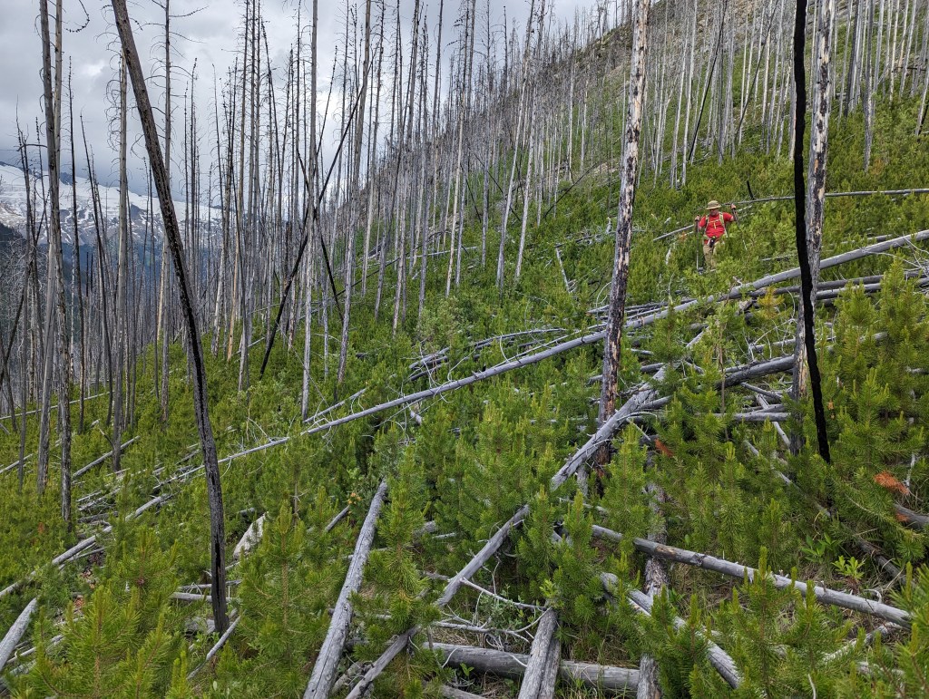
Notes: Significant bushwhacking through forest fire deadfall.
Trip Report
The bushwhacking gets very tedious on this one. Without the forest fire deadfall, this would be an easy walk up to the peak – something I would bring friends on. However, in its current state, the deadfall is up to chest-deep in places, making for slow progress with tree hazards.
We had initially planned to tackle this one in late April, but drove to Saskatchewan Crossing first to get a look at the slope. Noting the amount of snow still present, we decided to push this one back to a later trip. By early June the slope was completely bare.
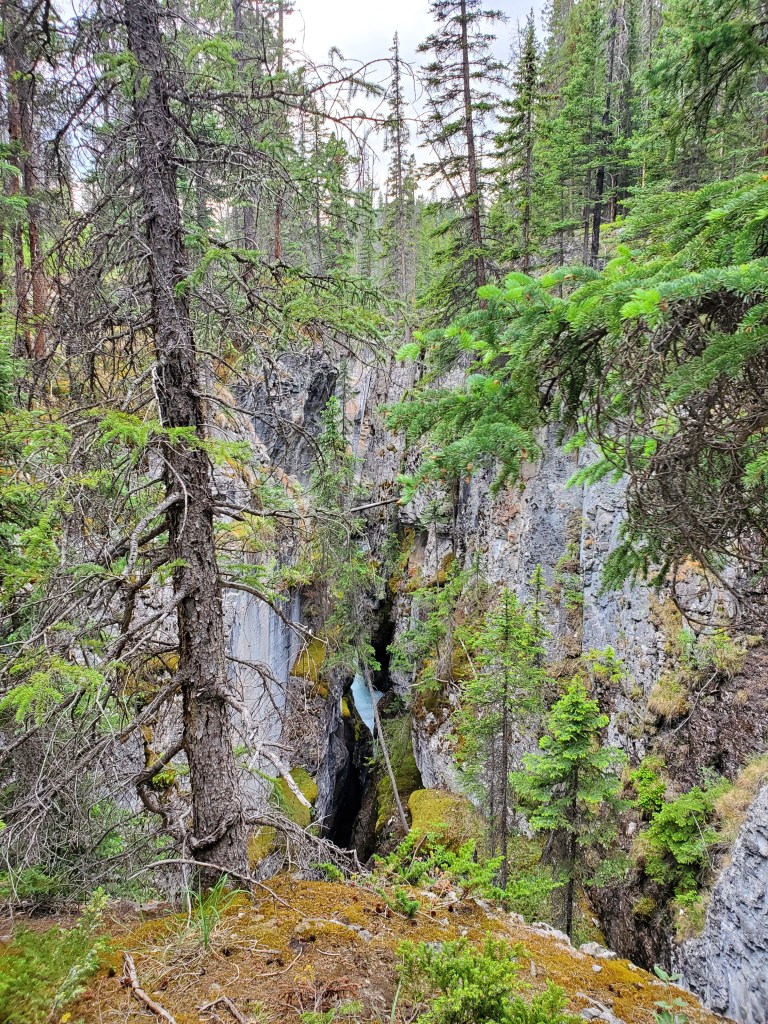
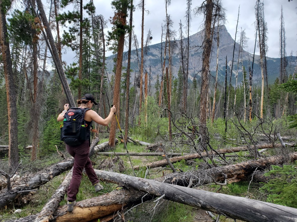
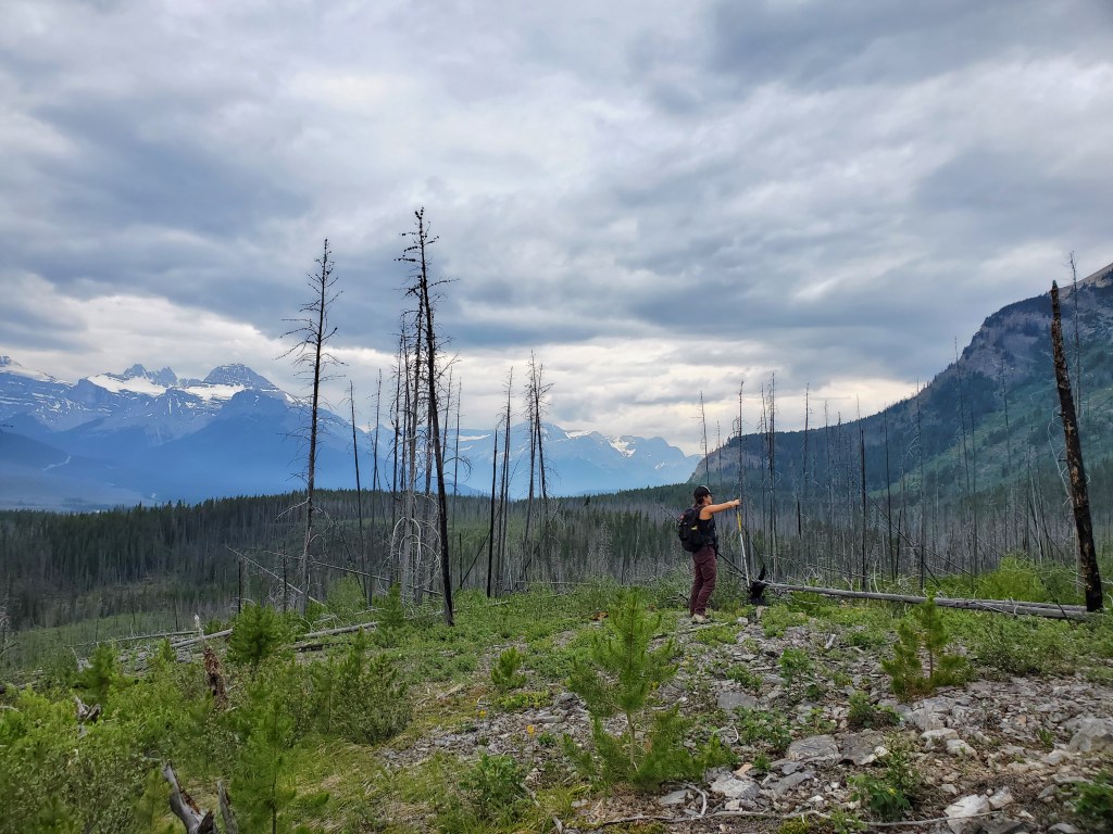
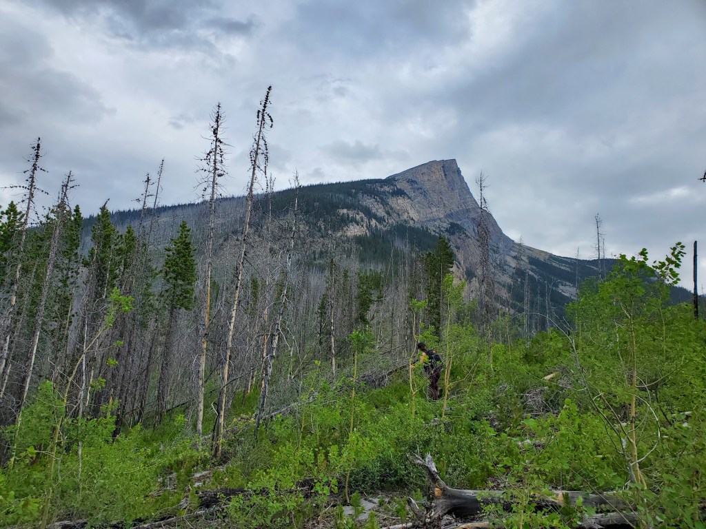
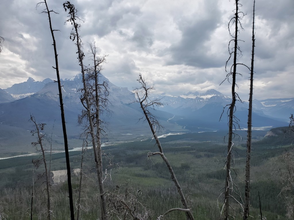
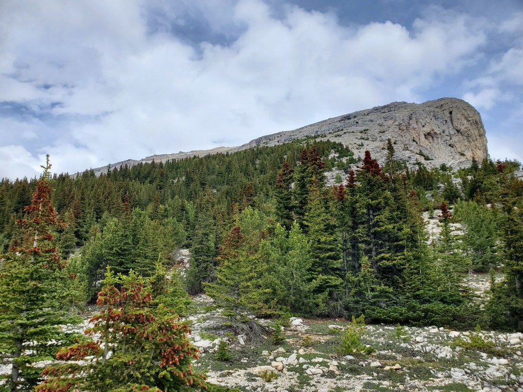
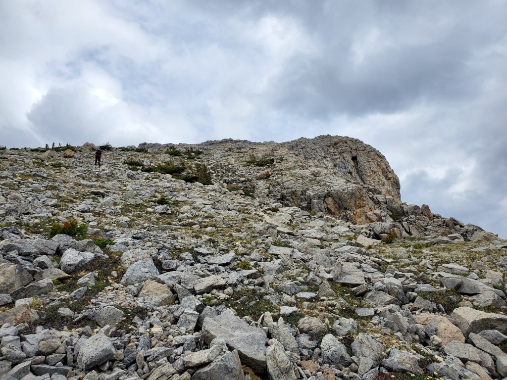
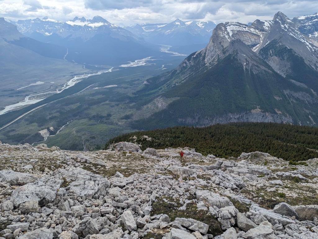
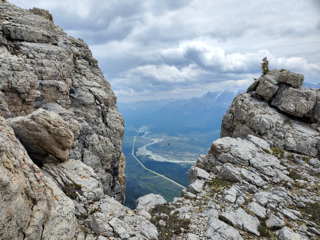
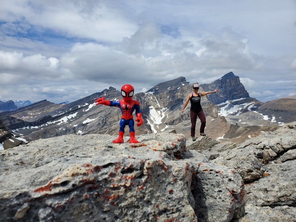
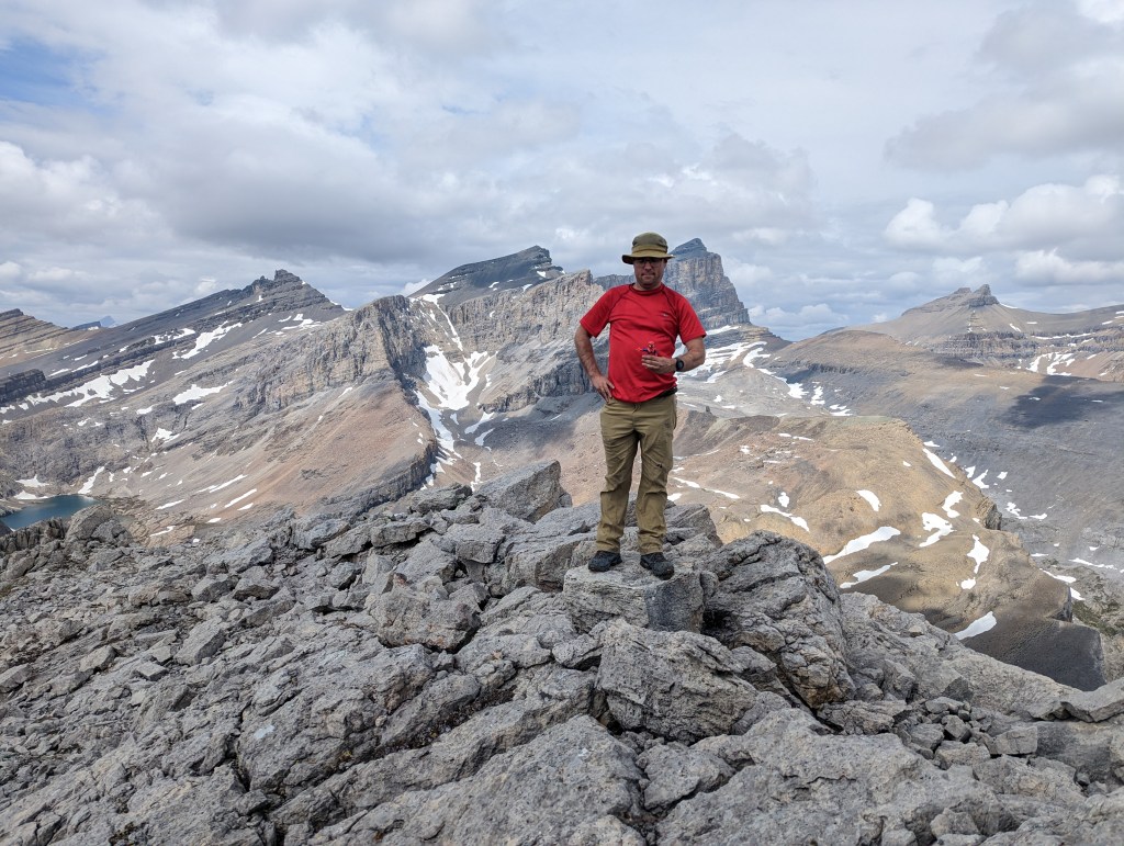
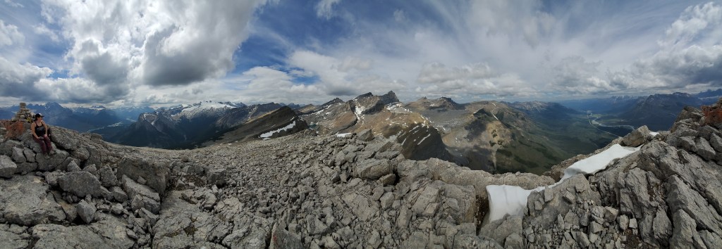
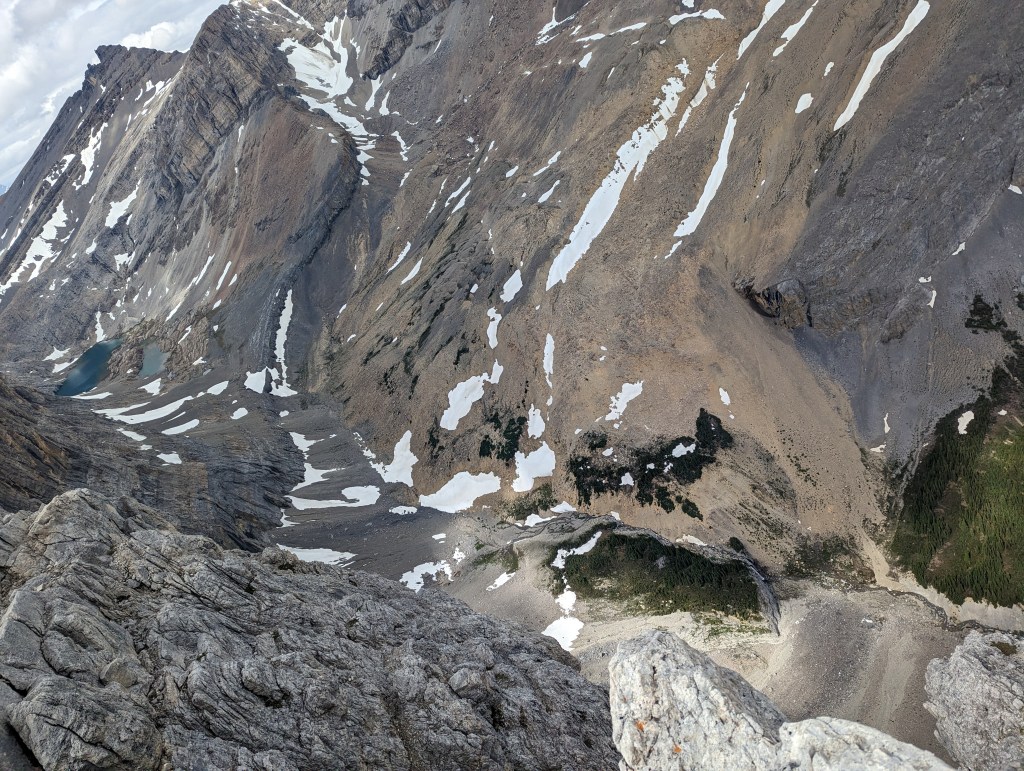
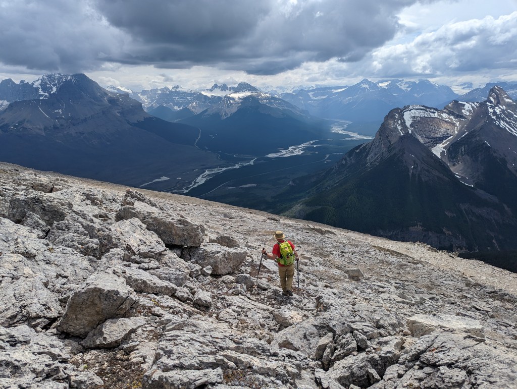
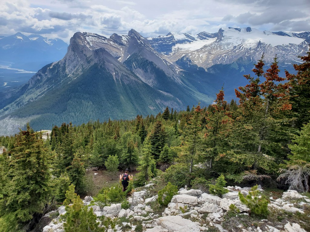
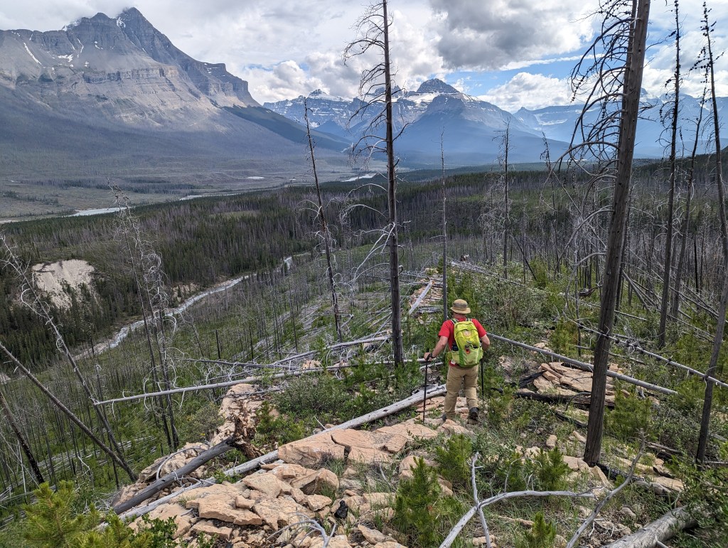
The peak is visible from the new parking lot. Many rest stops and camping areas along the corridor were improved in 2022. This trailhead, shared with Owen Creek and Great Divide Trail, now has a parking lot and outhouse on the south side of the highway.Initial travel on the trail is deceptively easy.Owen Creek offers interesting views along the way. This canyon becomes even more picturesque in winter, once ice-covered.Deadfall from an old forest fire is soon reached. It’s a nuisance, but isn’t terrible while on the trail.We soon reached our turn-off and paused to choose our favourite line of bushwhacking through deadfall. We aimed for this rocky ridge.The rocky ridge eventually became a bushwhack too, so we bee-lined directly toward a weakness in the ascent slope, climbing over chest deep trees and walking along logs where possible.Looking back towards Saskatchewan Crossing. Considerable deadfall continues even to this elevation.After what felt like hopelessly slow progress, we finally broke above the deadfall and started the easy portion of the day.Once above treeline, travel was unhindered and we gained elevation quickly.Looking back, to the west. The North Saskatchewan river winds its way through the valley. Mount Wilson is to the right.Looking east through a notch in the ridge.Spider-Man greeted us at the peak!Sometimes even a super-hero can only offer moral support. It had been a rough bushwhack to get here.The impressive Wilson Icefield covers the East side of Mount Wilson.Summit panorama.I scouted a bit further on the ridge and found a view over the hanging valley above the second falls up Thompson Creek.Looking down from the peak at Thompson Falls and the hanging valley above it. The angle is tricky but the base of the falls is to the right – see Appendix for a better view!After a brief break we reluctantly started back towards the deadfall.The ever-captivating Mount Wilson blocks almost the entire sky here.We arrived back at the deadfall, passing the time by playing “The Floor Is Lava”. The game was to see how many logs we could string together into one continuous path. Very high scores were possible.Brief respite along the rocky ridge before resuming our game.This was the longest game of “The Floor Is Lava” I have ever played. I did not win.
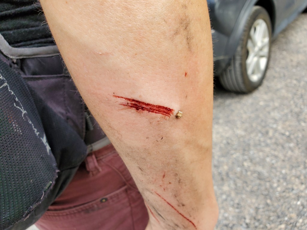
When I was almost back at Owen Creek I managed to fall off of a log and gore my arm. Thankfully it wasn’t as deep as it looked. I definitely earned ice cream in Rocky Mountain House though. If a path is ever cleared up this peak, it would make for an easy hike with great views. In its current state, however, I can’t see myself repeating this one.
Appendix
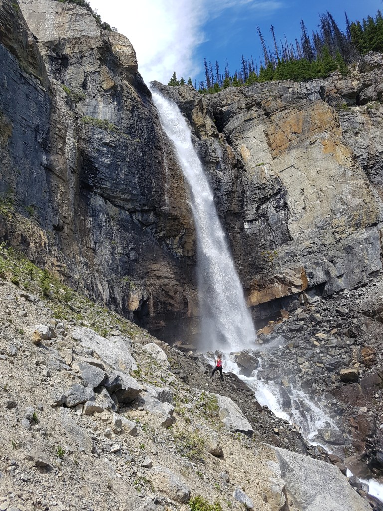
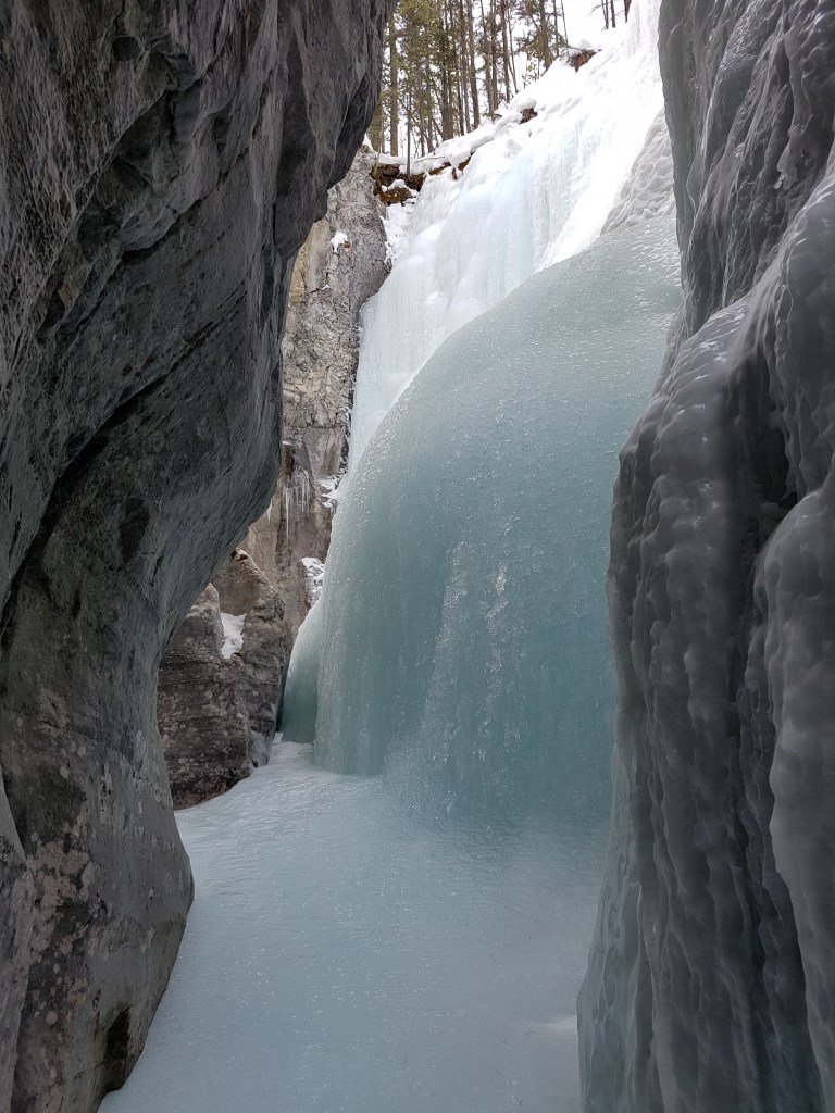
June 2017: The second falls in Thompson Creek. Some bushwhacking through forest fire deadfall was required to get to the falls, but nowhere near as bad as to reach the peak above. The trailhead to reach this waterfall is across from Thompson Creek Campground.March 2019: Owen Creek in winter. Note that Dan snapped this photo while roped up for climbing, with me above the canyon belaying him.