Notes: Trip report is for all three peaks. The scrambling is upper-moderate for a small-to-medium sized person but larger people may need to modify their route choice. The Bow Valley Parkway (Hwy 1A) is often closed to vehicles but can still be biked. This trip report includes roughly an extra 3 km of walking to and from the highway due to this closure.
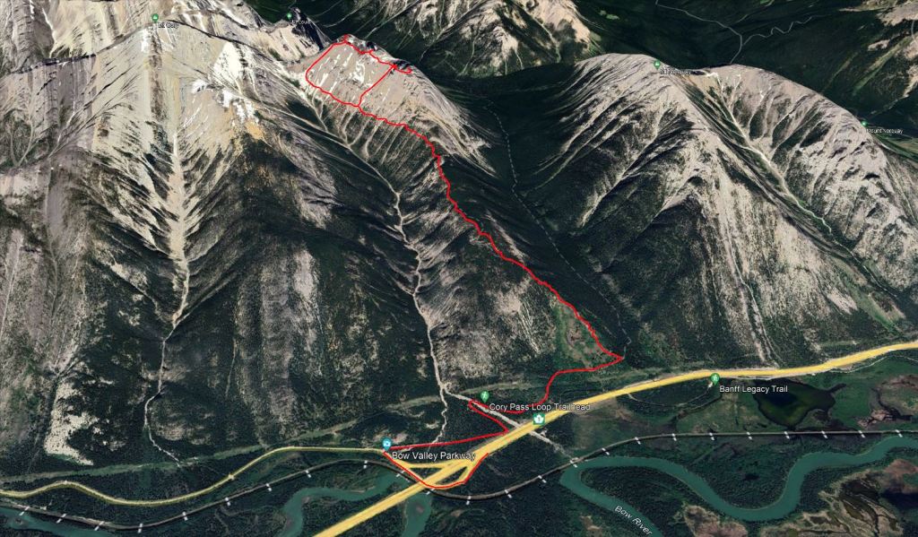
The 1A was closed to vehicle traffic the year of this trip report, so I parked along the onramp to the Trans-Canada Highway where there was a wide shoulder, and walked in via the 1A. It looks tempting in this map to park further east and bushwhack directly up to the trail, but jersey barriers prevent vehicles from pulling very far off to the shoulder there and tall wildlife fences line this entire stretch of highway. Further east is probably not a great place to stop.
Trip Report
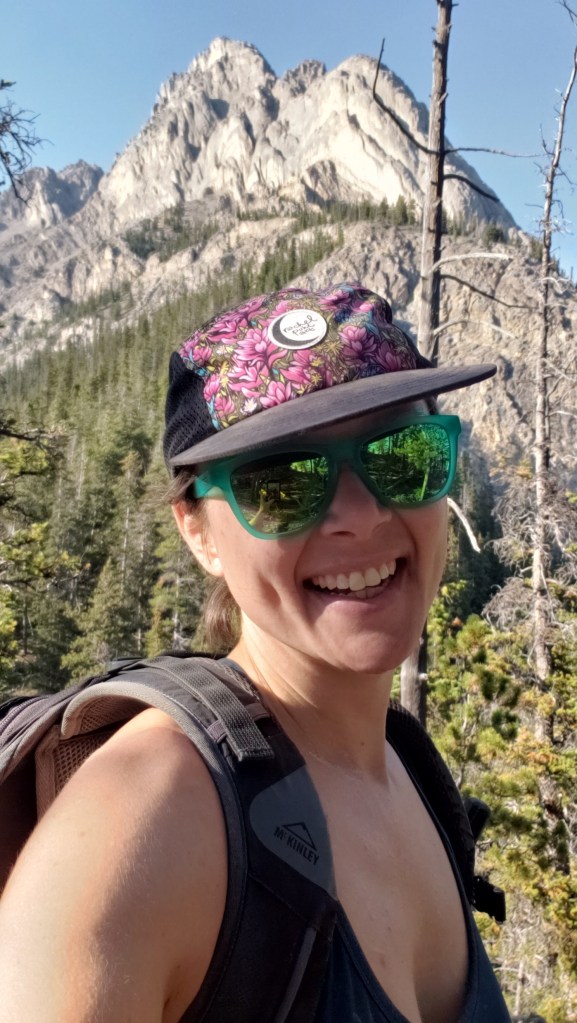
Cory Pass is one of the more popular trails in Banff, and with good reason: The dramatic faces of Mount Edith and Mount Cory are nothing short of jaw dropping. Closure of the 1A to vehicle traffic for a few years added an extra 1.5 km of walking each way to this iconic hike, which was enough to deter most hikers. I saw it as a small price to pay to have the route all to myself. I only saw three other groups in the entire day. Typically the trail starts at the Cory Pass trailhead. Because the 1A was closed, I parked along the Trans-Canada Highway at the onramp from the 1A, well out of traffic. I walked along the 1A underpass and up the road to the Cory Pass trailhead. There is an outhouse at the trailhead.
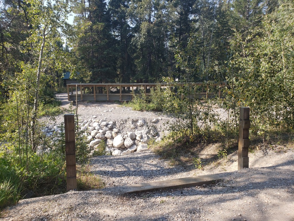
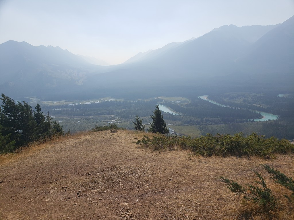
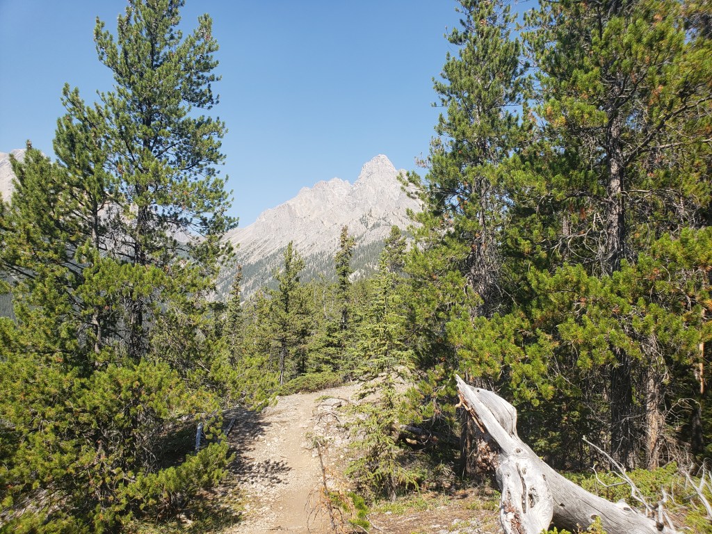
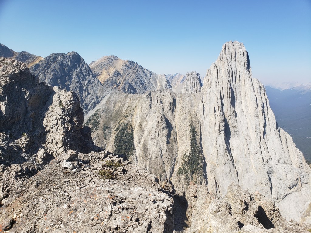
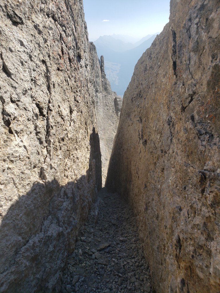
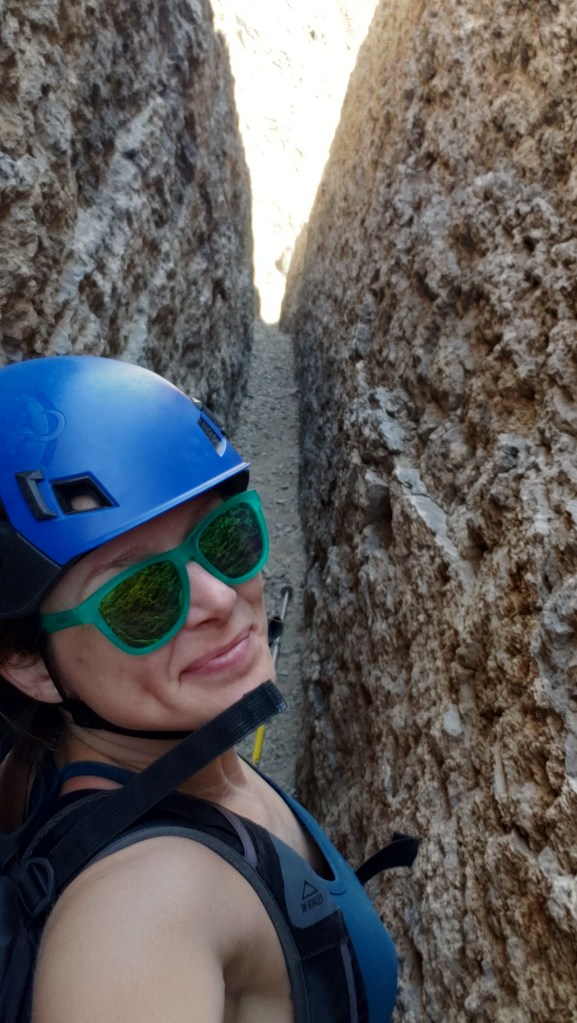
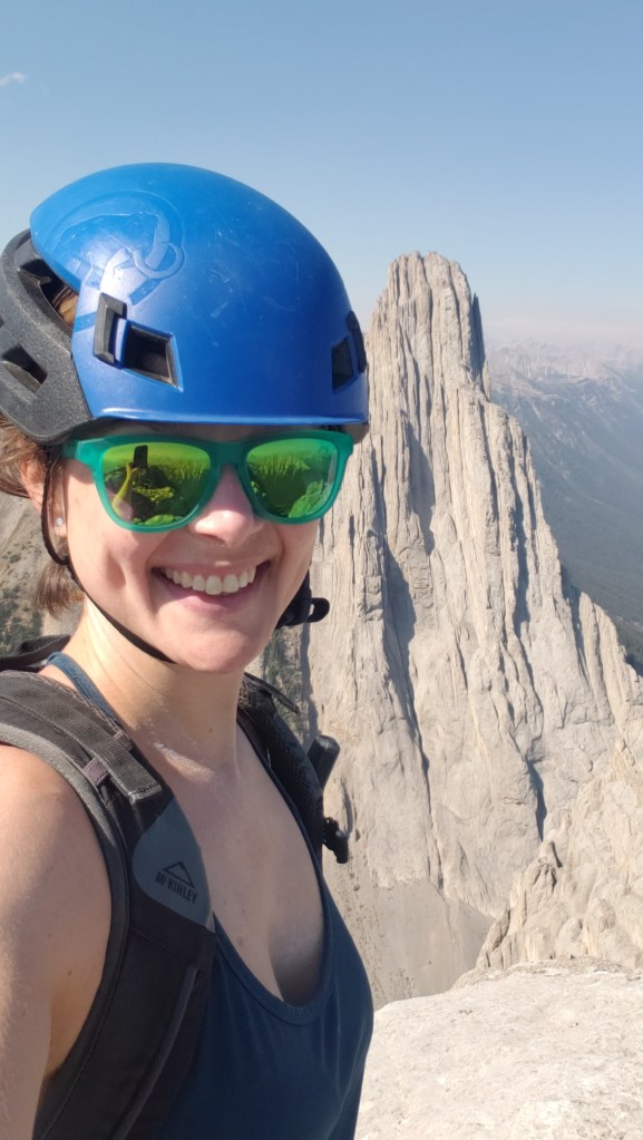
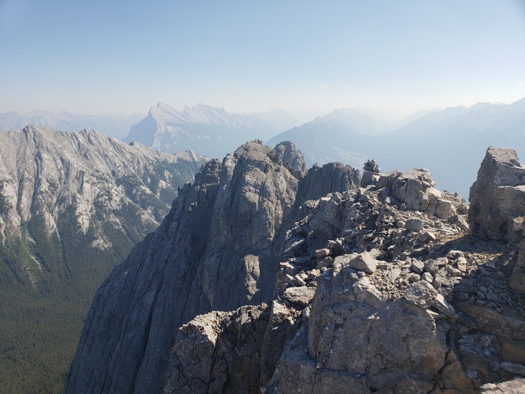
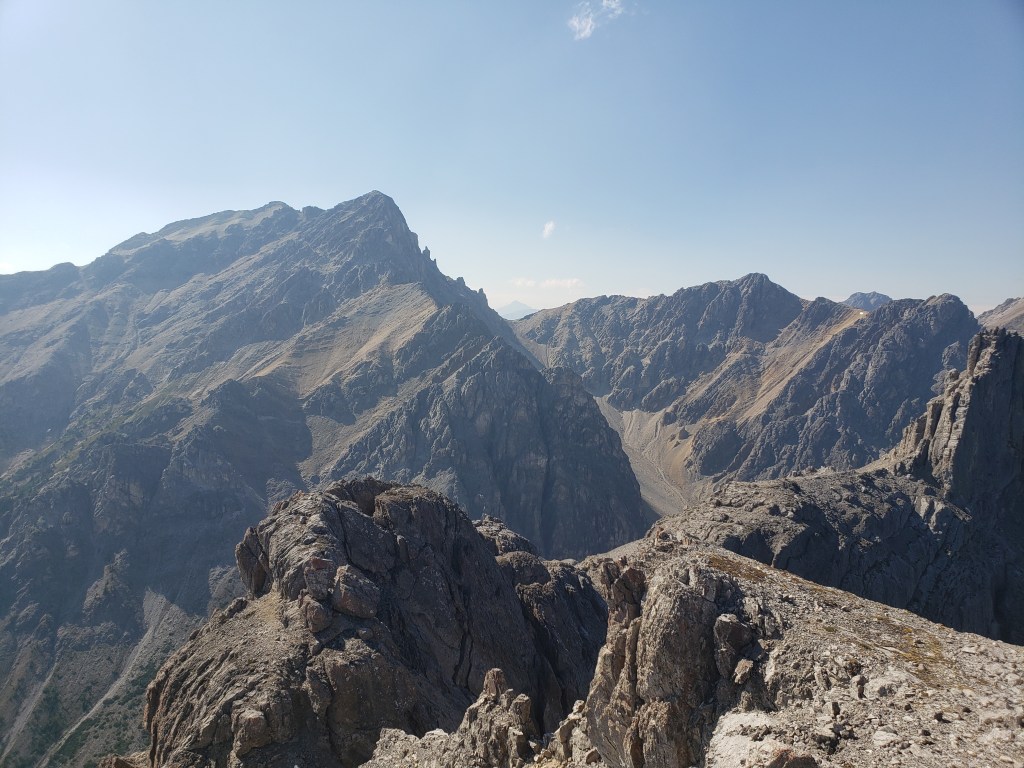
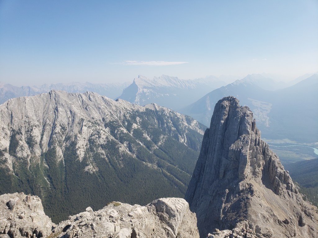
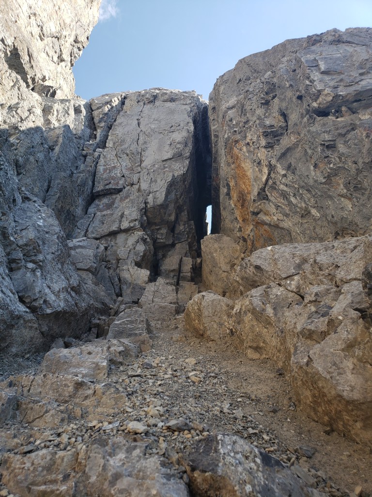
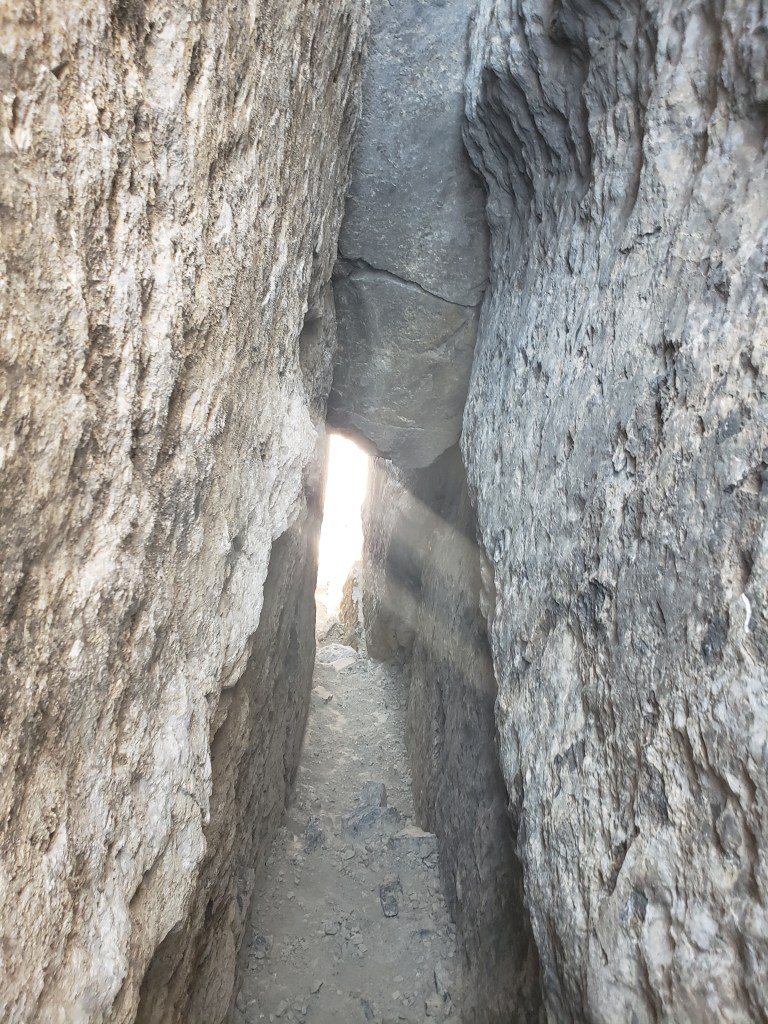
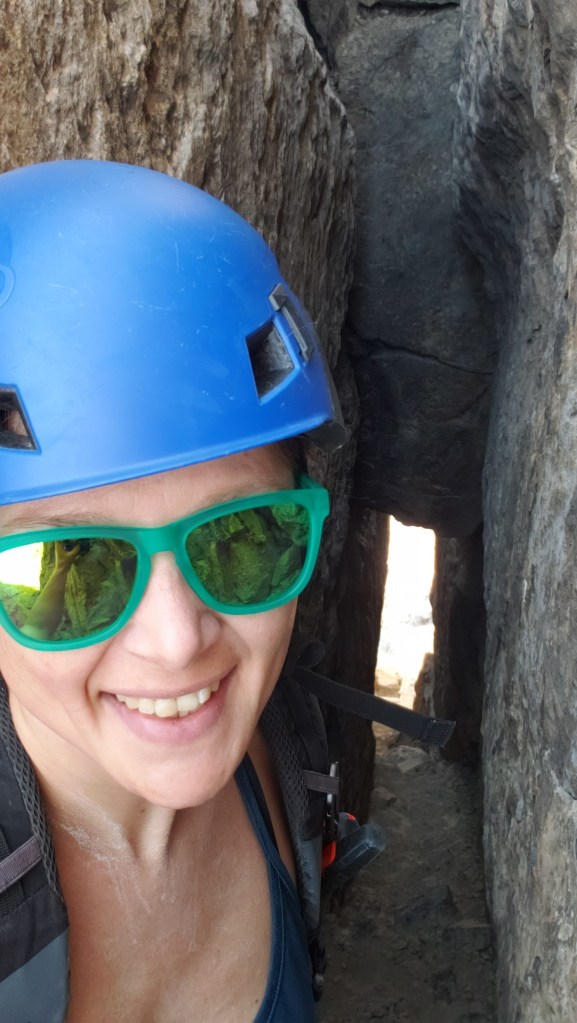
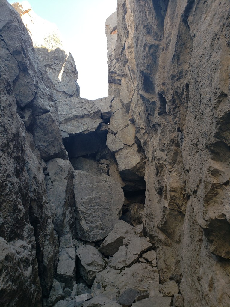
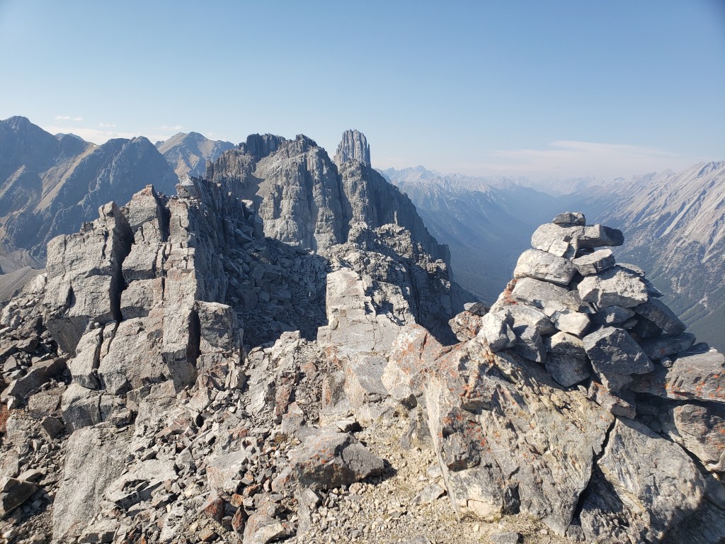
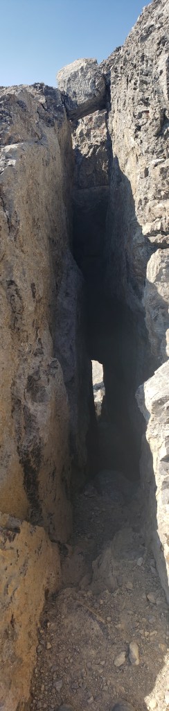
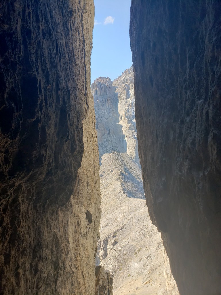
Immediately from the trailhead I had to rock-hop across a creek. The water was low and this was easy to cross. A nice bridge has been built, and it lies on the shoulder of the creek (for reasons I don’t know). This photo is looking back at the unused bridge and empty parking lot.Just over 1 km from the trailhead, the trail turns right and starts rising out of the trees. It was a hot, smoky September long weekend and even this gentle elevation gain had me sweating.Once up the toe of Mount Edith, the trail heads back into good tree cover for almost 2 km. Mount Edith comes into view through a gap in the trees. I followed the trail under the peaks to the far side of Mount Edith.Just before highest point between Mount Cory and Mount Edith, I turned right and started trending up the slope toward the tallest of Edith’s three peaks. From the shoulder of Edith, the views of Mount Louis (right) are extraordinary. Mount Fifi just pokes up to the left of Louis.I followed a trail up the slope of Mount Edith and under the cliffs of the first peak until I reached the south-facing chimney in Kane’s route description. A cairn at the right side of this photo confirmed I was at the correct chimney. I took the right-hand chimney.The chimney has tall, textured walls that offered secure hands. I found I had to brace my feet against the walls too to keep them from sliding out on the loose gravel. A larger person might find this a bit more snug, and a bit more secure.The chimney wasn’t as much of a squeeze as I expected. I’m turned sideways in this photo to show the terrain only – it wasn’t necessary to turn sideways to ascend the chimney. I’m only 5’4″ though, so a larger scrambler may have a different experience.Exiting the chimney and moving across to the peak was only moderate scrambling. At the notch described by Kane, where others have reported needing to jump, I simply downclimbed to where it narrows, and then moved securely across the gap. Here I am at the peak, with impressive Mount Louis in the background.To the southeast are Mount Norquay (left), Mount Rundle (distant left) and Sulphur Mountain (distant center).From the first peak I stemmed back down the chimney and then continued along the trail under the cliffs to the middle peak. The scramble up to the second peak was moderate by this route and the elevation loss/gain was only about 30 m. The view from this peak is almost identical to the first peak, but it was virtually no effort to reach.Looking west to Mount Cory from the middle peak of Mount Edith.Looking southeast to the third peak of Mount Edith. Mount Norquay is to the left. I descended the middle peak via the large scree gully to the south and then walked across to the base of the third peak.The cave mentioned by Kane was obvious, and was much bigger than I expected from his account. Most scramblers should be able to pass through without issue. A steep trail leads up to the mouth.The cave slopes upward with one small rock step to scramble up.The cave was very roomy, even more so than the chimney up the first peak.Zig-zagging southward to the south ridge was easier to navigate thanks to many cairns. I made sure to look back at my route for the return trip. This photo is of the two large rocks wedged behind a flake which I had to heave myself up and over, then exit to the left. The final scramble up the south ridge didn’t feel that exposed and I would probably only put it at upper-moderate scrambling.Reaching the third peak of Mount Edith, looking North to Edith’s other peaks and Mount Louis.I retraced by steps back to the cave. This shot is looking back down it.Looking out of the mouth of the cave at the gully I had descended from the middle peak. The gully was loose and steep, certainly not something I would want to scramble with others above me.From the bottom of the cave I followed a drainage back down to the main trail, then hiked back out the way I’d come. Here I am on the main trail, with the south peak in the background.By the time I reached the toe of Mount Edith again, the day had cooled slightly and the smoke had cleared. Here is a better shot of Mount Rundle (left) and Sulphur Mountain (center). The Bow River winds around Sulphur Lakes.
I reached my vehicle on the highway in 7 hrs 40 min. The extra walking along the 1A made my day slightly longer, but it afforded me solitude on what is typically a busy mountain. The 1A was still bustling with bicycle traffic and ringing bells, of course. For me the scrambling was never beyond moderate, but I can see where it would be an exposed, difficult scramble for a larger person. For once my small size was an asset!