Notes: The Chetamon Wildfire swept across this mountain a few days after this trip; expect conditions to have changed significantly. Celestine Lake Road changes direction of travel every 90 min and closes for Winter.
Trip Report
Esplanade Mountain is some of the best quality scrambling in Jasper. Unlike many peaks around Jasper, Esplanade has minimal scree and no talus. There are about three sections of difficult scrambling, but I found these to be fun moves on good quality rock. Sadly, lightning ignited a wildfire on Chetamon Mountain (the next peak west of Esplanade) about three days after our trip. The 2022 Chetamon Wildfire ultimately spread east across Esplanade, Gargoyle, and Roche de Smet. Updated aerial photos show only a few sections of green left on the steepest part of the ridge and around the warden station. Virtually every other tree along the route was scorched.
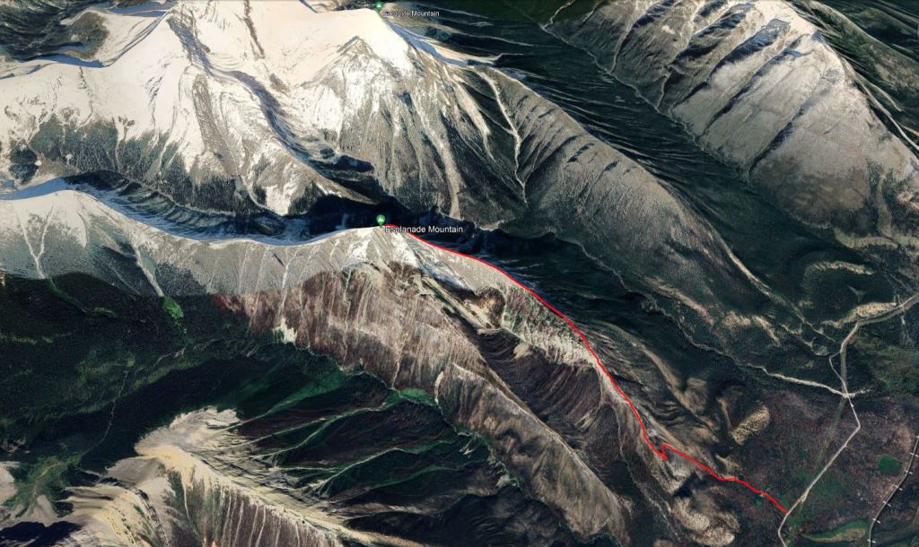
The route starts along Celestine Lake Road. This narrow, winding road alternates traffic direction every 90 minutes, requiring some planning to schedule around. I like to pack my camp stove in my vehicle so I can pass the time preparing and eating dinner at the end of the day, if needed. As of August 2022 the road was in fair condition, doable with my smaller vehicle. The closest outhouse is at the Moberly Homestead.
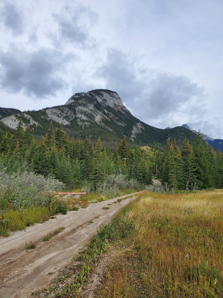
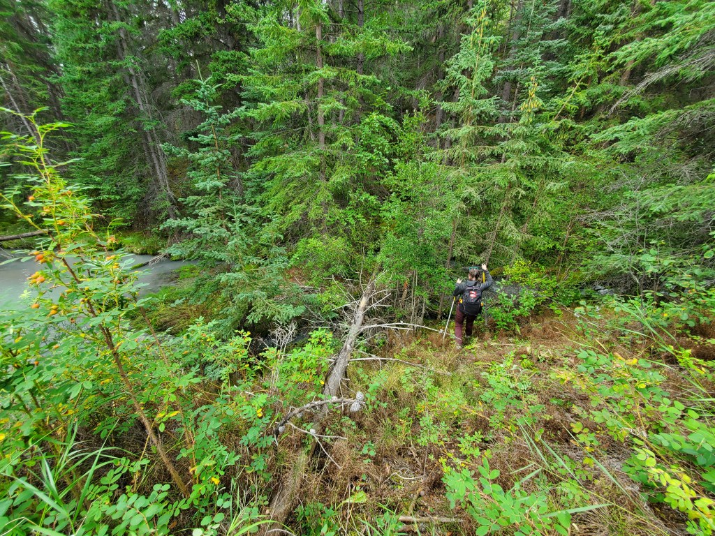
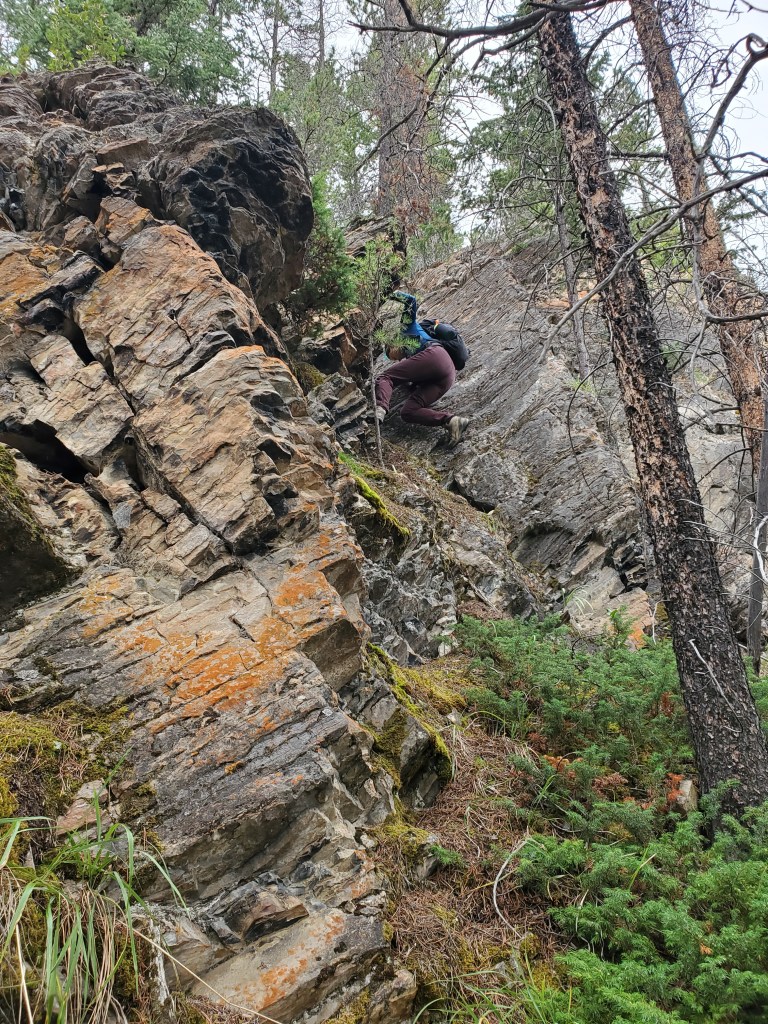
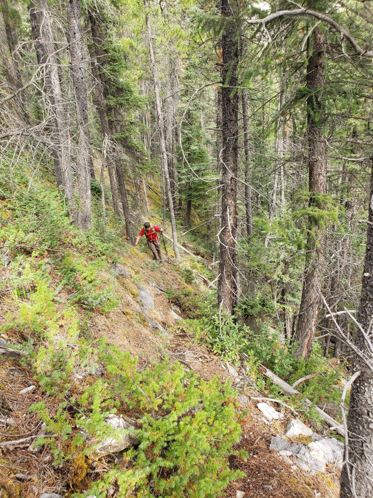
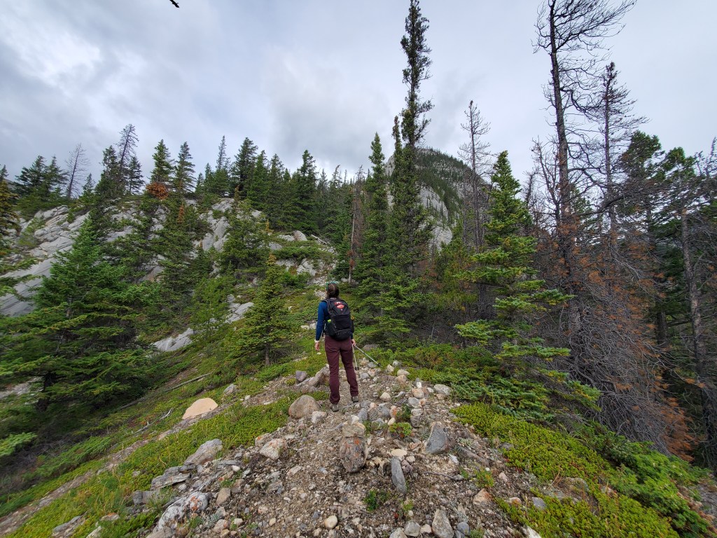
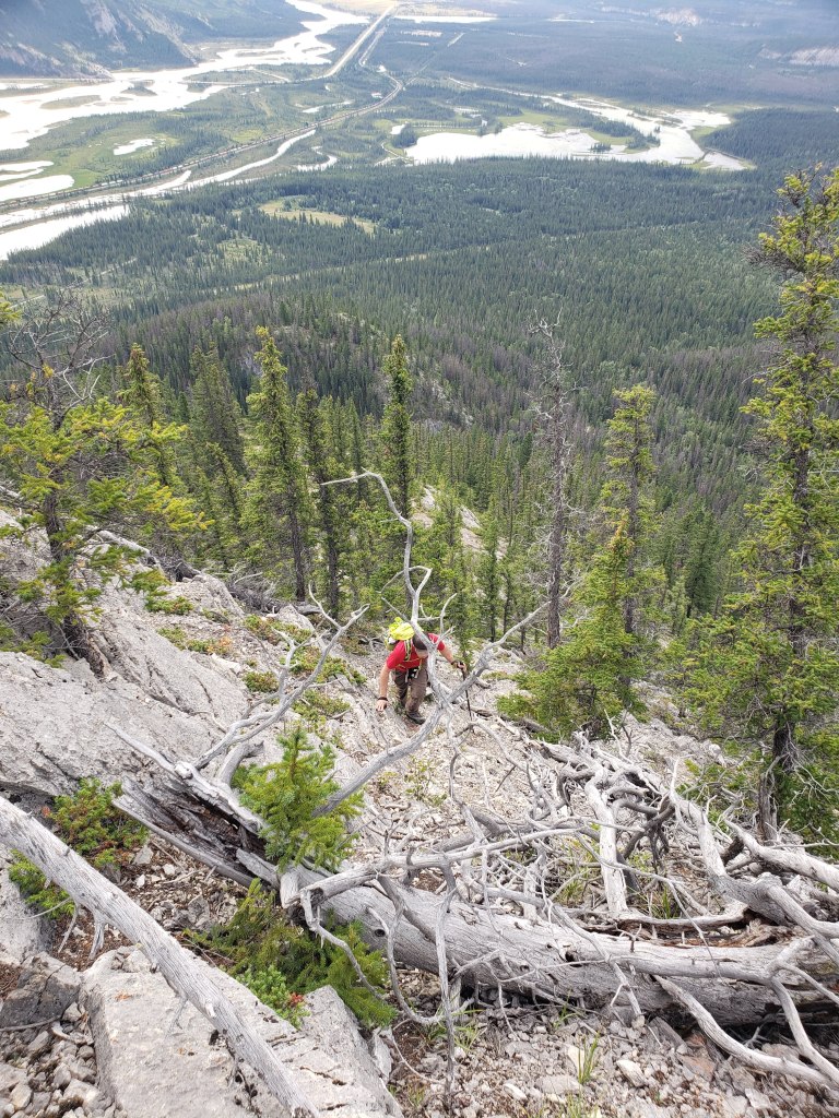
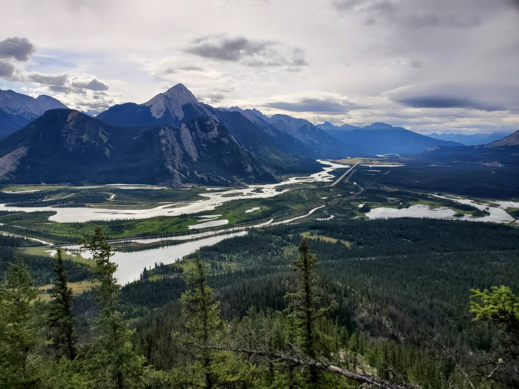
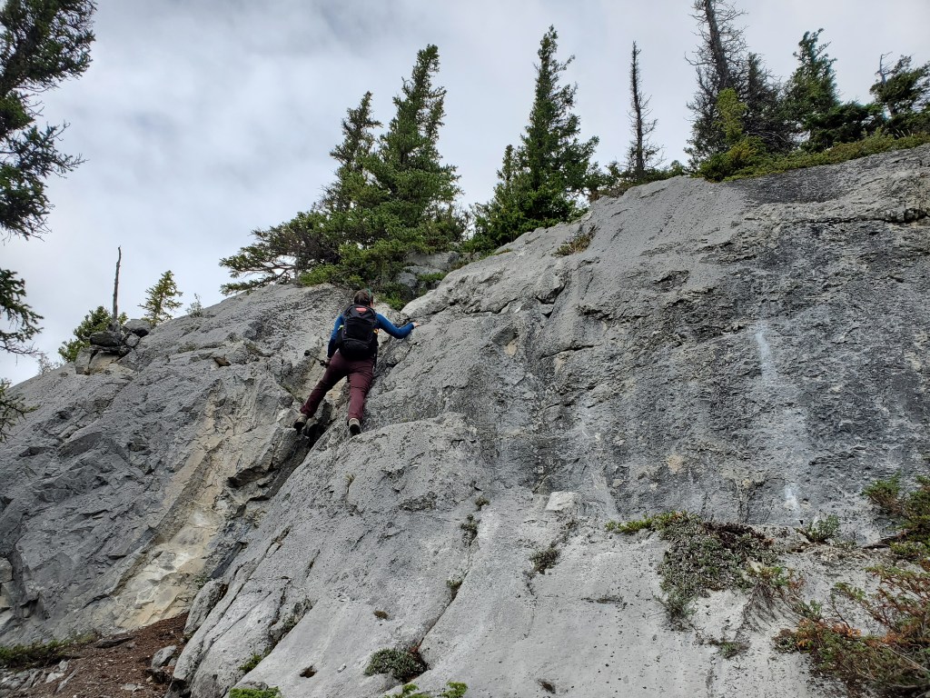
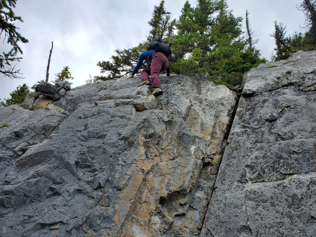
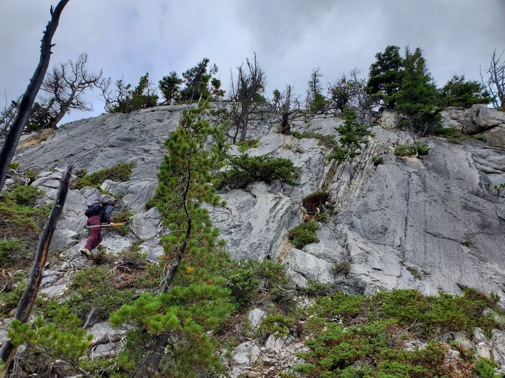
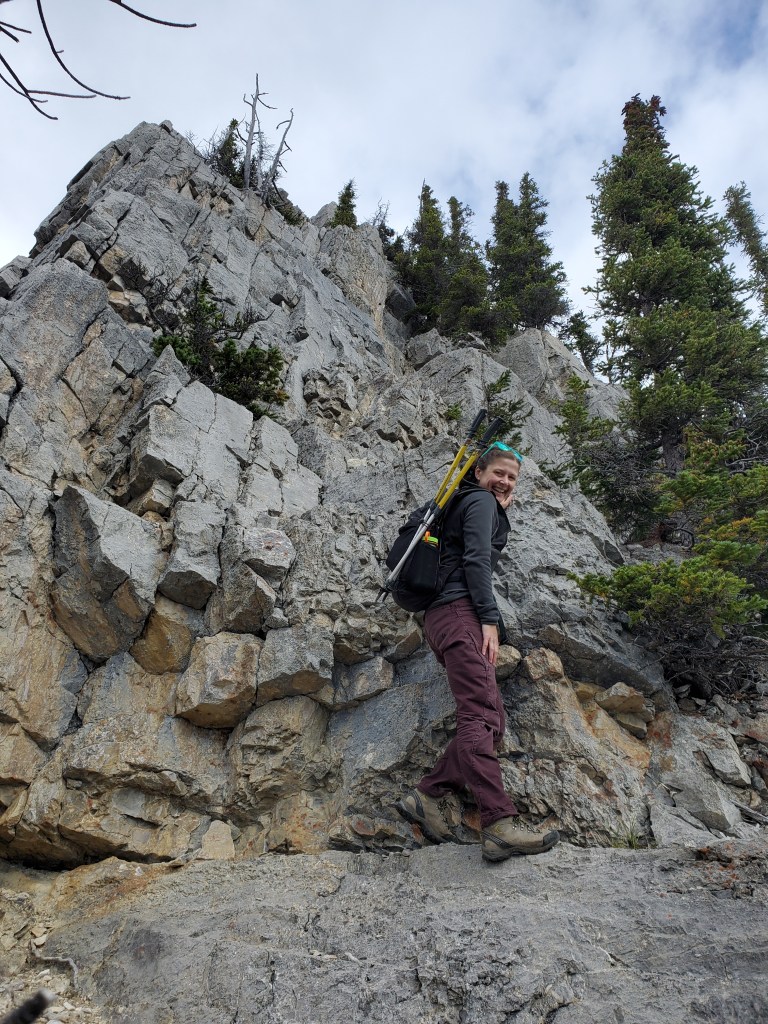
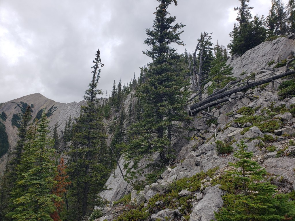
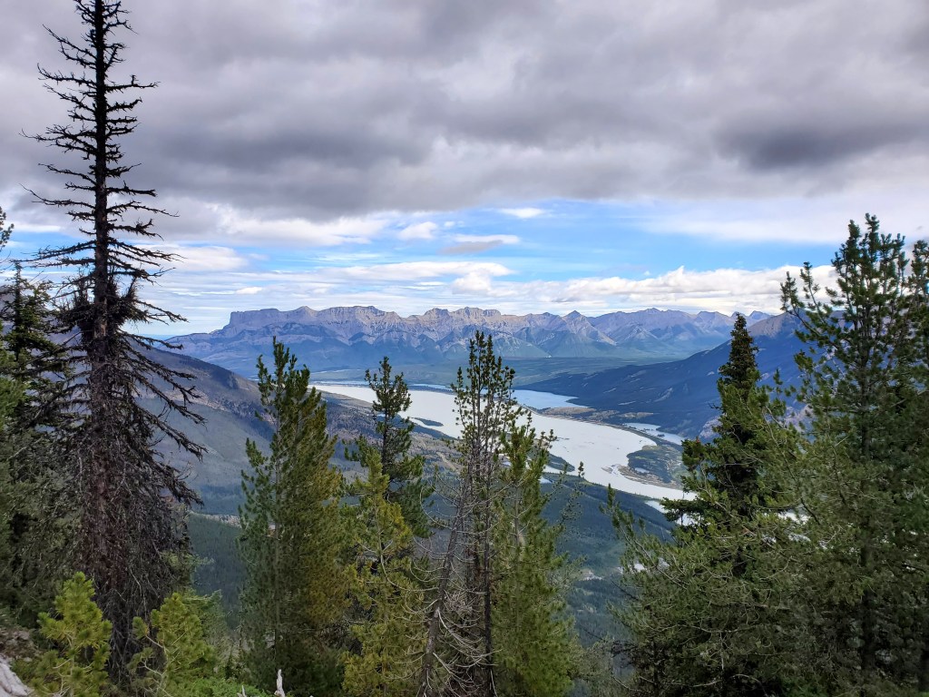
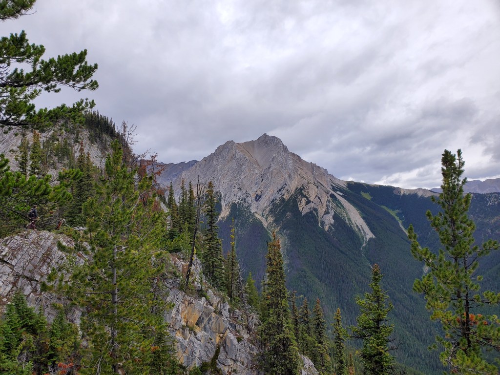
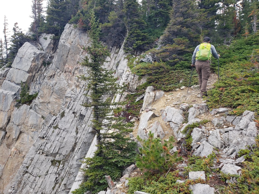
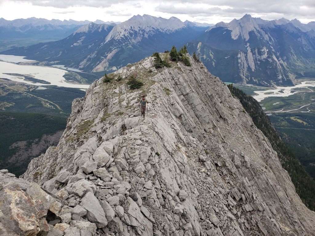
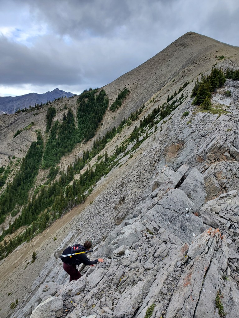
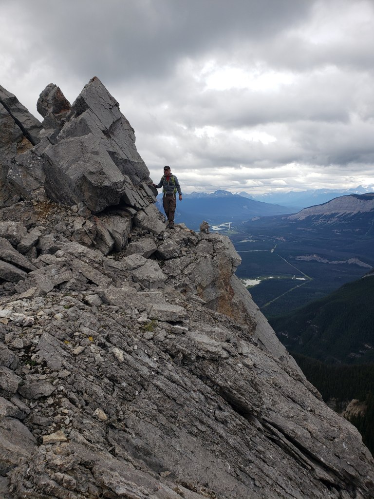
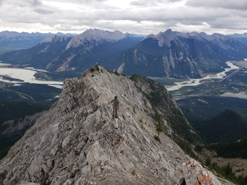
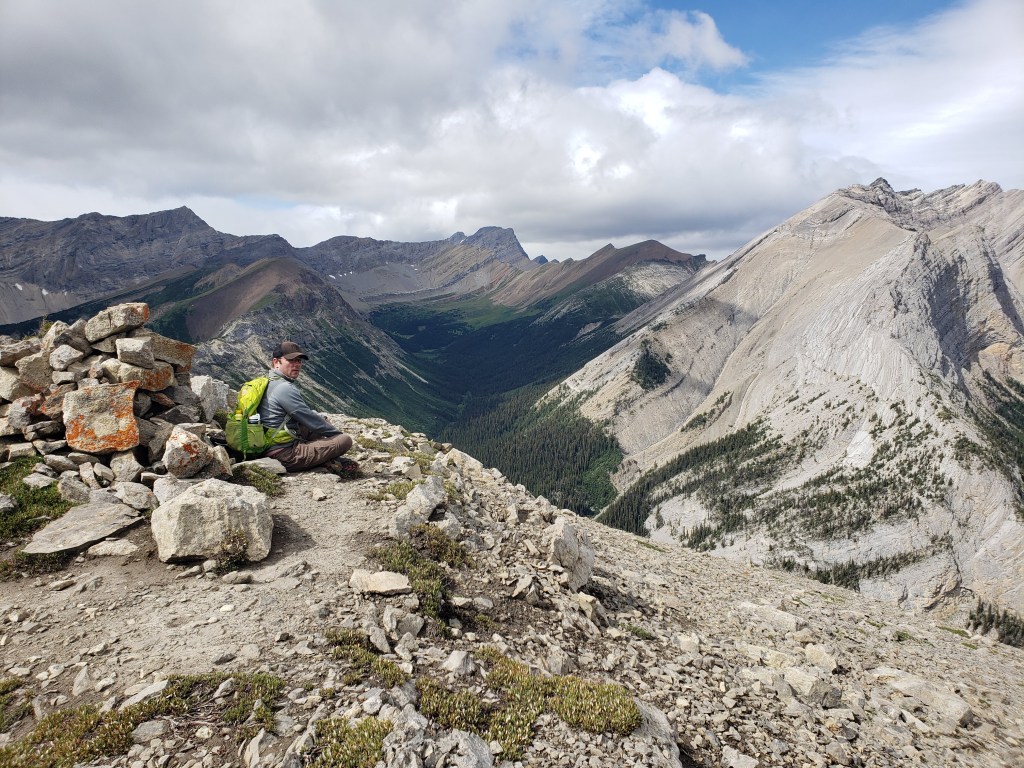
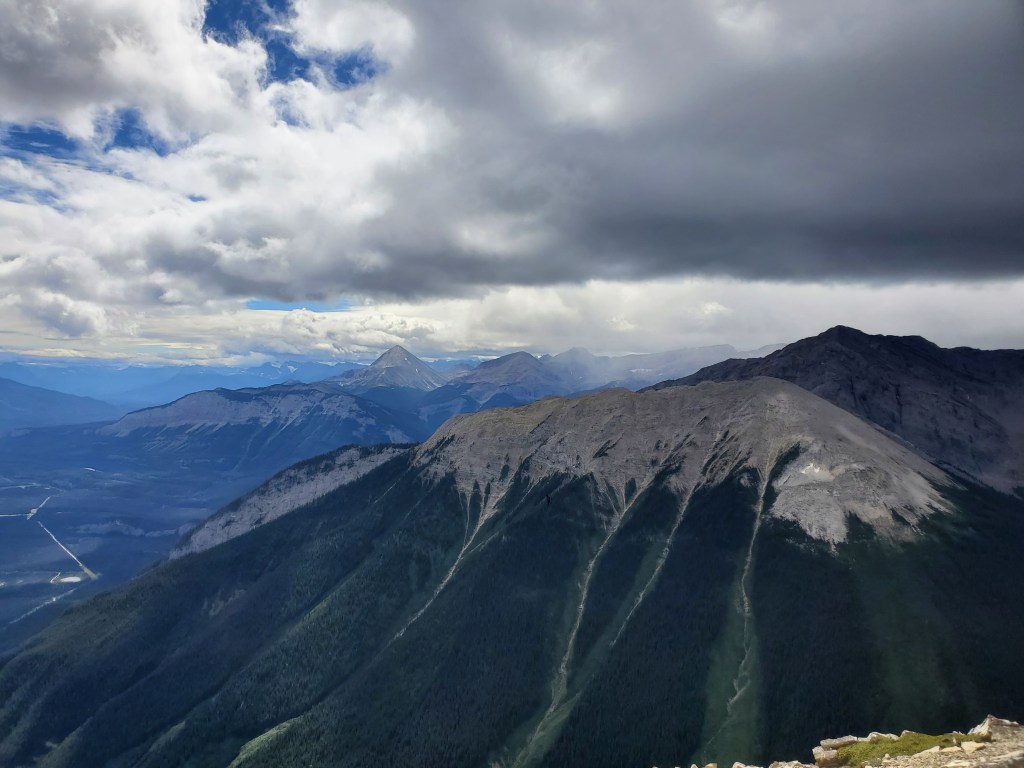
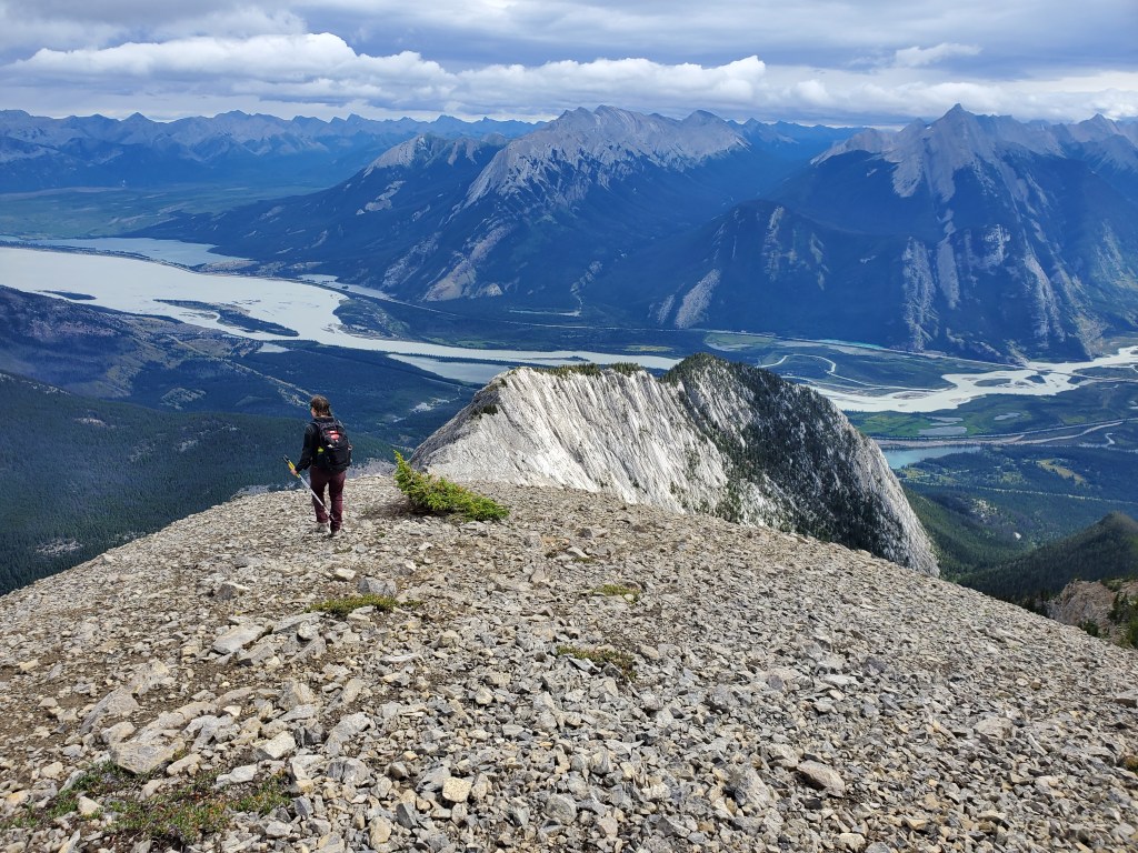
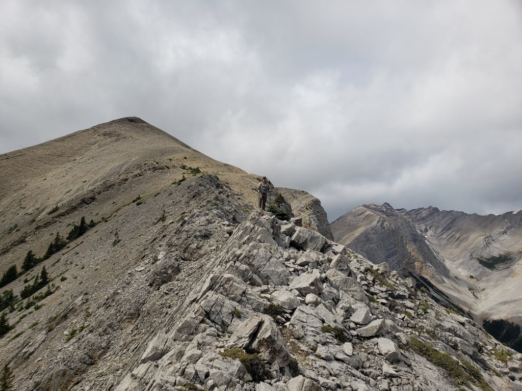
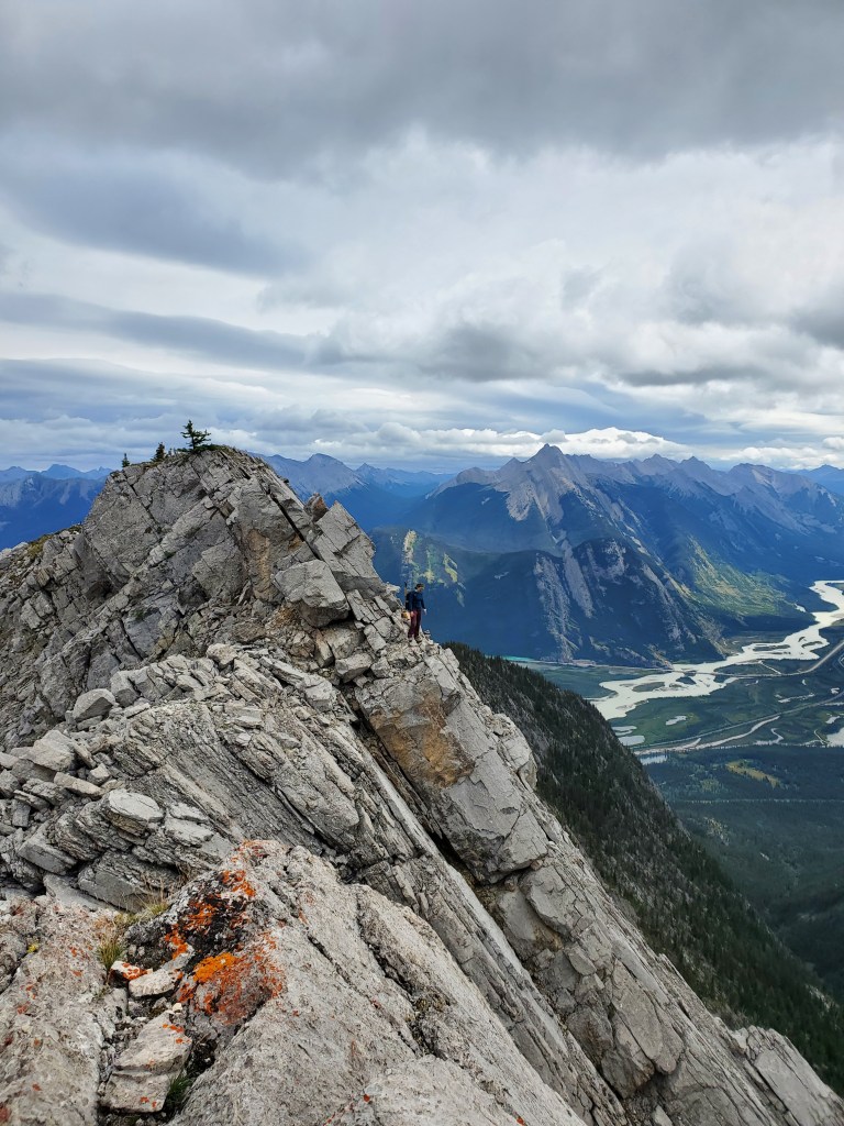
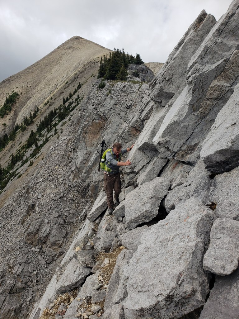
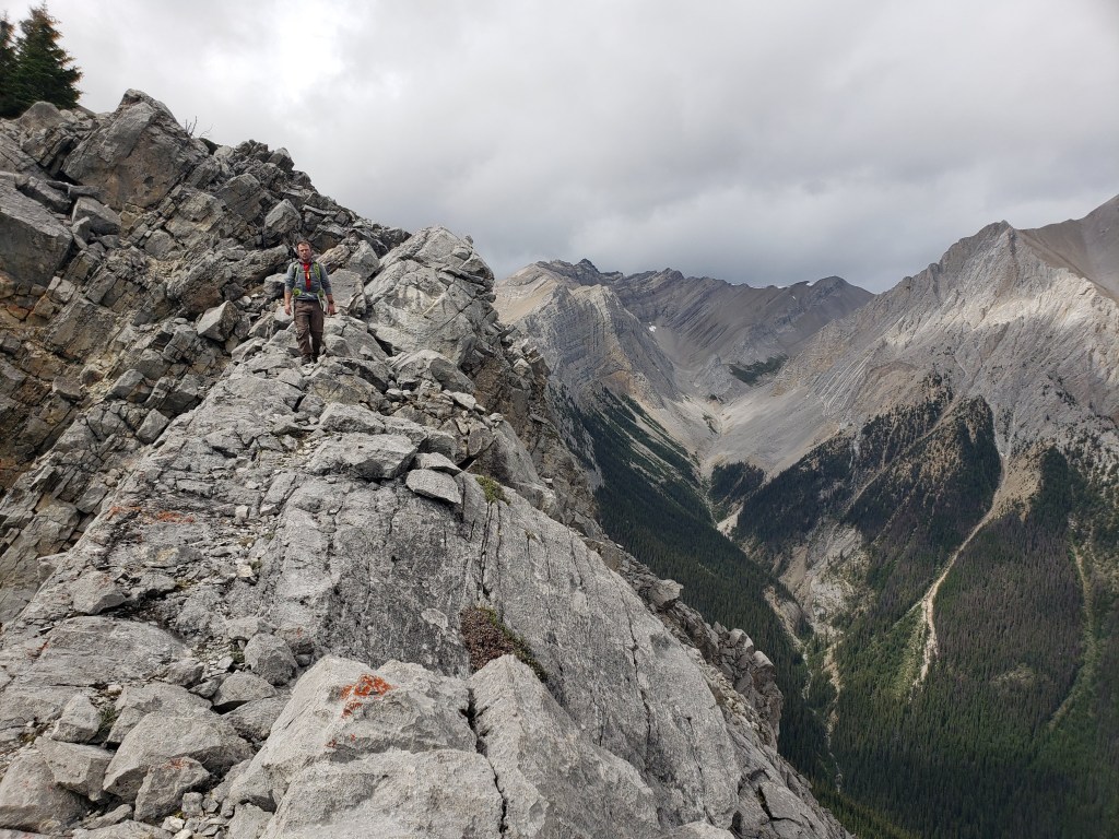
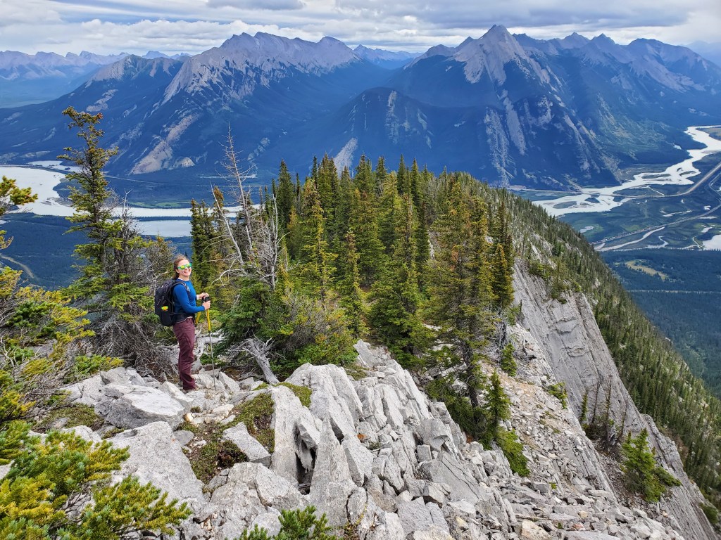
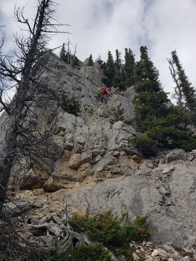
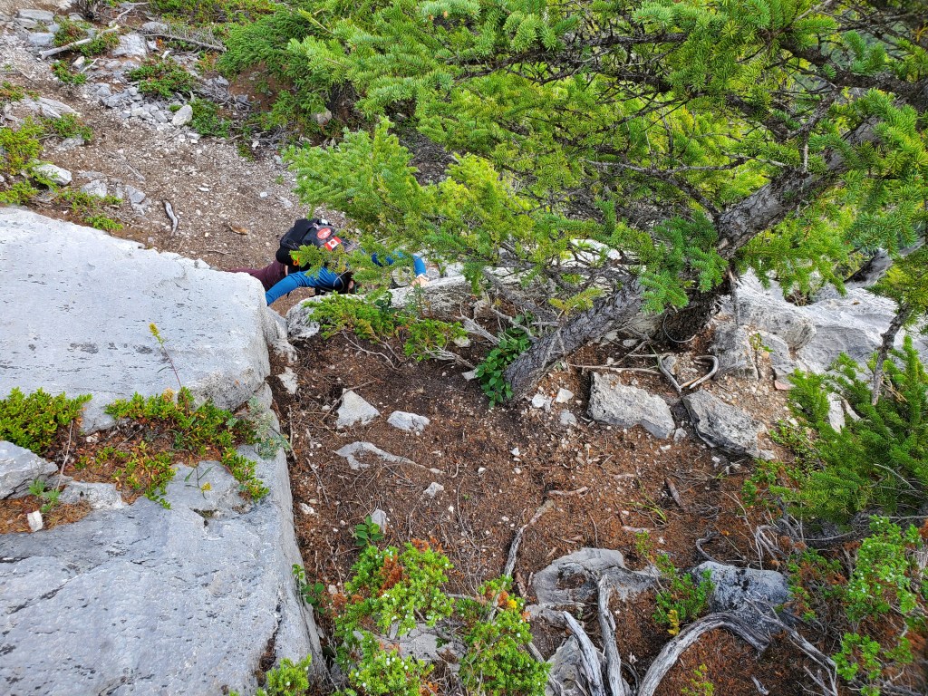
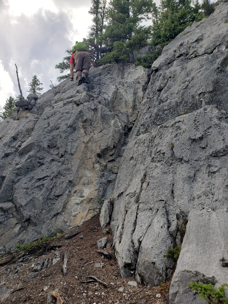
Just past the toe of Esplanade Mountain, a driveway leads to the Snaring warden station. We parked just off the driveway, taking care to park in a bald patch, not in the long dry grass that could be ignited by a warm engine. The ascent ridge of Esplanade Mountain can be seen in the background. The ridge is gained to the left, out of view.We walked past the warden station and followed a path into the forest. 2023 Update: Aerial photos show a small green patch around the still existing warden station, but everything surrounding and beyond the warden station was destroyed about a week after the photos you are seeing were taken.We scouted for an easy crossing over the creek to our left and found a fallen tree to shimmy across.It was about 1 km of bushwhacking to gain the ridge. A meadow or two are passed along the way, depending on route choice.We encountered a small cliff band in the trees. There is likely an easier place to gain it, I just liked the look of this corner feature.Almost on the ridge, the slope gets a little steeper. Game trails helped us along.We finally gained the ridge. Here the trees thinned out and the line up the ridge started to come into view.The ridge gets nice and steep immediately. The scree was minimal and solid slabs of rock made travel more pleasant.Gazing across the Athabasca River to Morro Peak (center) in front of its larger parent peak, Hawk Mountain.In my opinion, this section of difficult scrambling is the crux of the trip. The 4 m cliff is encountered early in the day. I traversed starting at the scrubby shrub to the right, then moved left and up, ending just above the cairn. It requires balanced moves across slab. Two difficult and more exposed sections are coming up still, but I found this part the most featureless and, hence, most difficult.Traversing left towards a cairn. I spotted a small piece of cordelette tied to a tiny tree above this line. I’m assuming this is only to mark the line. This should go without saying, but: the trees above this cliff are not of adequate size to serve as a tree anchor. Continuing up the ridge along undulating slab.Dan follows me up the steep ridge of Mount Esplanade. The ridge seen to the right is The Palisade.Did I not mention that this is a difficult scramble? Tee hee! This is the second section of difficult scrambling. We climbed the line straight above me in this photo, trending to the right at the top. The climb was big moves up the blocky face – easier than it looks, but still exposed.The summit of Esplanade Mountain finally comes into view. The steep, narrow ridge leading to the peak will be the third difficult scrambling section of the day.Jasper Lake is seen to the southeast. The sharp, unmistakable face of Roche Miette marks the north edge of the Miette Range.To the northeast is eye-catching Gargoyle Mountain. This peak may be best recognized from older $10 notes. Mount Esplanade itself is featured on the note too, directly in front of Gargoyle.As the ridge narrows, the trail passes adjacent to large slab cliffs. The trail wasn’t present throughout, but was helpful when available.We begin the final section of narrow ridge before the peak.As the ridge narrows, things get a bit more interesting.This is the third section of difficult scrambling. Cairns guided us around an impassible section along the crest of the ridge. We downclimbed to a thin traverse around a corner. The traverse is only a few meters long.Dan reaches the end of the traverse. A small cairn next to Dan marks the route.Nearing the end of the narrow ridge. Views to the southeast include the Miette Range (distant left), Jacques Range (center-left), and Colin Range (center-right).The final push to the summit was the only real scree-slog of the day, and it was comparatively easy.We reached the peak of Esplanade Mountain! Cliff Mountain is in the background to the left.Another shot of Gargoyle Mountain. The ridge beyond it is Roche de Smet. A keen eye might see what we soon spotted: A red water-bottle containing the summit register.Summit panorama from Esplanade Mountain (featuring me retrieving the summit register).The previous entry in the summit register was from only a month prior, so the register likely wasn’t lost for long. I tried to better bury it in the summit cairn when we left. At the right of this photo is the toe of Chetamon Mountain, and behind it is The Palisade. The distinctly pyramid shaped mountain behind The Palisade is, you guessed it, Pyramid Mountain.Another shot of Chetamon Mountain. Its peak is slightly further right than the edge of this photo.After enjoying the views at the peak, we began our return trip along the narrow ridge section.Looking back for one last glimpse of the peak.I reach the start of the traverse section.Dan follows behind me through the traverse. The previous photo better shows the fall potential here.Reaching the end of the narrow ridge, nerves perhaps a bit worse for wear.Continuing forward down the ridge. Aerial photos from 2023 show strips of green along this section of ridge. The islands of trees in these steep slab cliffs make it hard to say whether any of these green patches would be on the route, or even accessible.Dan downclimbing the exposed, blocky section.I knew exactly where I was on the descent when I spotted the little piece of cordelette wrapped around a scrawny tree trunk (right). It’s the featureless cliff traverse! Dan snapped this shot of me stretching to span and shift my weight across the crack.Dan lowers himself onto the start of the downclimb. The moves are tricky, but it’s certainly less airy than the ridge traverse.
We hiked the rest of the way back out and reached our vehicle in 7 hr 40 min. We managed to just squeeze out with the correct direction of traffic on Celestine Lake Road and didn’t have to wait 90 minutes. I thoroughly enjoyed the high quality scrambling on Esplanade Mountain, but would only have recommended it to experienced scramblers prior to the fire. The deadfall from the 2022 Chetamon Wildfire no doubt adds new hazards and complications to all of the trips along Celestine Lake Road, and I can’t say what state the route is now in. I was deeply saddened to watch news reports of the wildfire following this beautiful trip.