Notes: Elevation loss/regain required in both directions.
Trip Report
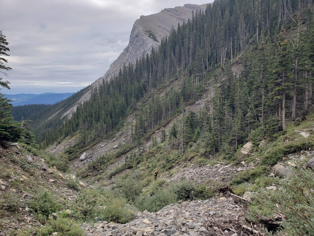
Bedson Ridge is a U-shaped ridge just west of Brûlé (locals pronounce it “Brool”). The eastern side of the U serves as a stunning backdrop for the sleepy hamlet. Locals refer to the prominent southeastern peak by the unofficial names Brûlé Mountain or Roche Brûlé. The highest point of Bedson ridge lies further back on the west branch of the U. Reaching it involves gaining one side of the U, losing elevation through the middle, and then regaining the far side.
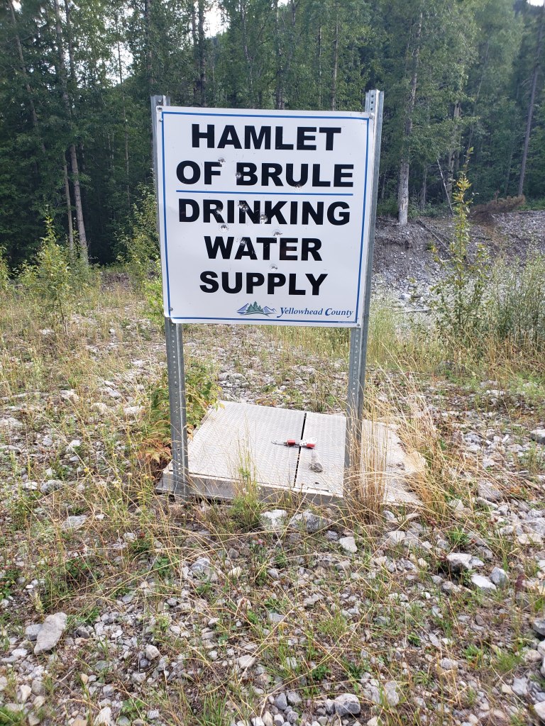
Brûlé is a historic mining town and modern mapping doesn’t seem to be quite accurate. I submitted updates to Google, but far better mapping is free for public use online through Yellowhead County (login as a guest).
Access to Bedson Ridge is via Supply Creek, south of Brûlé. It looks like there are two ways to get to the creek, but I’m not confident that the gravel access road from the County’s water and telecom site is available for public use. So, we stuck to Nearingburg and Coulthard’s recommendation and parked on 2nd St. We continued walking south along 2nd St beyond its gate, where the old road passes directly through Supply Creek.
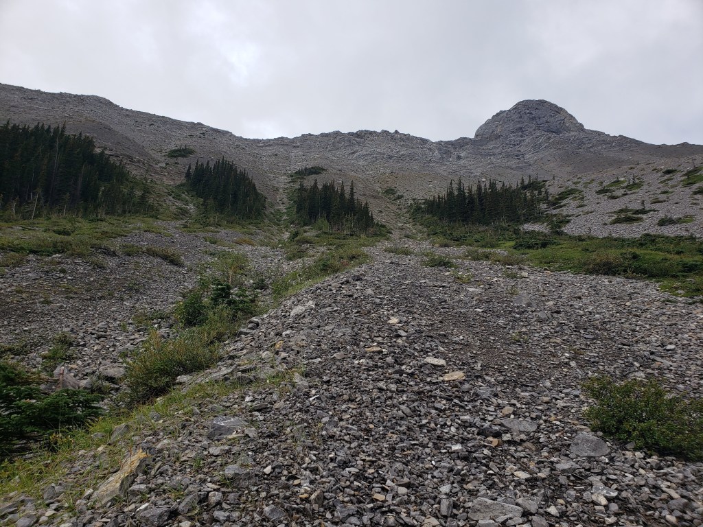
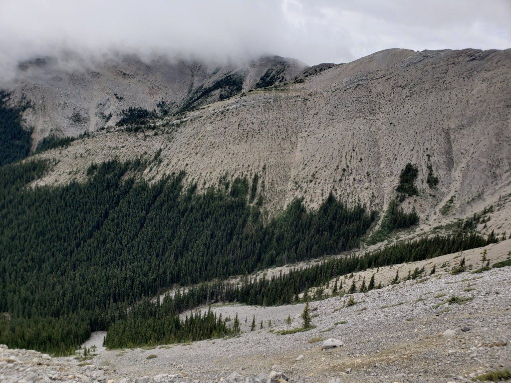
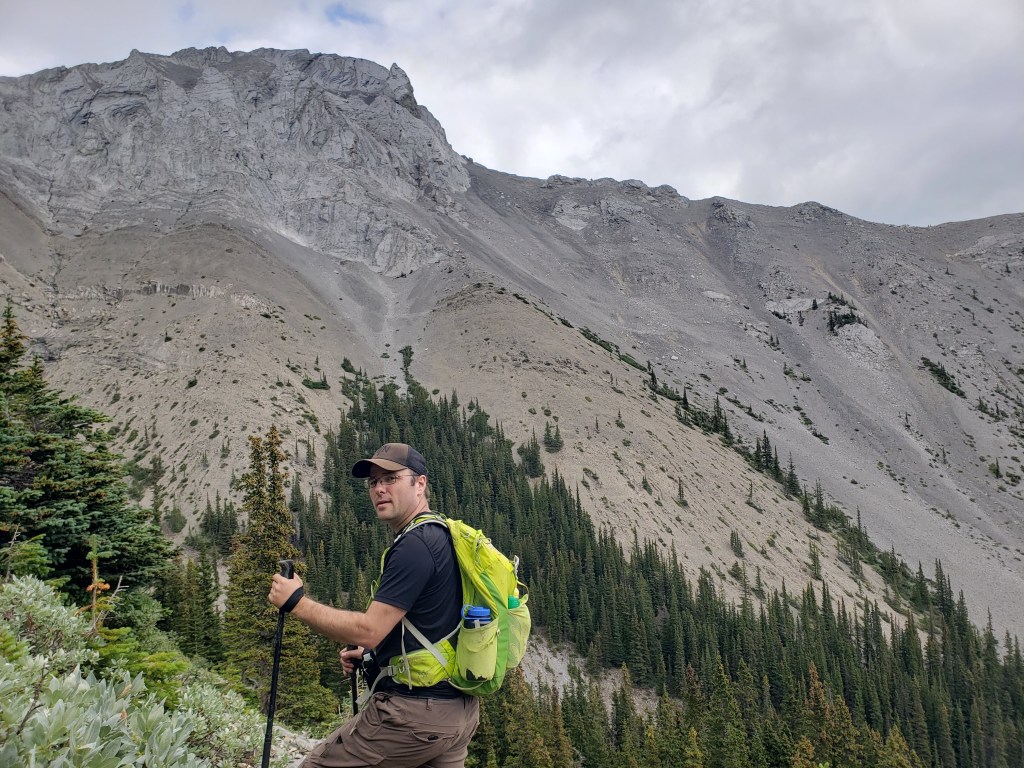
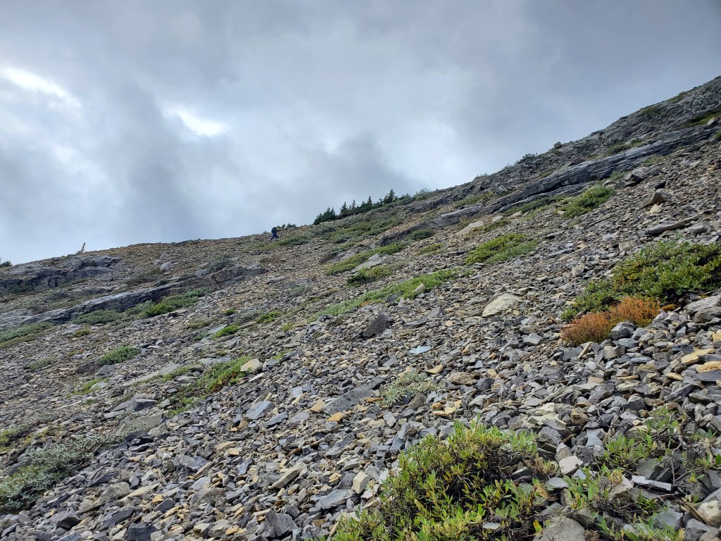
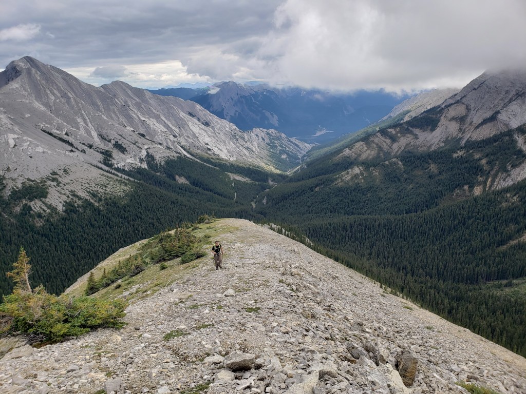
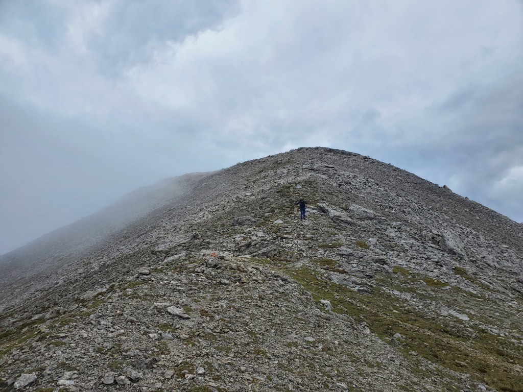
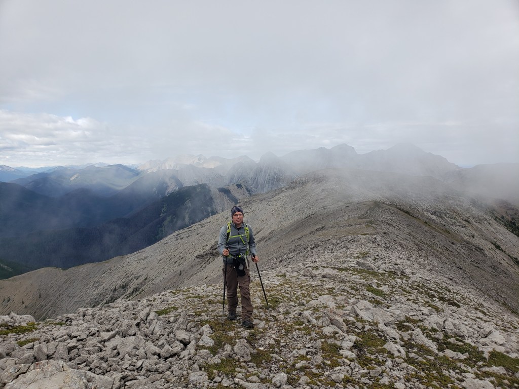
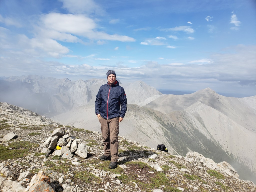
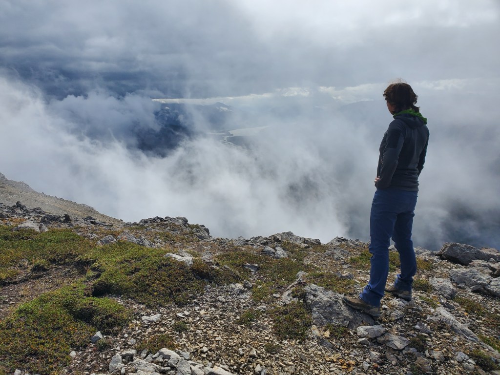
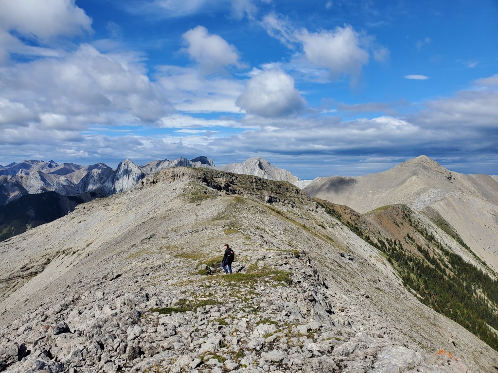
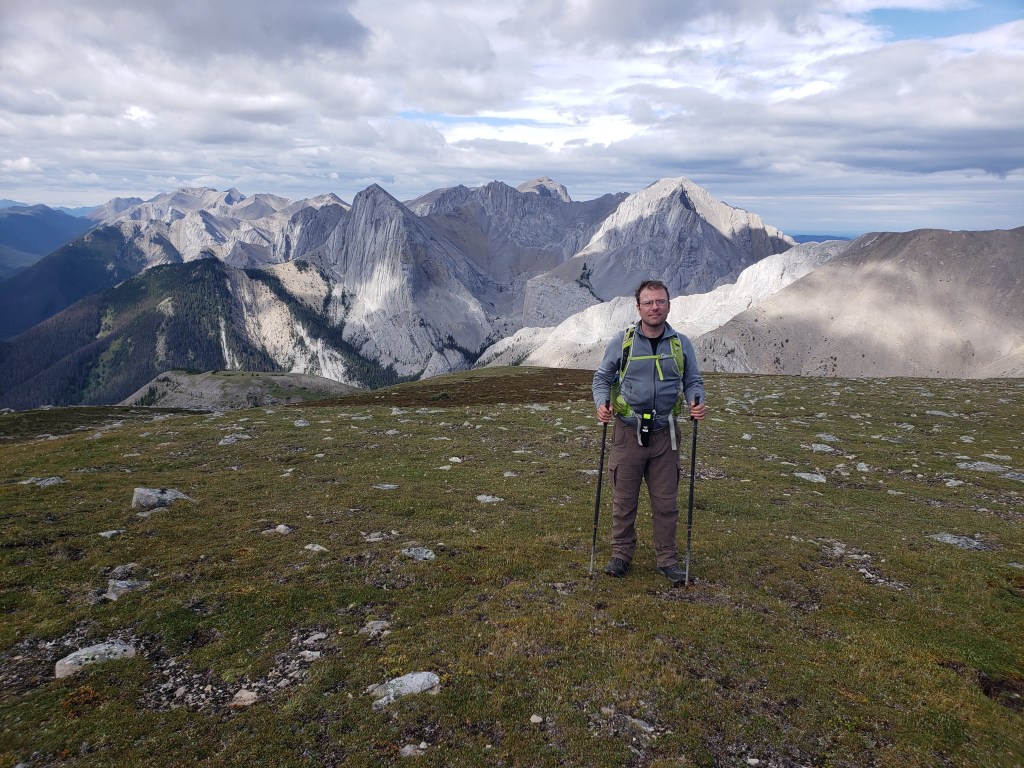
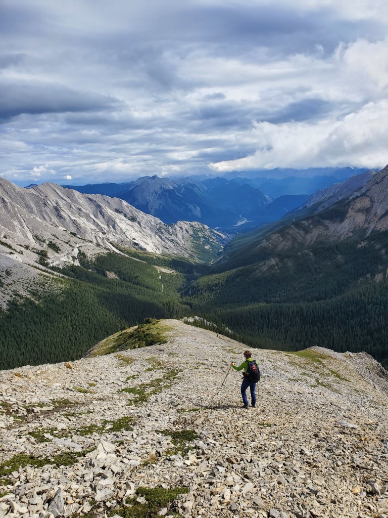
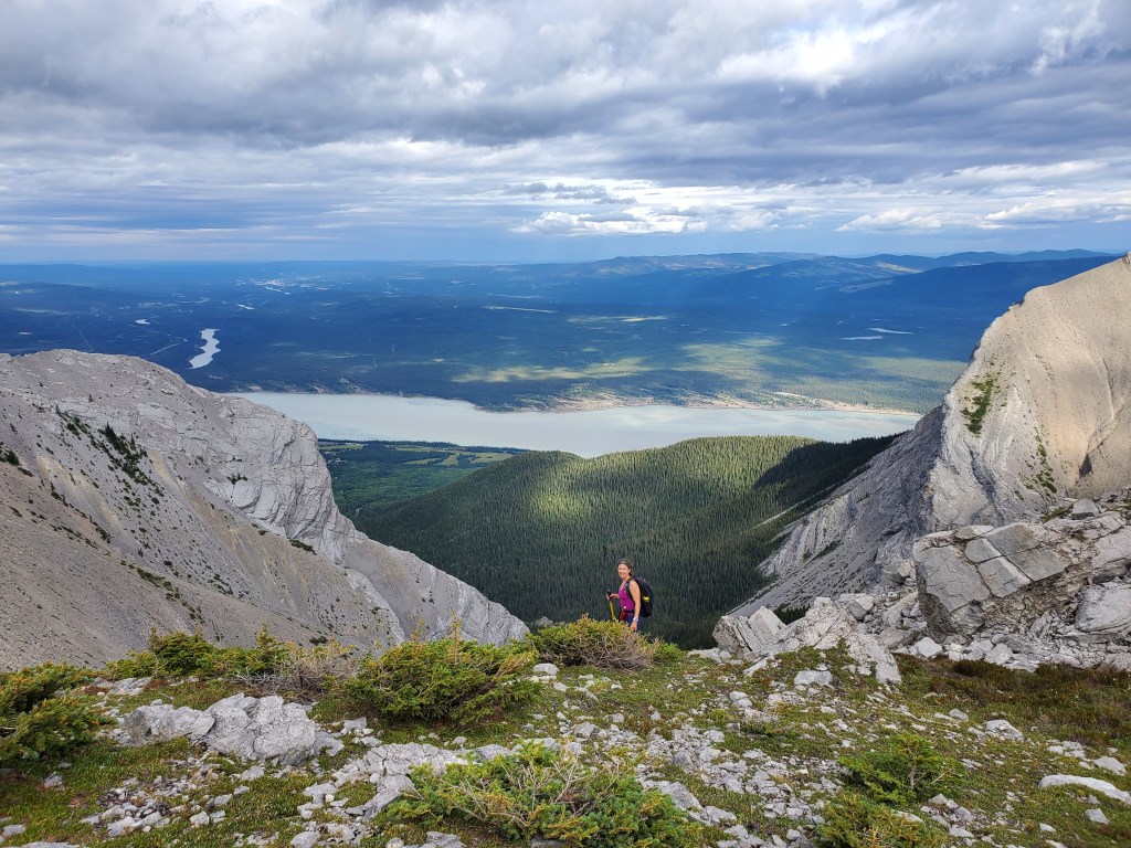
A trail can be picked up just north of Supply Creek. It’s easy to walk up the wide, dry creek bed too.A short way up the trail, signage confirms we are following the correct creek. The County’s access road leads to this spot.Supply Creek was mostly broad, dry gravel when we were there. Bedson Ridge lies ahead. We are aiming for the right-hand side of the low middle section.The turn up a branch to the right was marked with a number of cairns and inukshuks. I am pointing to the branch in this photo.A bit of hands-on scrambling over rocks was needed as we made our way up this branch.We passed through a few bushy sections, too.We went pretty much straight up the middle of this photo. We aimed for a low spot in the ridge, knowing any elevation gained would immediately be lost as we descended the back side.Looking back the way we came. Brûlé Lake comes into view behind us.Reaching the top, still on easy terrain.Upon reaching the top of the ridge, we got to see for ourselves how much elevation we would be losing and regaining to reach the peak (in clouds, to the left). It was certainly demoralizing.We briefly toyed with the idea of side-hilling around the U, but realized the error in our thinking after a few steps. Most of the scree is loose and tedious, much better for scree-skiing down. We spotted a solid looking gully at the far side that would allow us to regain elevation without too much of a trudge back up and we aimed for this.We crossed the floor of the U and bushwhacked through a short section of trees to get to the gully on the opposite side. Travel up the gully was decent, definitely easier than side-hilling the whole way around.Looking back at the side of the U we’d come from. The fierce block at the left is what prevents a scrambler from simply ridge walking around the top. I think the block resembles an Ogre head in profile, don’t you? Perhaps we can call it “Ogre Peak”? This fits well with nearby Ogre Canyon.Regaining the ridge, still on easy terrain.We regained the ridge on sort of a nose feature. This photo is looking south with the two sides of the U extending along the two sides of the shot. Ogre Canyon would be at the far toe of the left-hand ridge.Finally on the ridge and traversing around the rest of the U. The peak lies ahead in clouds.Looking back. We’d ascended the nose at the right. “Ogre Peak” is just behind it.Almost at the peak, hoping the clouds will part.Looking back. Is Boule Roche (not to be confused with Roche Brûlé) almost visible through the clouds?Spot WX‘s weather forecast was exactly accurate and the clouds broke just as we reached the peak. We came up Supply Creek out of the shot to the right, and then re-gained the nose at the right.Looking southwest over the Athabasca River.Summit panorama on Bedson Ridge.Looking across the U at the way we came. We gained the ridge slightly left of Dan and then scree-skied down the chute above my backpack. On the return trip we will aim to gain as much elevation as possible on solid terrain within the trees. The peak to the left is what I’m calling “Ogre Peak”. The peak to the right isn’t officially named, but locals call it Brûlé Mountain or Roche Brûlé.Views to the north of the Boule Range.Traversing around the U to the nose (right)Dan stands in front of Boule Roche. The peak is barely visible behind its jagged ridge.Descending back down the nose into the flat center of the U.We regained the ridge without too much fuss. Brûlé Lake looks a bit more cheerful in the afternoon light.After following Supply Creek back out to the gravel road, we stopped to take in some of the historic sites along the closed off section of 2nd St. Here are the foundations of the former Brûlé School.Here I’m walking the front steps to the former Mine Manager’s House, now all but reclaimed by nature.
The peak of Bedson Ridge is a bit of a demoralizing trudge. However, Brûlé is a pleasant area, well off the beaten path from the more touristy spots. I simply enjoy spending time here.
A special thank-you to a local friend (you know who you are) for helping with unofficial place names.