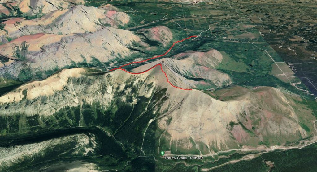
Notes: Following Nugara’s descent route for both ascent and descent.
Trip Report
I bet the reader is thinking that I only chose this scramble for the name… and they would be absolutely right. Shout-out to my hometown of Yarrow!
Spread Eagle Mountain is also called Mount Roche, but it doesn’t sound like this name is as widely used. The mountain clearly bears a likeness to an eagle with spread wings. Mount Yarrow is a high point on one of the wings. Yarrow is a common plant/weed with white flowers.
The weather forecast looked iffy for this day, so we chose to stick to Nugara’s easy descent route for both the ascent and descent. The ascent route in the book (which we did not take) is listed as moderate with one difficult step.
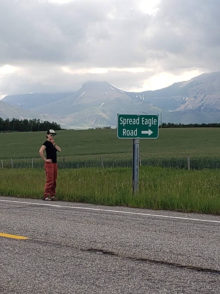
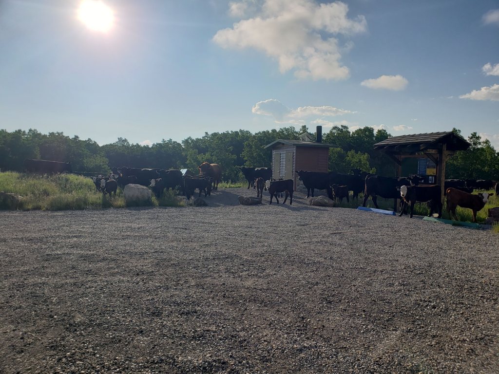
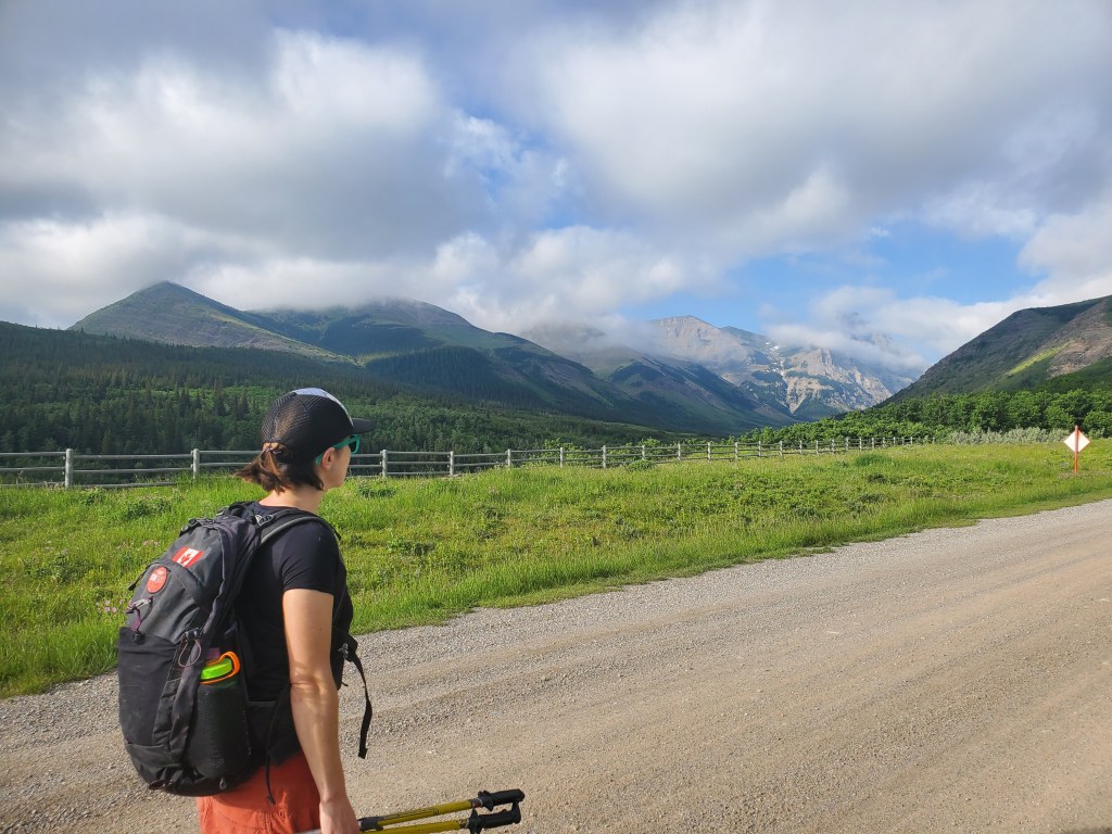
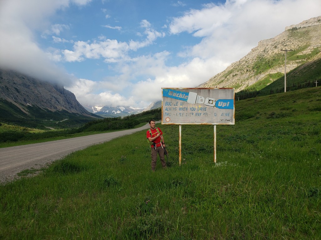
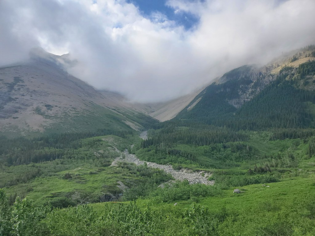
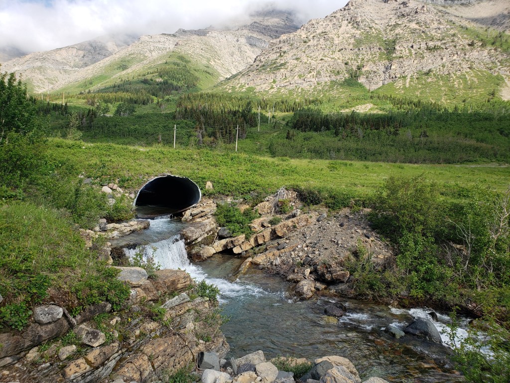
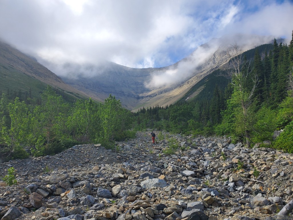
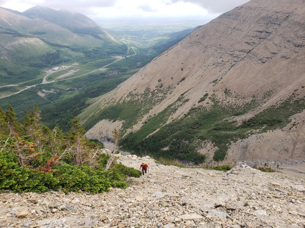
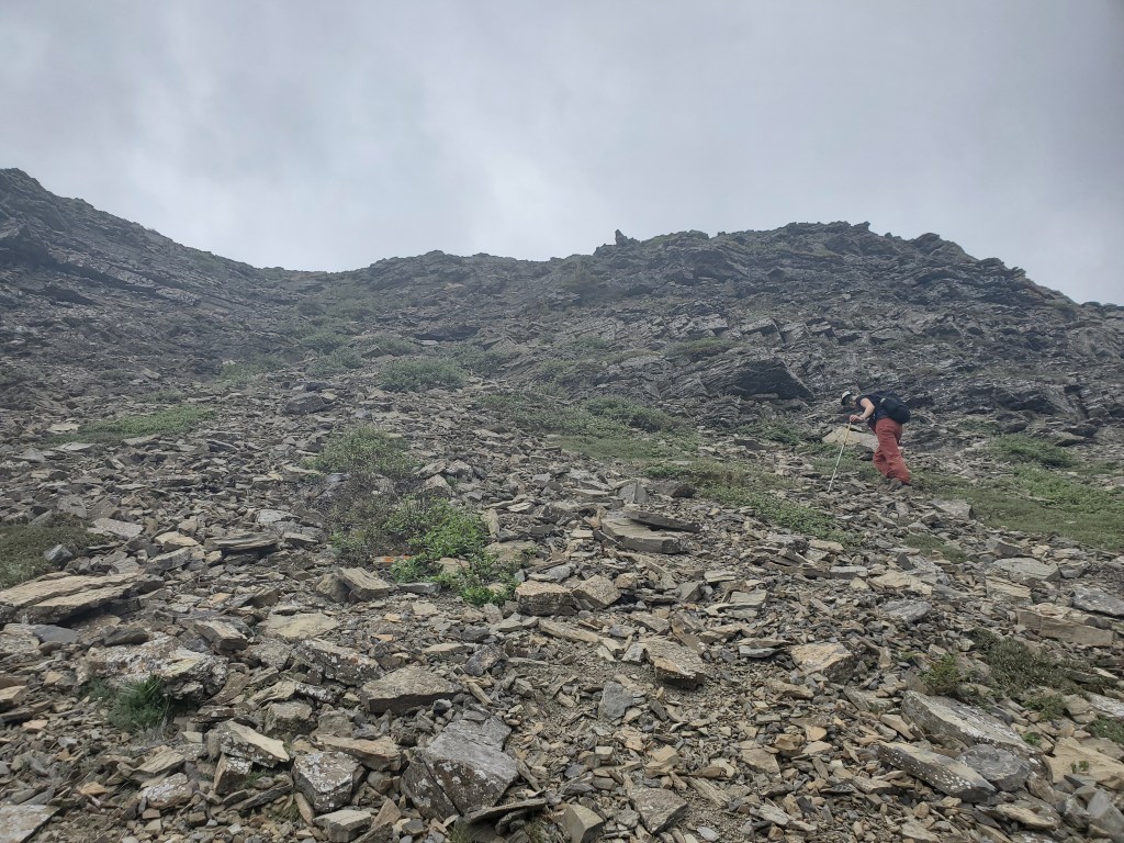
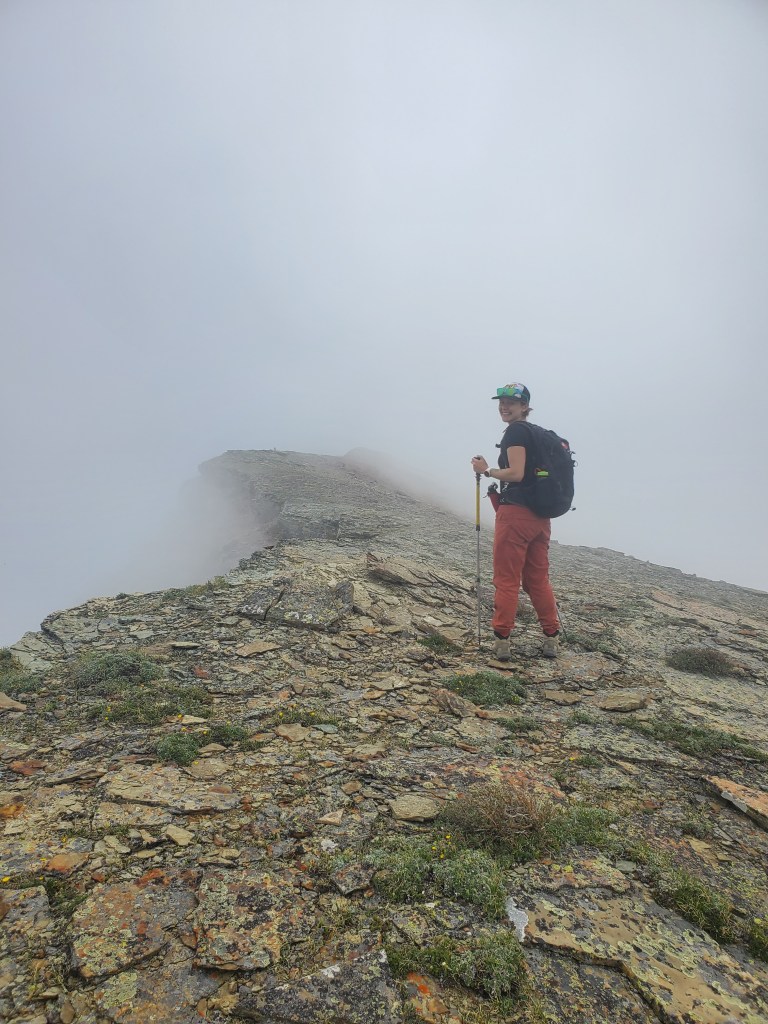
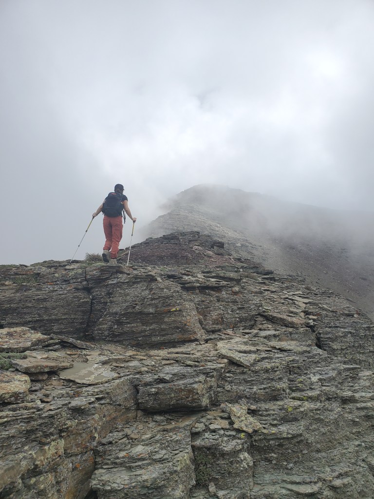
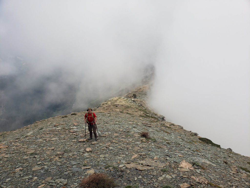
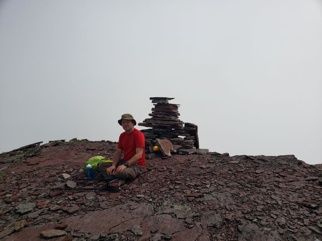
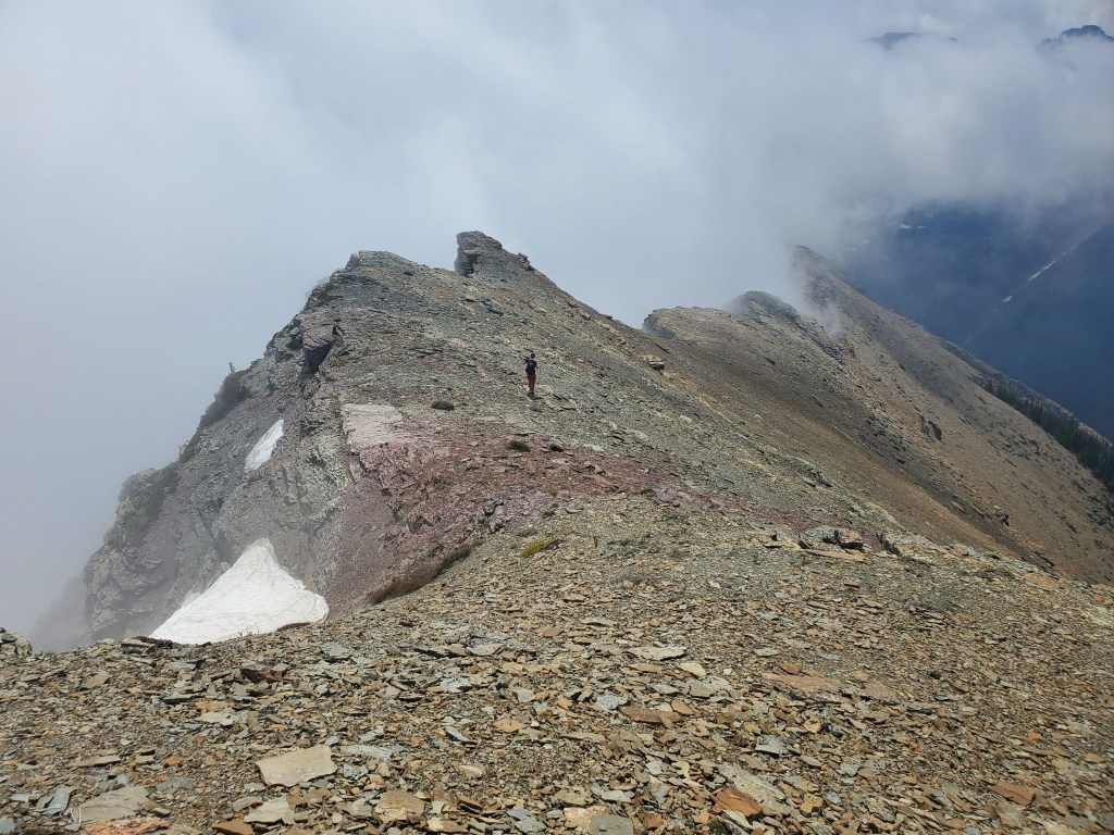
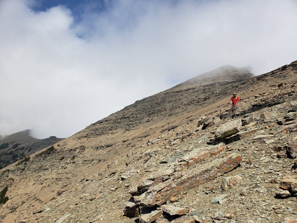
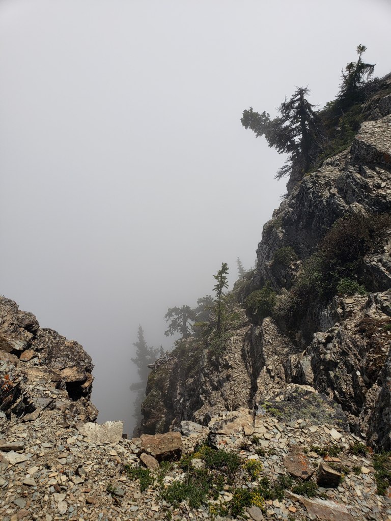
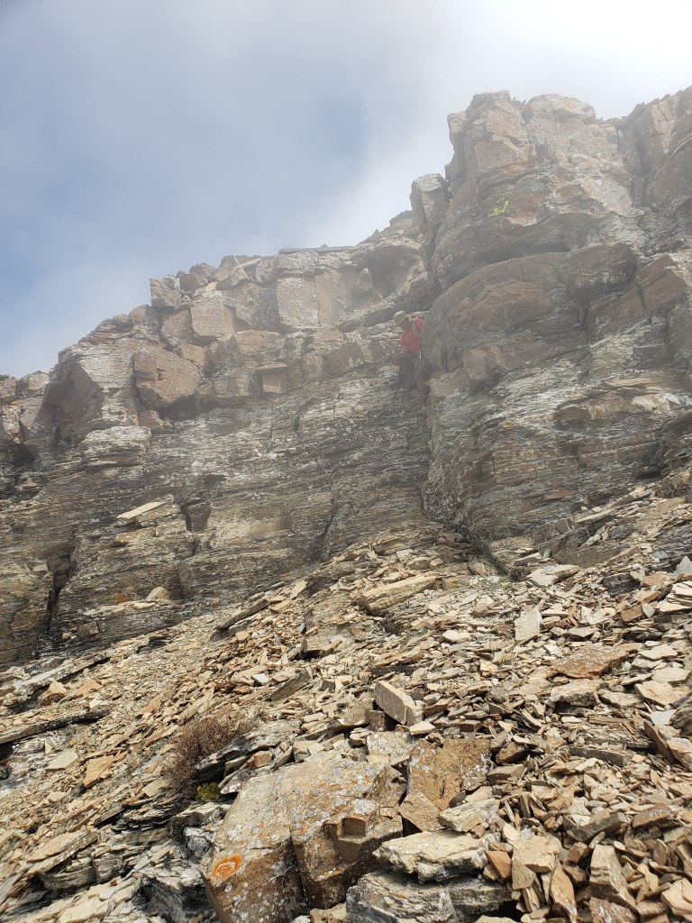
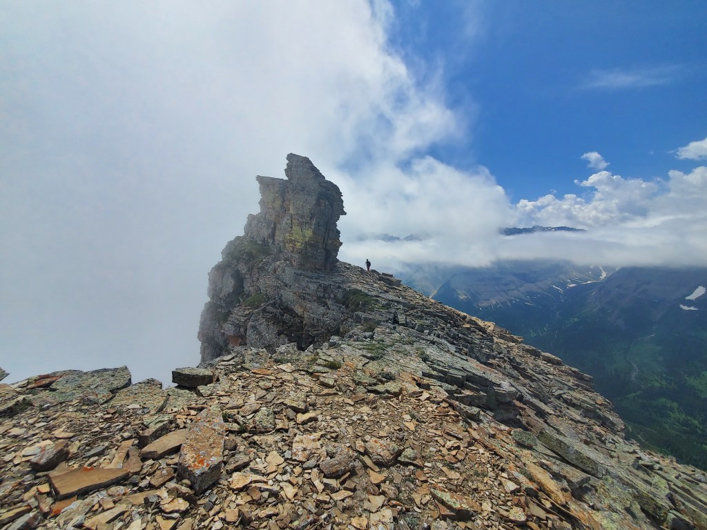
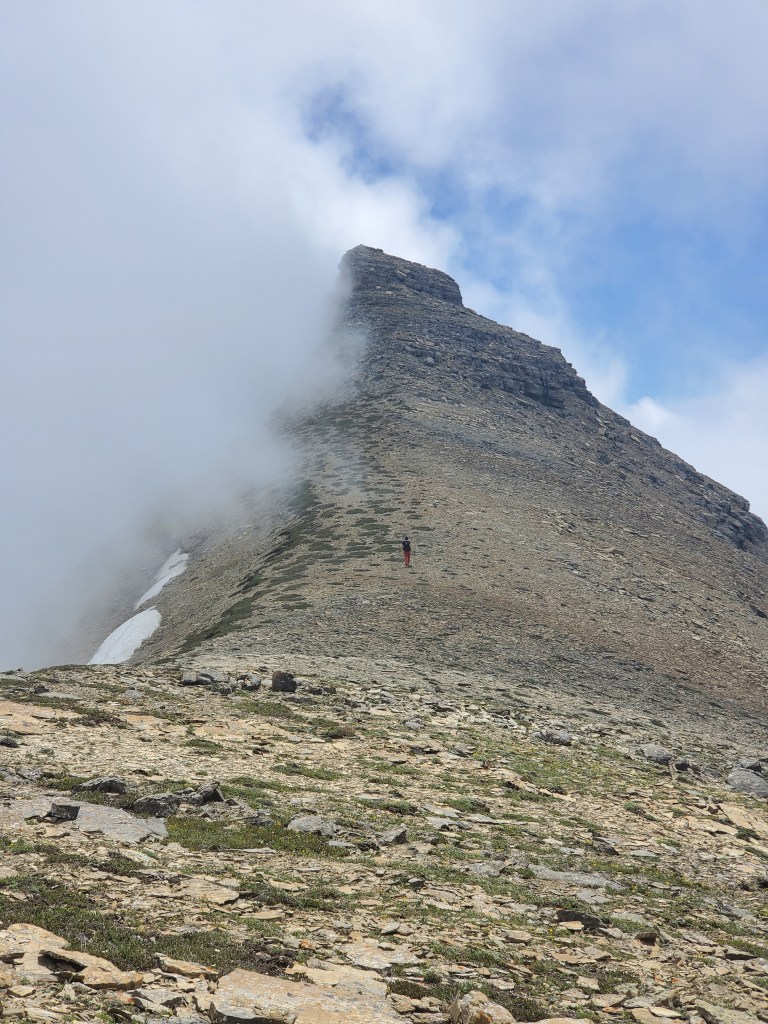
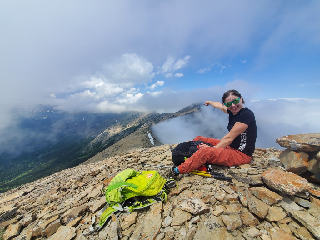
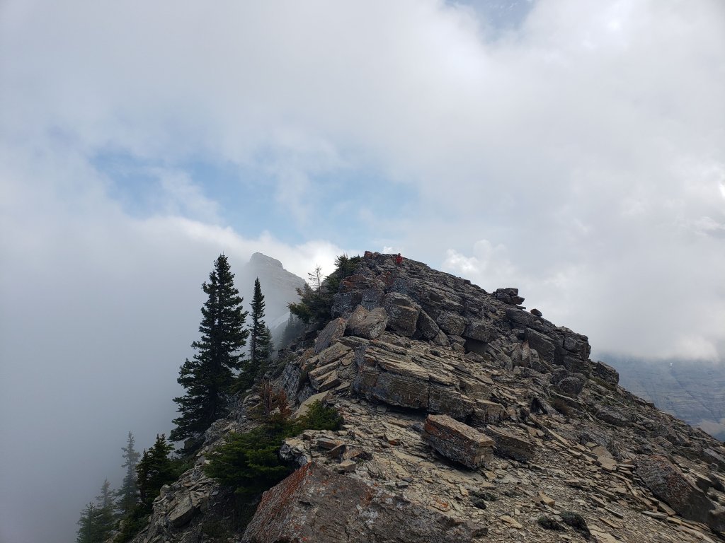
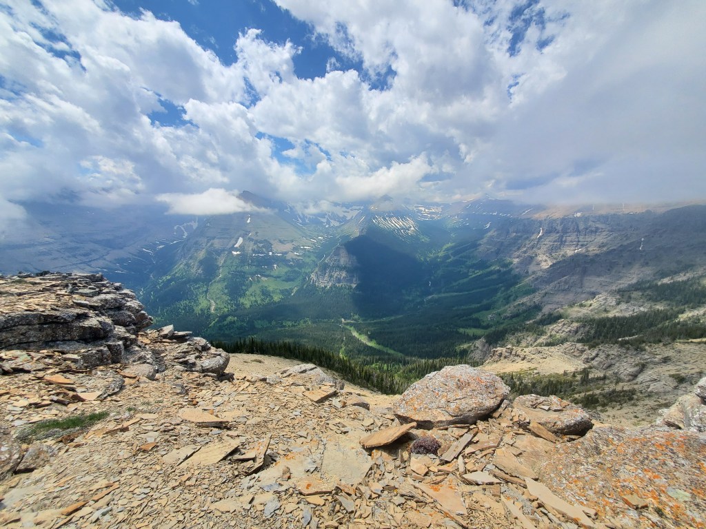
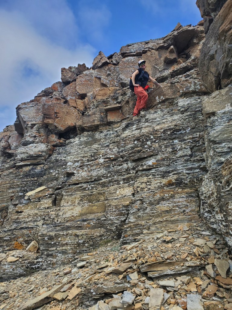
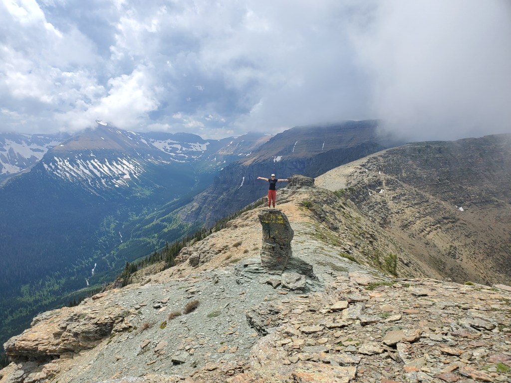
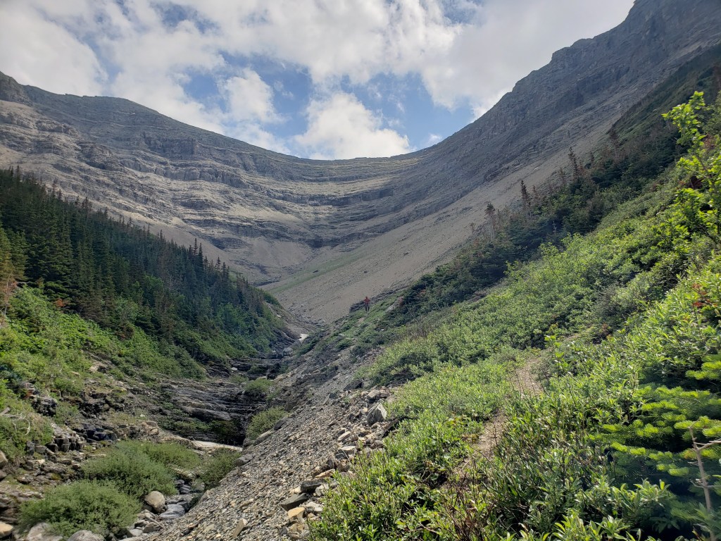
Driving south on Hwy 6, the turn-off is well marked. The closest outhouse is at Bathing Lake. It’s fairly common to encounter beef cattle grazing the area, and on this day they were blocking the rest stop. Herding cows is no problem for this farm girl! But, others in this situation might need to look for a good bush.We didn’t bring bikes for the road, but the flat 4 km walk went by quickly. Spread Eagle Mountain is shroud in clouds here.The style of the signs paired with the dry peaks made Dan feel like he was walking through the game Fallout. City boys can be adorable sometimes.We couldn’t quite see the peaks through the clouds, but had a feeling this was our drainage. We’ll be following the drainage up to the edge of the trees, and then following the trees up the slope to the right.Looking back at the sad, crumpled culvert under the road we’d been walking. We crossed the culvert and then headed in along the left side of this photo, to avoid crossing the stream.As we walked up the drainage, we caught a better look at the cliffs ahead. To avoid these we’ll be turning right and following the edge of the trees up the shoulder.Looking back after turning right. Dan follows me up the shoulder. We had game trails to follow for much of the way in. On the way out we scree-skied through the right-hand side of this photo.At the top of the right-hand shoulder we found a weakness in the cliff, allowing us to gain the ridge.Visibility was limited along the ridge but the direction of travel was obvious.We passed over a few rocky steps, but the trip up Spread Eagle Mountain was never beyond easy scrambling by this route.Looking back, the ridge disappeared behind us just as quickly as it appeared ahead of us.Taking in “the summit views”.After pausing at the summit of Spread Eagle Mountain, we lost a bit of elevation as we continued on to Mount Yarrow. There is one section of moderate scrambling coming up, but most of this ridge walk is easy too.Glancing back as the clouds part, showing a bit more of the terrain we had passed. We gained the ridge near the low spot to the left.Pausing to glance down the cliffs to our left. The route will not be taking us this way.This is the only section of hands-on scrambling. Nugara describes moderate to difficult scrambling being needed. With good route finding and body positioning we found it to only be moderate scrambling.Passing a pinnacle along the ridge. Cloudy Peak (right) lives up to its name.The clouds parted briefly and we saw how near we now were to the peak of Mount Yarrow.A Yarrow girl on Mount Yarrow! Representing Fun City BC (or “Un City BC”, depending on how recently the sign was vandalized…)! In this photo I’m pointing to the summit of Spread Eagle Mountain.Returning the way we came, misty Mount Yarrow pokes out at the left.The views to the southwest briefly opened up.Scrambling back up the moderate section.We bypassed the peak of Spread Eagle Mountain on the way back and side-hilled around to this section of the ridge. Here we’ll be turning right and leaving the ridge again, but first a pause for a photo on an interesting pinnacle.Descending the shoulder from the right and making our way back into the drainage. We’re almost back on the road now, but it’s still 4 km back to where we parked.
We made it back to our vehicle in 8 hrs 10 min. A bike would have saved a bit of time along the road, but we weren’t too bothered by the extra 8 km of very easy walking. Mount Yarrow had been on my to-do list for a few years and I’m happy to have finally made time for it. For those less enthusiastic about the name, the views alone are still worthy of a trip (though perhaps not the views on this particular day).