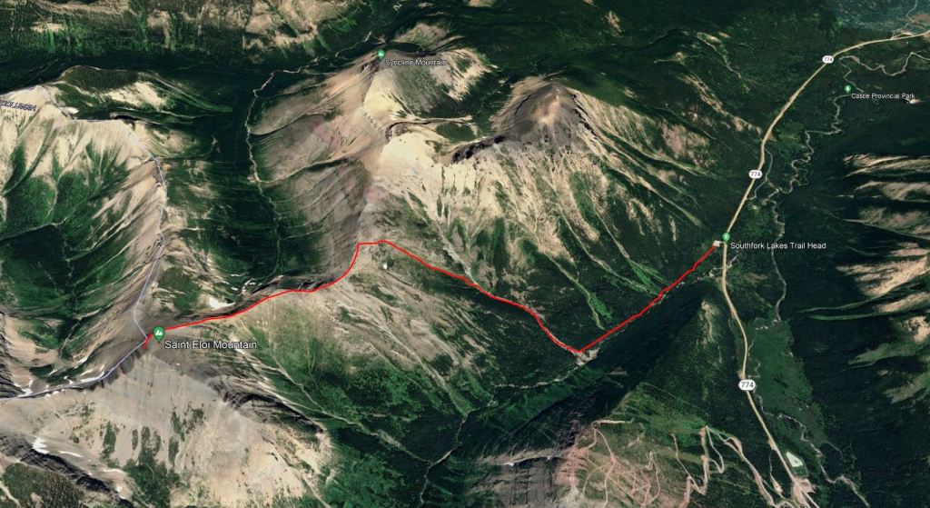
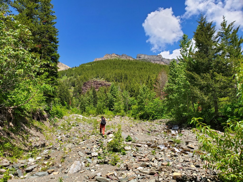
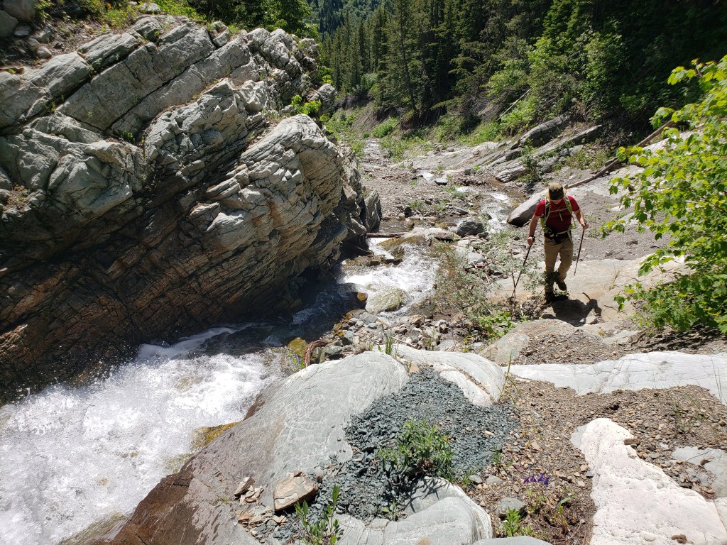
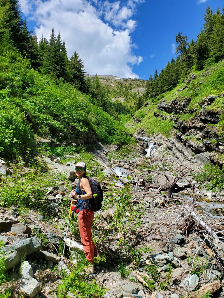
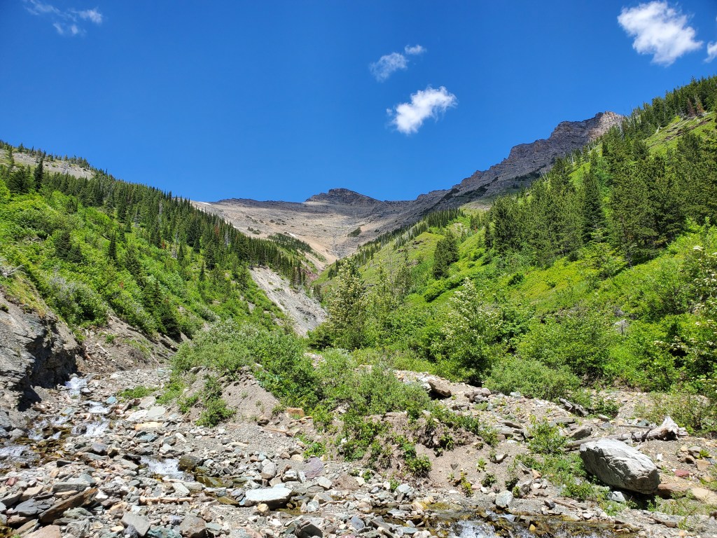
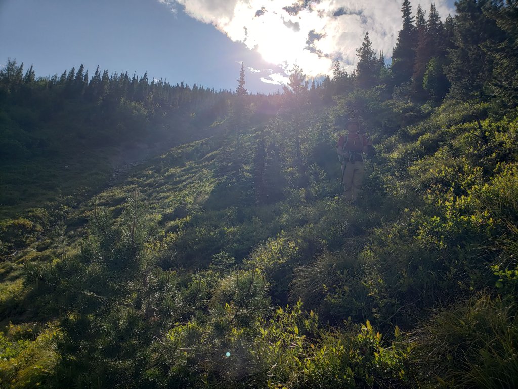
We traveled down to Castle Wilderness for the Canada Day long weekend, starting out at St. Eloi Mountain. Water in the drainage was still fairly high and some sections had to be bushwhacked around.
There was no need to park on the side of the road as Nugara suggests. A large parking lot with outhouses was built within the past few years, with signage for Southfork Lakes Trailhead. The correct trail starts at the south end of the parking lot.
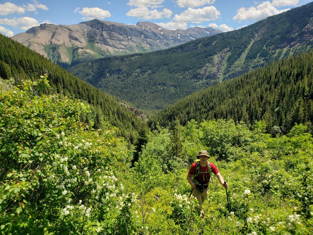
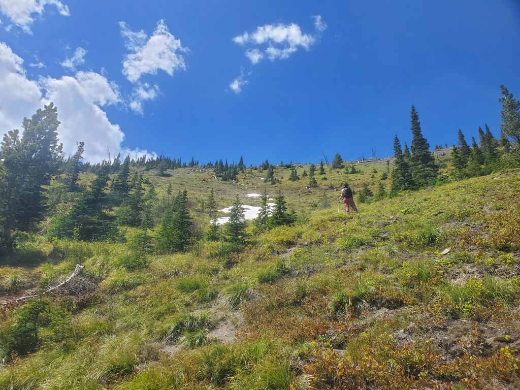
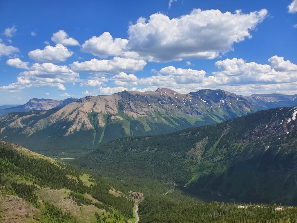
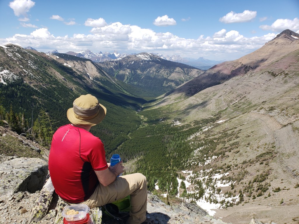
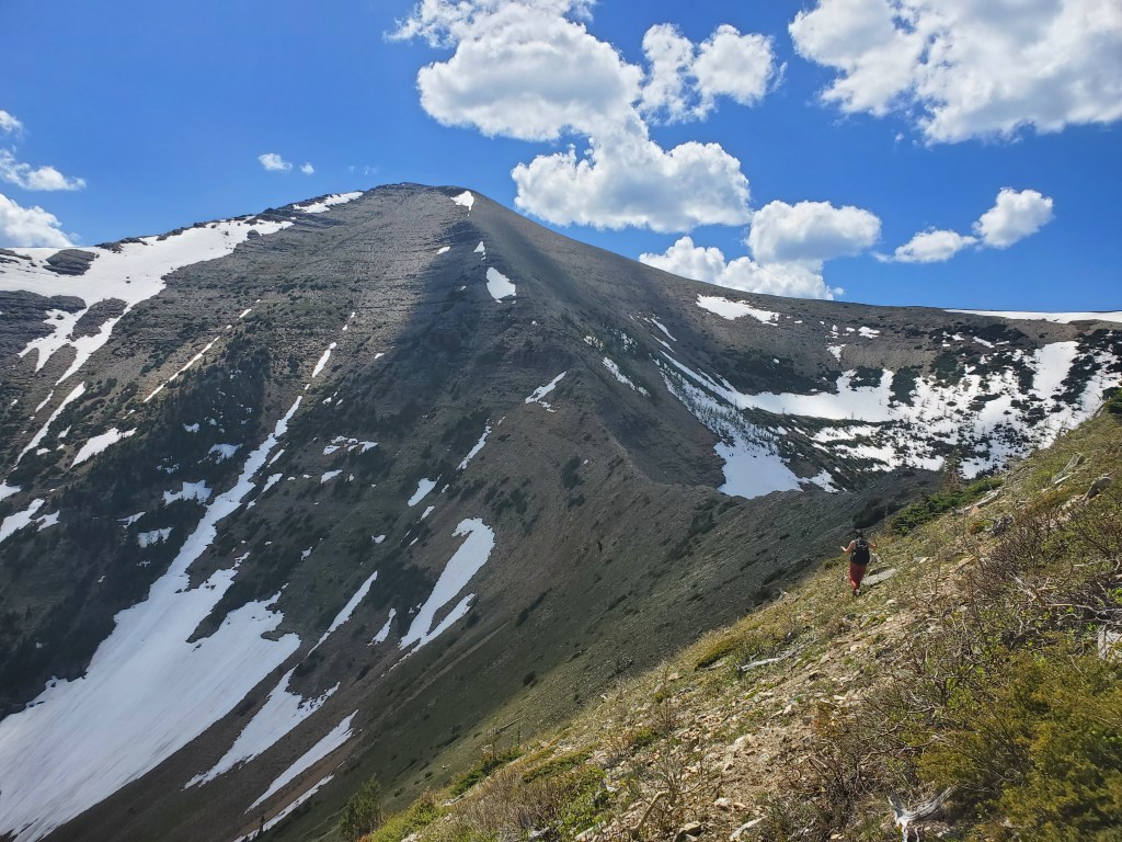
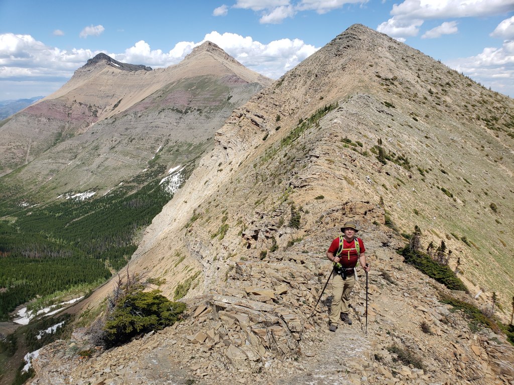
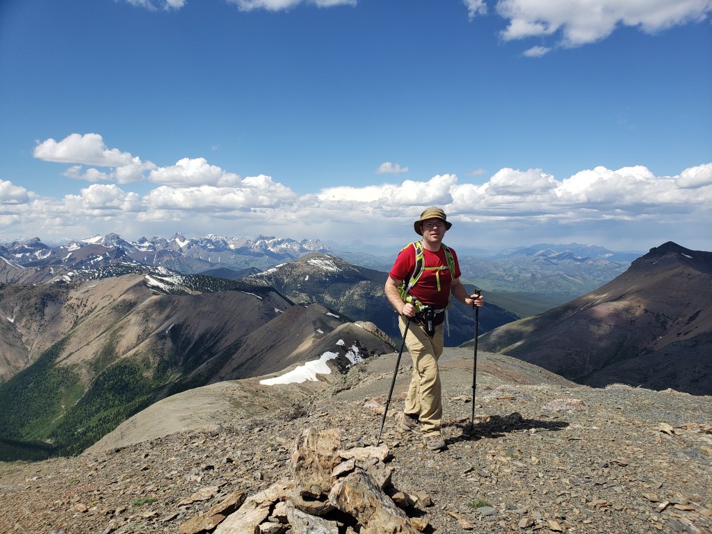
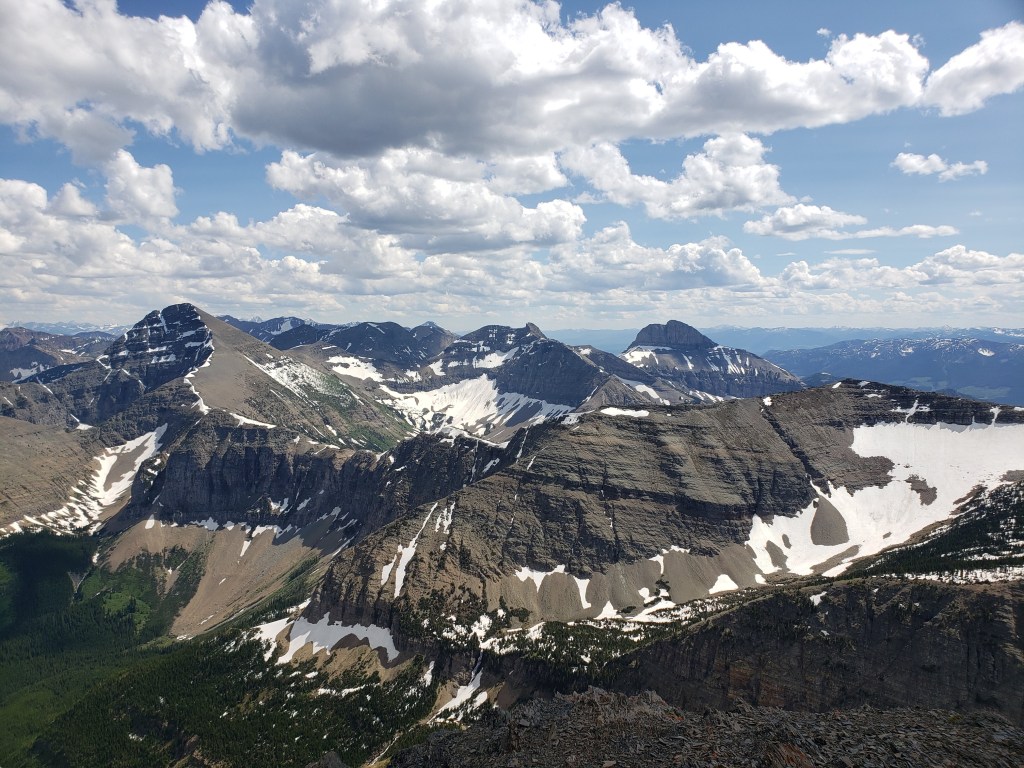
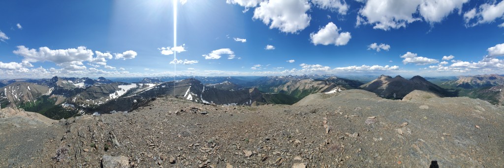
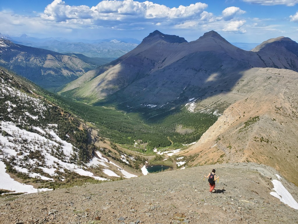
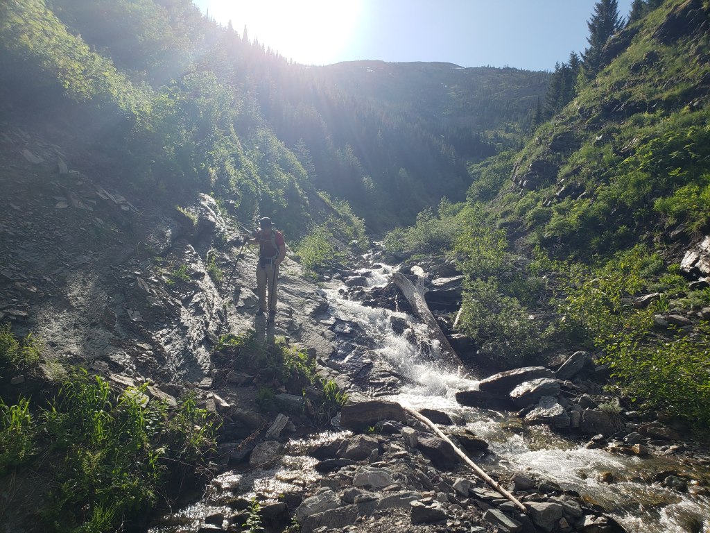
After following the trail for 20 min we reached the large, rocky drainage described by Nugara.The water was still high. Some sections required extra caution to walk up and others simply had to be bushwhacked around.Continuing up the drainage. We kept an eye on the slopes to the left, looking for where the slope opens up. This section still isn’t looking appealing and we are noticing that we are nearing the end of the drainage. But, we continued further up the drainage.Nearly at the end of the drainage, the slope to the left opened up enough to manage. We dragged ourselves up the shoulder of the drainage and started bushwhacking.We continued bushwhacking up the slope. Saskatoon blossoms somewhat improved the experience.Eventually the growth thinned, near the top of the slope.Looking back from the top of the slope at views over Barnaby Ridge and Southfork Mountain.Dan follows along the rocky ridge.We paused at a high point on the ridge for a snack. Syncline Mountain is to the right and Mount McCarty is at center. The prominent peak in the distance, just left of center, is Mt Darrah.Finished with our snack, we continued on to the final push up the summit.Looking back at the ridge (foreground) and Syncline Mountain’s summits 2 and 3 (left). Reaching the peak of St. Eloi Mountain on the BC-Alberta border. This peak and the ridge running behind Dan, off to the left, comprise the border.Views to the south of Mount Haig (left) and Tombstone Mountain (right).Summit panorama from the peak of St. Eloi Mountain.Returning the way we came. All three summits of Syncline Mountain are visible from center to right: 3, 2, and 1.Descending the slope of the ridge back to the ascent gully. The drive out from Edmonton in the morning meant we’d had a bit of a late start and were already losing daylight.We followed the rocky drainage back to the trail and made it back to the parking lot in 7 hrs 40 min.
The long daylight hours close to Summer Solstice afforded us enough remaining light to set up camp and relax in our hammock. Despite wearing a hat this day, I did brush one tick out of my hair while hammocking. St. Eloi Mountain was a good little scramble, but I would probably leave it for later in the season when the water is lower.