Flatiron Mountain (1898 m) and Needle Peak (2090 m)
Summary
Area: Coquihalla Summit
Trip Date: 2021 Sept 07
Trip Duration: 6 hrs
Elevation Gain: 1120 m
Total Distance: 13.9 km
Difficulty: Moderate Scrambling
Accompanied By: Dan
Beta: N/A
Notes: N/A
Trip Report
We traveled back home for the first week of September 2021 and, in true BC style, it rained 8 of the 9 days we were out. We made the most of our sole sunny day by tackling this iconic objective. The Coquihalla area offers fun scrambling on solid rock and unique views.
Pipeline construction was underway on our trip date, but access to the trailhead was still permitted. The area was fenced off and large signs detoured hikers through a fenced path to the start of the trail. I expect the trailhead and parking looks very different now.
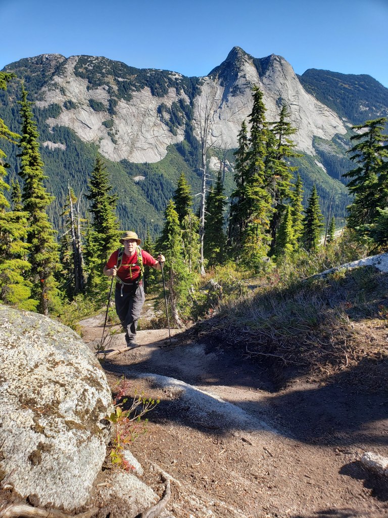
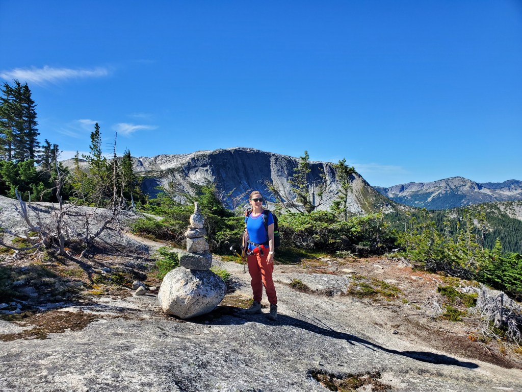
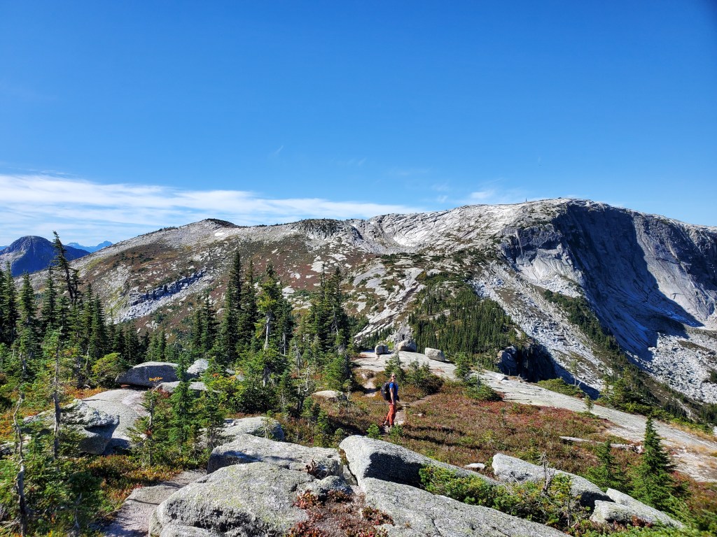
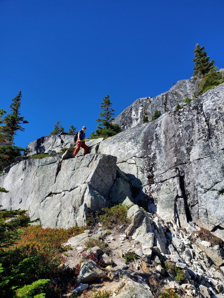
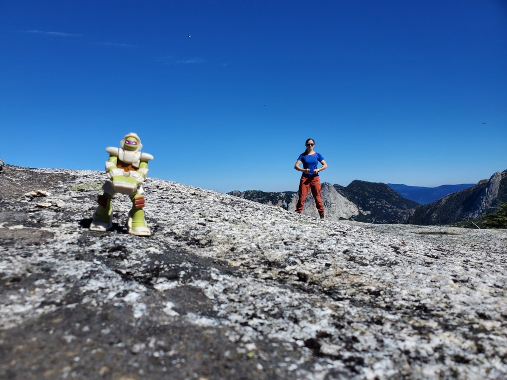
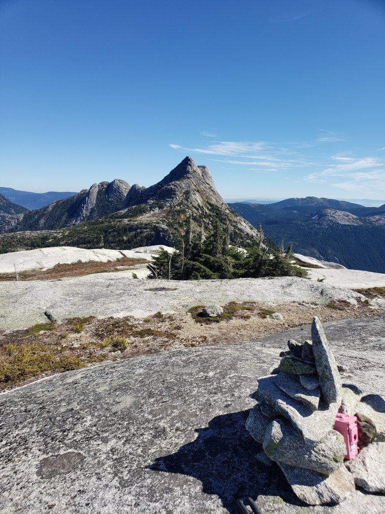
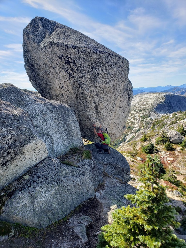
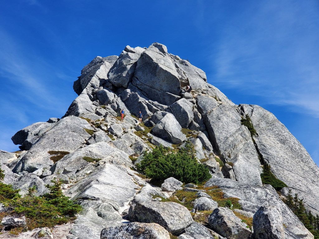
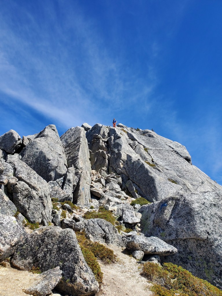
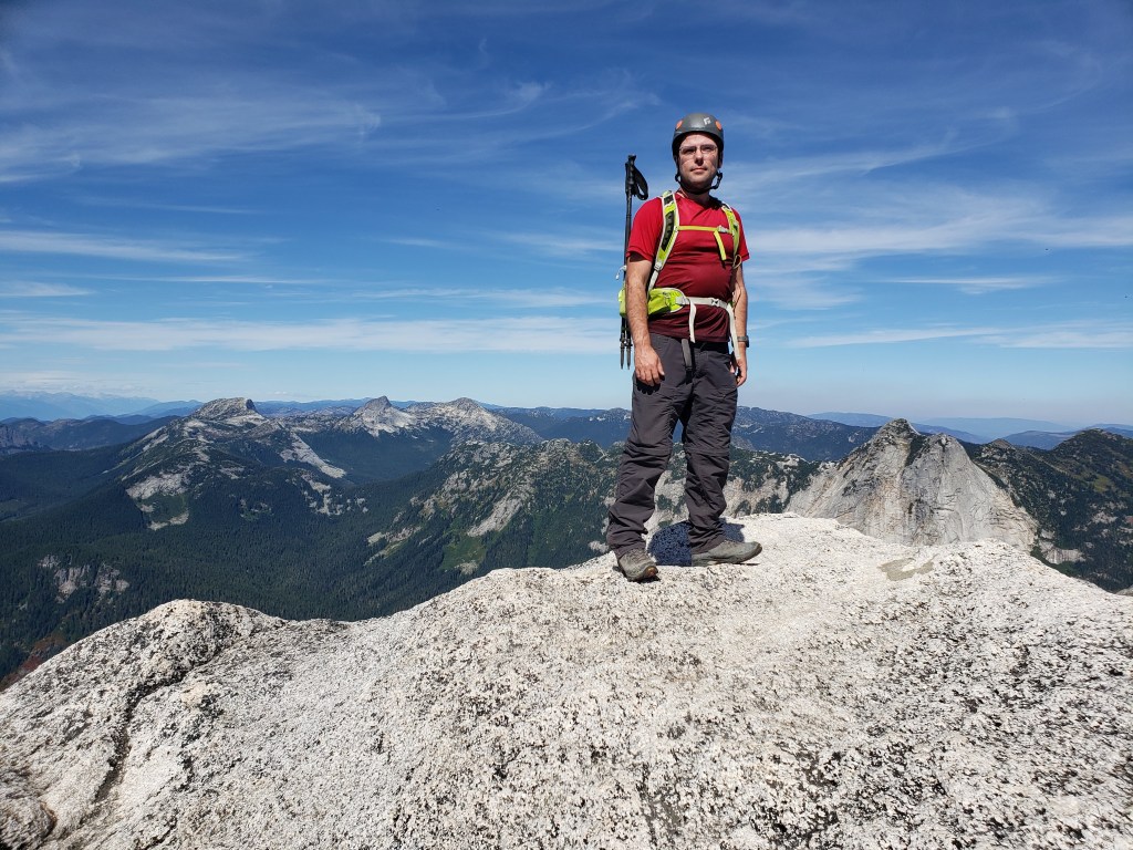
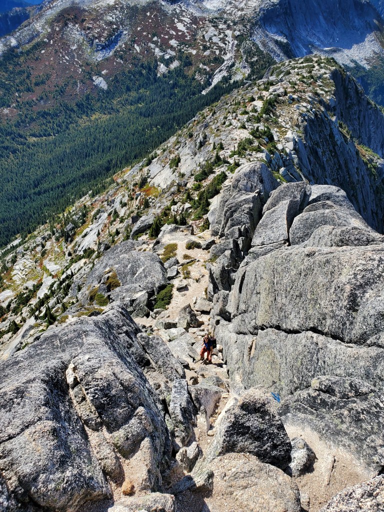
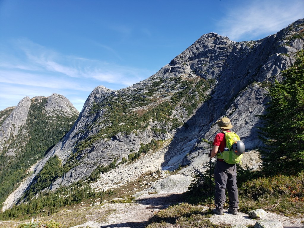
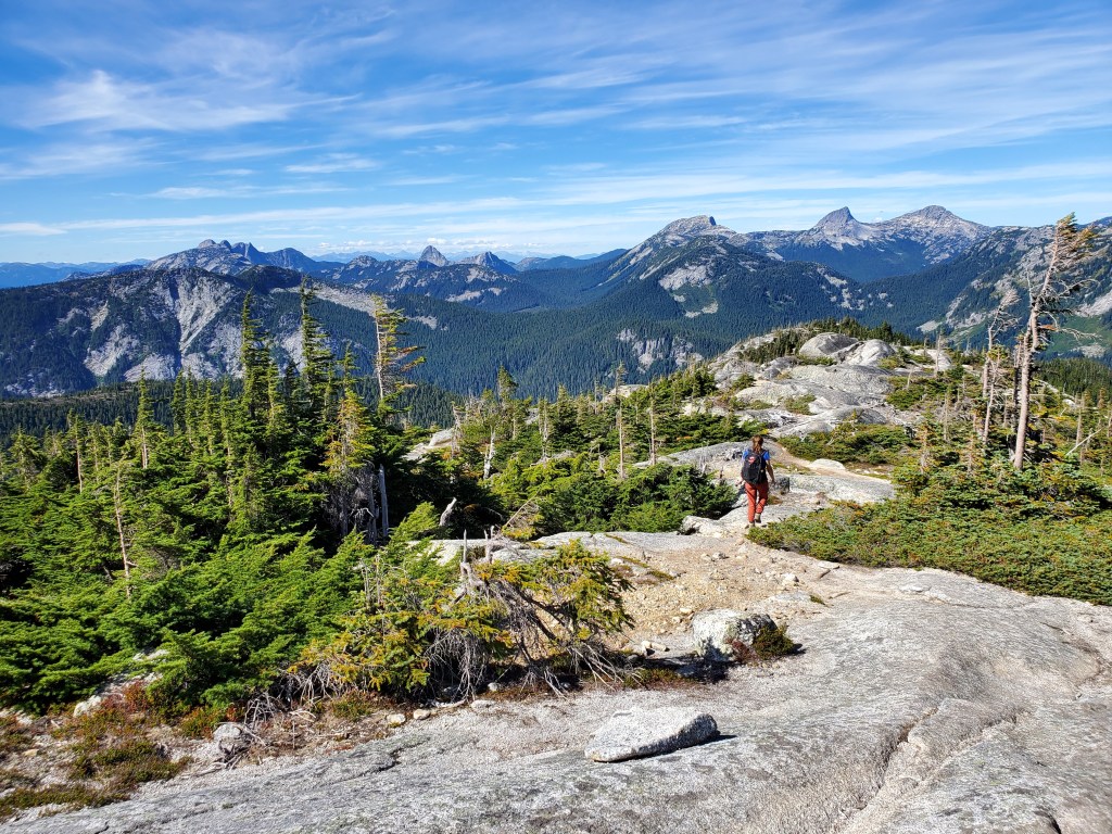
Beyond the construction site the trail runs straight up a steep slope. There weren’t switch-backs or erosion mitigation built into the trail, which was surprising considering the volume of traffic on this popular route. Parts of the trail have been eroded down to smooth, featureless slab. In this photo we are just leaving the trees, with Yak Peak in the background.A large cairn marks the split in the trail between Flatiron Mountain and Needle Peak. Flatiron Mountain can be seen in the background.A small tarn lies in the low spot to the left. A weather monitoring station can be seen at the top of Flatiron Mountain as the summit grows closer.There were several route options up Flatiron, and some are easier than this. The solid, coarse rock made for fun scrambling and we didn’t hesitate to hop onto anything that caught our eye.A weather monitoring station adorns the top of the mountain. The enormous glaciated peak of Mount Baker can be spotted to the southwest (center-right).I felt right at home finding the usual pink ammunition box with an action figure at the peak. I paused for a shot with Donatello.Gazing northeast to Needle Peak from the top of Flatiron Mountain.Descending back to the col and continuing on to Needle Peak. Yak Peak is to the left.Looking back: Flatiron Mountain can be seen in the background, to the right of Atlas.As we near Needle Peak, the route up comes into view. We’ll be hiking up toward the large hanging rock, then heading to the right underneath it, and finally up to the peak via features in the rock.I pause off to the left of the hanging rock while a pair makes their way down from the right.Once above the hanging rock the route is fairly obvious. Blue arrows painted on the rock remove any potential for confusion.Dan tops out onto the ridge behind me.The three peaks to the left are Alpaca Peak, Vicuna Peak, and Guanaco Peak (all members of the llama family). Yak Peak is to the rightAfter enjoying the fine summit views, we began the return trip, easily following the blue painted arrows back the way we came.Two ropes are available to get through this section, but we didn’t like the anchors and chose not to use them. The rock is solid and we trusted the rock more than the scrawny shrub serving as an anchor.Catching one last glimpse of Needle Peak (right). It is possible to continue on to Markhor Peak (left) and form a loop back to the start, but we did not take this route.Heading back to the trees. Alpaca Peak, Vicuna Peak, Guanaco Peak are to the right, joined by various other animal peaks to the left.
We made it back to our vehicle in 6 hrs, easily getting back in time for family dinner. This scramble is one of my favourites to date and I look forward to returning to the area. Although the peaks are fairly small, the rock is solid, beautiful, and fun to climb.