Notes: By southwest scramble route (not the northeast alpine climb).
Trip Report
Mount Edith Cavell is an enormous mountain that shouldn’t be underestimated. With strong route-finding skills and good conditions, the technical hands-on scrambling for this peak is similar to Mount Temple (Also an 11,000er that can be scrambled). No one really knows what happened to a couple whose bodies were found south of Edith Cavell’s west ridge, but I do think the location sounds suspiciously like this scramble route. As with any scramble, difficulty can quickly exceed scrambling if off route or in poor conditions. It’s also worth noting that a mountain this size will be significantly colder at the peak, likely to require crampons and a mountaineering axe at any time of year. There is a walk across an exposed slope near the peak which turned back other groups the day we went (those groups didn’t have crampons).
Dan had a big milestone birthday on this weekend in 2021 and I chose to celebrate it at the peak of a huge mountain. Some people surprise their husbands with breakfast in bed, but this lucky guy was surprised with 13 hrs of hiking! The trail head starts at a pullout just before the main parking lot for Edith Cavell. The main parking lot is for a few short, popular hikes as well as the alpine climbing route, while the pullout before Cavell Lake is mostly used by backpackers heading into Tonquin. All of these objectives are extremely popular and parking tends to fill up quickly during peak tourism season.
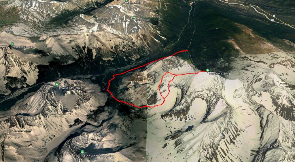
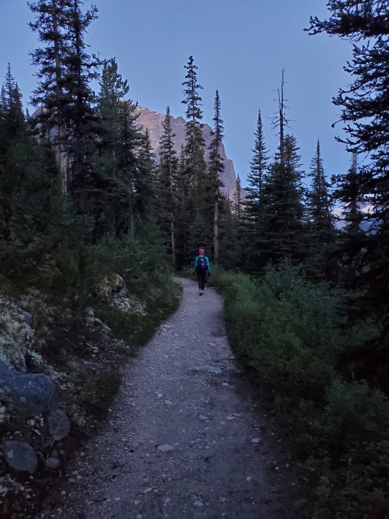
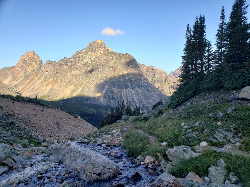
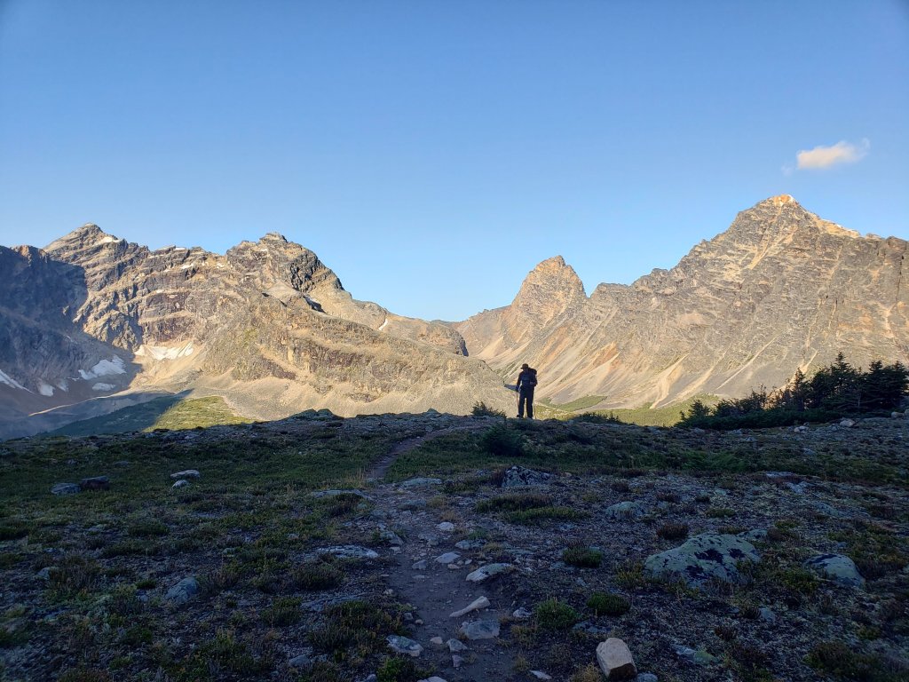
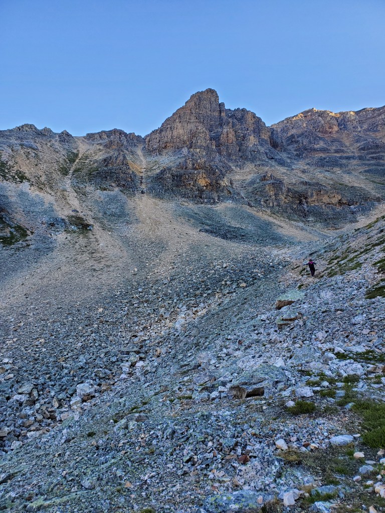
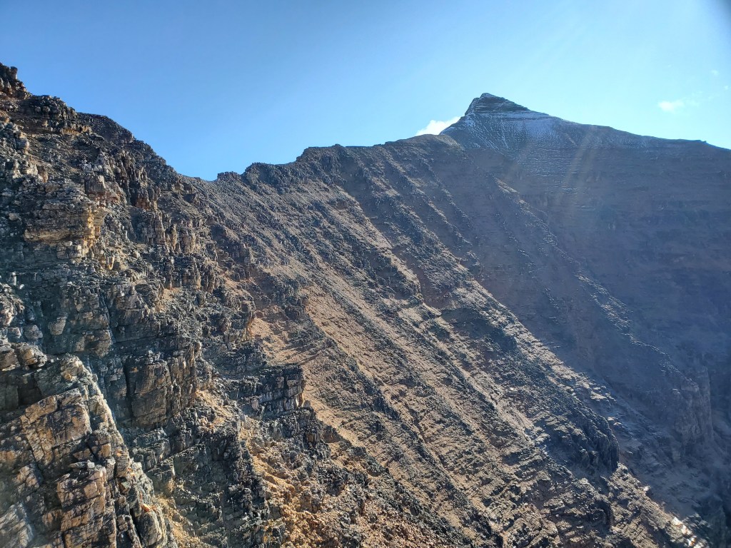
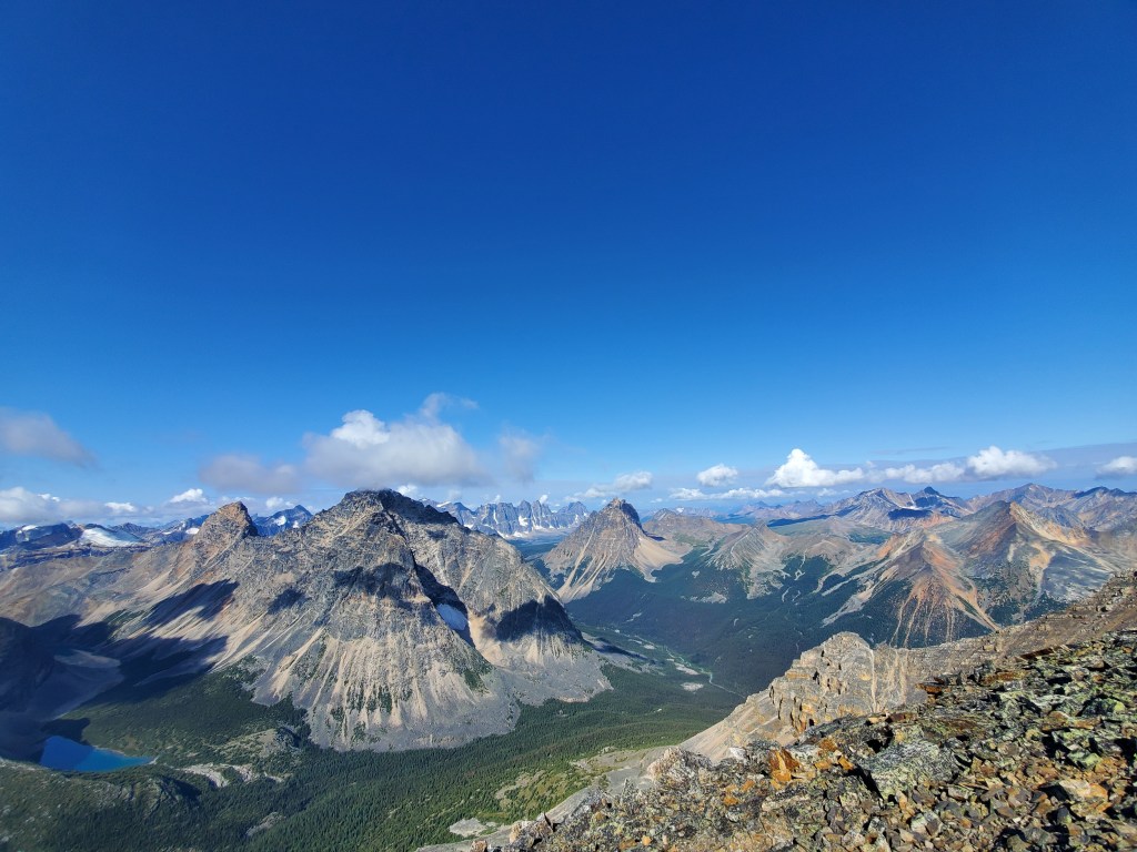
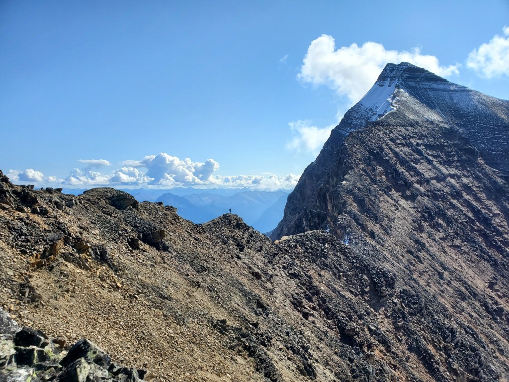
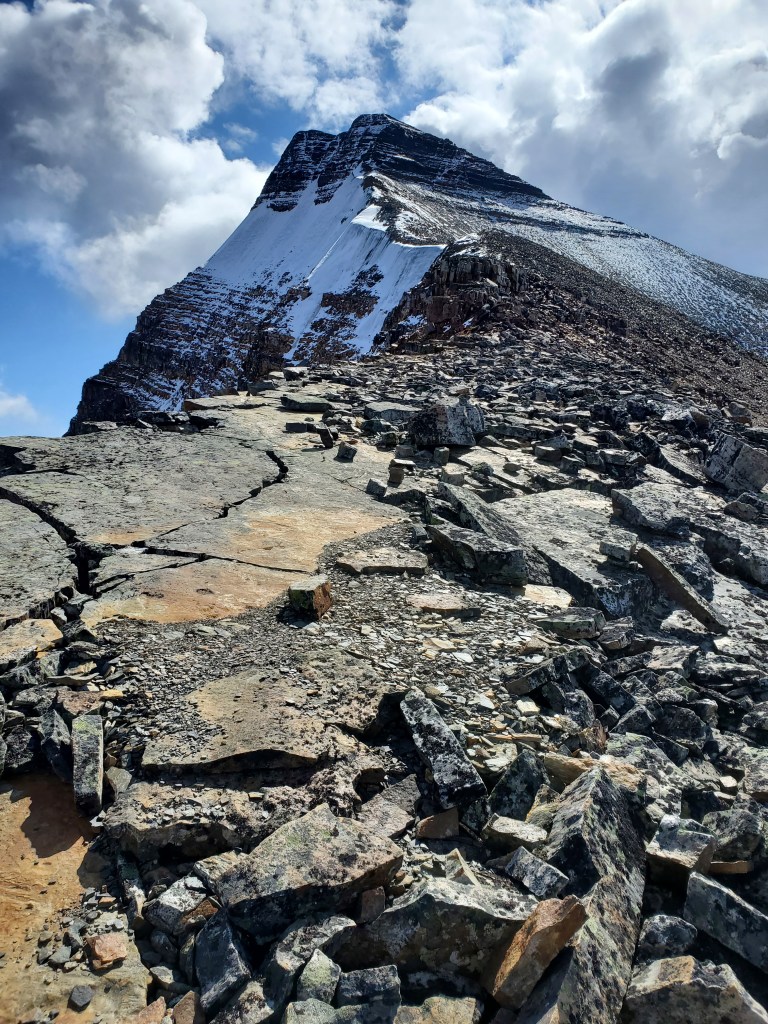
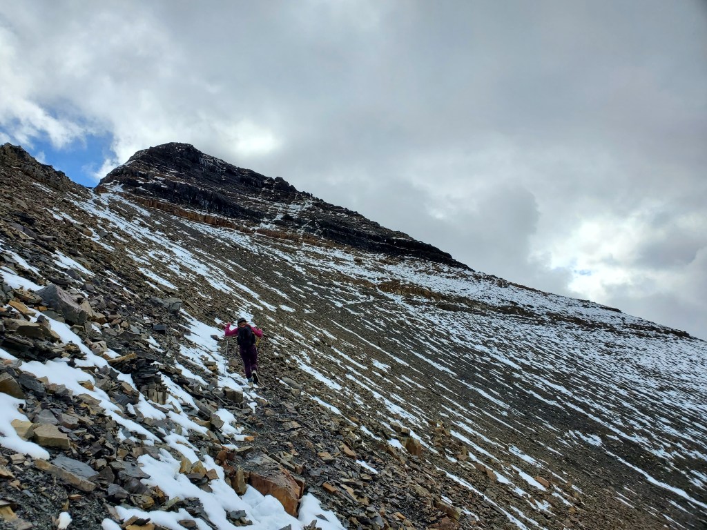
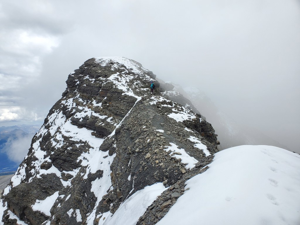
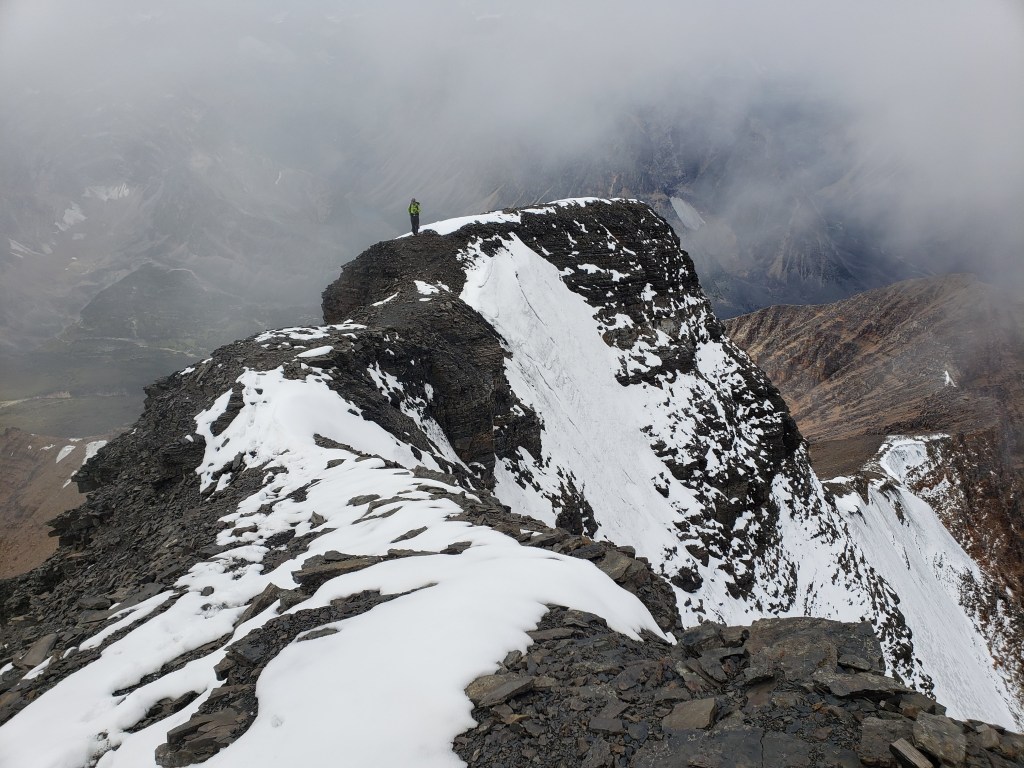
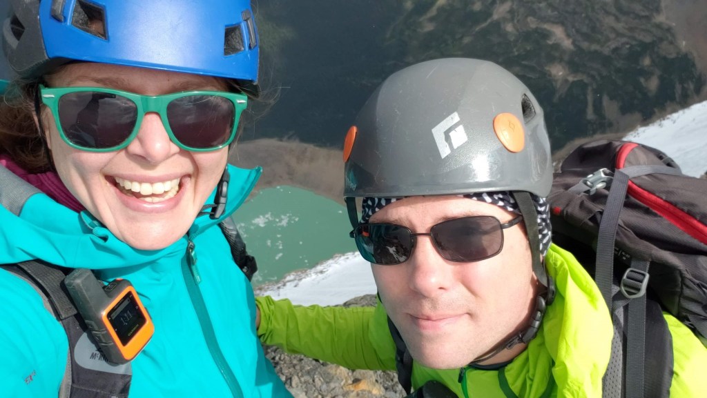
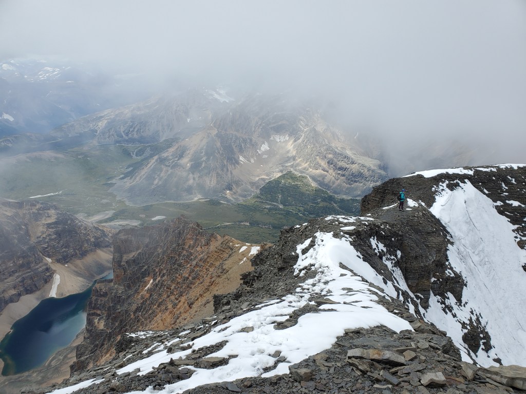
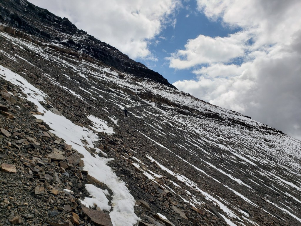
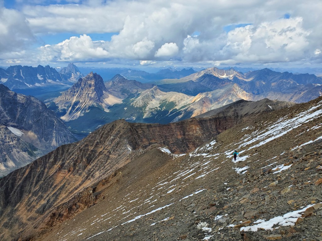
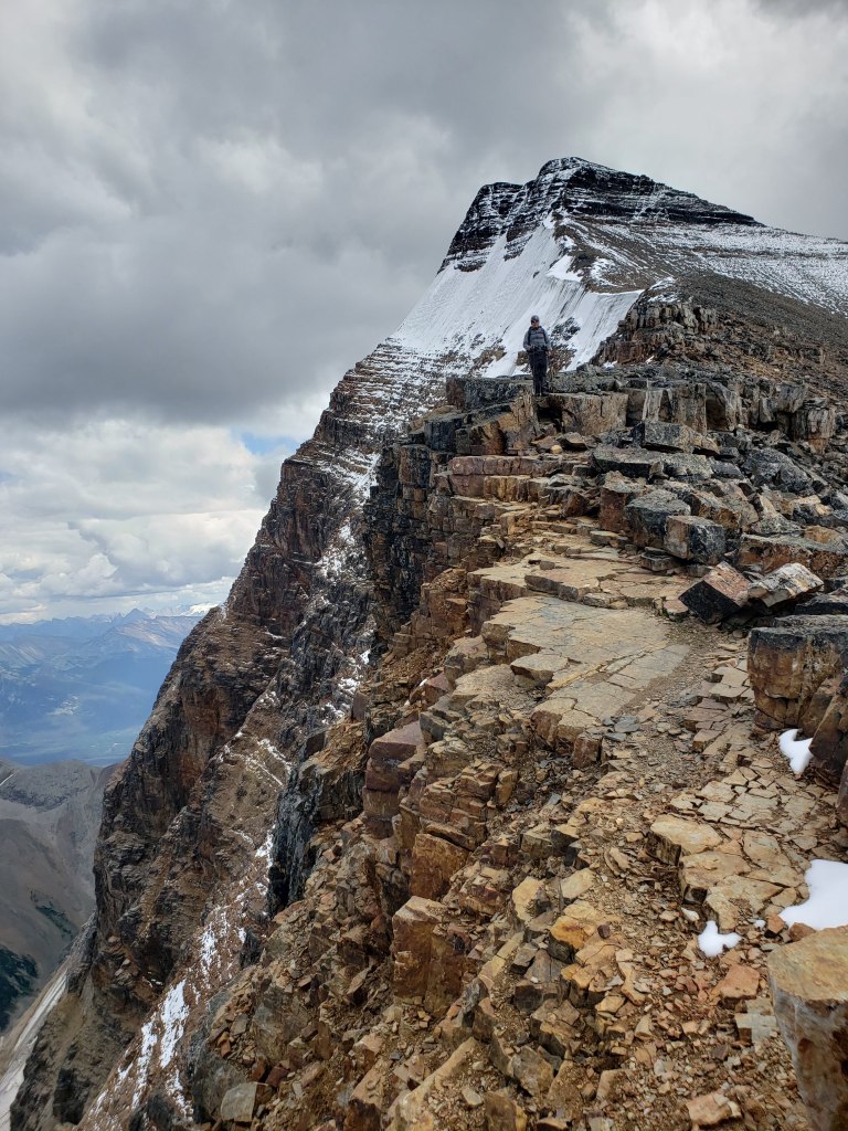
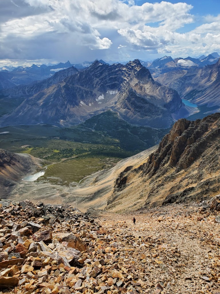
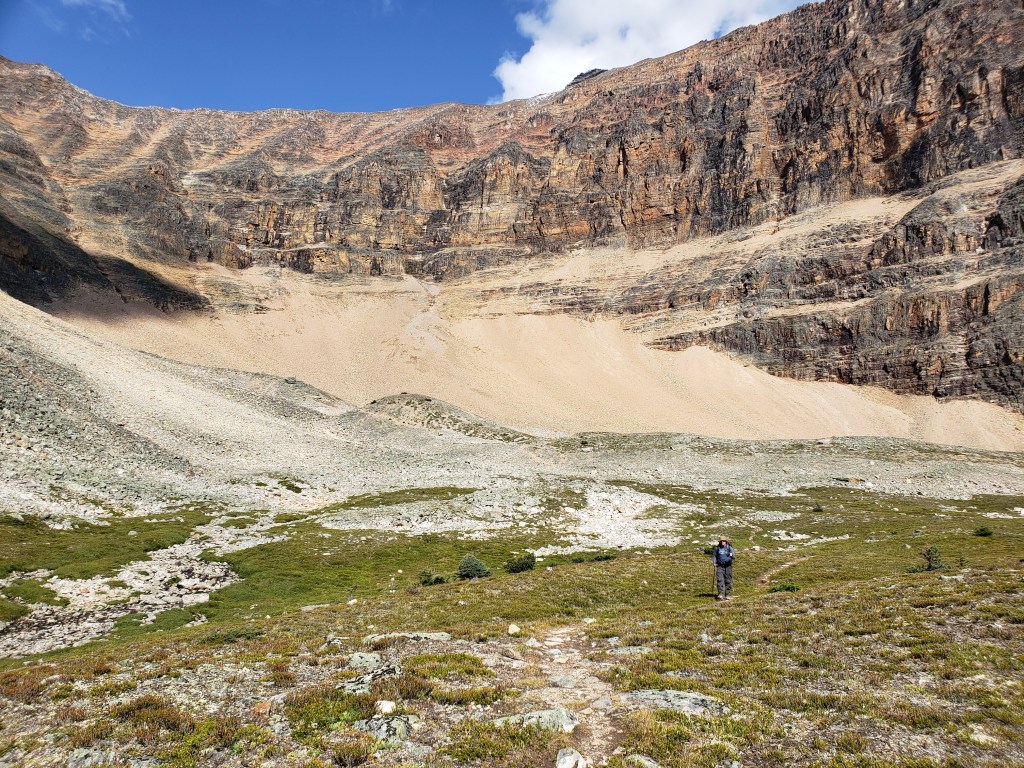
Expecting a long day, we rose early in the morning and started in the dark. Thankfully we were able to find parking at the pullout. The pullout can accommodate roughly 20 vehicles and was already half-full.The main trail into Tonquin is wide and well-maintained. Throne Mountain is visible through the trees (and truly looks like a throne). We’ll be looking for the turn-off to Verdant Pass Trail before it.Looking back, Verdant Pass Trail is narrower and a bit bushy in places, but still very easy follow. The side of Throne Mountain can be seen in the background here. The throne is facing right and this angle shows its back and right arm.A trail leads to the bowl below the west ridge of Edith Cavell. Opposite to the bowl are Chevron Mountain (left), Blackhorn Peak (center-right), and Throne Mountain (right).Nearingburg and Coulthard direct the reader to find “a prominent break in the cliff bands and then [ascend] upwards.” They meant a break more towards the middle of the bowl, but the line was not entirely obvious from below. We spotted easy lines to the left and tried one of them out – it worked. Our ascent line ended up being slightly longer, but the route-finding seemed slightly easier.A large cairn was stacked at the bottom of the ascent gully we chose.We donned our helmets and started up the chute.The chute narrowed as we hiked up. The way was obvious and never beyond moderate scrambling. Chevron Mountain towers above Verdant Pass in the background.Gaining the west ridge, views opened up across the Tonquin Valley to the west. Oldhorn Mountain is just left of center, Throne Mountain is at the far left, and the Ramparts towering over Amethyst Lake are peaking out between them. The shorter peak at center is Mount Maccarib and the two taller peaks to the right of it are Majestic Mountain and Manx PeakViews to the south are of Verdant Pass, beyond which lies the Hooker Icefield including legendary Mount Hooker, once fabled to be over 16,000 ft but now determined to be only 10,800 ft. For further reading see Corbett’s 11,000ers of the Canadian Rockies.From where we gained the shoulder it is still a long ridge walk to the peak. We are keen to see whether the dusting of snow on the slope below the peak will end our day early. The route traverses across this slope and would bump this up to a mountaineering objective if snow covered.Another shot of Blackhorn Peak, Throne Mountain, and Oldhorn Mountain. The snow-padded seat of the throne is nicely visible from this vantage point.Traversing ahead of Dan, I am standing on a hump at center. I ran into two other groups near here, but no one else had packed crampons and the others ended up forced to turn back at the traverse.The traverse begins at the hump ahead and then crosses to below the bottom-right corner of the triangular cliff face.The first part of the slope was no problem, but we paused part way across to put on our crampons (not microspikes). Even with only a dusting of snow the slope was slick and muddy.Once across the slope we followed a faint trail around to the back of the triangular cliff face. Dan is rounding the corner here, with Chevron Mountain and Blackhorn Peak in the background.Once we gained the summit ridge it was still a short ridge walk to the peak. Progress was slow here as I thoroughly probed each snowy foot placement.Looking back at Dan following on the summit ridge. Clouds moved in as soon as we neared the peak!Looking down over the ridge at the Angel Glacier and Cavell Lake.A selfie at the peak, above Cavell Pond. Note that the summit cairn isn’t quite at the peak – the peak is a few meters further on the next hump.The clouds didn’t want to cooperate for photos, nor did we want to risk waiting so long that we would be scrambling in the dark. Content simply to have reached the peak, we returned the way we came.Dan traverses back below the triangular cliff face. The slope isn’t quite as steep as it looked from further back, but is still very steep and exposed.I follow the traversing trail back to the ridge. Rather than gaining the high point ahead and continuing down the left, the way we ascended, we will be turning left at the col between Edith Cavell and Sorrow to descend by the climbers’ descent route. I had chatted with another group that had ascended by the climber’s descent route and it sounded straight-forward. Sorrow Peak is at the end of the ridge to the right.One last shot of the lucky birthday boy in front of Mount Edith Cavell.The descent route was easy to spot by the obvious trail through the scree. The path through the scree generally trended to skier’s right, with a few jogs to the left to scramble around cliffs. The scrambling was never beyond moderate.Hiking out through the bowl. The descent route is at the left side of this photo and avoids the lowest cliff band by emerging more toward the center of the bowl.After a long walk out on trail we finally made it back to the trailhead at Cavell Lake. The peak of Edith Cavell is at center, still hiding in clouds. One wing of the Angel Glacier can be seen about half way up.
Feeling satisfied and exhausted, we wrapped up our day with a birthday poutine at North Face Pizza in Jasper. North Face Pizza’s logo is even Mount Edith Cavell! Mount Edith Cavell has some of the most spectacular views I have encountered and I would happily go back again. I am grateful I had the last-minute thought to throw crampons into our bags. Because of this, out of the 8 people attempting the peak this day, we were the only 2 to get through. This route is only a true scramble if bone dry, which is even a coin toss in summer.
Appendix
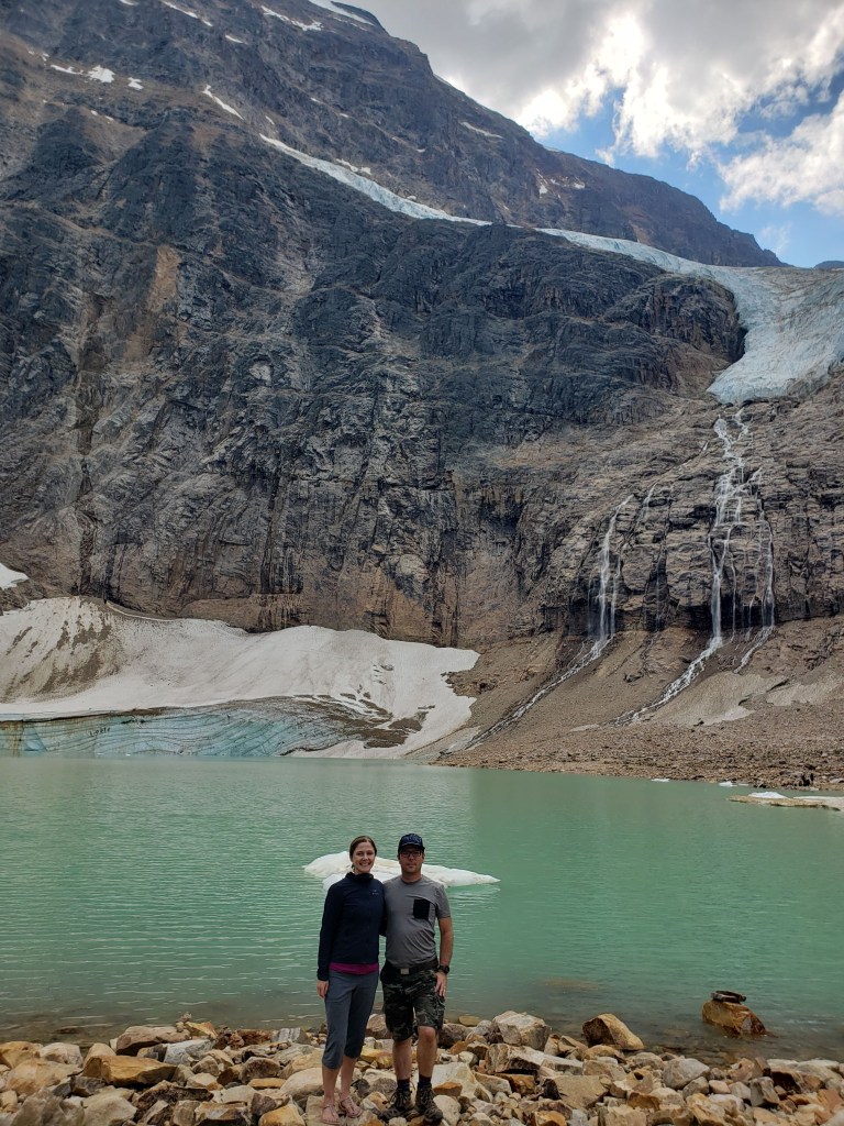
The more commonly viewed angle of Cavell Pond and the Angel Glacier from the Path of the Glacier Trail, August 2022.
One angel wing and the upper torso can be seen part way up the cliff. The other wing is out of frame to the right and part of the hem of the angel’s dress is along the water. Sadly most of the angel’s dress has receded over the years and the glacier no longer bears a strong resemblance to its namesake. Just a note: This pond is prone to icefall from the glacier above and one should never approach the waterfall. Even the spot where we are standing can occasionally see huge waves if larger pieces break off.