Notes: These might be the best views of any day hike in Jasper. I returned in 2023 with friends – see appendix for these better photos.
Trip Report
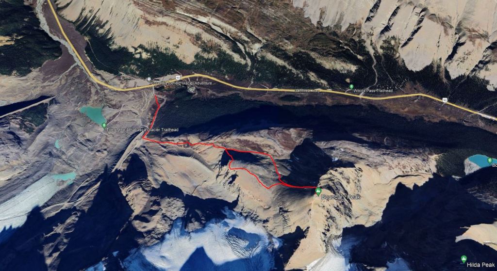
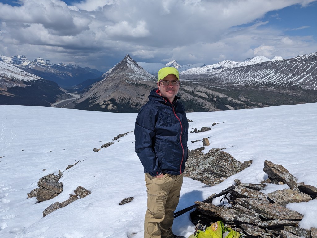
Boundary Peak is a subpeak of Mount Athabasca which marks the boundary between Jasper and Banff National Parks. A shoulder sits in front (west) of Boundary peak which makes a short but worthwhile detour, offering spectacular views of Mount Athabasca. I completed Boundary Peak in 2021 in poor visibility, but then returned with friends in 2023 in clear skies. We didn’t complete the peak on the second trip, but did get far better photos – see appendix.
The route begins across from the Icefield Information Center at a small parking lot, about 150 m south of the highway. From the parking lot I walked through the meadow behind the outhouses to the tour-bus road. The easiest route follows the road until just before the bus terminal where a large cairn marks the left turn up a broad gravel wash-out (an earlier turn-off from the road makes a detour through trees before leading to the top of the same gravel slope).
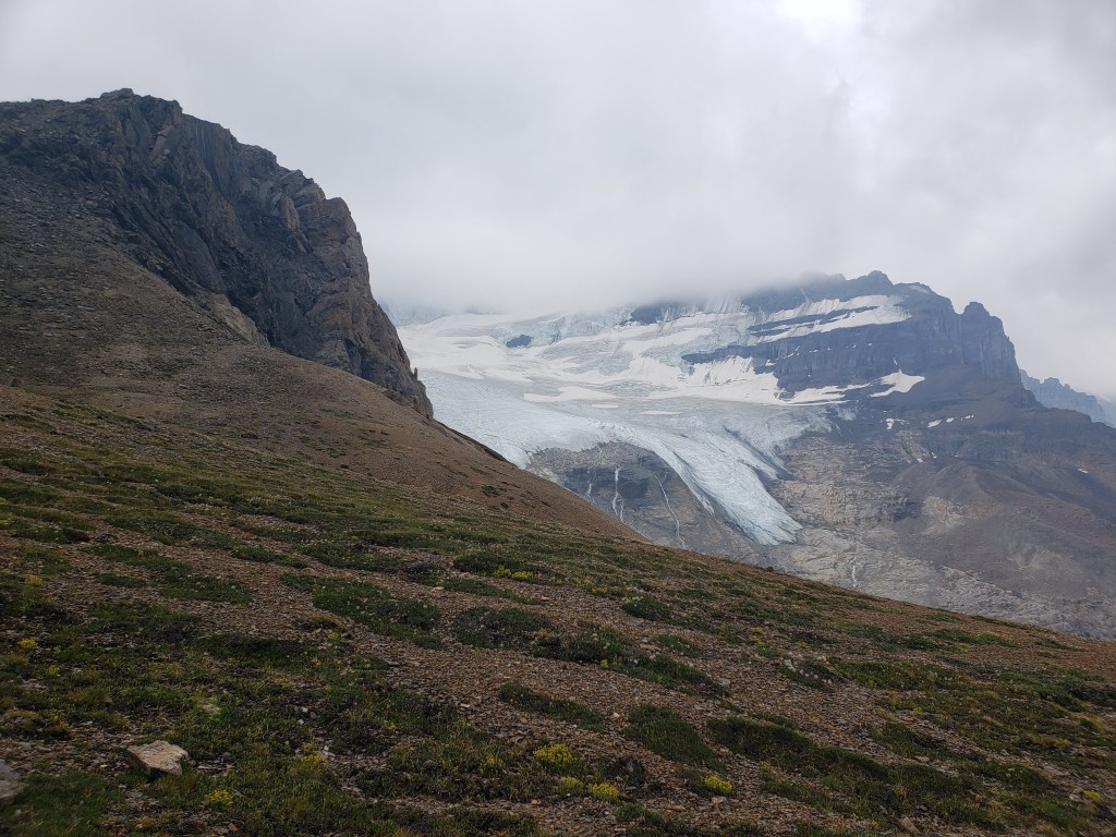
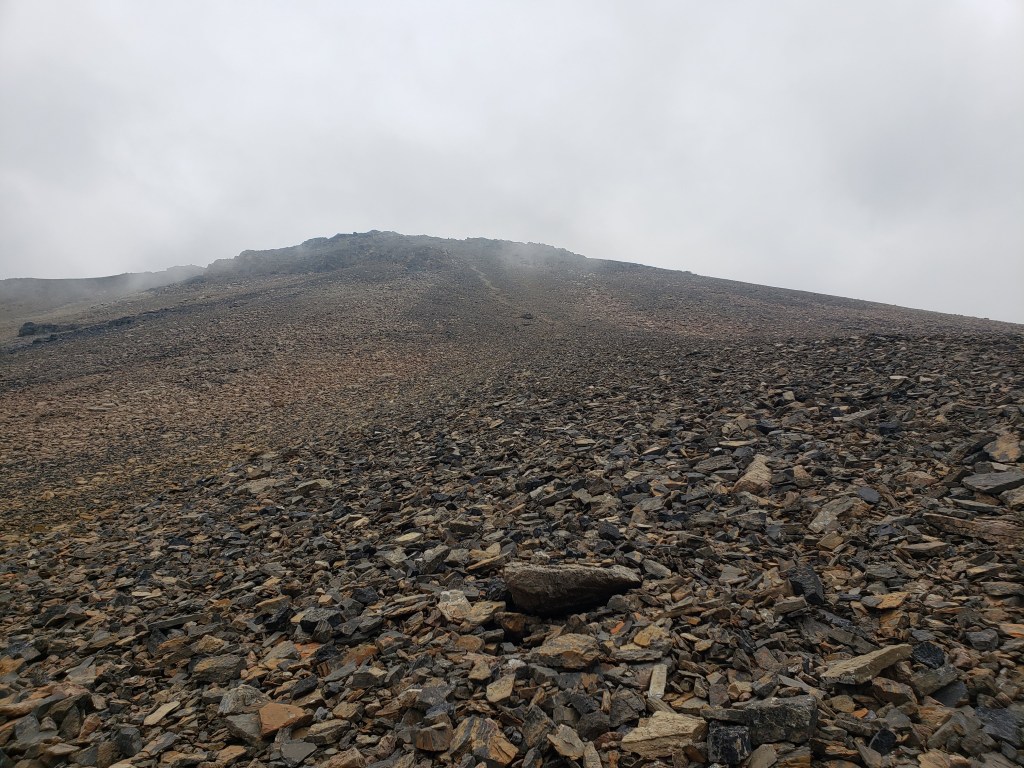
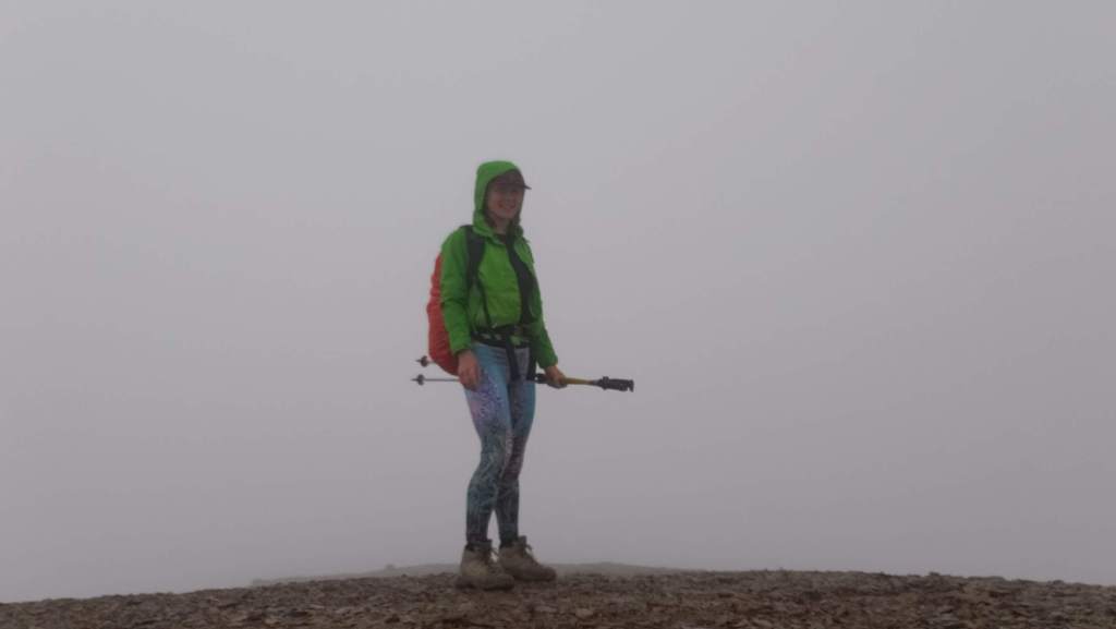
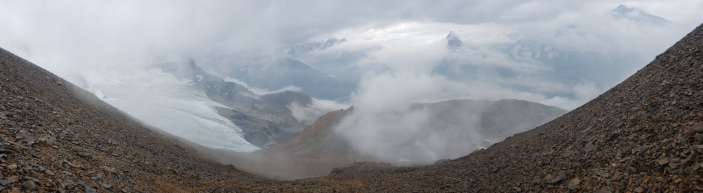
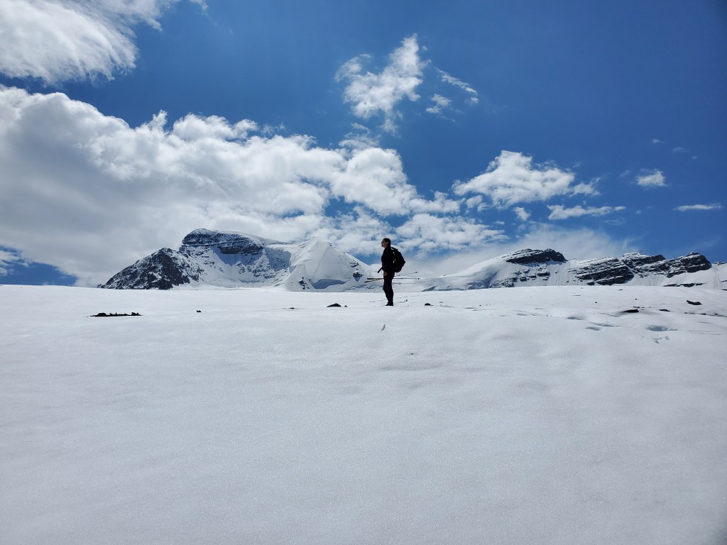
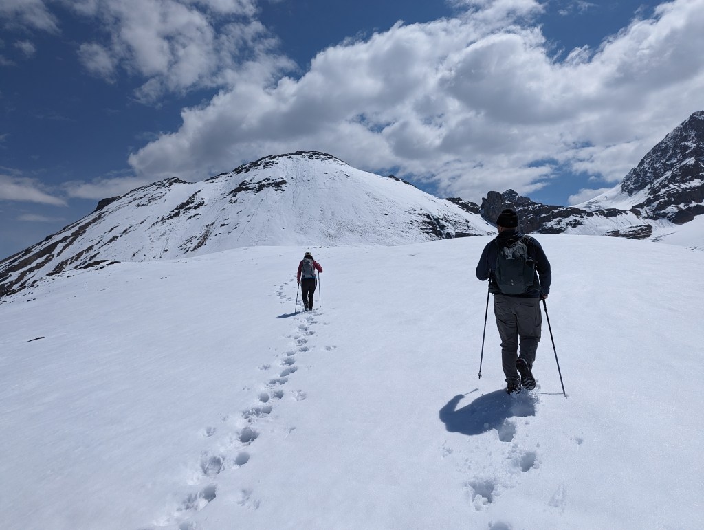
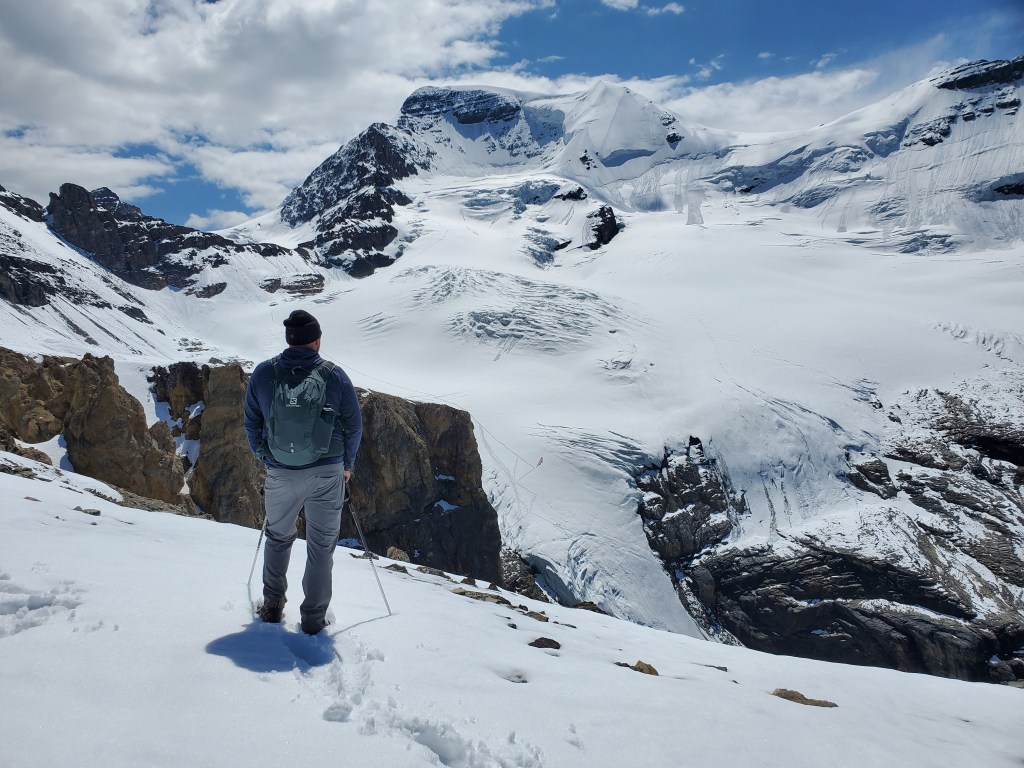
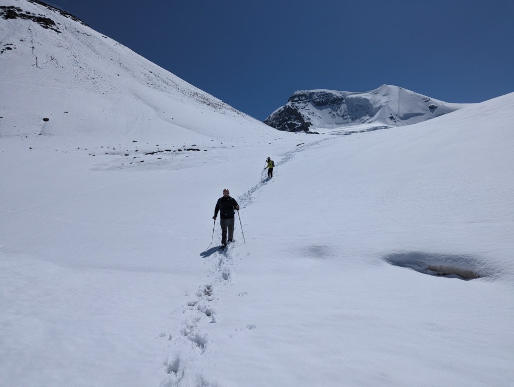
Regardless of turn-off taken from the road, both lead to the same place. The rocky edge of the shoulder is ahead at center. On the way in I kept left and took the easiest path below the shoulder.Passing by the edge of the shoulder, catching a glimpse of the toe of the Little-A glacier and Mount Athabasca.The walk below the shoulder was easy and uneventful. The final push to the summit is a bit tedious, but an ok trail zig-zags through the treadmill-scree.The last few moves to gain the peak are a tad scrambly, but were still doable while completely wet.The summit is flat.The clouds thinned slightly on descent. Pointed Mount Wilcox pokes through the clouds at center, looking like something out of Tolkien.On the return trip I kept high on the shoulder and was treated to a few glimpses of Mount Athabasca and the Little-A glacier. Note that the brown area at the left edge of the glacier is part of the glacier and any footprints leading across this are from people roped up for glacial travel. The popular Silverhorn route up Mount Athabasca follows this glacier and is a mountaineering objective.The north end of the shoulder proved to be the best views of the day. The shoulder is positioned almost like a stage placed specifically for admiring the Little-A glacier. This summer had been extraordinarily hot and the poor glacier was looking quite sad, unfortunately.
I made it back to the parking lot in 3 hrs 40 min. I am guessing Nugara’s estimate of 4-6 hours adds extra time to be distracted by the majestic views, which wasn’t really applicable for me on this day. From the few views I did have though, I knew I needed to come back and show my friends.
Appendix
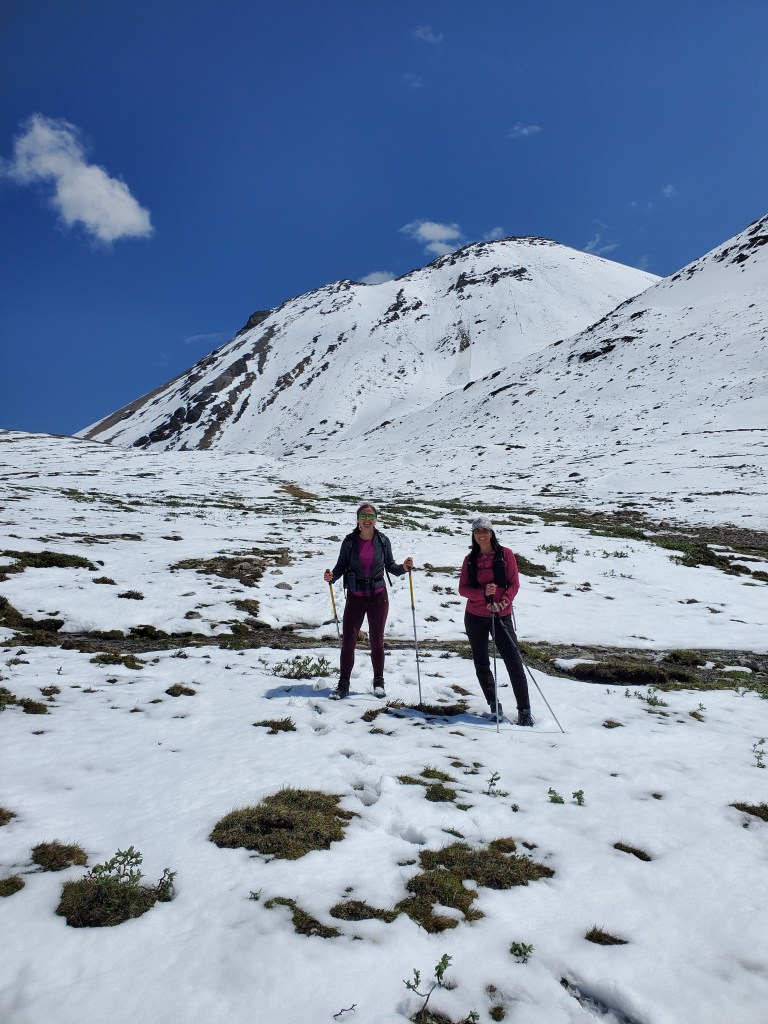
2023 June 24 – Chris, Cynthia, Dan, and I returned to Boundary Peak
Jasper had a freak snowstorm earlier that June. I had hoped the snow would melt relatively quickly and the peak itself would be doable, but the final ascent slope turned out to be in poor shape and we only hiked to the shoulder.
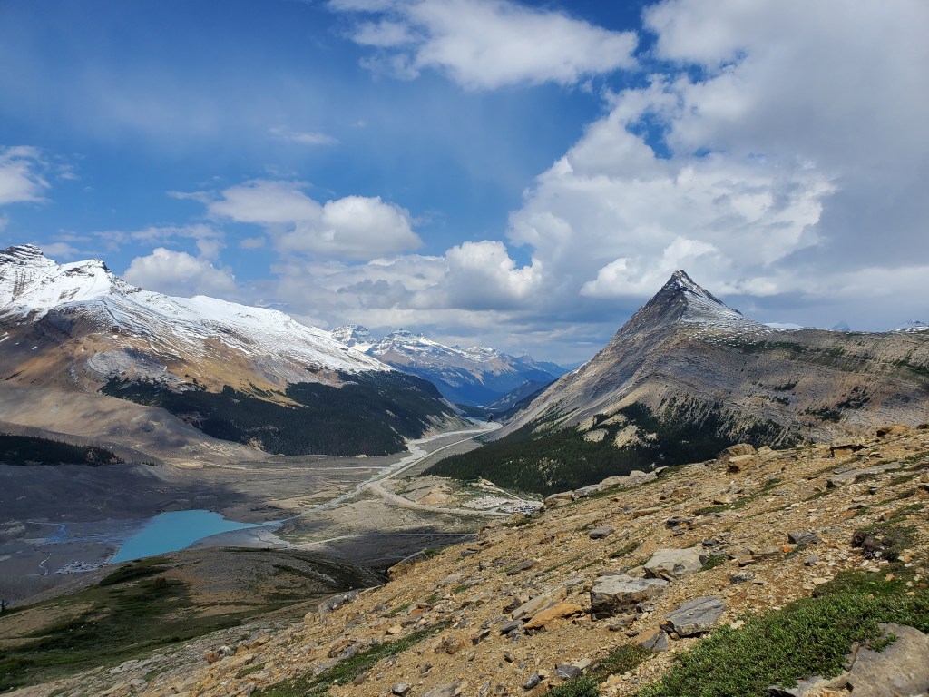
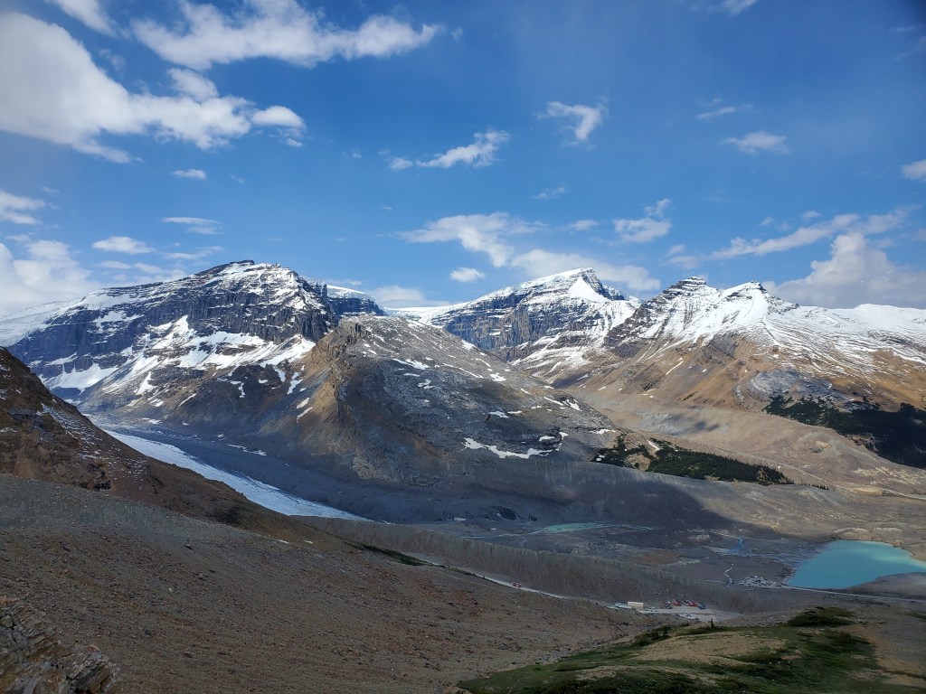
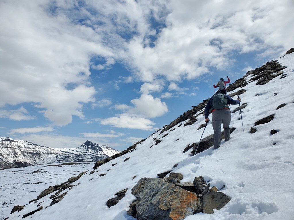
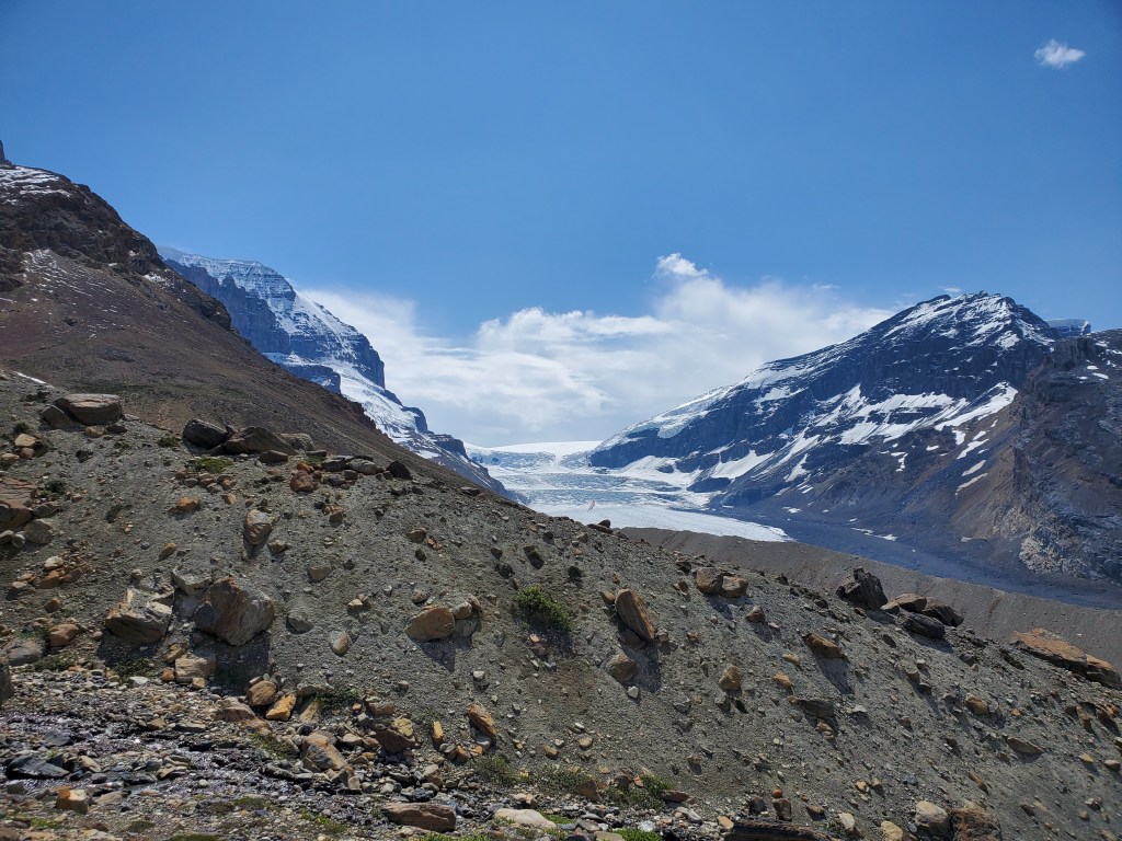
Chris, Cynthia, and I at the parking lot. The rocky, bare cliff at center is the shoulder we will hike to. Boundary Peak is behind it, mostly covered in snow, and Mount Athabasca is to the right.Part way up the slope, looking back toward the highway. Even without spooky clouds surrounding it, pointed Mount Wilcox looks like something right out of Middle Earth.Gazing West to the toe of the Athabasca Glacier. Towering over their surroundings are Snow Dome (left) and Mount Kitchener (right). The bus terminal is just barely visible in the foreground at the right – it marks the turn-off for Boundary Peak.Returning to the rocky shoulder. Instead of staying low on easier terrain, I wanted to gain the shoulder at the west end to get to views as quickly as possible. The recent snow made this tricky though.The start of the slope wasn’t very steep and the snow wasn’t too deep so we persevered on. The interesting peak in the background is an outlier of Nigel Peak.Near the top of the slope we kept to the rocks to keep out of the snow, making this more of a scramble than a hike. My friends weren’t very appreciative, but are thankfully both competent and forgiving.Finally gaining the shoulder, with Mount Athabasca in the background.Walking along the shoulder. Boundary Peak is in front of us and still holding a fair amount of snow. The slope is showing heavy thermal influence with lots of small slides visible on its steep slope. The day is only getting hotter and the group decided to skip the final push to the summit and take in the views from the better vantage point on the shoulder.Stopping at the spectacular viewpoint at the west end of the shoulder, looking out over Mount Athabasca and the Little-A glacier. Footprints can be seen zig-zagging up the toe of the glacier.Another view of Mount Wilcox (center) with the long ridge of Nigel Peak to the right and tall Sunwapta Peak poking above Dan’s head.We walked the length of the shoulder and then descended its east edge, keeping clear of any possible sloughing from the slope. This end is much more gentle and easy. We walked out using the easy path below the shoulder. Boundary Peak can be seen in the background.One last glimpse of the Athabasca Glacier and Snow Dome (right) as we near the bus terminal.


One thought on “Boundary Peak (2870 m)”