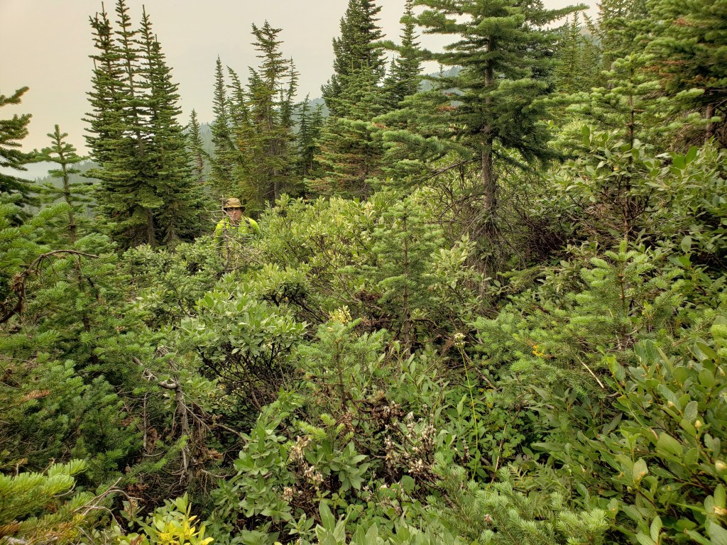
Notes: The scrambling moves feel closer to moderate, but the fall potential is severe. The bushwhacking was fierce too.
Trip Report
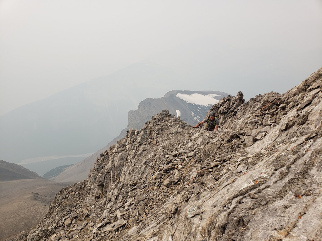
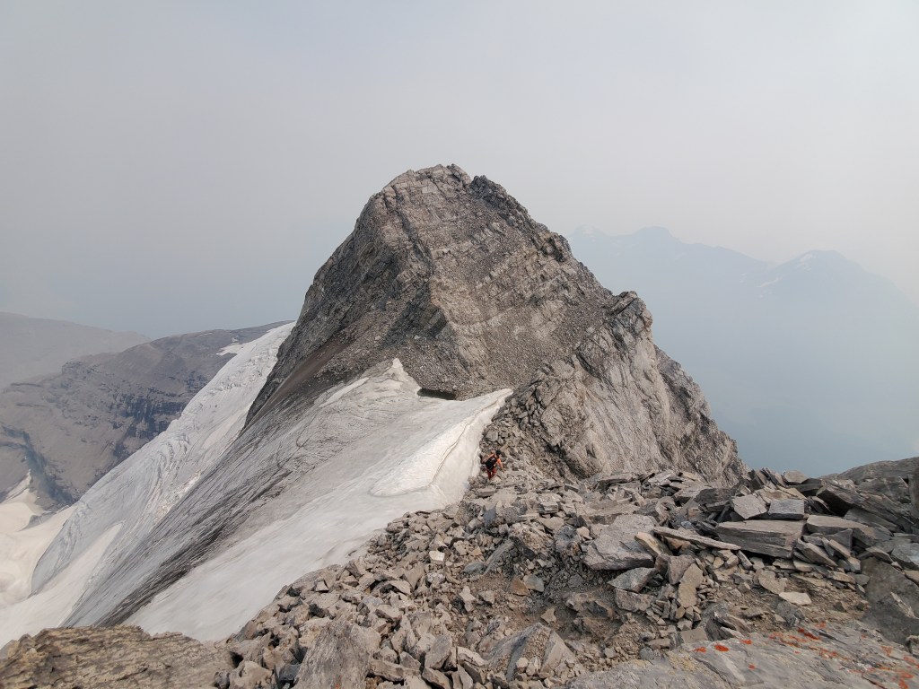
An extraordinary heat wave from late June to mid July 2021 caused unusually rapid glacial melt. As such, the summit ridge was entirely free from snow and ice during our trip. Without ice covering parts of the ridge the scrambling moves along the ridge were only moderate, however a fall would still be fatal. We didn’t end up using our mountaineering axes, but still brought them.
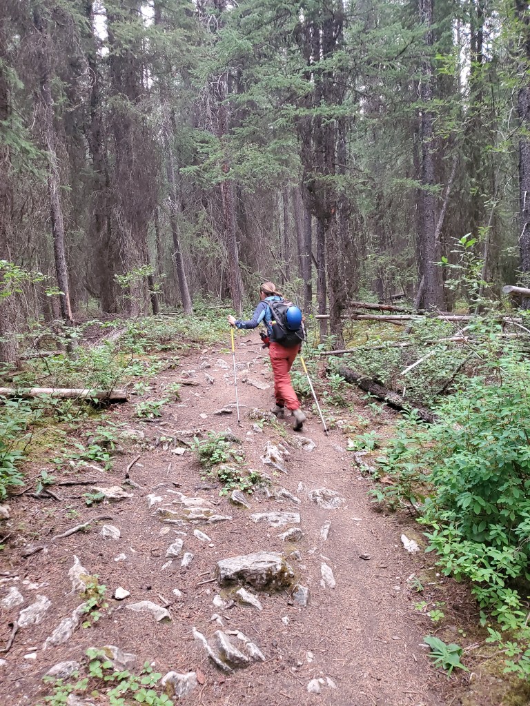
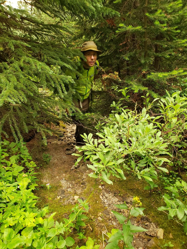
The bushwhacking is only 1 km in each direction, yet quickly gets frustrating. On the way in we explored around the trees a bit in hopes of finding a slide path that had been cleared out, without success. On the way out we just followed the drainage, which is still a bushwhack but was much easier.
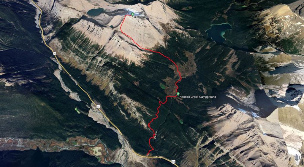
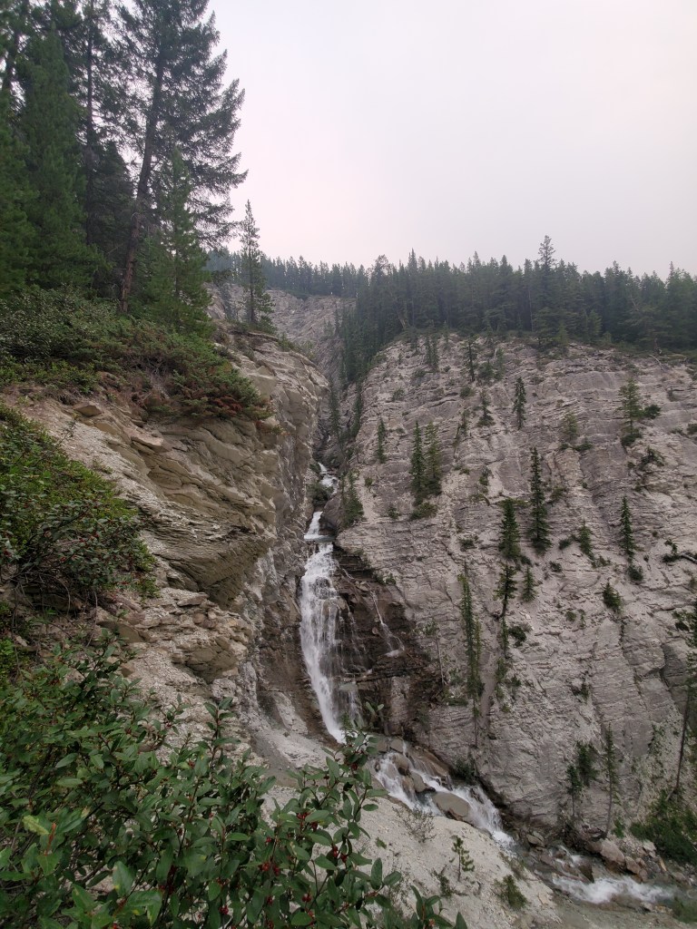
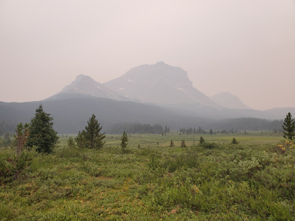
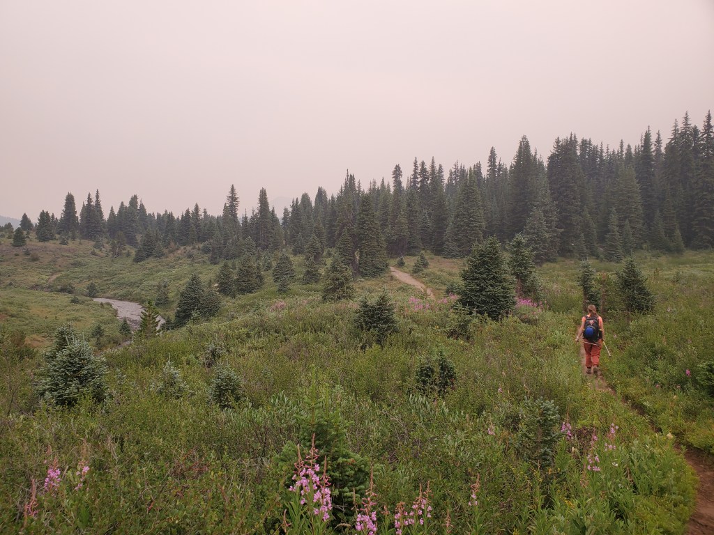
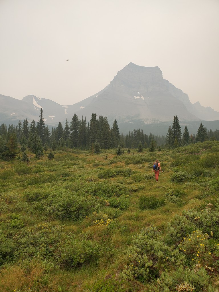
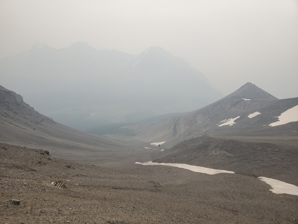
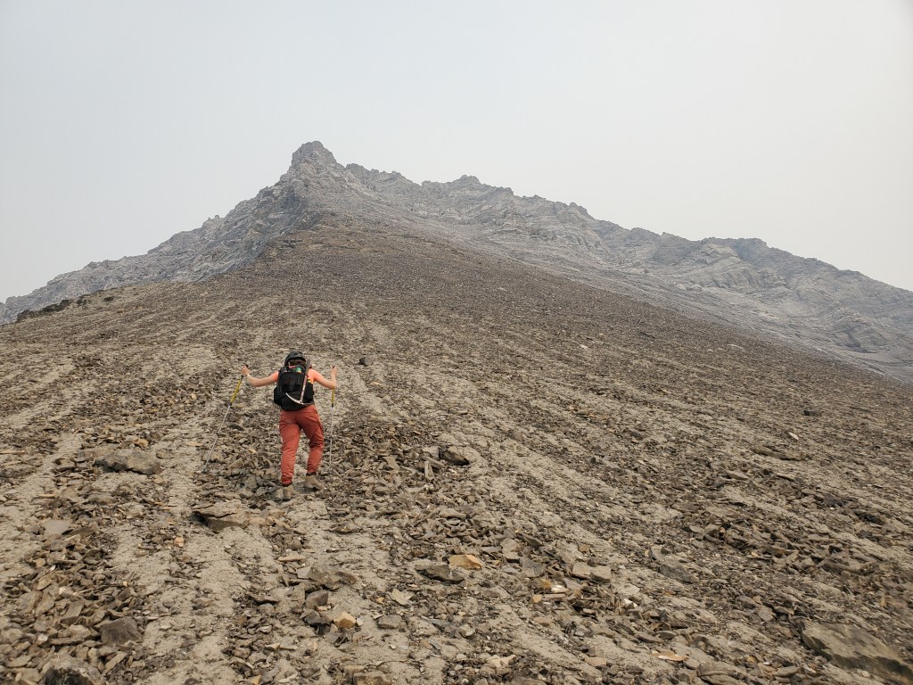
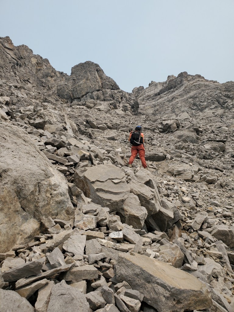
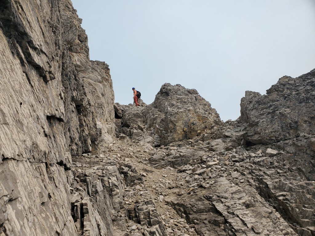
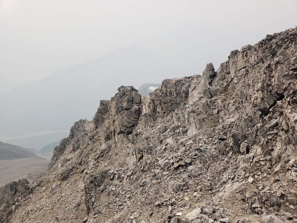
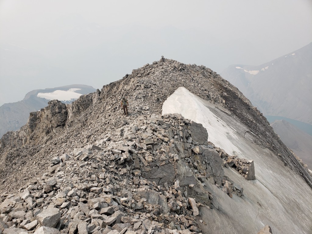
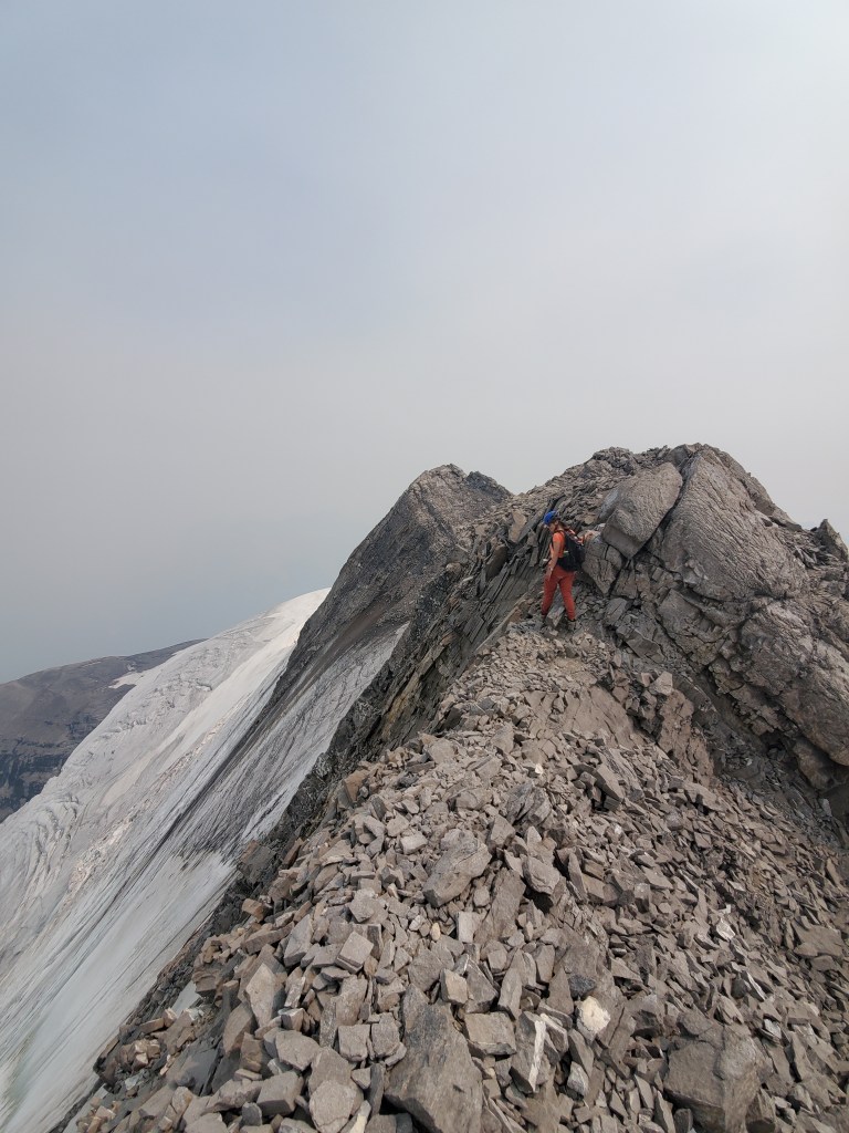
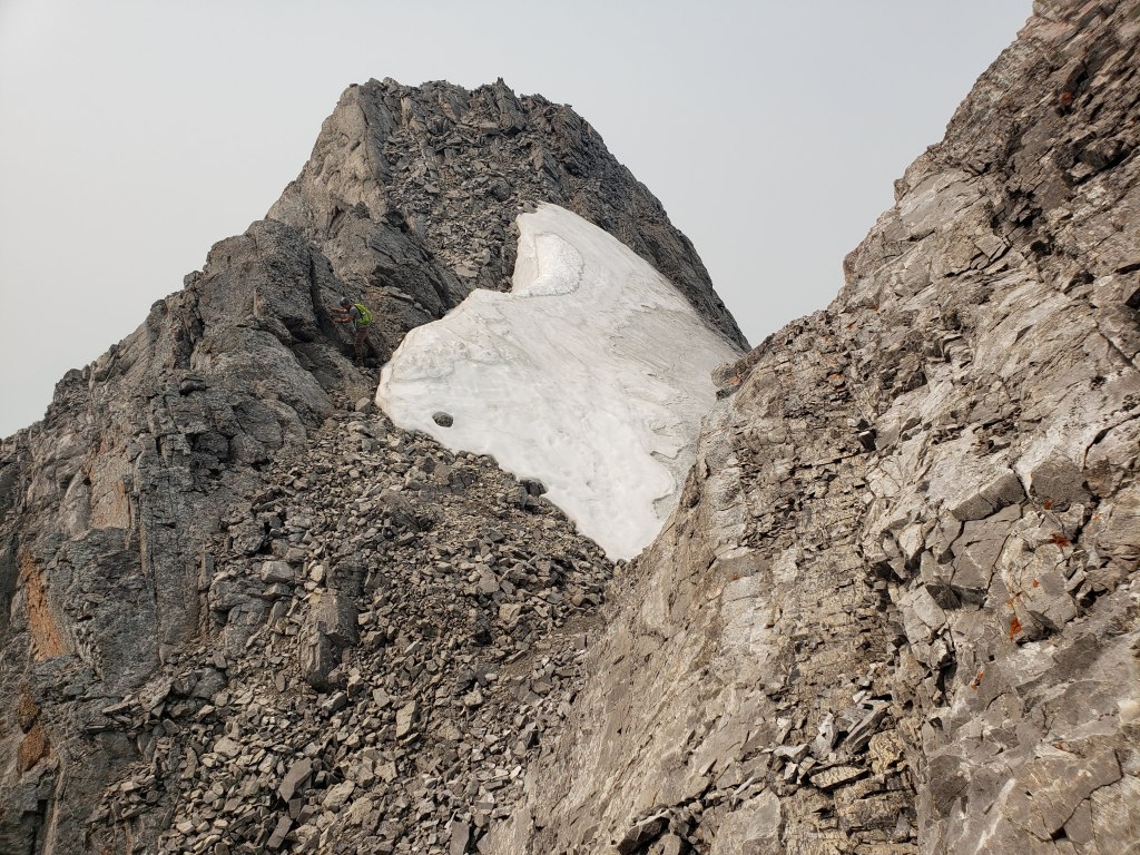
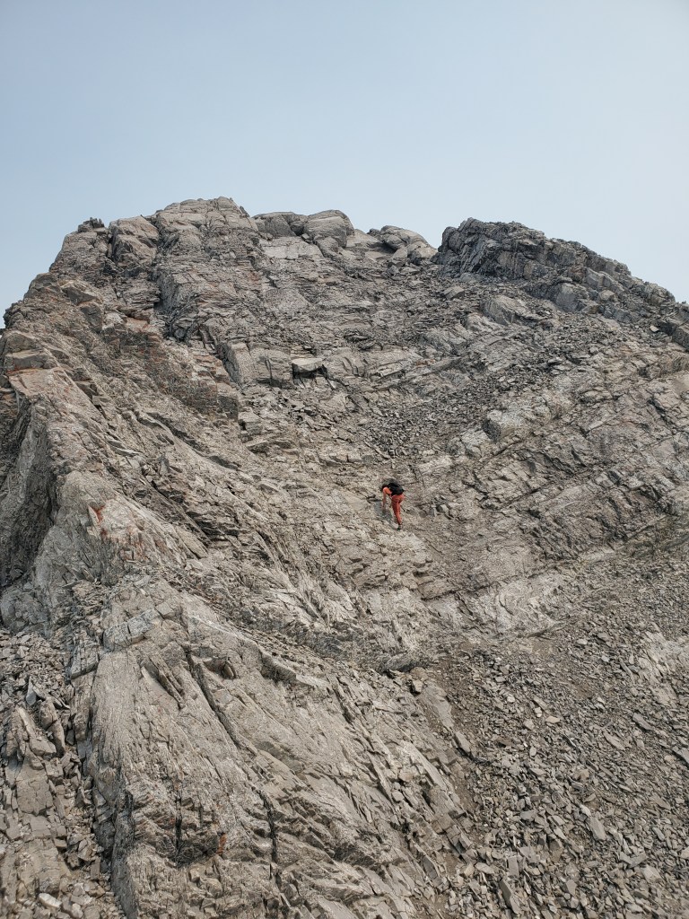
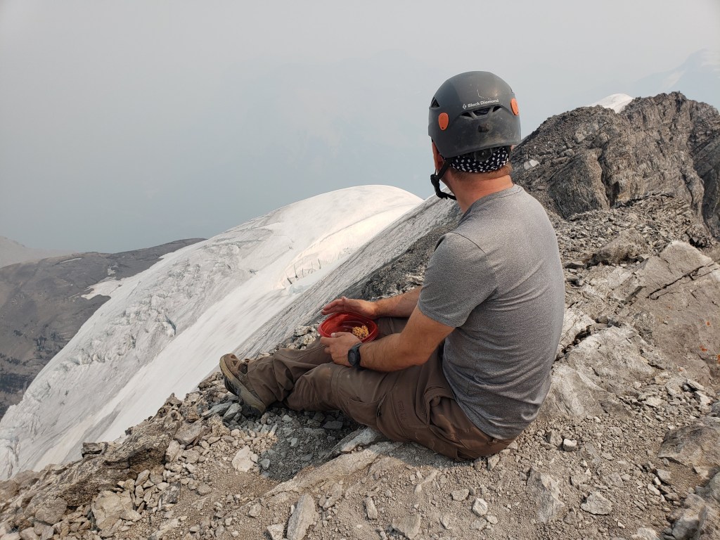
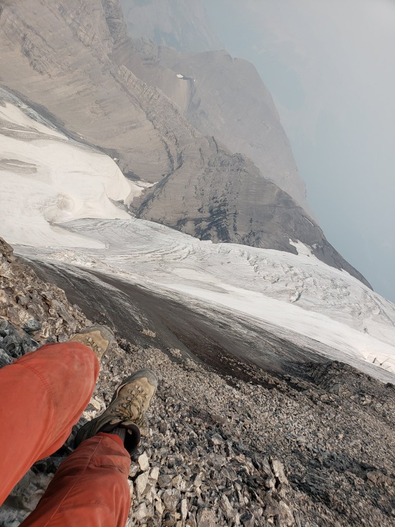
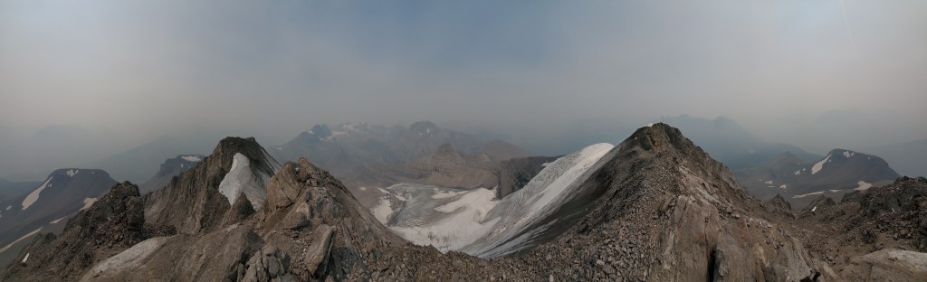
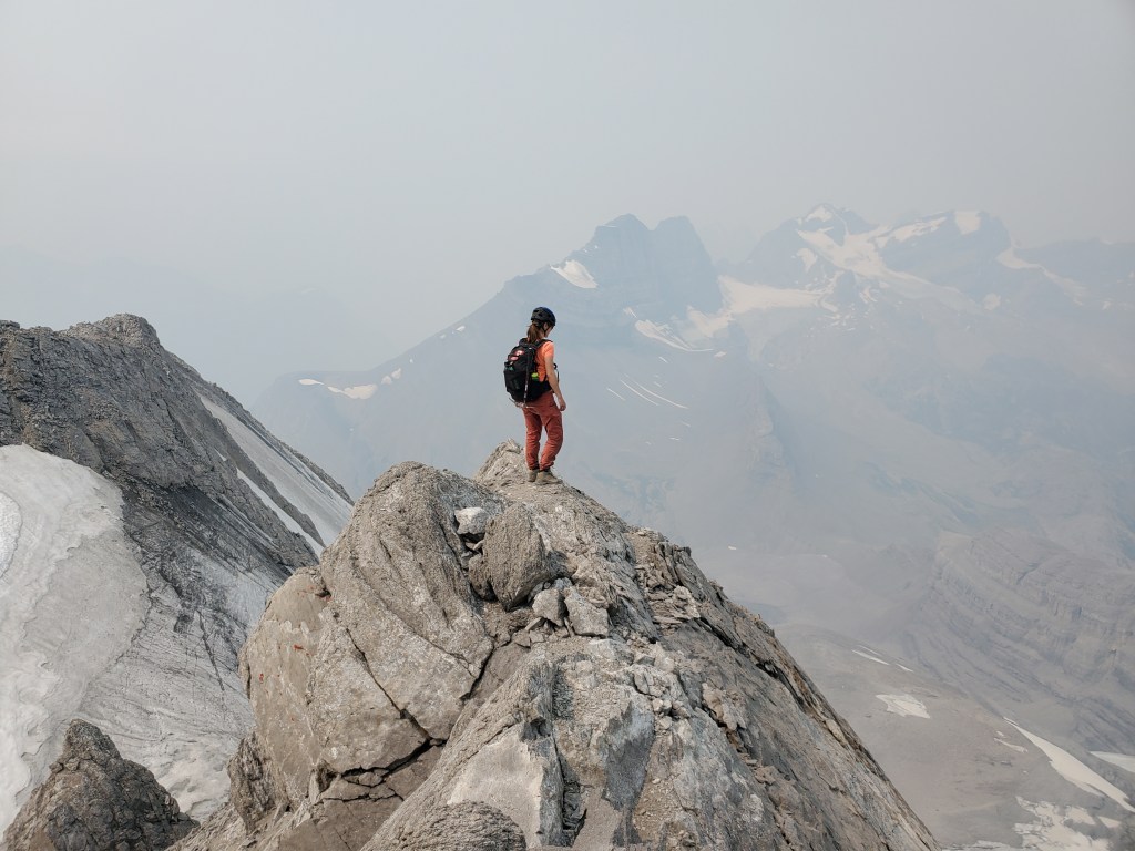
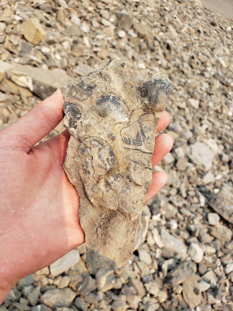
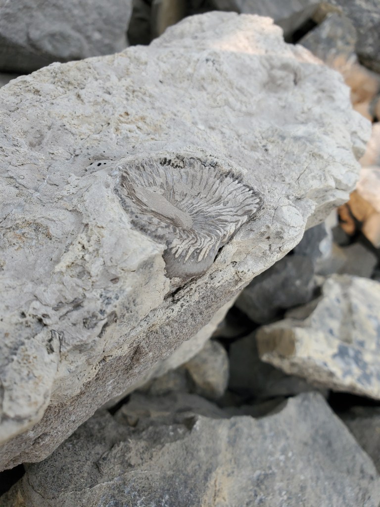
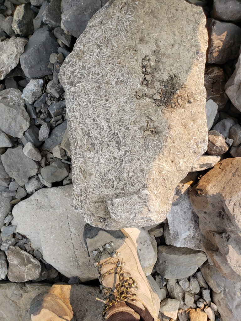
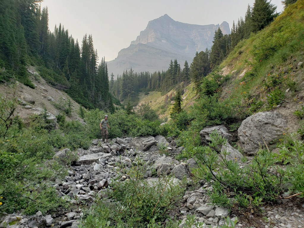
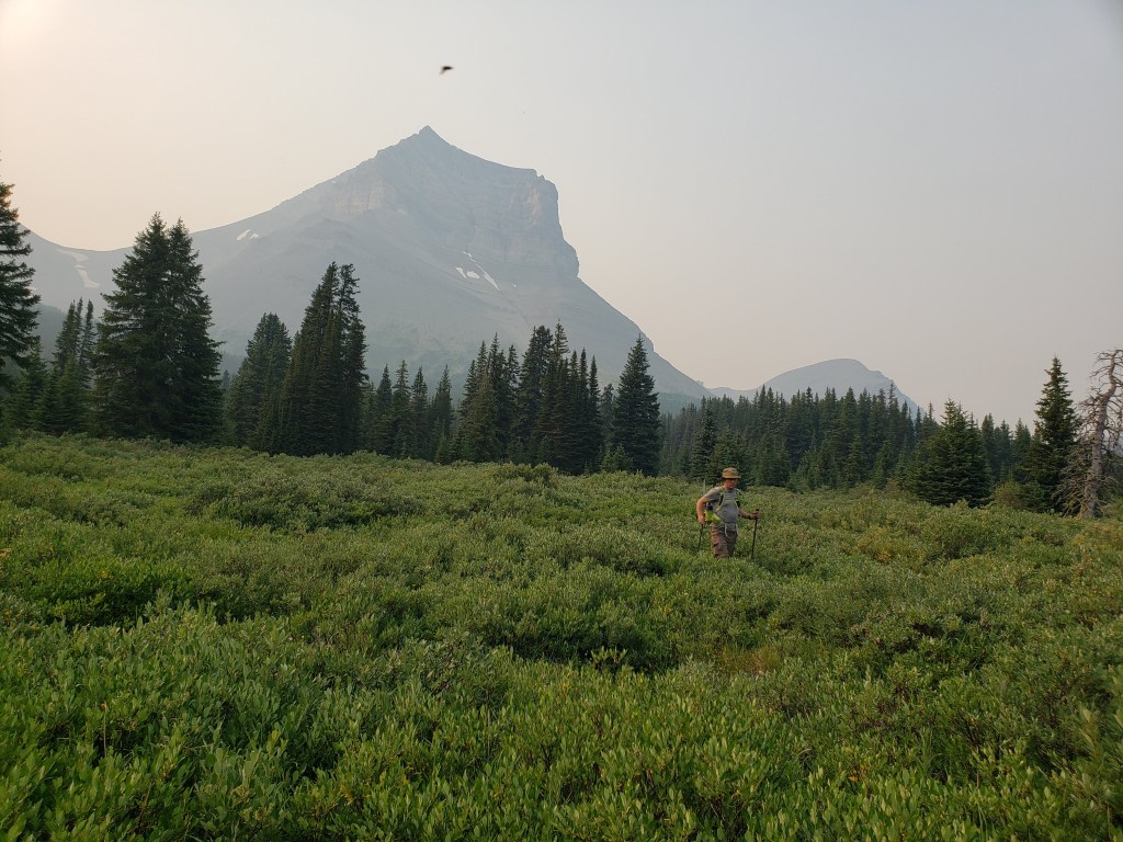
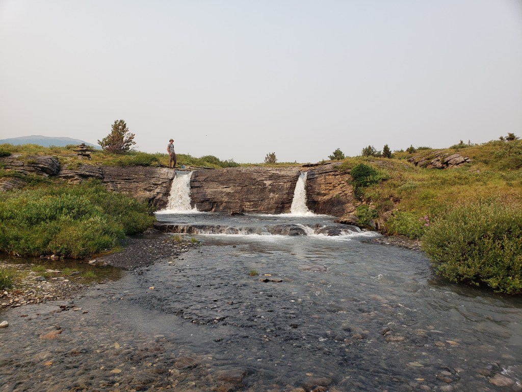
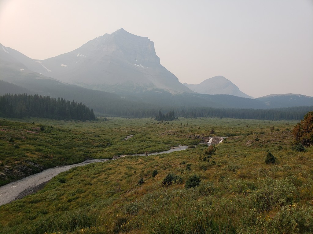
We parked at the Sunset Pass trailhead and hiked in along an easy trail. The parking lot is large, well marked, and has an outhouse.We paused to take in this impressive waterfall, not far from the trailhead.After hiking up and over a slight shoulder, we left the trees and continued on trail through meadow. Wildfire smoke was so thick this day that the sky appeared pink. Mount Burwash is to the right.To the north we caught our first hazy view of Mount Coleman.We kept left just before Norman Creek Campsite to stay on Sunset Pass trail.Once approximately under Mount Coleman we left the trail and angled toward its base. In retrospect, the bowl at its left narrows into a drainage, from which water runs. We would have been better off navigating to this, and it ended up being our descent route. The bushwhack was fierce on the line we took.The bushwhacking starts out innocently enough.The deeper we went, the bushier it got. Dan is in this photo.Thankfully the bushwhacking was only around 1 km. Looking back at the way we came.Finally out of the trees we aimed for the top of the bowl at center. This is the same bowl I pointed out four pictures ago. Once at the top we will turn right to ascend Mount Coleman.We passed a large group of goats sunning on Coleman’s cliffs.Looking back down the bowl. Our bushwhack had taken us to the scree shoulder at the left.We turned right and began ascending toward Coleman’s summit ridge.This part is never beyond moderate scrambling.Nearing the top, studying my route options.Topping out on the summit ridge.Looking back as Dan follows me up.Dan follows along the summit ridge. Coleman’s steep glacier is to the right.We get our first look at the summit. It’s not far, but it’s very exposed. We made sure to evaluate each foot placement, staying on solid rock and not moraine. The glacier had melted back from the ridge over the summer, but this last section would be extremely difficult with only a slight change in conditions.The scrambling moves only feel moderate, but the severe exposure earns this peak its difficult rating. Nearing the summit, pondering how we will gain the last steep rock face.Looking back as Dan traverses above the glacier on solid hands and feet.The final slope becomes much friendlier up close and was only a moderate scramble up.Finding a sturdy rock bench at the peak, we had a seat and paused for a snack.Extending my camera out over my feet to snap a shot of the glacier below us, happy to be firmly seated!A very smoky summit panorama.One last look at the smoky views before turning back and returning the way we came. We will be downclimbing behind me and then traveling across the ridge to the left.Traversing back above the glacier.Returning back to the bowl. For the trip out we simply walked down the middle of the bowl and along the drainage below.The bowl is rich with fossils (which cannot be removed, of course). Fossil affectionados, feel free to comment below if you can ID these.Continuing out through the drainage proved far easier than our ascent route. It turns into a bushwhack near the end but is still easier than the surrounding terrain.Finally emerging from the trees and happy to be back out in the meadow.We came across a lovely double-waterfall in Norman Creek.One last look up at smoky Mount Coleman with Norman Creek in the foreground.
We made it back to the parking lot in 12 hrs 20 min, a longer day than expected. We were slowed down a bit with bushwhacking troubles on the way in, but I think Kane’s estimate of 8-12 hours might be a tad light. Mount Coleman is an exhilarating scramble that is only appropriate for a seasoned scrambler with mountaineering experience. I wish the skies had been a bit clearer for us, but the fantastic fossils made up for the smoky views.