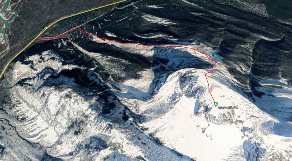
Notes: Approach now follows transmission line 6L530.
Trip Report
Historically, the crux of this scramble was finding the correct trail at the start of the day. This is no longer the case with the completion of 6L530 in 2019. This transmission line parallels the pipeline that was previously followed, but is much easier to spot. The parking is the same as for Shredder Reef Crag. Rather than following the obvious trail to the climbing crag, follow the old, dirt road along the powerline for ten minutes. The poles are numbered incrementally and the turn off is just past structure 332. This has been updated in newer printings of the 3rd edition.
2021 was my second time tackling Roche Miette. Shanna and I had a paddling trip planned for the following few days and we decided to drive out early to get some scrambling in.
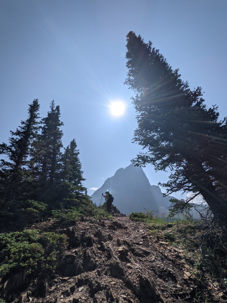
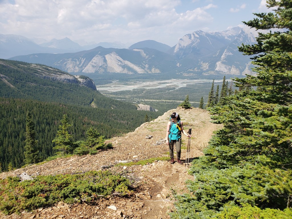
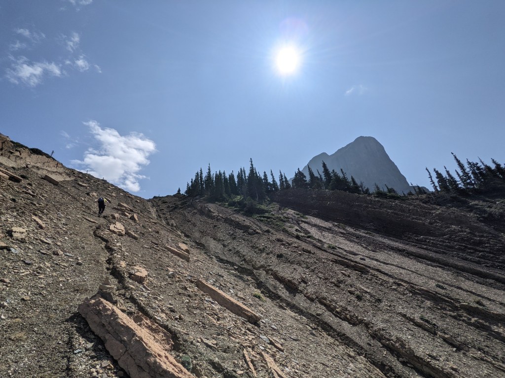
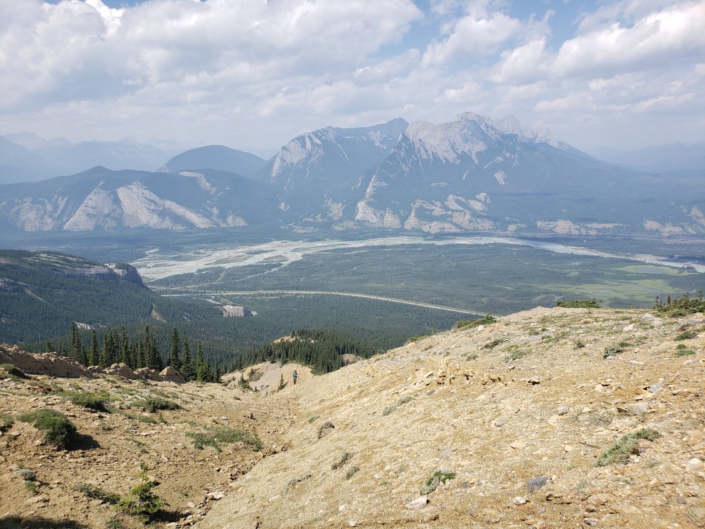
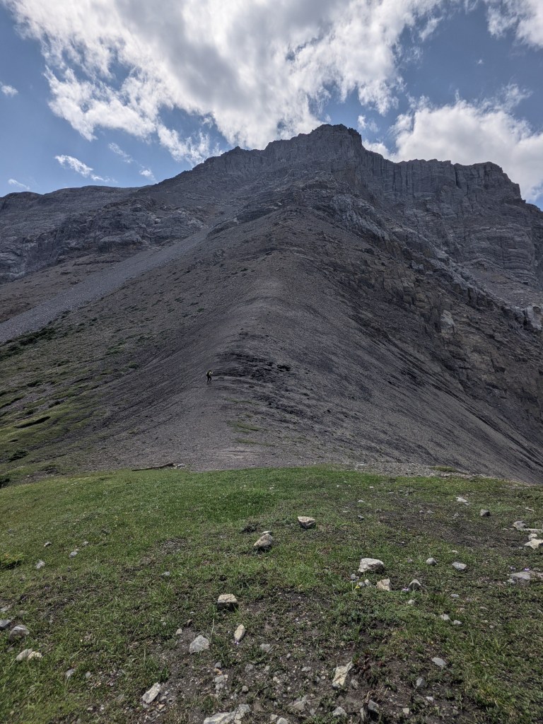
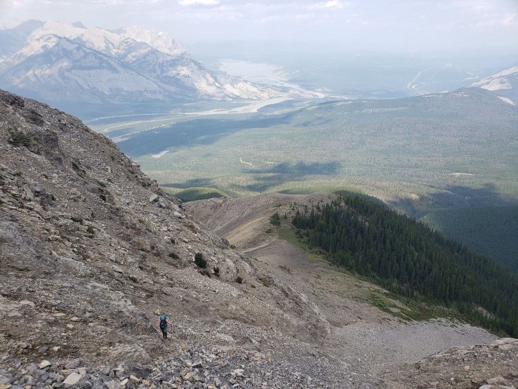
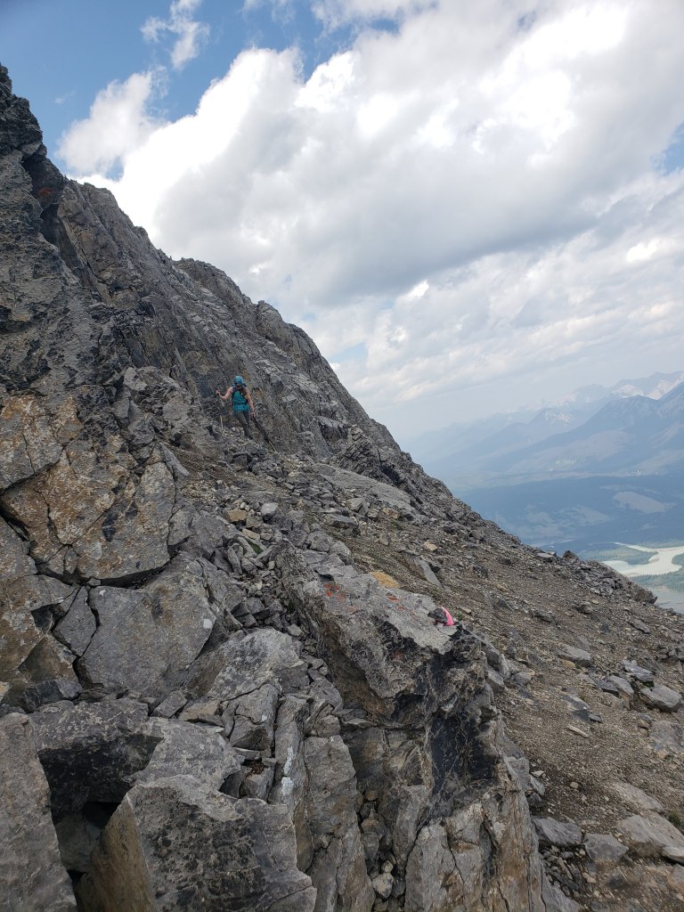
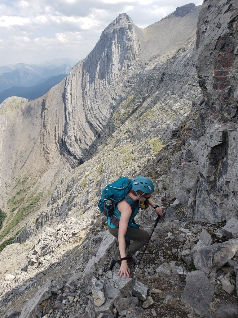
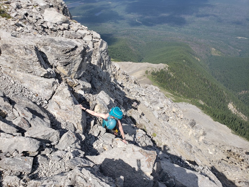
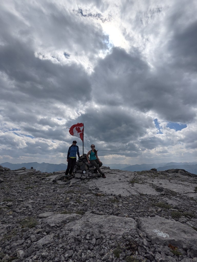
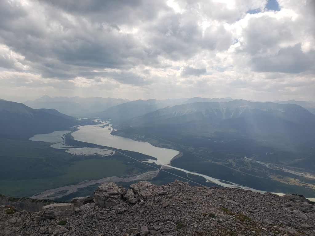
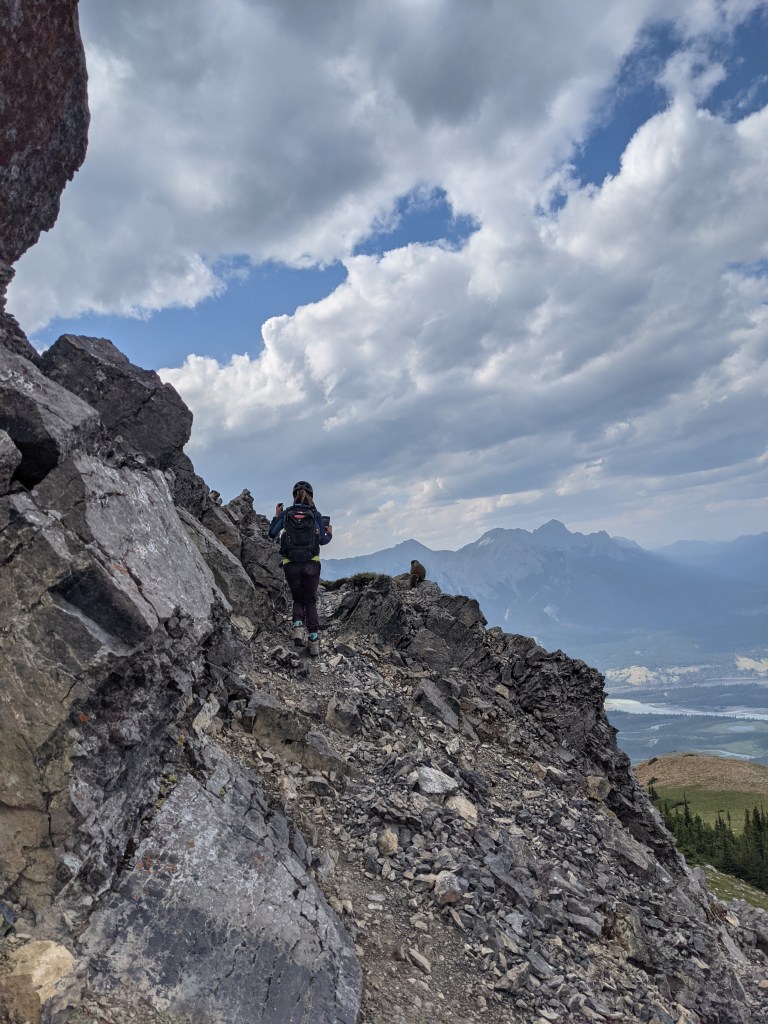
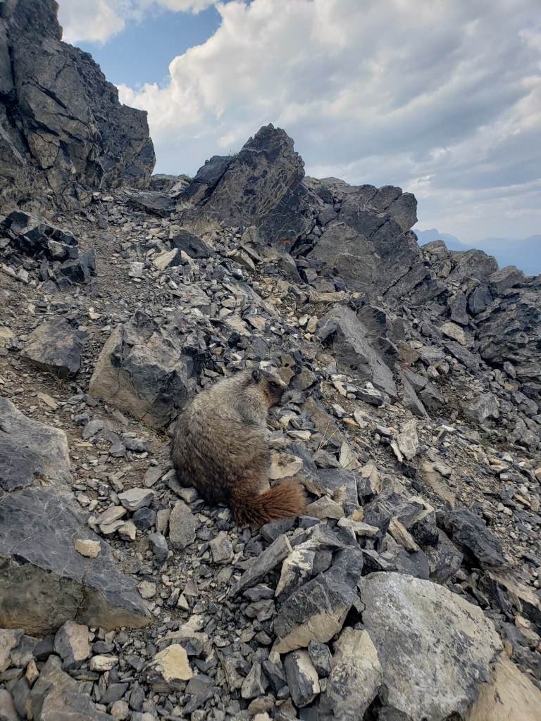
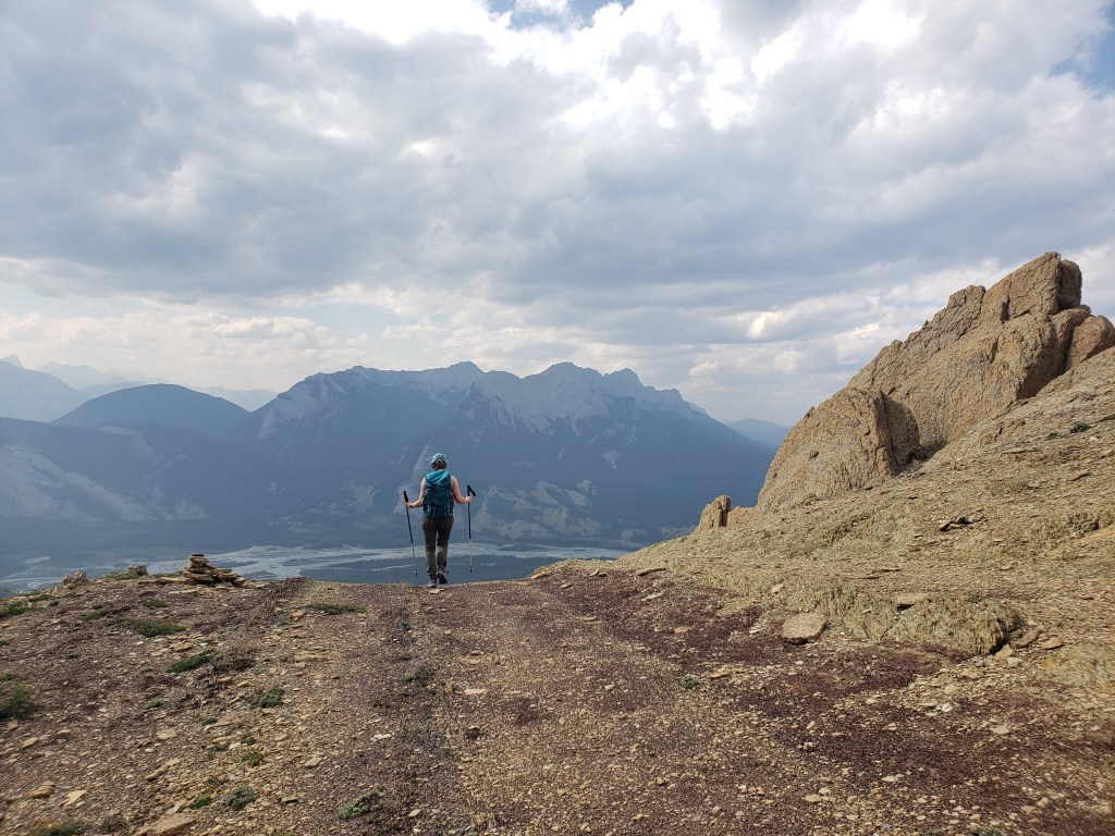
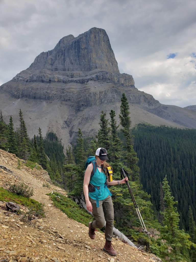
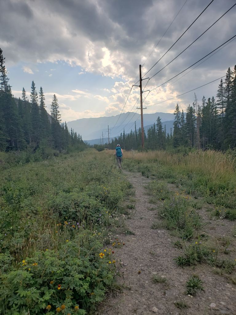
After turning off from the powerline, the trail was obvious and easy to follow. Views begin to open up after about 20 min of hiking. The dramatic north face of Roche Miette steals this shot.Looking back (west) across the North Saskatchewan River are Beaver Bluffs and Roche Bosche. At the center of the photo are the sand cliffs/hoodoos that would be passed on the way to Shredder Reef Crag. Tip: If you pass hoodoos while trying to summit Roche Miette, you are off route.At the top of the trees we briefly traversed left to the start of this long ramp. The next hour will be spent trudging up this ramp.This ramp is longer than it looks. Each time it seemed like we were near the top of it, another section was revealed. Thankfully the terrain is solid and travel is relatively easy. In the background are Beaver Bluffs, Roche Bosche, and Roche Ronde.We finally reached the top of the ramp and turned right to face Roche Miette. We will be trending left across the lower cliffs, and then tackling the upper cliff at the left where the incline is gentlest.This section is a tedious slog up very loose rocks. If other scramblers are descending here, it’s best to just wait near the trees until they’ve passed. Brûlé Lake can be seen in the distance.The way through the cliffs was well marked with pink flagging tape, as seen in foreground.The final few meters before the summit plateau are moderate scrambling if on the easiest line. Kane mentions that “a more exciting, but exposed, option is to angle left onto clean slabs for the finish.” The slabs he is referring to are to Shanna’s left and are not the route we took. The easiest line traverses left-to-right ~2 m here, and then straight up ~2 m. The final few meters of scrambling look worse than they are. The holds were all there and the scrambling was never beyond moderate.Topping out onto the summit plateau. From here it’s still a few hundred horizontal meters to the peak The sheer cliff face behind Shanna is Ashlar Ridge and Roche à Perdrix is behind that.After a pleasant stroll across the plateau, the summit is reached. The peak has a cairn, summit register, and even a big Canadian flag!Views to the southwest are of Talbot Lake (left of the highway), Jasper Lake (right of the highway), and Roche de Smet (right). Mount Greenock (center) is a subpeak at the front of Roche de Smet’s long ridge.We passed a family of hoary marmots on the way down, but they weren’t nearly as excited as I was. If anything, they were slightly peeved that I had interrupted their glorious basking.Just look at that tail!We continued our descent down the long ramp. In the background Roche Bosche and Roche Ronde stand above the North Saskatchewan River.One last glimpse of the impressive north face of Roche Miette as we make our way back to the trees.We finished the day walking back out the way we came, along the pipeline and powerline corridor. The corridor was full of life with July wildflowers.
We made it back to the vehicle in 6 hrs 45 min. For an interested party, the detour to examine the sand cliffs/hoodoo is less than 1 km roundtrip via the trail to Shredder Reef. No need fretting over missing out on seeing Shredder Reef since the Miette Reef Complex encompasses most of the Miette Range, including Roche Miette itself!
Roche Miette is an eye-catching peak, always managing to sneak into the photo albums of passing tourists – and even the movie River of No Return. Aside from the tedious scree slog up the east slope, Roche Miette is a fun day out and a short drive from Edmonton.