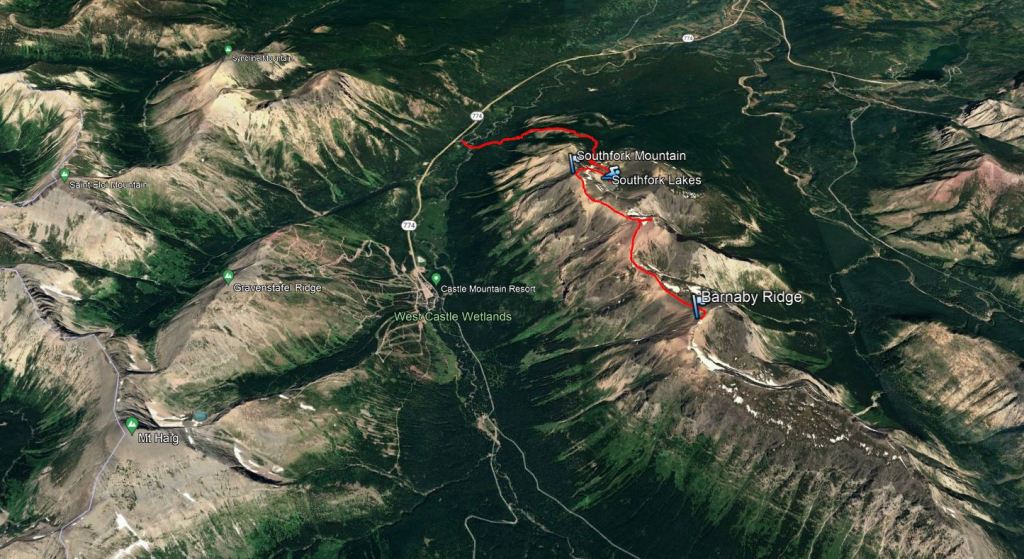
Notes: Via Southfork Lakes route, requiring fording the West Castle River. Easy scrambling to Southfork, moderate to Barnaby.
Trip Report
Alberta saw a historic heat wave in late-June to early-July 2021. Jasper’s all-time record high temperature was set the day before with 41.2 °C on June 30, 2021. We were relieved to be camping further south, where the high was only 35 °C. We still took it easy and paced ourselves accordingly.
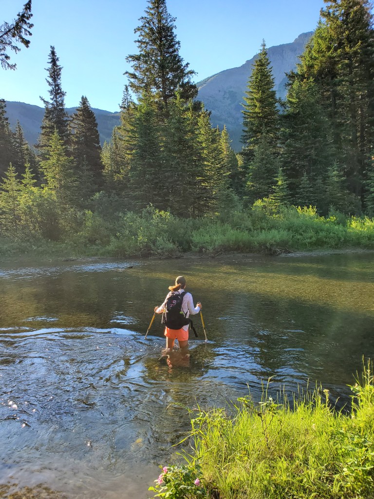
The river crossing and lakes along this trail piqued my interest, considering the hot weather. However, July 1 is very early to be tackling a major river crossing and others had been turned back only a month prior. Luckily, I found that Alberta Environment and Parks publishes live data from a water monitoring station a few km downstream of this spot and I was able to confirm that the water level had dropped significantly. “Castle River at Ranger Station” on rivers.alberta.ca is downstream of the merging of the Castle River and West Castle River, meaning the recorded water levels are higher there than at this crossing, but it still gives a good idea of trends for the area.
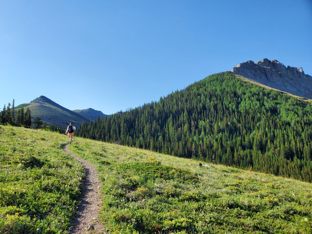
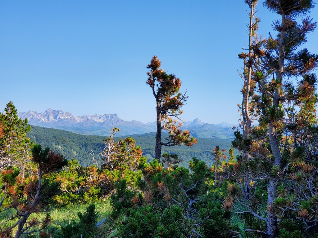
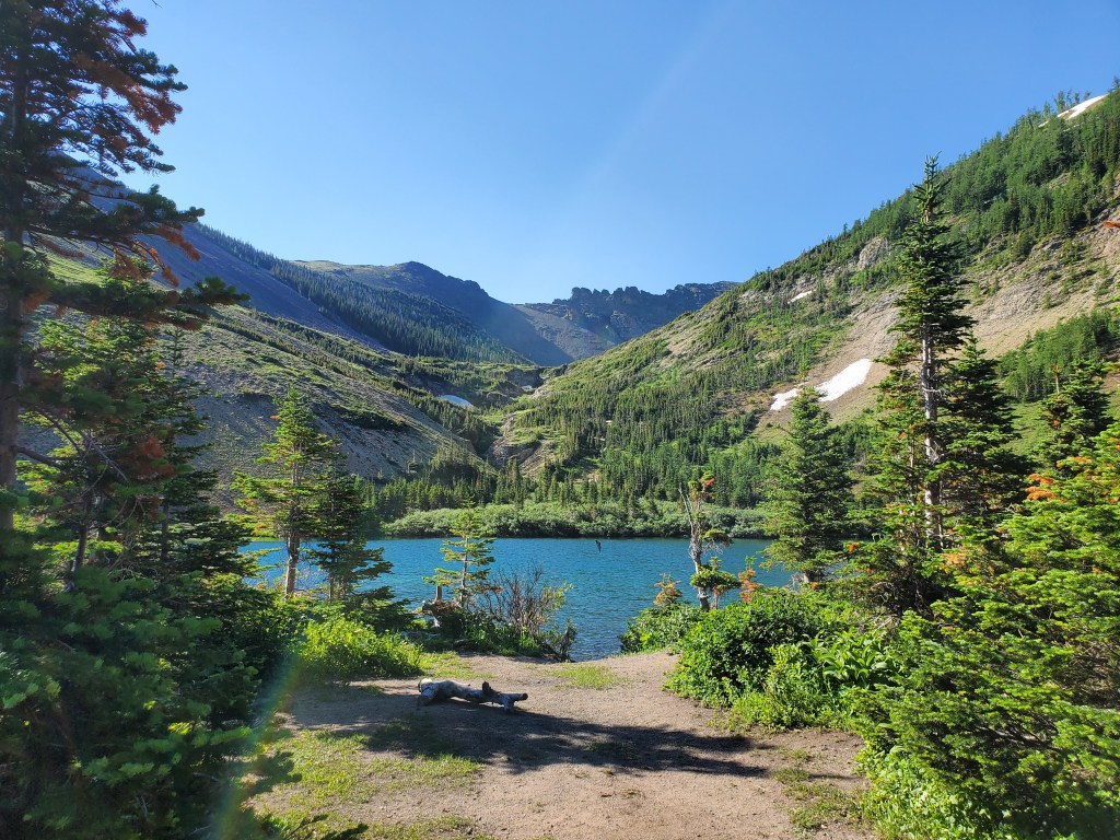
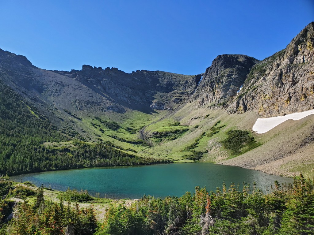
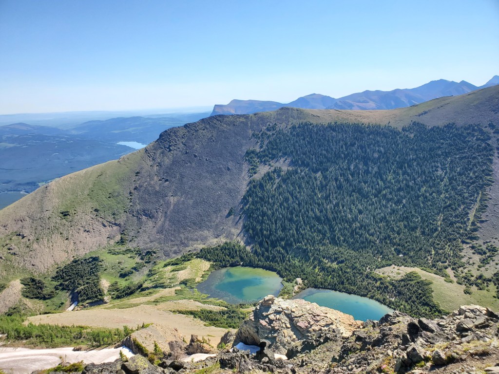
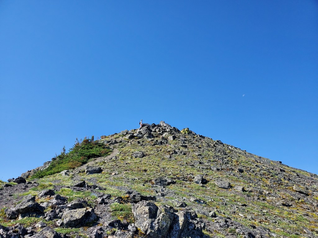
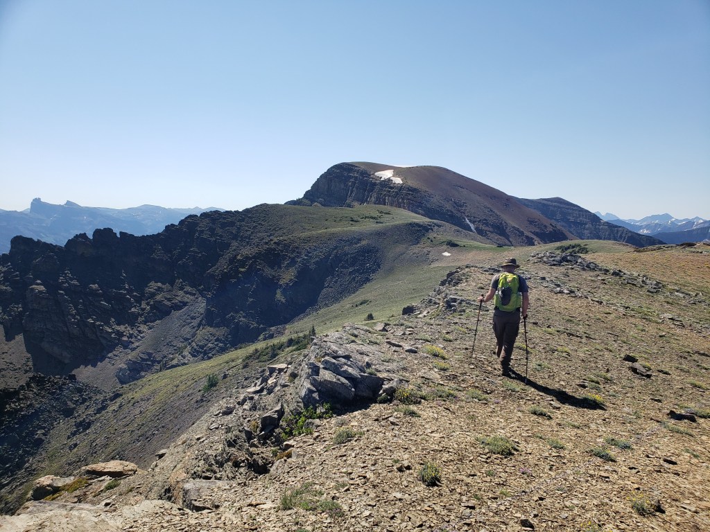
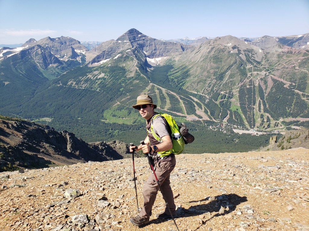
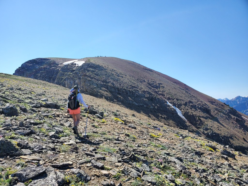
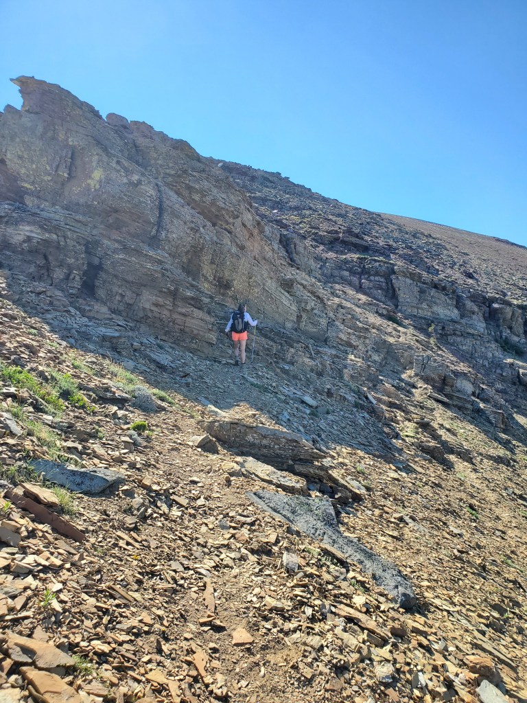
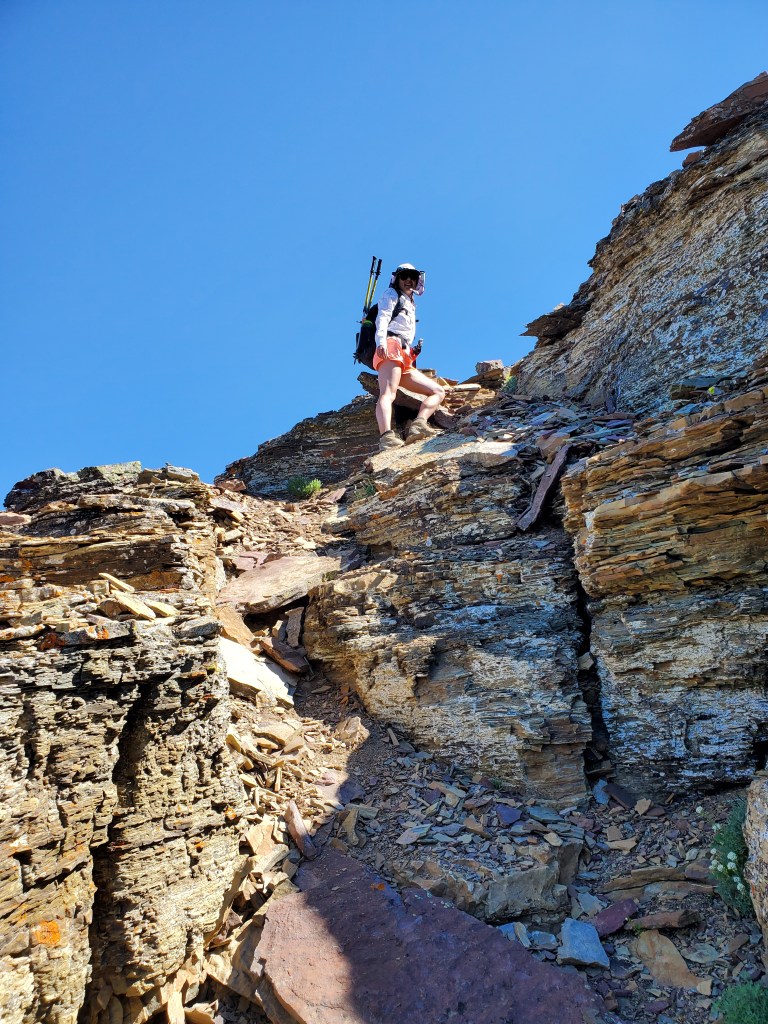
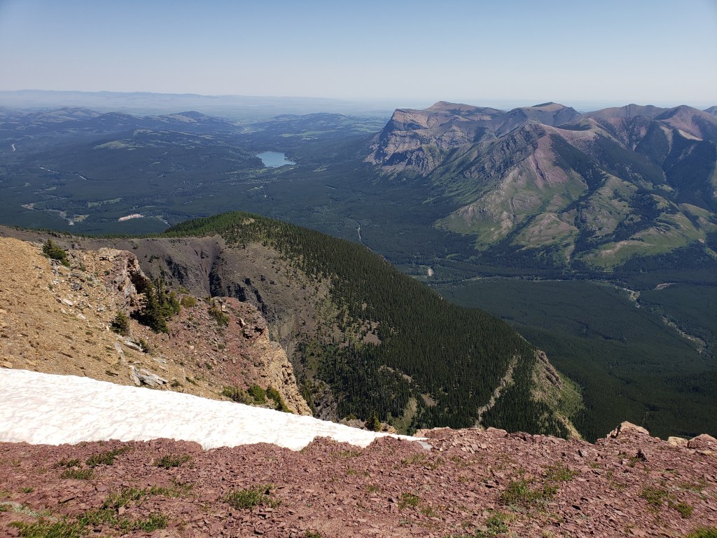
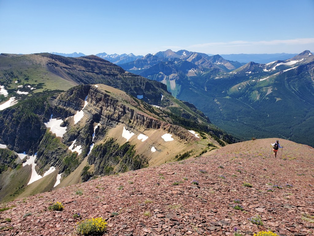
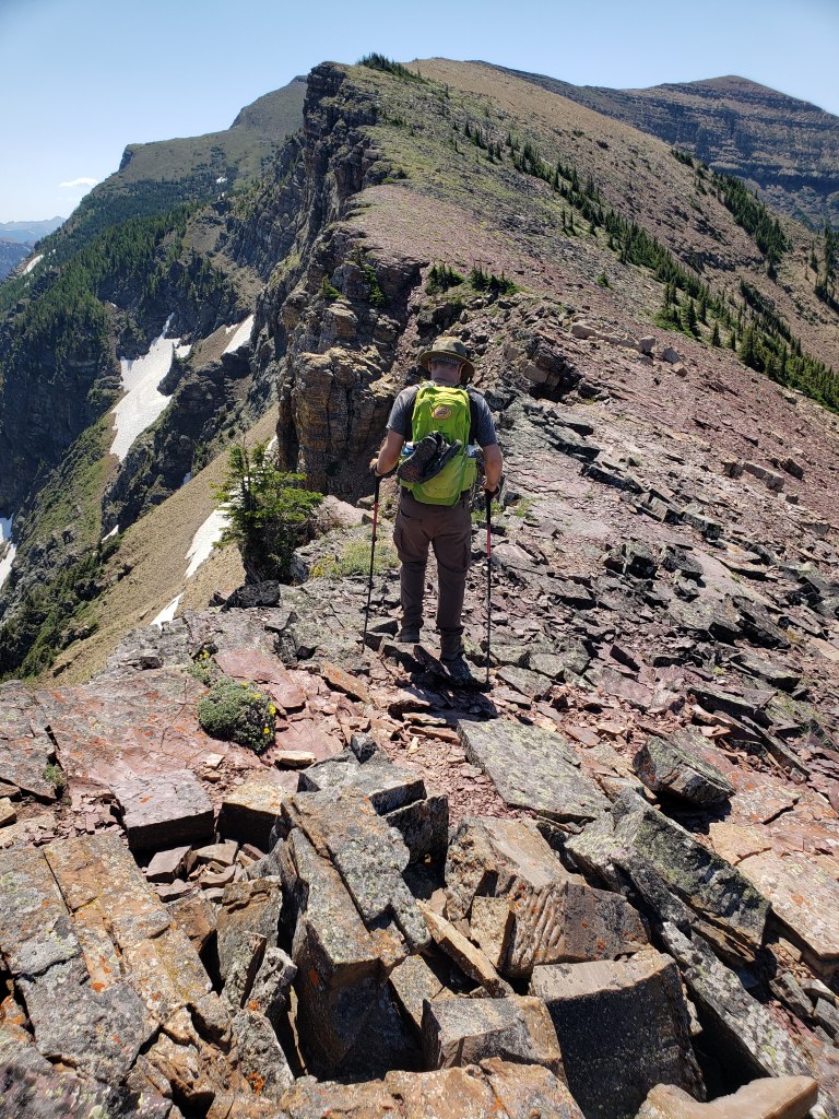
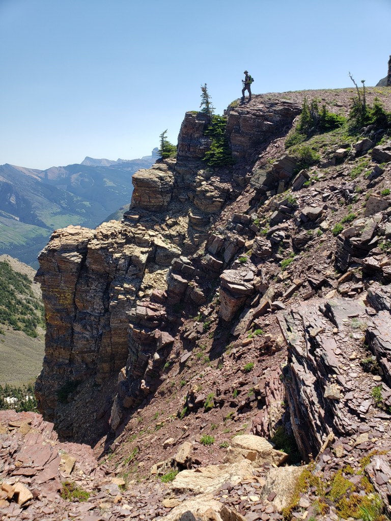
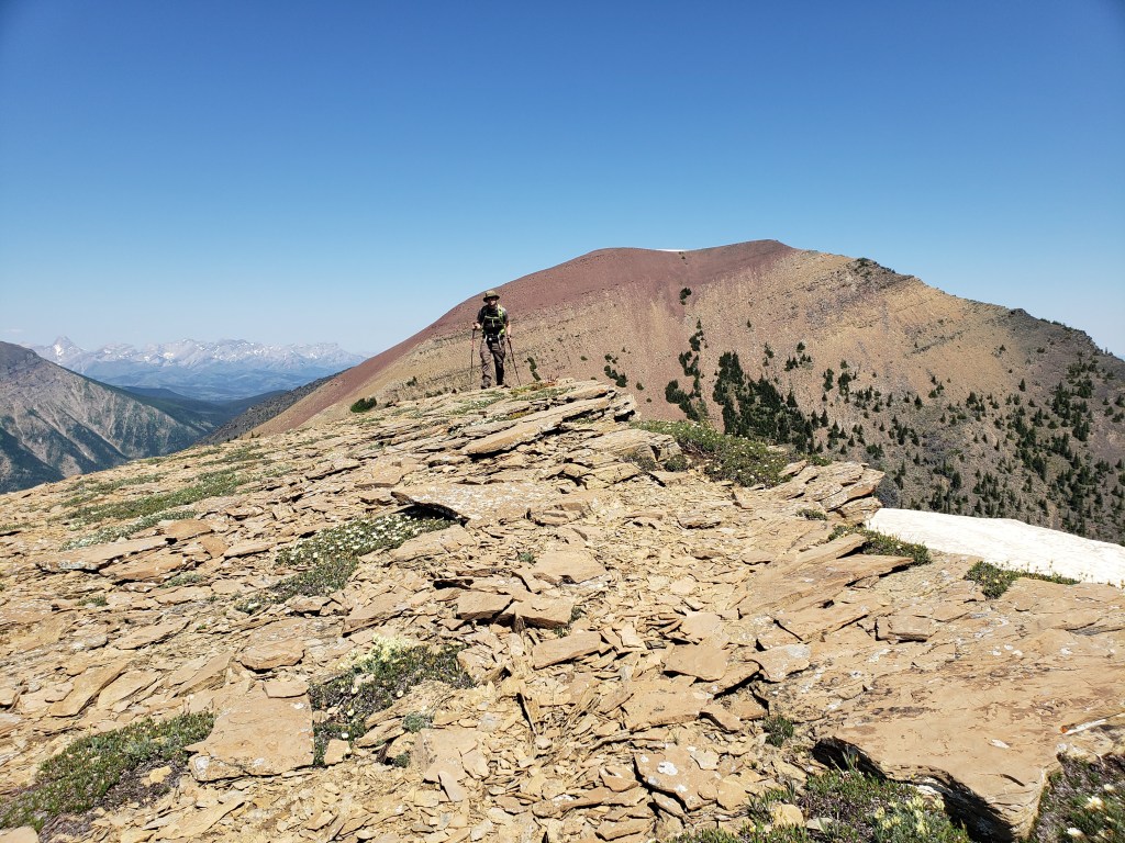
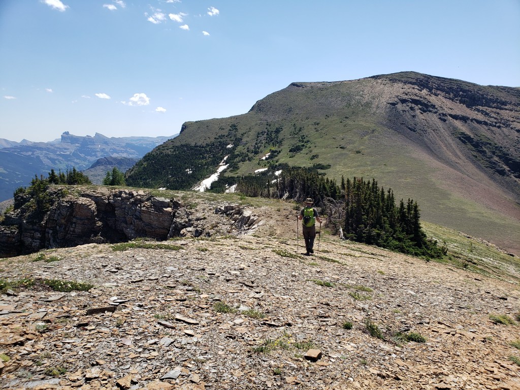
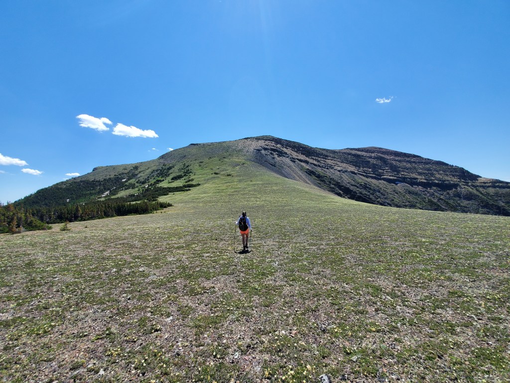
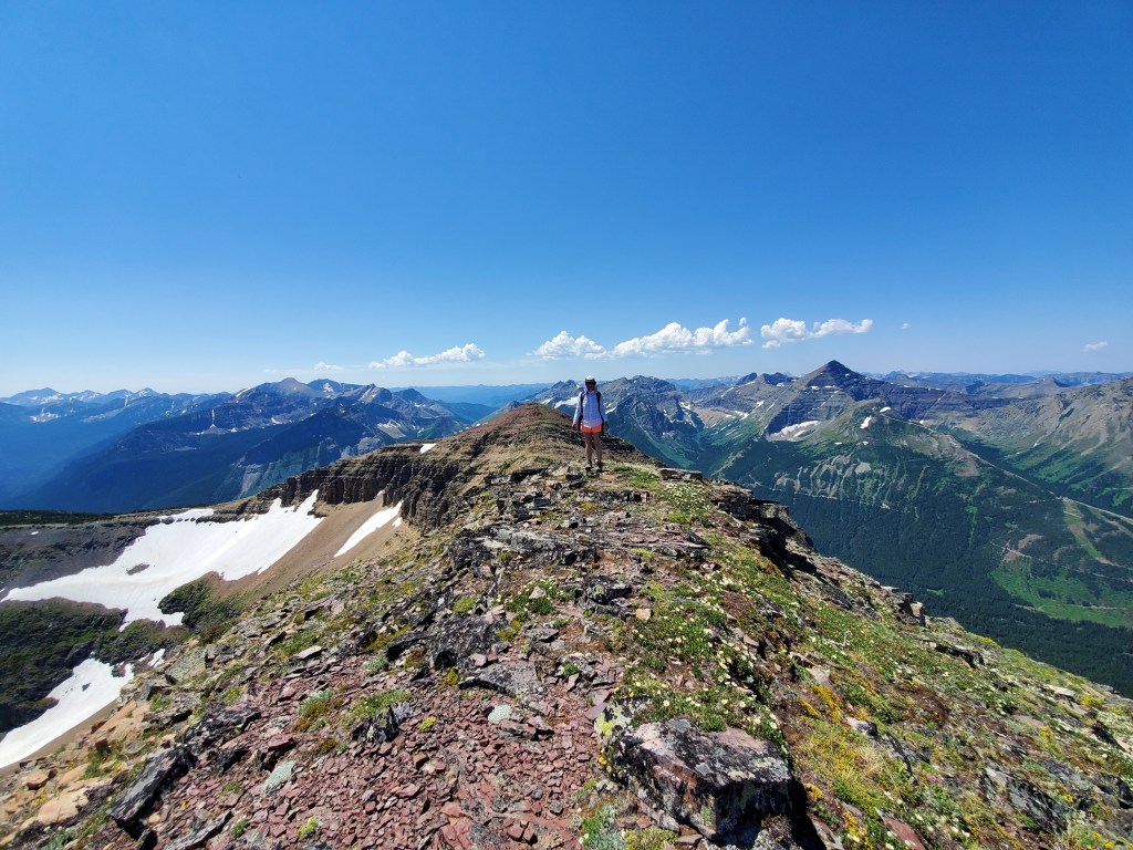
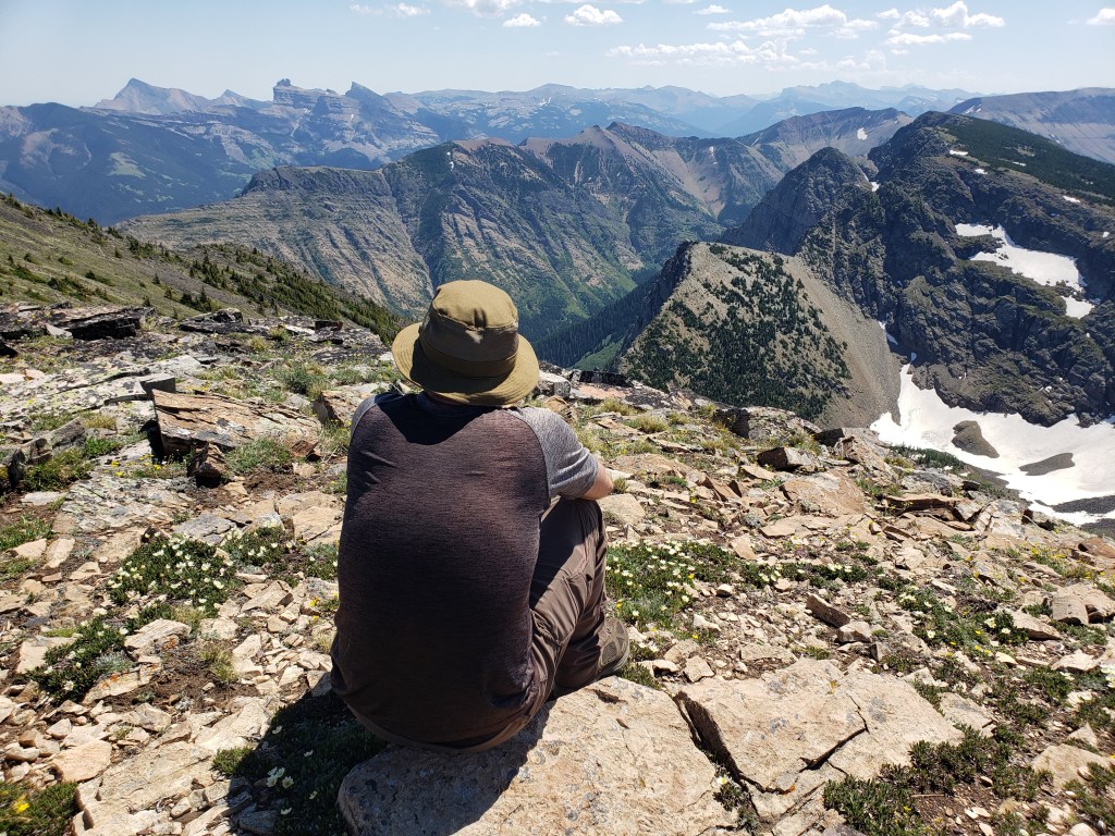
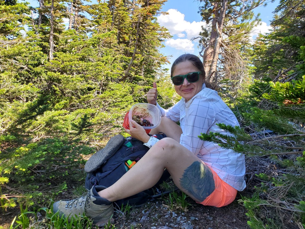
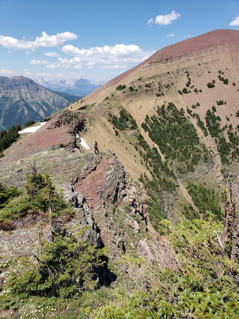
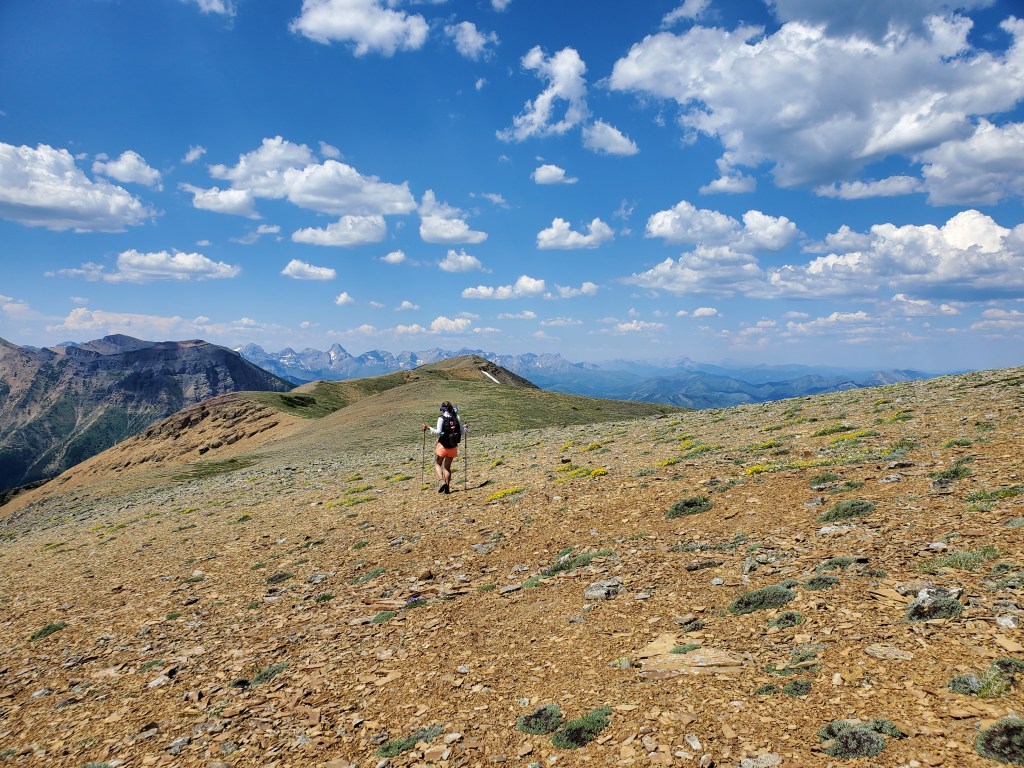
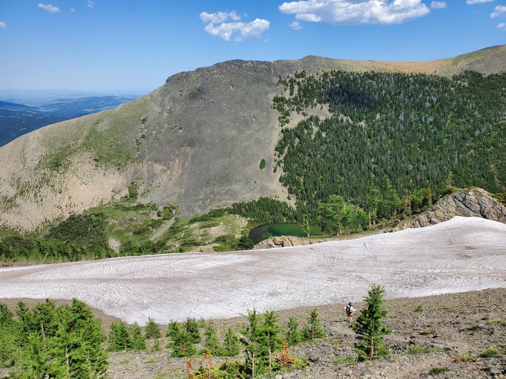
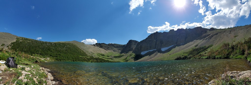
Most people choose to tackle this crossing in autumn when it is only calf deep. With water levels being this high we made sure to unclasp our backpacks before starting across, ready to ditch our packs if we lost our footing. We also packed sturdy sandals for this part.Beyond the river crossing an obvious trail begins. You’d expect the river crossing to deter the majority of hikers, but the trail looked well-travelled. Our first objective, Southfork Mountain, comes into view at the right. The peak is further behind the cliffs that are seen here.Looking north to Crowsnest Pass. Crowsnest Mountain can be seen through the gap in the trees at the right.The first lake encountered is Barnaby Lake. We will be continuing around the right side of the lake and up to the next lakes.Reaching the second of the two Southfork Lakes. From here we kept right and gained the ridge via gentle larch-covered slopes (out of view).We crossed one snow patch that was still lingered along this east-facing slope and then continued up the gentle terrain to the peak of Southfork Mountain.Looking down on Southfork Lakes from the top of Southfork Mountain.The peak of Southfork Mountain was easy to reach, little more than off-trail hiking. We arrived in 3 hrs from the trailhead.From the top of Southfork Mountain we continued south along the ridge toward the high point of Barnaby Ridge. An intermediate high point in the ridge, aka The Amoeba (center), obscures most of the peak from here.Views to the west are of Mount Haig and Gravenstafel Ridge, with the open runs of Castle Mountain Resort.The cliff band ahead will be the only scrambling of the day. The easiest spot through the cliff is directly ahead of me and it gets much friendlier once closer.The moderate line is a zig-zag up the cliff, first right and then left. It’s not exposed, just a bit loose.Reaching the top of the few moves of scrambling for our day.We detoured a couple hundred meters to the edge of The Amoeba to take in the views. Looking northeast to Table Mountain (center) and Beaver Mines Lake. Whistler Mountain is closer and to the right.Continuing south, the peak of Barnaby Ridge comes into view (left of center).The ridge-walk between The Amoeba and Barnaby Ridge offers brightly coloured rock and interesting terrain.Continuing along the ridge, looking east. Castle Peak just pokes out from behind a tree.Looking back at The Amoeba. A trio of scramblers we had passed are continuing across the middle of the red patch on the mountain (not quite visible at this resolution). What looks like a vertical cliff from here is only a gentle scree slope.Small tree patches scattered below the high point of Barnaby Ridge were the closest thing we found to shade while on the ridge, and we eagerly took advantage on the way down.Nearing the peak of Barnaby Ridge. In this photo the highest point can be seen at center. Nugara’s mapping includes three high points along this summit, but the middle is the highest.Along the summit ridge of Barnaby Ridge. The tall peak to the right is Mount Haig. The cluster of peaks to the left includes Rainy Ridge, Three Lakes Ridge, and Scarpe Mountain.Gazing southwest from the high point of Barnaby Ridge, iconic Castle Peak featuring prominently to the left. The tall peak to the left is Victoria Peak.Summit panorama.Returning to the small trees below the peak, we stopped for a break in the best shade available. Our lunches were melted messes by this point.Continuing along the ridge toward The Amoeba. On the way back we tried avoiding elevation gain and loss by side-hilling around the west (left), but it was very loose and probably ended up being more work than just regaining the high point.Beyond The Amoeba, returning to Southfork Mountain.Descending back to the lakes. The snow patch is looking alluring in this heat, but we know we are almost at the lakes.We returned to Southfork Lakes at roughly the hottest point in the day, the perfect time to stop for a dip in the cool, turquoise water.From Southfork Lakes, we hiked the rest of the way back out and finally crossed back through the West Castle River. Don’t be a Downer-Dan, unclasp your backpack for water crossings.
We made it back to our vehicle in 10 hrs, likely a bit slower than we would have been in cooler weather. I imagine this trip is gorgeous in autumn once the larches have turned. Low water-levels for the river crossing would be a bonus.


One thought on “Southfork Mountain (2350 m) and Barnaby Ridge (2471 m)”