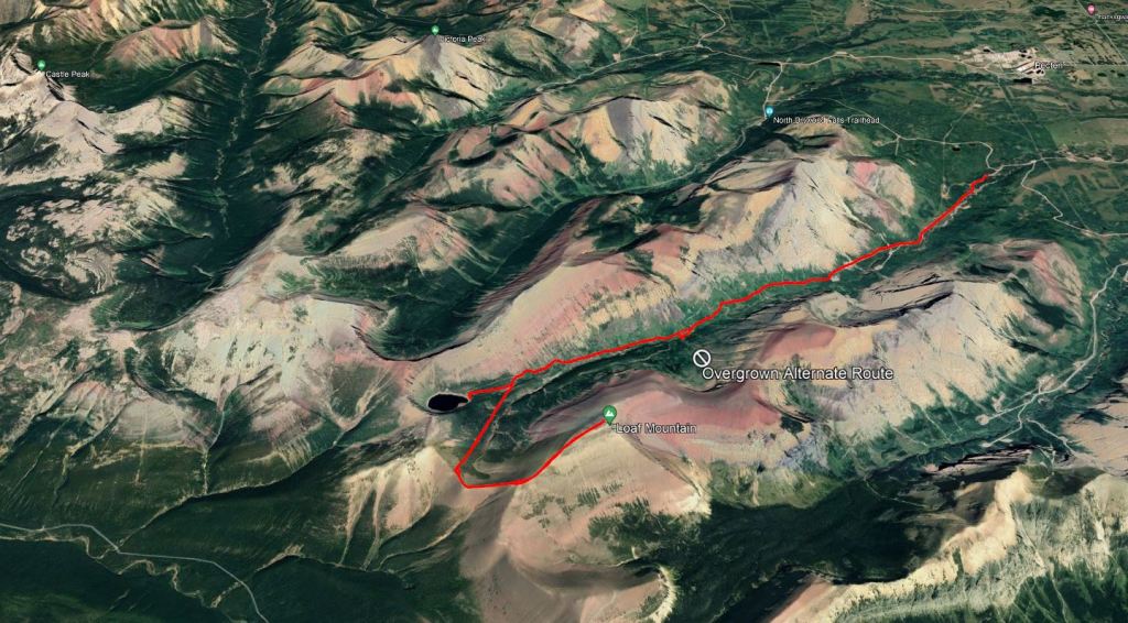
Notes: Includes detour to Bovin Lake. Most of this route could be biked.
Summary
Bovin Lake Trail is wide and easy to hike. Biking it is blue difficulty – rocky, washboard quality with a few larger rocks, but still a broad trail with wide turns. We scouted around a bit on the way in looking for an alternate route up, but if I did this mountain again I would just bike straight through to the col. Above the col the route becomes steep and loose – black difficulty. However, the summit register indicates that the peak has been biked before.
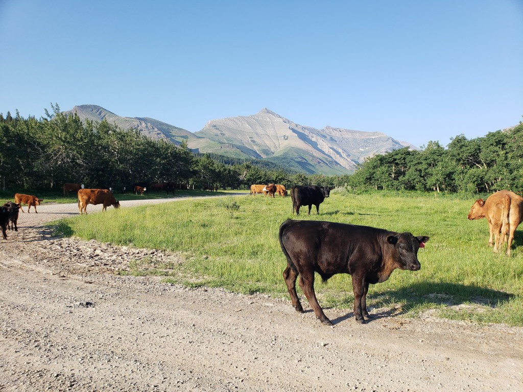
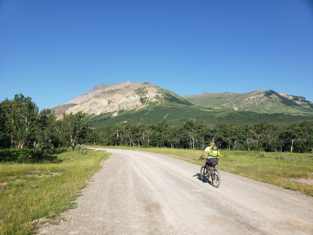
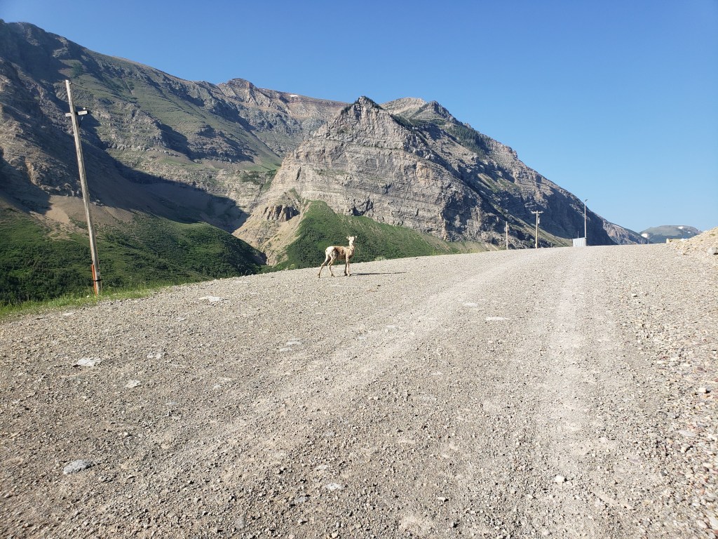
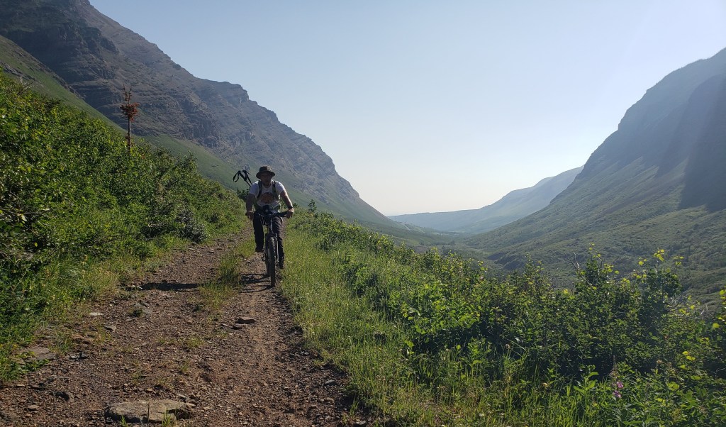
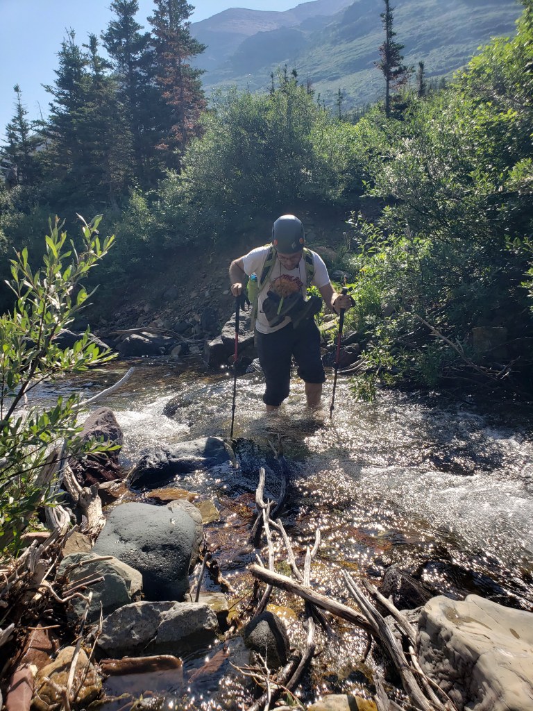
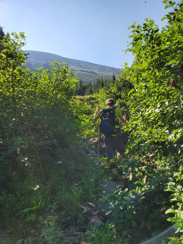
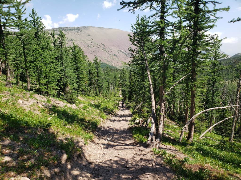
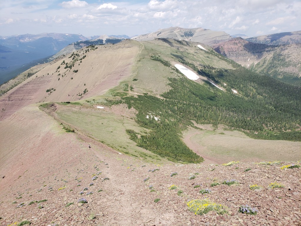
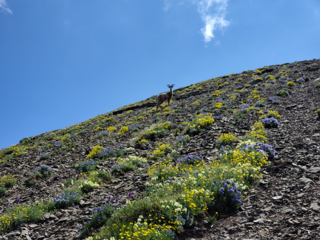
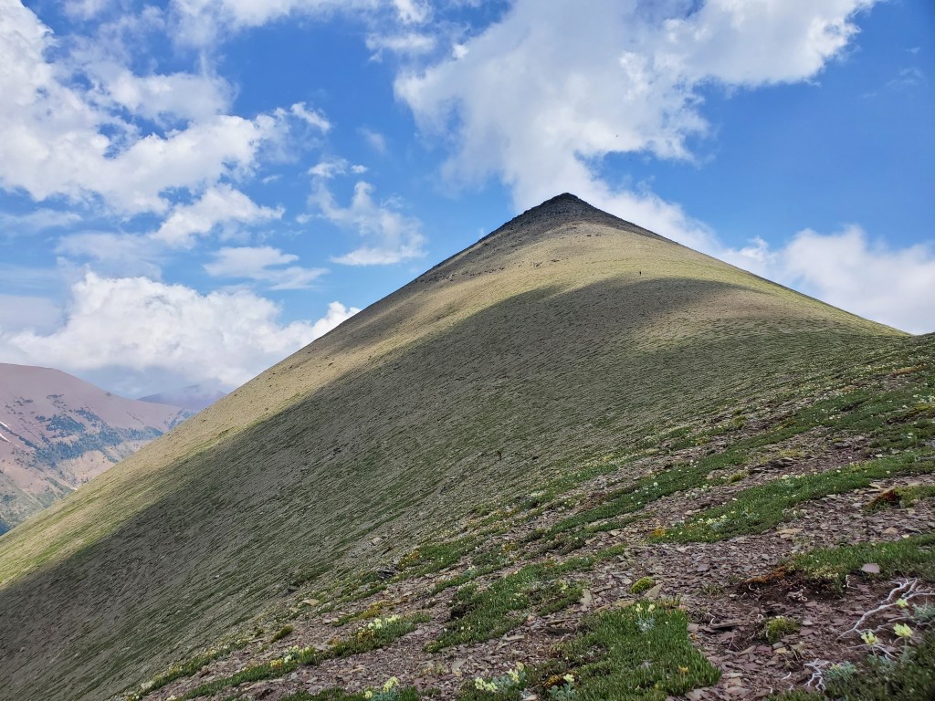
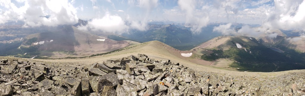
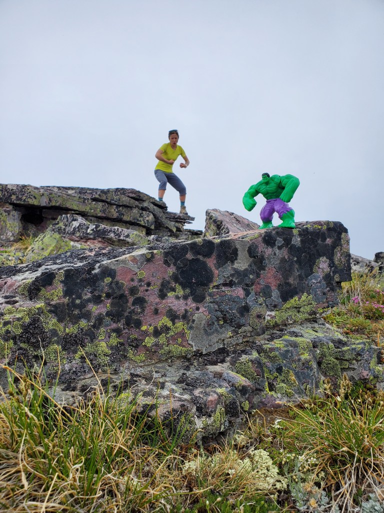
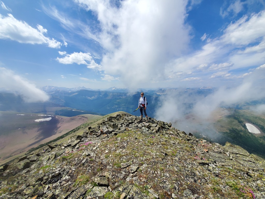
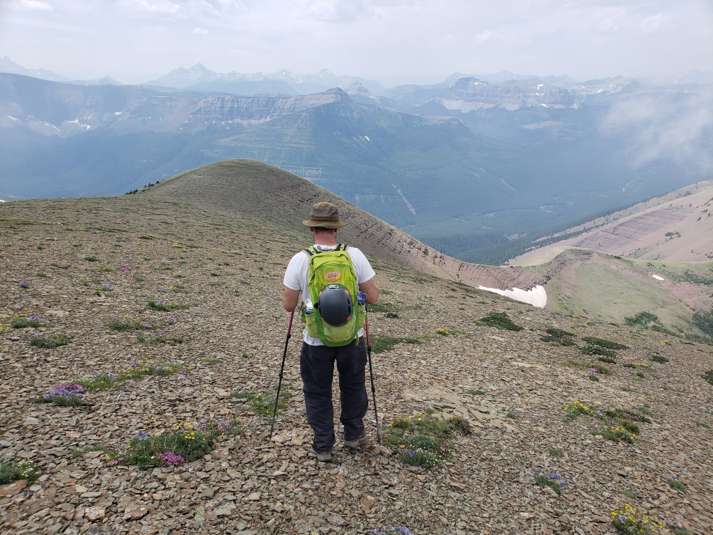
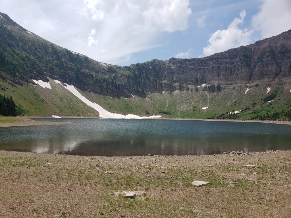
The adorable cows gathered around the parking area felt like an auspicious sign for the day.The ride in begins along a well-graded road. Drywood Mountain can be seen to the right of the road.Powerlines run parallel to the road, serving a handful of gas wells. Loaf Mountain rises to the left of the road. One curious sheep glances in our direction.Beyond the gas sites, a gravel trail continues through the valley. The peak of Loaf Mountain is to the left. We will be attempting to gain the slope in front of it (and then failing and coming along the trail through the valley).Looking back up the valley framed by Drywood Mountain (left) and Loaf Mountain (right).We pause for a waterfall in South Drywood Creek.Spotting the drainage indicated by Nugara, we tucked our bikes away and waded across the creek toward it. This photo is looking back at Dan, with Drywood Mountain in the background.The drainage was a bit bushier than described, but we figured it would thin out further from the creek.We reached an impasse. The drainage was completely overgrown and the slopes surrounding it were just as bad. We gave up and turned back.These larches must be beautiful in autumn. In retrospect, we should have taken our bikes to the col to save time on the descent. Instead, we scouted around on foot looking for a better line up and finally walked all the way to the col above Bovin Lake, leaving our bikes at our failed turn-off. The slopes at the col are wide open and easy to travel. The peak of Loaf Mountain is just out of view to the left.Looking back as Dan follows behind me. The trail we hiked in on can be seen descending through the trees to the right. The gentle ridge continues further back, all the way to Victoria Ridge. Virtually all of this would be doable with a mountain bike.This lucky sheep gets to spend its day lounging in a sea of wildflowers. Turning left and beginning the final push to the summit. I am the tiny speck just beyond the cloud’s shadow.Clouds began to move in as we approached the peak. I grabbed a partial panorama from just below the summit.Clouds fully enveloped the peak by the time we had reached it. Had I just watched The Shrine too recently, or is this summit cairn a tad unnerving?Not to fear, the Incredible Hulk is on top of this summit cairn situation.The clouds offered us a brief gap on our descent. To the southwest are Sage Mountain and various peaks comprising the BC-Alberta border.A closer view of Sage Mountain before turning right and descending back to the col.On the return trip I took a quick detour to check out Bovin Lake. It has a few picnic tables and backcountry campsites. There was still snow lingering around the sites in early July.
We hiked back to where we’d stashed our bikes and then coasted the rest of the way out on trail. The ride out was the most fun of the day! We were careful to limit our speed on the way out on account of the number of groups we passed. This is a busy trail, but as of writing bikes are still allowed.


One thought on “Loaf Mountain (2640 m)”