Notes: Don’t use this route. Private property and sour gas wells.
Trip Report
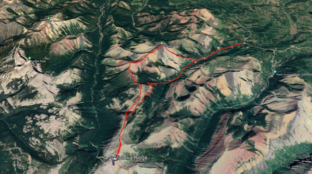
This route follows Nugara’s description from More Scrambles. Unfortunately, it crosses private property and can’t be used. We didn’t look at land titles before heading out in 2021, naively figuring we were on a popular route from an established guidebook, so it was probably fine. We were a bit confused to see warnings of sour gas at the trail head and did pause to note the wind direction before continuing. After starting out on our bikes we were chased by two large dogs. It seemed like they were only guarding the site though and didn’t pursue us beyond that. Since 2021, people look to have switched to Spirko’s 2021 approach. But, his line still trespasses on private property and I wouldn’t be surprised if that route is blocked next.
A better option: Victoria Ridge can be easily accessed by bike using the Bovin Lake Trail, along South Drywood Creek. This Alberta Parks link includes a georeferenced map which identifies the quarter section of private land below Victoria Peak that can’t be accessed. Using an app like Avenza Maps, a user can view their real life location on a georeferenced map. It might take more than a day to continue all the way to Victoria Peak and back via South Drywood Creek, but the charming backcountry campsite at Bovin Lake nicely solves that problem.
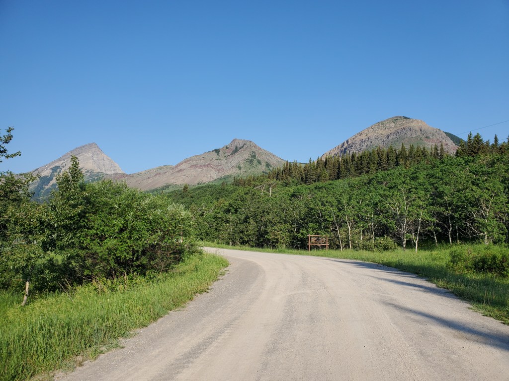
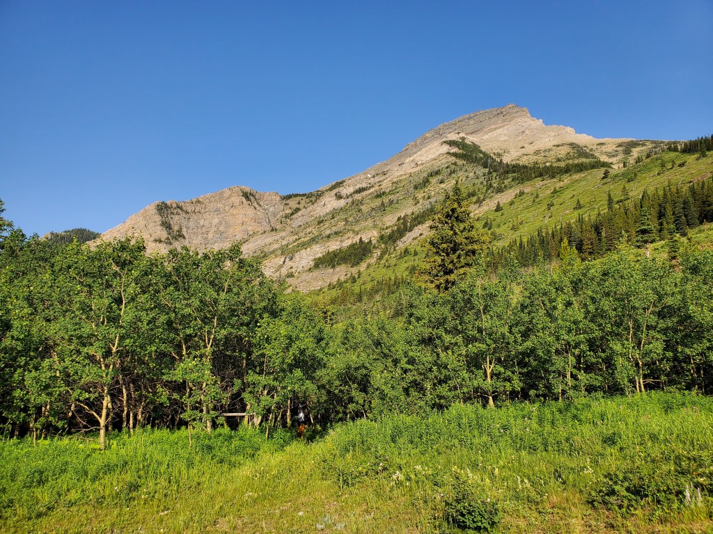
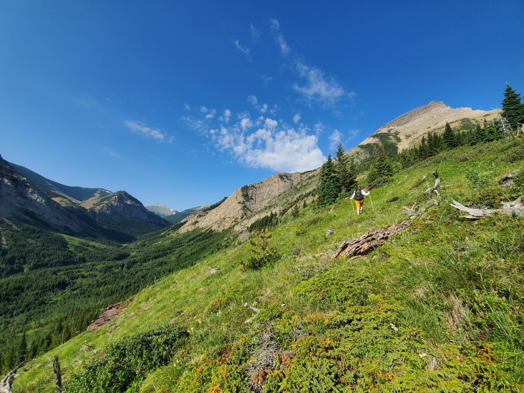
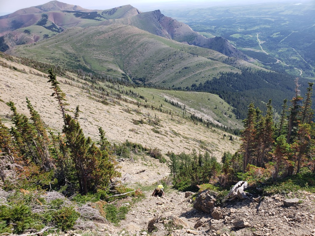
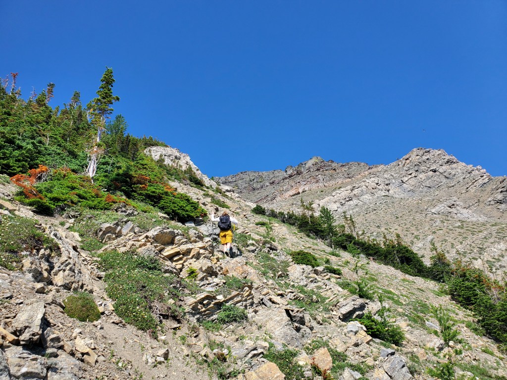
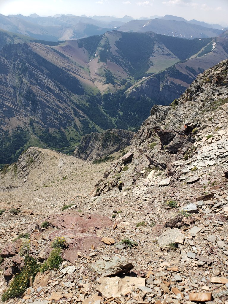
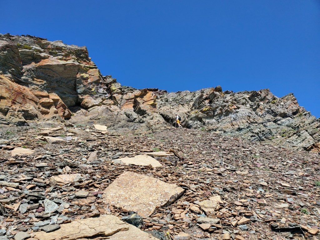
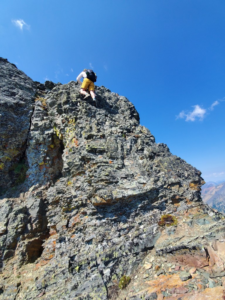
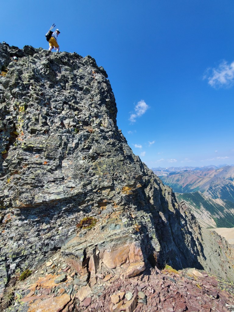
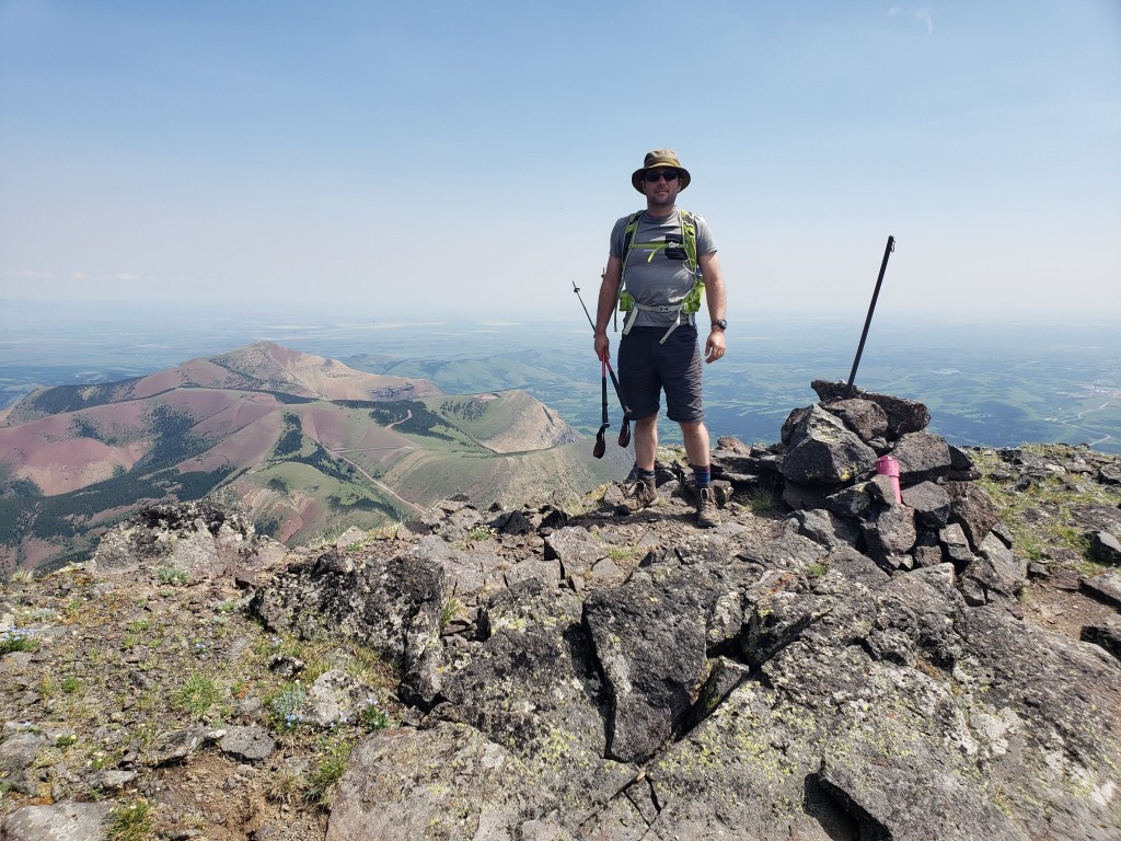
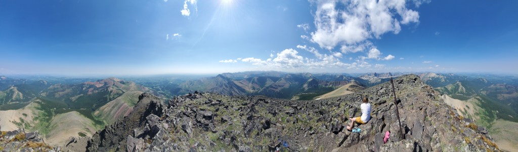
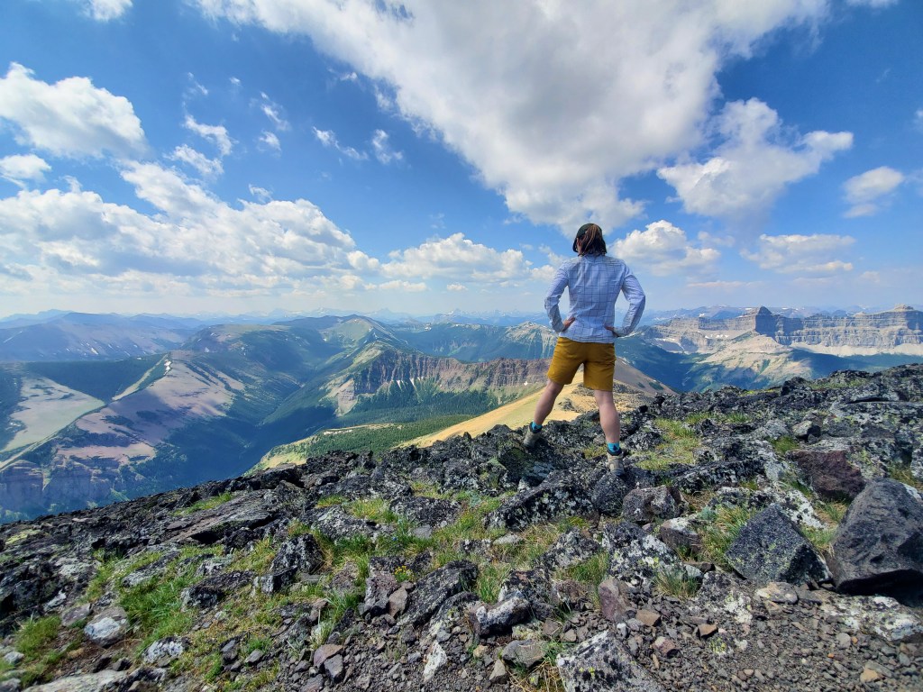
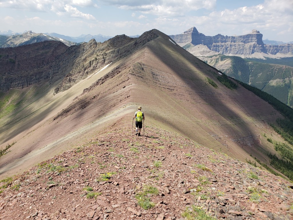
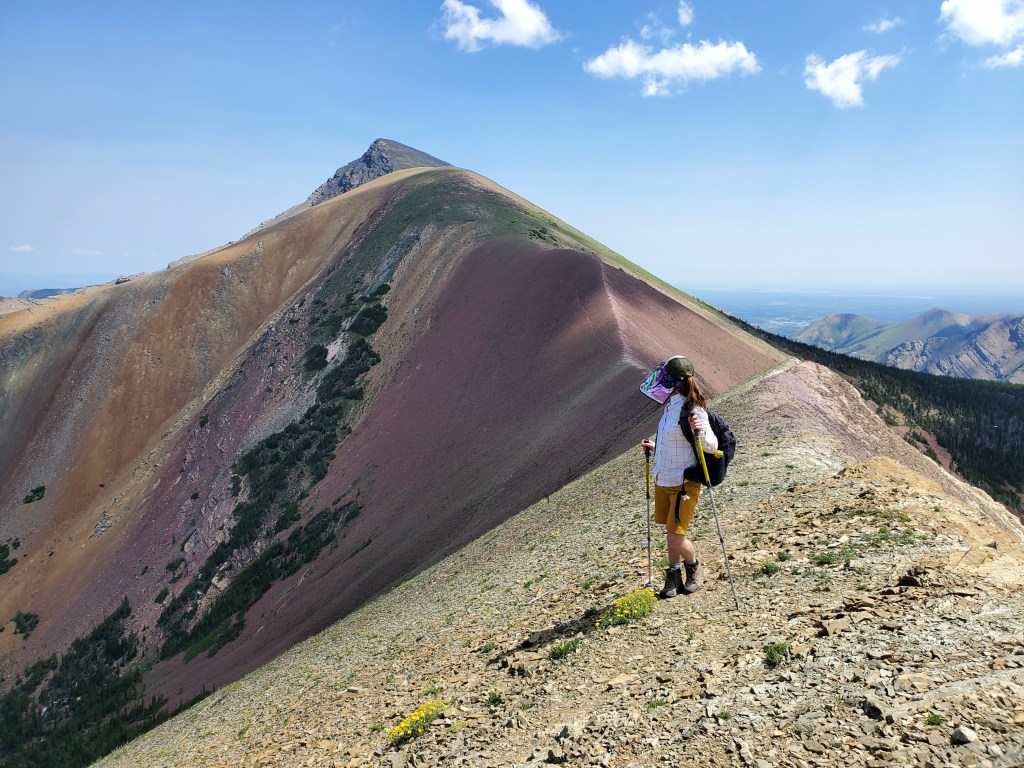
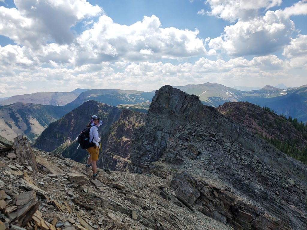
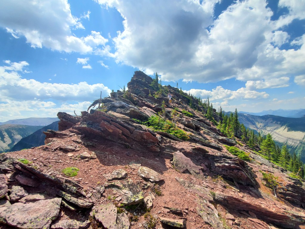
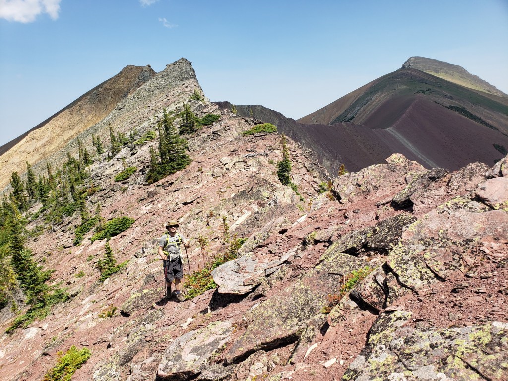
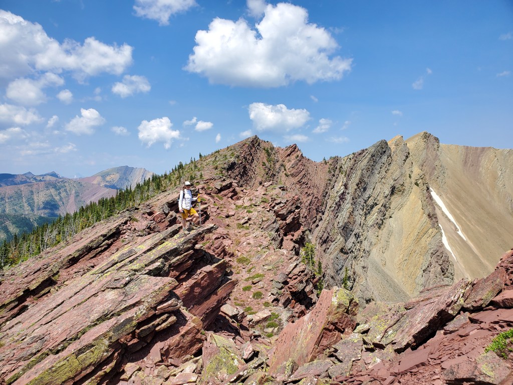
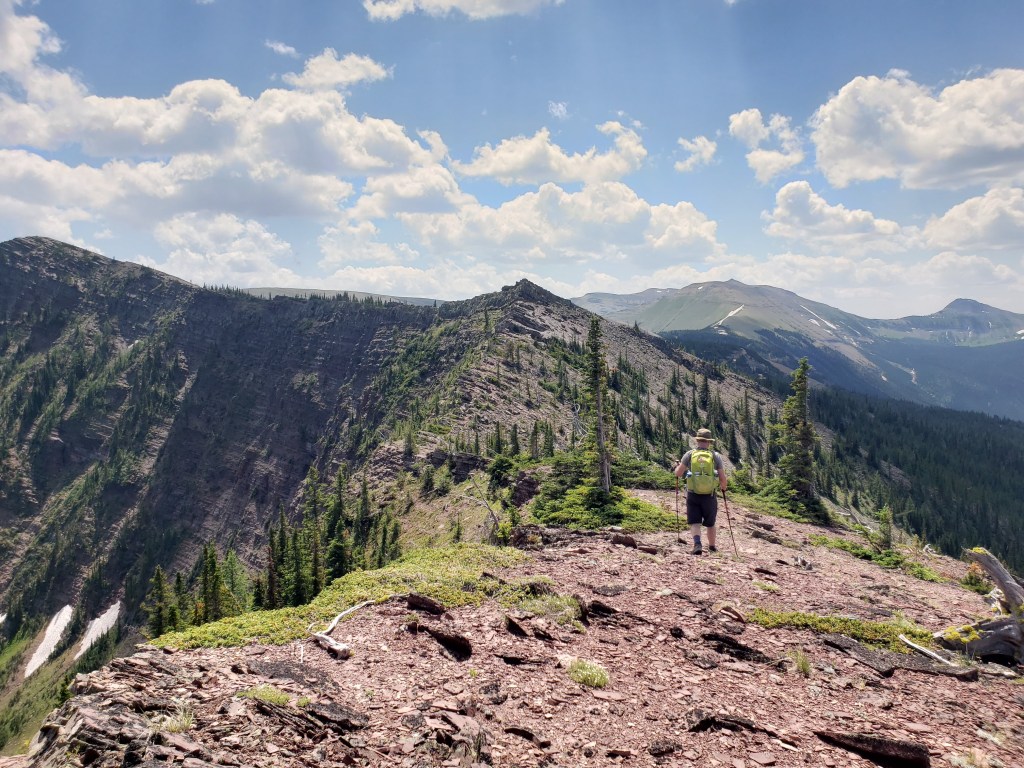
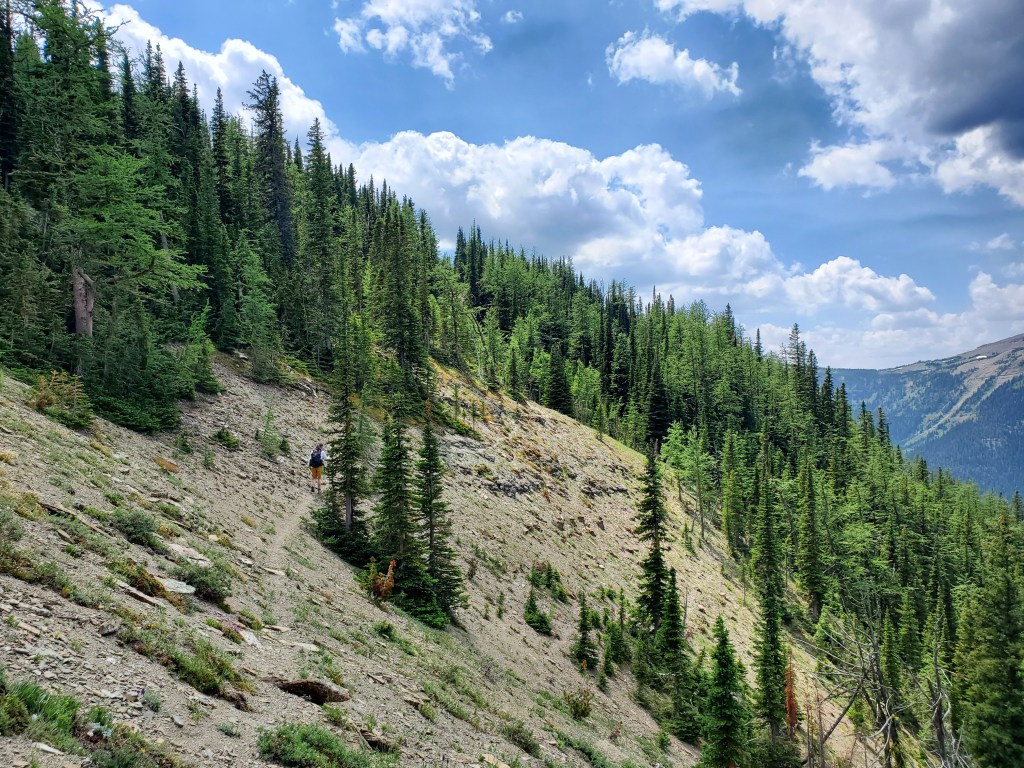
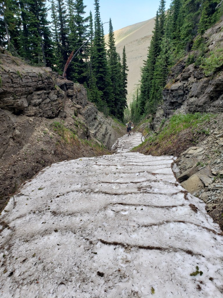
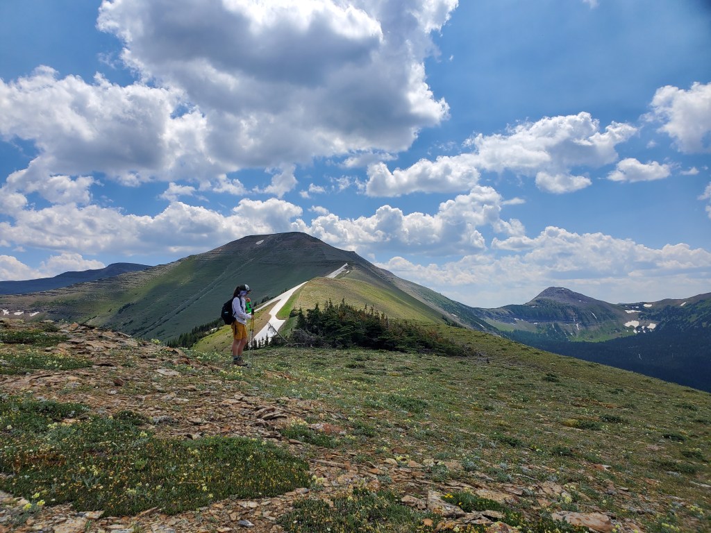
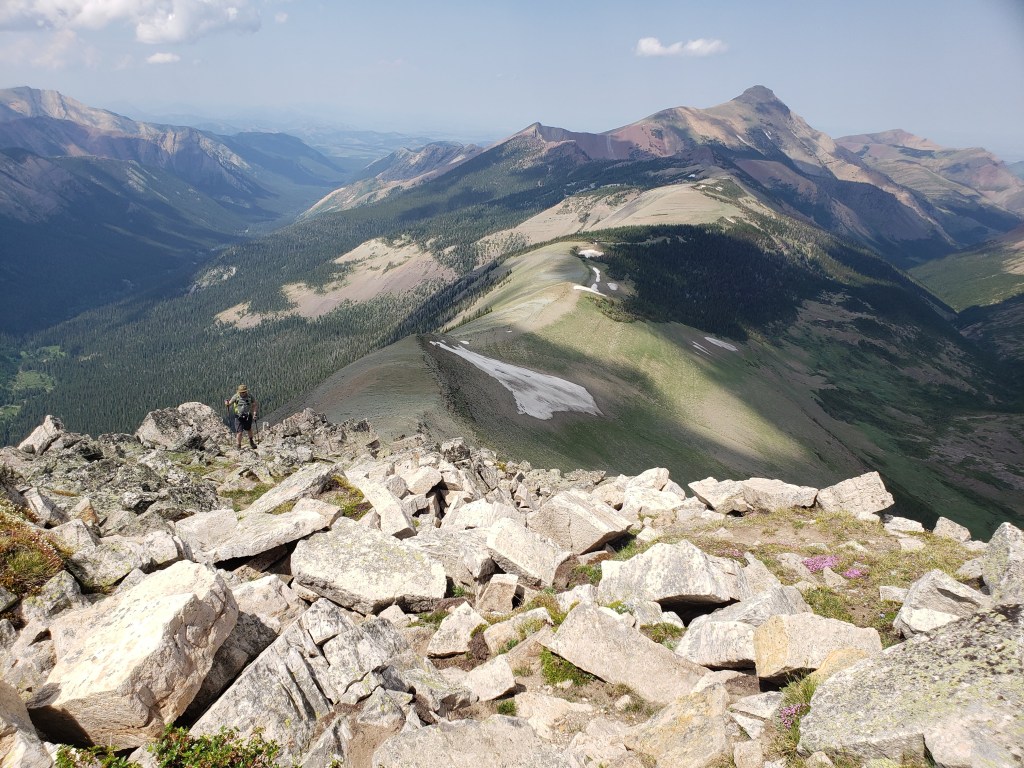
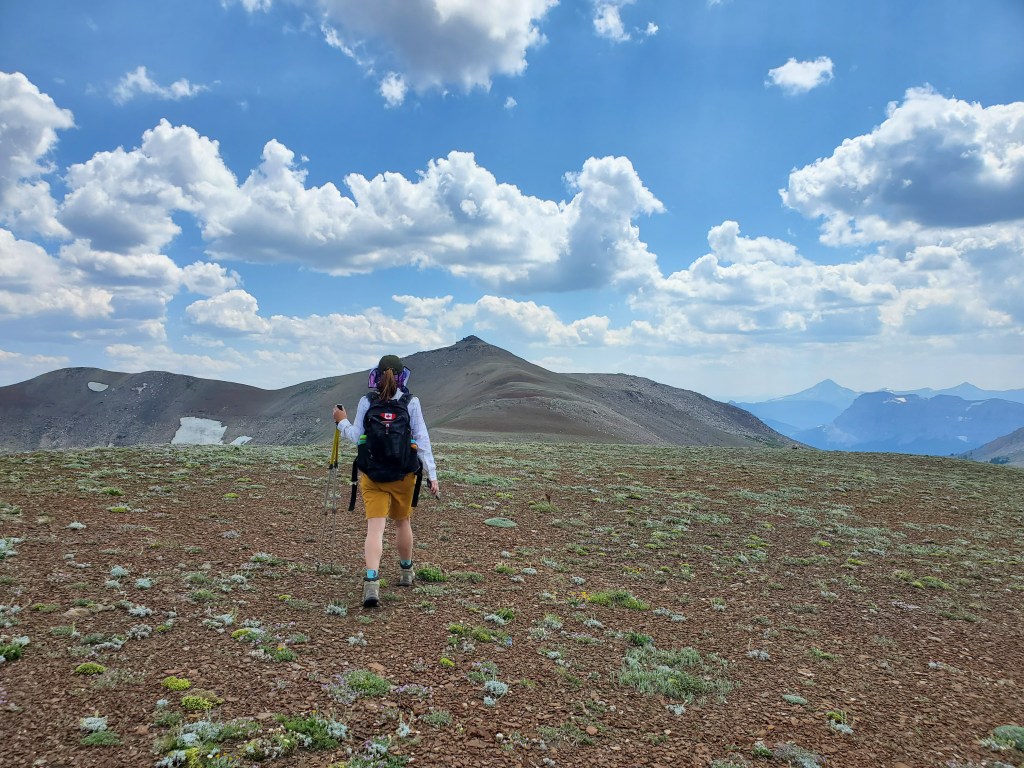
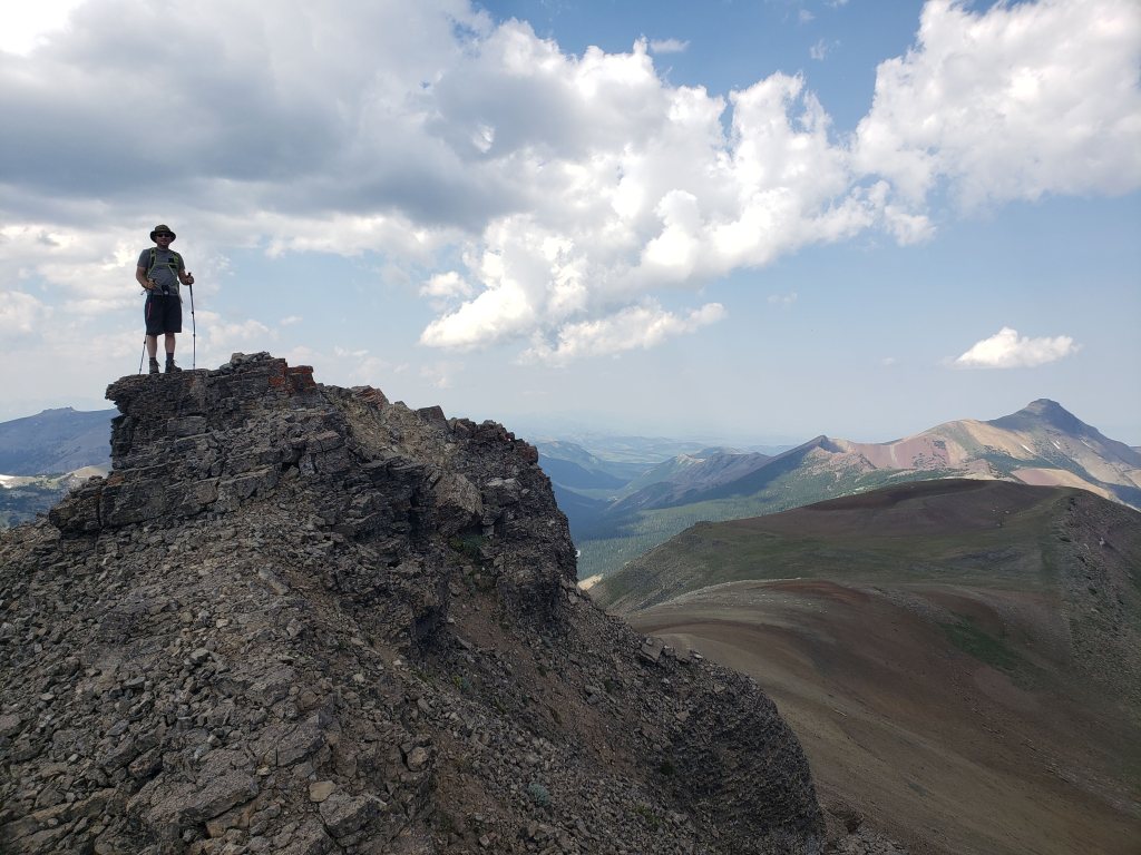
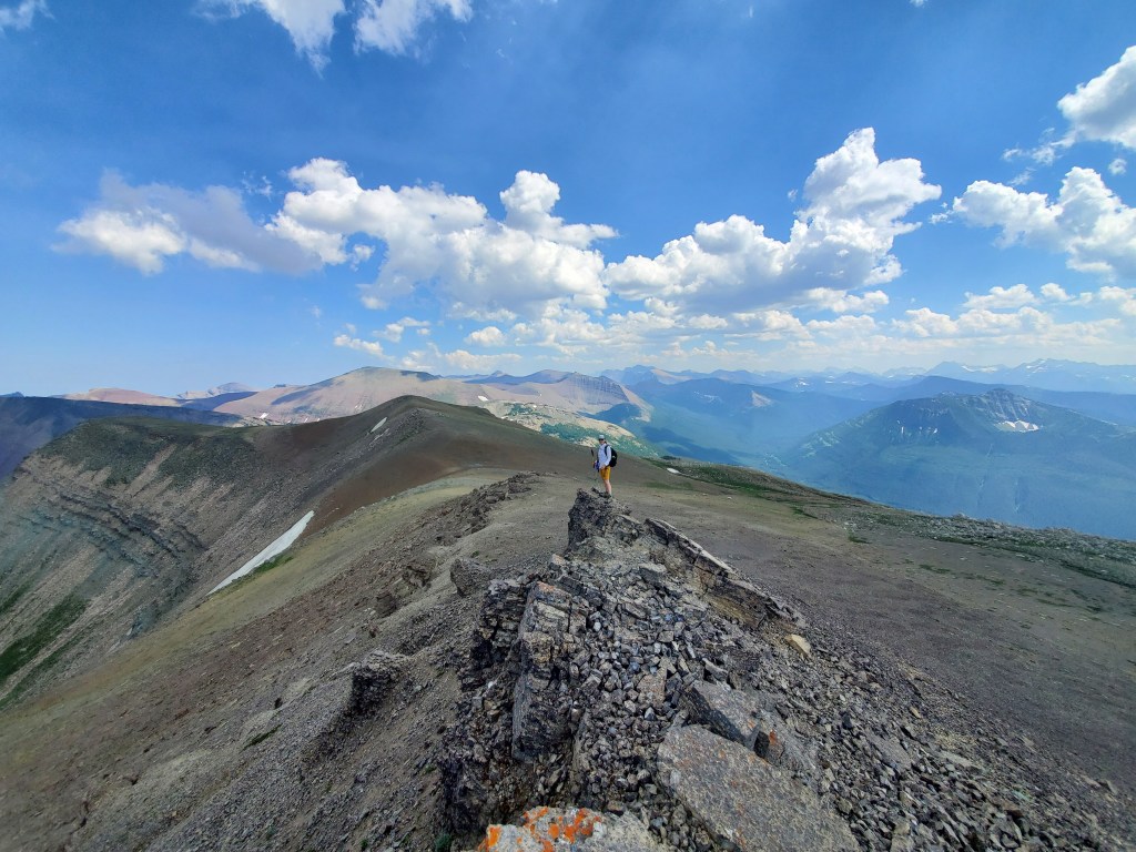
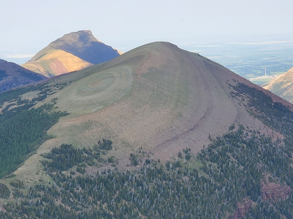
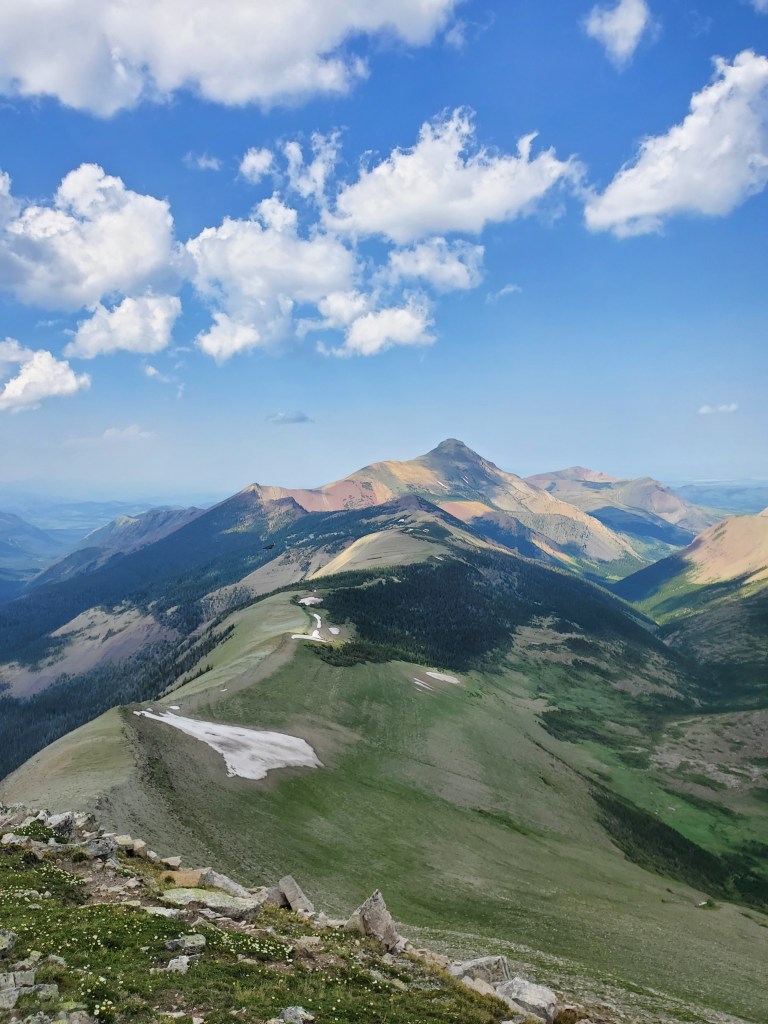
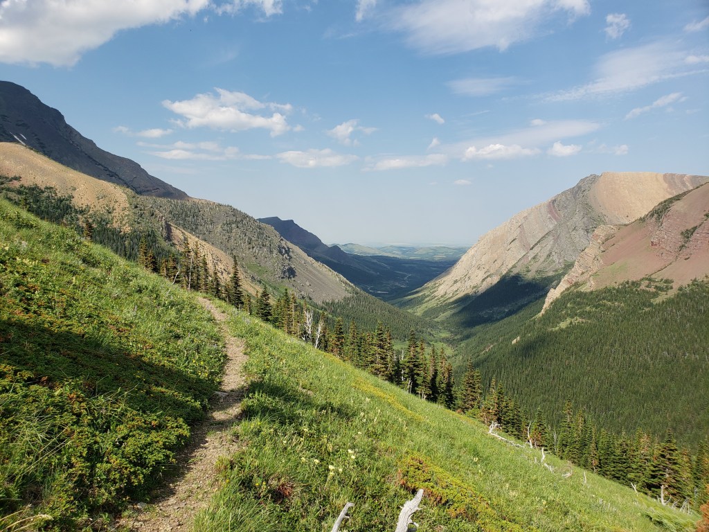
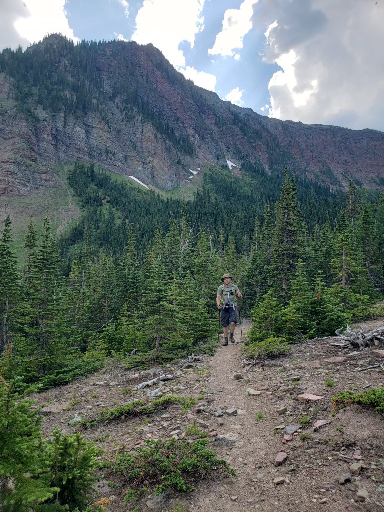
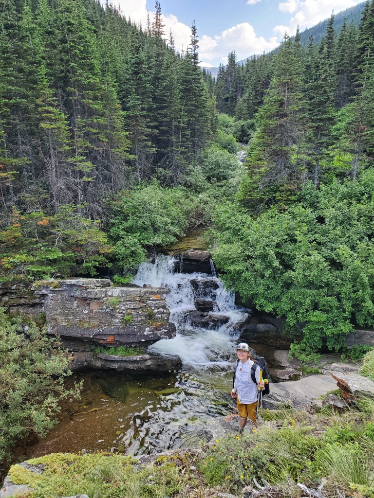
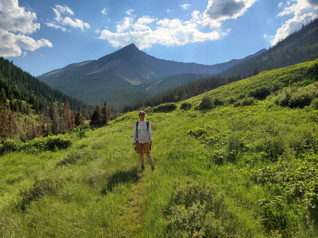
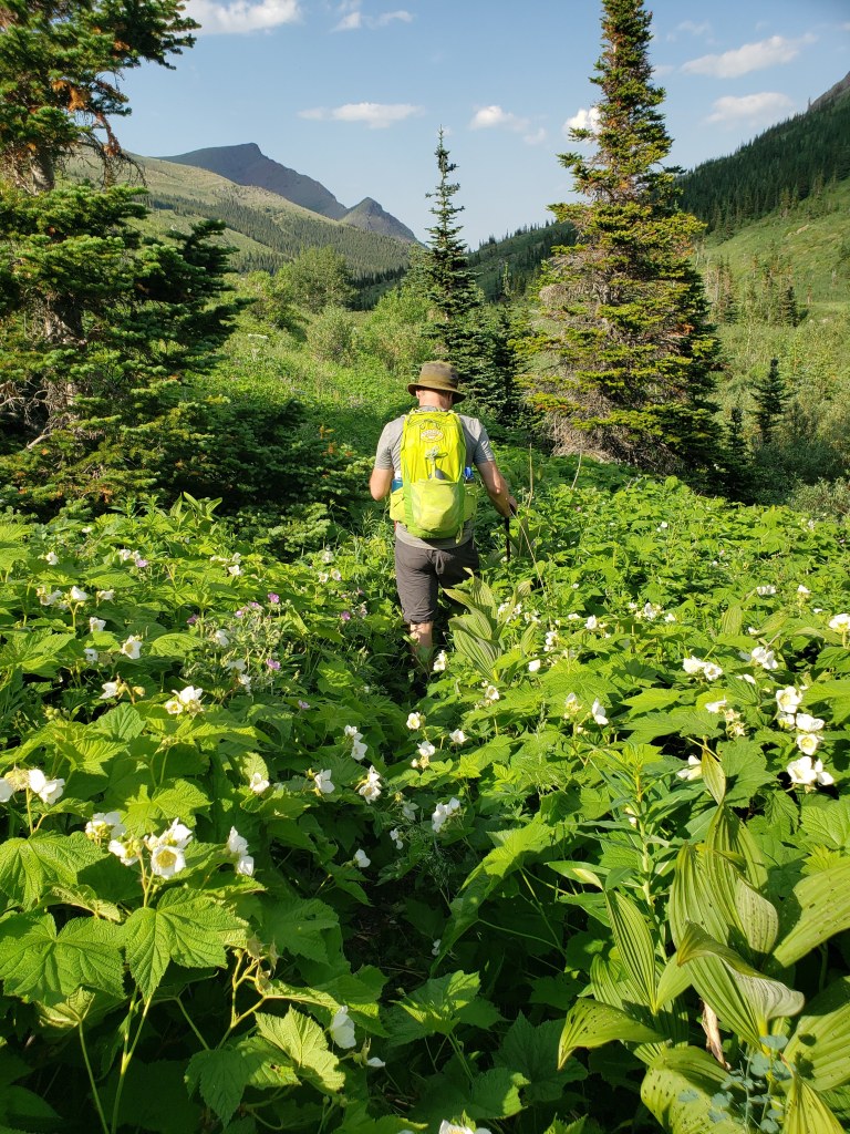
Once past the dogs, we regained our wits and continued biking toward Victoria Peak (left). We stashed our bikes in the trees below Victoria Peak and continued on foot up the grassy slopes above.The first part of the slope is grassy and open. We made our way up, trending toward Victoria Peak’s north cliff (right).Further up the terrain gets rocky and loose, making us wish we’d packed helmets.We continued up, gradually trending to the right while trying to keep to the more solid terrain in the trees.Nearing the top. From here we’ll weave our way through a couple of cliff bands below the peak.Most of the cliff bands were only moderate scrambling, choose-your-own-adventure style.This is supposed to be the moderate line through the final crux, but height may be a factor. I am only 5’4″ and I couldn’t reach the more solid holds beyond the chossy ledge at face level. The slope below me would be a decent tumble, and my hands didn’t feel solid enough to bump my feet up. This line didn’t feel positive at my height.Instead, I climbed the face to the right of the moderate line. This is an exposed scramble (the drop-off to the right is sheer and fatal), but the holds and movement felt more secure for my build.Reaching the top of the difficult scrambling section. Looking down at Dan from the top of the difficult section. The cliff to the left makes the scrambling exposed, bumping this up to a difficult rating.Reaching Victoria Peak! Views extend far across the prairies.Summit panorama.The route from Victoria Peak to Victoria Ridge will follow the backwards “C” in the ridge in front of me before heading up the grassy ridge left of center.We began the long walk to Victoria Ridge summit. Castle Peak (right) looks magnificent from this angle. Surprisingly, that mountain is shorter than the one we just summited, Victoria Peak.Looking back at Victoria Peak and the brightly coloured stripes of the slope connecting it to Victoria Ridge.Continuing through the backwards “C” part of the ridge, where the terrain gets a little more blocky. Our destination is the high point right of center in the distance.Stacked, red rock plates add interest to this section of the ridge.Looking back from another angle at the bright stripes of the ridge.These stacked, red rock plates make for delightful cliffs. We will walk out below them later.Rounding out the end of the “C” ahead and nearing the treed section of the route.We followed an obvious trail trending right, and then turned left up a gap in the trees (center). It worked, but didn’t connect as nicely as hoped. It looks like trending left at the trees would have led to an easier path.The gap in the trees was snowier and more enclosed than we expected. We followed this to its high point and then bushwhacked a few dozen meters until we were out of trees again.Once through the trees, the rest of the route comes into view. The summit of Victoria Ridge is behind the high point left of center in this photo, a bit more of a trek than it looks.Nearing the top, looking back at our long journey from Victoria Peak, the high point to the right.The high point of Victoria Ridge is the rocky mound in the otherwise smooth rolling ridgeline. Shortly past the point where this photo was taken, we were surprised to see two mountain bikers speeding toward us in the distance.Dan reaches the high point of Victoria Ridge. The ridge walk from Victoria Peak can be seen winding off into the distance at the right.The ridges are broad and uniform here, almost making it tempting to keep going to Loaf Mountain (left, not in shade), but we knew we still had a long trek back out.The infamous bullseye of Pincher Ridge.We begin the long walk back. Rather than returning over Victoria Peak, we’ll be turning right just before the “C” in the ridge and then following Pincher Creek out.A good trail leads down toward Pincher Creek.Following the trail out, looking back up at the impressive cliffs from the ridge walk earlier in the day.A small waterfall in the creek was an unexpected treat on the walk out.Continuing along trail through meadow, looking up at the cliffs from earlier.The last part of the trail was getting overgrown, but the way was still obvious.
We retrieved our bikes from where we’d stashed them and rode out to our vehicle. We’d saved our tastiest treats, just in case we needed to bribe dogs (shh, don’t tell), but the dogs weren’t around for our return trip. Our round trip time was 10 hrs 20 min.
The next day we biked to Loaf Mountain and realized that there is a wide, easy trail all the way to the col above Bovin Lake. Bovin Lake is roughly the spot where Spionkop Ridge, Loaf Mountain, Drywood Mountain, Pincher Ridge, and Victoria Ridge meet. That trail was substantially easier and was bustling with other hikers. We wondered why it wasn’t the recommended approach for Victoria Ridge! Victoria Peak would be significantly longer from this approach, but would avoid trespassing and would also avoid the difficult cliff section, reducing the objective down to an easy scramble. The Bovin Lake trail just seems like a better time out.