Notes: Via Direct Route. Kananaskis Conservation Pass Required.
Trip Report
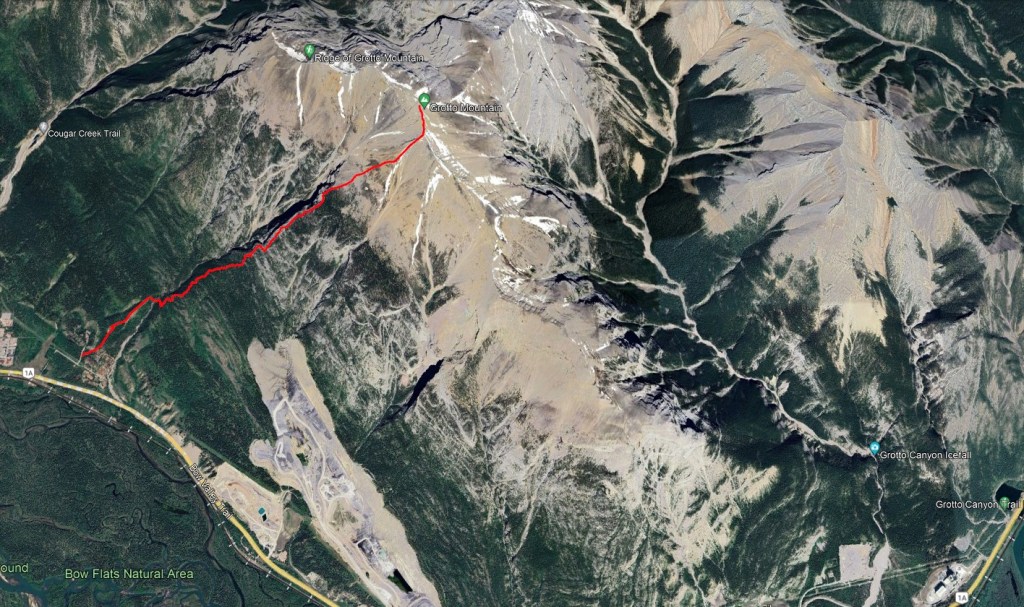
Unless conditions dictate otherwise, the well-graded ACC Route is generally the favourite for this mountain. It and the Direct Route both start near HI Canmore (and the ACC Clubhouse). Parking at the hostel is for guests only.
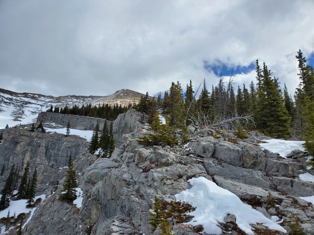
Both routes begin near a maintenance shed. The ACC Route keeps left and gains the summit ridge further west, then follows the summit ridge to the peak. We had concerns about the strong wind and chose the Direct Route, sheltered behind the mountain. Both routes ascend potential avalanche slopes. We scouted out these slopes from the highway before starting and verified they were largely snow-free.
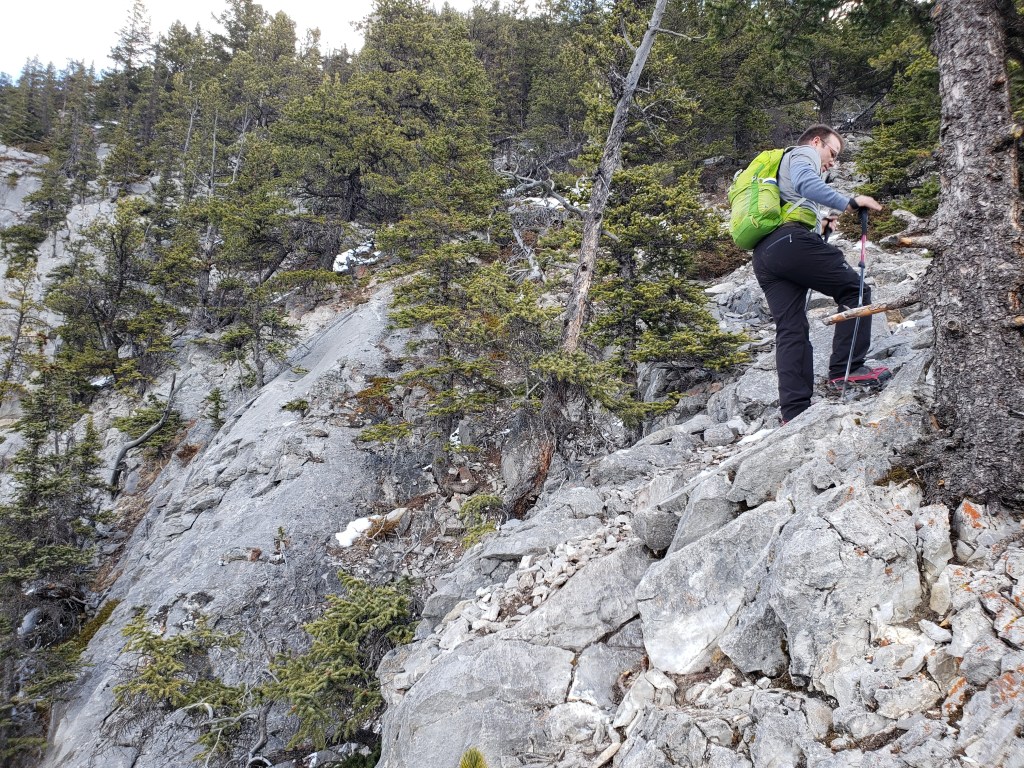
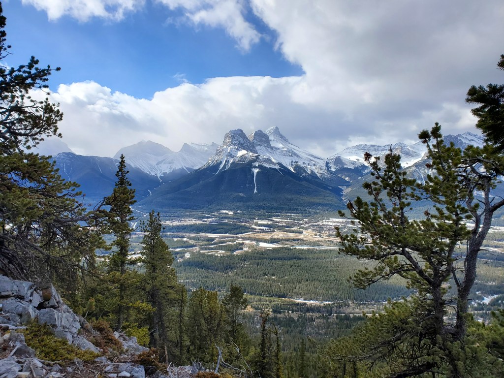
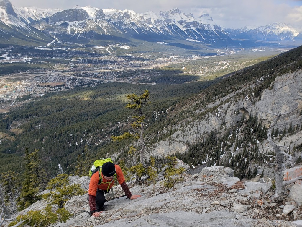
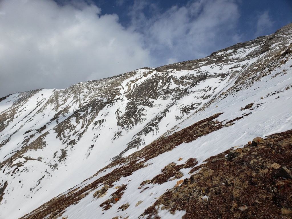
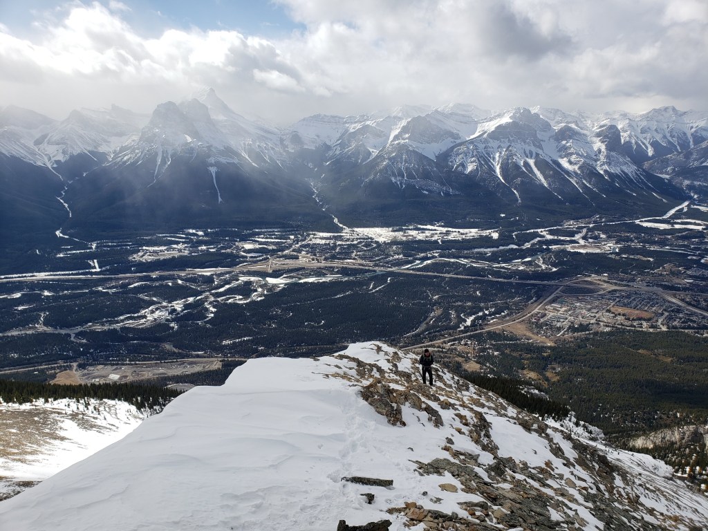
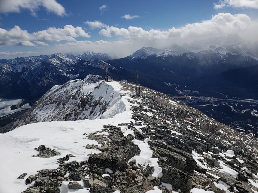
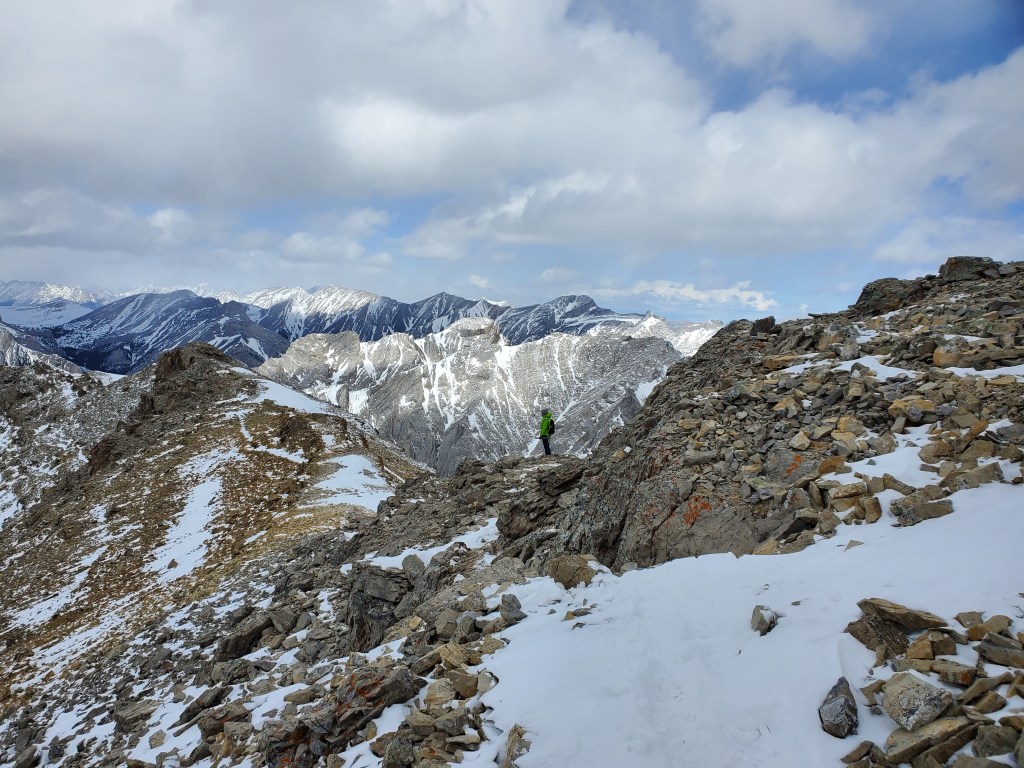
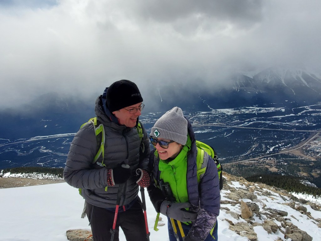
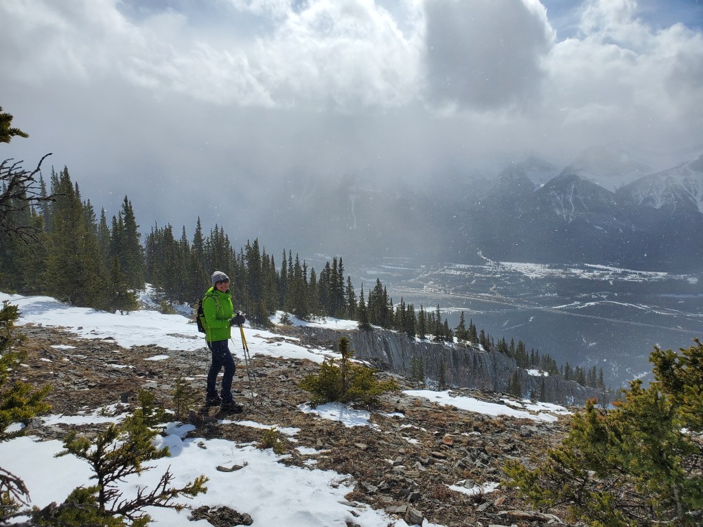
We had an obvious trail to follow through the snow on this day. After passing a low, icy section below a major drainage, we began ascending the east shoulder of the drainage.The trail winds its way up the shoulder of the drainage. Further ahead we will bypass a short cliff by traversing around the left for a meter or two, along the steep edge of the drainage. Some may find that move mildly exposed.Views of the Three Sisters from Grotto Mountain just may be the best in the Bow Valley!To the west are views of the many peaks of Mount Rundle. The large drainage we’ve been following can be seen to the right.As the trees start to thin near the top, the rest of the route comes into view. From here, it’s still a good trudge to the peak, but the terrain isn’t technical (provided it’s snow-free). Kane identifies the high point at center as the peak, whereas some mapping shows the peak being ~ 250 m to the left (north). We’ll stop at both locations to be thorough, but I suspect Kane is correct.Looking across the gully to the ACC Route, which follows the summit ridge to the peak. Tales from friends describe parts of this as a bit narrow, not a place to be on a windy day. Cornices tend to be a concern in winter too. On a calm summer day, the route would be beautiful though.Dan follows behind me, almost at the top. In the background the Three Sisters are lined up behind one another (left). The cluster of peaks to the right is the Ehagay Nakoda Massif (Ship’s Prow, Mount Lawrence Grassi, Miner’s Peak, and Ha Ling).Looking south along the summit ridge with its shiny assortment of communication equipment.We toyed with the idea of returning along the ACC Route and started exploring north along the ridge. This detour also lead us to what mapping shows as the peak (it didn’t really seem higher). The first dip encountered along the ridge seemed to create a funnel effect where the wind was particularly intense, cold, and difficult to walk through. Looking ahead, the ridgeline had many such features and we decided this descent route wasn’t going to be enjoyable in these conditions. We turned back and returned the way we came. Passing over the top again we ran into another scrambler – a fun, chatty fellow that grabbed a few photos for us. Cute, eh?Returning the way we came, the Sun broke through the clouds for a moment, just as the wind swept up a gust of flurries around us.
We made it back to the hostel in 7 1/2 hrs. The Direct Route made for a pleasant March objective and a memorable first day of Spring. There are a few other routes on Grotto Mountain that look fun to explore too, for a future trip.