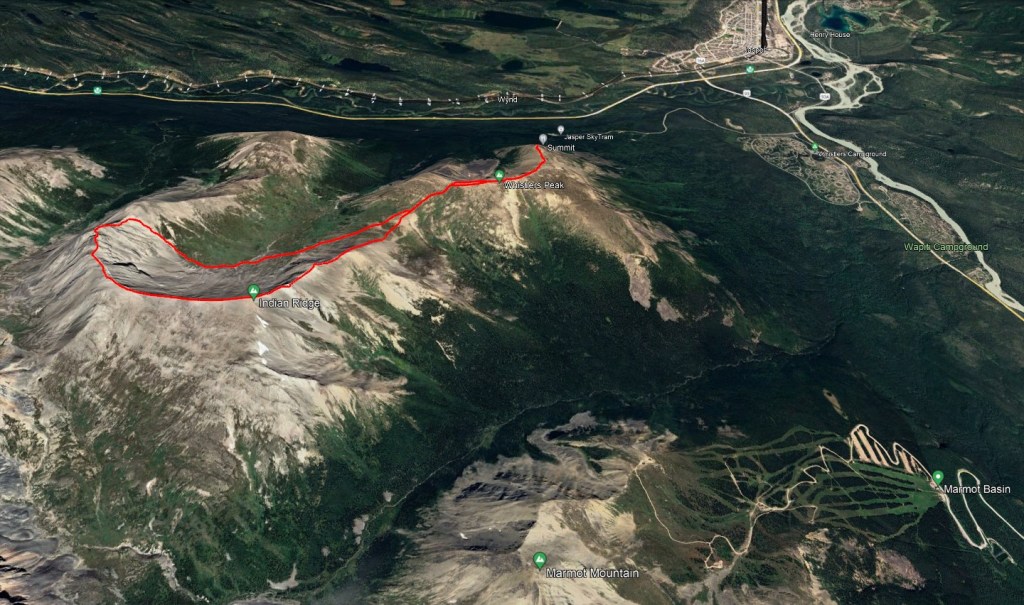
Notes: Easy scrambling up to notch, moderate for full traverse. This route begins at the top of the Jasper Sky Tram. It is possible to hike up sky tram too, but this part of the route was impacted by the Jasper Wildfire in 2024.
Trip Report
Completion of the full traverse of Indian Ridge is moderate scrambling. I’ve skimmed through trip reports where parties were turned back by snow or forced to detour left at the notch due to a lingering snow patch, and all said it looked like it would probably be easy if snow-free. I can share that I completed the full traverse in perfect, snow-free conditions, detoured right at the notch, and am confident that the full traverse is moderate scrambling.
Despite living in the Edmonton area for a decade we had never taken in the Jasper Sky Tram. So, we decided to take advantage of discounted tickets and finally check it out. From the top of the tram, a full traverse of Indian Ridge makes for a worthy afternoon adventure. Check conditions before leaving by viewing the webcam at the top of the sky tram.
The base of the sky tram is near the former HI Jasper hostel. Long ago, before Marmot Basin began operating, Whistlers used to be the ski hill in Jasper. The old lodge from that ski hill served as a hostel for many decades after, up until HI Jasper relocated to the Jasper townsite in 2019. If looking to hike to the top of the sky tram, the trail starts about 200 m behind the old hostel – Look for a turn-off in the road just before the hostel. The trail closes in winter due to avalanche hazard.
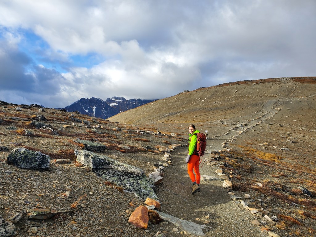
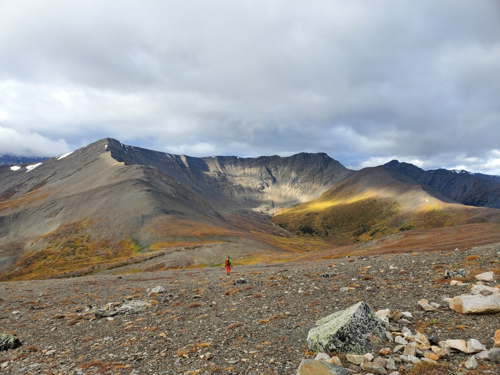
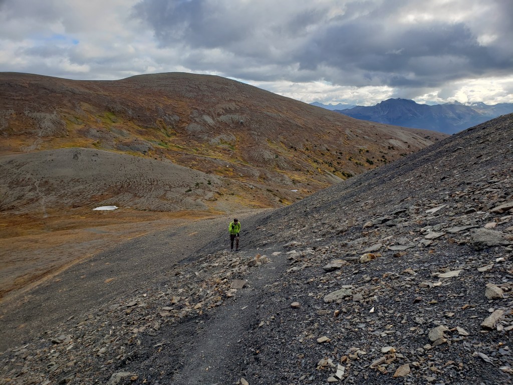
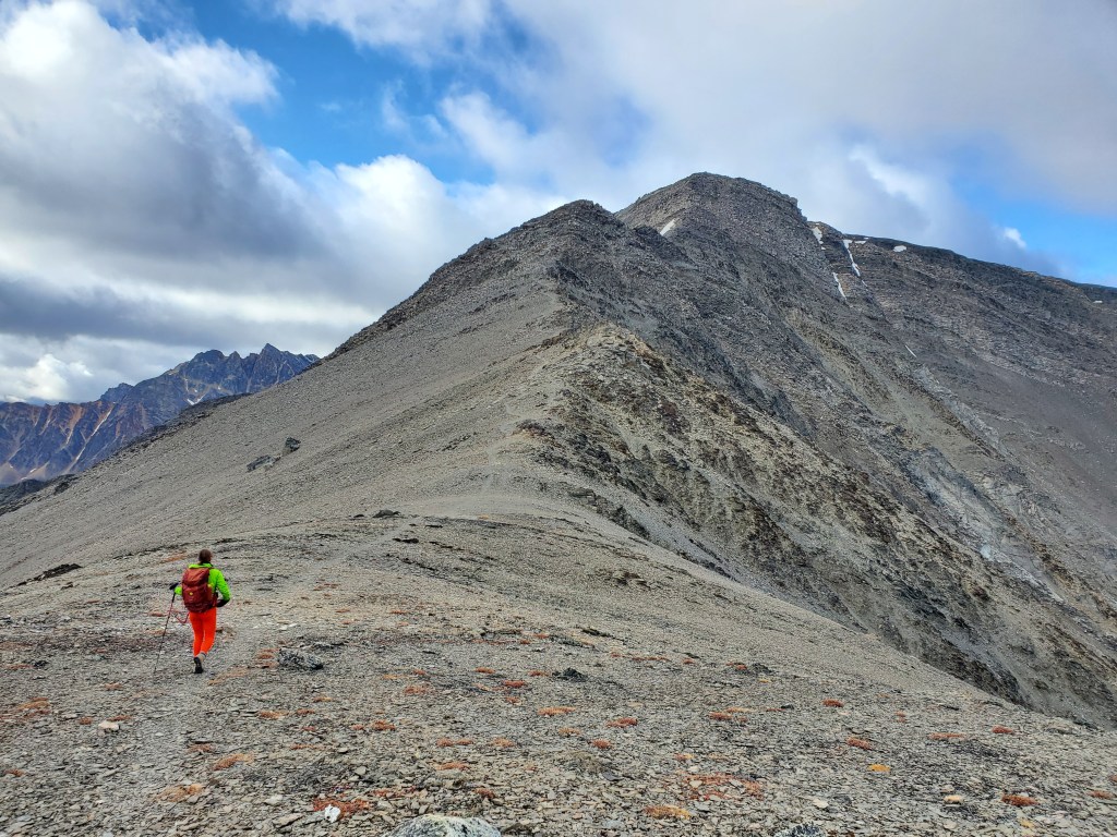
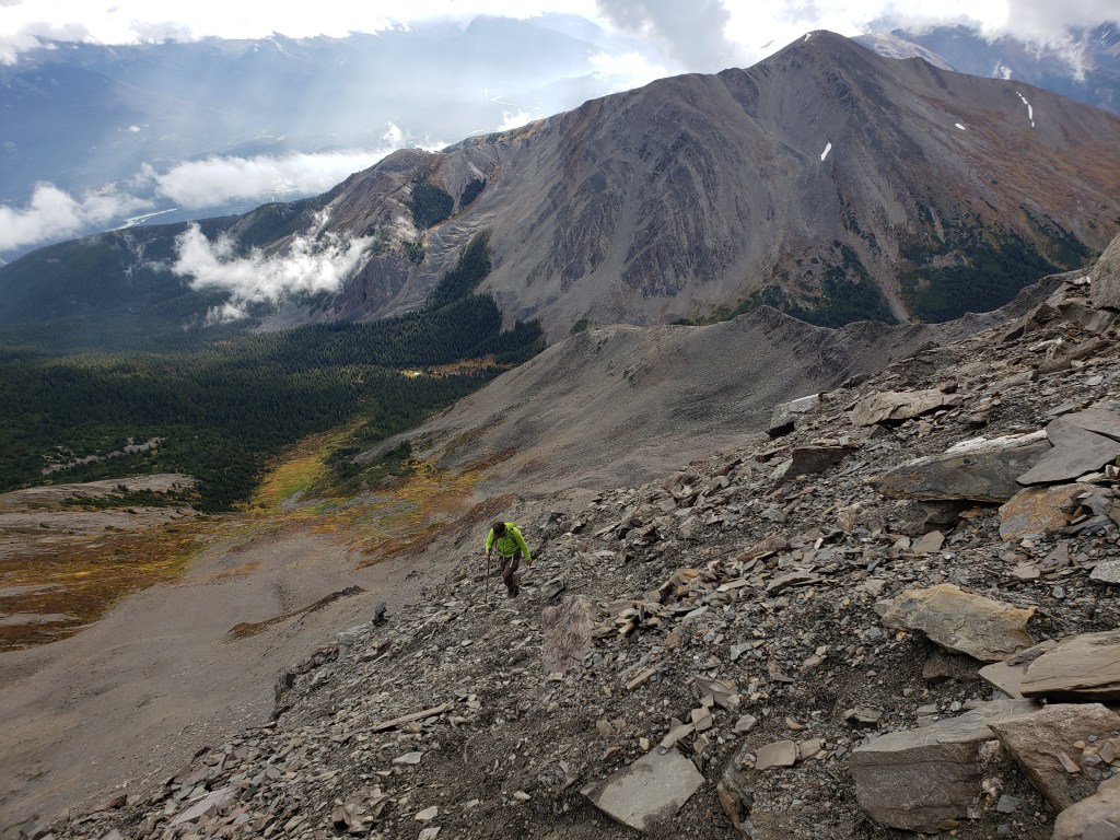
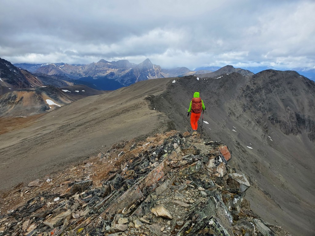
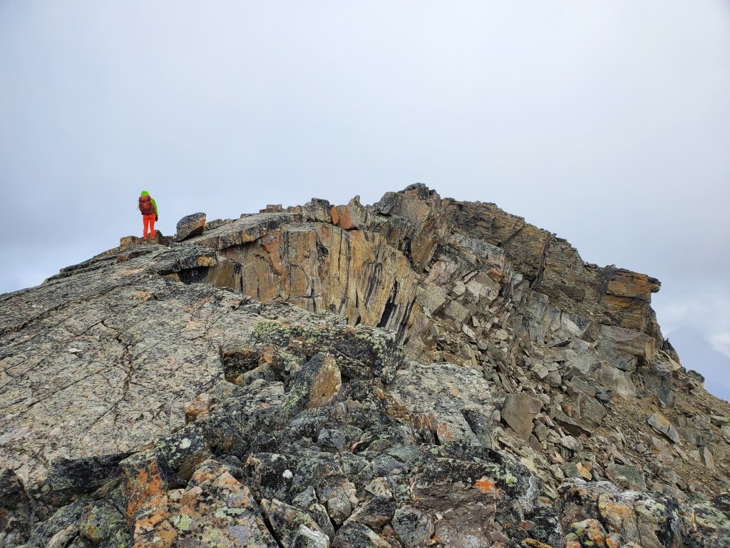
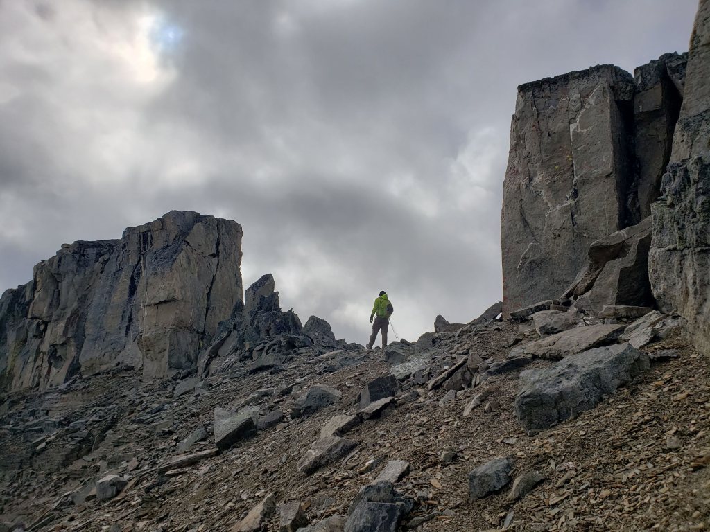
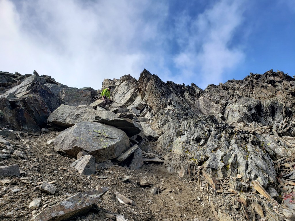
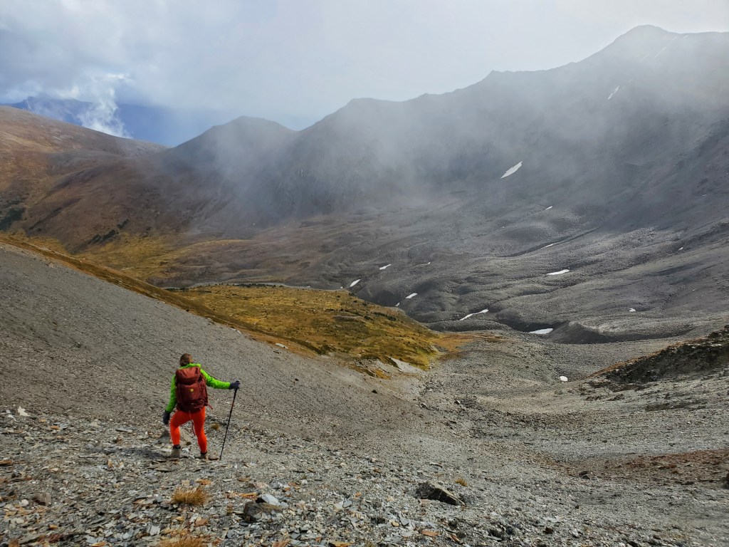
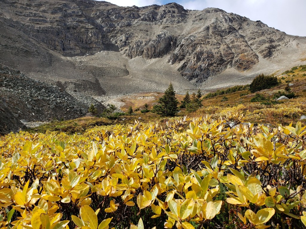
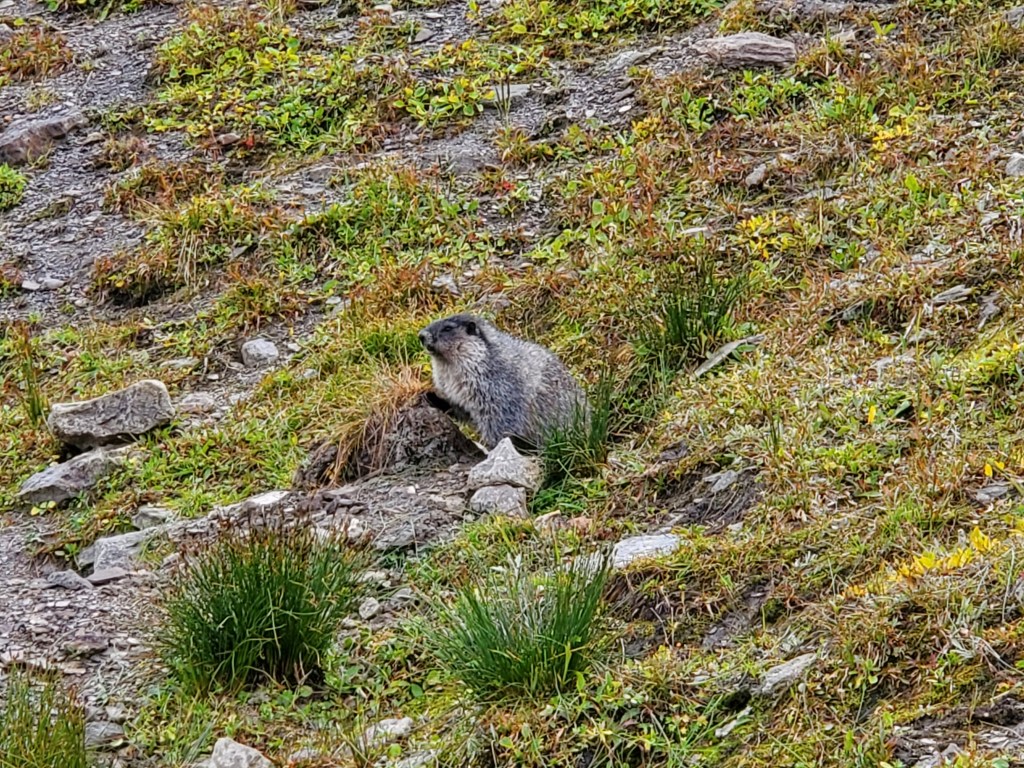
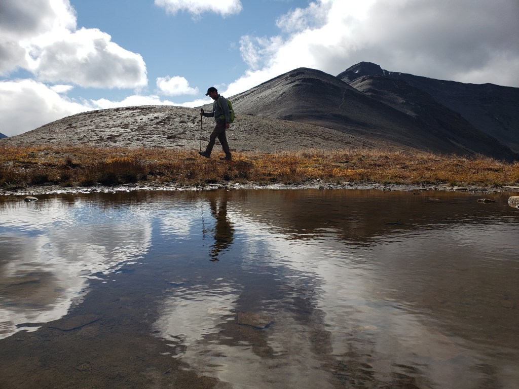
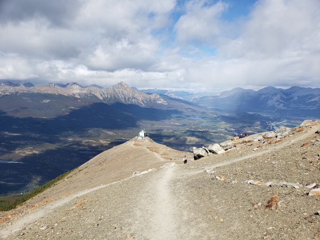
The hike from the top of the sky tram to Whistlers Peak (right) is very simple. We passed virtually all ages and abilities – Some needed a few extra breaks, but they all made it.Beyond Whistlers Peak, the traffic thinned to only a handful of parties. The full traverse is visible from here, with the high point of Indian Ridge seen ahead to the left. We will be exploring the full traverse and then descending into the bowl at the right – roughly following where green meets rocky brown – before eventually making our way back to this point.Looking back at Whistlers Peak as Dan follows the trail up Indian Ridge.The obvious trail follows the easiest line along the left side of the cliffs ahead. A healthy dose of loose shale is passed, but nothing too tricky. The scrambling is never beyond easy for this part.Looking back, the north side of Marmot Mountain can be seen in the background. Tres Hombres is behind the cloud at the left, but most runs are out of view on Marmot’s southern slopes.The high point of the ridge offers fine views of Terminal Mountain and Manx Peak.We continued along the ridge, starting out on deceptively easy terrain. Roche Noire is the striking peak at center. Looking back at the high point of the ridge.Approaching the notch in the ridge, I survey our route options. We ultimately chose a line down the right side. Snow tends to linger along the right side of the ridge here, forcing most parties to detour left. Both options are moderate scrambling, but left looked a bit more airy.Dan stands in the notch looking back up at where we’d just been.Looking back at the notch, showing a better view of the airy downclimb options on the backside.Below the notch the descent along the ridge is on hard mud-slab with loose rocks and small hidden cliff bands. The potential to lose one’s footing and take a painful fall is high on this type of terrain, so we proceeded very slowly.The terrain eventually eases and the descent becomes more pleasant. We will hike out across the bowl and then return to the low spot at the left side of the ridge.Looking back at Indian Ridge. The tree at center points to the notch. The section following the ridge from the notch to the col at right is unpleasant, moderate terrain. Once at the col the scrambling becomes easy again.We passed a dozen or so marmots in the bowl, all eager to remind us that the nearby peak was named for their whistling.Passing a large puddle as we regain the low spot of the ridge. The obvious trail up to the high point of the ridge can be seen to the right.Passing over Whistlers Peak and starting down the well-worn trail to the sky tram, with what was certainly the highest density of cute dogs I have encountered on a hike. The sky tram is at center, with Pyramid Mountain standing in sunshine in the background.
We made it back to the sky tram in 5 hrs 15 min, feeling a bit confused as to why that had been rated as an easy scramble (in two different books!). After revisiting several trip reports I realized that most parties don’t complete the full traverse – they tended to either turn back at the notch or continue on to Muhigan. The groups that continued on through the notch did it in snowy conditions and presumed that the route must be easier when clear. This experience was one of my early inklings that it might be worth sharing my own trip reports.
We thoroughly enjoyed riding the sky tram and hiking as far as the notch. If I did this one again I would turn back at the notch. The scrambling to continue down through the bowl is poor quality and not fun. If returning the same way, the scrambling is never beyond easy.