Notes: Plan to park early or take a shuttle. Allow time to socialize and/or wait at bottle-necks on Whyte.
Trip Report
Mount Niblock and Mount Whyte are perfectly situated for taking in spectacular views of Mount Lefroy and Mount Victoria. Mount Whyte has a few sections of difficult, exposed scrambling that may not appeal to everyone. Mount Niblock offers a more straight-forward moderate alternative that is certainly worthy of a trip on its own.
The Lake Louise parking lot is notorious for filling early, so we parked at 6:00 AM to secure a spot. Parking fees have been introduced in recent years, but the lot still tends to fill up by dawn. As of writing, parking is $36.75 per day. Other options are the Parks Canada shuttle or Roam Transit, both at comparable prices.
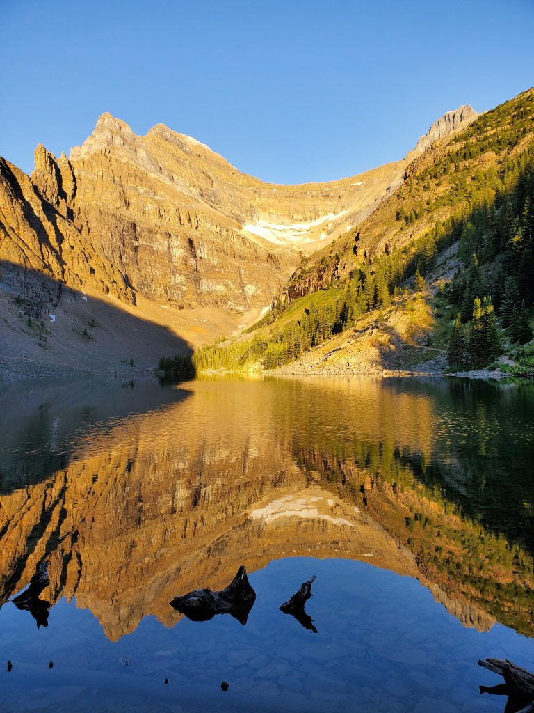
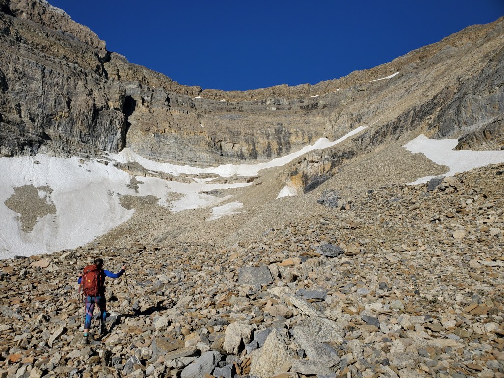
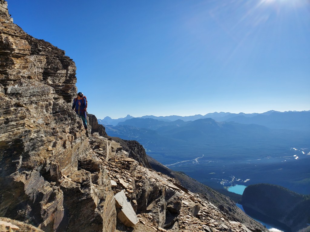
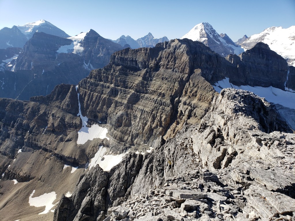
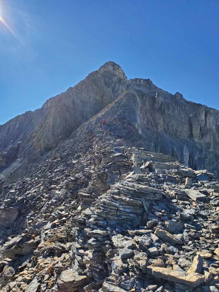
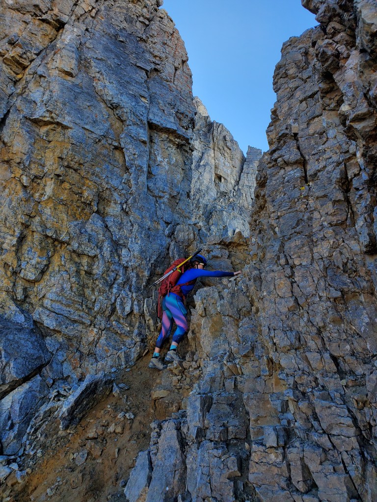
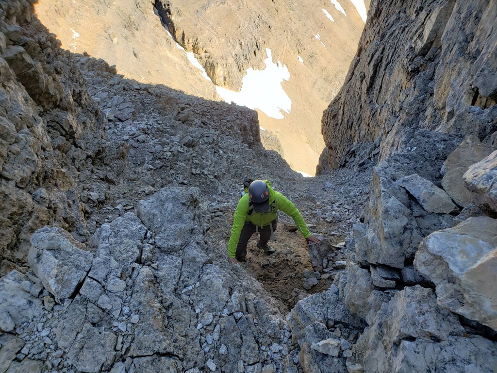
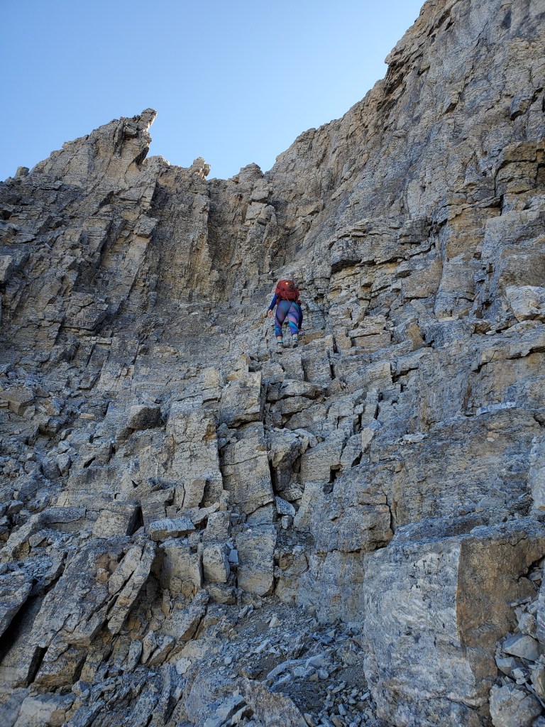
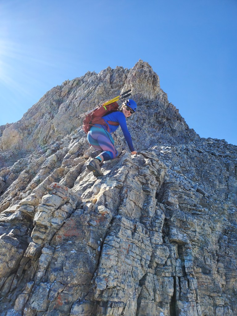
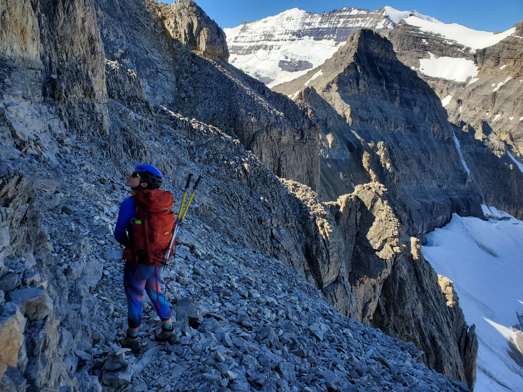
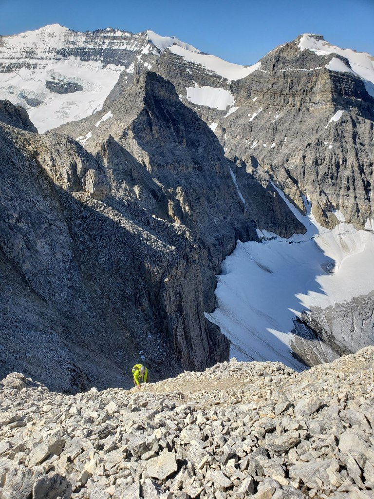
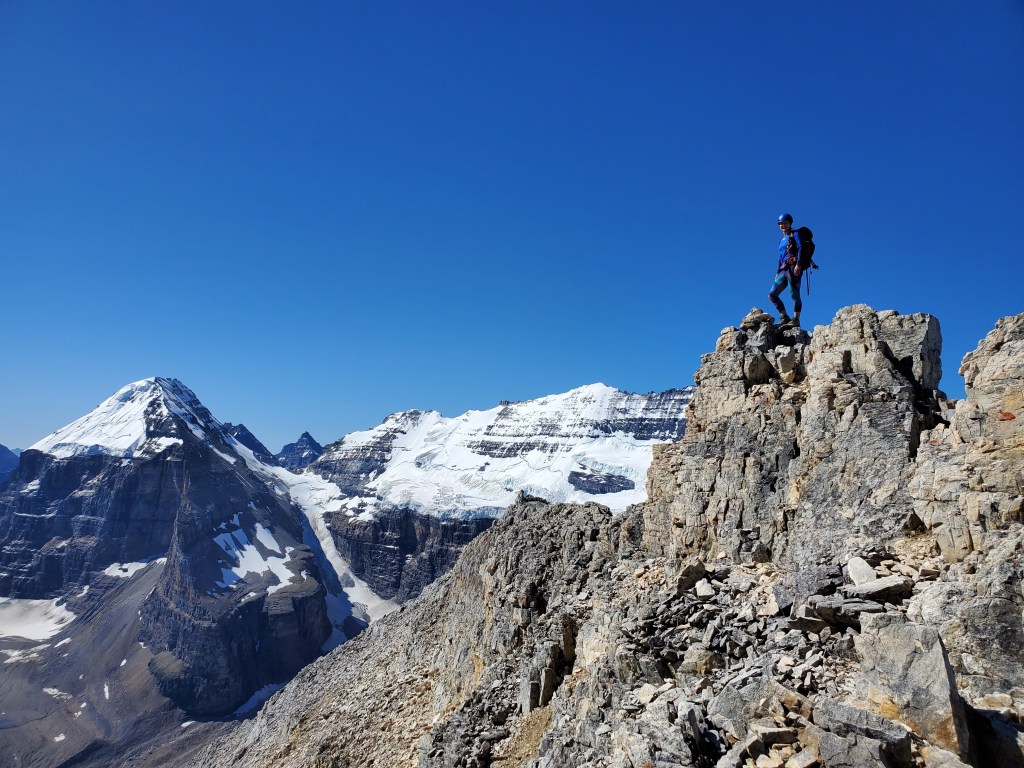
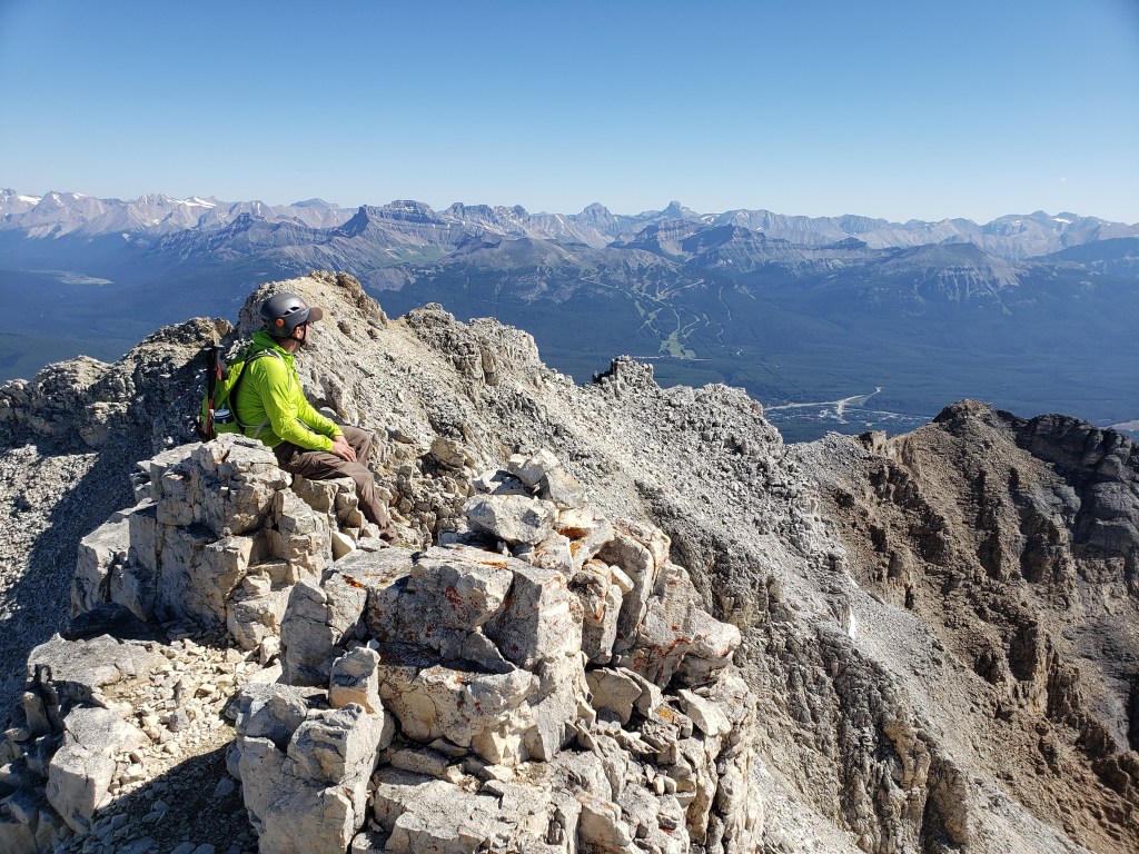
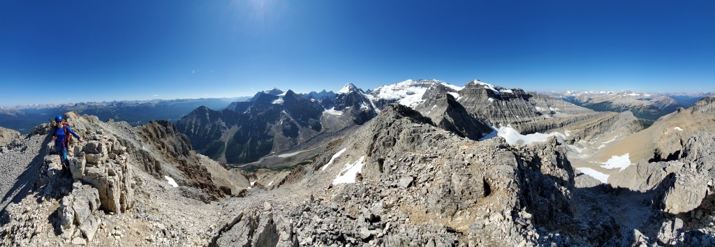
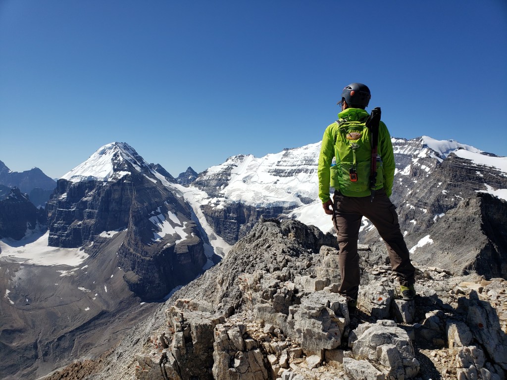
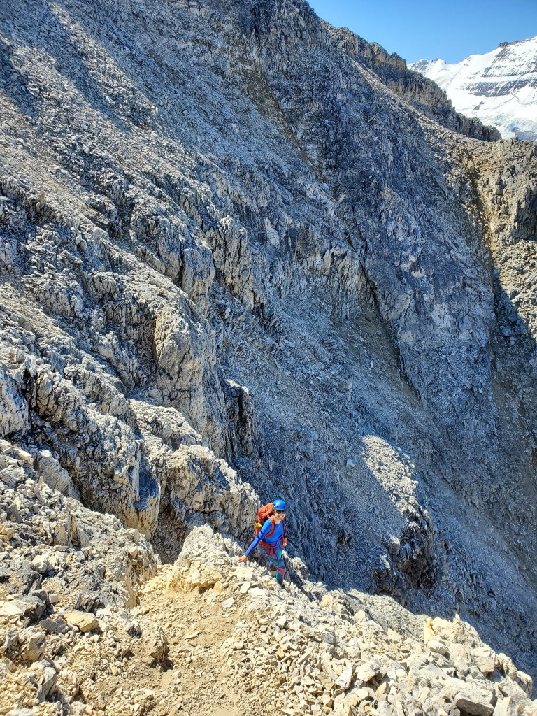
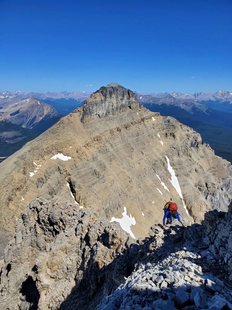
We set out early in the morning, enjoying the tranquility before crowds arrive. Lake Louise is framed by Fairview Mountain (left) and Mount Whyte (right). Glaciated Mount Victoria stands at center. The seemingly endless switchbacks leading to the teahouse only, in fact, took 50 min. Our early start afforded us a nearly empty trail and this peaceful view of Whyte (left) and Niblock (right) from the edge of Lake Agnes.We continued along a trail wrapping around the right (north) side of the lake, and eventually up the scree cone pictured at center. A section of moderate scrambling through the headwall brought us to the hanging valley above.From above the headwall, the route trends right, bypassing the cliffs ahead. The col is gained at the right, just below the peak of Niblock.Nearing the Whyte-Niblock col, looking back toward Lake Agnes (dark blue, closer) and Lake Louise (bright turquoise, further back). From the col we followed a trail around the backside (climber’s left), gaining Niblock from the west. The scrambling was never beyond moderate.Taking in the views over Bow Valley from the peak of Mount Niblock. Lake Louise Ski Resort can be seen at center – Dan’s right elbow is pointing at the main lodge.Looking to Mount Whyte from Mount Niblock. Our ascent route will largely follow the narrow ridge at center. Mount Lefroy can be seen behind Whyte and Mount Temple is the giant at the far left.Looking up the route to Whyte from the col – not for the faint of heart!After traversing left on the prominent scree ledge we arrived at the right-slanting gully. Kane advises not to climb the gully and to instead climb the cliff to the right. Both options are exposed and after evaluating as a group we chose the gully for this day.Looking down the gully. Sliding down through the notch would certainly be fatal (a fall of a couple hundred meters). It’s easy to see why Kane advises against this line. We traversed in from the left in this photo and the line Kane recommends climbs the cliff at the left – still fairly exposed. In today’s dry conditions we felt that the footing in the gully offered a more secure route up, but this could easily change from day to day depending on recent weather. Always be prepared and competent to make your own evaluation of risk.Continuing up, we eventually found ourselves traversing right, looking for “the first broad gully”. After considering options we selected the easiest looking line and just about started climbing when a group above began descending. We were assured to be on the correct line, but rockfall through this section limits passage to one scrambler at a time. We waited off to the side until the other group was clear and then made our way up, finding that another group at the top was now patiently waiting for us.The section directly after the gully is easily the most airy part of the day. The holds felt solid and the moves weren’t difficult, but the face I am climbing is above a sheer drop of a few hundred meters.Next we traversed right, finding ourselves at the final steep scree slope for the day. We’ll take turns on this section too to minimize rockfall hazard.Looking down as Dan follows up the scree slope. Mount Victoria towers above to the left.At last, the final push to the summit is in sight. Kane’s description to “continue along the ridge to the cairn a few minutes away” trivializes this last section. It’s not too bad, but there is still a bit of moderate scrambling and route finding left before the peak.Reaching the peak of Mount Whyte with views of Mount Lefroy (left) and Mount Victoria (center).Looking back over Bow Valley from the peak of Mount Whyte.Summit panorama.Gazing south at Mount Lefroy and Mount Victoria.We returned the way we came, downclimbing the summit block.Returning down the steep scree slope, taking care not to miss our turn-off.Downclimbing the airy section, looking across to Mount Niblock.Finally, descending from the col and returning to Lake Agnes, preparing to face the crowds. Fairview Mountain stands above Lake Louise at the right.
The trail beyond the teahouse was bustling with afternoon traffic, but we clenched our teeth and smiled through it. We made it back to the parking lot in 9 hrs 15 min. Mount Niblock and Mount Whyte make for a spectacular and fulfilling day. Mount Whyte remains a favourite of mine.