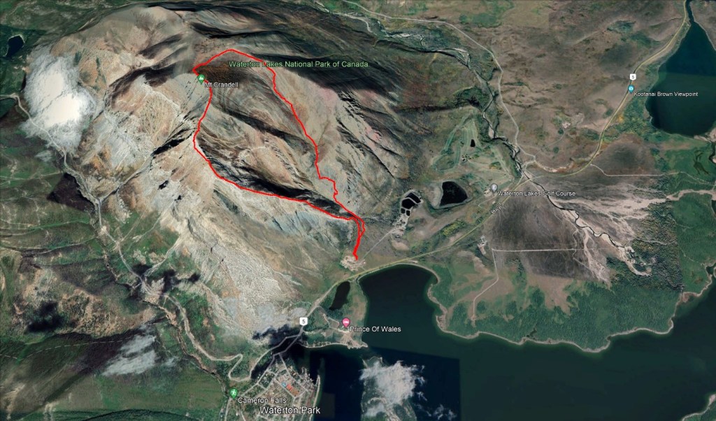
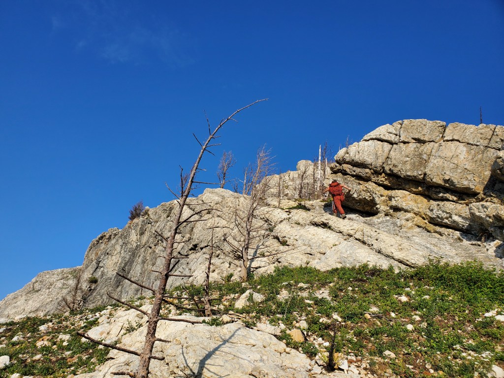
Mount Crandell has two common ascent routes: Bear’s Hump and Tick Ridge. We’d already had a few sweltering hot days in Waterton and, with temperatures forecast to reach 30C+ again, we felt content to stick to the more moderate Tick Ridge route for this day. The trip reports I’d found were for either the more difficult Bear’s Hump route or for the Southeast Slopes (descent route), so I didn’t look too closely at them – if I had, I would have realized that the hardest part of the Bear’s Hump route is the cockscomb, which is shared with the Tick Ridge route. Even with bypassing the cockscomb, there were a couple of difficult moves needed to regain the ridge.
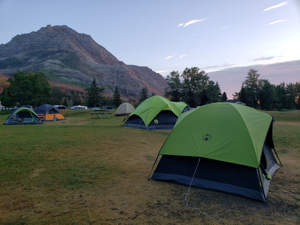
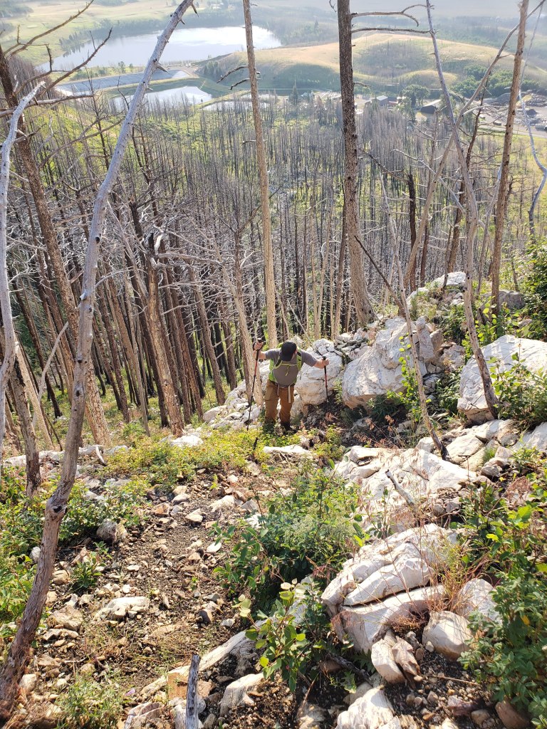
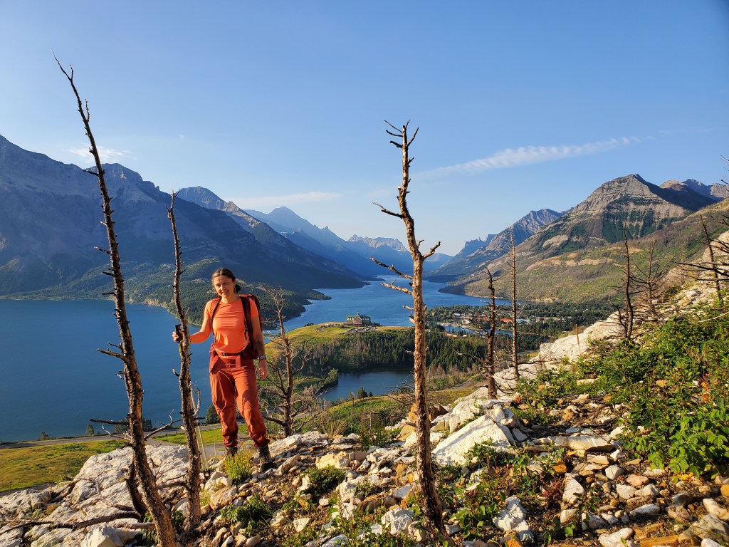
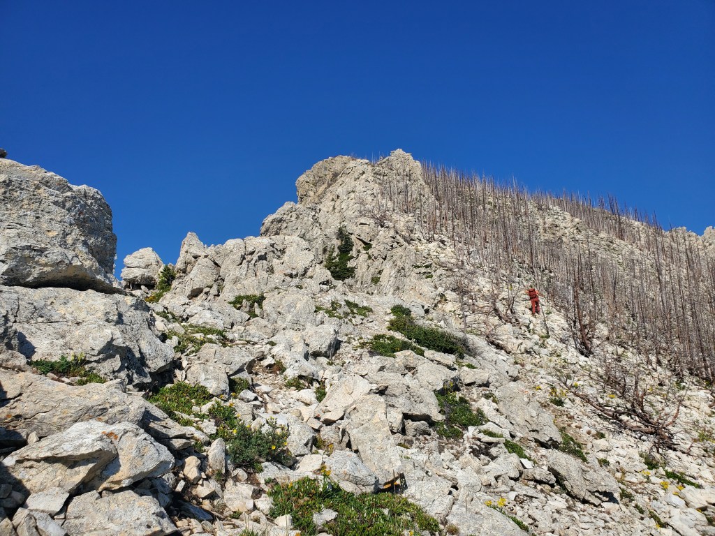
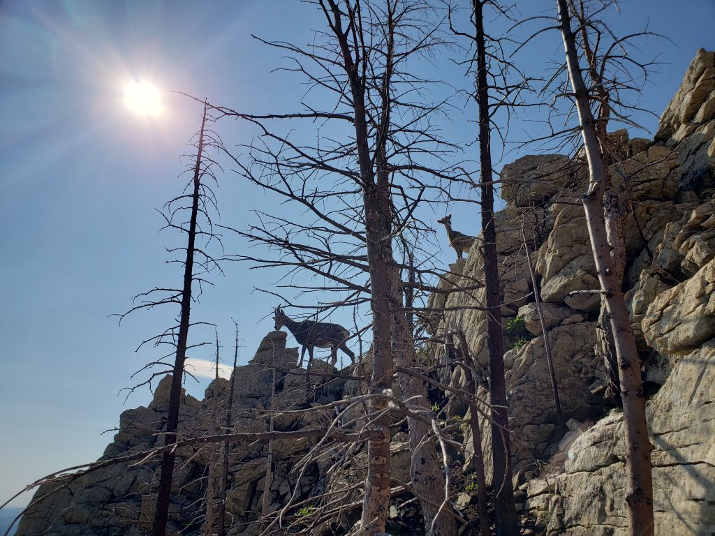
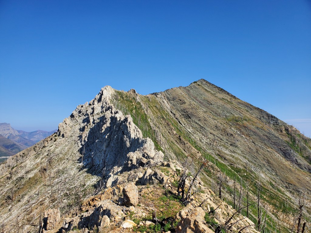
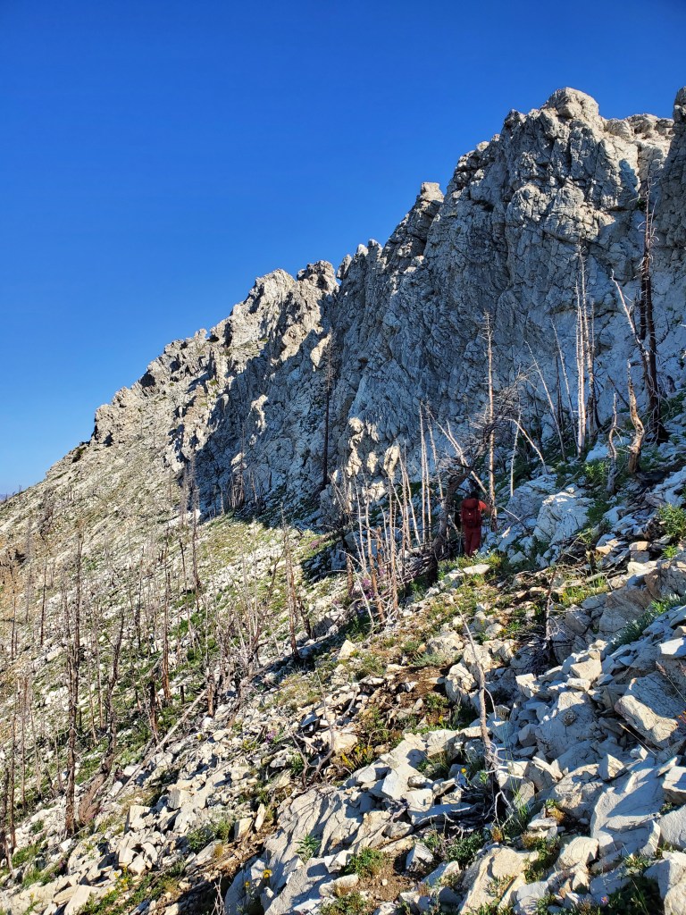
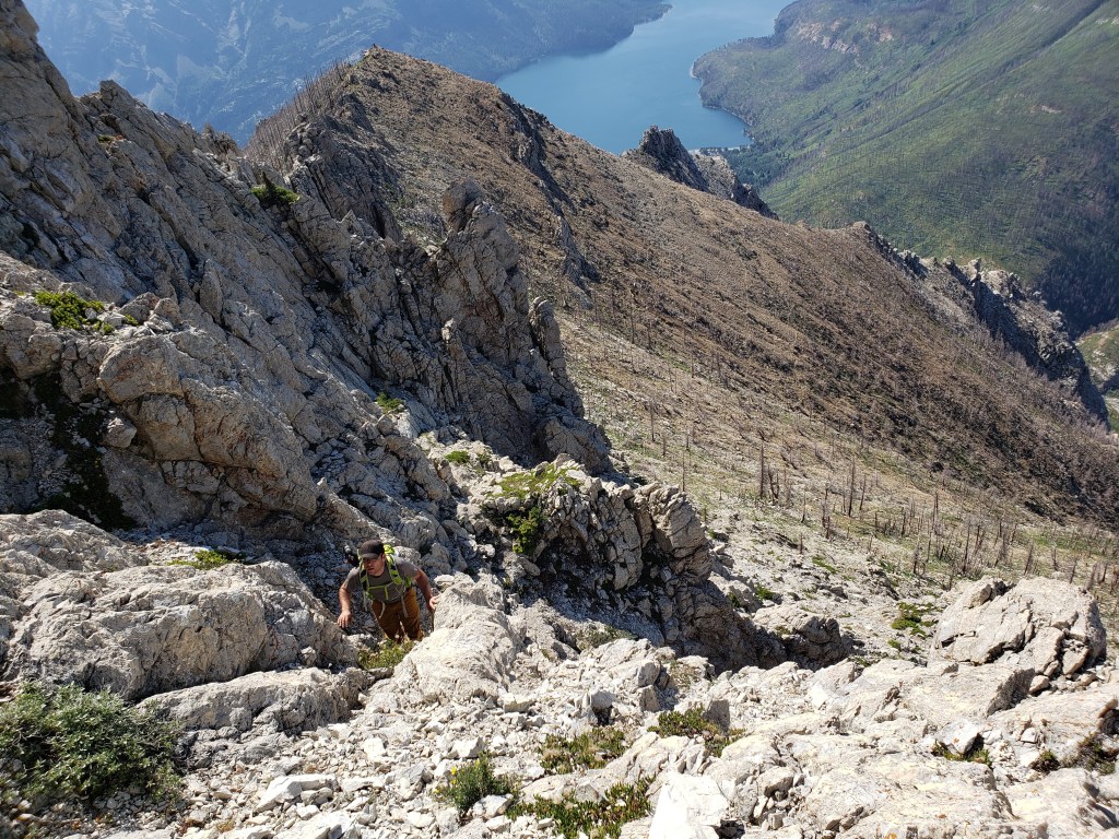
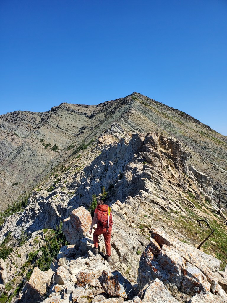
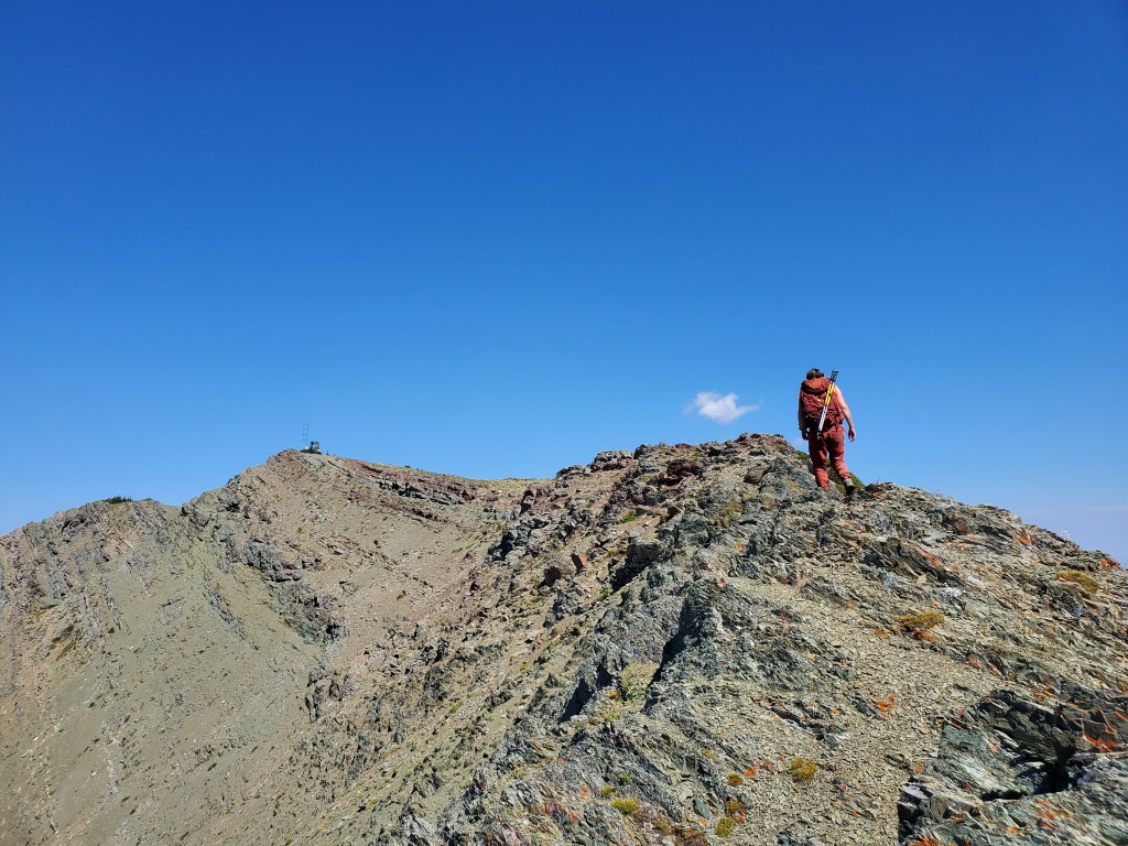
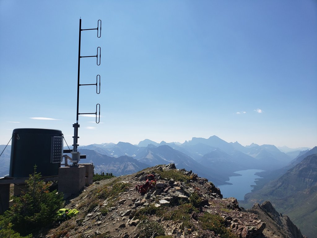
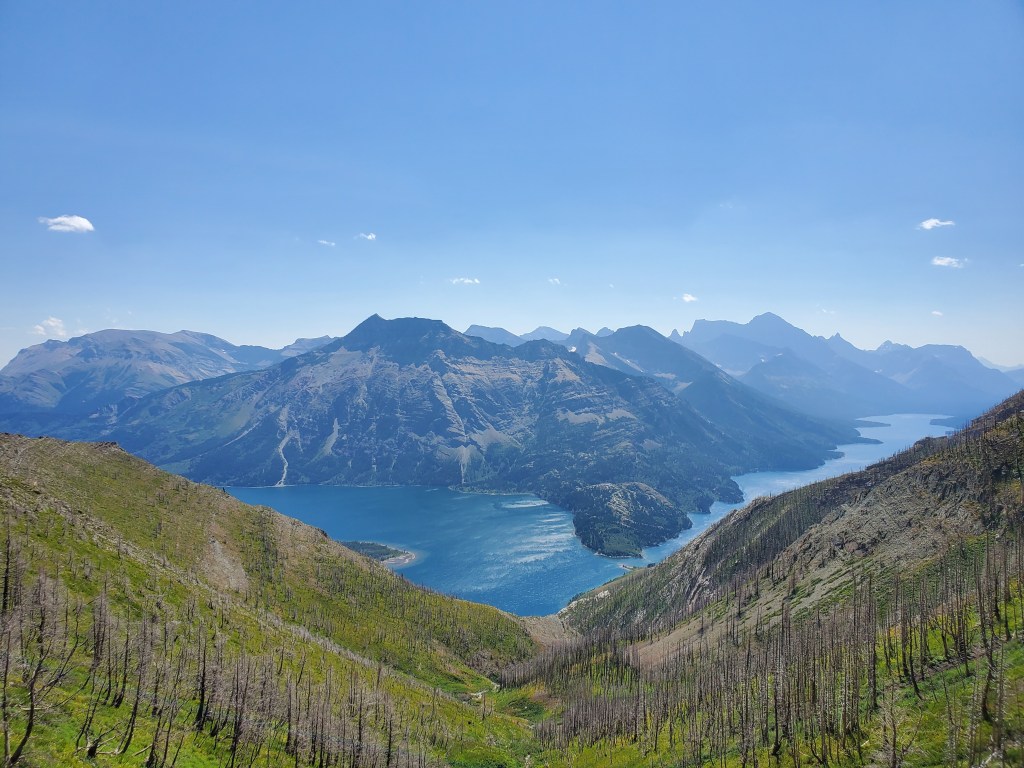
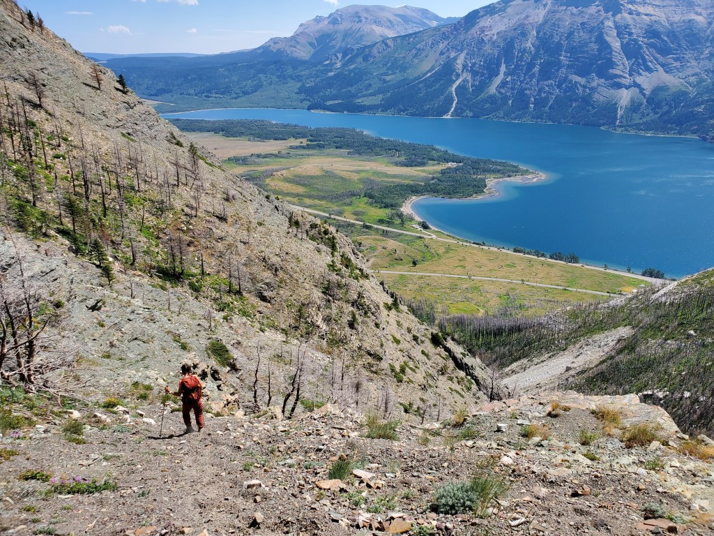
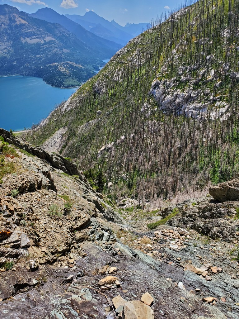
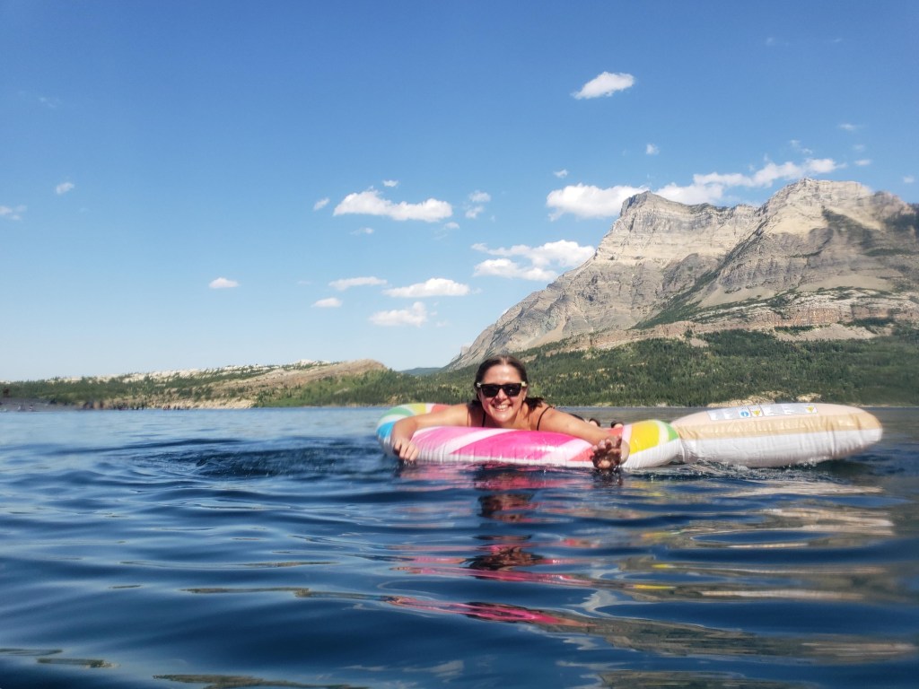
Crandell Mountain Campground was destroyed in the 2017 Kenow Wildfire and remains closed as of writing. This photo of Mount Crandell is taken from what’s serving as the “campground” in the townsite. Tick Ridge is the right-hand shoulder and Bear’s Hump can be seen at center.We spotted our ridge behind the ranger station and easily made our way to the base of it. As of 2020 most of the trees were still standing after the 2017 fire. But, I wouldn’t be surprised if forest fire deadfall worsens this route over the years.The ridge offers splendid views over the Prince of Whales hotel and Waterton Lakes. The immense efforts to save this historic building from the fire are not unappreciated.Continuing up the ridge, a few sections of moderate scrambling are encountered – nothing too serious, just enough fun to add variety.Approaching the top of the ridge, nearing the spot where we’ll meet up with the Bear’s Hump route.We were please to spot signs of life on this sad, scorched slope. This mama-sheep brought her baby over, seemingly to gawk at us clumsy humans.Looking south from the top of Tick Ridge at Upper Waterton Lake, which extends south into the USA. In the foreground the Bear’s Hump route meets up with Tick Ridge. The views here were better than at the peak!Panorama from the top of Tick Ridge.Looking forward, to the cockscomb. We will be bypassing the section immediately ahead of us by detouring to the left under the shadow, and then regaining the ridge at the wider section, where the shadow ends at the left.Bypassing the cockscomb to the left (west) might have been the only shade we encountered this day!This wider section of the cockscomb looked like a reasonable spot to regain the ridge. It starts out as only moderate scrambling.The last few moves to regain the ridge at this spot felt loose and exposed, probably closer to difficult scrambling. Perhaps a more moderate line exists though.Gaining the ridge and looking forward. It looks like continuing the bypass at the left may have led to another option for regaining the ridge after skirting the northern end of the cockscomb, perhaps offering a more moderate line. We had taken the first line that worked.Continuing along the summit ridge and looking back. We bypassed the large fin in the background to climber’s right. The moves to tackle the feature head-on look fun, but the rock is not solid.The final portion of the summit ridge is an easy ridge walk. The peak can be seen ahead, marked by a repeater station.Taking in views of the radio repeater site at the top of Mount Crandell. Aside from those with a particular appreciation for communications infrastructure, most people seem to prefer the views from the top of Tick Ridge to this.From the peak, we continued north to Kane’s descent route, down this drainage. Kane suggests that the full descent could be possible in one hour, but I am highly skeptical.We kept to the left of the stream, keeping high above where it narrows. Cliffs ahead eventually forced us into the drainage.The line down a side drainage was moderate scrambling on loose terrain, not something I would want to rush through. As hot and tired as we were, we plainly saw that Kane’s suggested descent time of one hour was not going to happen. We carefully picked our way down into the drainage and then rock-hopped our way down the steam bed to where we had started. Our descent from peak to car took two and a half hours.We reached our vehicle in 7 hrs 40 min and rewarded ourselves for a safe trip by heading directly to Upper Waterton Lake. This lake is typically too cold to be comfortable for swimming, but on this day it was absolutely perfect. It was also packed with tourists, contrary to the norm. Vimy Peak stands above the lake in the background.
If looking to bag the peak of Mount Crandell, it sounds like an easier line exists from its west side (this area was still closed from the fire the year of our trip). If views over Waterton Lakes and the townsite are the goal, a nice set of stairs leads part way up the Bear’s Hump route to a scenic viewpoint. I would recommend neither the Bear’s Hump route nor the Tick Ridge route to a friend. Each is a different ratio of loose rock and forest fire deadfall, but neither is especially fun.