Notes: Ascent via third drainage, about an hour up the trail. Closer to easy scrambling by this route.
Trip Report
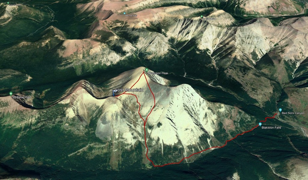
We spent an extraordinarily hot long-weekend in Waterton and weren’t feeling very ambitious for most of it. With much of the park still closed after the 2017 Kenow Wildfire, we landed on Anderson Peak for this day. The route described in Nugara’s More Scrambles in the Canadian Rockies ascends the second drainage and gains Anderson’s east buttress before continuing on to the peak. We took a look at this second drainage but it looked a bit spicy, and the east buttress seemed like unnecessary elevation gain/loss – maybe this was fatigue clouding our judgement. Instead, we continued on to an easier line up the third drainage, as described by Bob Spirko.
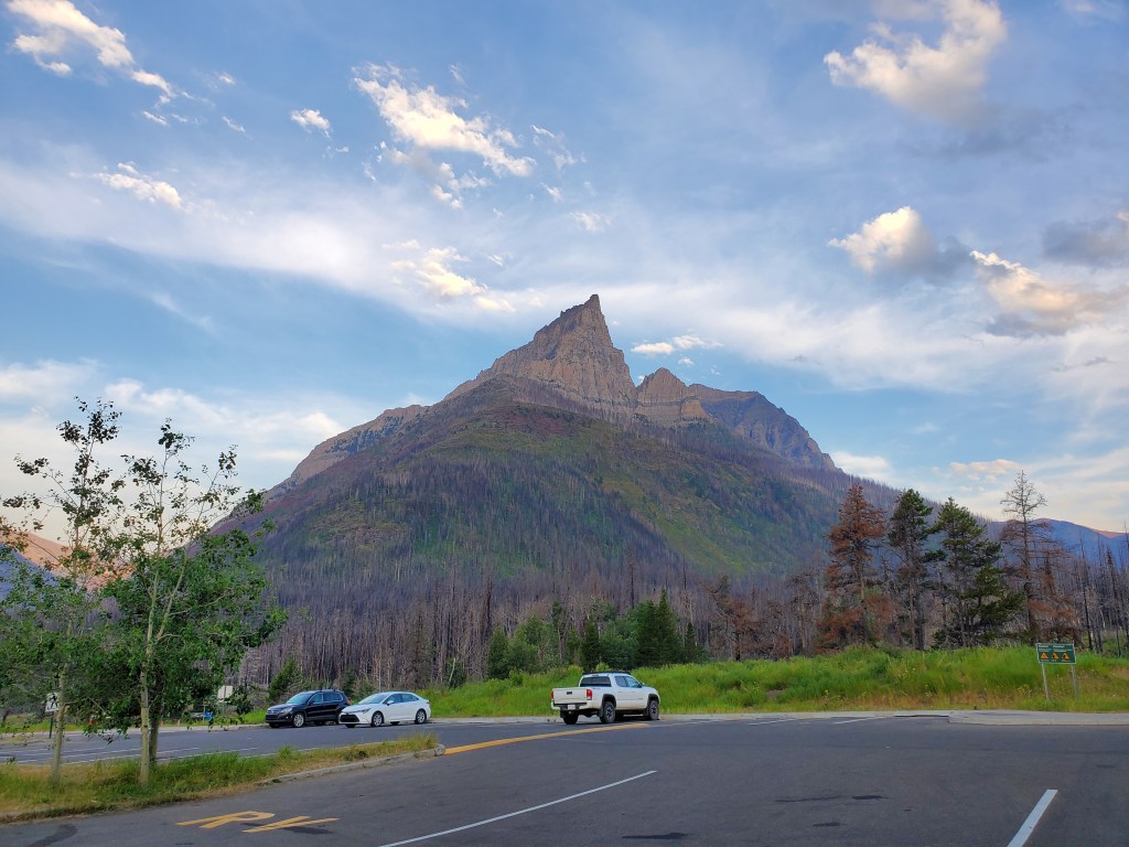
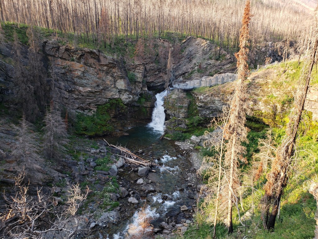
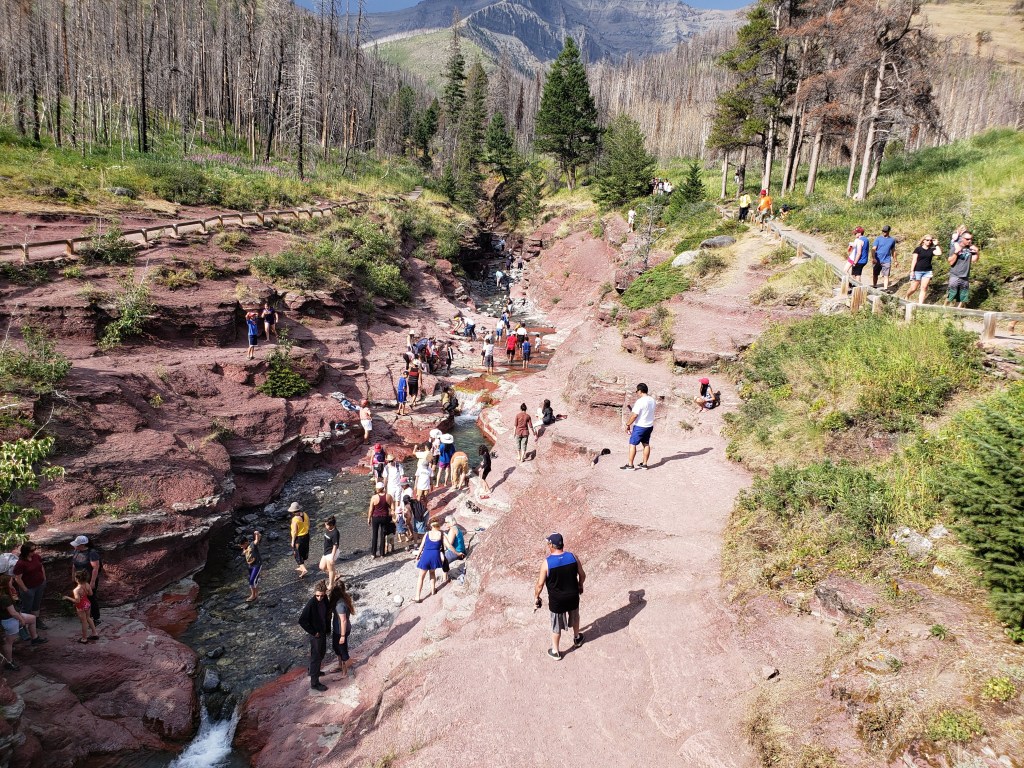
The parking lot is shared with Red Rock Canyon and Blakiston Falls. The eye-catching peak seen from the parking lot is the east buttress of Anderson Peak. The peak itself is behind and slightly right.The approach trail passes through Red Rock Canyon. Note the tranquil beauty at around 7am. We’ll pass back through here later.Continuing along the wide, well-maintained trail leads to Blakiston Falls – Another pleasant spot for a break, at least in the early morning.After considering and eliminating the second drainage, we side-hilled our way around to the third drainage on treadmill scree. This was the worst part of the day, and was unnecessary in hindsight – but in the moment, we thought it would be a shorter journey from the second to the third drainage this way than to return to the main trail.
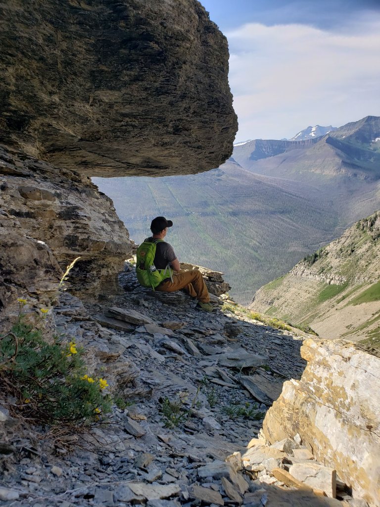
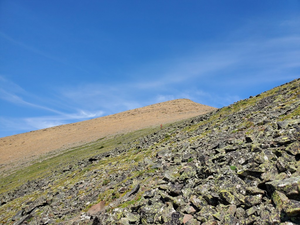
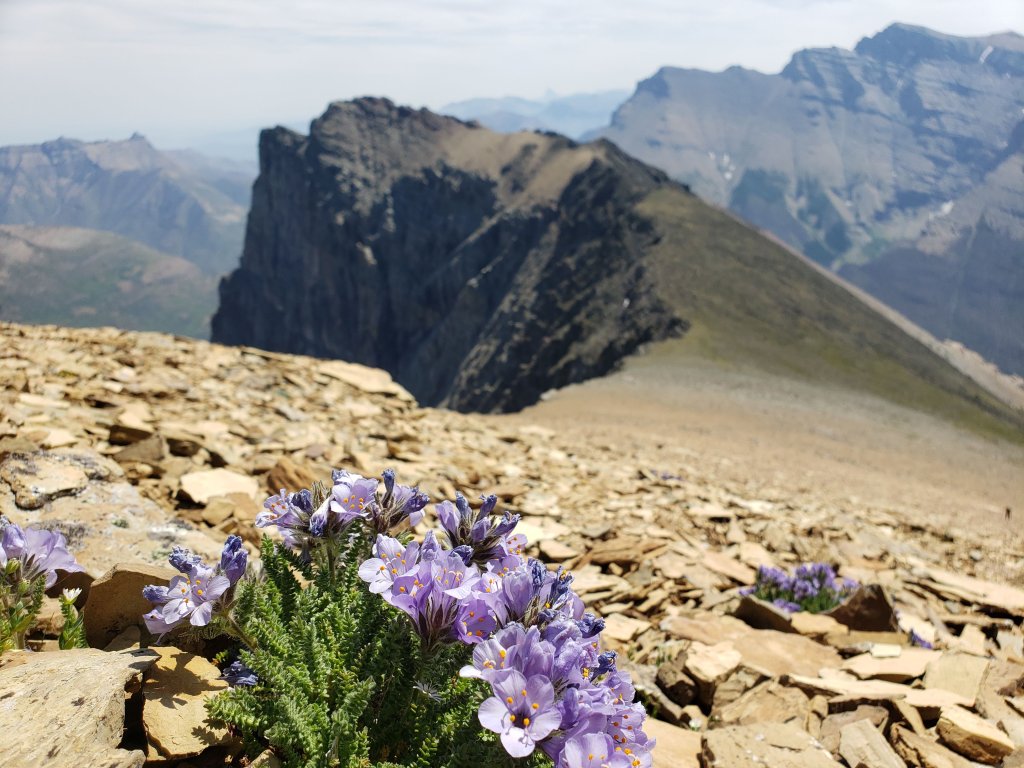
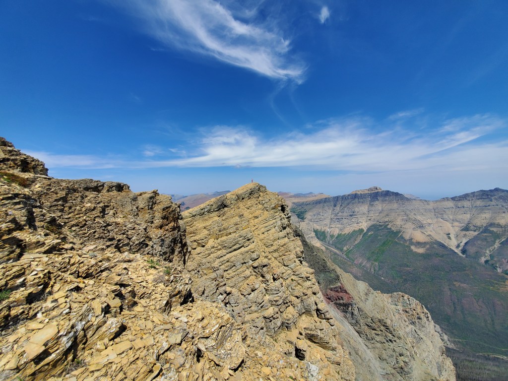
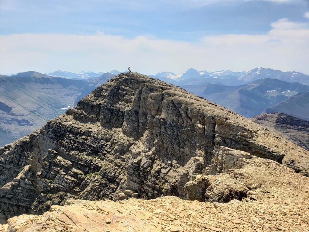
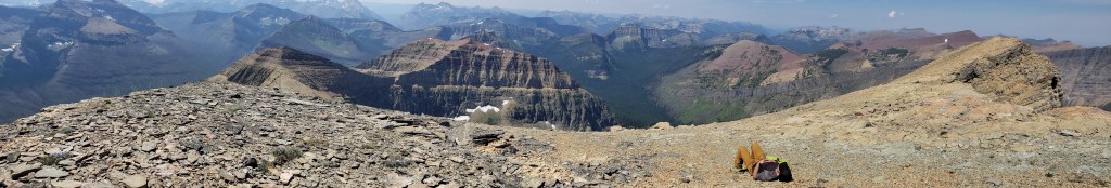
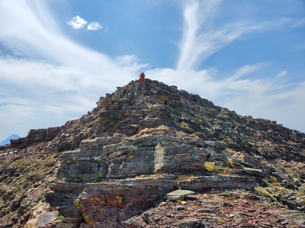
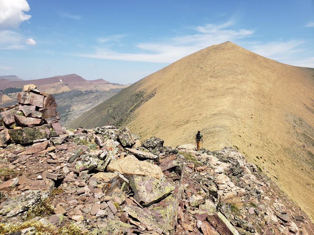
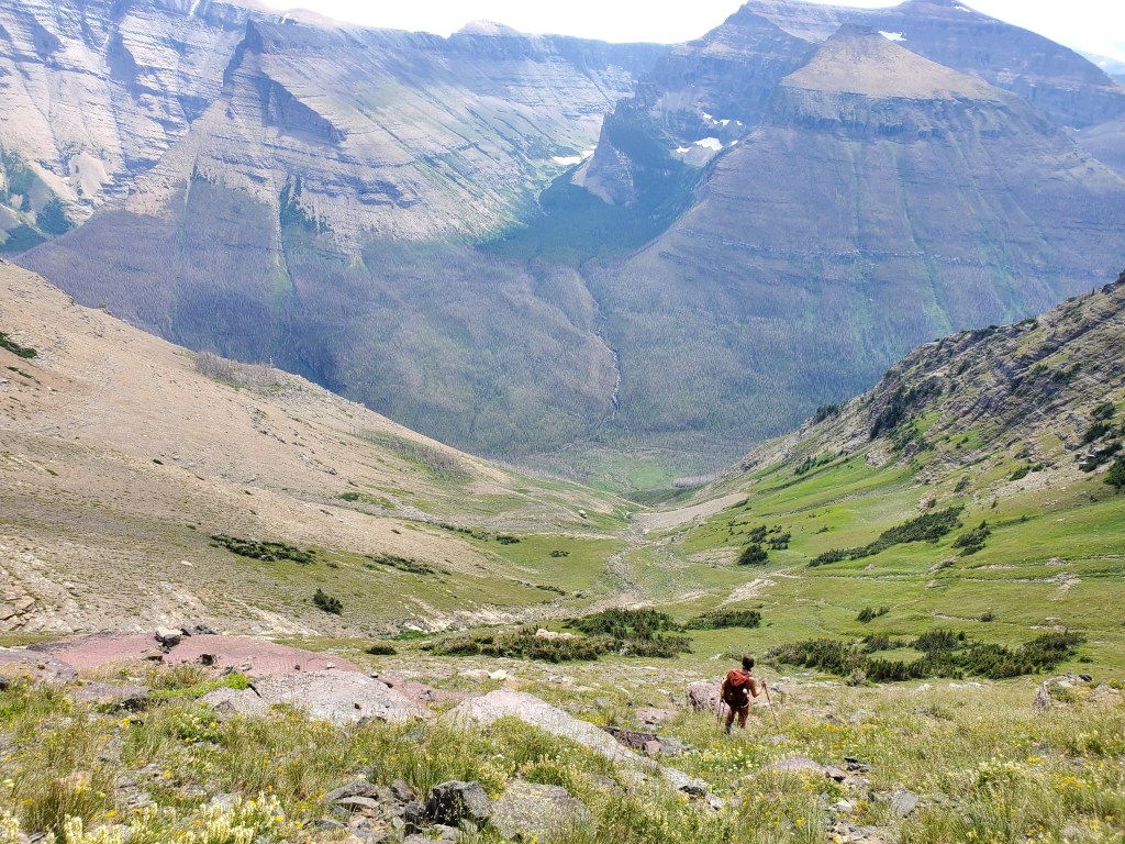
Once in the third drainage, we avoided any more tedious terrain by trending high to the right, onto a talus slope. This shot is looking back toward Blakiston Creek and our ascent line up the third drainage.We found one small patch of shade where we could stop for lunch – the only shade of this brutal 30C day.Continuing on to Anderson Peak. We were grateful for the relatively easy travel offered by this talus slope. Looking back to the east buttress. Dan is the tiny black spec at the right side of the frame.There are two roughly equivalent high points on Anderson. I explored slightly further to the second high point, pictured here. Looking back at Dan, standing next to the summit cairn of Anderson Peak.Returning to Dan at the peak, dwarfed by bright red Avion Ridge in the backgroundSummit panorama from Anderson Peak.The ridge walk from Anderson Peak to Lost Mountain took only half an hour. A friendly group we passed encouraged us to continue to Kootenai Brown Peak and Mount Bauerman, where they had just come from. But, we were roasting in the heat and had run out of water by this pointLooking back at Anderson Peak as Dan approaches Lost Mountain.“Victory”? Selfie on Lost Mountain?We greedily descended back toward the approach trail, eager to return to the cool rushing water of Blakiston Creek.Returning to the trail along Blakiston Creek, delighted to reach a water source! Mount Blakiston (above) lies to the south, its peak is hidden by the outcropping in the foreground.Passing back through Red Rock Canyon at around 5PM is a very different experience from the early morning!
We made it back to the parking lot in 10 hrs. I have no doubt that waffling over route choice paired with the day’s high temperatures added an hour or so to our day. Hey, no worries, we still made it! But, an average group can probably expect to complete this trip a bit more efficiently.