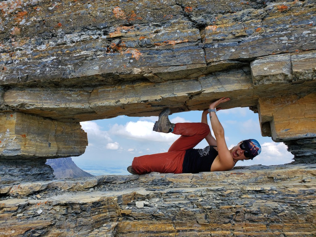
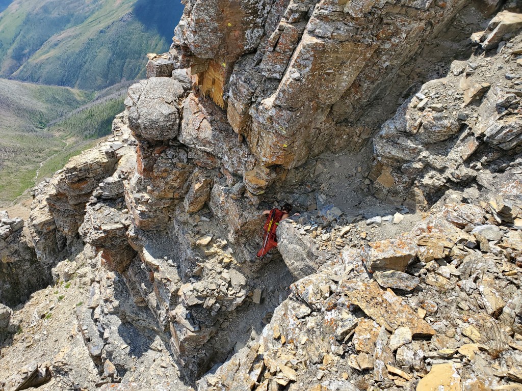
Notes: Loose exposed traverse (Cover photo to 3rd Edition). Fun little window just past traverse.
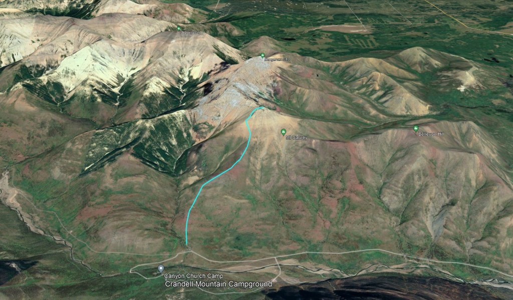
No GPS tracks are available. This is an approximate hand-drawn route only.
Trip Report
Mount Galwey is a quick, fun little one. The loose, airy traverse will likely turn back most hikers, but shouldn’t be a problem for parties comfortable on difficult scrambling terrain.
We tackled Galwey as the first in a very hot long-weekend in Waterton. The drive out from the Edmonton area occupied most of our morning, making this short trip a perfect choice for an afternoon start in 29C. We easily picked up the trail from Coppermine Creek picnic area and started up toward the peak.
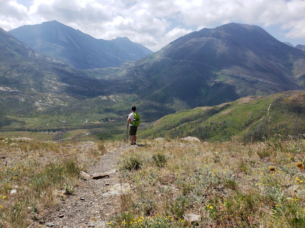
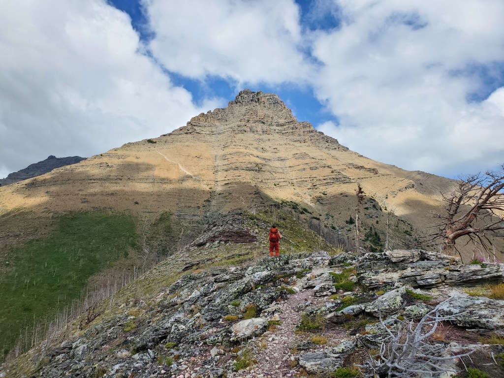
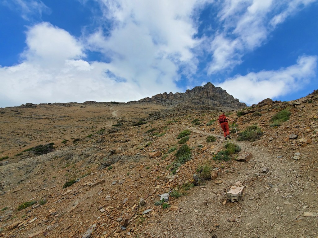
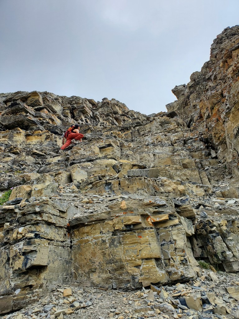
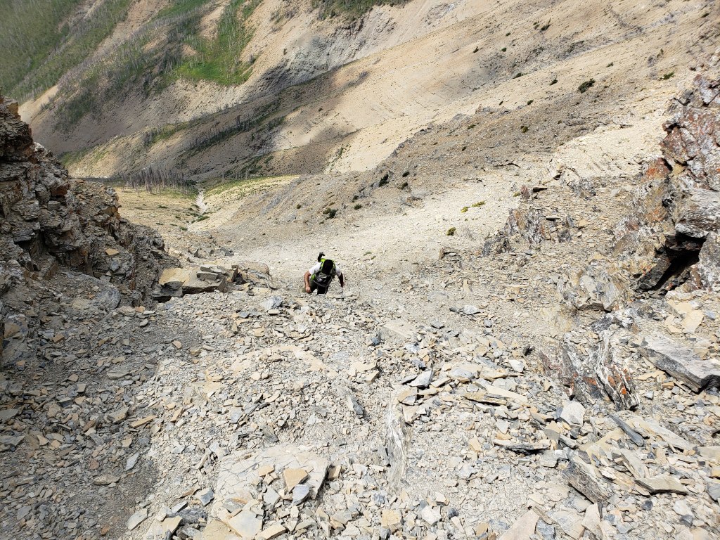
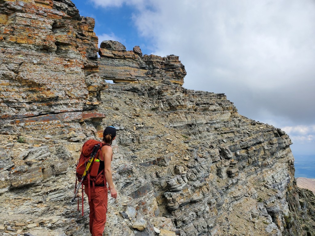
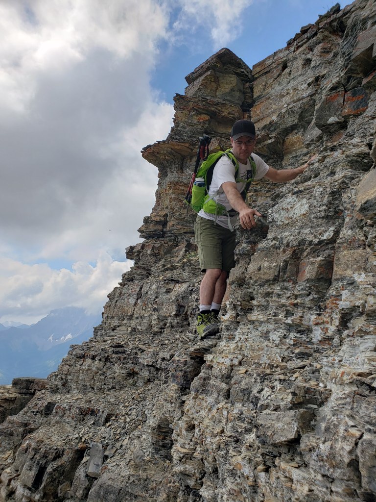
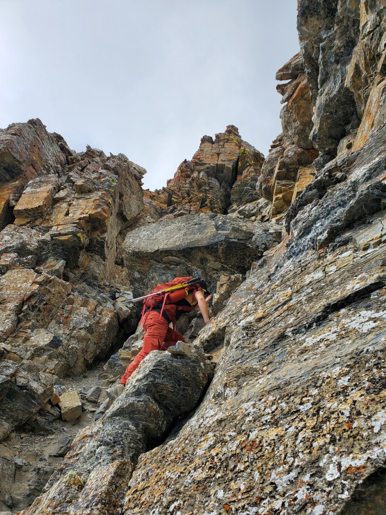
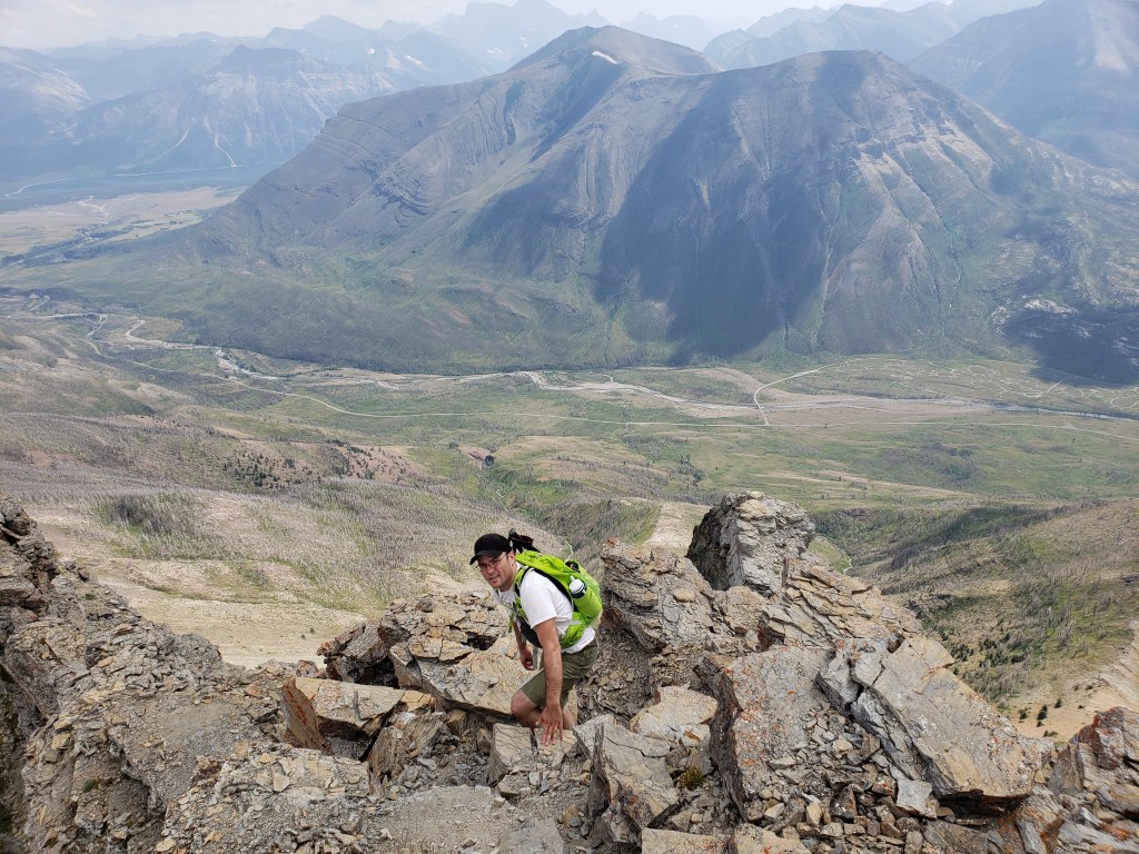
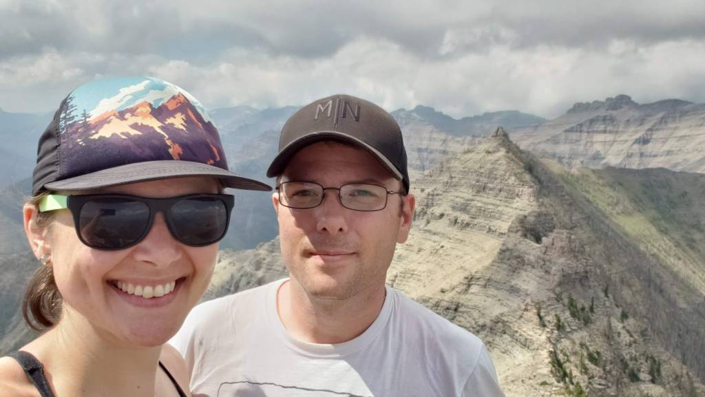
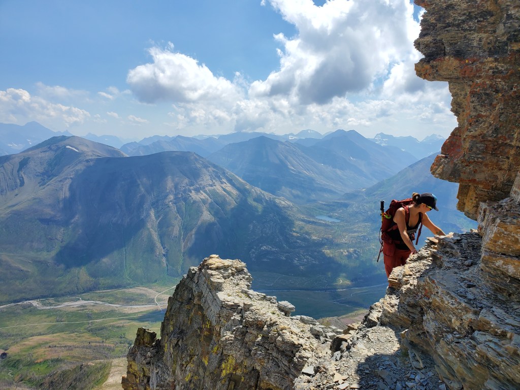
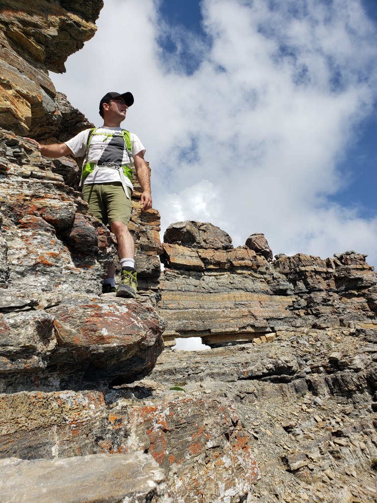
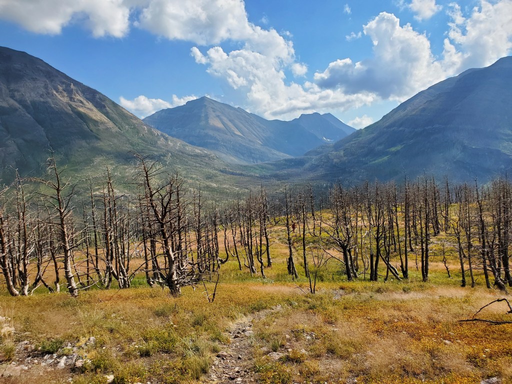
Damage from the 2017 Kenow Wildfire is evident throughout most of Waterton National Park. The impact to this scrambling route is low due to the minimal treed sections, but the views have certainly changed.Looking back across Blakiston Creek to the former Crandell Mountain campground. As of writing, this campground has not yet reopened since the fire.After gaining this shoulder, more of the route came into view. The peak lies ahead, the trail to which can be seen crossing the scree slope at the left before ducking behind the left ridge to the start of the scrambling section.As is often the case, foreshortening made the scree trail seem worse from a distance. It flattened out and became much easier as we approached it.The scree trail leads around the shoulder to the start of the scrambling. This first section is only moderate.Looking back as Dan follows through the moderate scrambling section.The trail seemed to disappear all of a sudden, but a glance to the left revealed the window, letting us know we had reached the start of the (dreaded) traverse.I always hope the difficult sections will feel more secure in person, but that was not the case here. The traverse is thin and loose. There is a band of slightly more secure rock, but nothing felt great. Keep high to find a more solid line.Okay, the fun window almost makes the traverse worth it.The chute leading to the peak lies between the traverse and the window. This part is loose, difficult scrambling. Unlike the traverse, however, the narrow chimney offers better stemming moves and felt more secure.Looking back as Dan tops out on the chimney, reaching the peak of Mount Galwey. Mount Crandell can be seen in the background.Victory selfie with the north summit of Mount Galwey in the background. Apparently the north summit is the true high point on the mountain, but that one doesn’t have a window.Downclimbing the chimney again. The chimney is short enough that we simply took turns climbing to avoid kicking rocks onto each other.Returning back through the traverse. The rock “wing” described by Kane can be seen in the foreground at center.Looking back as Dan completes the return traverse. If you compare to an earlier photo you can see how much higher this return line is, using the window as a reference point. The rock was much more solid along this higher line.We returned the way we came, reaching the parking lot in 4 hrs 45 min. Even on the Heritage Day long-weekend, Coppermine Creek has a good amount of water flowing, offering a cool spot to splash off and relax before heading back to the crowded townsite campground.
Mount Galwey is a difficult scramble, true to the grade. While I am comfortable with heights and not bothered by exposed scrambling, I don’t especially enjoy the combination of loose and exposed terrain, as found here. Overall I would still consider this to be a fun little trip.