Notes: Unofficial peak, commonly referred as Brûlé Mountain
Trip Report
While bagging the peak on Bedson Ridge two years prior, the highest point at the south end of the Boule Range caught my eye. A bit of asking around revealed that this high point, and the prominent mountain dominating the view from the Hamlet of Brûlé, is commonly referred to by locals as Brûlé Mountain or Roche Brûlé. The peak is not officially named, nor could trip reports or a route description be found. But, it looked like a clear ridge walk from the col.
A brave friend of ours asked to join us on our next trip and was surprisingly undeterred by my description of an unproven route up an unnamed peak. He was keen to get out and try scrambling! We agreed and were happy for Peter’s company.
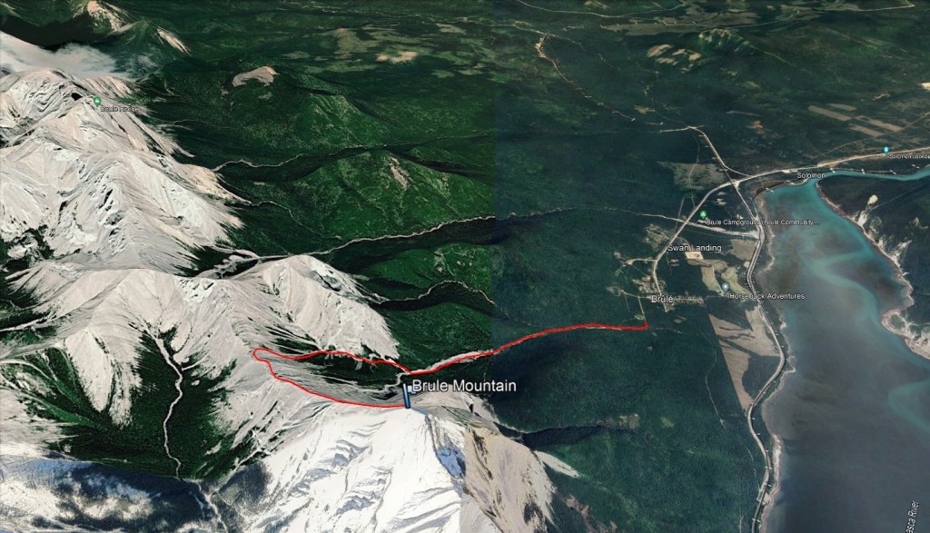
The street mapping for Brûlé tends to be outdated in many apps and the best option is the free online mapping through Yellowhead County (login as a guest). Access to Bedson Ridge is via Supply Creek, south of Brûlé. As with our previous trip we parked on 2nd St and then continued walking south along 2nd St beyond its gate.
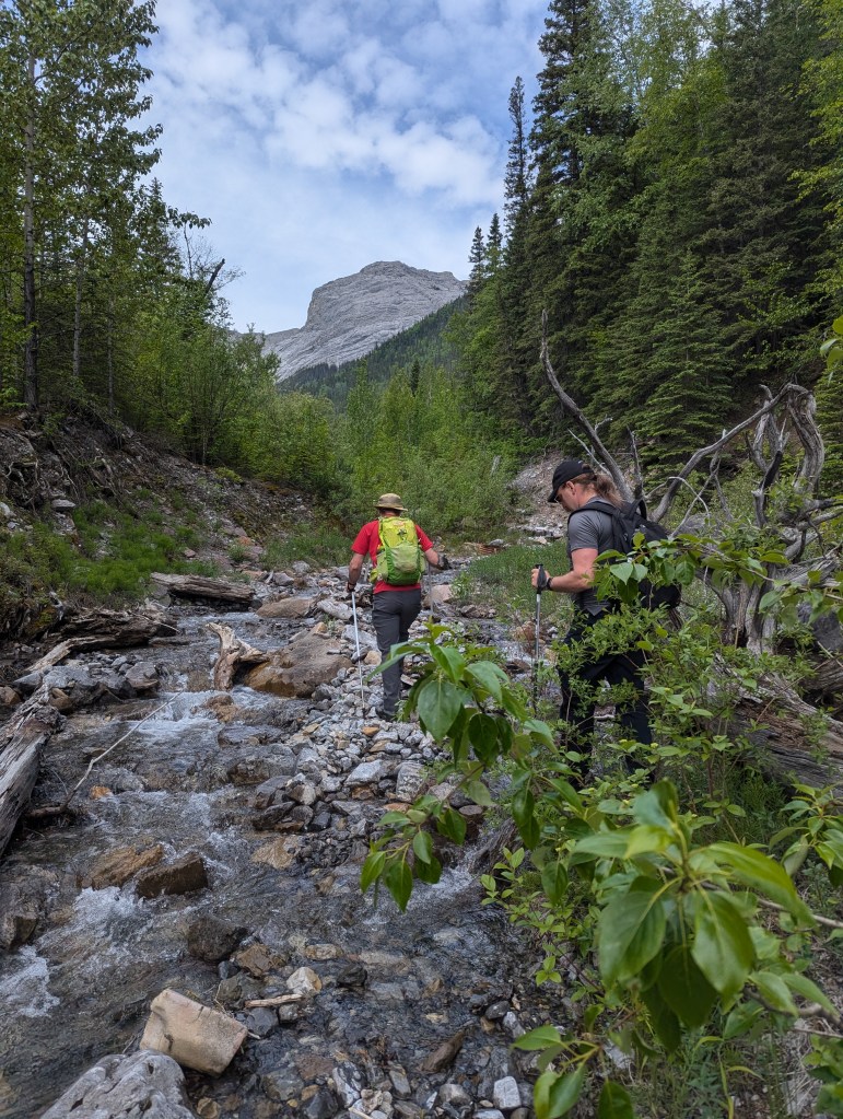
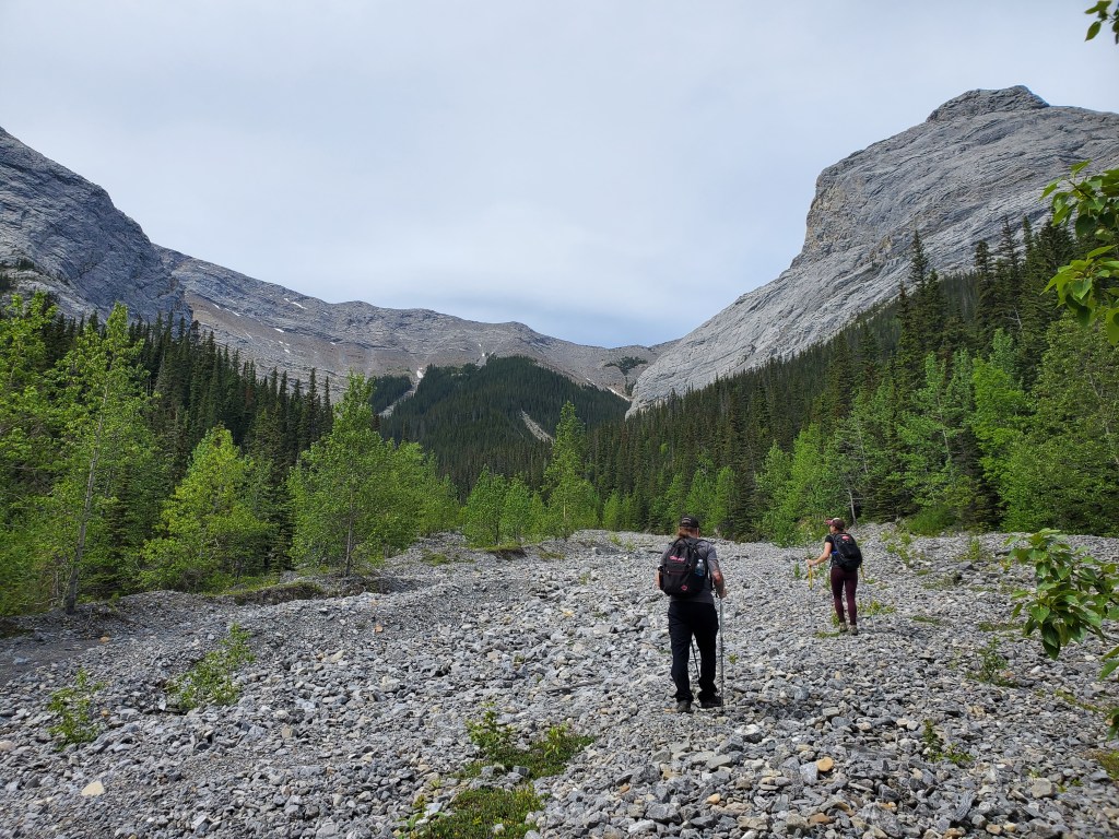
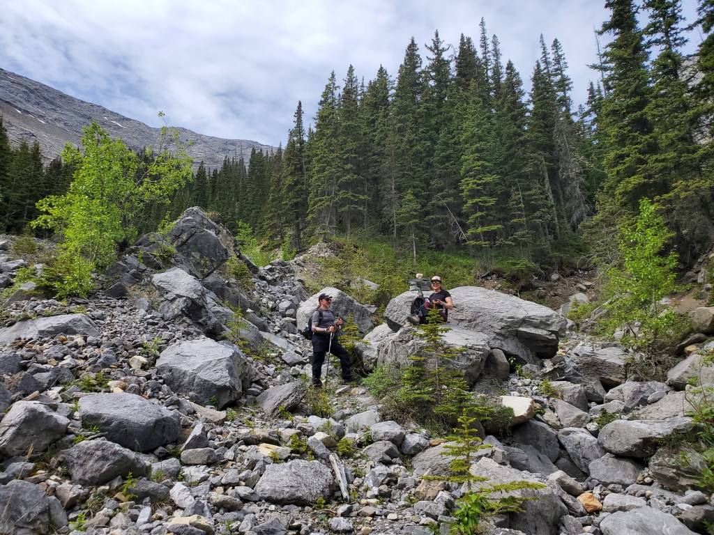
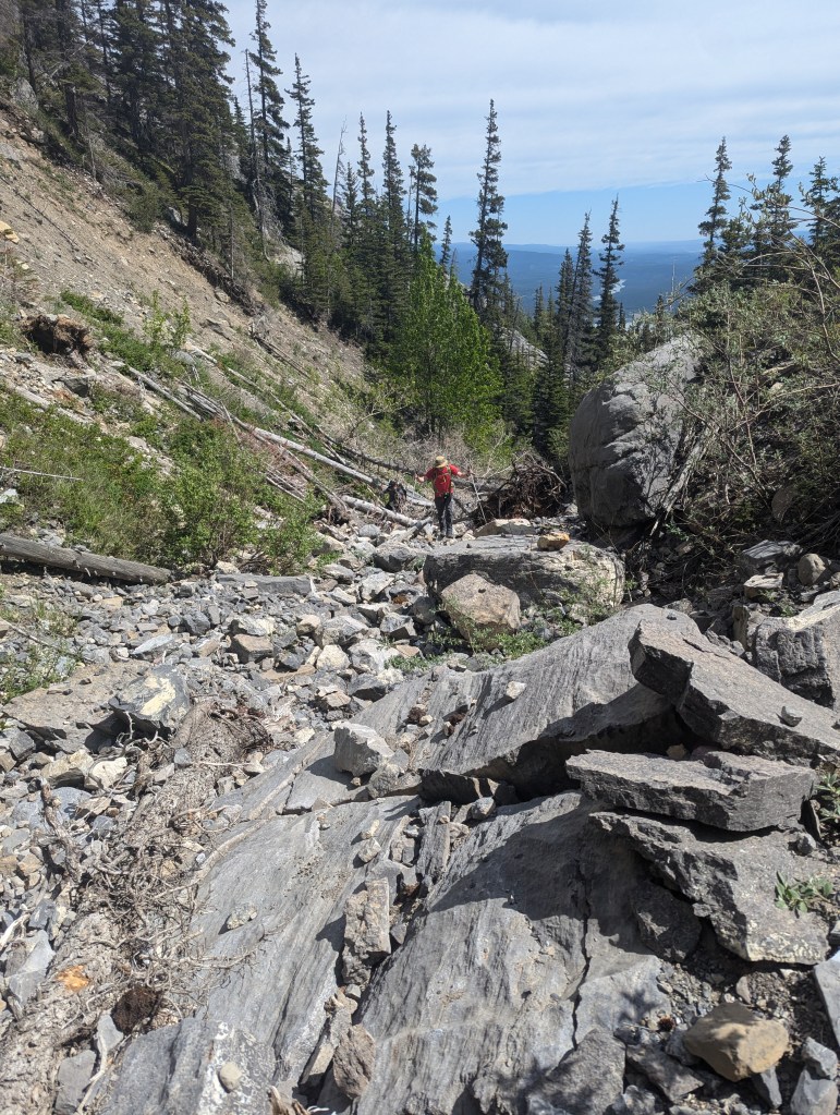
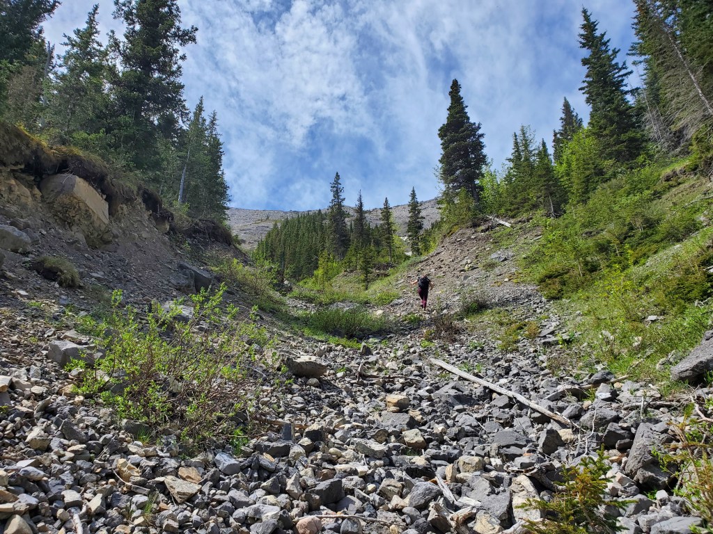
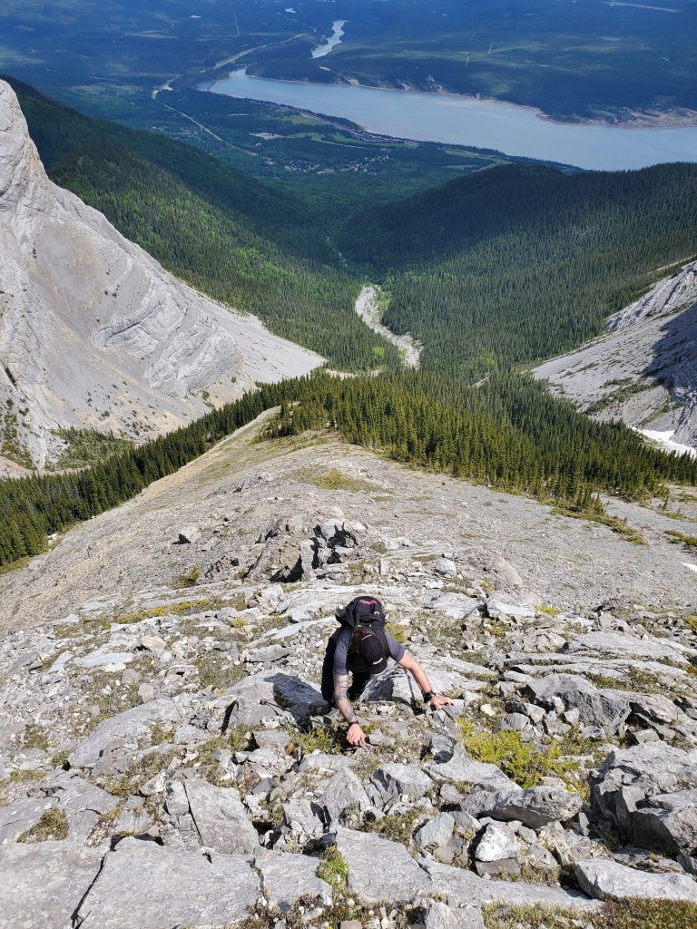
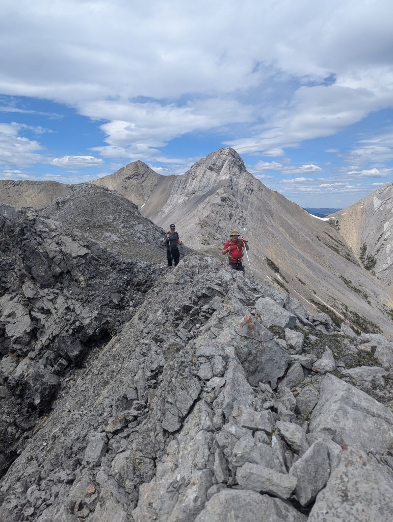
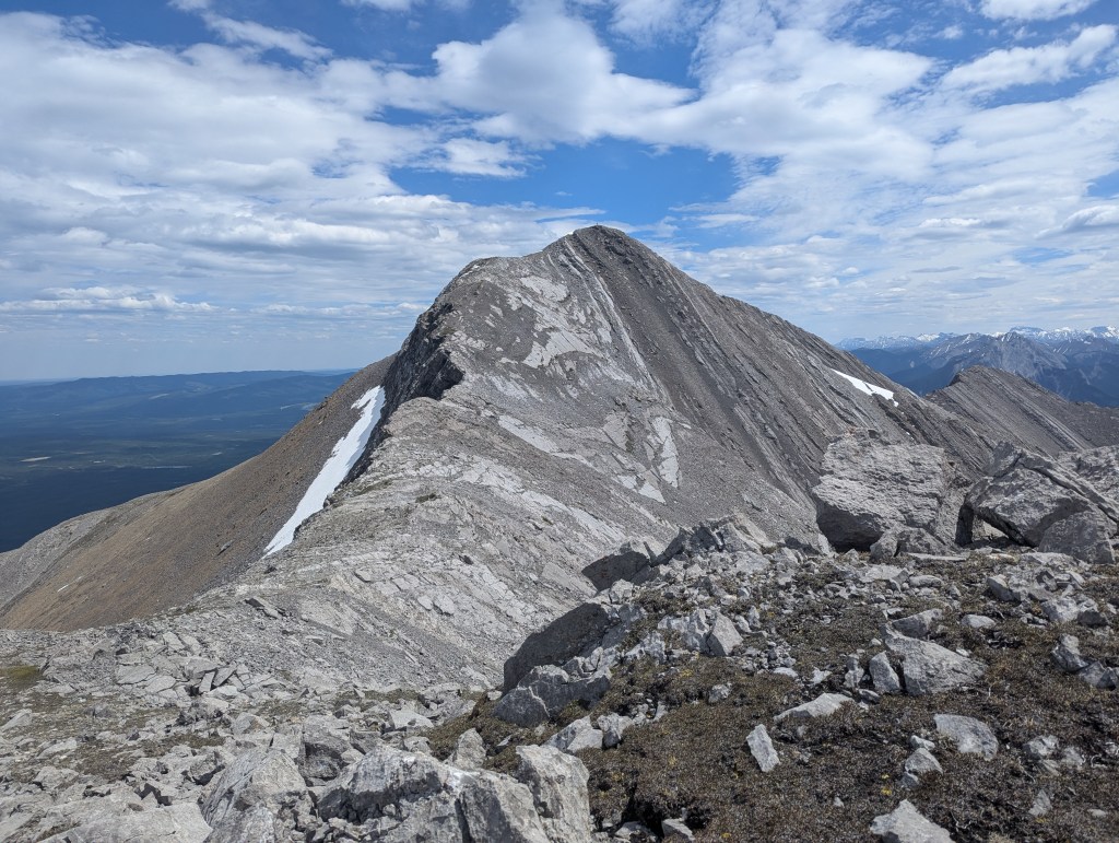
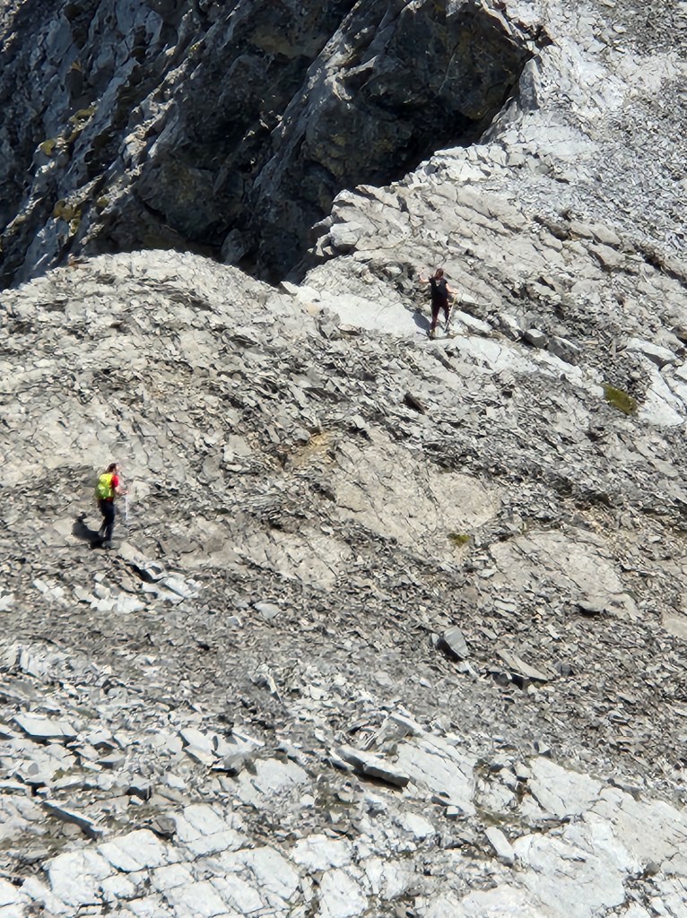
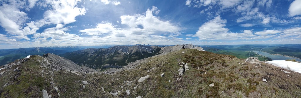
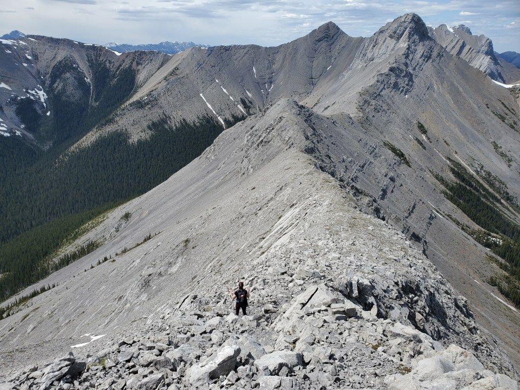
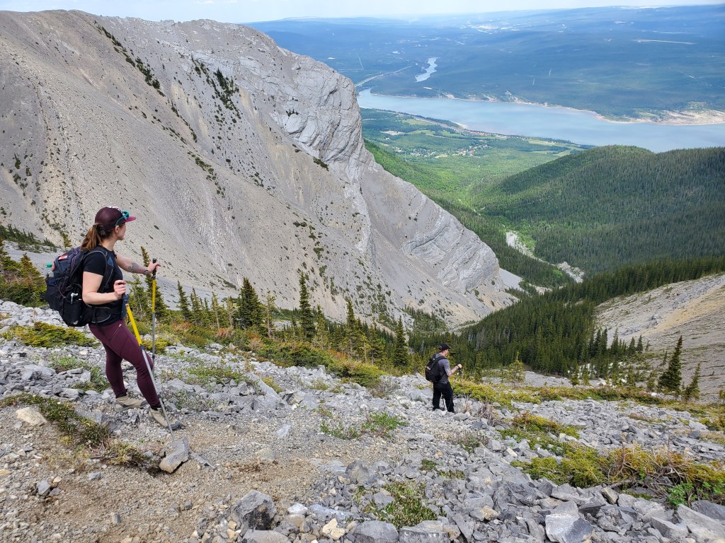
A trail appears just before the creek. Last time, we missed the trail and began the rock-hopping up Supply Creek from here. This time we ducked into the trees and followed the well-worn trail about 100m, where it opened up on to a vehicle path with signage visible to the left marking the Hamlet of Brûlé’s official water supply. Either way, the approach is a mix of rock-hopping and bushwhacking with a few game trails to aid progress, but our ankles appreciated the short stretch of softer terrain on both ascent and descent.The first part of Supply Creek was quite bushy, but it eventually widened into a flat gravel bed. Significant braiding offers a tradeoff between bush and stream crossings to your liking; trend upstream to stay on course.Looking upstream at the flat gravel bed area, with our objective out of view to the left. To gain the ridge we will first follow a drainage behind the large prominence at the right which joins this primary watercourse.We reached our turn-off in an hour. The drainage was well-marked with cairns, plus some excellent flat rocks for a snack break. We’ll head off to climber’s right from here.After a good break we continued up the drainage. This section has more boulders and debris, but was never beyond easy scrambling.The drainage opens up near the top and the ridge is most easily gained by going directly up. This last push is loose and tedious, but brief.We veered to climber’s left on ascent, aiming to avoid the tedious terrain from our previous trip, but it was no better and may have bumped the grading for this day up to moderate. Our ascent drainage can be seen below to the left. We’ll take a route inline with the drainage on our return trip.Gaining the ridge and looking back (north). We ascended from the right in this photo. If continuing to the true high point of Bedson Ridge we would descend down the slopes to the left. To reach the peak of Brûlé Mountain we are instead continuing south along the ridge.Looking south, the route is obvious. The peak is the high point furthest back. A few humps are passed along the way, but the elevation gain/loss isn’t as bad as it looks.Looking back as Dan and Peter follow me along the ridge.Peter joined us as far as the last hump before the peak. This shot is looking south at the final push to the summit. Another scrambler can just be seen standing at the peak. We were surprised to encounter anyone else out there on such a seemingly unknown route!Peter grabbed a shot of us working our way through the slab. There were maybe two moves of moderate scrambling, but the route unfolded pretty much as expected.Summit panorama. Sorry, but this will never get old!Looking east over the Hamlet of Brûlé and Brûlé Lake from the peak of Brûlé Mountain. The summit register held a few wet, mostly blank pages of paper. A few entries could be made out from 2005, 2007, 2018, and 2019, all scramblers from local communities. We returned the way we came, this time keeping to a more direct descent line into the drainage.The descent into the drainage was just as loose as I’d remembered from the previous trip. We minimized rockfall hazard by spreading out and walking abreast. I wouldn’t try this slope while another party is present and helmets might be wise.As tired as the boys claimed to be, they couldn’t resist one fun little rock slide on the return route. This feature is easily bypassed to climber’s left.
The final half hour of rock-hopping and bushwhacking along Supply Creek grew tedious by the end of the day. We were delighted to finally reach our vehicle, in just over 7 hrs round trip. Overall this is a fun little peak with fantastic views and no crowds, worthy of a daytrip. Peter enjoyed his first day out and will no doubt crush many more!