Notes: Mostly walking on fire road. Road can be biked as far as Signal Campsite. This route will have been impacted by the Jasper Wildfire in 2024.
Trip Report
Signal Mountain is great option to keep in the back-pocket for a poor weather day. Most of the day is spent trudging up an old fire road without views. But, the dense, uniform tree cover provides some shelter from the elements.
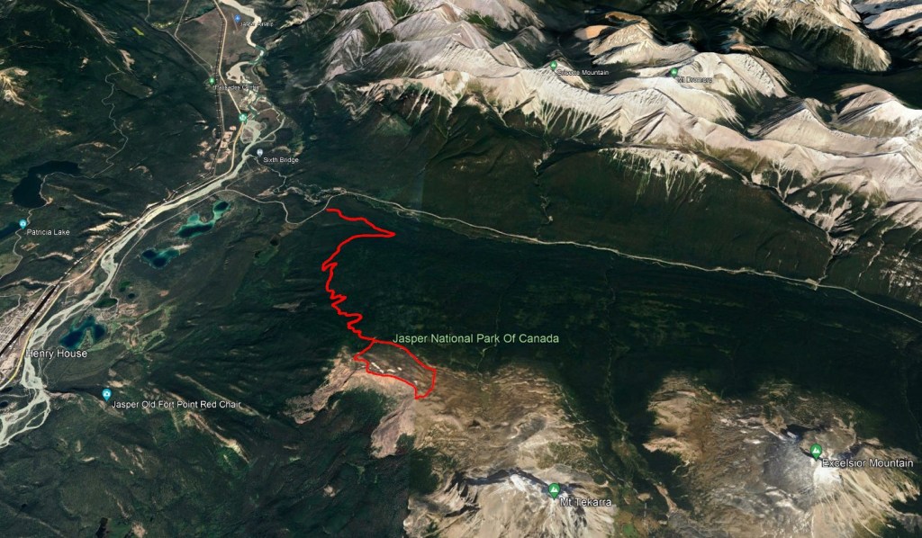
The route is shared with Skyline Trail, starting from the Signal Trailhead. The small parking lot for this popular backpacking trail tends to remain full throughout peak hiking season, but another lot is available a few hundred meters further down the road, the Maligne Canyon overflow lot. Overnight parking is not permitted at the overflow lot.
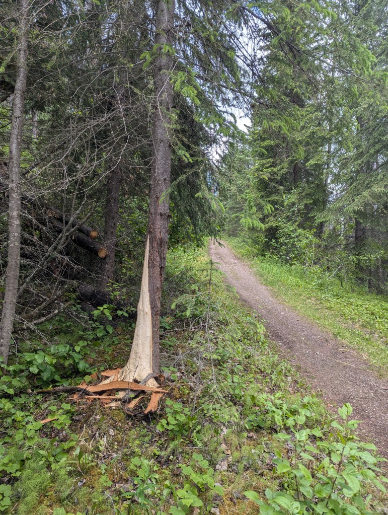
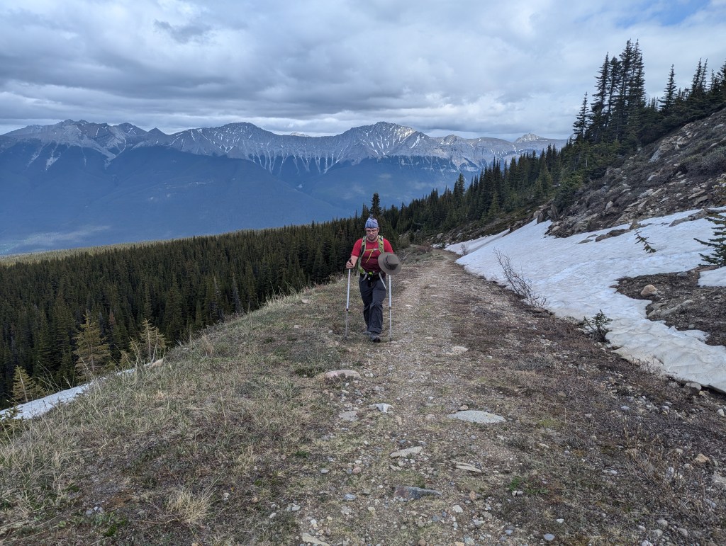
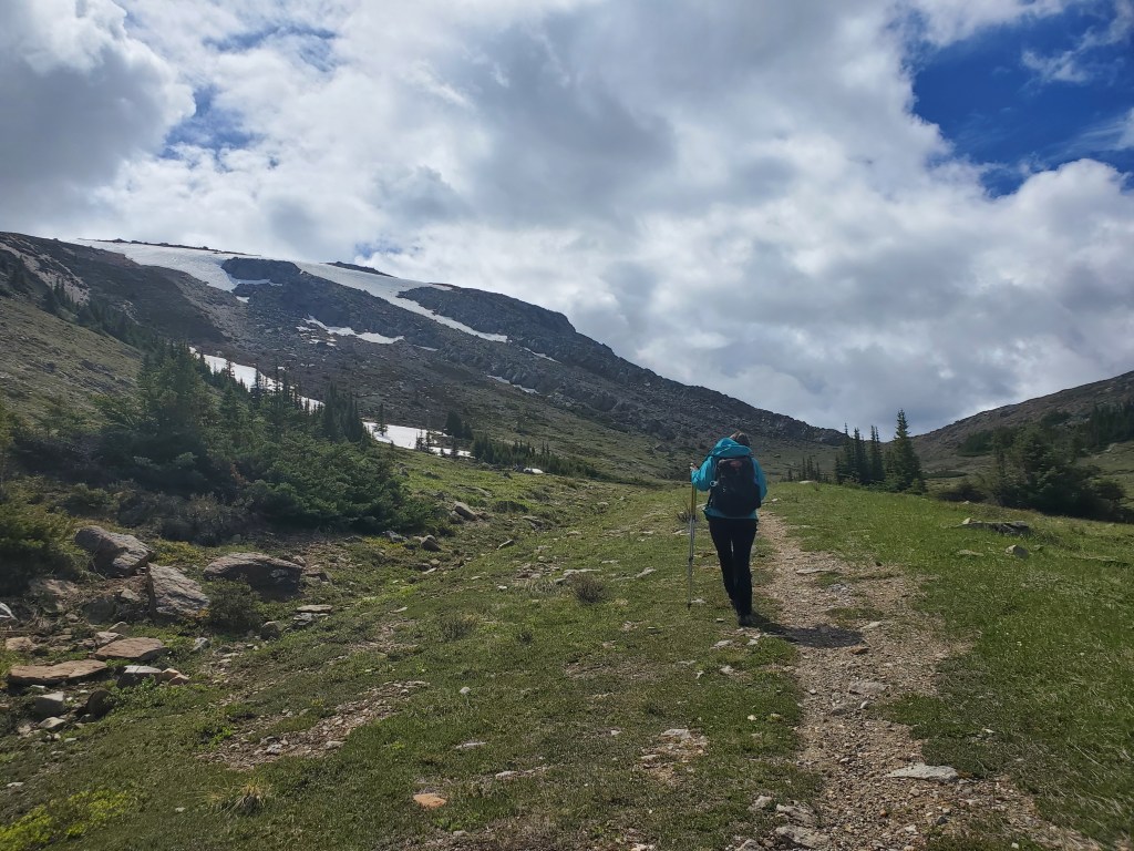
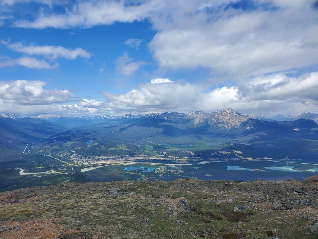
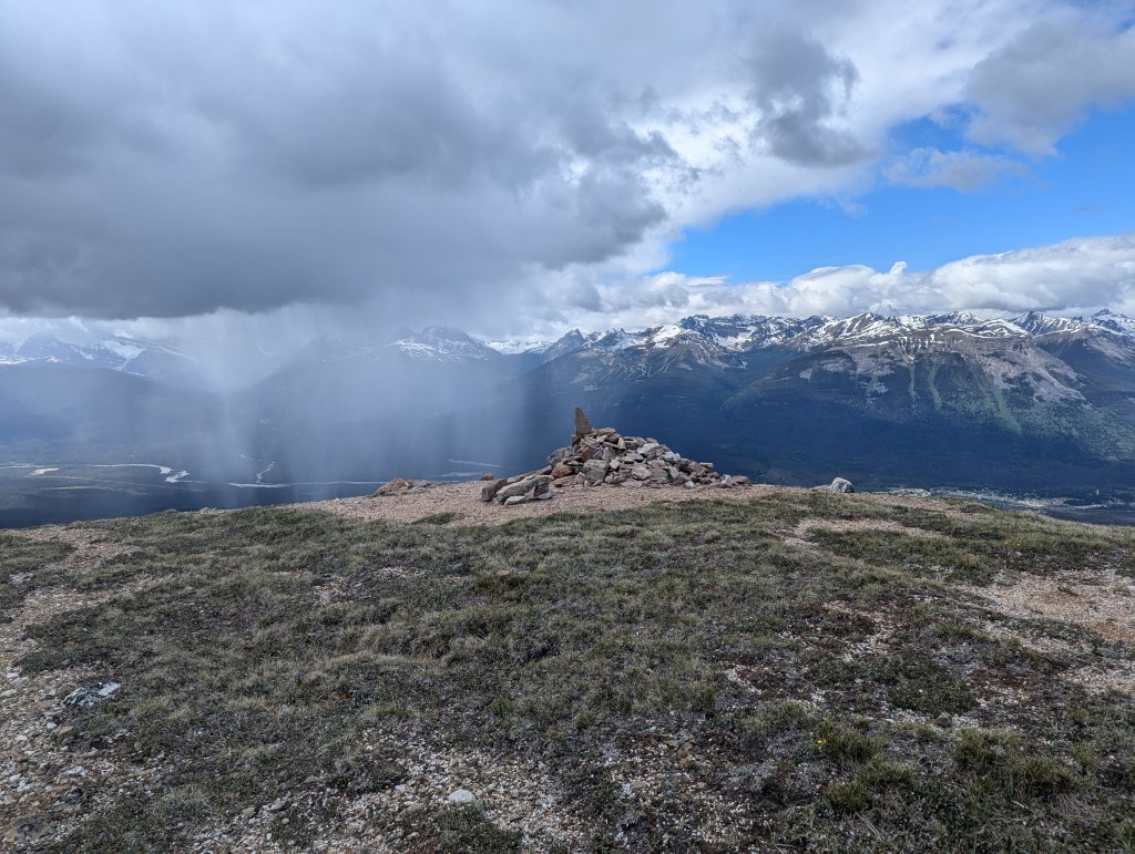
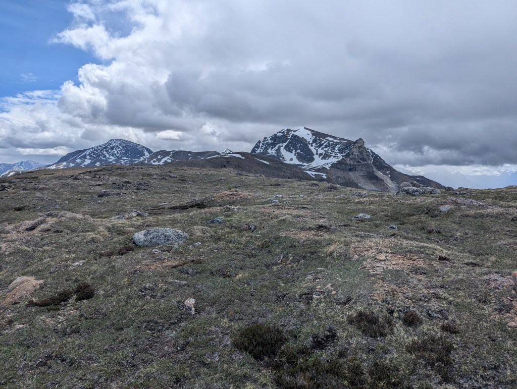
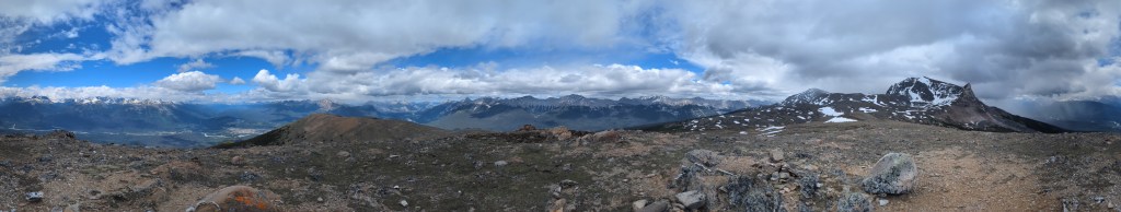
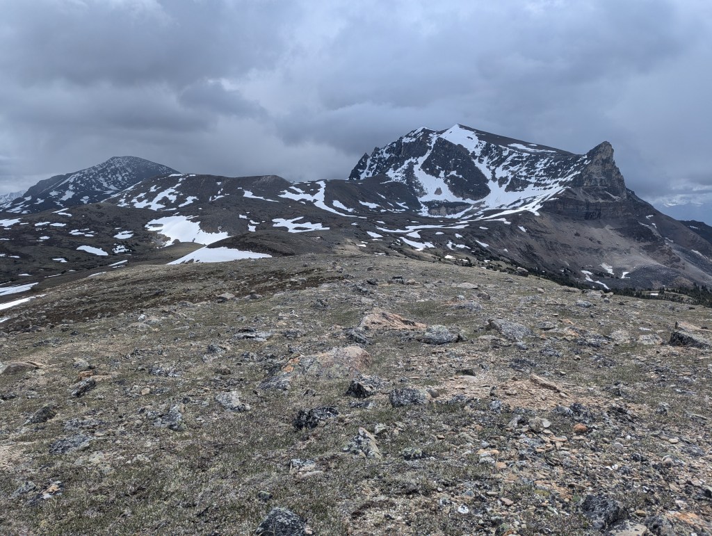
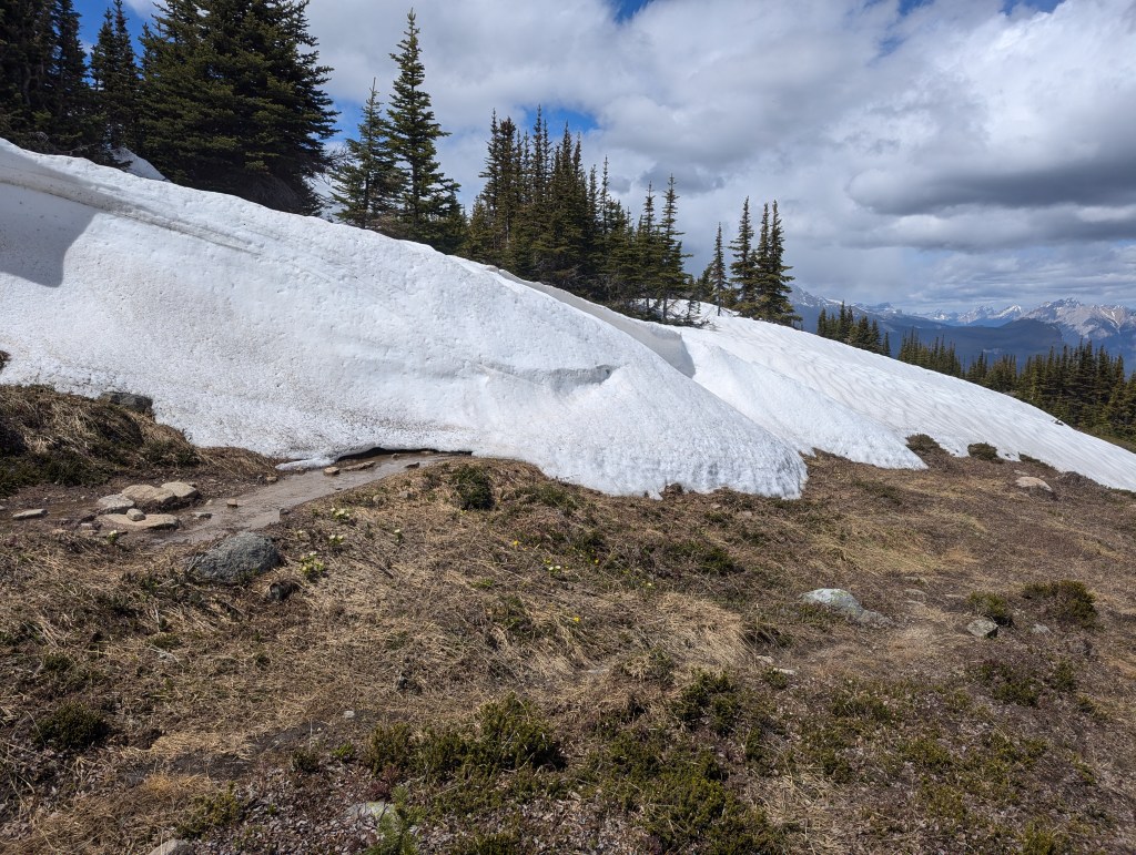
We noted significant evidence of a bear along the first few kilometers of trail, including this stripped off section of bark. Not pictured is the generous spread of fresh scat along the trail. We also spotted what looked like a recently eaten patch of dandelions.Signal Campsite is reached in about two hours, or 8.4 km. From the campsite, we hiked toward the lookout and then followed the ridgeline to the peak. It is also possible to instead stay on Skyline Trail for another ~1.2 km before angling up toward the peak. The latter alternative is less scenic, but sheltered by the ridge.Just before reaching the lookout, we left the trail and angled left toward the alpine meadows above. Looking northwest to the Jasper Townsite. The obvious peak at the right is easily recognized as Pyramid Mountain.The high point above the lookout is a false summit only, but boasts a larger summit cairn than the peak itself, oddly. We spotted a weather system moving directly toward us here and could feel the wind picking up as it approached. Dan, having tweaked his ankle the previous day, chose to retreat back to flat, easy terrain. I put on my coat and continued on along the ridge to quickly tag the peak. The true high point can be seen at center, looking southeast. It is about 1.1 km ahead, but only 30m or so higher. Seen to either side of it are Excelsior Mountain (left) and Mount Tekarra (right).I reached the peak just in time to watch the weather system pass behind Mount Tekarra and narrowly miss me. The ski runs on Marmot Mountain can be seen behind me, to the west.Summit panorama.Another shot of Excelsior and Tekarra, to the southwest, still shroud in brooding clouds and rushing wind. I chose a more sheltered path for the return hike, dropping down to Skyline Trail. This end of Skyline Trail has decent cell coverage, making it easy to coordinate a meet-up with Dan.This section of the trail tends to hold snow much later into the season than the windswept ridgeline of Signal Mountain. The trade-off to seeking shelter from the wind was having detour around chest-deep snow drifts.I found Dan waiting at the bike rack near Signal Campsite, as arranged. We trudged back out along the fire road, reaching the parking lot in 5 hrs 20 min.
In inclement weather, Signal Mountain provides a means to get outside, stretch the legs, and even bag a peak. There is no variety to the route along the fire road, but the tree cover offers some shelter. The view at the top is still worthy of the trip up. On a day with better conditions though, I would tend to choose something like neighbouring Roche Bon Homme.