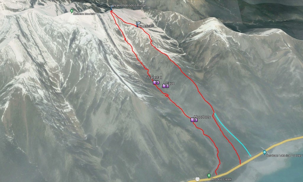
Notes: Ascent via ridge, descent via creek. Creek includes a cave, waterfall, and hoodoos. Save for later in the season.
Actual route taken shown in red. Possible alternate start shown in teal.
Trip Report
Hoodoo Ridge makes for a fun day of moderate scrambling, very similar in feel to neighbouring Humpback Ridge. Unlike it’s neighbour, however, a loop route leads down through Hoodoo Creek with it’s hard-packed mud-slab terrain and less enjoyable scrambling. The cave, waterfall, and hoodoos do nearly make up for it. This objective is best saved for later in the season once all lingering snow has melted and water levels have declined.
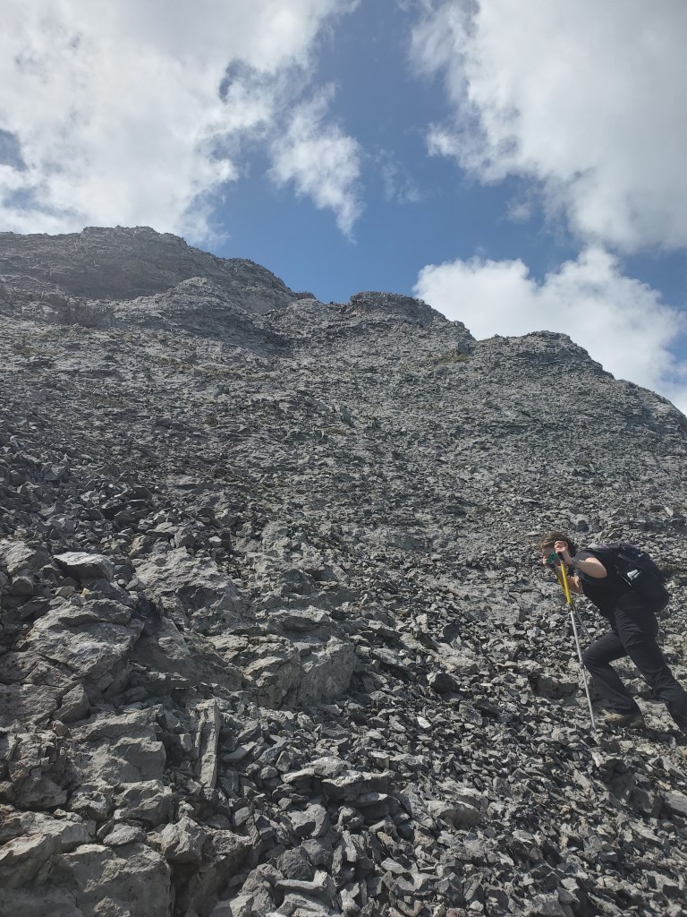
The parking for Hoodoo Ridge is the same as for Hoodoo Creek. Improvements along the corridor in 2022-2023 saw parking lots and outhouses added along the David Thompson Highway, including for this trailhead. Pawlyk describes the start simply as heading up from the highway. Once on the ground, the ridge can be seen to have two toes extending to the highway, the right of which (east toe) is less heavily treed. If walking from Hoodoo Creek, as we did, the left-side toe is the first line encountered and the line we took. We found a short traverse about 45 min up to join with the main ridge without losing elevation. I suspect though that the right-side toe was the intended route.
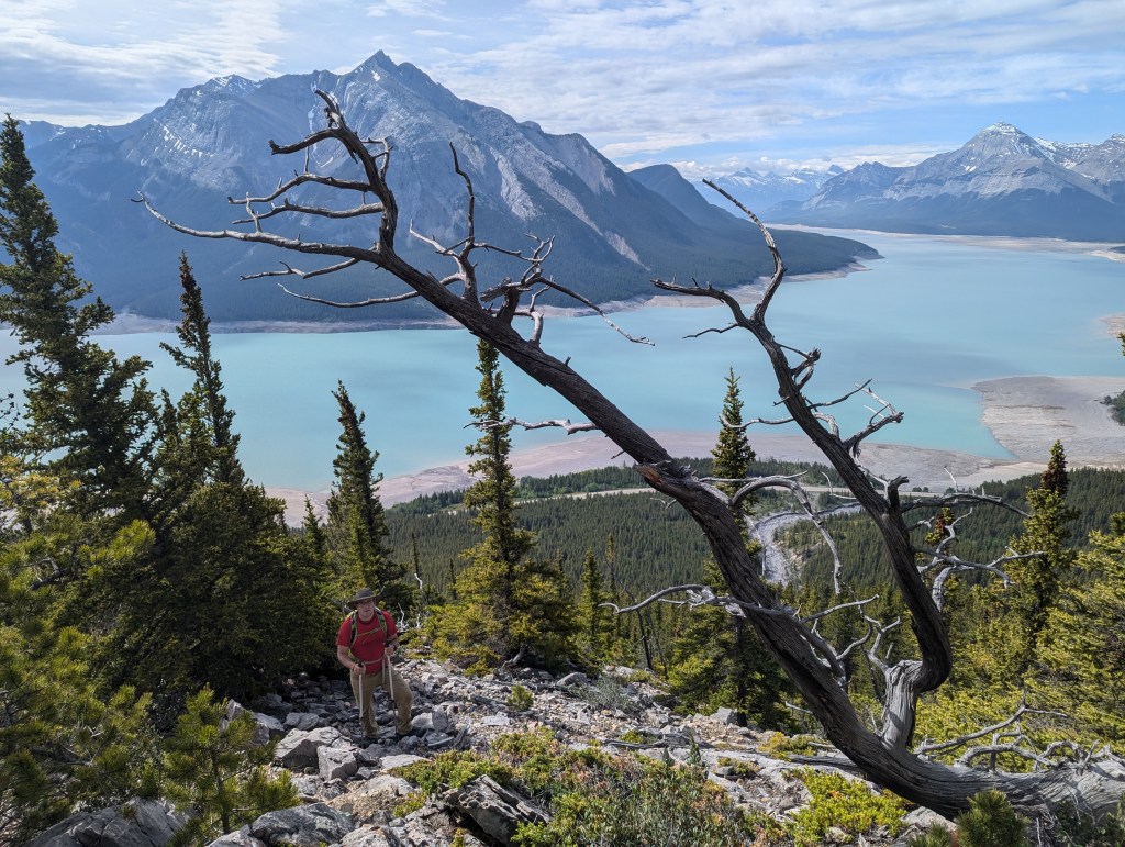
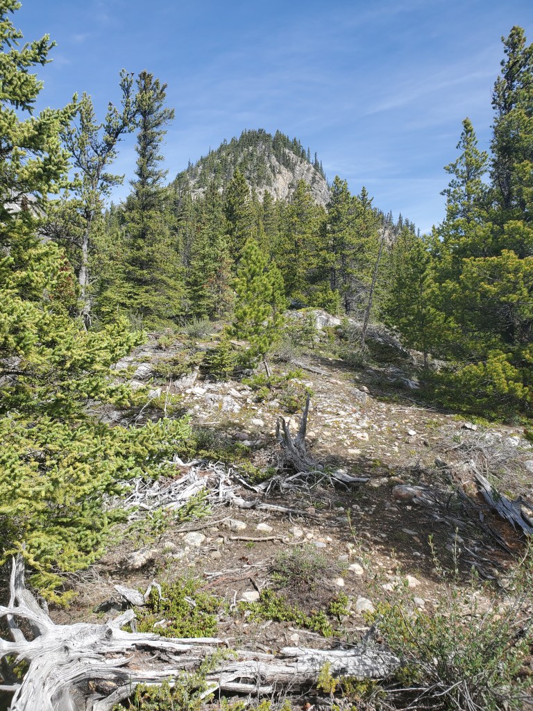
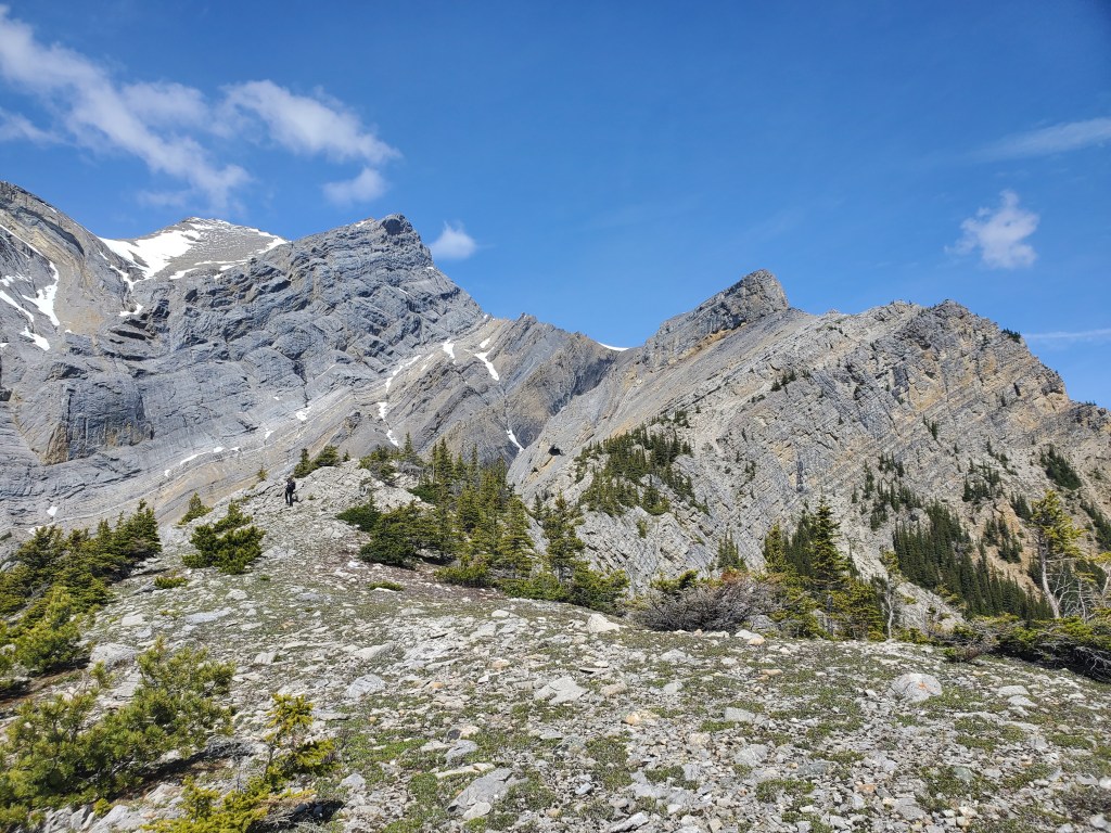
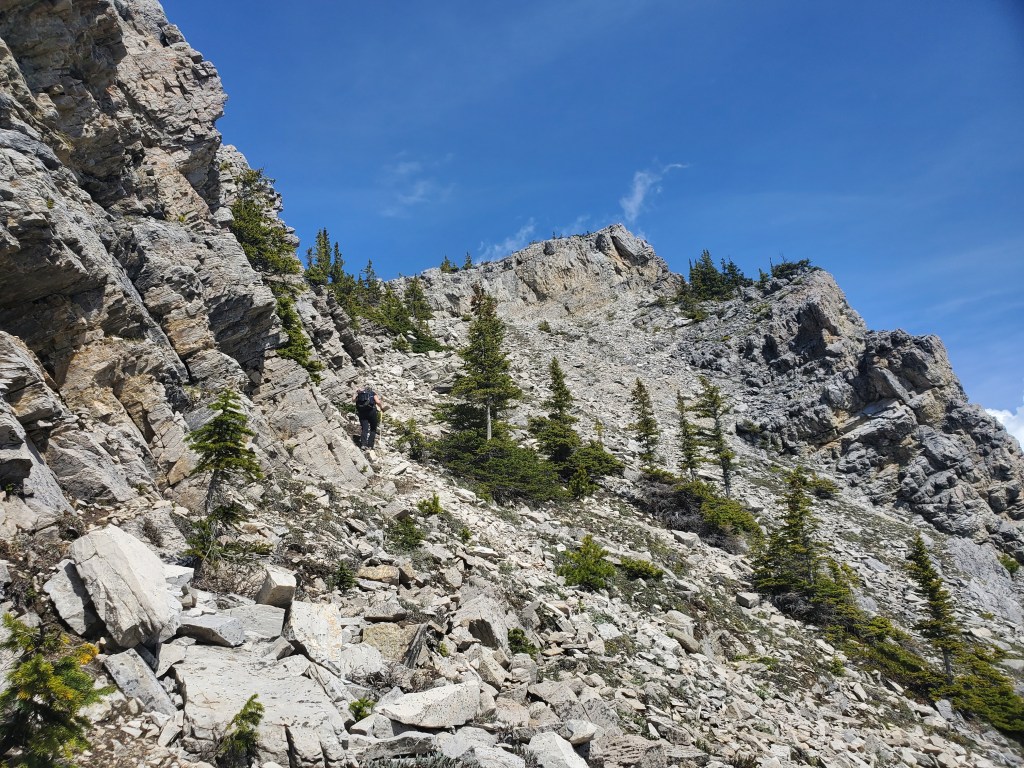
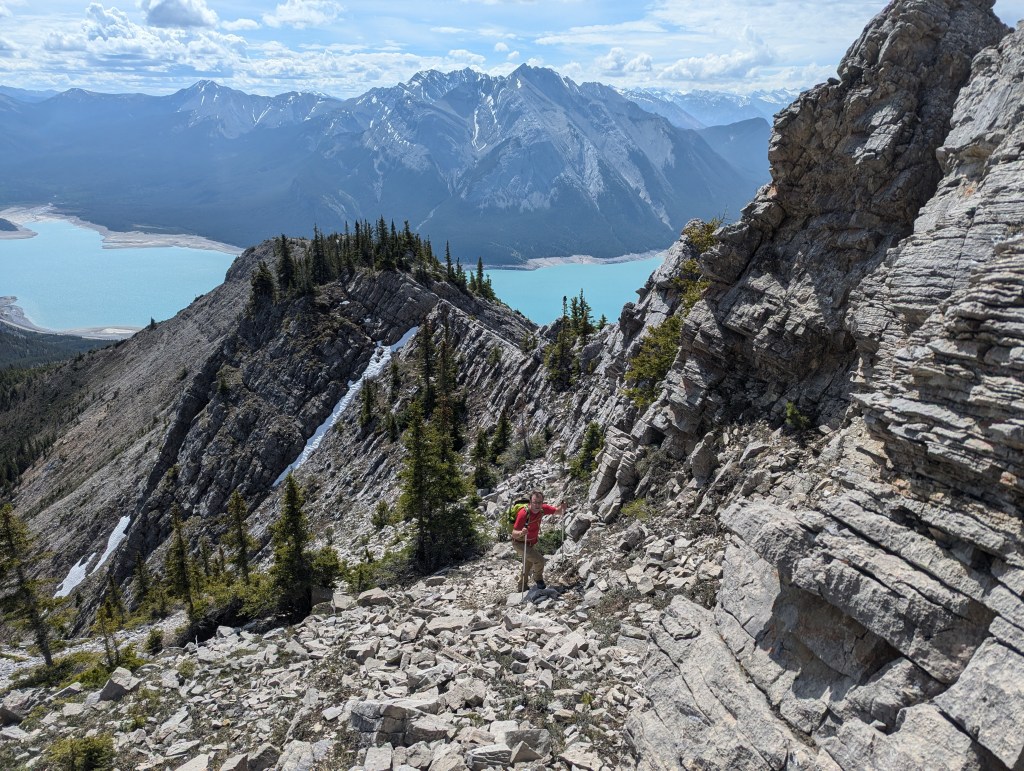
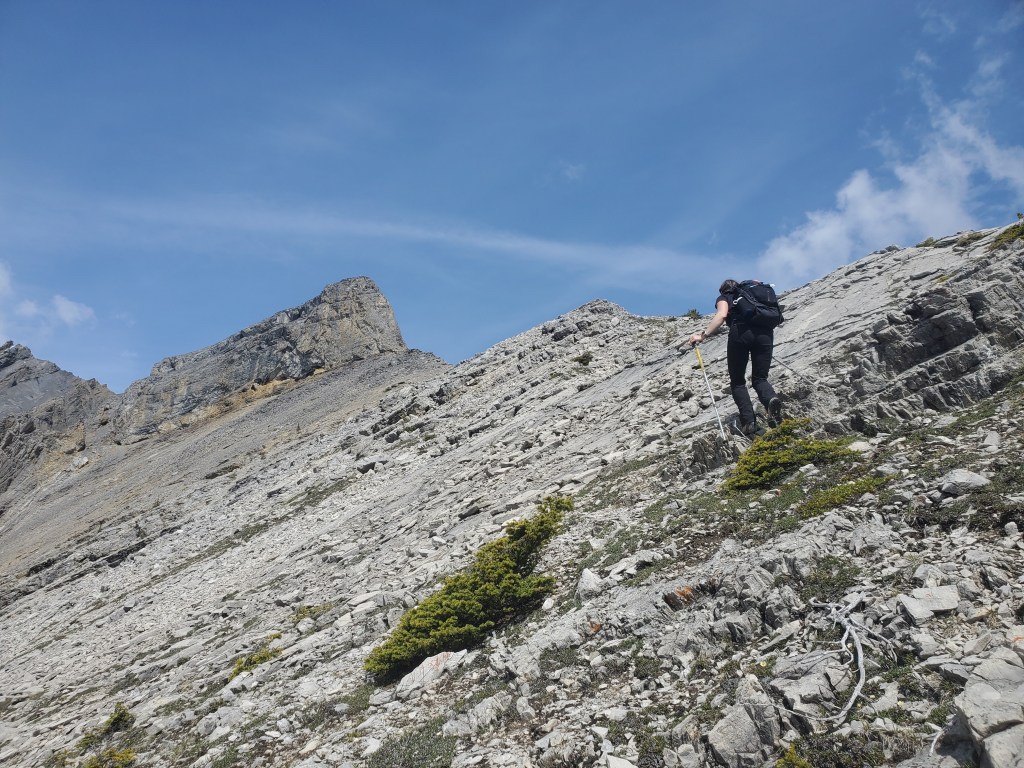
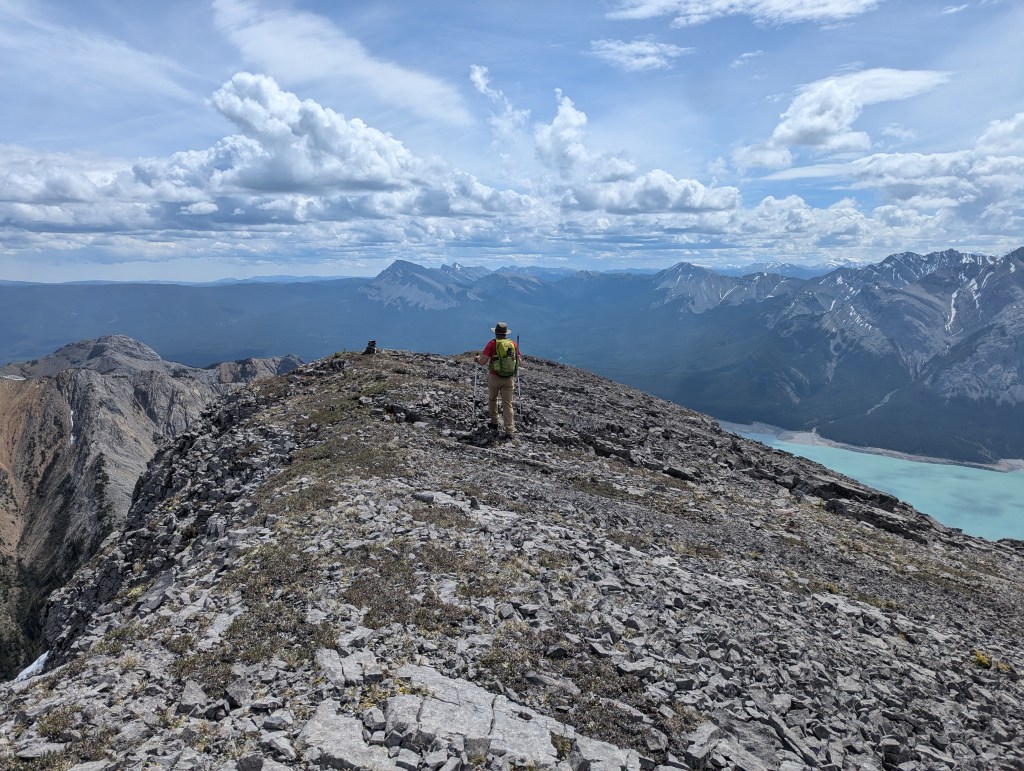
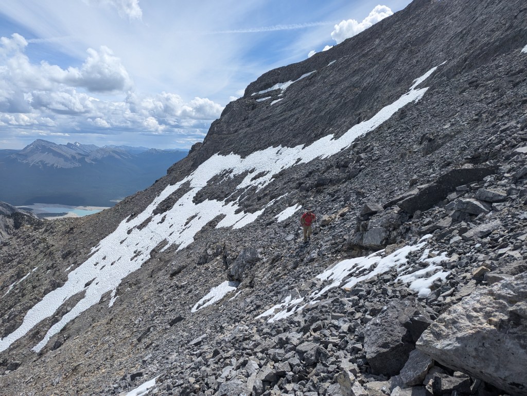
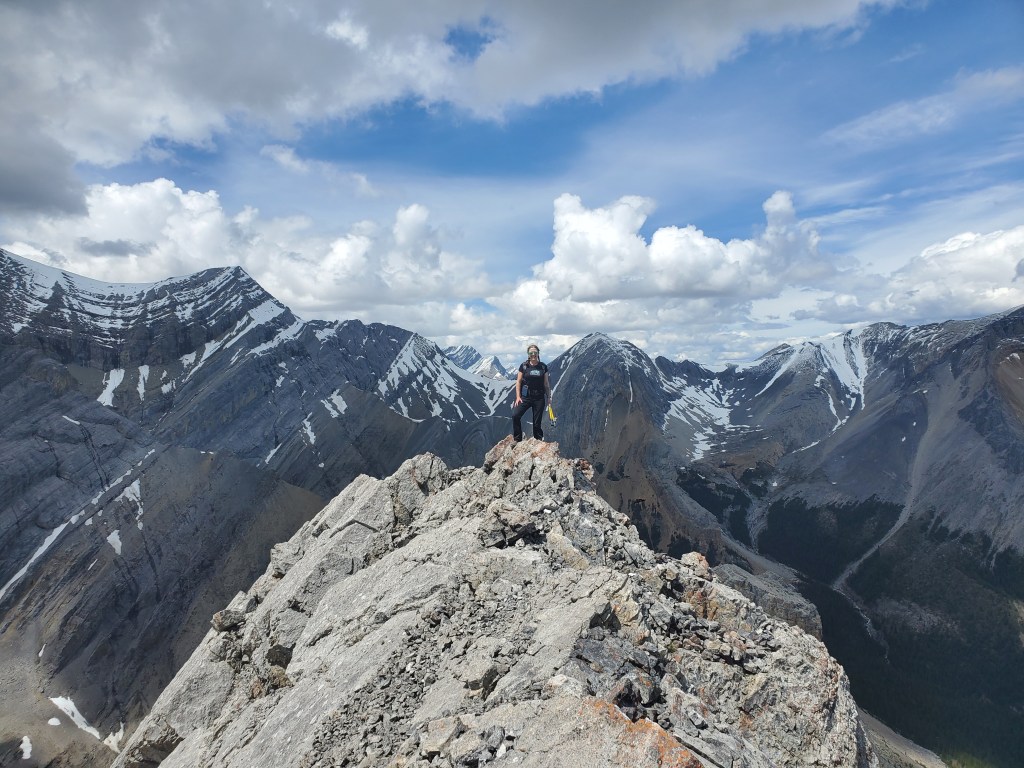
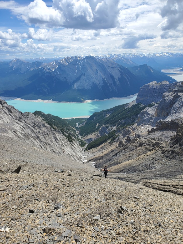
Whichever path is taken to gain the crest of the ridge, views soon open up across Abraham Lake and Mount Michener (center-left). The bushwhacking is relatively thin by either line.Looking to the rolling ridge ahead, reminiscent of neighbouring Humpback Ridge.Eventually the treed ridge opens up to slab. Looking ahead, our route trends to the right, bypassing the large pinnacle at center-right, and continuing to the peak (still out of view). We’ll eventually return down the drainage to the left of the pinnacle. Oddly, the pinnacle, the obvious highest point of the ridge, was not chosen as the peak of Hoodoo Ridge. We popped up onto it anyway while passing by, wrangling with some difficult moves on steep, loose, gravely slab. Avoid if wanting to keep the challenge moderate.Portions of the slab can be easily bypassed on a faint trail to the right. Looking ahead, we will regain the ridge at the cluster of trees in front of me.Looking back at the way we came. The snow seen here was tough to assess from our ascent route, so we detoured to the ridge crest to avoid it to the right (climber’s left). The scrambling was never beyond moderate.Continuing ahead on slab, the pinnacle looms closer. Before heading up the pictured slab, we explored to climber’s right for a bypass but were met by steep cliffs and no obvious way past.
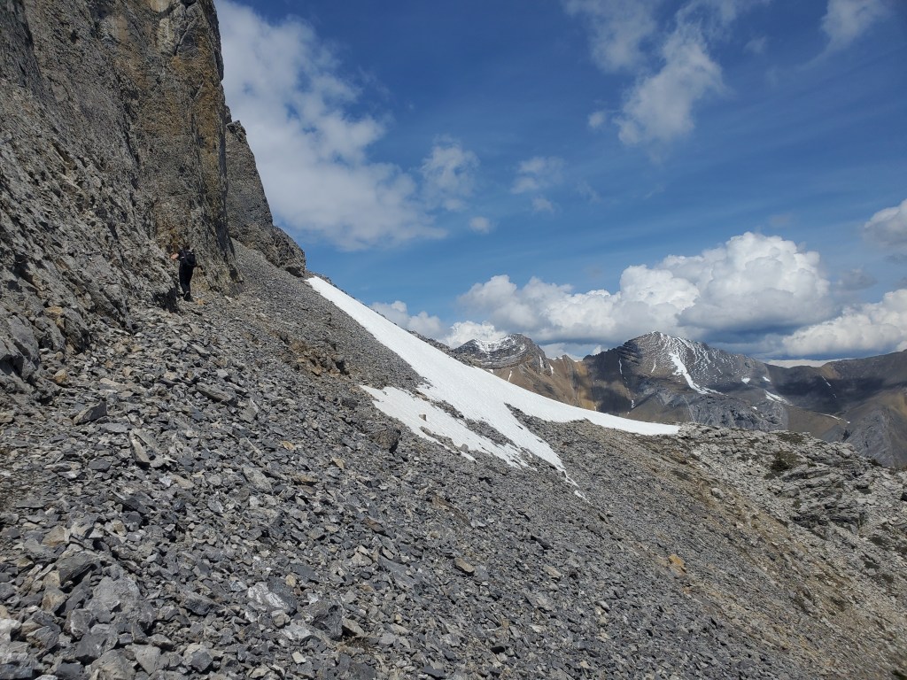
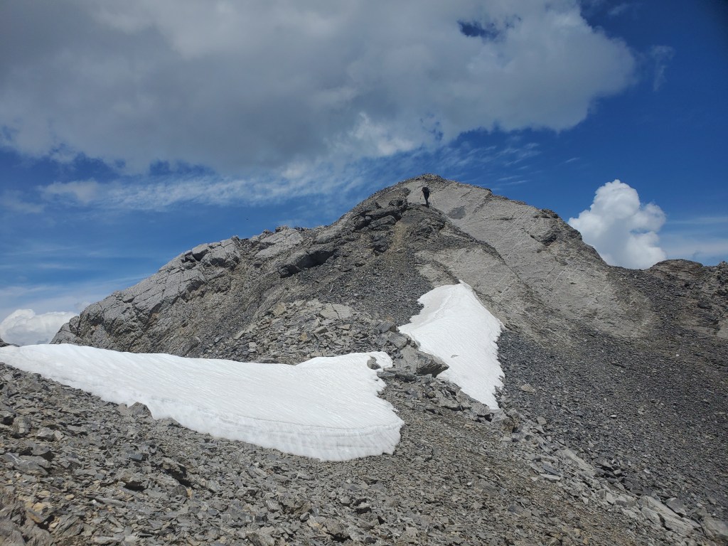
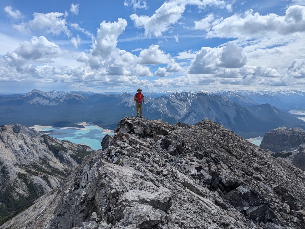
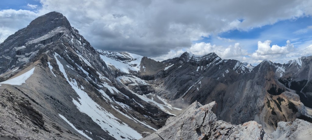
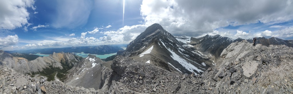
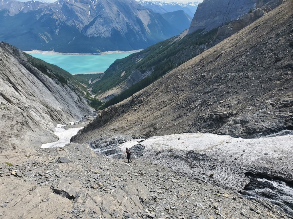
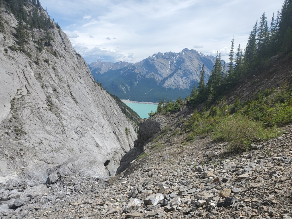
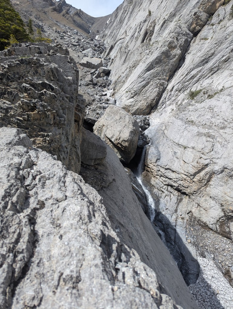
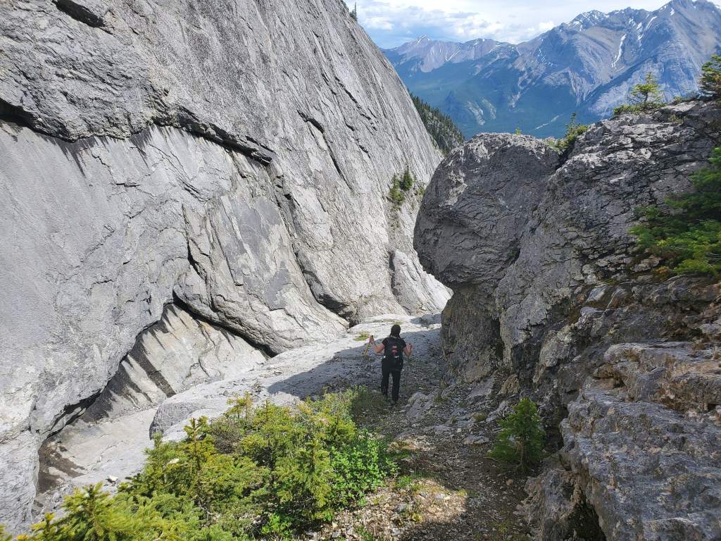
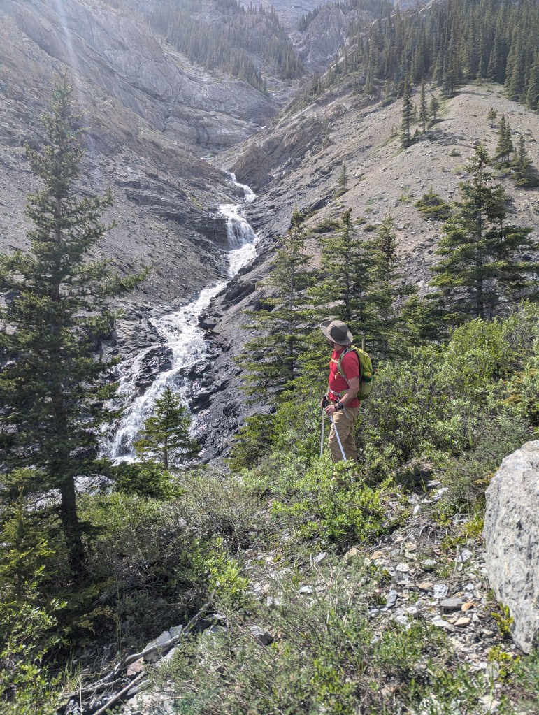
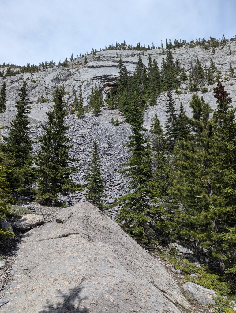
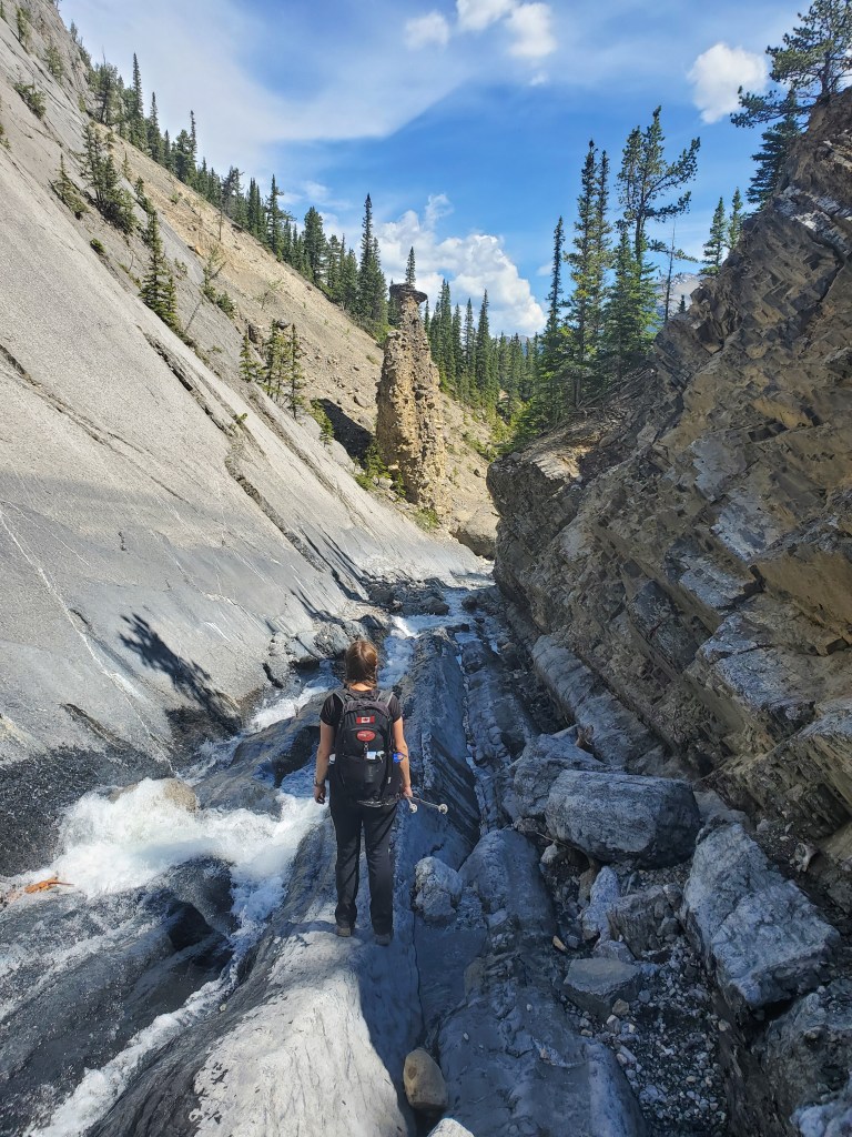
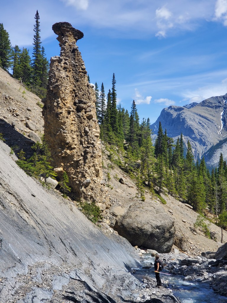
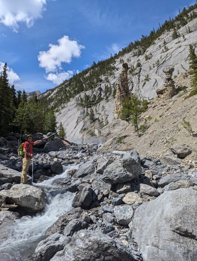
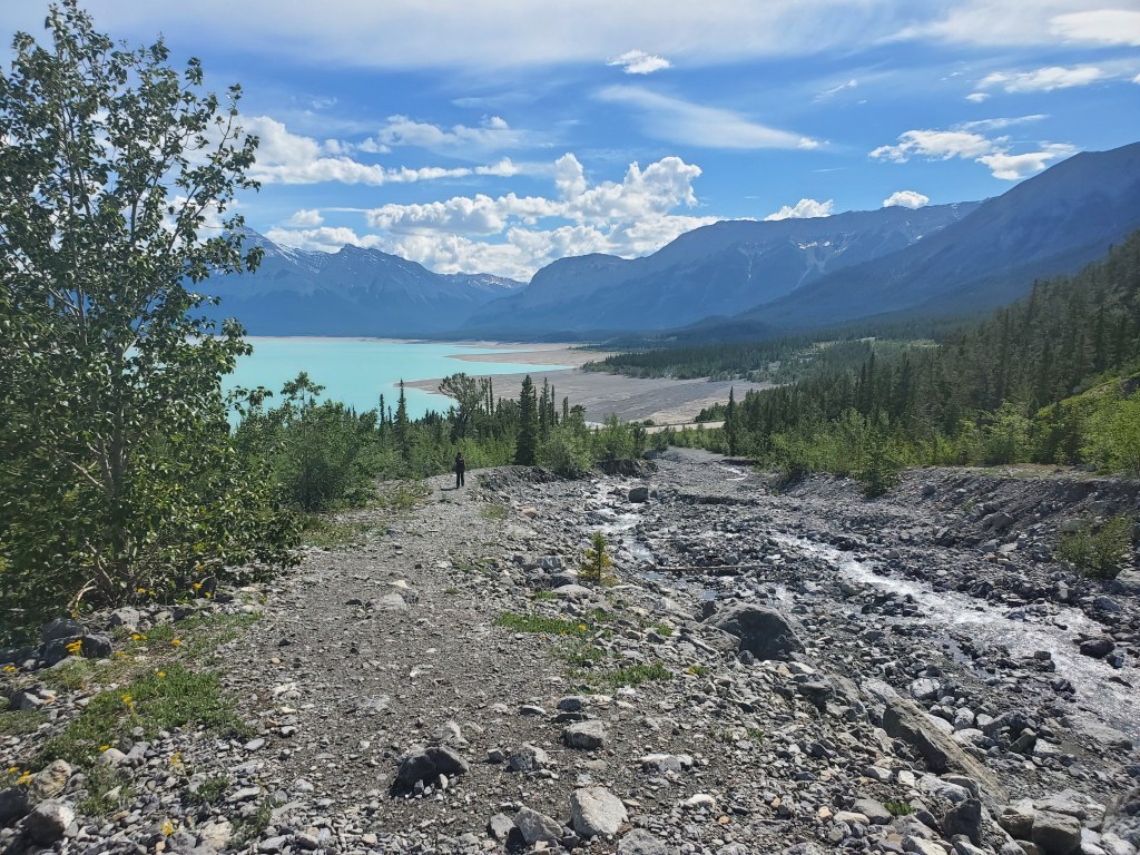
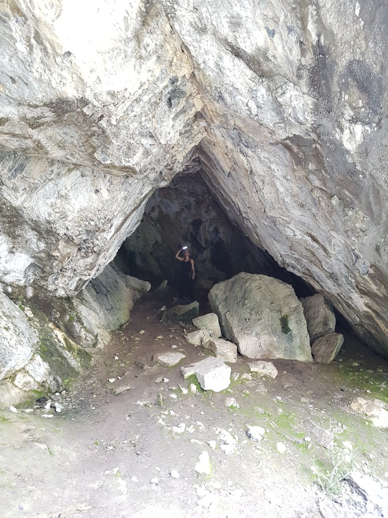
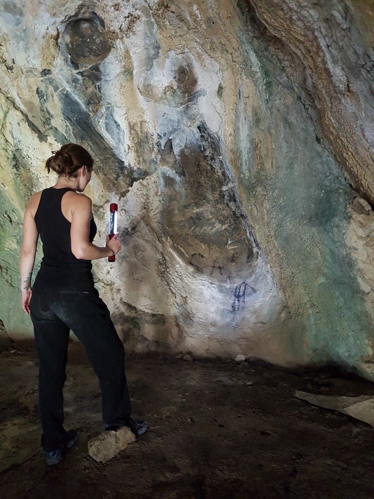
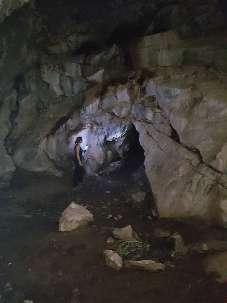
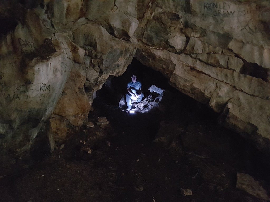
We will be bypassing the pinnacle to the right (behind it, from this angle). The slab to the left (in front) is severely exposed here.Bypassing the pinnacle to the right would be an easy walk if snow were not present. We hoped this would be the only snow encountered. But, a larger snow patch is hiding just around the corner.Upon arriving at the larger steep snow patch we decided to see if we could gain the pinnacle and connect with the ridge. A difficult scrambling line exists up the back side, but the pinnacle does not connect with the ridge and we had to return the same way. A helmet would be an asset if attempting this optional detour.Dan gazes across Abraham Lake to Kista Peak (center-left) from the top of the pinnacle. Next, we returned down the difficult scrambling line to tackle the snow patch.The mountaineering axes and crampons we had packed “just in case” proved handy after all and we crossed the snow patch without incident. The formation ahead resembling bull horns is our objective. The high point chosen as the peak of Hoodoo Ridge is the left horn. This horn is taller than the pinnacle we just passed, but doesn’t look to me to line up with Hoodoo Ridge. It looks more like a high point on Mount Abraham (Littlest Abraham, perhaps?).Looking back at the snow patch and the way we came. After breaking the initial trail, we were able to keep to rocky terrain for most of it.Continuing ahead to the left bull-horn. The snow-patches visible near the top were no problem and we hiked past them without difficulty.A short slab-climb leads to the narrow, exposed peak.Standing at the high point of Hoodoo Ridge, with Allstones Peak visible in the background (left).Looking back at Dan from the high point of Hoodoo Ridge.Admiring Mount Abraham (left) and Allstones Peak (center-right).Summit panorama.Once satisfied with the views from the top, we began descending into the drainage that becomes Hoodoo Creek. The slope was deep soil damp from the melting glacier in the col above, and we quickly plunge-stepped our way toward the valley floor with some relief.Further into the drainage the snow accumulation became much larger. Below the surface were snow-caves hiding rushing water and slick rocks. We avoided the snow accumulation by side-sloping across at the right on hard mud-slab with no give. It was a slow process of etching out footholds with my trekking poles and hiking boots, in some ways the toughest part of the day.Approaching a slot canyon, I had a foggy memory from previously hiking Hoodoo Creek to stay high and far into the trees at the right (I am the small figure in black). The thinner trees closer to the edge hold loose gravel on exposed slab. The bushwhack further in is unpleasant, but thankfully brief, and feels much more secure.Looking back at the slot canyon. The waterfall column alone is over 2 meters tall. Even if fully dry, I would have no interest in heading directly up this feature. Additional features are encountered along Hoodoo Creek, with plenty of rock-hopping and some moderate scrambling needed. The remaining terrain is less exposed but still requires multiple creek crossings, making this trip much more fun later in the season when the water is lower.About 100 m before the cave, a tall cascading waterfall is passed to the right. The water pours from a large drainage on Mount Abraham that can be seen from the road.The cave is soon passed on the left. An obvious trail leads up through scree to the entrance. We had already explored this small cave on a previous hike in 2017 (see Appendix), so we continued on without stopping this time.At last, the hoodoos are spotted ahead. The smooth creek rock is slick in high water and makes for slow progress. Hoodoo Creek is best saved for later in the season.Another shot of the largest of the hoodoos. From here it is an easy 1 km hike out on trail.Looking back at the hoodoos for one more photo. Dan helpfully points them out.We kept to the left of the creek, above the bank, to pick up the obvious trail and easily hiked out. The Hoodoo Creek trailhead is marked by a memorial for Jeff Newton, who tragically lost his life scrambling somewhere on the slopes of Mount Abraham near Hoodoo Creek in 2019.
We returned to the parking lot in 7 hrs 20 min, glad to be out of the creek. If we’d had a better view of how much snow was still in the creek, we would have stayed on the ridge and simply returned the way we came. I expect this route is more fun when the water levels are lower and I would probably wait until Autumn if I wanted to try it again.


One thought on “Hoodoo Ridge (~2530 m) and Hoodoo Creek”