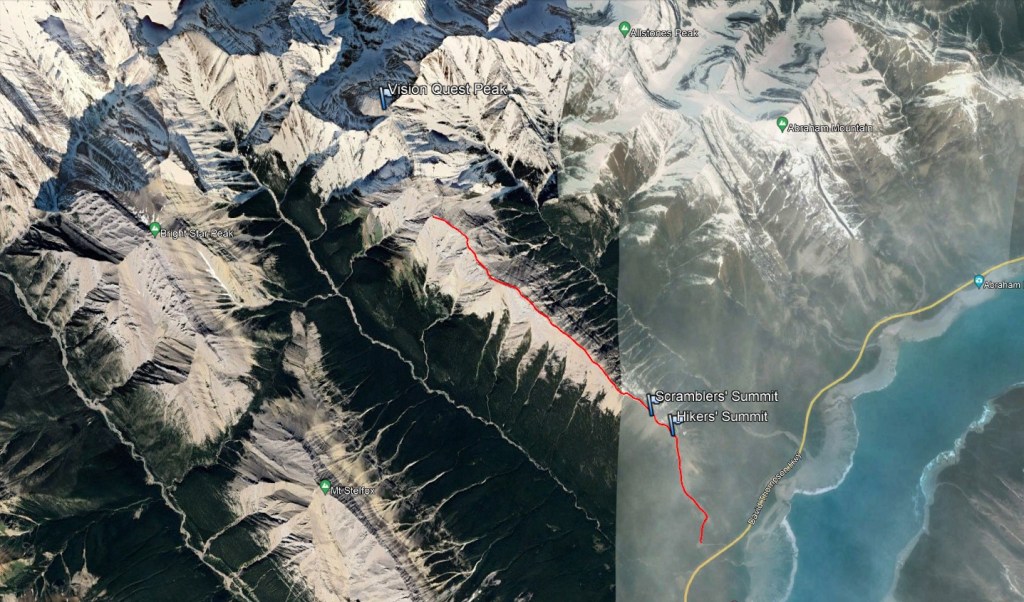
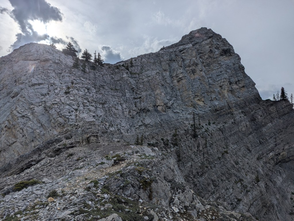
Notes: Pawlyk’s description is to the second/third-highest point on the ridge only. Beyond this a pinnacle blocks the ridge, ~0.5 km before the peak. A bypass may be possible, but we’d reached our turn-around time.
Trip Report
I can’t get enough of Vision Quest, or so it would seem! The views are spectacular and the route up the east ridge is fairly straight-forward. I’ve done the east part of the ridge a couple of times over the years and enjoy it as an early-season leg stretcher. For this day we chose to explore as far back as we could, hoping to reach the true summit. Upon closer inspection though, the route description in the book does not, itself, connect with the true summit. The trip still makes for an fun ridge walk and an excellent day out, as long as a true summit isn’t the goal. Unverified reports indicate that there may be a bypass route that eventually leads to the peak, but I expect it would take a couple of hours beyond the time allowance provided by Pawlyk.
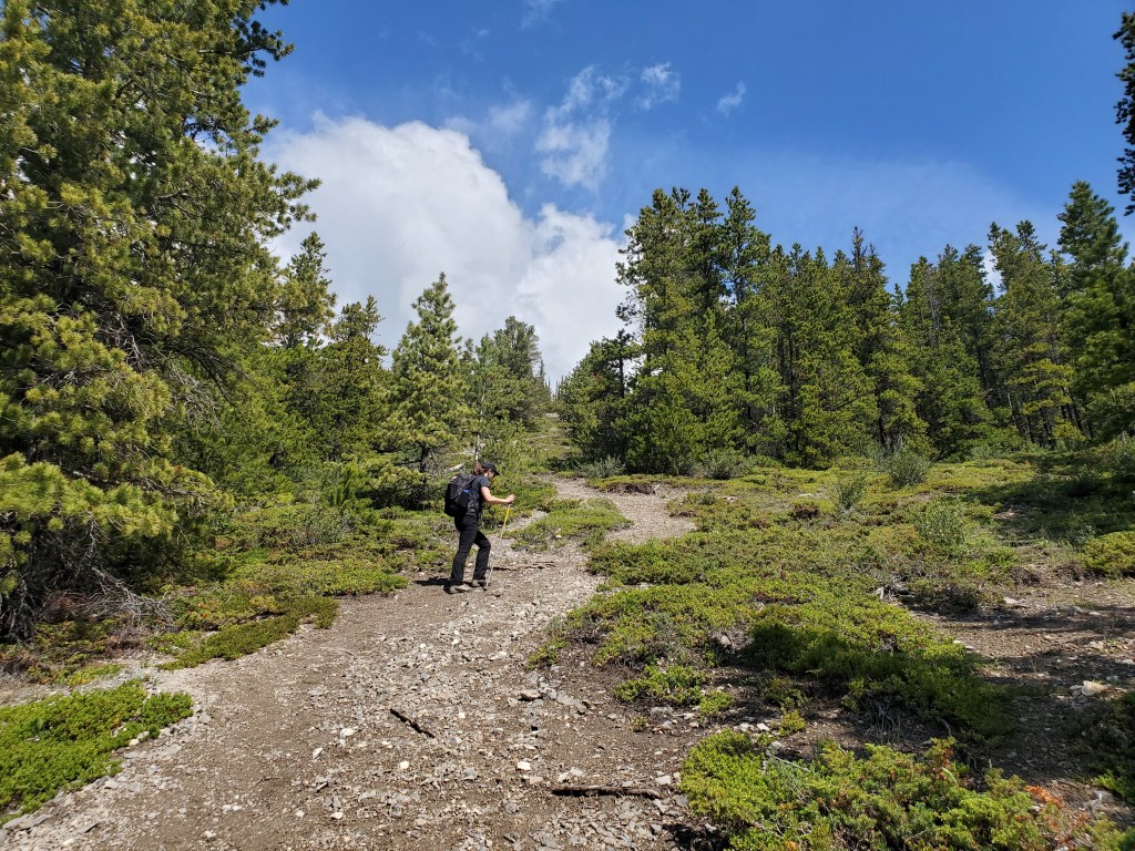
We parked at the waste transfer site and easily picked up the worn trail with its small hiker sign. The short driveway is in good shape and the parking lot can accommodate around a dozen vehicles.
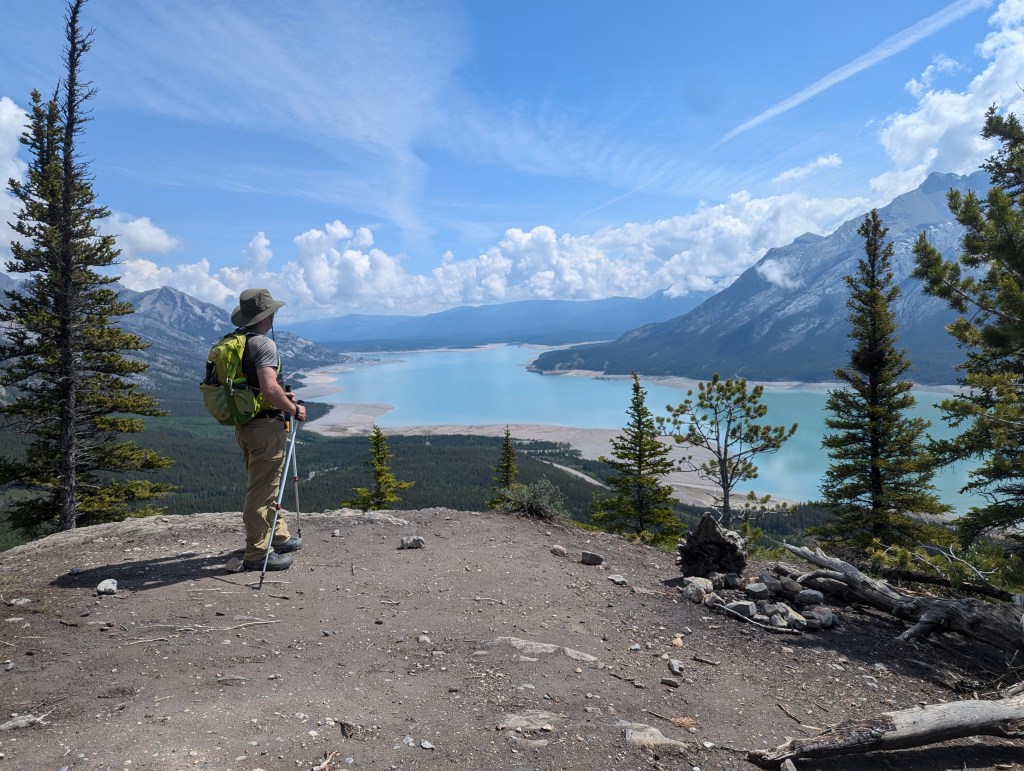
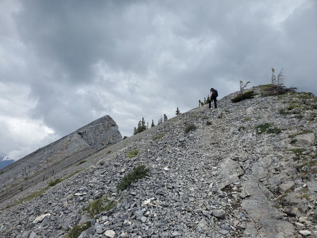
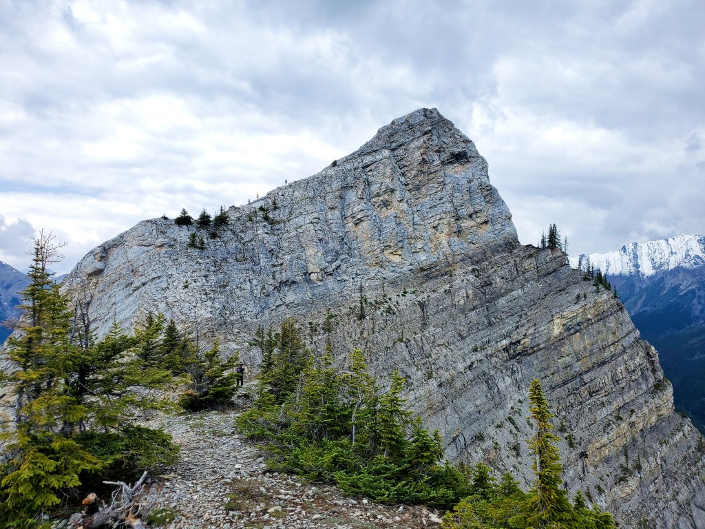
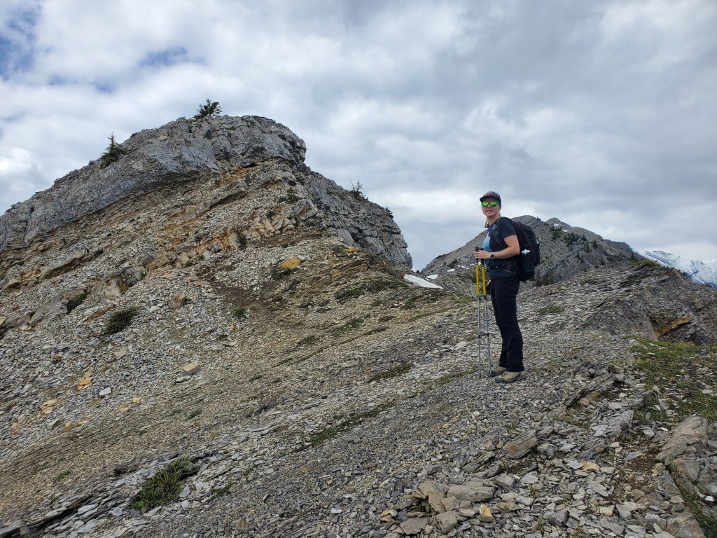
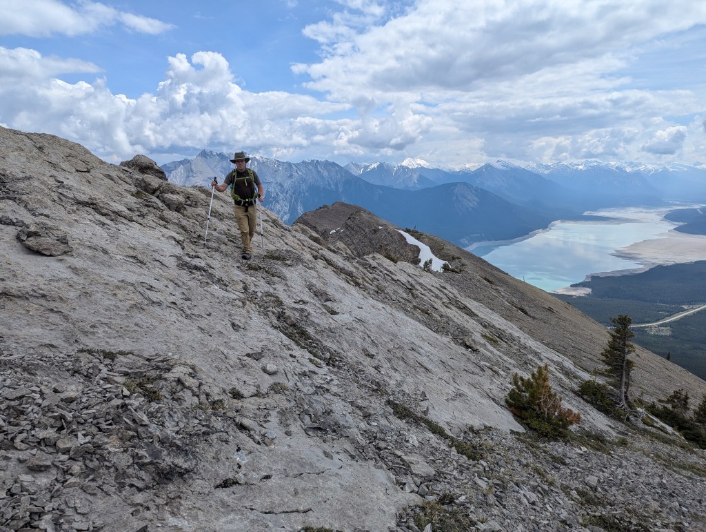
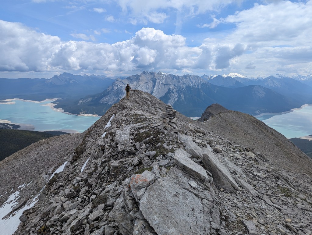
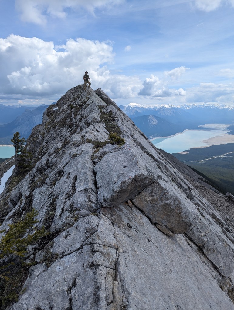
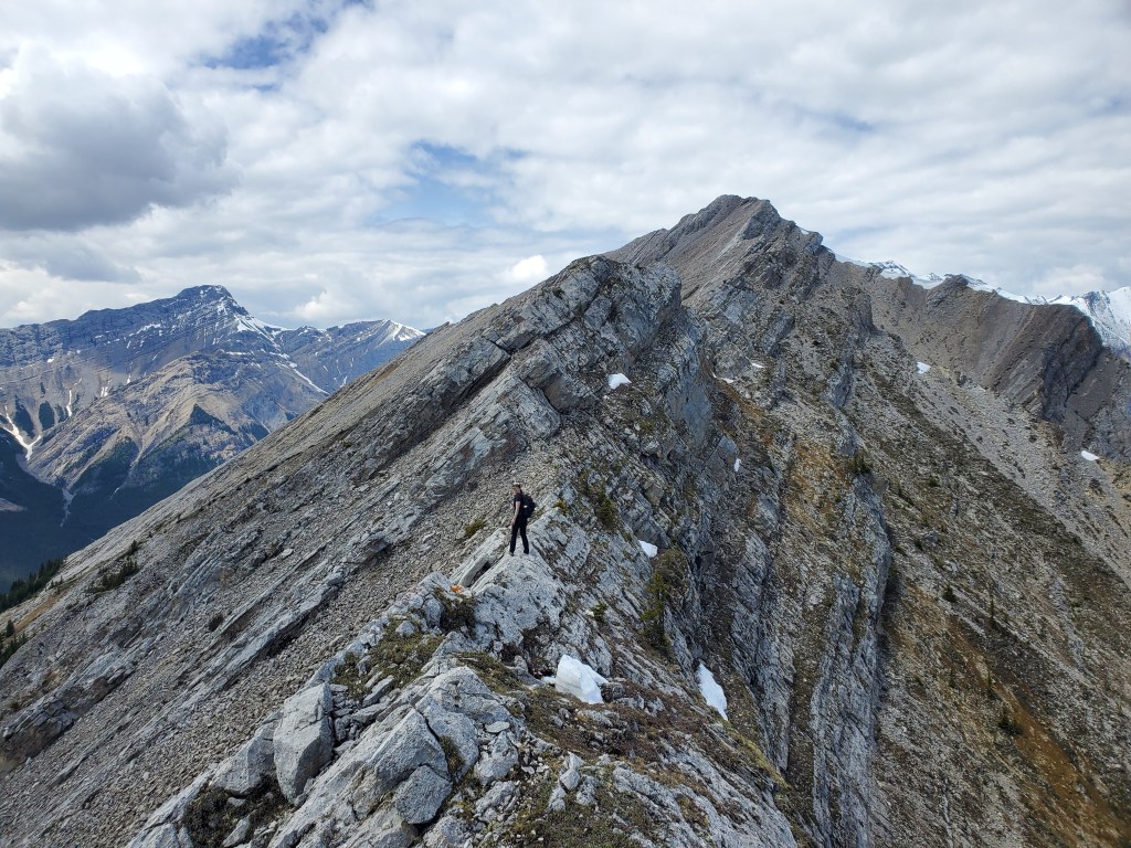
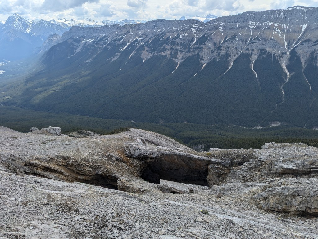
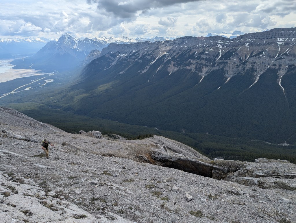
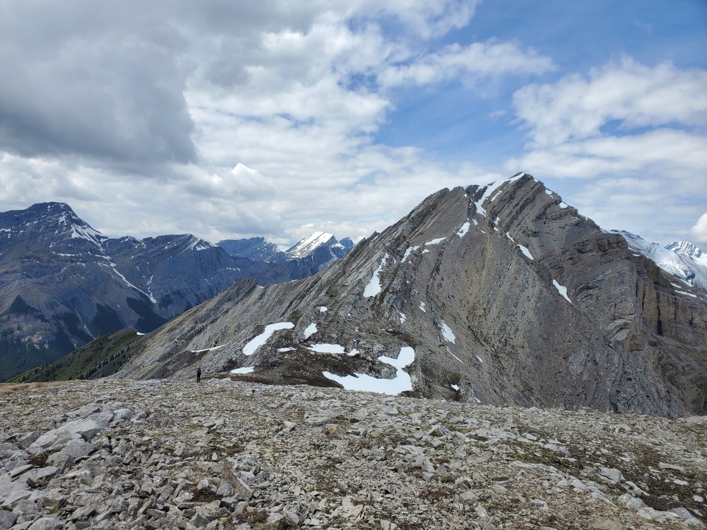
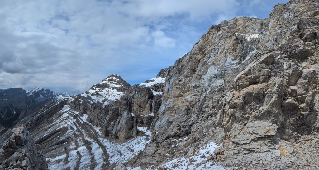
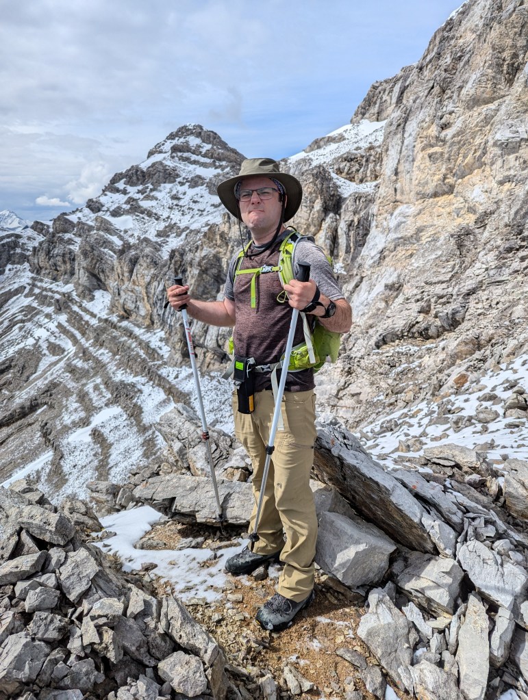
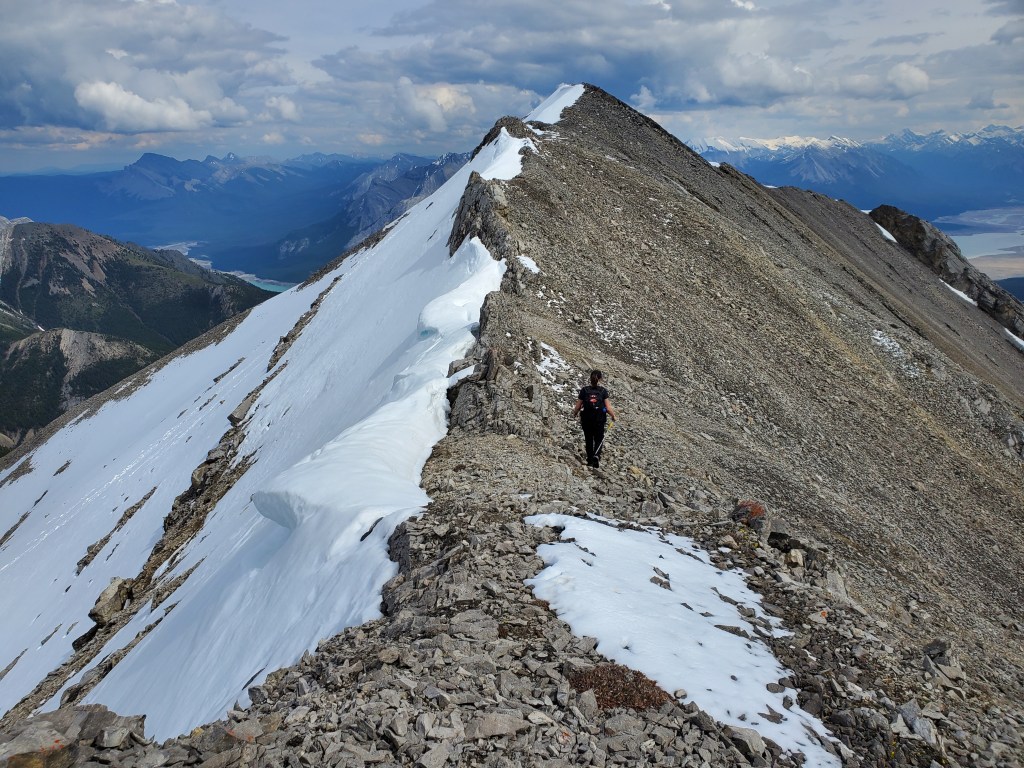
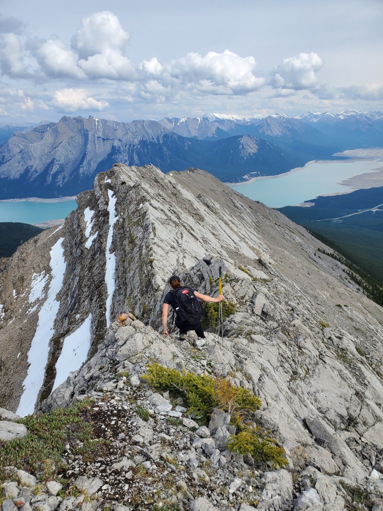
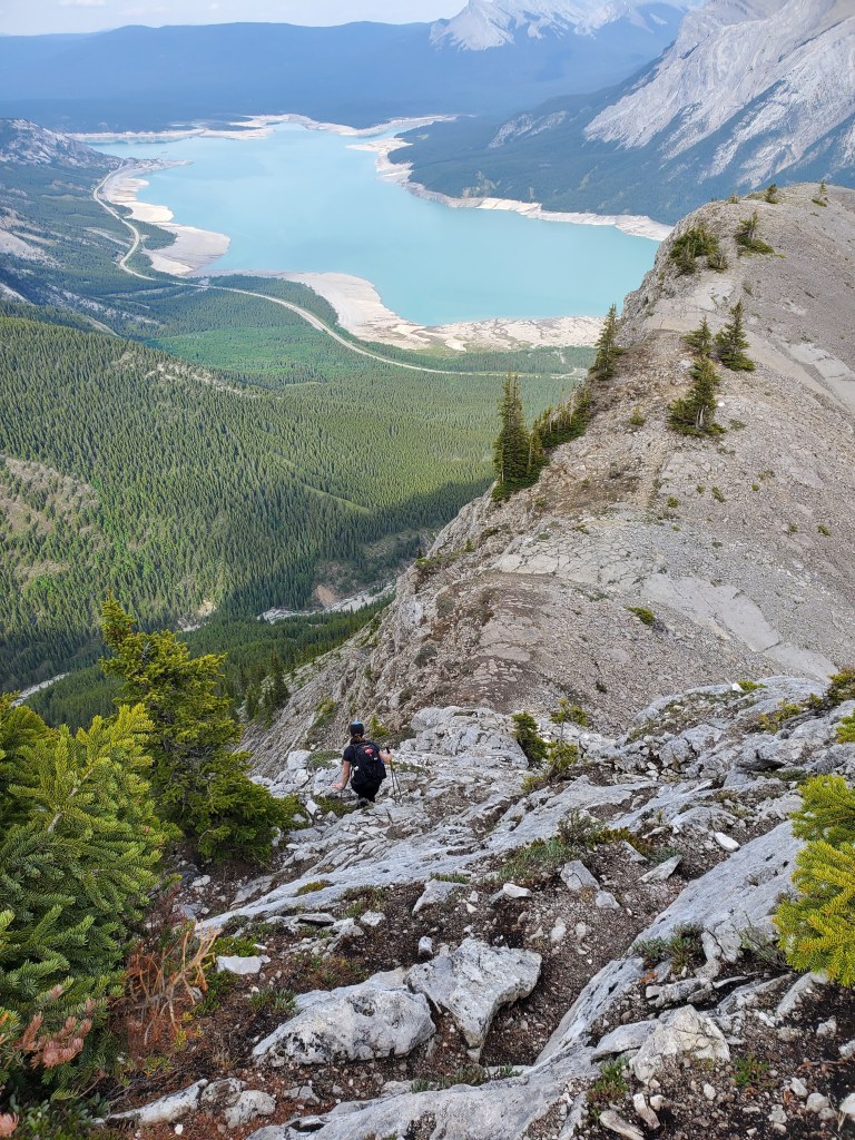
A Y in the trail is reached about 200 m in. The line to the left is ever so slightly shorter, but the line to the right has far better views. We kept to the right.Views open up across Abraham Lake in about 10 min and continue throughout the day.The vision quest site for which the ridge is named is reached in just over half an hour.Looking ahead from the vision quest site to the hikers’ summit. The equally popular scramblers’ summit is only about 200 m further along the ridge, but requires a bit of moderate scrambling. Compared to the overall scale of the ridge and the progressively higher points reached beyond these, the distinction between these two summits is immaterial in my mind.The next 50 min is an unglamourous trudge up scree trails, but does end eventually. This shot is nearing the hikers’ summit. The cliff further back is the scramblers’ summit.Probably the best views of the day are at the hikers’ summit!Another group can be seen descending the scramblers’ summit. They will follow the ridge to the small shrub furthest left, and then head straight down. This is the same as the ascent route and it looks worse than it is. Once up close, the moves are all there and the exposure is never beyond moderate.Just beyond the previous picture, the “crux” for the route to scramblers’ summit is a short cliff band. A few viable options exist and the easiest line is marked with cairns.We reached the scramblers’ summit in just shy of 1 1/2 hrs, from the parking lot, and then continued along the ridge. At the next cliff band encountered (pictured) we bypassed by walking around the right side.Looking back along the ridge. The scramblers’ summit is the high-ish point at the far end of the ridge. We still have plenty of ridge ahead of us!A couple of additional summit registers and/or tall cairns are passed along the ridge, with no seeming logic to their placement.Continuing our ridge walk through some fun slabby sections. Only one move of difficult scrambling was encountered during our day. I tackled it head-on and Dan easily bypassed to climber’s left. The bypass is necessary to keep this route at a moderate grade.Looking ahead. No noteworthy high points are even within view yet. It’s a long ridge!Continuing ahead to more slab – yay! Note the interesting cave/window features at the left side of this photo.A closer look a the caves/windows.Dan for scale.We kept an eye out here for the line illustrated by Pawlyk for reaching what he describes as “the second highest point on the ridge”, the high point ahead. We had to detour right, walking down two cliff layers, but easily hiked through once on the correct line. It’s tempting to descend only one cliff layer, but this gets cliffed out quickly.
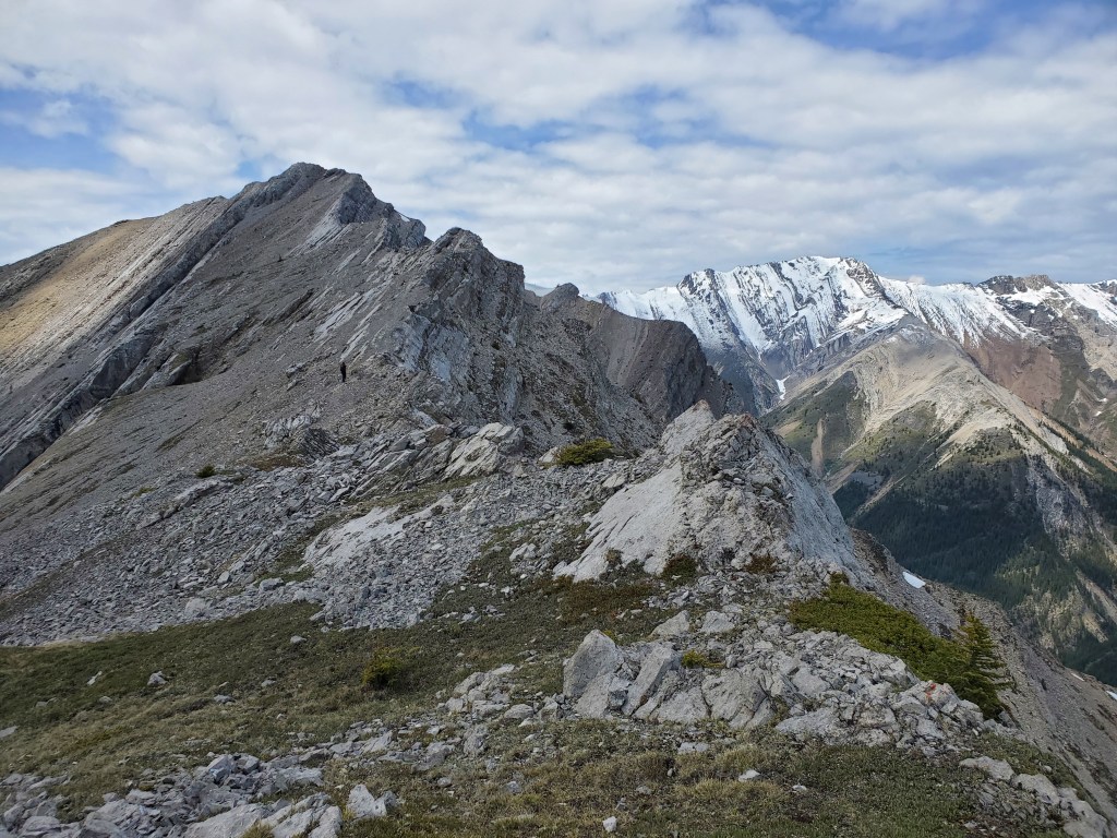
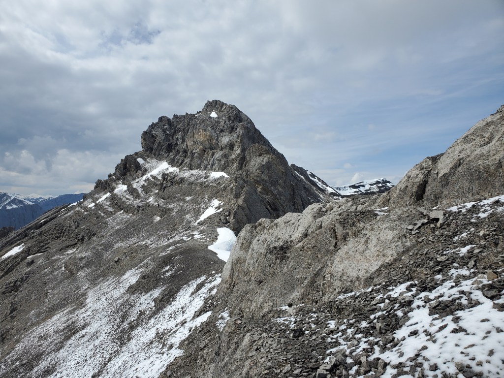
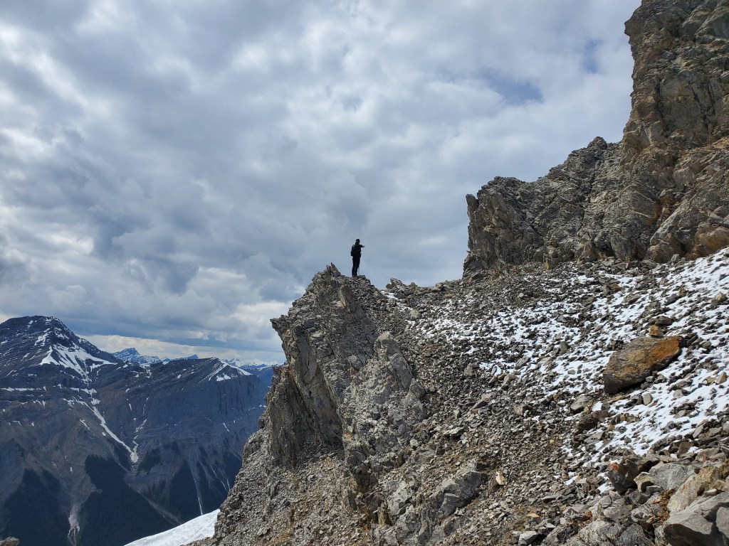
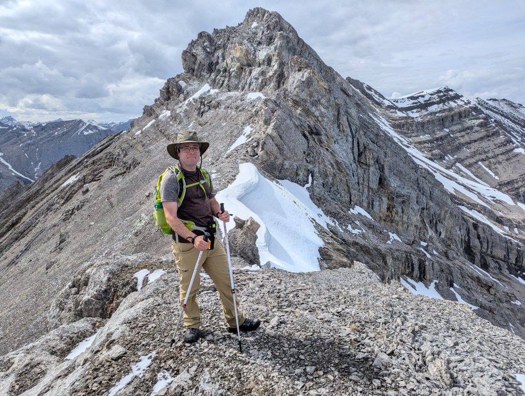
I believe this is the third highest point on the ridge and what Pawlyk describes as the “true summit just poking out” in his photo (or what I describe further on as the pinnacle) is the second highest peak. The true summit is still quite far back from here.The correct line for reaching the second/third highest point on the ridge is this way.Working our way up and over the second/third highest point, the pinnacle that will soon stop us comes into view.The cliffs to the right side of the pinnacle looked impassible, but the scree slope around the left side offered a glimmer of hope. I scouted ahead to see if the line would go (tiny black dot midway across the slope).This was where Dan caught up with me, still squinting ahead to see if any lines looked promising. And here’s the view that had me so engrossed. The peak is just out of view to the right.Dan for scale.By this point we were half an hour from our turn-around time and any route option, if it worked at all, would take more than half an hour. So, we instead used the time for a snack break before returning the way we came.One last look back at the pinnacle, somehow hoping the right-hand side will look less terrible this time. It doesn’t.The ridge walk back out is no faster than the hike in. Slab sections can be bypassed, but the terrain is worse quality lower down. Sticking to the ridge proved to be the easiest line.Downclimbing the cliff in front of the scramblers’ summit. The hikers’ summit is just in front of me.Looking back at Dan, effectively camouflaged in grey-on-grey, as he walks down the cliff from the scramblers’ summit. It’s easier than it looks!
We made it back to our vehicle in 8 hrs 15. So, 15 min slower than the upper limit of what we expected the route to take, and we didn’t even reach the true summit! Upon closer inspection of the book, the line drawn on the overview doesn’t lead to the true summit and the description reads “the route continues way back!” In retrospect, I don’t think it was the author’s intent to lead to the true summit. I just wish this had been clearer.