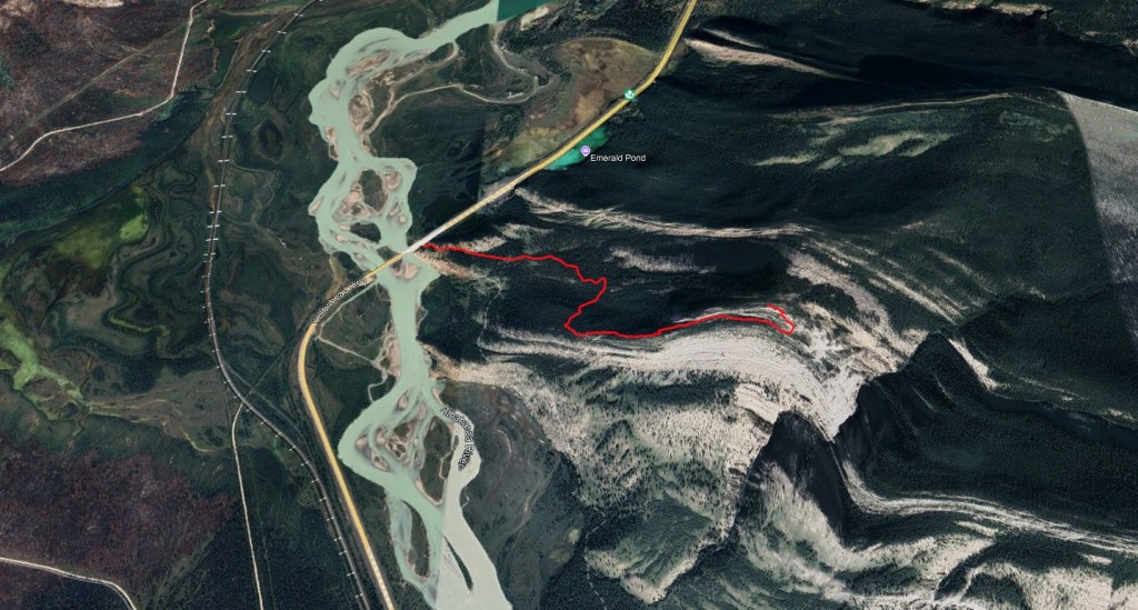
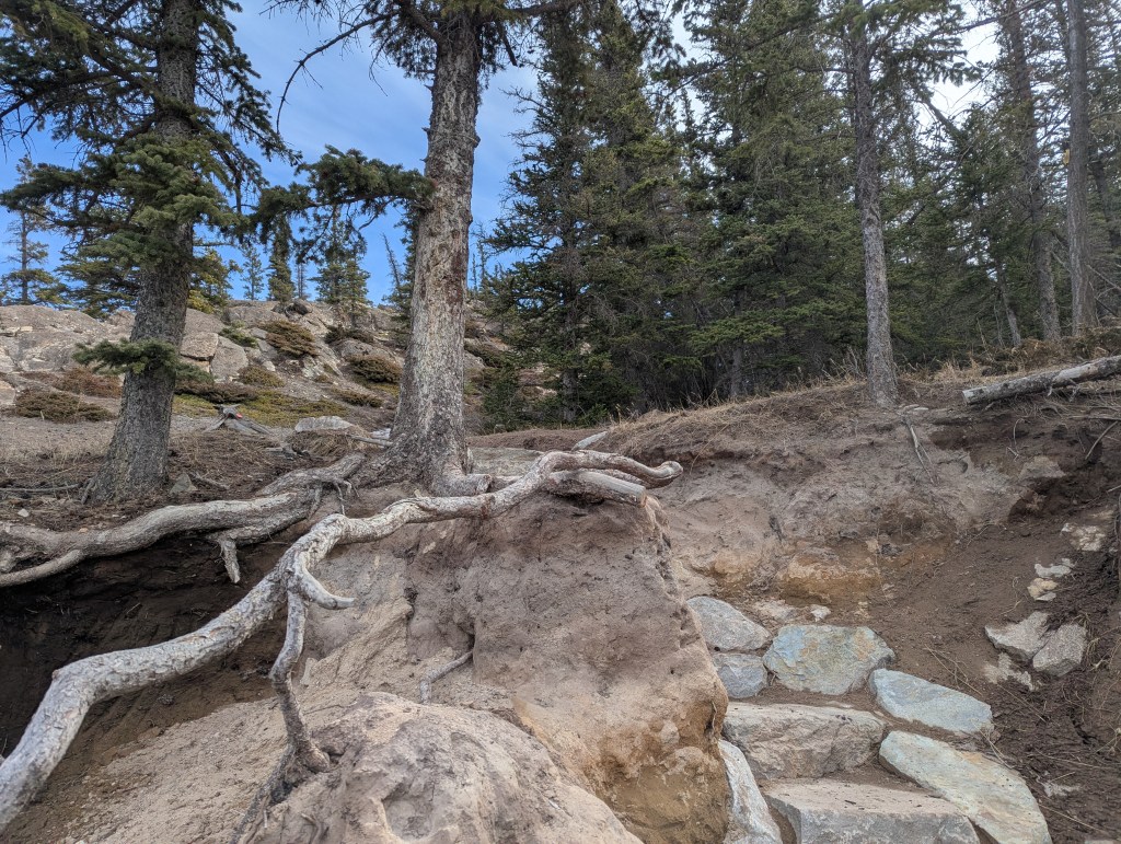
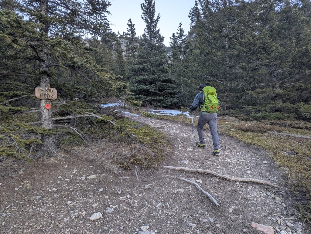
Morro Peak is a small mountain in Jasper which lies at the toe of Hawk Mountain. On a day with great conditions, its lofty neighbour makes for a much more impressive ascent. For the other days though, Morro Peak provides a fun little outing with nice views and more interesting terrain than expected. In summer its southwest face is a popular spot for easier rock climbing, including two bolted multi-pitch climbs. Morro Peak Trail also serves as the climbers’ walk-off route. It and Overlander Trail share the same trailhead, but the two diverge within steps of the parking lot. The parking lot is a paved pull-out along the highway on the east shore of the Athabasca River. Look for an obvious rock staircase.
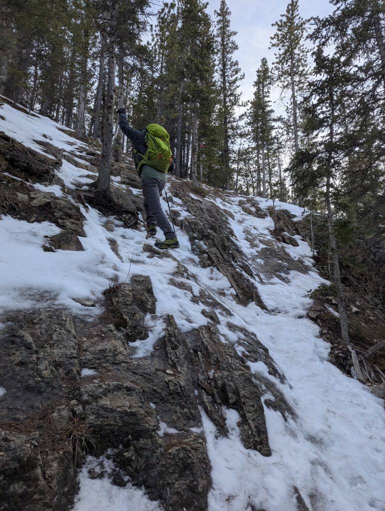
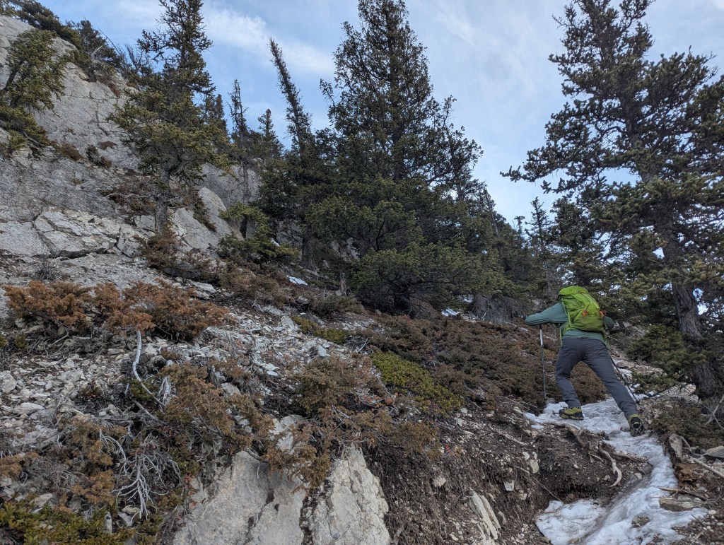
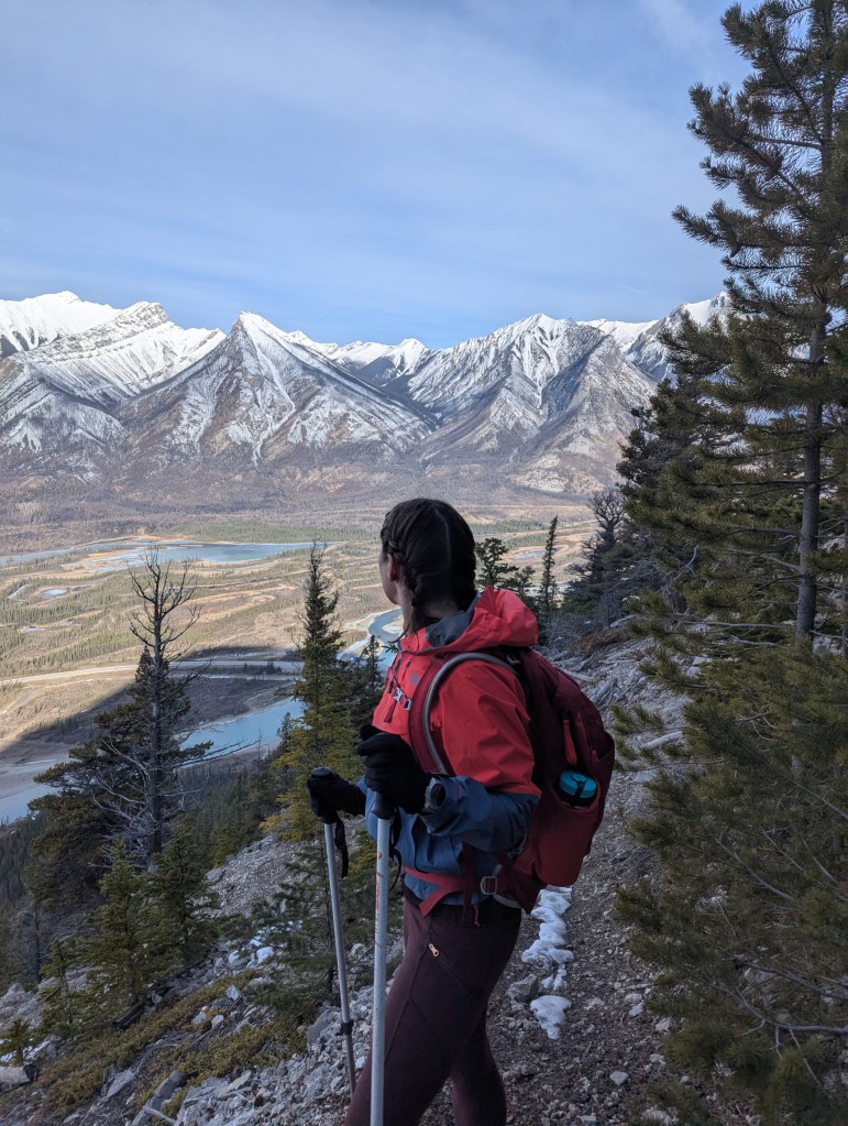
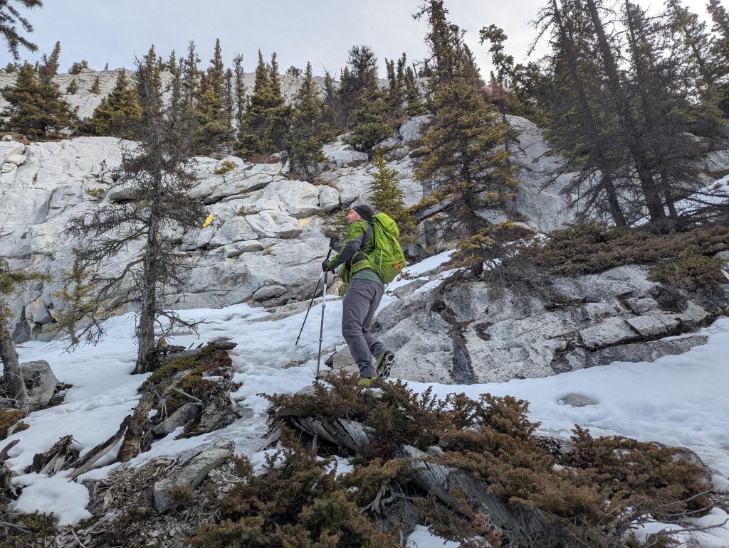
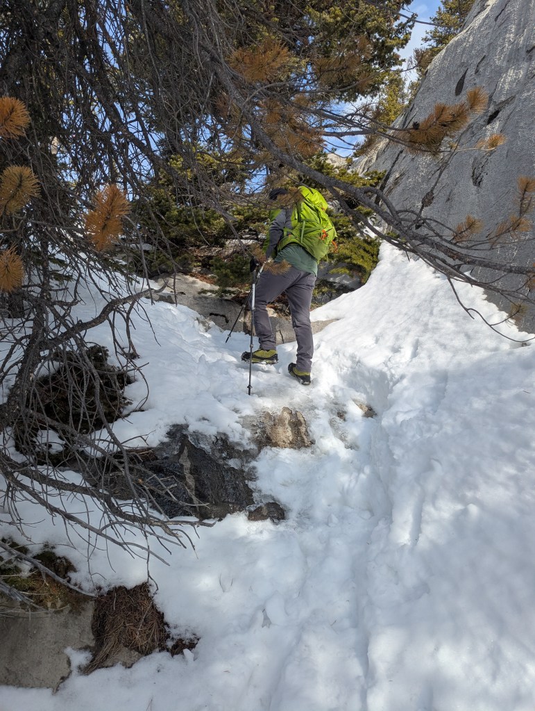
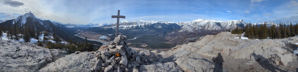
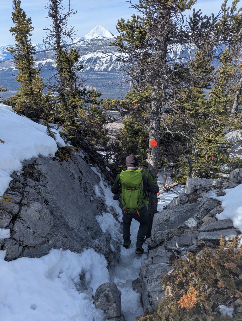
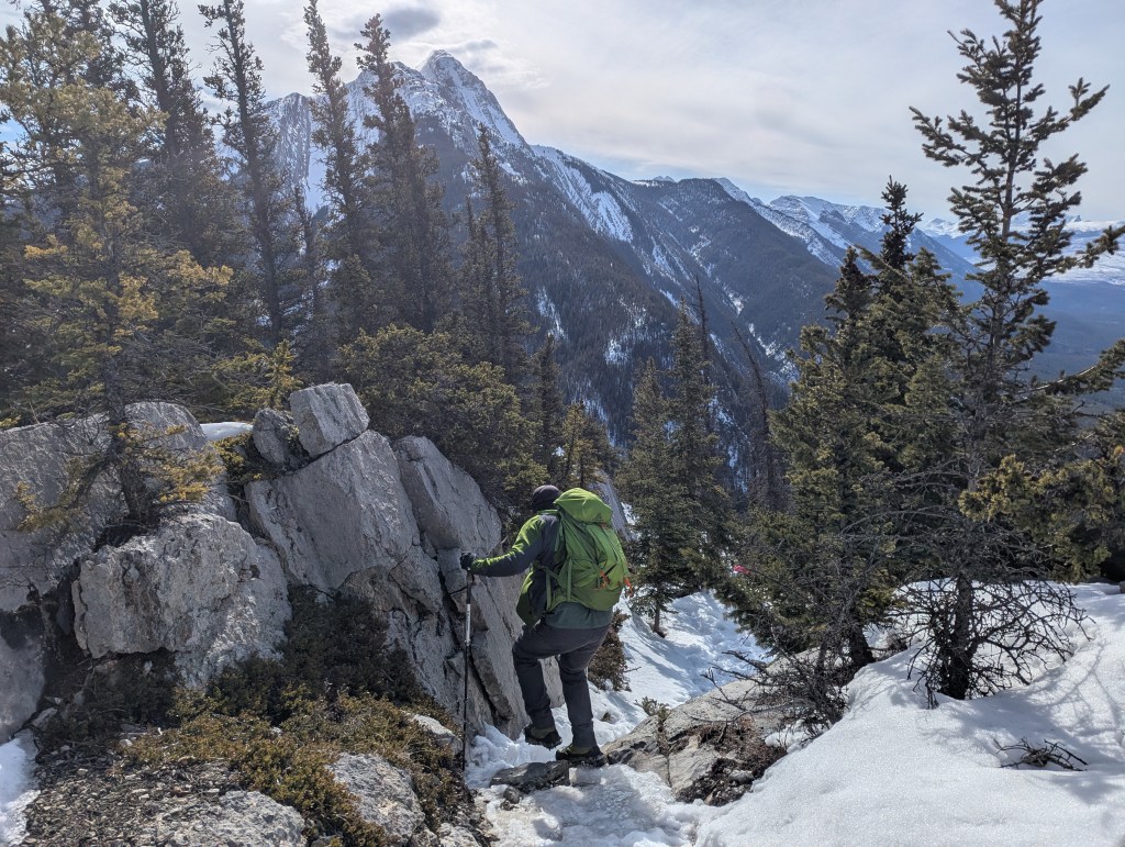
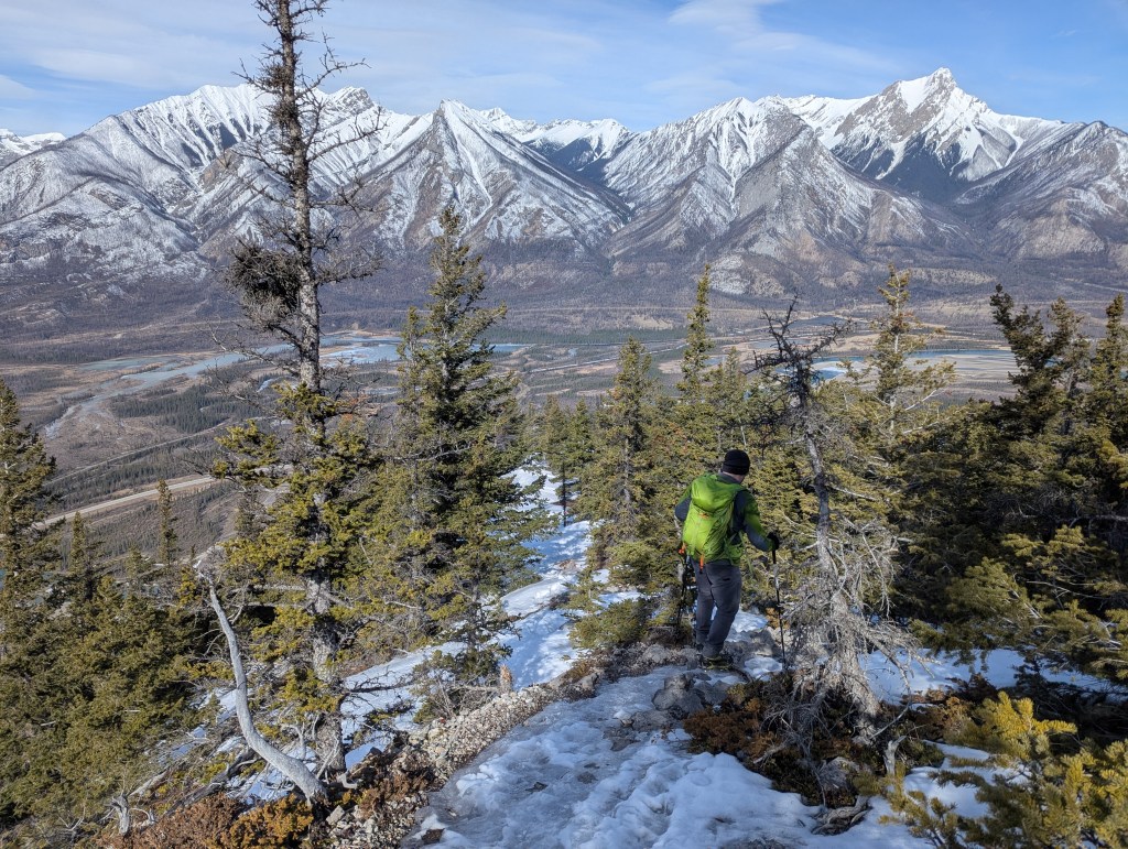
Looking up the rock staircase from the parking lot, a red marker can be seen on a stump to the left and a yellow marker can be seen on a tree to the right. Morro Peak Trail is the one that starts to the left and is marked with red circles throughout. The more obvious trail to the right is Overlander Trail, an official Parks Canada trail with yellow markers, identified as 10b. A connector trail can be picked up a few hundred meters in if one starts out on the wrong trail. It’s easiest to just stick with the red markers from the start though.A few game trails are crossed near the start of the trail, but we were assured to be on the correct trail upon passing this sign about 500 m in.The first section of easy scrambling is encountered about half an hour in. This short, steep section was very icy in winter, making us grateful to have packed sturdy trail crampons rather than just microspikes.The trail emerges from the trees within 45 min and views across the Athabasca River open up to the west. The next hour will consist of fun, easy scrambling following the trail as it picks its way through small cliff bands, generally trending to the southeast.Looking back, gazing north to Chetamon Mountain (left) and Esplanade Mountain (right).Several sections of easy scrambling like this are encountered, keeping the day interesting, but never challenging. In addition to the red markers, supplemental yellow flagging tape is present through this section. We never struggled to figure out which way to go.The trail continues trending to the southeast (right), avoiding the larger cliffs directly ahead. Shortly before the summit, the trail makes a U-turn, ultimately approaching the summit from its south side.After making the U-turn the trail hugs this cliff on the right, guiding us to a handy notch which allows easy access to the summit.The notch in the cliff was well marked and the obvious easiest way up. This part was particularly icy!We reached the top in 2 hrs. The summit cross on Morro Peak gives this small mountain a bit of a European feel. The long ridge seen in the background at the left (southwest) is The Palisade and Pyramid Mountain just peeks out behind it.Summit panorama on Morro Peak.Hawk Mountain stands to the southeast, significantly taller than Morro. The wind at the top encouraged us to keep our stay brief!We returned the way we came, down through the icy notch.Continuing back south briefly before the trail makes a U-turn. Hawk Mountain dominates the view ahead.Working our way back through the easy scrambling section of small cliff bands. Across the valley are Chetamon Mountain (left), Esplanade Mountain (center-right), and Gargoyle Mountain (right)We made it back to the parking lot in 3 hr 45 min, leaving plenty of time to grab brunch at Jasper’s Wafflato. Hiking in cold weather had worked up a healthy appetite in both of us and we greedily indulged in our delicious treats!
Morro Peak is more interesting terrain than I had expected, but is never beyond easy scrambling. The views from the top are good, particularly for how little effort is expended to reach to the summit. Overall, I would recommend this scramble, particularly for the off-season.