Notes: Ticks in spring. One move of moderate scrambling, mostly hiking.
Trip Report
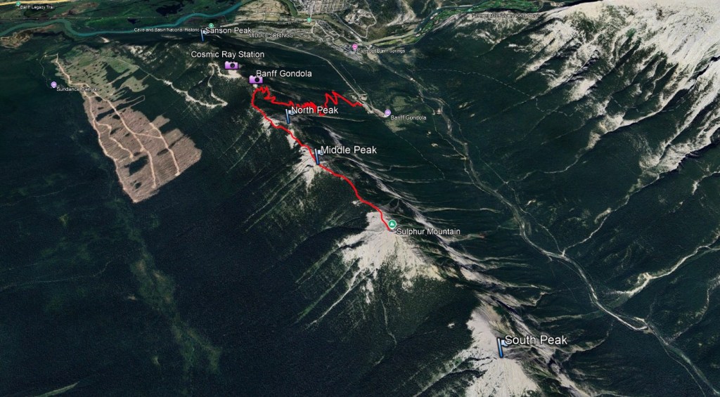
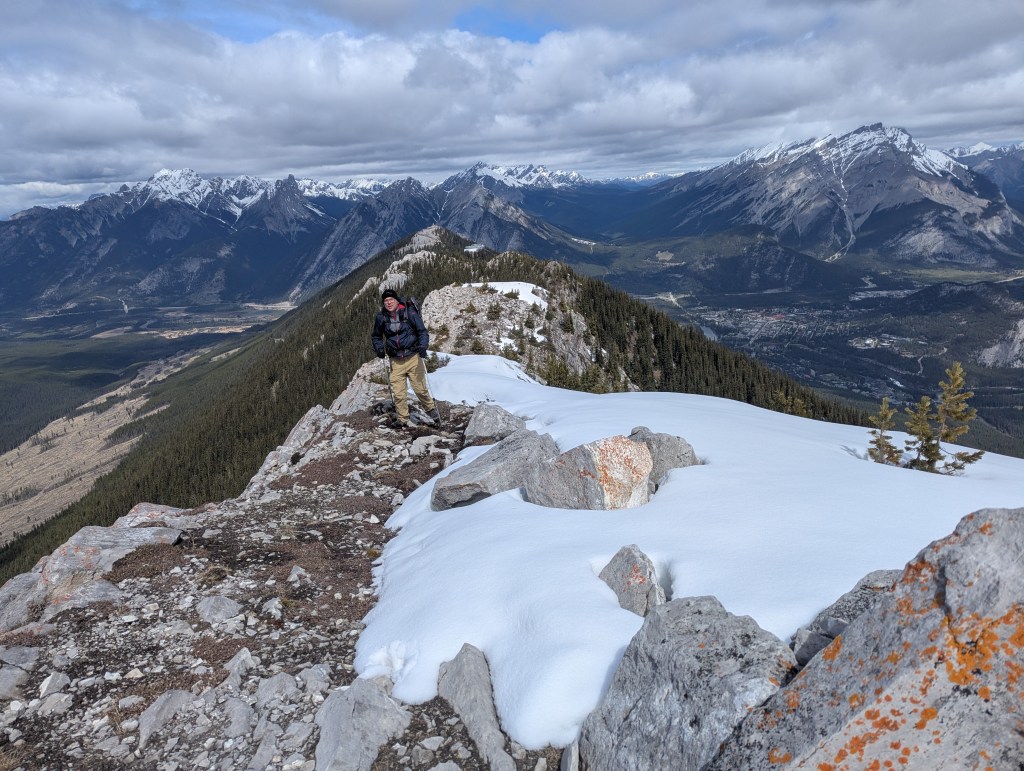
When most people think of Sulphur Mountain, they think of the high point reached using the boardwalk at the top of the Banff Gondola. In fact, the true summit is a few kilometers away and requires some moderate scrambling to reach. This was our second trip up Sulphur Mountain, the first being a few summers prior on a day with a risk of thunder in the forecast. On that day we chose Sulphur Mountain for its many escape options to dense, uniform tree cover. On this day though, we chose it as a relatively tame shoulder-season objective while waiting for snow to melt on the larger surrounding peaks. The first part of the trail is an easy well-maintained series of switchbacks below the gondola.
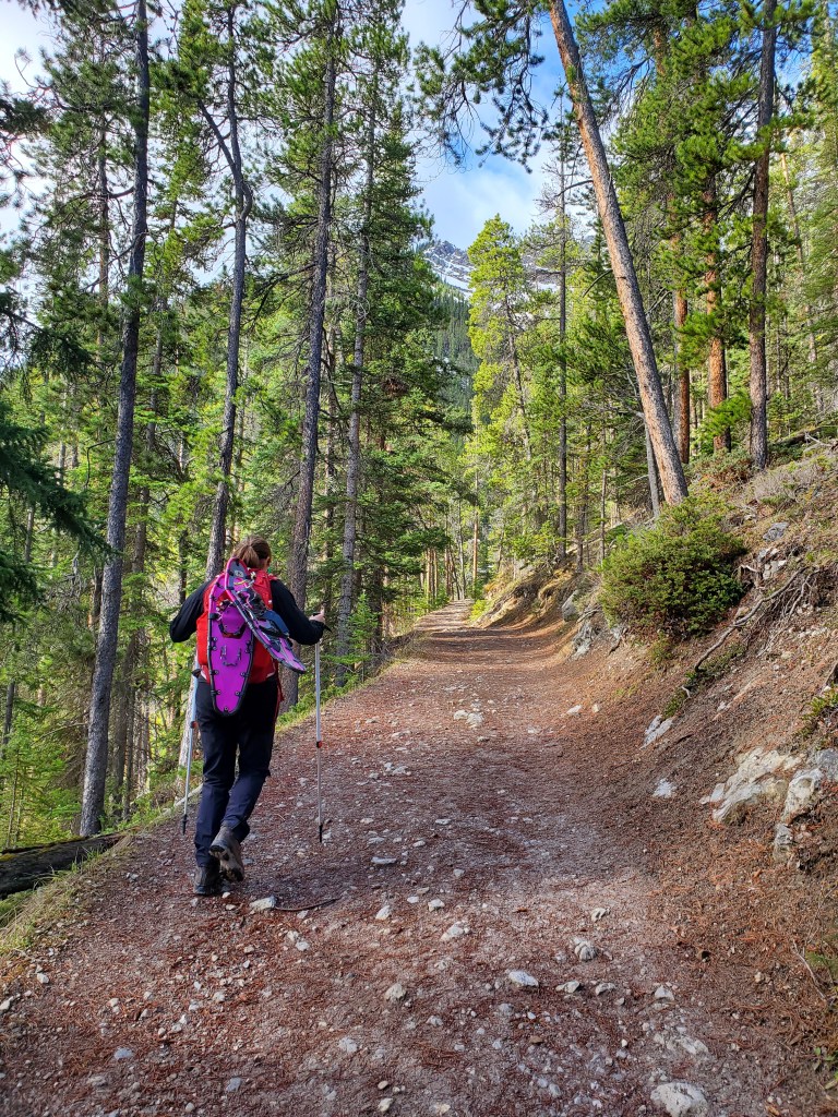
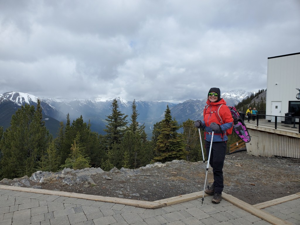
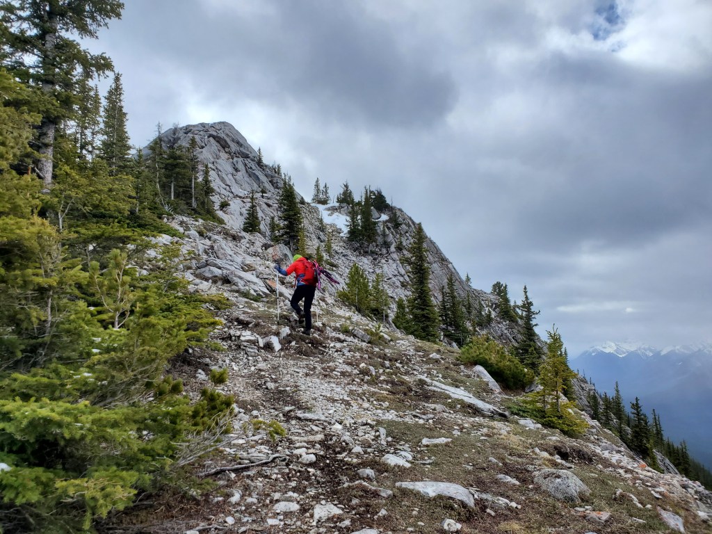
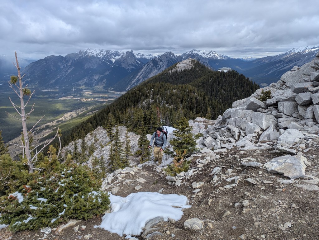
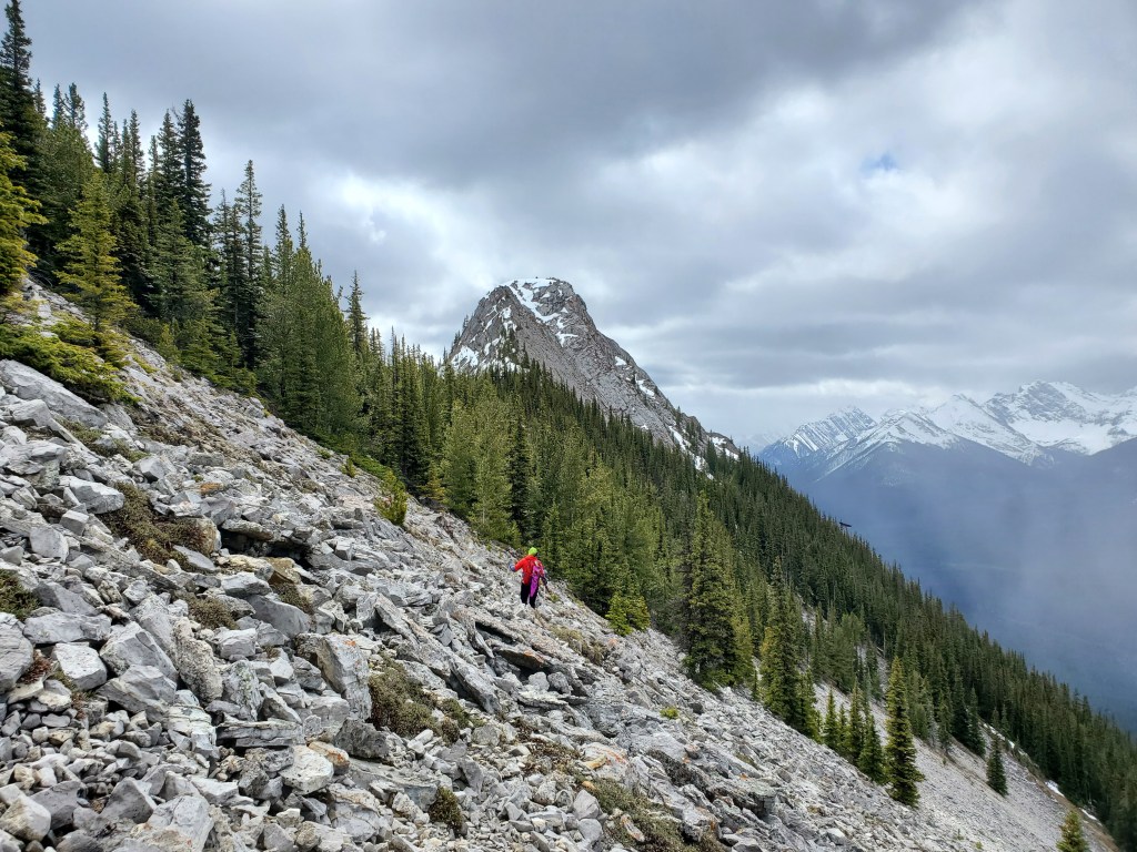
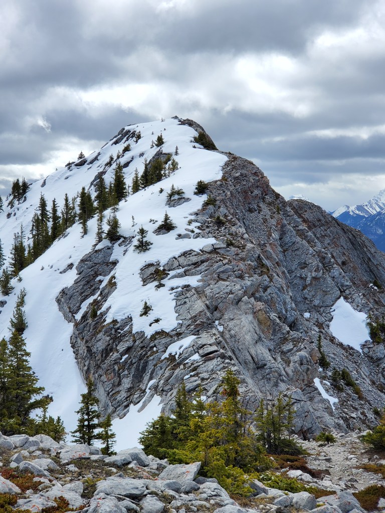
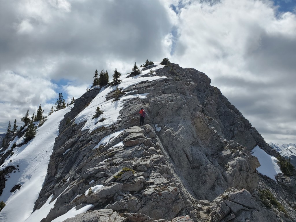
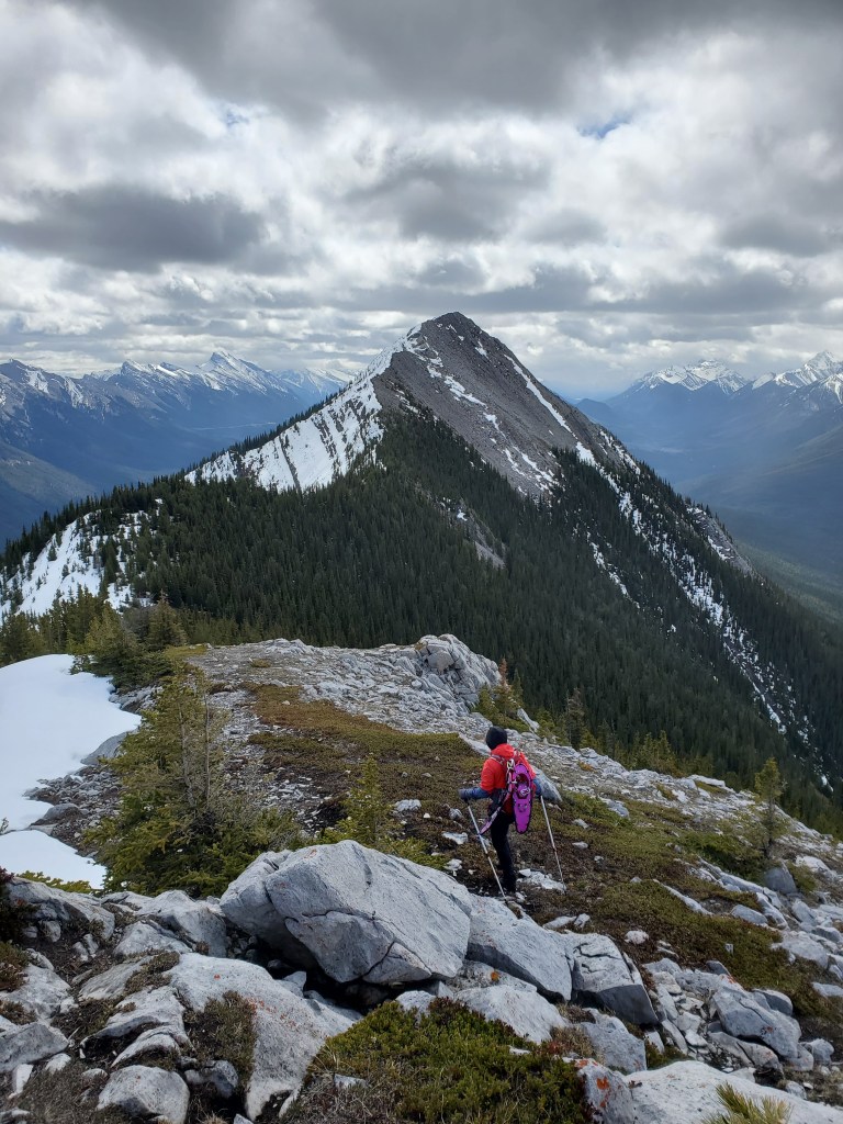
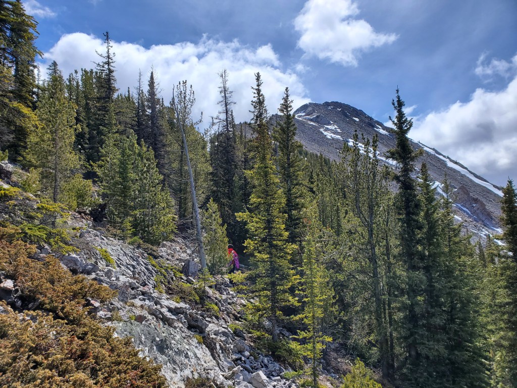
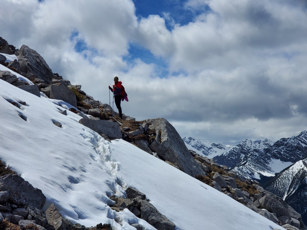
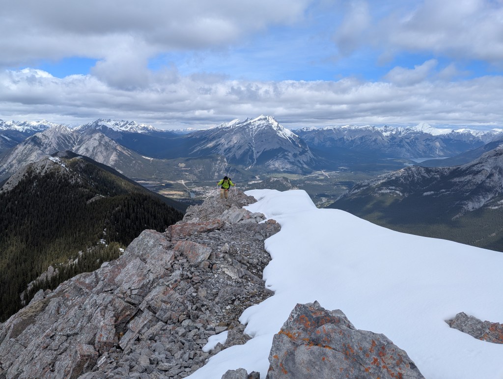
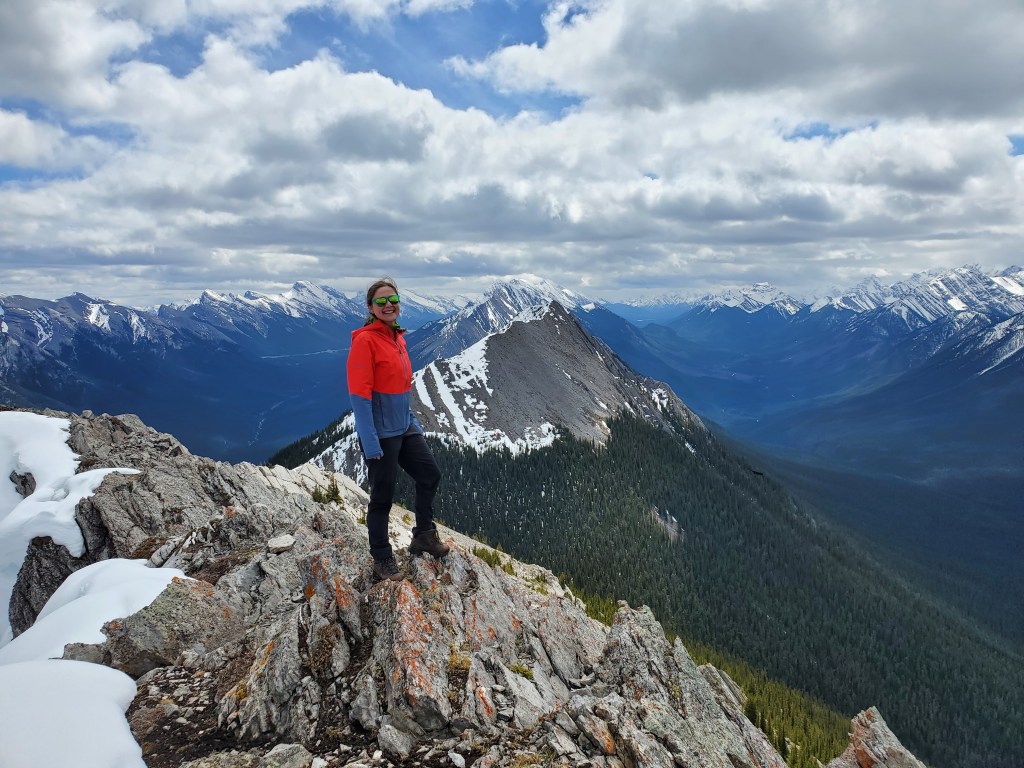
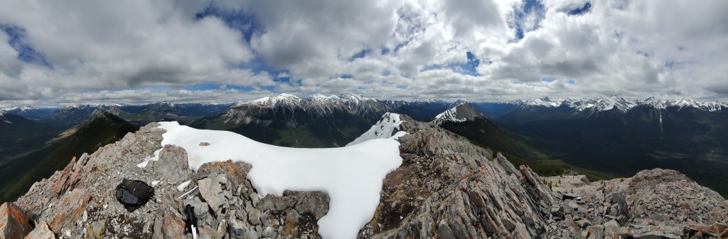
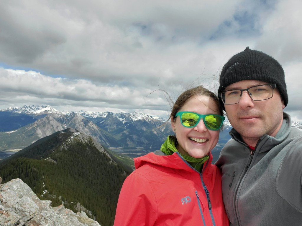
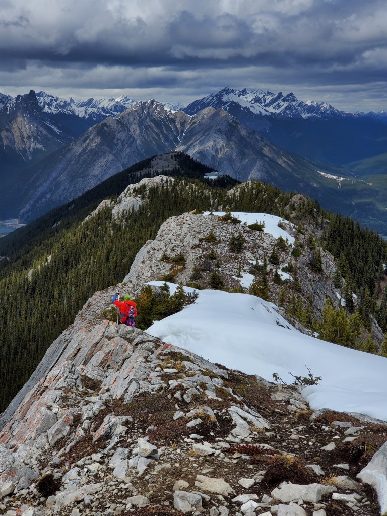
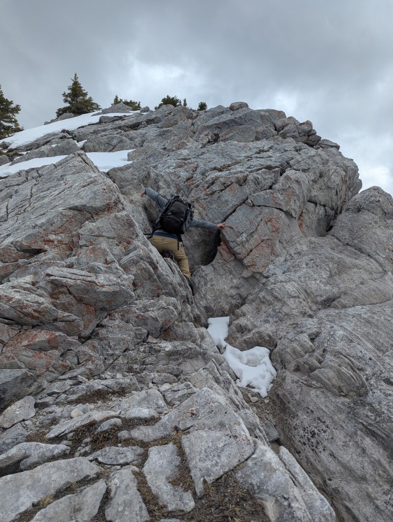
The first hour and a half of the hike looks mostly like this. The switchbacks did start to feel monotonous over time, but the terrain is very easy. If looking for a little fun, this part of the hike could be replaced with a ride up the gondola (for around $80 as of writing).The reward for reaching the top is a crowded gondola platform. But, where everyone else hiked north along the boardwalk toward the cosmic ray station, we headed south on a faint trail toward the true summit of Sulphur Mountain. We had the trail to ourselves beyond this point.A faint trail leads along the ridge toward the north peak. Others have reported tackling this peak head-on or traversing along a ledge, and in dry conditions I expect these options are both easier. On this day we hiked up along the snow-patch seen on the right-shoulder and then dropped down into the trees to the right (west), bypassing this peak. The bypass requires strong route finding skills through the slabby treed terrain, particularly on the return trip.Looking back from above the same snow patch, the cosmic ray station and the boardwalk leading up to it can be seen at center. The top of the gondola is slightly lower, to the right.We made use of a network of game trails winding through the trees, generally trending ahead to this clearing. After bypassing the north peak, the middle peak comes into view. There are really two peaks to tackle, the first of which has a tricky snow patch and the second of which requires one move of moderate scrambling.The snow lingering on the middle peak was deeper than it looked and couldn’t be fully avoided. We elected to use our snowshoes for a few meters of travel on this steep slope, more so for the crampon than the float.Beyond the snow patch of the middle peak, the rest of it comes into view. Generally considered the crux of this route, one move of moderate scrambling can be seen ahead, about a third of the way up this photo. The lingering snow higher up caused no problems, surprisingly, thanks to a continuous snow-free path along the right (west) side of the ridge.I can be seen standing in front of the crux. This move can be tackled head-on or from the right. The right side isn’t as exposed as it looks from this angle, but both options have moderate exposure.Looking down at the crux from above as Dan demonstrates tackling the section head-on.Looking back, near the top of the middle peak, a snow-free path provides easy travel. The Banff townsite can be seen to the right, below Cascade Mountain.Looking ahead from the middle peak, the true summit still looks very far away, hopelessly steep, and heavily corniced. At this point we are 3 hr 15 min into the hike and it will still be another hour to reach the true summit.Travel between the middle peak and true summit was very easy, with a good game trail to follow. As is so often the case, the hopelessly steep slope eased as we grew closer and the peak began to feel attainable again.A good game trail leads across the slope, avoiding the cornices but crossing two steep snow patches.Evidently, this trail sees a lot of traffic, albeit of the hooved variety. A solid track was already packed down through the snow patches. Beyond the snow patch, we turned up the slope and easily scrambled the rest of the way up to the summit ridge on blocky talus.Looking back as Dan approaches the summit. The middle peak can be seen to the left, in front of Mount Norquay. Cascade Mountain stands at center.We reached the summit in 4 hrs 15 min. This photos is looking east at Mount Rundle, still very snowy for the season.Gazing south to the south peak.Summit panorama.Victory selfie.We returned the way we came. Here we are returning down the middle peak, just above the crux section of moderate scrambling. Mount Norquay can be seen at center, above the cosmic ray station. Mount Louis and Mount Edith make a dramatic statement to the left.Here, Dan demonstrates the right-side option for tackling the crux. This photo gives a better perception of the slope of the rock, which is not as exposed as it appears in the earlier photos.Returning along the bypass of the north peak was a good test of patience, having to skirt around several slabby sections to weave our way back to the shoulder. A sheep sits above us on the north peak, judging our silly route choice. If I were to do this objective again, I would probably just try to tackle the north peak head-on, despite reports putting that line closer to difficult scrambling.
We enjoyed the last bit of hiking through the trees back to the top of the gondola, beyond which we rejoined the crowds and continued back down the endless switchbacks, finally making it back to the parking lot in 8 hrs. Despite my best efforts to keep my hood on while in the trees, we managed to pick up a stow-away somewhere along the way. Luckily the tick washed off in the shower and was the only one we found.