Notes: A vehicle with decent clearance is needed for the drive in, 4×4 too when not fully dry.
Trip Report
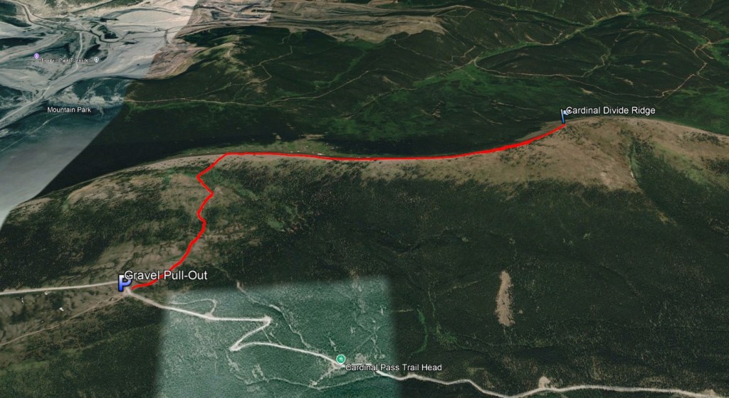
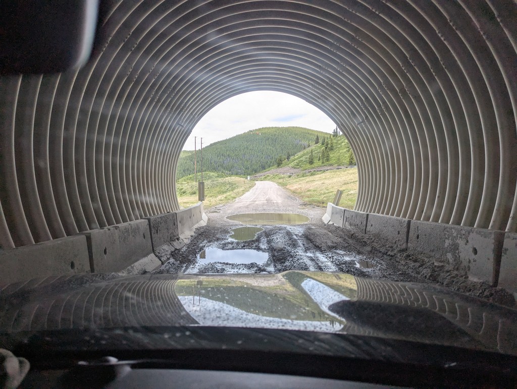
The drive to Cardinal Ridge is probably more of an adventure than the hike itself, but with 4×4 it was a fun day out. It doesn’t appear the road has been maintained since the closure of Cheviot Mine in 2020 and it is looking a little worse for wear. We picked this as an easy hike for a rainy day, but the wet conditions added a little adventure to the drive. The trailhead is 20 km south of Cadomin, not to be confused with the nearby Cardinal Pass Trailhead. Cardinal Divide Ridge marks the divide between two major watersheds, with the rivers to its north draining into the Arctic Ocean and the rivers to its south draining into Hudson Bay.
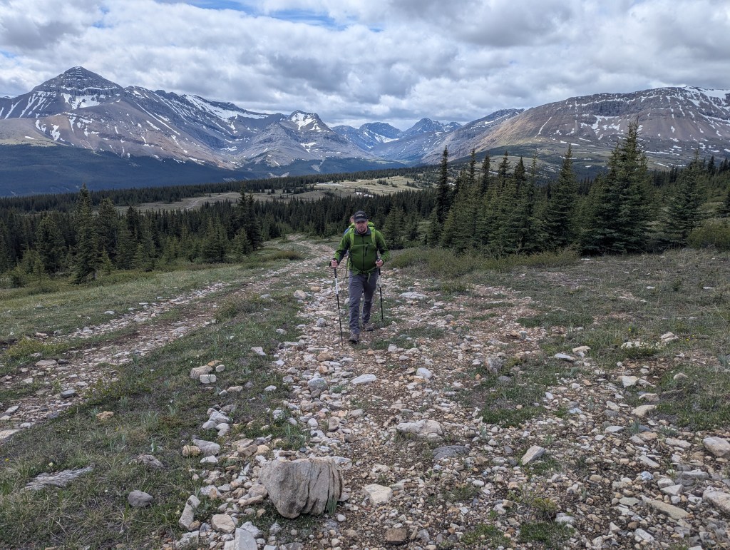
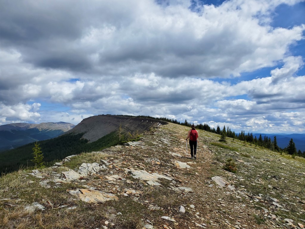
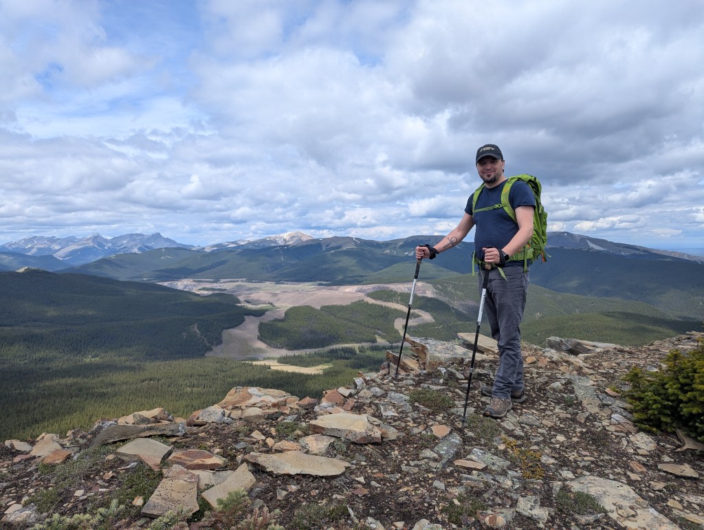
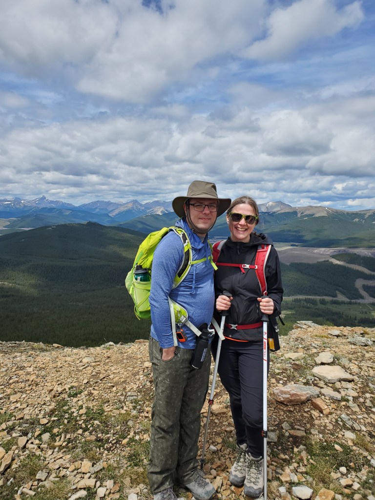
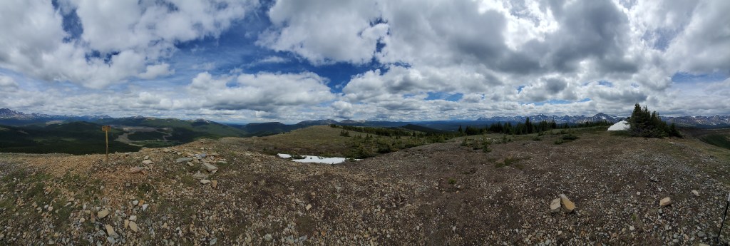
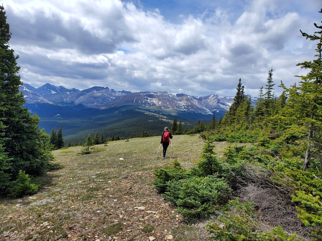
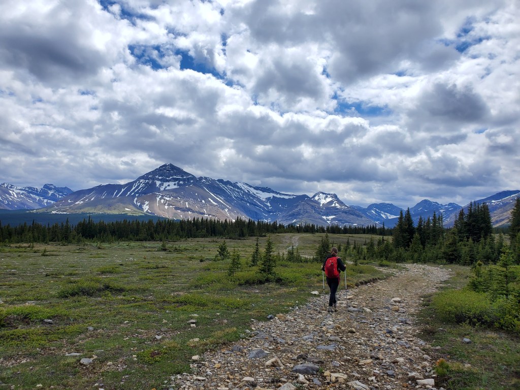
A vehicle with decent clearance can likely make it through when fully dry, but 4×4 was needed on the wet day we went. Once reached, the parking lot is a good-sized gravel pull-out with an outhouse and signage for Cardinal Divide Staging Area.From the staging area, an obvious trail leads up toward the ridge. It took us a little less than 30 min to gain the ridge. We encountered two other groups on the trail in this section, but no one else on the ridge.Looking back toward the staging area and picturesque Whitehorse Wildland. This was the only notable elevation gain of the day.After gaining the ridge, we turned right and headed toward the high point ahead. The trail grows much fainter once on the ridge, but travel was never difficult.Looking back at the gentle terrain along Cardinal Divide Ridge.We reached the high point on the ridge in one hour. Views to the north are of the former Cheviot Mine, which was also the site of the historic Mountain Park Coal Mine.Dan and I, at the high point of Cardinal Divide Ridge.Summit panorama. The only marker was a yellow post.We returned the way we came. Mount Tripoli can be seen ahead, with its peak obscured by trees at the right.We followed the wide trail back out to the staging area, making it back to our vehicle in just over 2 hrs. The prominent peak to the left is Mount MacKenzie.


One thought on “Cardinal Divide Ridge (2220 m)”