Notes: A free day-use pass is required to park at Golden Ears and can be booked online two days in advance. Mostly hiking with a short section of scrambling at the top.
Trip Report
I will never complain about a sunny day in the lower mainland. We only had three days in BC, and ended up catching temperature highs that broke 50-year records, but I was still just grateful it wasn’t raining! Evans Peak has dense tree-cover throughout the route, providing plenty of shade and making it a good choice for a hot day. Even the scrambly section near the top is heavily treed and I expect this peak would be well-sheltered on a windy day too.
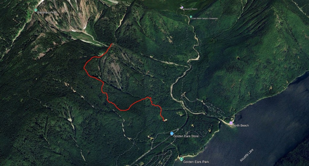
The trailhead starts from the West Canyon parking lot. Knowing that there is no cell coverage in the park, I booked our free day-use pass online two days in advance and saved the reservation number to my phone. Despite booking within hours of passes opening up for this day, and booking for a Monday only, there were no full-day passes left, no afternoon passes left, and only a dozen morning passes left. Thankfully the morning pass worked with our schedule so I snagged the reservation. Park staff checked our reservation number as we entered the park, but oddly the parking lot was mostly empty both when we arrived and left. The outhouse at the West Canyon parking lot is hidden from view while parking, but it’s easy to find next to the trailhead.
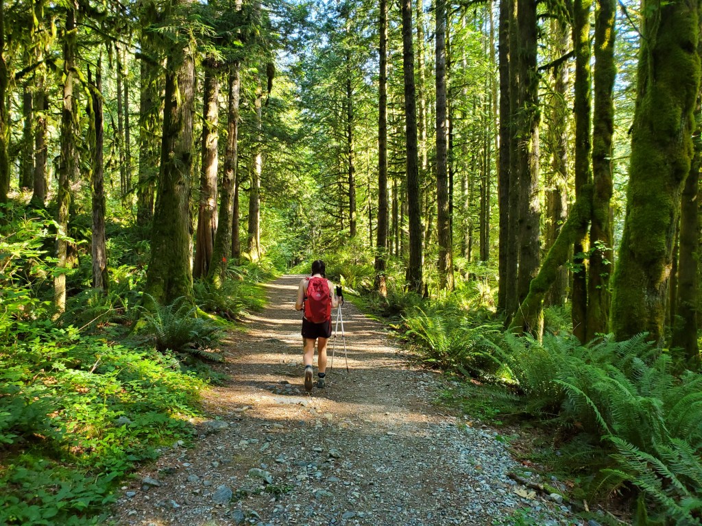
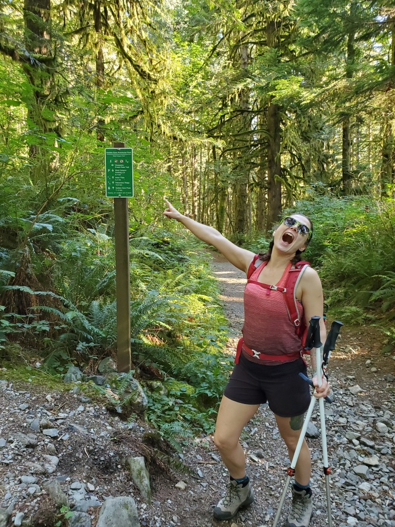
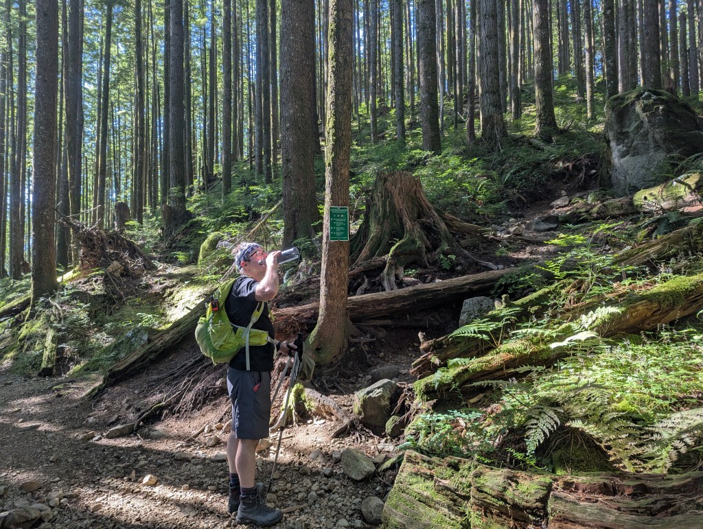
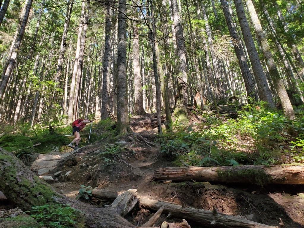
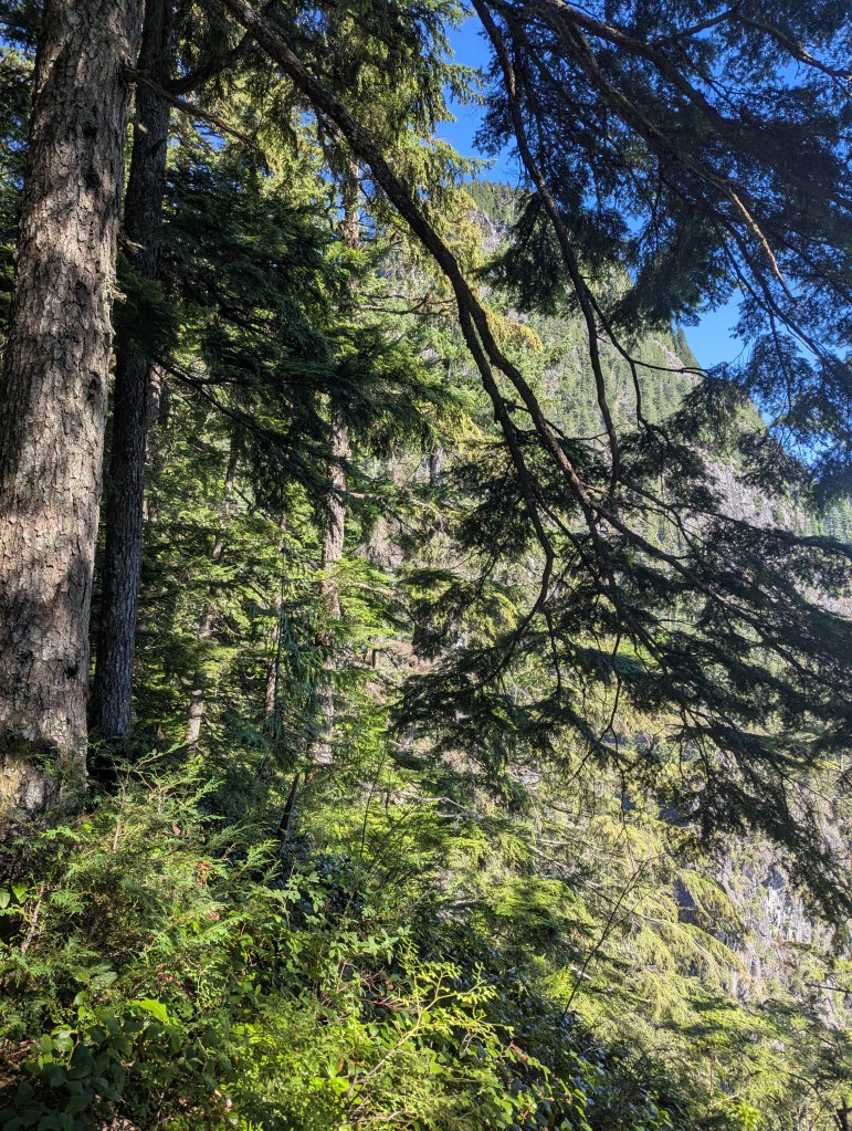
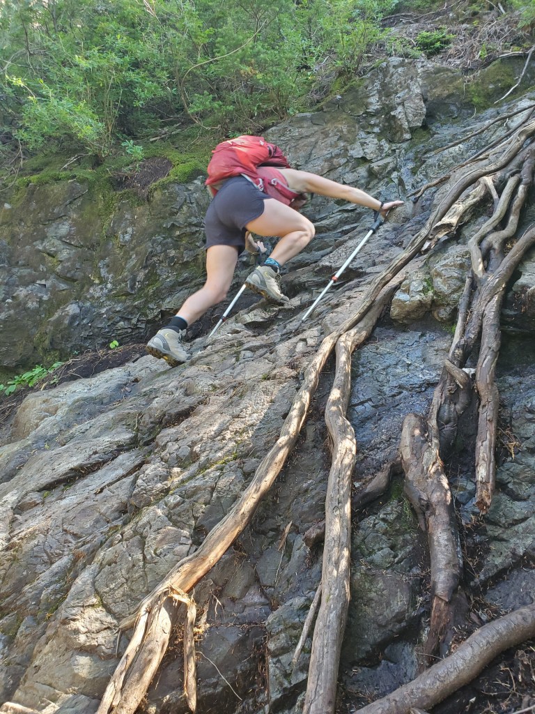
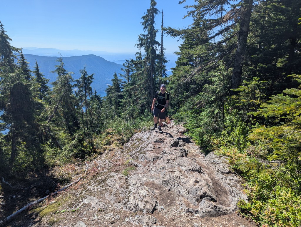
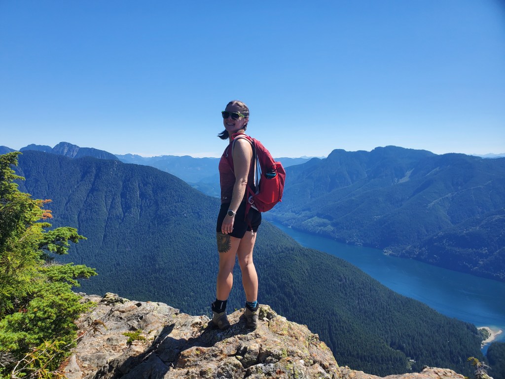
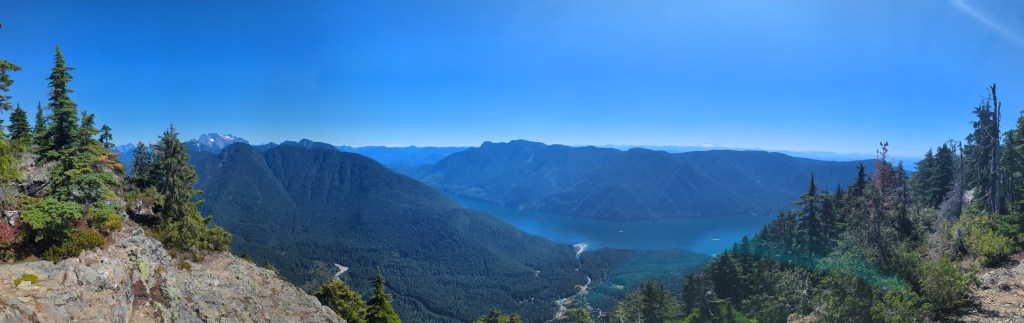
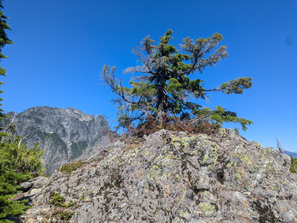
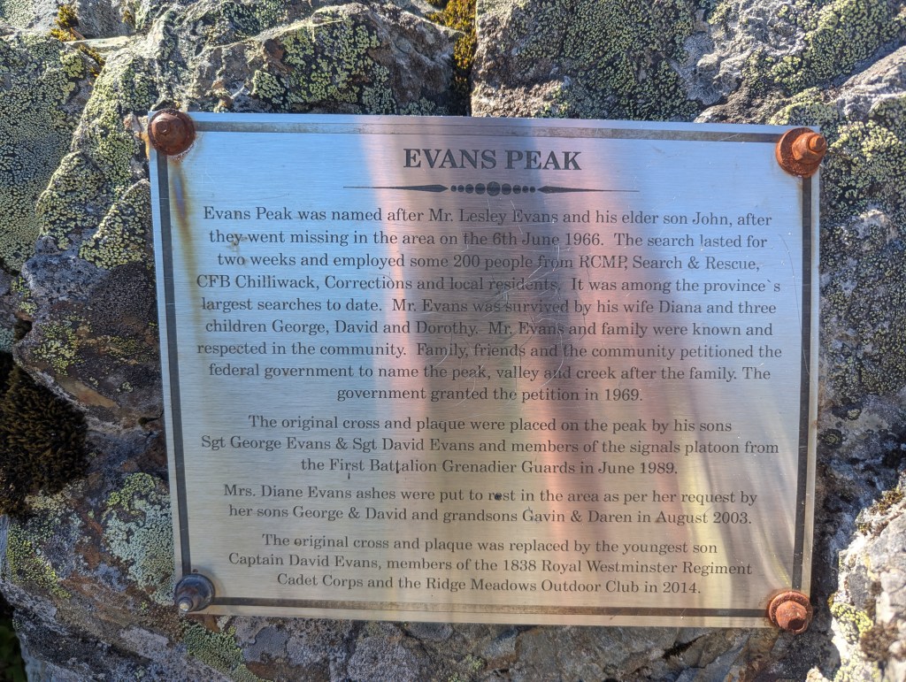
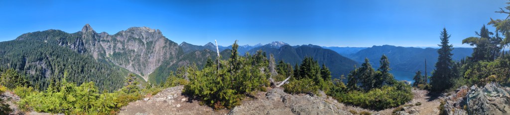
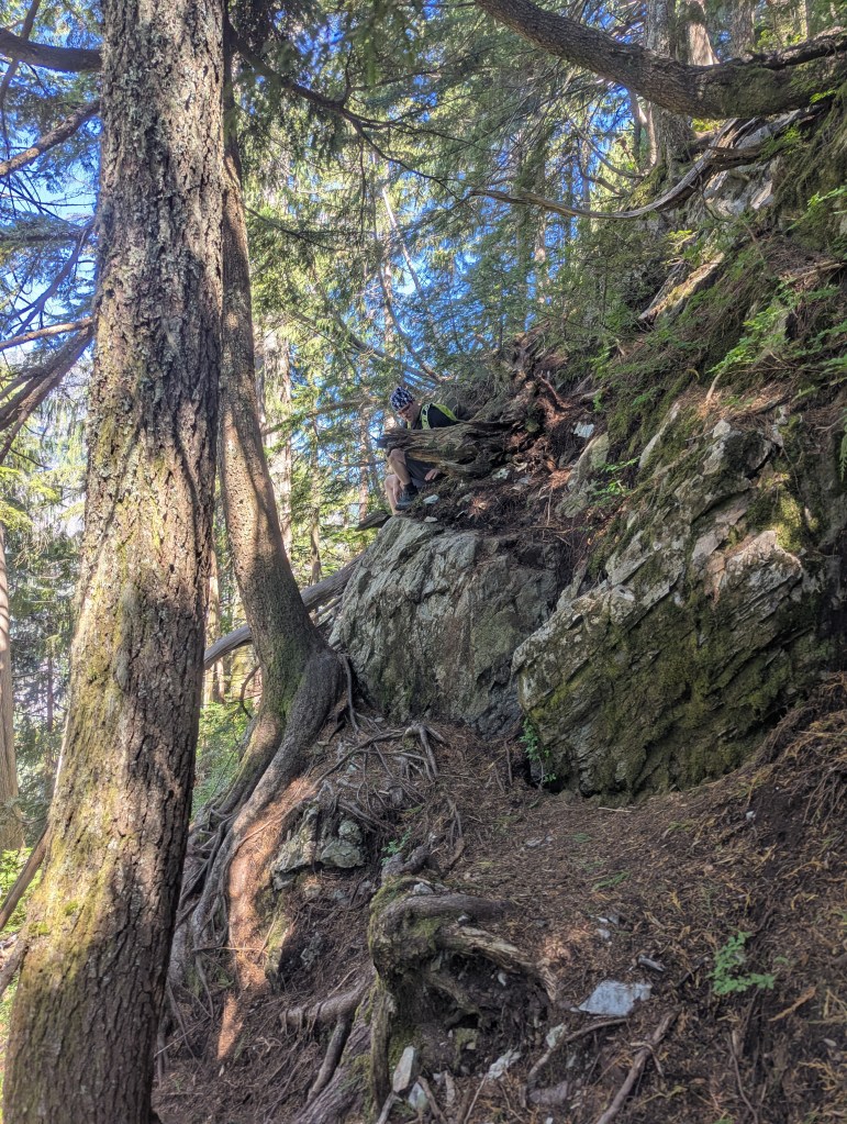
The main West Canyon Trail was wide and flat, with no difficulties encountered. Signage at the trailhead indicated a trail closure, but this didn’t impact the short portion of the trail we used. The first trail we encountered to the left was closed due to washed out bridges, which luckily was not our trail.We reached our turn-off in 7 min, obvious thanks to signage for Viewpoint / Evans Peak Trail.Travel remained easy as we began to gain elevation on the Viewpoint Trail. Frequent orange markers provided extra assurance that we were on route.The turn off from Viewpoint Trail to Evans Peak Trail was well marked. This is where the steep slog began.Dense tree cover masks the steepness of this slope, leaving us feeling old and out-of-shape, wondering why this “easy treed slope” was so tiring! Precisely as described by the book, we reached a modest view point in 1 1/2 hours. The peak, visible ahead, still looked quite far away.Precisely as described, again, we reached a fork in the trail at the 2 hour mark.The terrain changes from hiking to easy scrambling for the last 30 min or so before the peak. This photo is the first of three little cliff sections. The second section is directly above this and has a rope that can be used, if wanted, but isn’t needed. It’s worth noting that even on this 35 C day, the rock was a bit damp and slick.The third cliff section, pictured here, is the tallest and the crux of the day. An optional dirt line exists to the left, but it’s not as solid as this rock line. Another rope is available here, if wanted, but I preferred the solid rock holds. Finally reaching the summit ridge, a few small clearings began to crop up, offering glimpses of Alouette Lake. The view along most of the ridge is obscured by trees.We ran into another group taking in the views over Alouette Lake from this splendid viewpoint just before the peak and decided to pause too.Panorama over Alouette Lake from the viewpoint along the ridge.I left Dan at the viewpoint and continued hunting for the peak, described as being “crowned by a small tree”. The trees all look about the same, but I was eventually able to locate the one in question (pictured) by the plaque at its base. I reached the peak in 2 hrs 40 min.A plaque at the base of the tree honours two hikers that went missing in the area in 1966.Summit panorama at Evans Peak. The prominent needle at the left is Blanshard Peak.On descent we tried out the dirt line next to the crux, but it wasn’t any easier.We made it back to the parking lot in 5 hrs, pausing only long enough to take off our hiking boots before rushing down for a quick cool-off in Alouette Lake. The lake is excellent for swimming and gets quite busy on warm afternoons. A canoe rental is available at the main beach, if you are looking to make a full day at the park.
looks great! bc is sometimes difficult to navigate they do things diffferent there. Matt gunns scrambles in SwBc was the best book and I think it’s available now again on amazon. Even when I worked out there committing to a peak and finding info I found it tough.
Thanks, I think had heard of the book but thought it was out of print – I’ll grab a copy now! 105 Hikes has been quite accurate and reliable so far, but obviously only covers easier stuff.


looks great!
bc is sometimes difficult to navigate they do things diffferent there. Matt gunns scrambles in SwBc was the best book and I think it’s available now again on amazon. Even when I worked out there committing to a peak and finding info I found it tough.
LikeLiked by 1 person
Thanks, I think had heard of the book but thought it was out of print – I’ll grab a copy now! 105 Hikes has been quite accurate and reliable so far, but obviously only covers easier stuff.
LikeLike