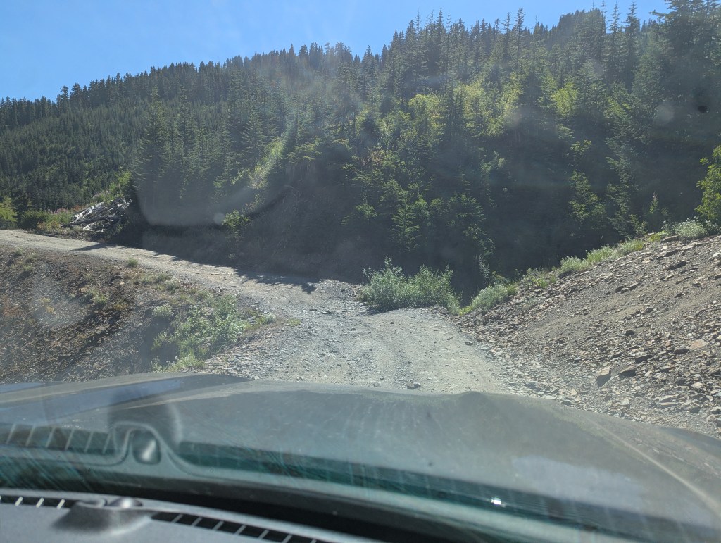
Notes: High clearance vehicle required for forestry road.
Trip Report
Mount Cheam holds a special place in my heart as one of the mountains I grew up gazing at from my family’s farm in Yarrow, BC. It is prominently visible from virtually everywhere in the municipality and is one of the few peaks any Chilliwack resident can point out on the horizon. Despite what Google will let you believe, the name is pronounced by locals as “she-AM”, with two syllables. The Cheam range has long been on my to-do list, and my recent upgrade to a 4×4 vehicle bumped this peak to the top of my list for this trip!
For most people, the crux of the day is the drive to the trailhead. The single lane road certainly wasn’t the muddiest, most rutted, steepest, or airiest road I’ve seen; rather, the challenge comes from a dozen or so ditch crossings where it is easy to bottom out without a high clearance vehicle. The road starts out relatively tame, but gets progressively worse as the drive continues, with the final 4 km providing the biggest challenge. On the day we went, the other vehicles which made it to the parking lot were two Jeeps, two larger SUVs, and a Chevy Silverado.
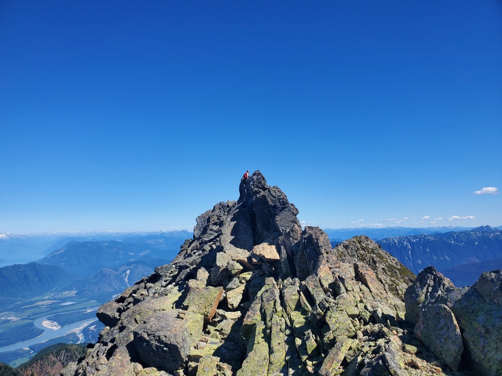
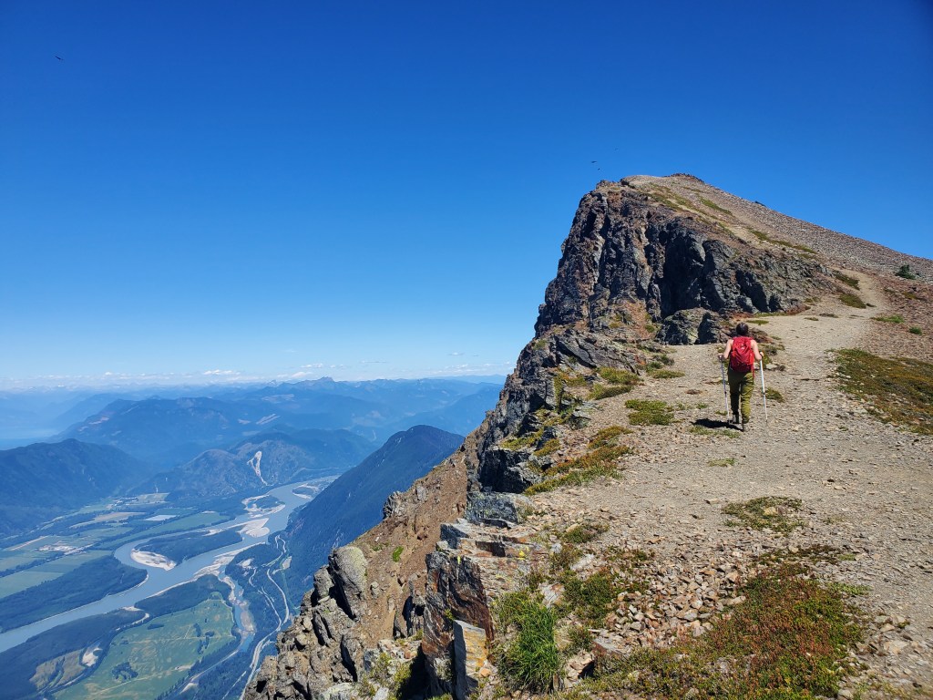
For me, the crux of the day was not the drive, but the final climb up the tallest rock at the top of Lady Peak. From the few trip reports I found, it doesn’t sound like most people include this part in their ascent, but it definitely looked like the tallest point on the mountain. A local I ran into on Cheam also agreed that the tall, narrow rock on Lady is the true peak.
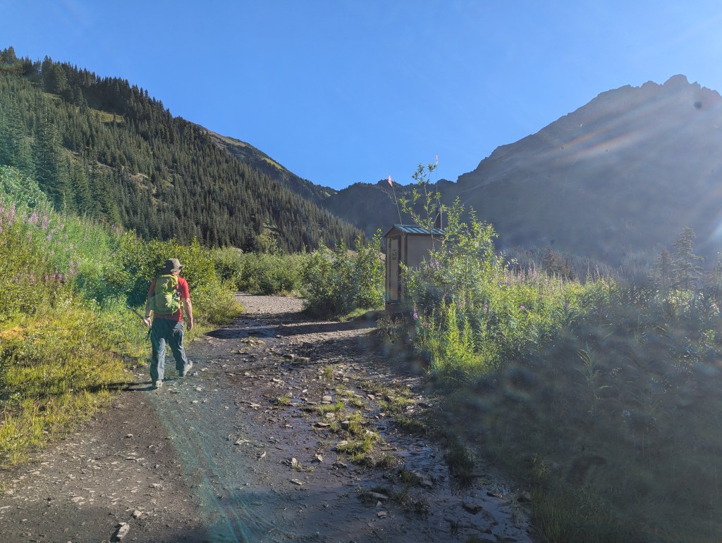
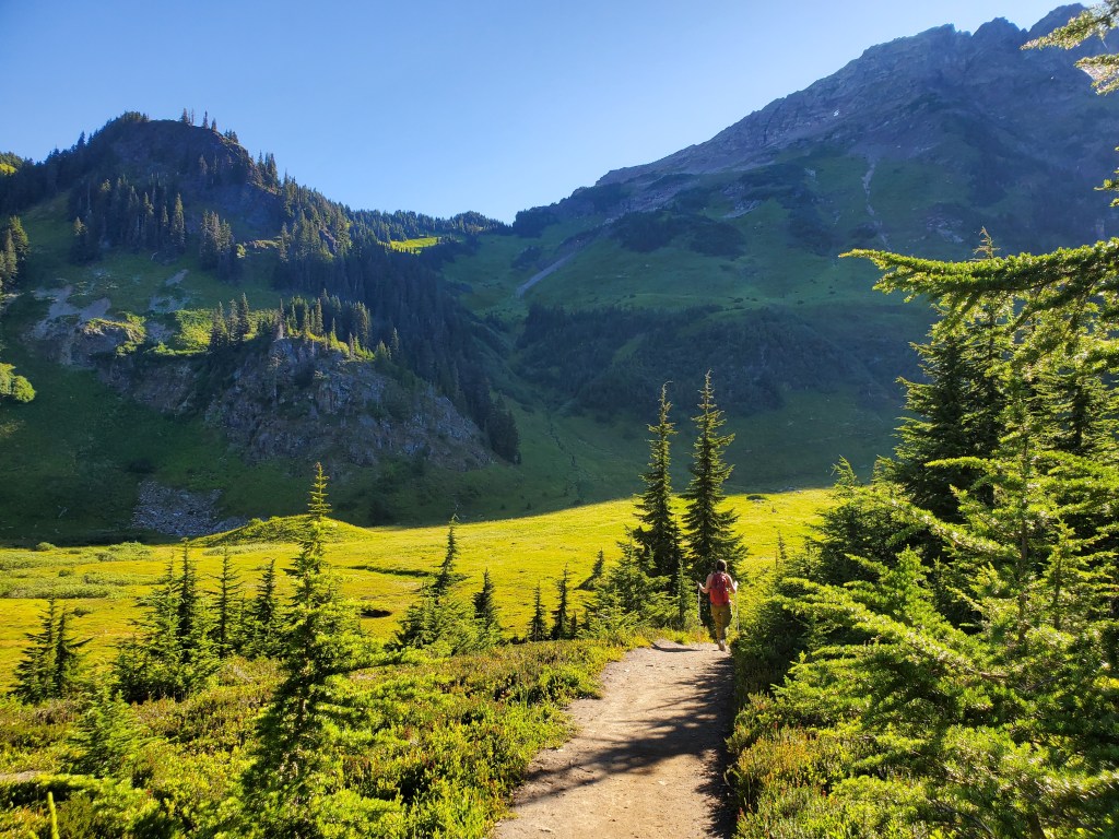
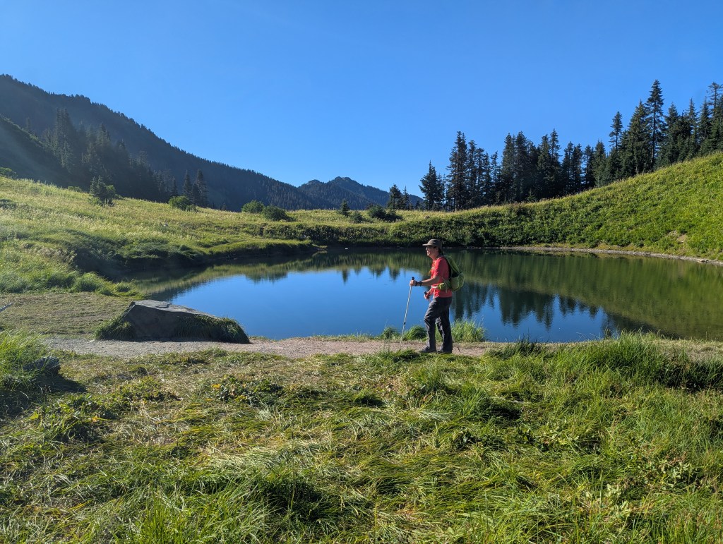
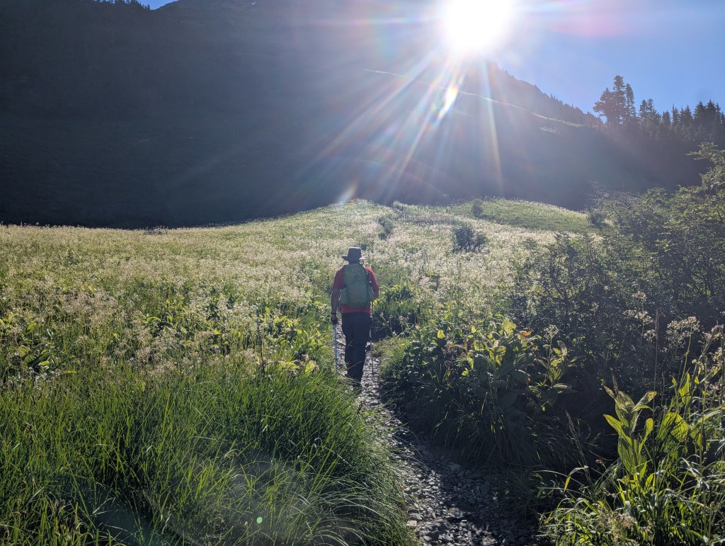
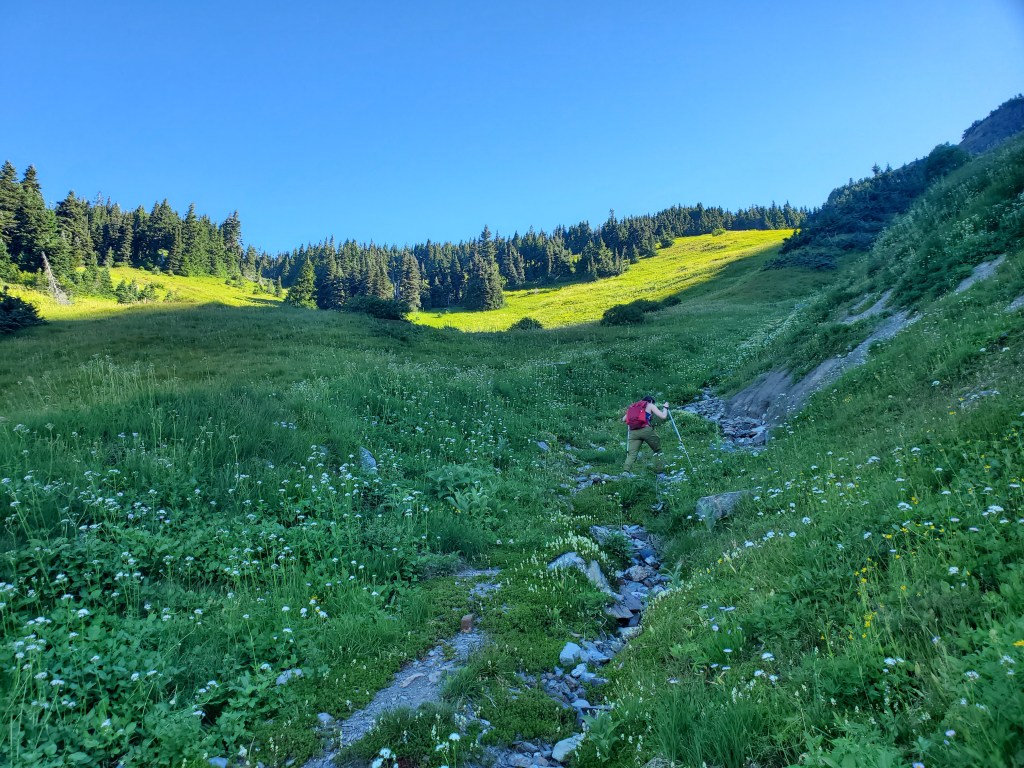
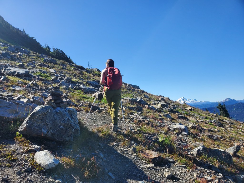
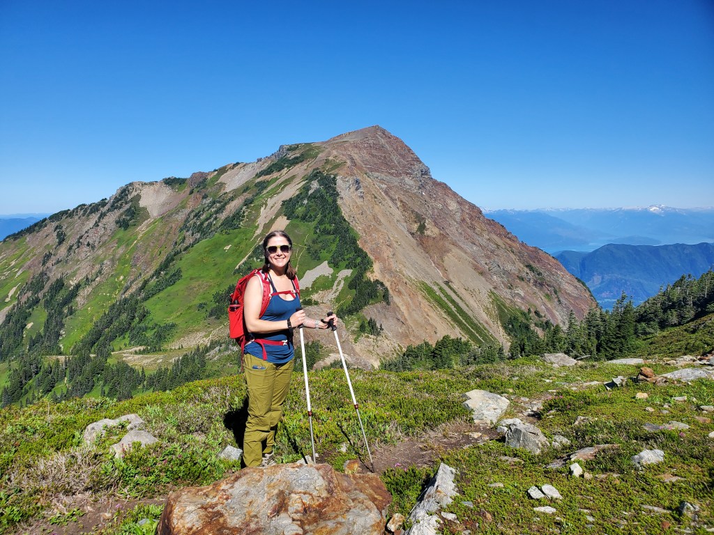
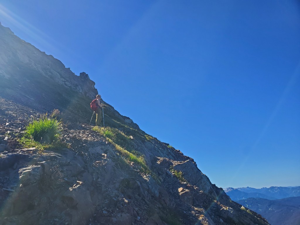
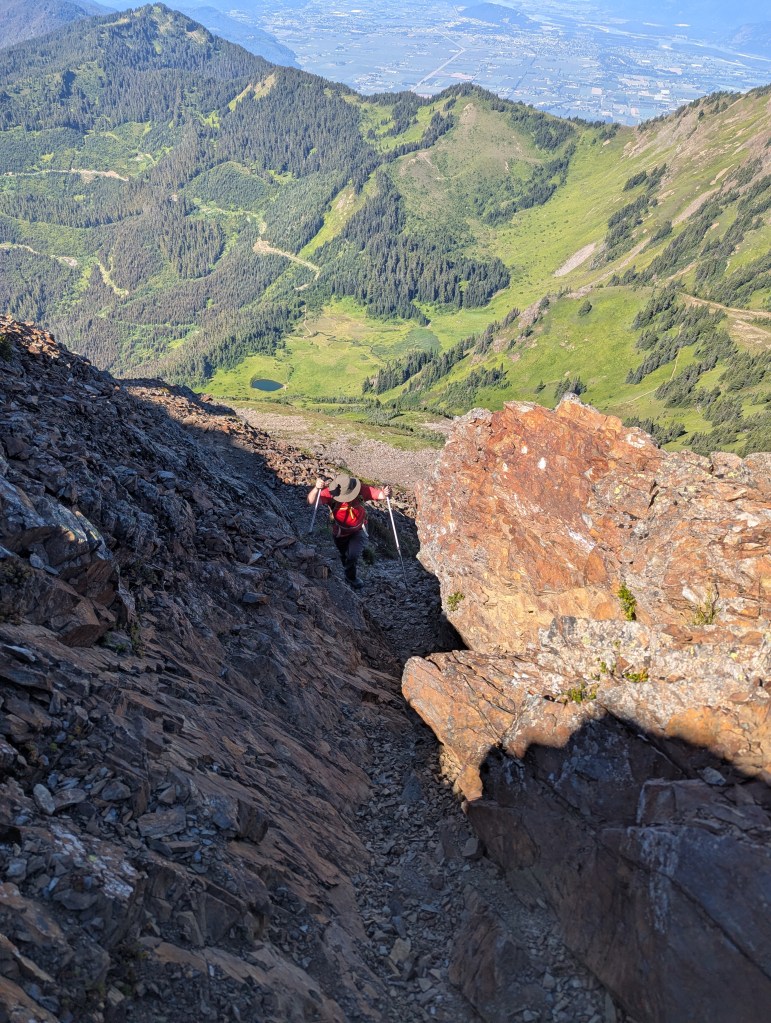
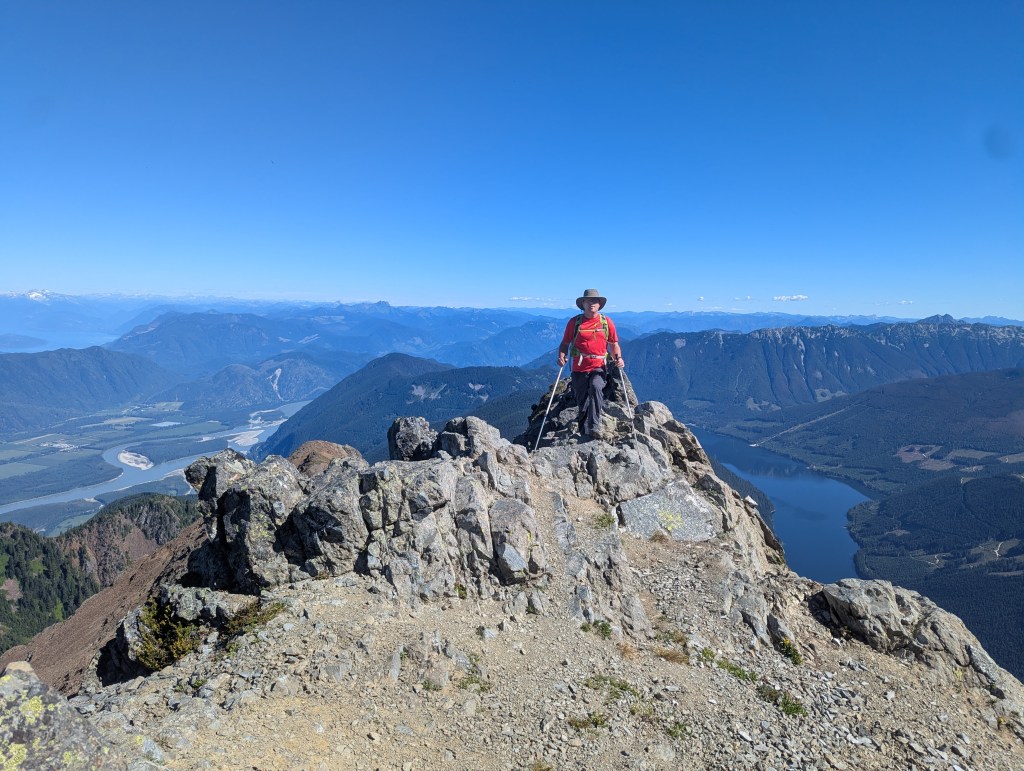
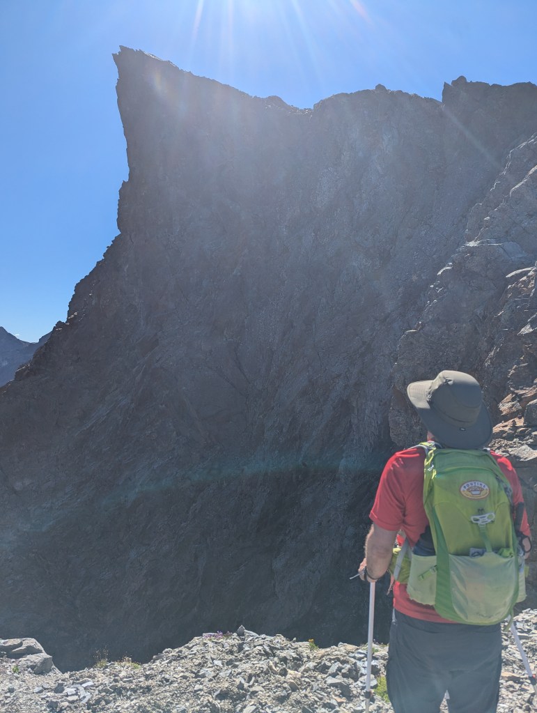
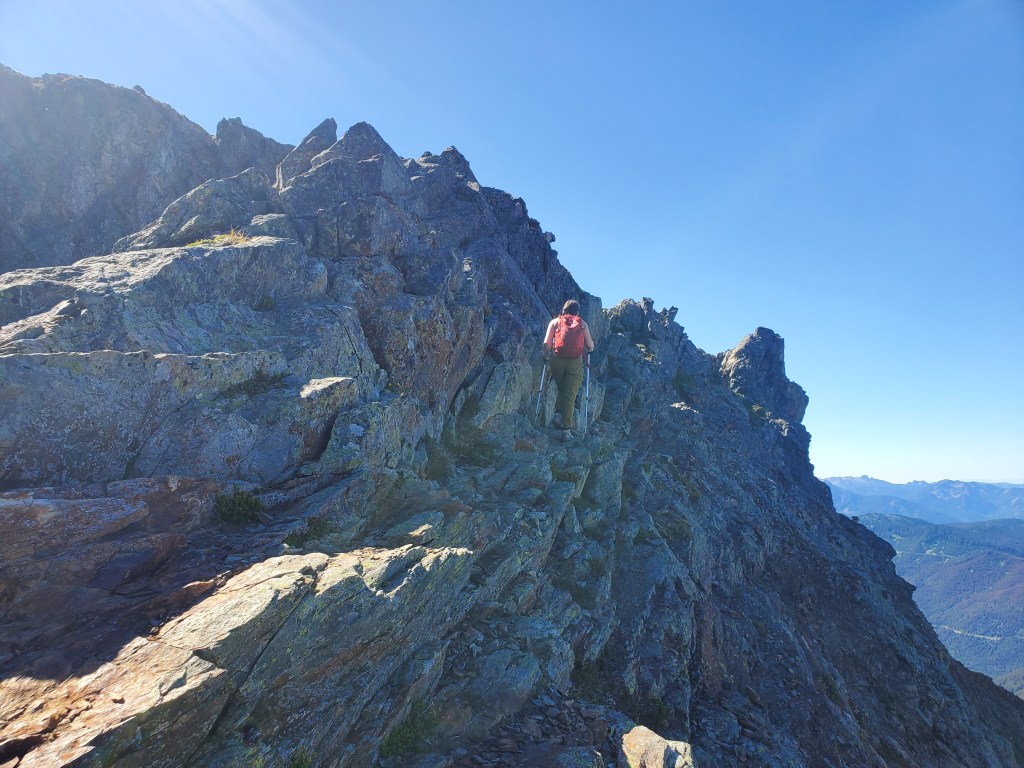
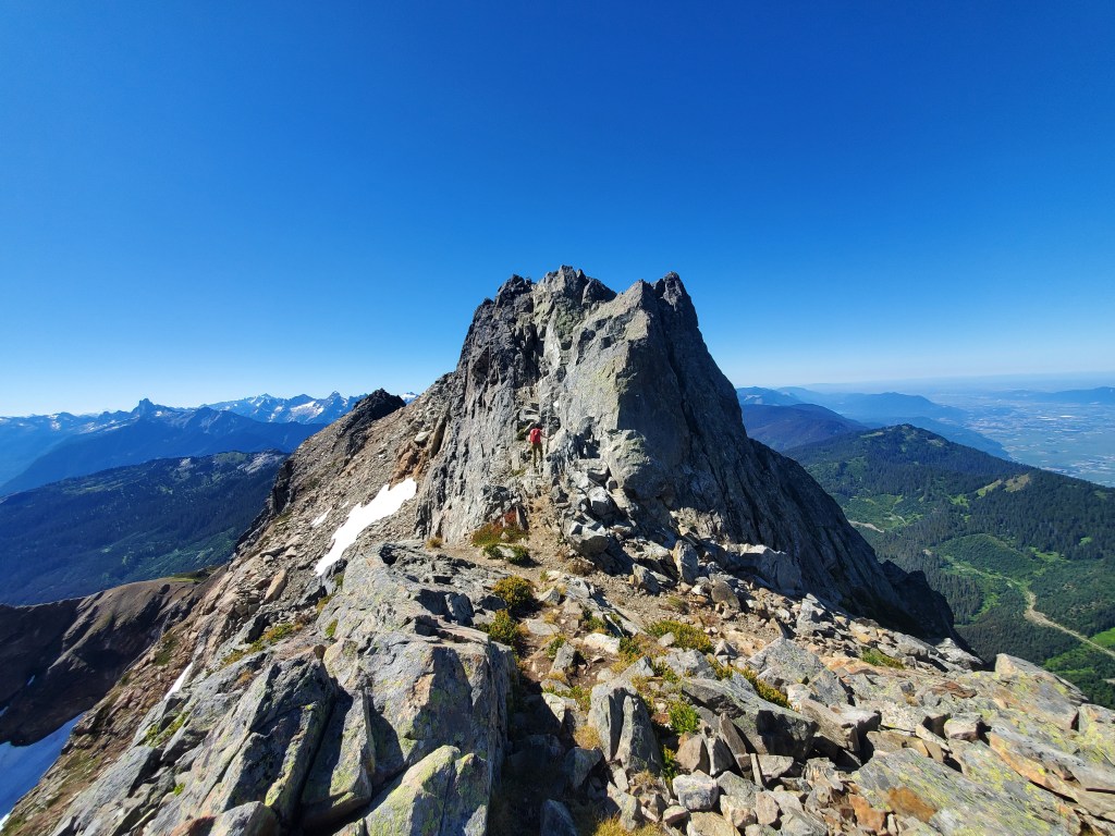
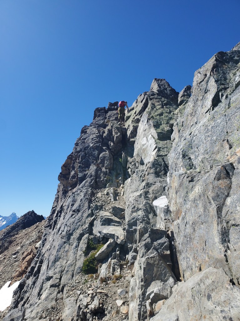
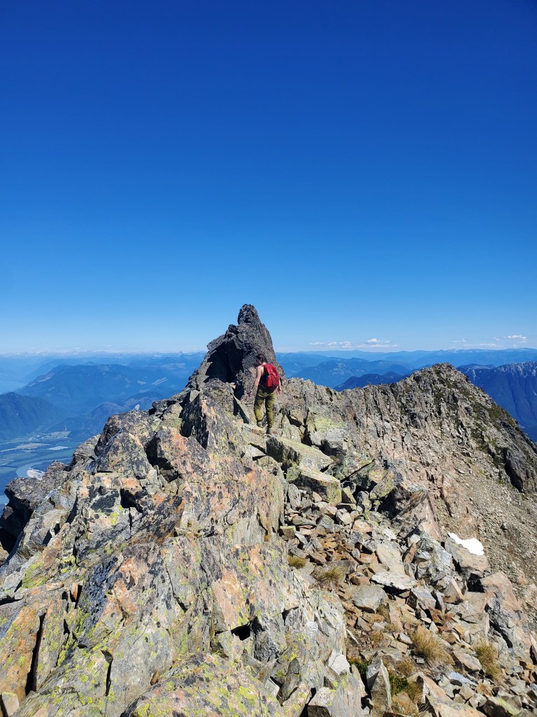
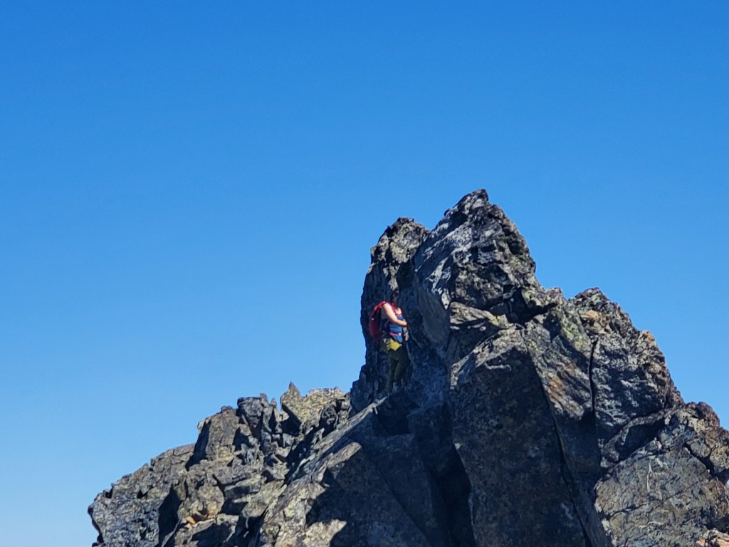
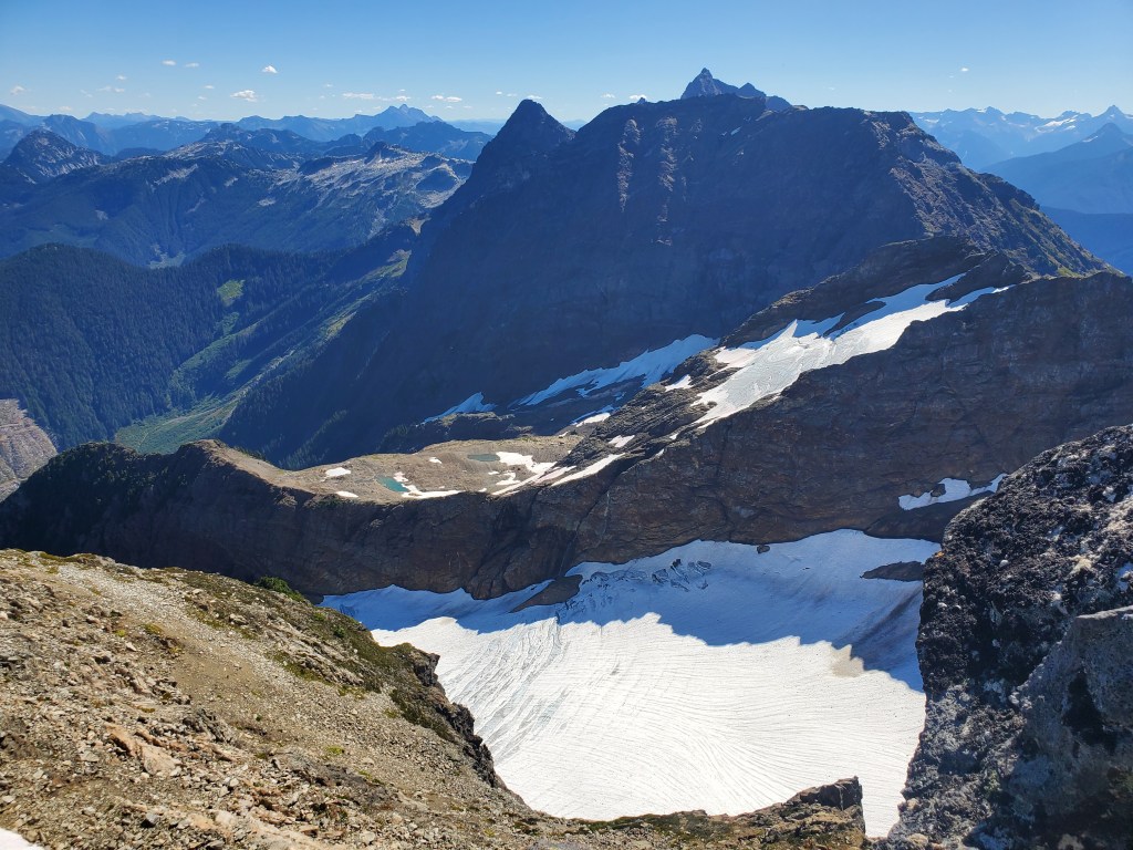
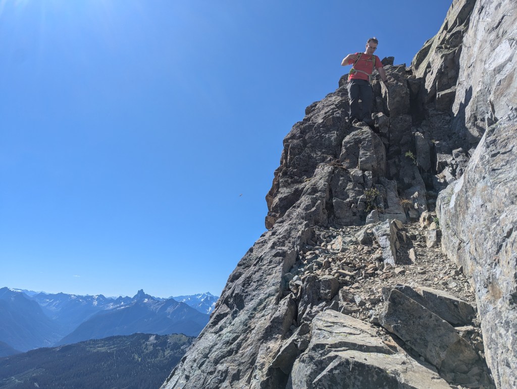
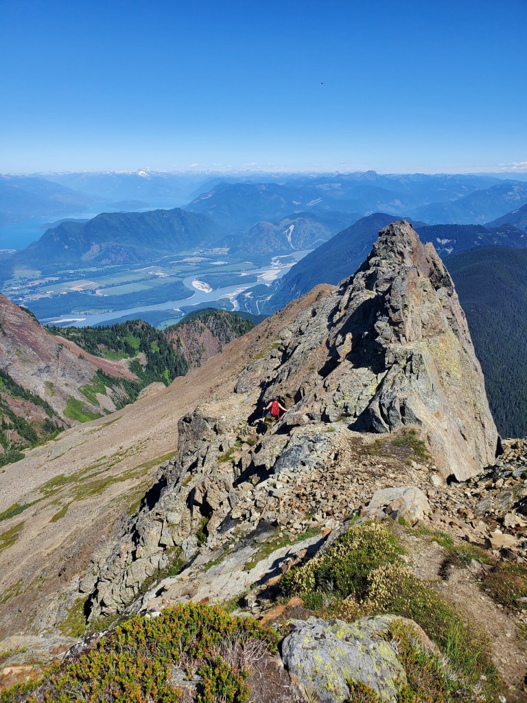
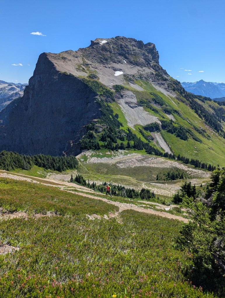
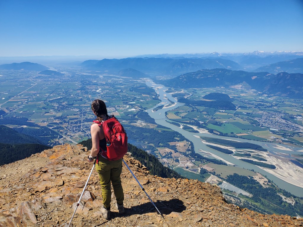
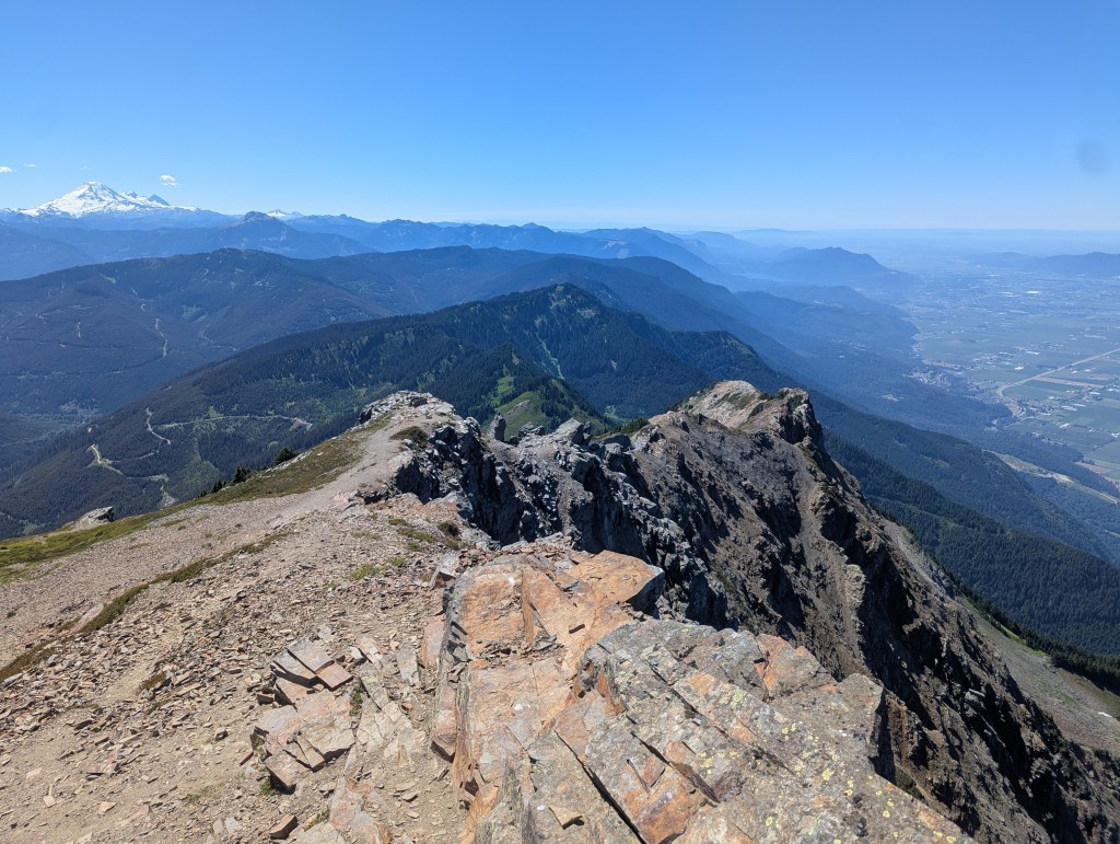
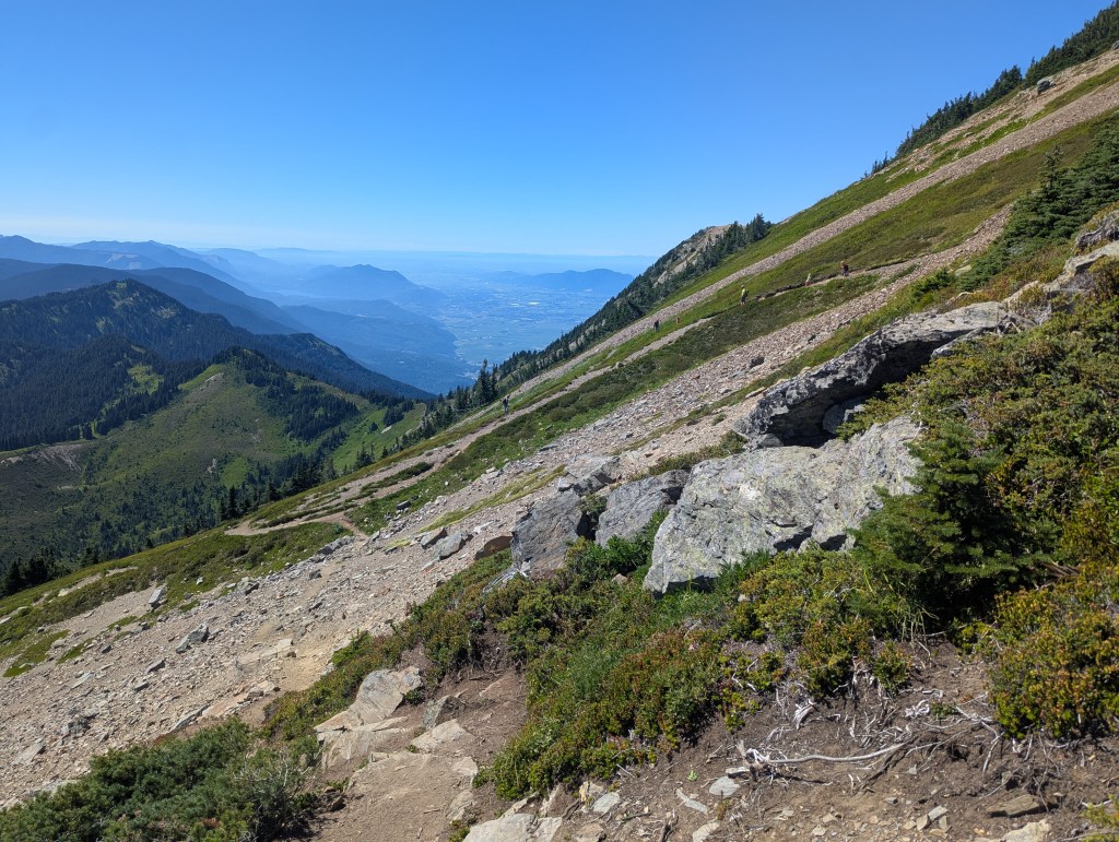
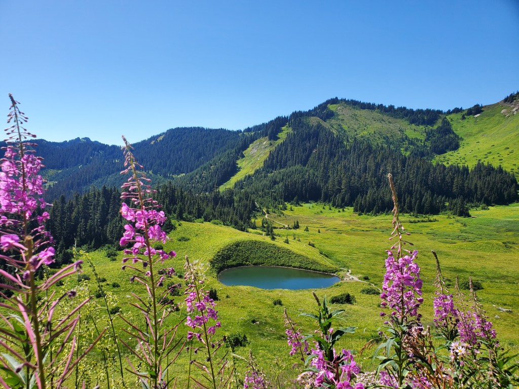
The trail for Lady and Cheam is shared for the first 45 min. It begins as a wide, easy trail with an outhouse about 100 m in from the parking lot. Lady Peak can be seen here to the right and was our first objective. Mount Cheam is out of view to the left.The trail soon winds around a shoulder and enters lush, green meadows. Our route up Lady Peak will take us up the meadowy drainage at center, after skirting around the main bowl.A charming tarn is passed in the meadow.The main trail makes its way up the lower slopes of Lady Peak (ahead) before traversing around to Cheam. We noticed what pleasant morning shade Lady has and chose to start with that one on this scorching hot day. The route up Cheam lies on the southern aspect and was in full sun for the entire day.Once the main trail started its traverse toward Cheam, we kept an eye on the slopes above us to our right and turned upslope when we spotted this easy drainage.Continuing up the slope, we met up with a more obvious trail which traverses between Cheam and Lady higher on the slope. We turned right to follow the trail up Lady, beyond which navigation was straight-forward on a decent trail with regular cairns.Mount Cheam, viewed from the slopes of Lady Peak. The easy, obvious switch-backs leading to the top can be seen from here.The trail up Lady rises toward the cliff band above and then cleverly zig-zags up through weaknesses in the cliffs.Looking down a chute which provides easy passage up through the cliff band. The meadow tarn passed earlier is visible below.Topping out on the cliff band, views open up to the east and north north, including Jones Lake (aka Wahleach Lake) to the right and the Fraser River to the left. Harrison Lake can just be seen in the distance at the upper left.Looking ahead, the summit ridge above looks intimidating from this angle. Our route will keep back from this cliff edge, gaining the summit ridge more to the right.We headed to the right along the cliff band, keeping low and traversing across a nice shelf toward the slopes of the summit ridge. It looks possible to follow the top of the cliff band here instead, but the exposure to the left seemed unnecessary.Rounding the corner of the cliff band and starting up the slope below the summit ridge requires one move of moderate scrambling (pictured). We followed an easy trail up this slope toward the summit ridge above.Once on the summit ridge, a few moves of moderate scrambling lead to the hikers’ summit. I can be seen starting this scrambling section at the left side.This line is foreshortened in photos and not as exposed as it looks. There were plenty of good holds on solid rock, and I only felt that this was moderate scrambling, or YDS class 3 terrain.Topping out at the hikers’ summit. This spot offers good, solid footing and makes for a nice photo or snack break, if you can ignore the amorous insects. This seems to be where most parties turn back, and I won’t begrudge anyone that isn’t comfortable continuing to the exposed peak. Apparently some insects engage in lekking behaviour, a ritual where they gather at the top of mountains to breed. I worry these particular insects may have gotten the wrong impression about our intentions for this summit visit.Panorama from the hikers’ summit on Lady Peak.As we stood at the hikers’ summit, it was impossible not to notice one tall rock, standing on end, the obvious highest point. Okee dokee.We first bypassed around to the other side to get another look. Looking from the south side, there is no question that this tall rock is the peak. I spotted a ramp at the west side (left in this photo) leading to a thin climb up the rock and decided to give it a try.In this photo I am at the top of the ramp and beginning the thin climb. The climb is only about 2.5 m tall and tops out in a low, narrow spot on the rock (About 20 cm wide). From the low spot on the rock, I ever-gracefully smeared my whole body across the top to the highest point. The right side of this photo is very exposed, bumping this up to a difficult scramble (YDS class 4 terrain). The left side has potential to be a bad tumble too.“Well she always knows her place, she’s got style, she’s got grace, she’s a winner. She’s a Lady. whoa whoa whoa, she’s a Lady.” -Tom JonesI reached the top 2 hrs 40 min from the parking lot. Before returning back the way we came, we grabbed a photo looking south to Knight Peak. Judging by the complex, glaciated terrain connecting the two, it becomes obvious why these objectives aren’t typically combined.We returned back down the section of moderate scrambling below the hikers’ summit. This photo better shows how juggy and positive the line is.We made our way back down the slope below the summit ridge and rounded the corner back onto the traverse along the cliff band. Rounding this corner (pictured) is the other brief move of moderate scrambling.We continued down the slopes of Leady Peak on the trail. This time, at the intersection with the upper traverse, we turned right and headed toward Mount Cheam. A very faint trail can be seen ahead of me in this photo.Looking back at Lady Peak from the easy switch-backs of Mount Cheam. We passed two groups descending Cheam, very clearly not for the first time. They were friendly and chatty; one of them confirmed that ridiculous rock on Lady Peak is in fact the true summit.The easy switch-backs lead to a final gentle ramp up to the top of Mount Cheam. Despite the rugged and imposing appearance of this peak, there is absolutely no scrambling required, just chill enjoyable hiking.We reached the top of Cheam 4 hrs 20 min from the parking lot. Jones Lake (aka Wahleach Lake) can be seen in the background.Summit panorama on Mount Cheam.Gazing out over the Fraser Valley. The two mounds in the distance at the left are Sumas Mountain and Chilliwack Mountain. The City of Chilliwack sits in front of Chilliwack Mountain. The town at the right side of the river is Agassiz (Pronounced “AG-uh-see”).The west ridge of Mount Cheam looks like an interesting scramble, but is not part of the hiking route. The trail turns left here and returns down easy switch-backs. The monstrous glaciated peak in the distance to the left is Mount Baker. Cultus Lake can just barely be seen through the smog at the right side of the sea of mountains ahead.We passed a group heading up Cheam as we were hiking out. The group had several children in tow, some probably not even school aged. These are clearly some very tough kids, hiking in 30 C, but this is also a very doable hike (when done without Lady). We continued down the switch-backs and hiked back out through the meadow, past the charming tarn. We made it back to the parking lot in 5 hrs 45 min.It’s hard to capture the frustration that is the forestry road in a photo, and this one doesn’t do it justice. It’s not particularly steep, narrow, or rutted; it instead has a dozen or so little ditch crossings where a car or even crossover would bottom out. A pile of culverts passed part way down makes me think that maybe the culverts were pulled out some time ago, leaving ditch crossings where they used to be. I would only attempt this road in a high-clearance vehicle, and even then I’d prefer it be a vehicle I don’t like very much. We tested the skid plates on our vehicle a couple of times.
Mount Cheam is a great day out, a must-do for any hiker visiting the Fraser Valley in late summer. For me, Lady Peak was the cherry on top of an already great day. I initially only added the peak onto the trip because of how close it is to Cheam, but I truly enjoyed getting in a bit of technical scrambling on solid rock. The route up Lady Peak was fun and interesting, although perhaps not for everyone. If doing Cheam only, allow for 4 hours of hiking.