Notes: Most of the ridge can be bypassed, but I can’t verify that the final portion of the bypass route is still a good line. Keeping to the summit ridge for the final portion is difficult scrambling. Kananaskis Conservation Pass required.
Trip Report
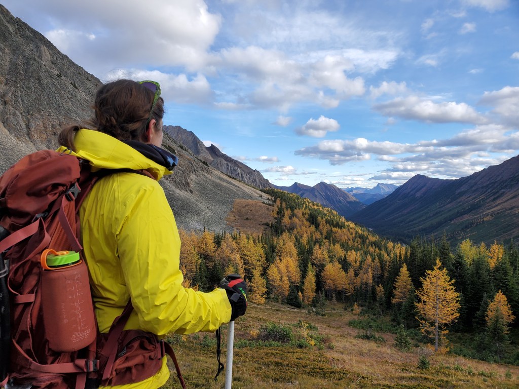
While the “larch madness” crowds can sometimes get a bit overwhelming, the sublime golden larches somehow just keep drawing me back every autumn. The approach to Mount Rae passes through Ptarmigan Cirque, an extremely popular larch hike, which I just couldn’t resist! As expected, the parking lots were completely packed and it took a bit of patience to find a spot. The main trail was bustling with people, but we left the crowds and the larches behind within half an hour.
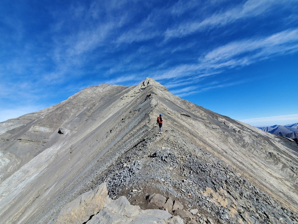
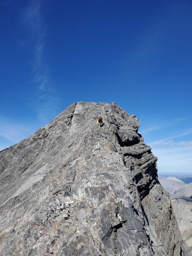
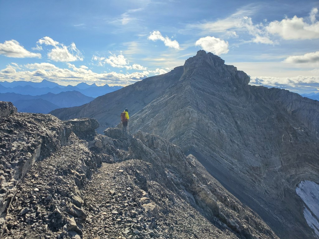
Kane rates this objective as a moderate scramble, but also notes that the summit ridge can be bypassed to the left. The terrain to the left of the summit ridge looked steep, slabby, and in my opinion sketchier than the summit ridge. I believe it’s possible that parts of the slope have washed away, taking the old bypass trail with them. The route following the summit ridge required a couple of exposed moves, making me bump this rating up to a difficult scramble.
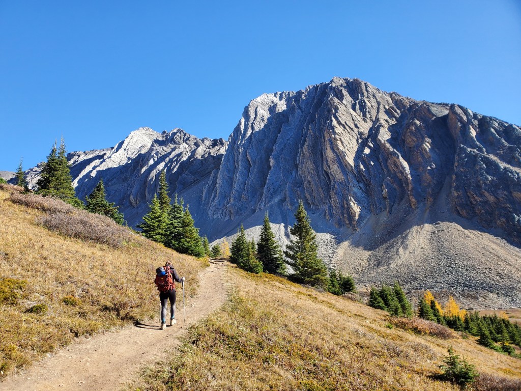
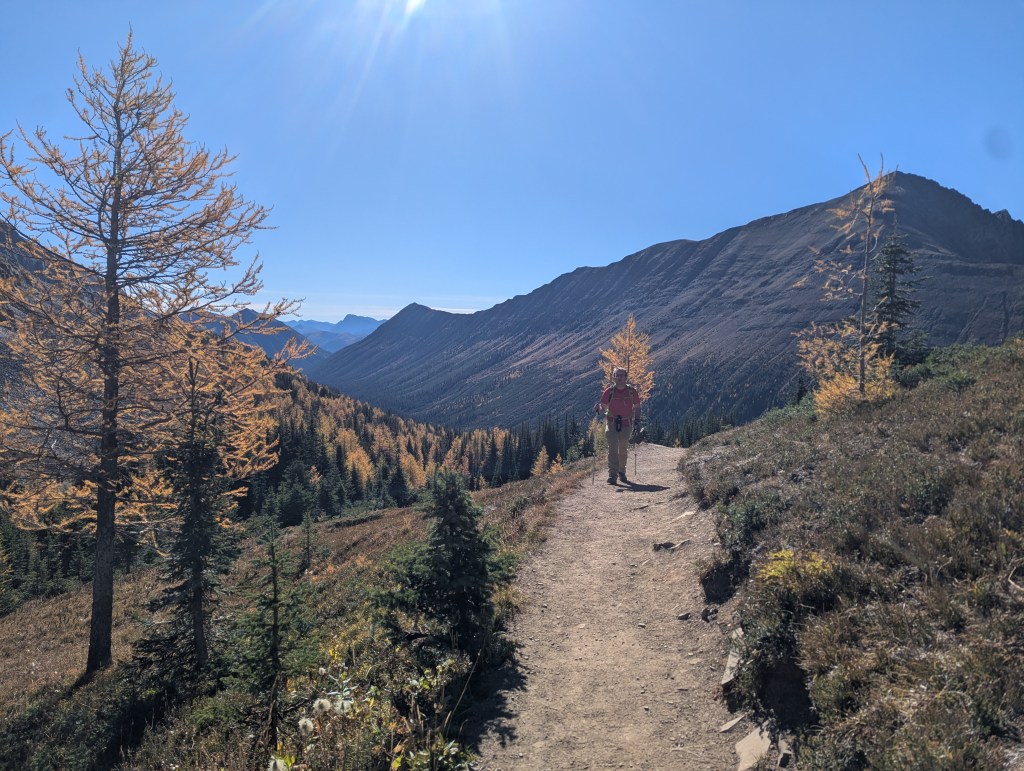
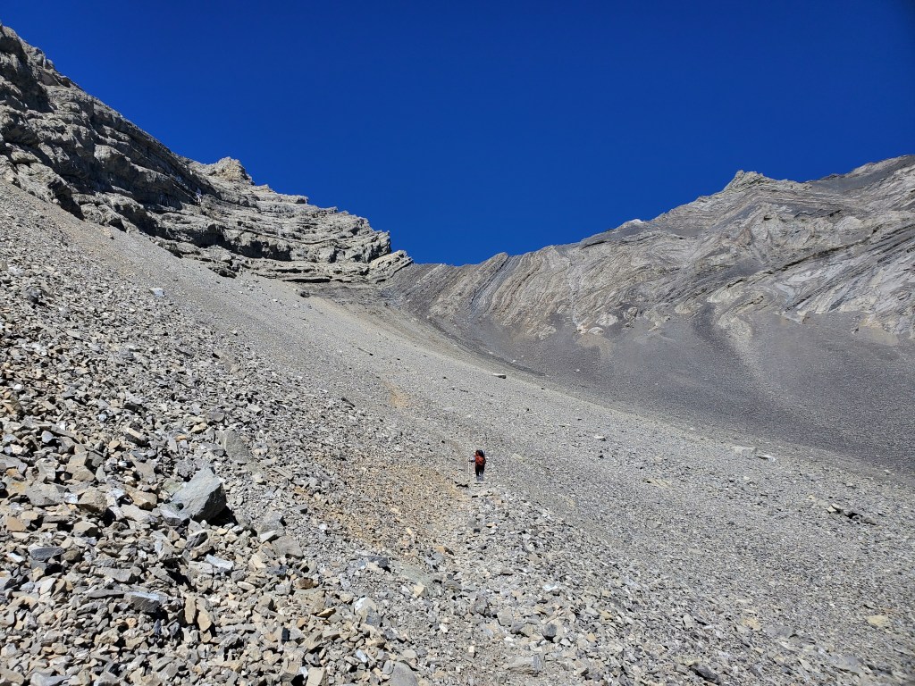
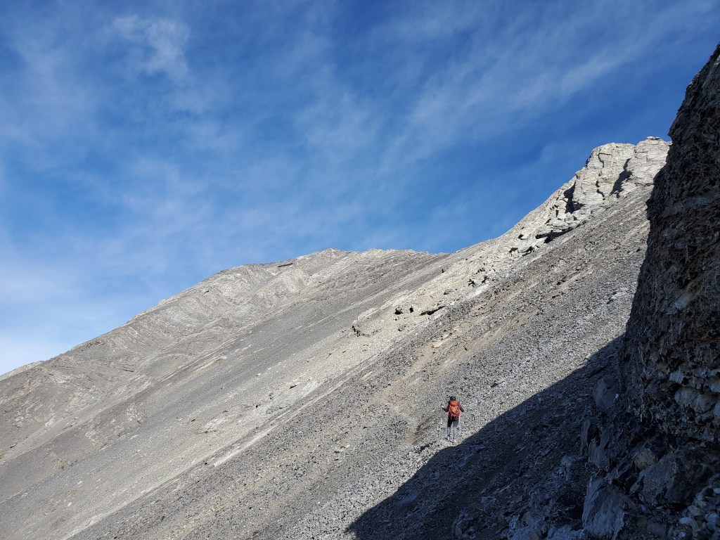
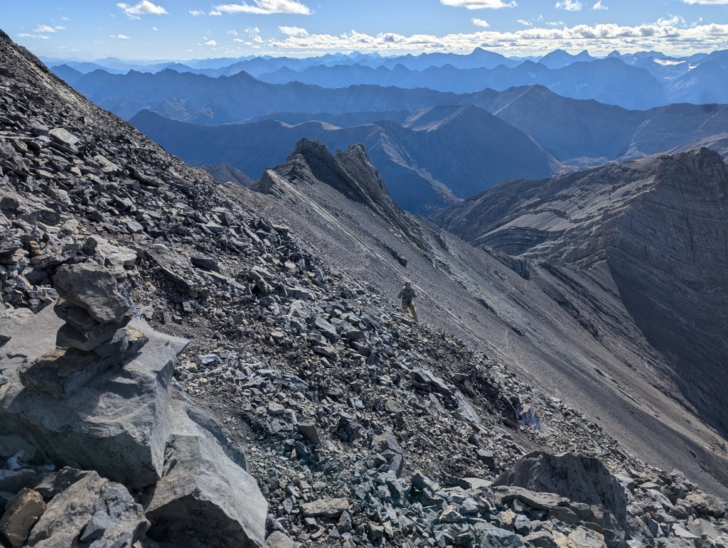
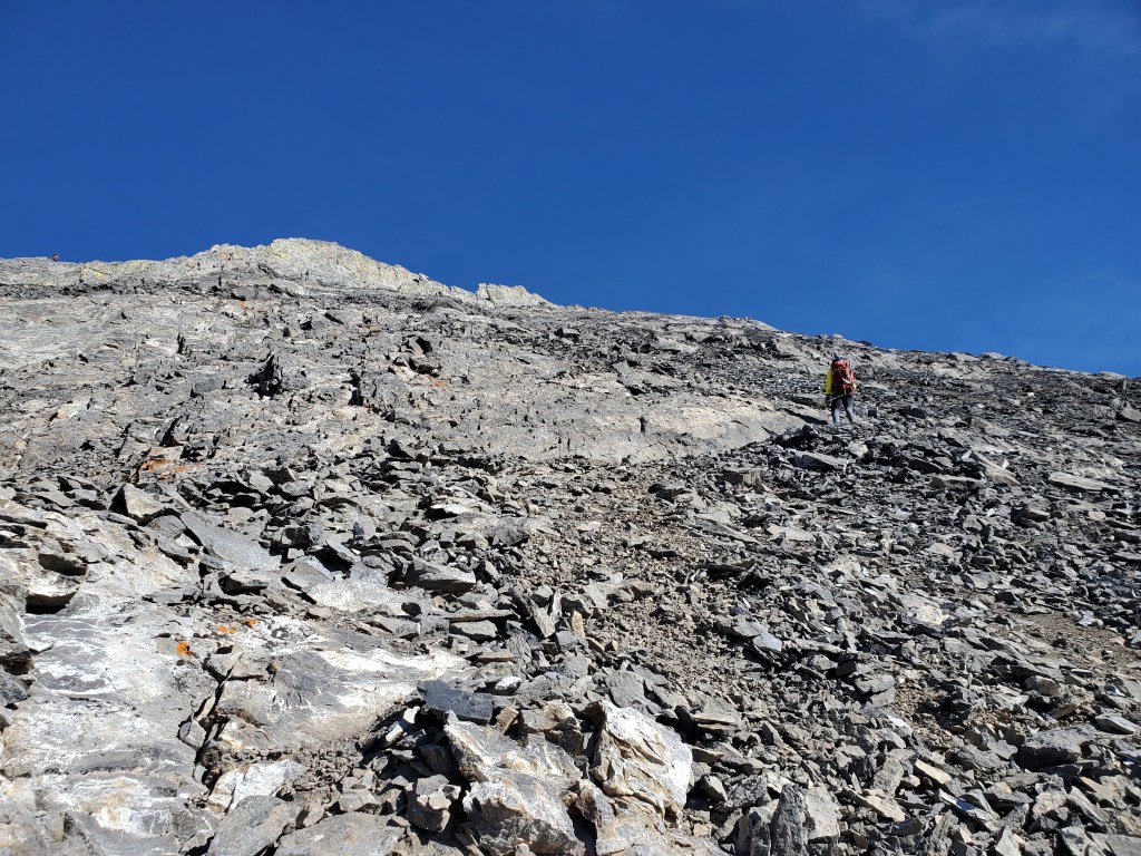
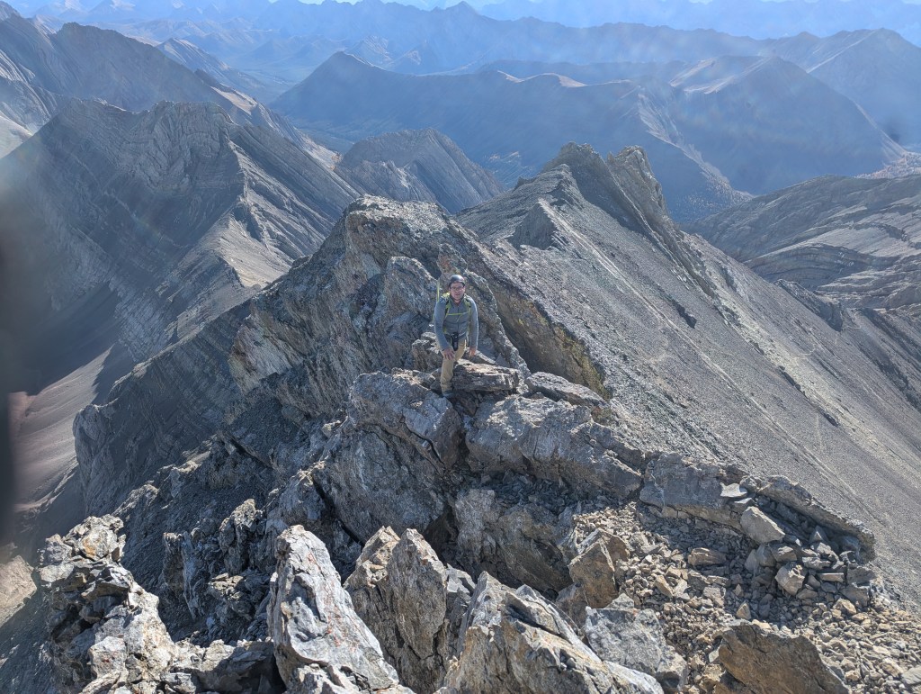
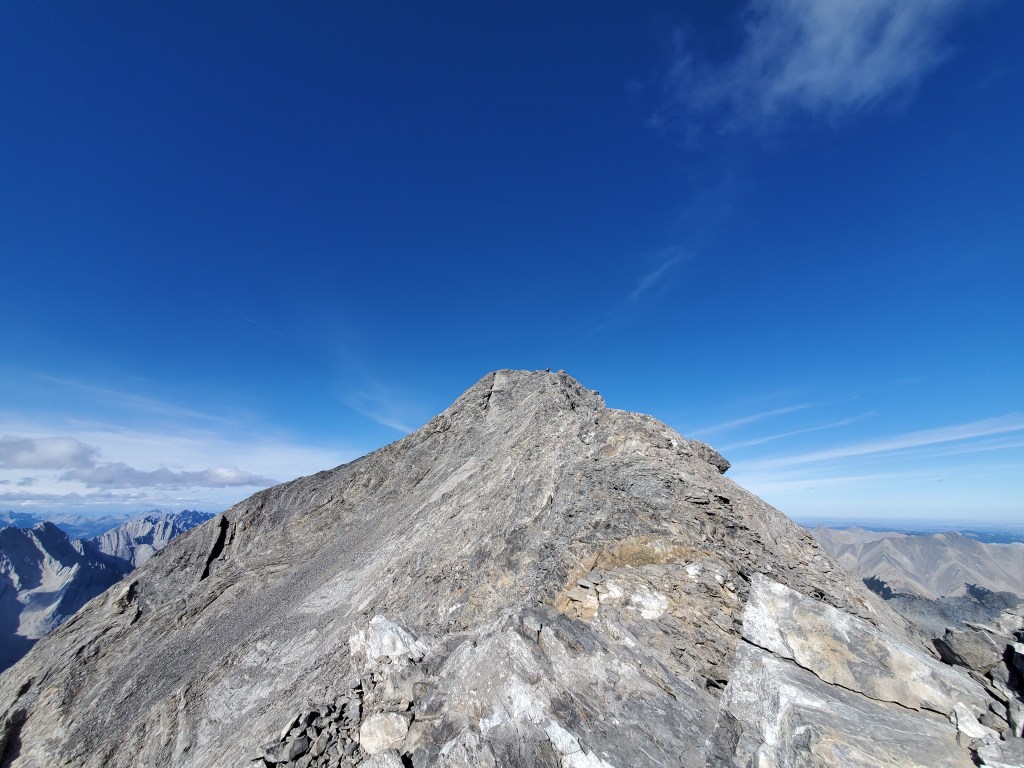
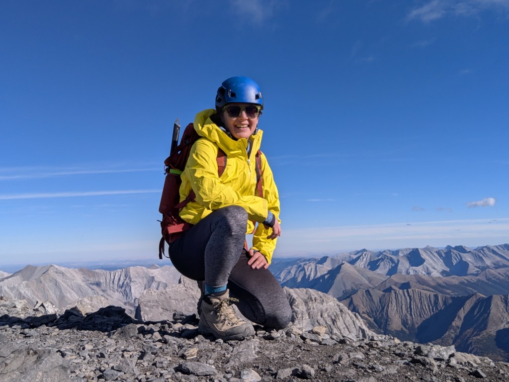
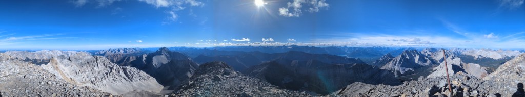
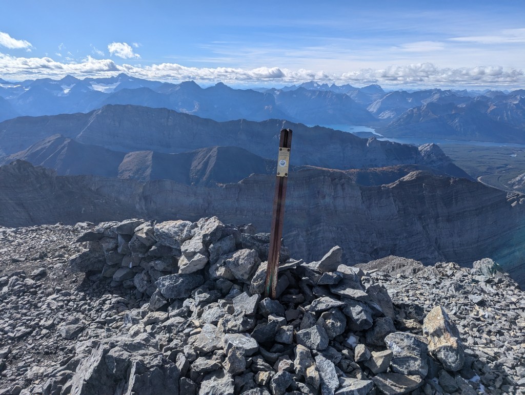
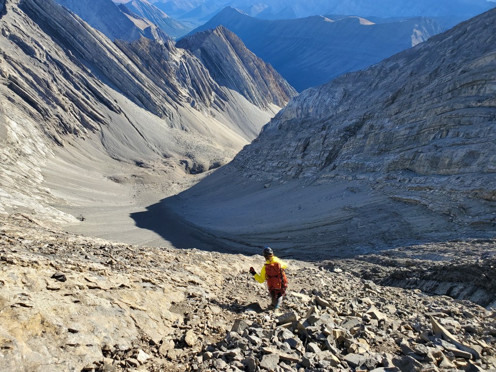
A wide, well travelled trail leads to Ptarmigan Cirque. Views begin to open up within 10 minutes, including the dramatic faces of Mount Arethusa (left) and Little Arethusa (right). There were plenty of other hikers on the trail, but we had no trouble passing other groups on this day.Here are the larches you were promised! Highwood Ridge stands in the background.Where the official trail begins to loop back around, a thin but obvious trail continues on through the valley. This view looks back toward Ptarmigan Cirque from the continuing line.Continuing on ahead, the trail follows the bowl as it curves around to the left. The slope ahead is foreshortened from this angle and will take about an hour to gain from this point, along ribs of rock that offer rubbly slab terrain. Having heard this section has a reputation for rockfall, we chose a rib a few to the left of the main trail, to keep out of the line of fire of anyone that might be coming down.Reaching the ridge, the peak comes into view (left). The gendarmes described by Kane are visible ahead, with the largest one featuring prominently at center. Following his recommendation for dry conditions, we followed the logical detour left onto scree.The first part of the scree trail was swift easy travel. It bypassed the gendarmes and then turned upslope just before a loose section. The last uphill portion was a bit tedious, but fairly short.Looking back as we follow the trail up to where it regains the ridge.We regained the ridge at a cliff dabbled with yellow. An individual can be seen at the left here, at the start of the exposed section of the ridge, waiting while his friend tackles the technical section.Looking back as Dan tops out on the yellow cliff and regains the summit ridge. He tested out the first few moves of the summit ridge, but decided to instead wait with the other scrambler while I continued on solo.Most of the summit ridge was fun, hands-on scrambling with solid holds. But, there were a couple of moves where I briefly stepped around to the right, above very exposed terrain, so I must give this objective a difficult rating. Looking down to the left while scrambling, I saw parts of what looked like a trail, but sections of it disappeared into steep, bare slab. To me, it looked sketchier than the ridge, so I stuck with my chosen line.The peak, as seen from Dan’s vantage point just before the technical portion. I can just barely be seen as the spec nearing the top. Comparing this photo to page 9 of So’s trip report, the bypass trail previously pictured and described does not appear to be present in 2025.A summit selfie, framed by the front ranges to the east. I reached the top in 3 hrs.Summit panorama on Mount Rae.Mount Rae’s significant summit elevation provides an excellent vantage point to take in the sea of peaks of Kananaskis Country. The three ridges in front, starting from nearest, are Mount Rae W 1.7, Pocaterra Ridge, and Mount Pocaterra. A glimpse of Kananaskis Lake can be made out behind Mount Pocaterra, beyond which several lofty, glaciated peaks can be seen.We returned the way we came, again avoiding the gendarmes on the bypass trail. This shot is approaching the col, with Mount Rae SW1 ahead.Looking back as Dan makes his way to the col.On descent we stuck to the most obvious path down the ribs of the col, to climber’s right of our ascent path. We checked to make sure no one was on the same line as us before starting, as the rockfall was notable. We had to stay close together to avoid striking each other, much closer than how we started out in this photo.By the time we were returned to Ptarmigan Cirque in the late afternoon, most of the crowds had dissipated and we had the larches all to ourselves!
We returned to the parking lot in 5 hrs 20 min, a little over an hour before sunset. The parking lot, which had been bustling in the morning, was nearly empty in the evening.
As an aside, you’ve probably heard of The Sharp End Podcast, a podcast aimed at minimizing mountaineering accidents by sharing stories of past incidents, but you may not know there is an episode featuring a 2020 accident in Alberta, and on this peak no less. Give it a listen if you’re interested: Broken Neck on Mount Rae