Notes: Roughly 7 km of bushwhacking. Glacier-adjacent travel.
Trip Report
This route has a desolate feel to it and offers unique 360 degree glacial views without having to rope up for glacial travel. A good portion of the route is glacier-adjacent, meaning basic mountaineering knowledge is an asset here to avoid accidentally crossing onto glacier.
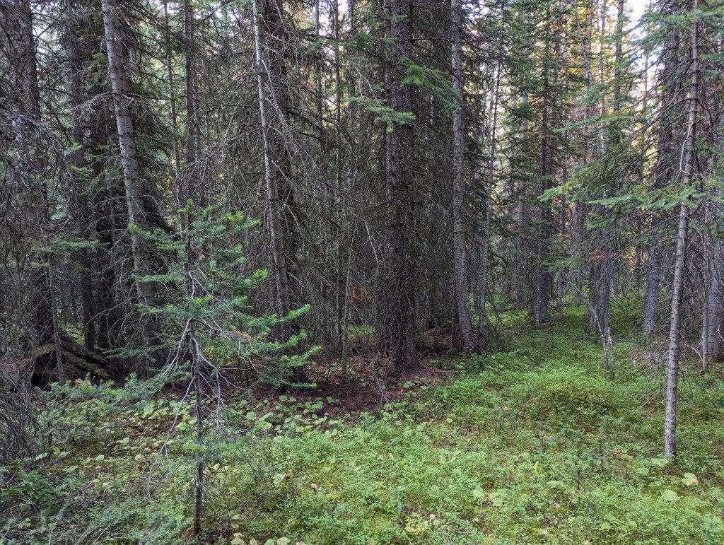
The bushwhacking certainly isn’t for the faint of heart. Whichever herd was making trails through here at the time of Nugara’s trip seems to have moved on. I didn’t find the game trails he writes of. Fortunately, only 2 km of the roughly 7 km of total bushwhacking was thick and unpleasant.
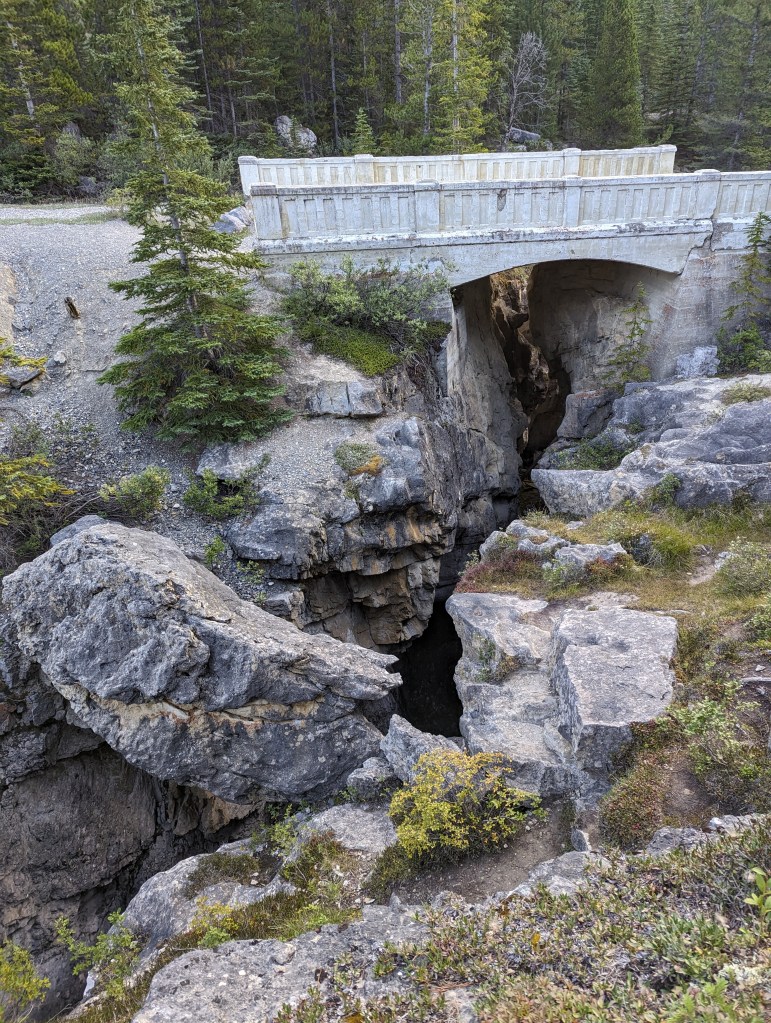
The driveway off of the highway is steep and easy to miss. There’s only room for about five vehicles to park, but this didn’t cause me any issues.
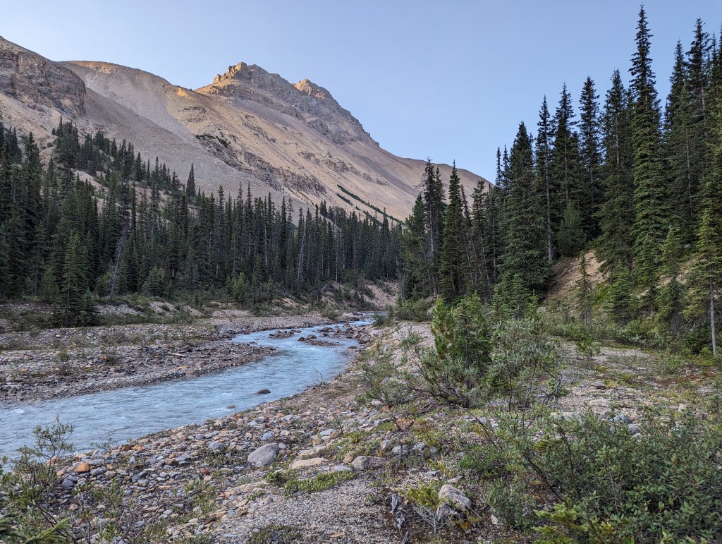
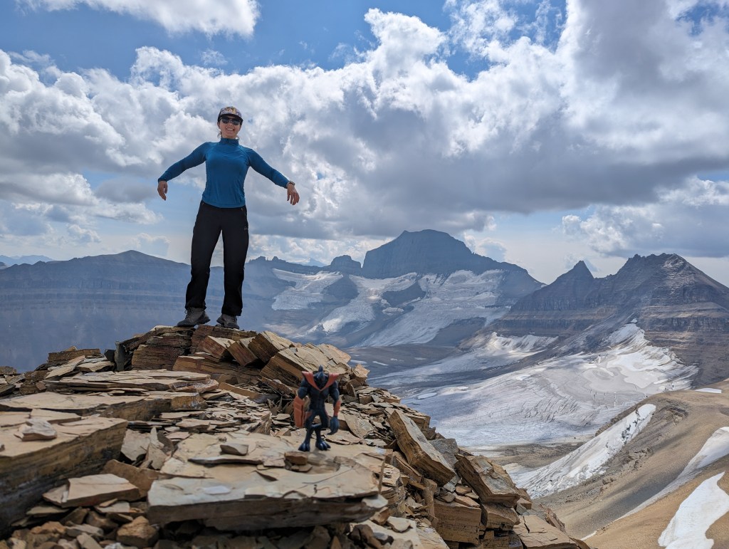
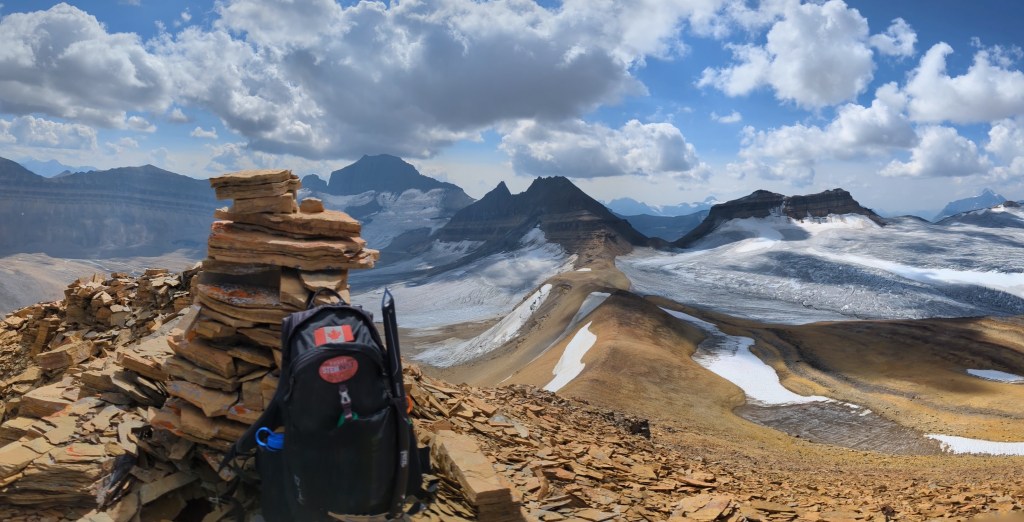
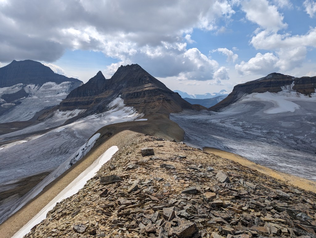
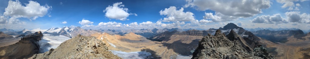
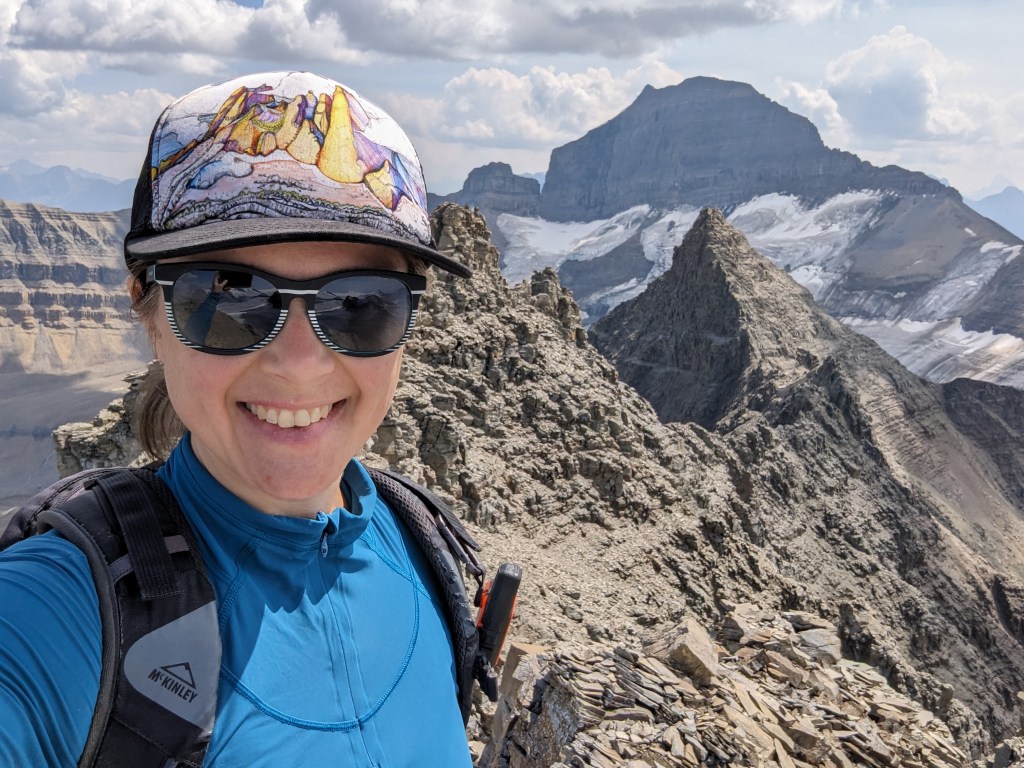
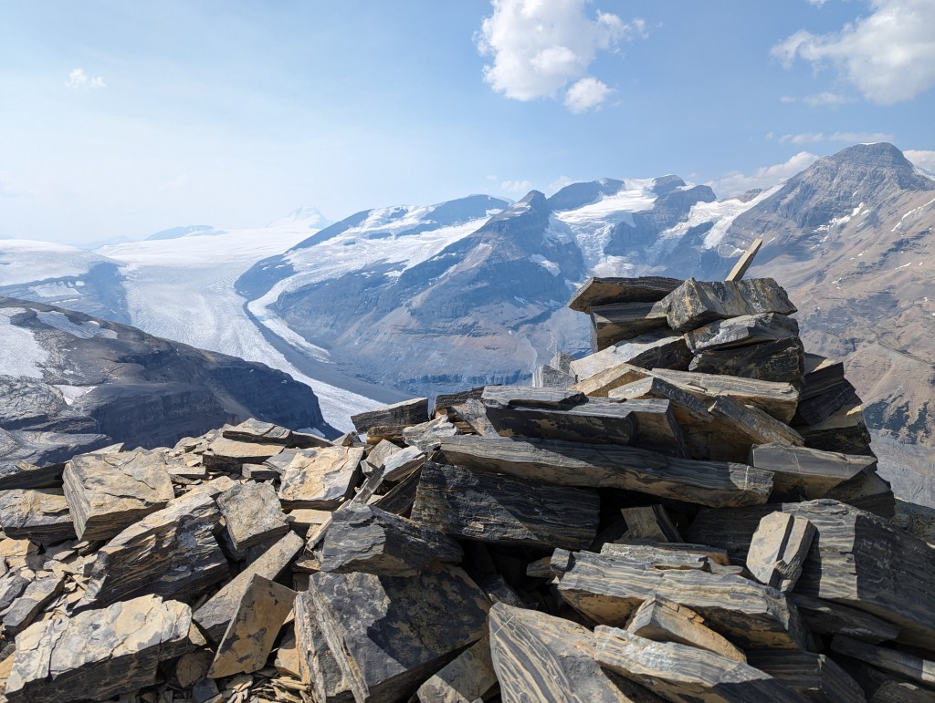
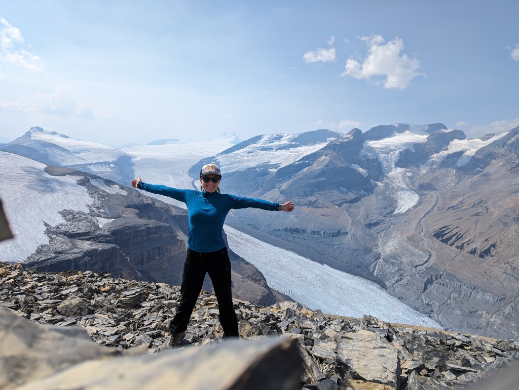
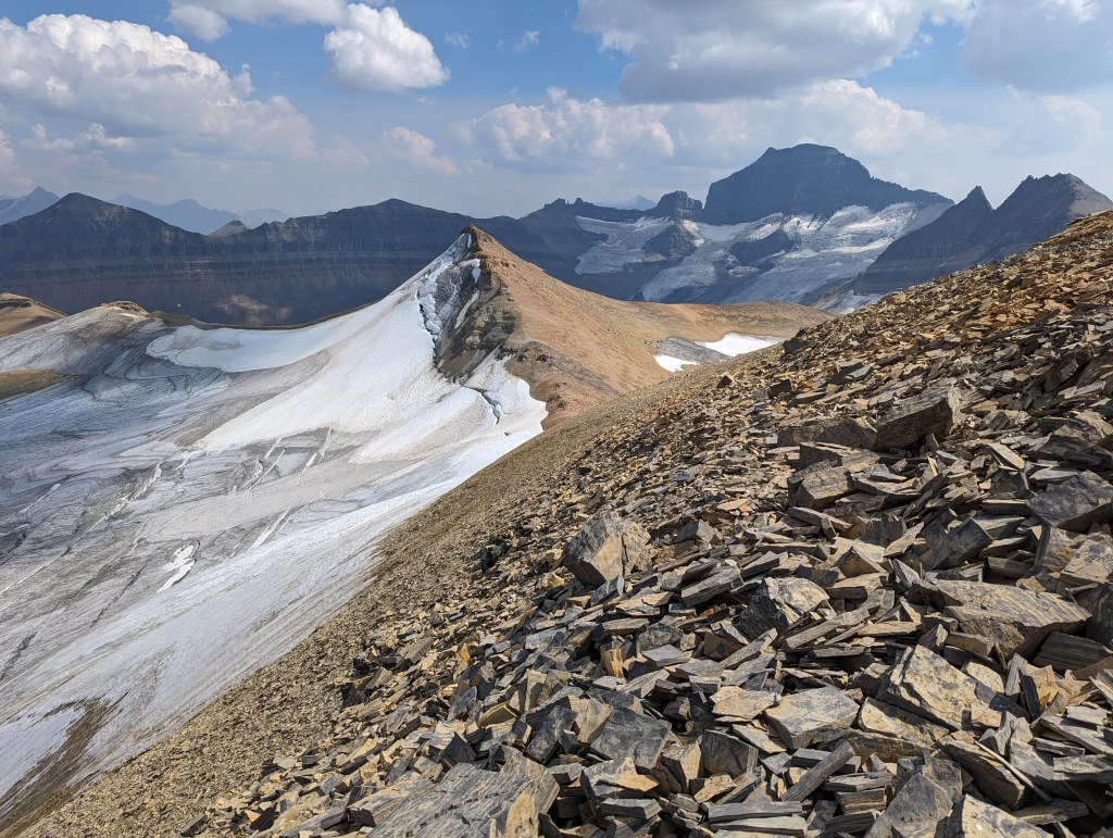
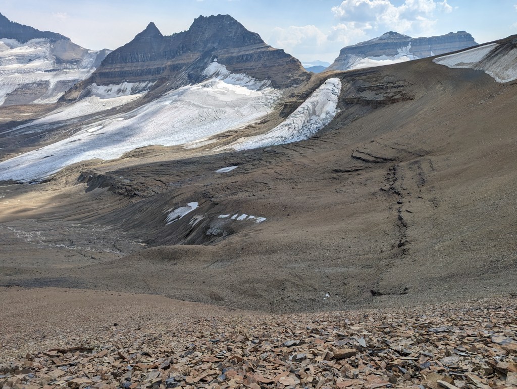
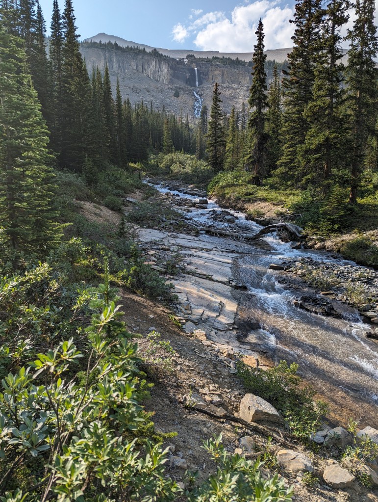
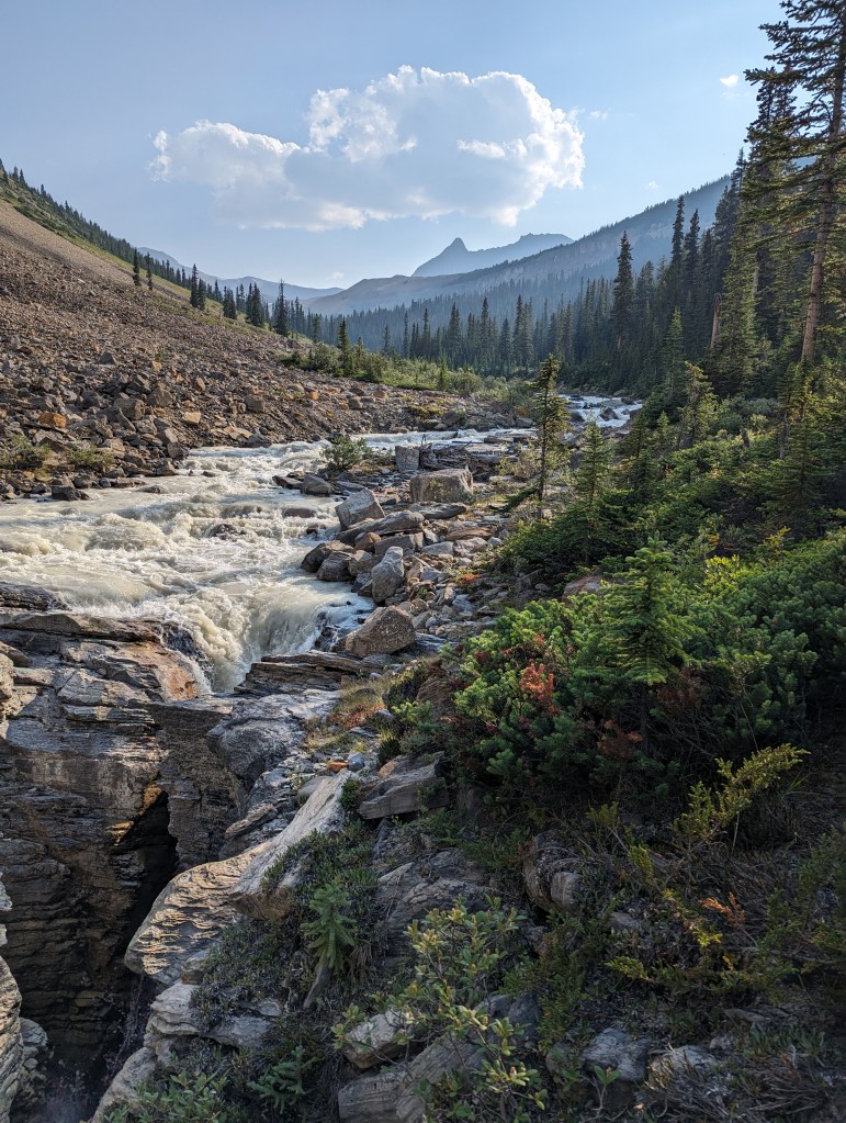
Parking is to the left of this bridge. After crossing the bridge on foot, I turned right into the trees and picked up a trail above the river. This trail soon meets up with an old road leading to the Saskatchewan Glacier. Rather than continuing to the glacier, I turned left at the high point of the road and started bushwhacking.The initial bushwhacking is sparse. It’s easy to cross over the shoulder of Big Bend Peak and then descend down to the stream.This stream is followed for about 3 km. The stream is easy to follow closely for the first km. Travel is easy about 30-50 m in from the stream for the last km. There was no easy going for the middle km.The glacial stream has carved out interesting canyon features.Flow in the stream was very light in the morning, but this changed over the day. I made sure my water bottles were full before leaving the stream and starting up towards the peaks. Mount Saskatchewan is in the background.I gained a low spot in the ridge to the right of Mount Saskatchewan Junior I and then easily followed the ridge to the peak. Mount Saskatchewan and the North Towers of Mount Saskatchewan are in the background. Based on the summit register, this peak only sees one or two parties a year.An astute observer might recognize this view from the peak of Mount Saskatchewan Junior I. It’s the background for my blog!Next in my day was the North Towers of Mount Saskatchewan. It is impossible (without glacial travel) to summit the North Towers of Mount Saskatchewan without first summiting Mount Saskatchewan Junior I. The route is obvious. The peak to the right (west) is “Mount Totally Awesome View”. No, really.The final portion of the route up the North Towers gets a bit steep and loose, more towards the harder end of moderate scrambling. Smart route choices and body positioning kept me from feeling too exposed and the terrain was always within the realm of moderate scrambling.Looking back at the approach route. The two sandy peaks are Mount Saskatchewan Junior I (far-right) and Mount Saskatchewan Junior II (center-right). The larger peaks in the background are Andromeda and Athabasca.The North Tower has a few mini-towers on it, the broadest of which is marked with a small cairn.Summit panorama from the North Towers of Mount Saskatchewan.Looking Northwest: “Mount Totally Awesome View”, Mount Andromeda, Mount Athabasca, Mount Saskatchewan Junior II and I, and Big Bend Peak.Feeling awe and delight. There are truly glaciers in every direction and not a human in sight.One last shot of “Mount Totally Awesome View” – If we say it enough, the name will stick, right?Looking East. The stream runs from right to left below this prominent ridge. I approached from the left.I was doing well for time and decided I might as well bag Mount Saskatchewan Junior II while here, even though I didn’t see much point. I returned to Mount Saskatchewan Junior I and then followed the ridge for 20 min over to Mount Saskatchewan Junior II.I have to hand it to Nugara. He is right that the view of the Saskatchewan Glacier is most impressive from here.Looking back at Mount Saskatchewan Junior I. The glacier to the North prevents a scrambler from looping back over Big Bend Peak for the return. Instead, I returned the way I came.From the North Tower of Mount Saskatchewan it would be tempting to cut across this section to avoid regaining Mount Saskatchewan Junior I. But, the terrain looks like a mixture of snow, glacier, and moraine, making it difficult to confidently choose a safe path. I gave this section a large berth and simply stuck to the ridge I had ascended.I followed the same stream out. Many new tributaries to the stream had formed in the heat of the day. When I crossed the spot in the photo in the morning, the tributary was little more than a wet patch. By the afternoon, I had to carefully watch my footing.By the afternoon the stream had swelled with glacial melt, thick with sediment.For comparison, this photo is of the same interesting gully captured in the morning. The rise in water level during the day is impressive.After another healthy dose of bushwhacking, I was overjoyed to return to the old road and follow this little Canadian Jay back to the trailhead.
My round trip time was 13 hrs and 15 min. It was a long day, but certainly worth it for the extraordinary views and the experience of being immersed in the icefields. These peaks have a remote, desolate feel to them, which I particularly loved.


That looks amazing and remote.
LikeLike