Summary
- Area: David Thompson Corridor
- Trip Date: 2023 May 28
- Trip Duration: 4 hrs 45 min
- Elevation Gain: 880 m
- Total Distance: 15.1 km
- Difficulty: Easy Scrambling
- Accompanied By: Solo
- Beta: N/A
- Notes: Photos are from a combination of April and May 2023.
Trip Report
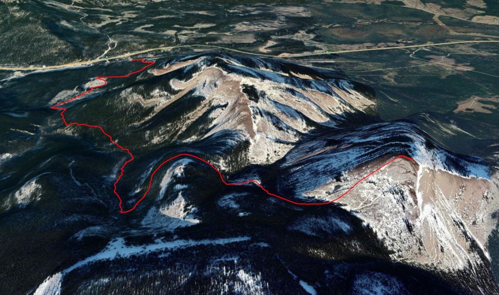
I occasionally flip through my copy of The David Thompson Highway Hiking Guide for inspiration and ideas. I thoroughly enjoy Ross and Kyba’s dry wit, but find their route descriptions tend to be outdated. The preface to the 2016 second edition describes thorough updates, however my experience hiking their book has involved a fair amount of simply bushwhacking in the direction I “feel” is right. For this reason, I try to find a second source before embarking on their hikes. I skimmed through a few reports that the old approach to Eagle Mountain from Woodlot Road has fallen into disuse. This peak is now typically accessed from the trailhead at Beaverdam Recreational Area. I used the latter route.
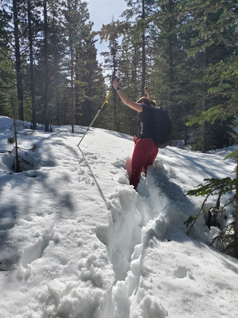
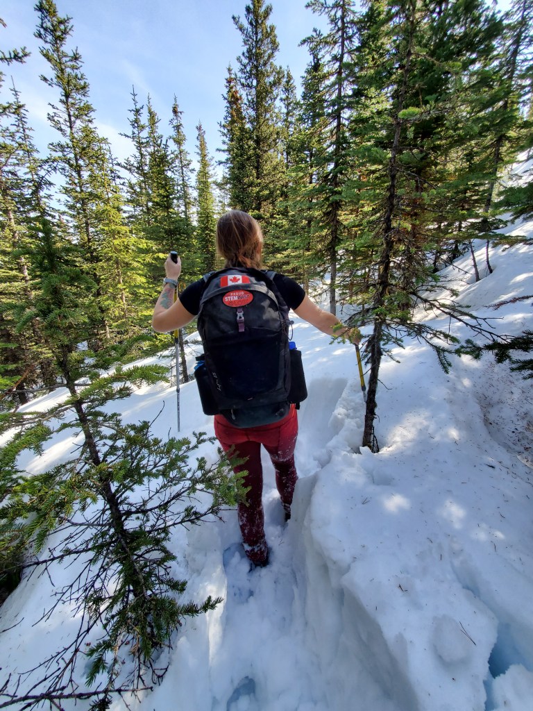
My first attempt at this peak was April 30, 2023. The start of the trail was hard-packed and easy to follow. I noticed that the footprints I was following were distinctly hoof-shaped, but they trended in the correct direction so I gave it a shot anyway. Unfortunately, the game trail lead to the ridge of Eagle Mountain only. The sheep seem to enjoy the North slopes of Eagle Ridge, feeling no need to hike to the peak. As soon as I left their trail and started breaking trail towards the peak, I found myself on the leeward side of the ridge where late-season snow was still piled deep, making frustratingly slow progress, and was forced to turn back. I returned May 28 and easily completed the peak.
The route begins along a gravel road before skirting the edge of an old campground turned logging laydown. The logging site is guarded by a caretaker with large dogs, but they didn’t interact with me. A game trail is easy to pick up at the far end of the logging laydown and leads to an easy, well-graded trail up to the ridge.
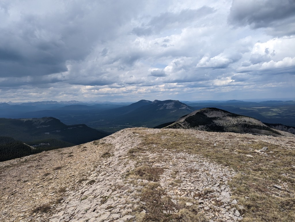
I spotted thunder clouds sweeping across the prairies, heading my way, and made quick time returning to treeline. The heavy rain never hit and I hiked out without issues. Back at the car, I mentioned this to Dan who expressed surprise. A heavy storm had passed directly over where he’d been relaxing a few km from me. Weather in the mountains can truly be unpredictable. My round-trip time was 4 hrs 45 min.
