Notes: Trail was improved in 2022. We traversed from East to West.
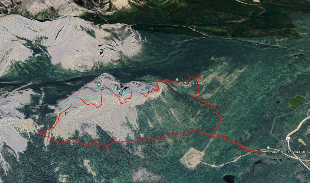
Shown in red are my GPS tracks, as measured by my Garmin smart watch and imported into Google Earth. Hand-drawn in teal is my actual route above the cliff. I present both lines here to illustrate the limitations of GPS data and impress the importance of learning to read terrain rather than following GPS tracks. The poor data quality on this day is likely attributable to multi-path interference caused by the sharp cliff face. Poor geometrical arrangement of satellites on this day may also have contributed. Additional information is available here: Using GPS for GIS data capture. Because I don’t typically navigate using GPS, I didn’t notice this until I got home.
Trip Report
This trail previously had a fierce reputation for rockfall and busy crowds, hence why this peak never quite made it onto my weekend agendas. This reputation was well earned and unfortunately lead to a fatality in 2020. The good that came out of this tragic incident is that the hiking/scrambling descent trail was rebuilt in 2022 to reduce rockfall hazard. We checked out both trails on this trip and found the new one to be faster travel on more pleasant terrain. It’s worth noting, however, that rockfall hazard still exists while under rock climbers, of which you will spot many on this popular face.
With Spring in the air, Shanna and I were itching to get out to the mountains. We picked a short scramble in the front ranges, something that could be done as day trip from Edmonton. The closer parking lot was already full by the time we arrived, but the parking lot at the road had plenty of space. We made sure to pay for our Kananaskis Conservation Pass and then started out from the trail head on a well-graded double-wide trail through light forest. There was no risk of feeling lonely, passing and chatting with many parties on the way up. The forest eventually opened up and we kept left at a Y (signs for Raven’s End) to reach the start of the scramble.
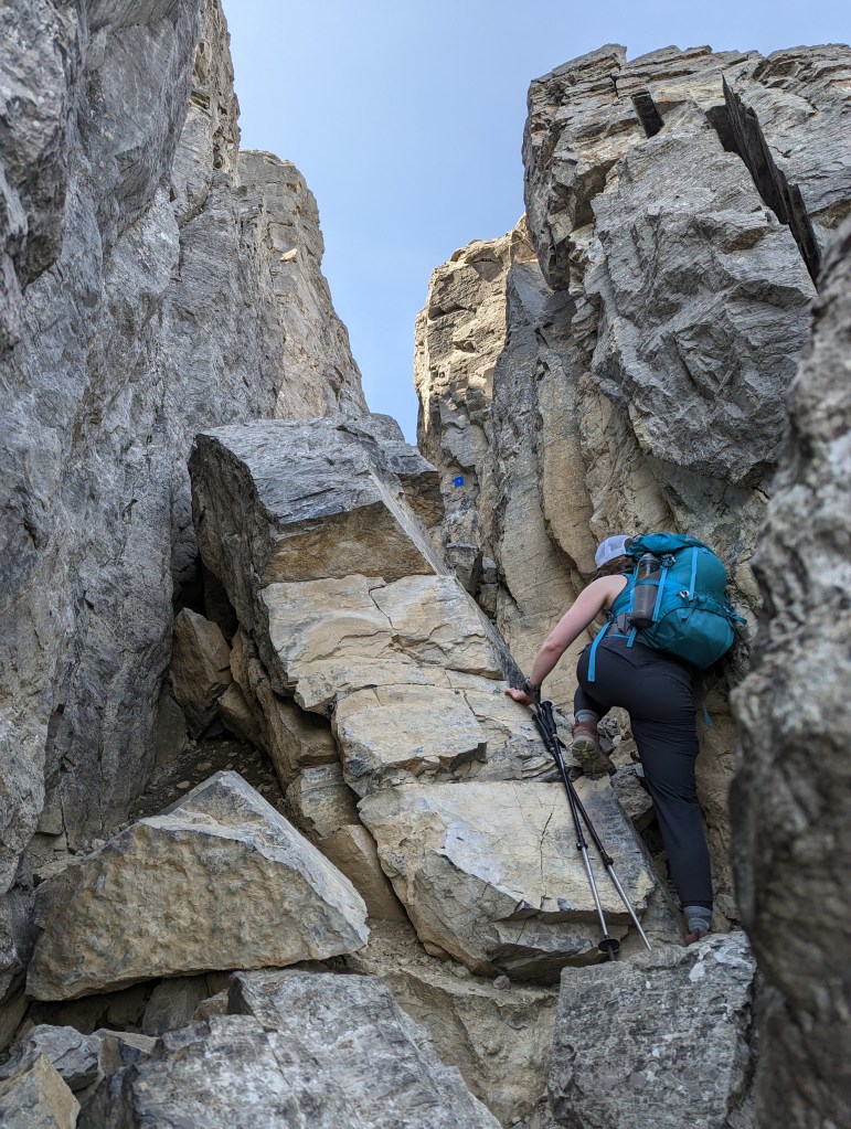
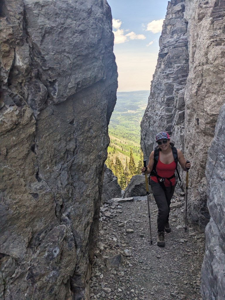
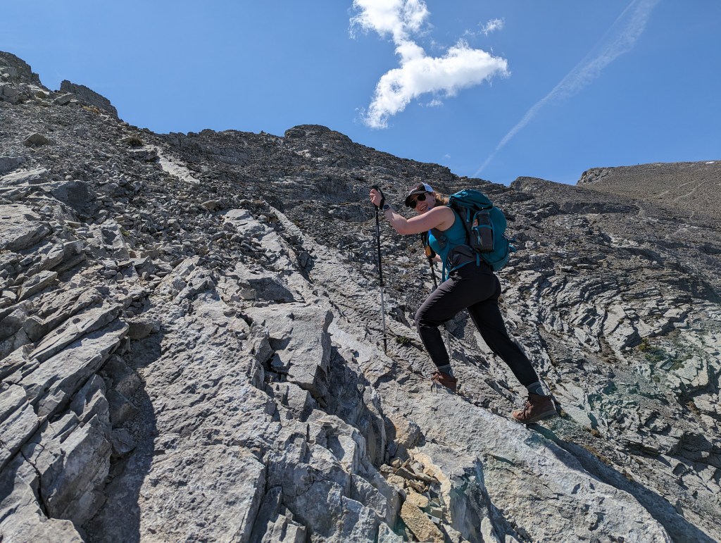
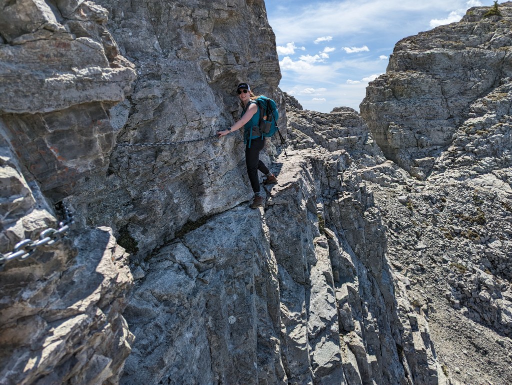
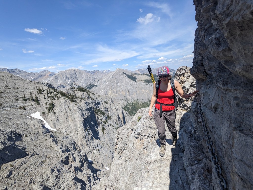
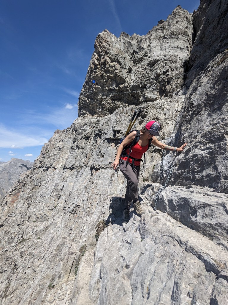
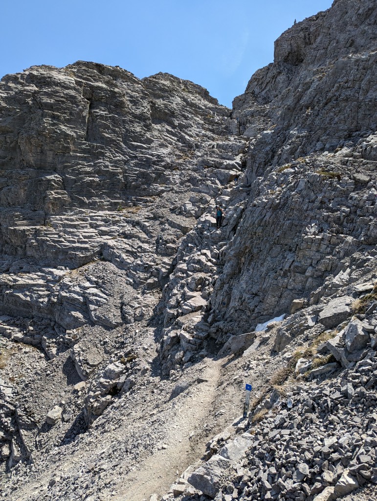
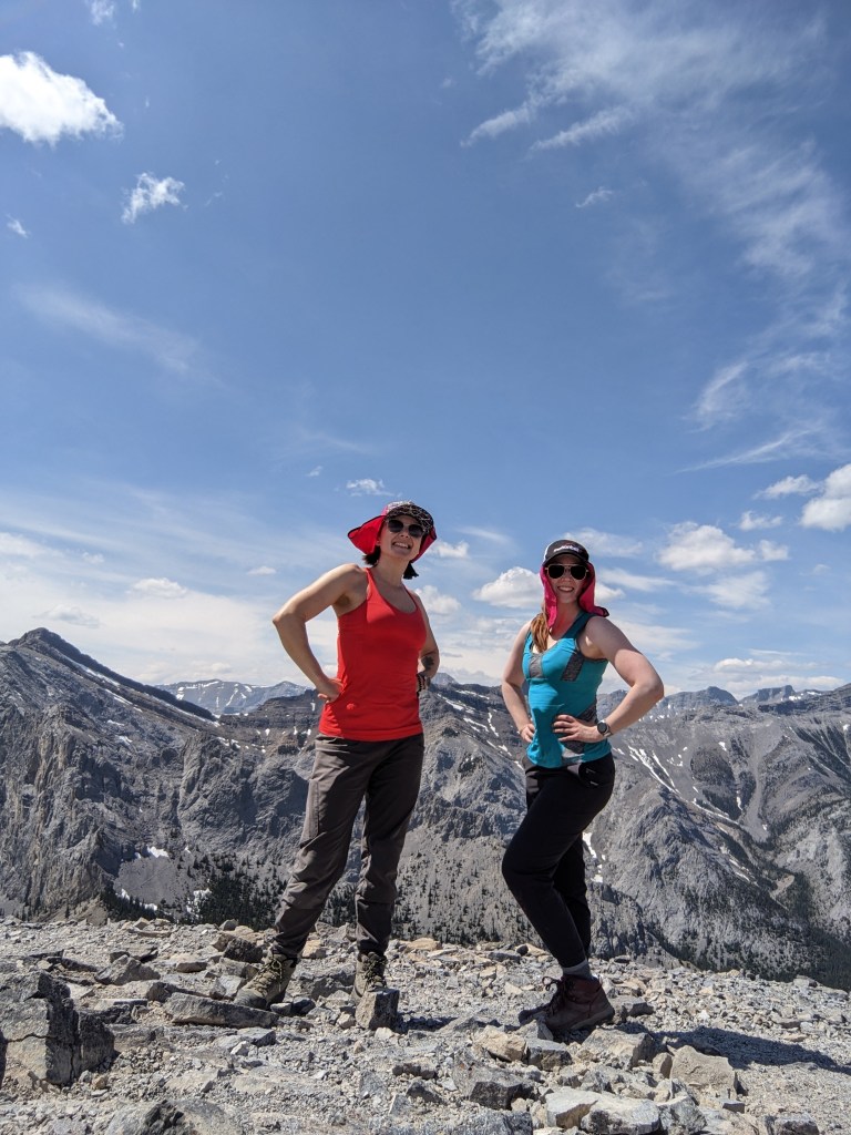
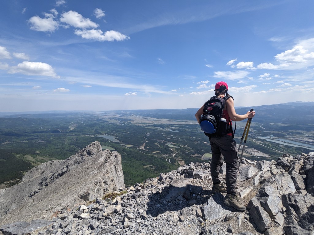
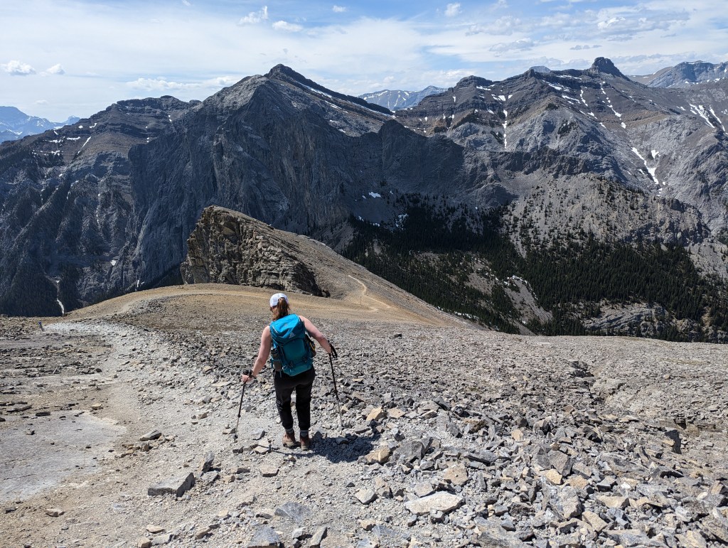
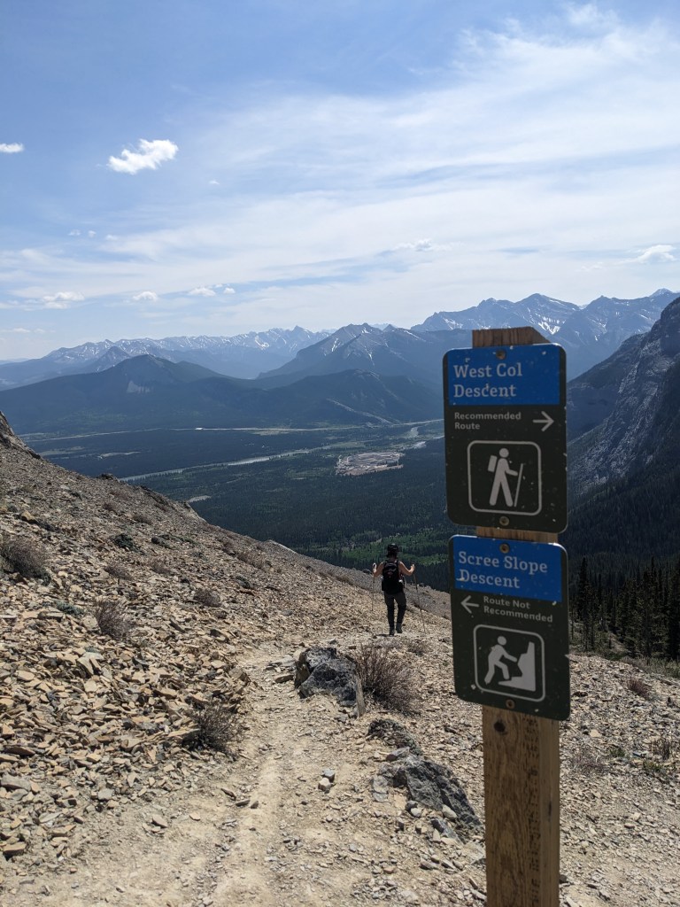
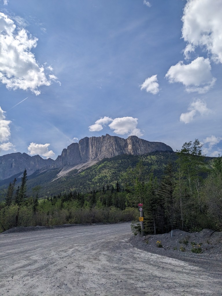
The route is very well marked with blue squares, as seen in this photo.The scrambling was always easy, but we still had some interesting features to navigate through.Obvious, well-worn trails lead across the summit ridge. There were blue markers every few minutes for the full length of the trail.As of 2023, the chain was beefy, in good condition, and well bolted. The traverse presented no concerns.This large shelf provides easy travel for most of the short traverse.There is an awkward corner, above me in this photo, where the chain was nice to have. For the most part, I didn’t really use it though.Beyond the chain there is a section of down-climbing. This stretch is easy in dry conditions, but would likely require a mountaineering axe if snow covered.Beyond the downclimb it’s an easy walk to the peak. The summit boasts wonderful views of Old Goat Mountain (left). Just out of view was some sort of party: a dozen or so hikers wearing Hawaiian clothes were relaxing at the peak.Looking East from the peak. It’s hard to believe we are still so close to the prairies! After a quick break, we left the party behind and continued west. The trail is obvious.We ensured no one was below us and then donned our helmets and opted to check out the Scree Slope Descent. We were hoping for a good scree-ski and a fast descent, but this route is more of a hard-packed sand-slab with loose rocks in it. The routes cross further down and we took the opportunity to switch to the new trail, the West Col Descent. The new trail is well-graded and makes for swift travel. I agree with the sign in this photo and recommend the West Col Descent.Reaching the parking lot and looking back up at iconic Mount Yamnuska. The parking lot is well patrolled, as was evidenced by tickets fluttering on vehicles we passed. Watch for no parking signs!
We arrived back at the parking lot in just shy of 4 hrs. This was a fun day out and I can see why it’s so popular. The new trail is a pleasure to hike and I would recommend this to friends that want to try scrambling.