Notes: Ridge can be bypassed which would reduce difficulty to moderate scrambling. The ridge hosts a thriving tick population.
Trip Report
The easy scramble up to the nearer peak of Whirlpool Ridge is a worthy objective on its own and makes for a much shorter day. Continuing on for the ridge-walk portion of Mount Frank makes for a fun day for an experienced scrambler, but is more technical terrain. It’s also possible to bypass the ridge, eliminating the hardest scrambling from the trip. Once you’ve committed to a route though, there is no opportunity to switch lines until the other side of the ridge.
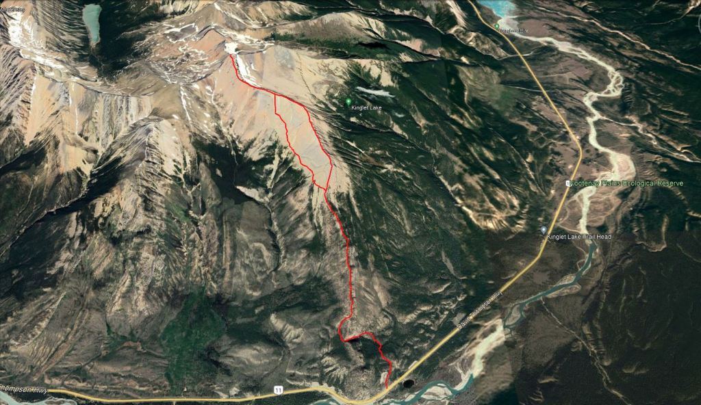
Almost the first 1 km of the route is shared with the approach to Whirlpool Ridge Crag. It’s a broad, flat trail that was bustling with climbers when we went. Mind you, the new crag had just been announced a few weeks prior, so it may be less crowded once the novelty fades.
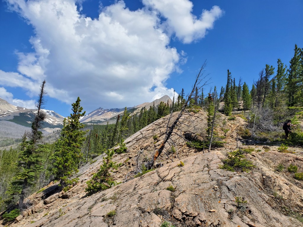
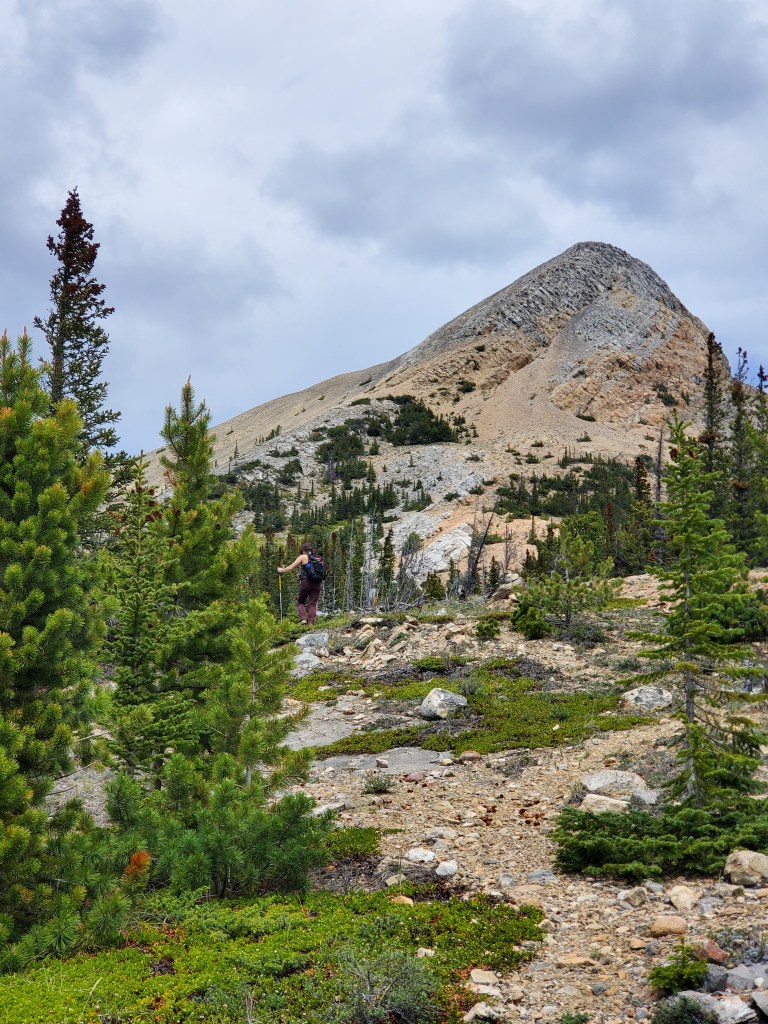
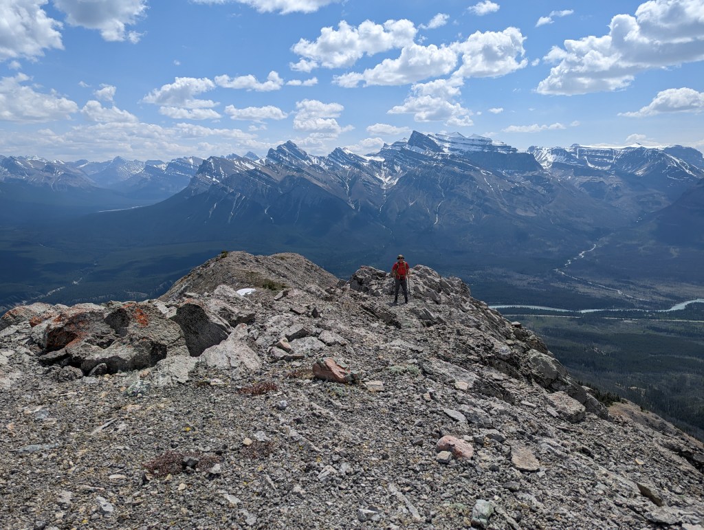
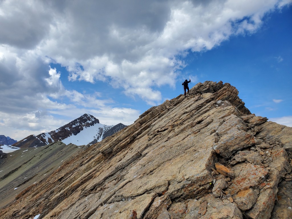
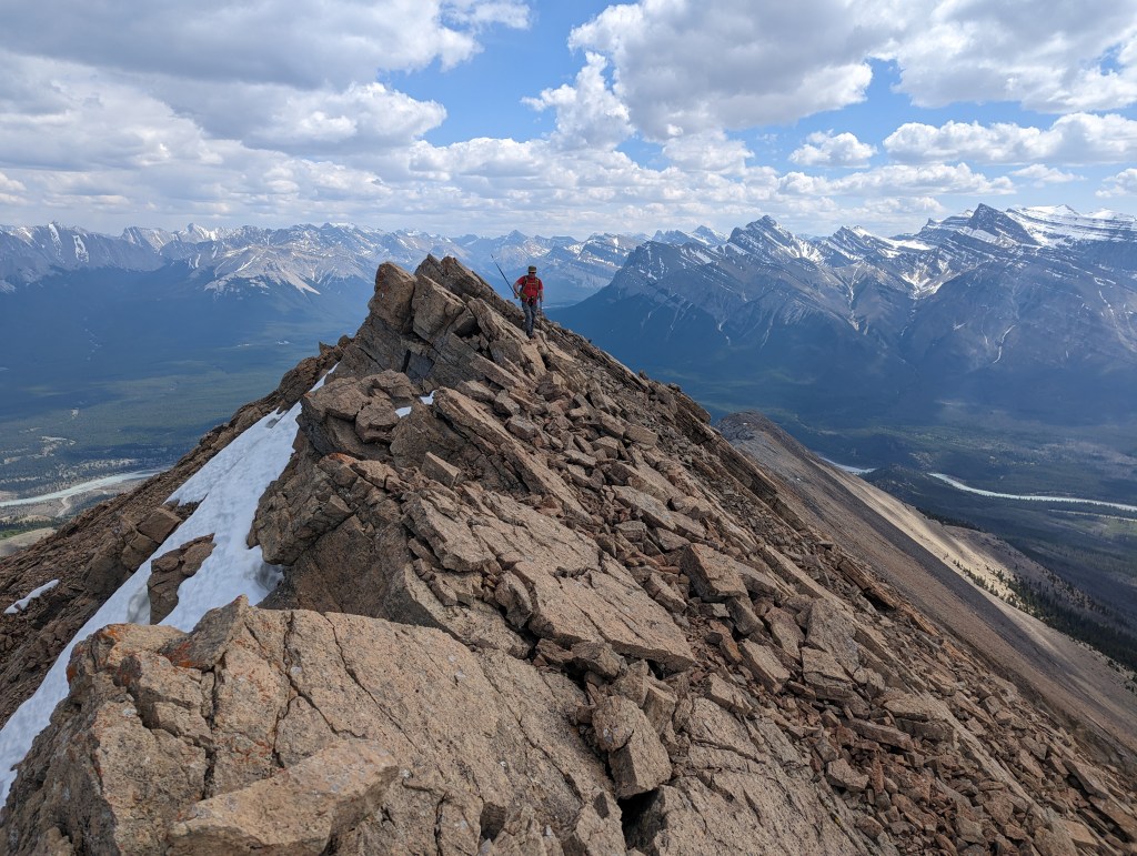
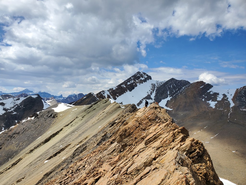
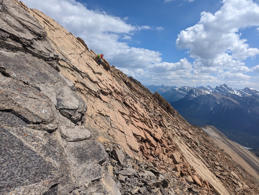
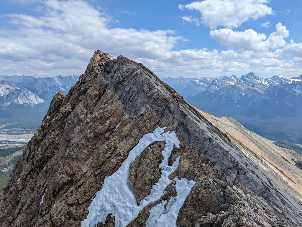
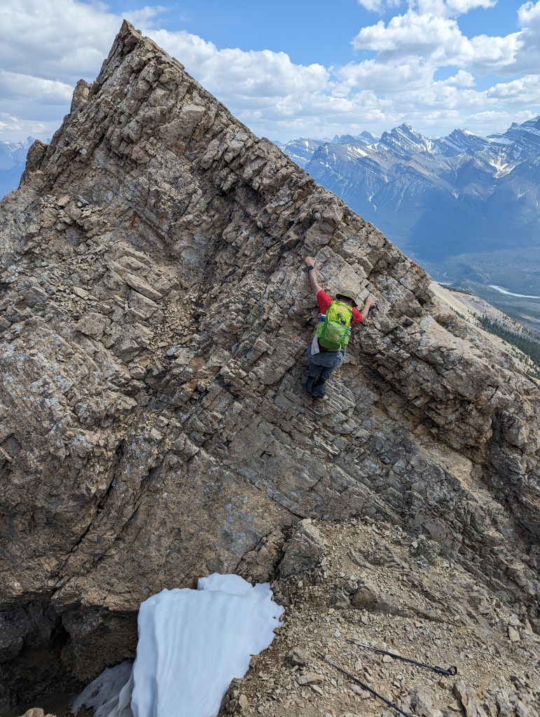
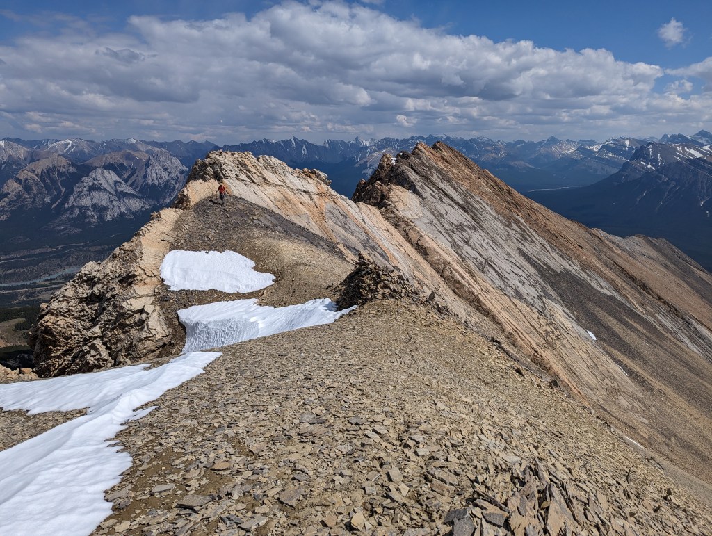
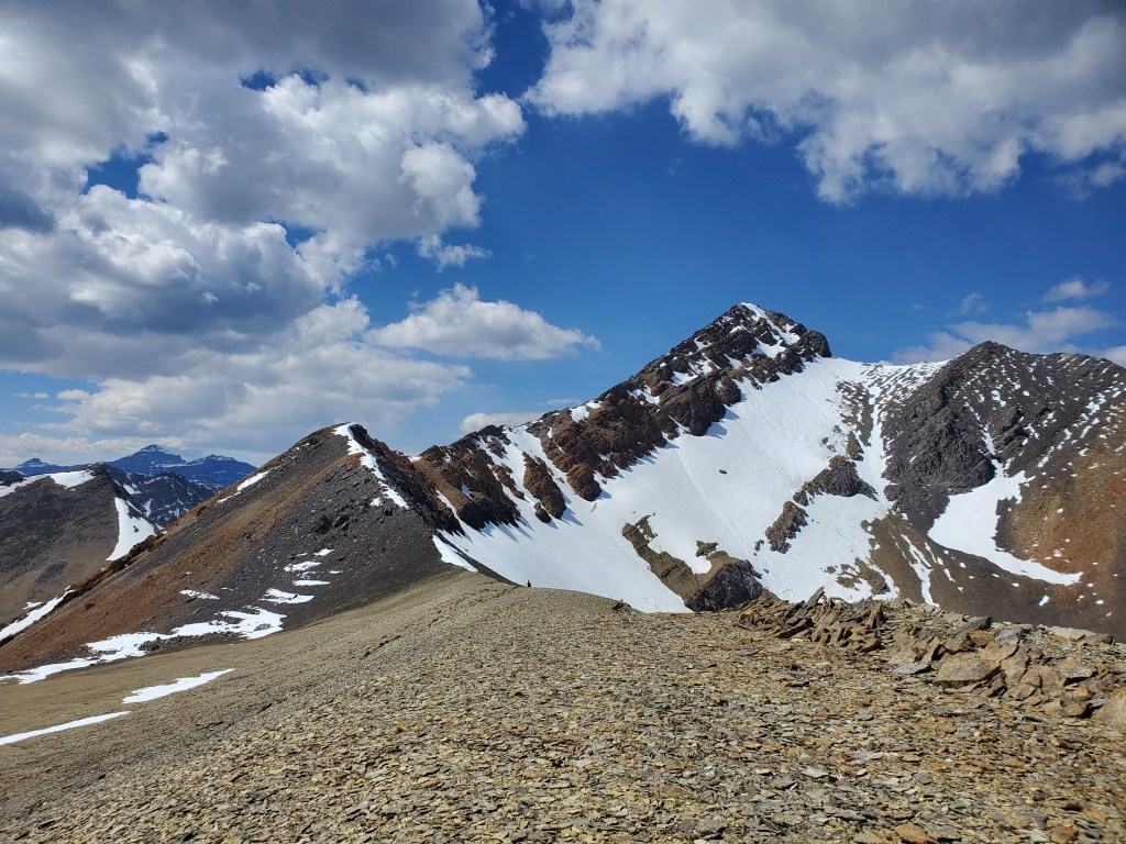
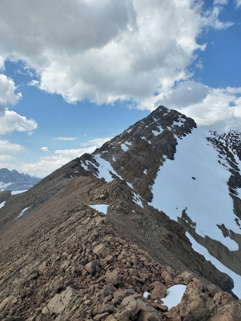
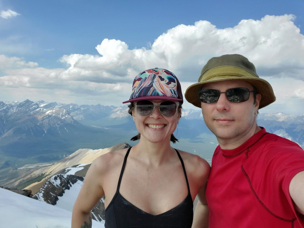
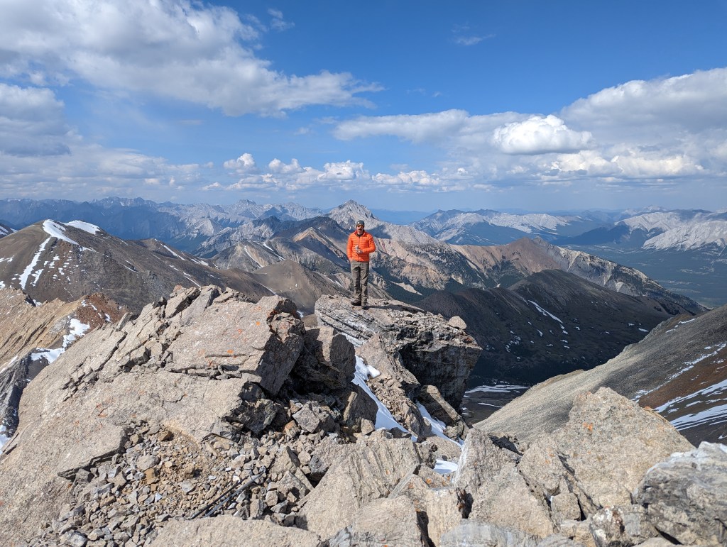
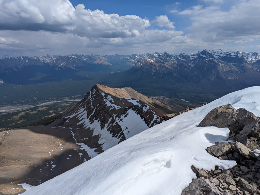
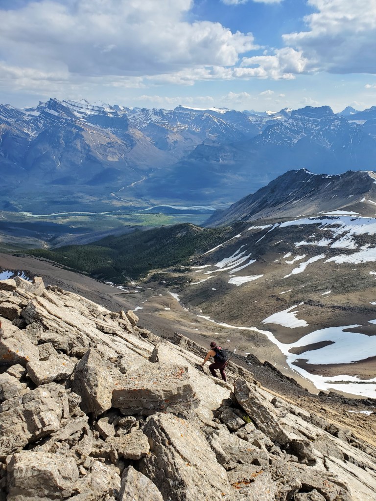
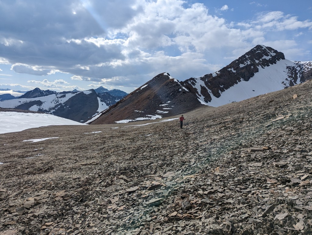
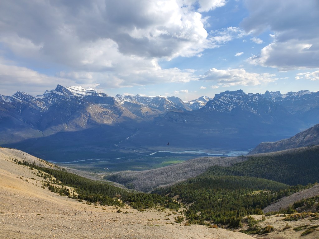
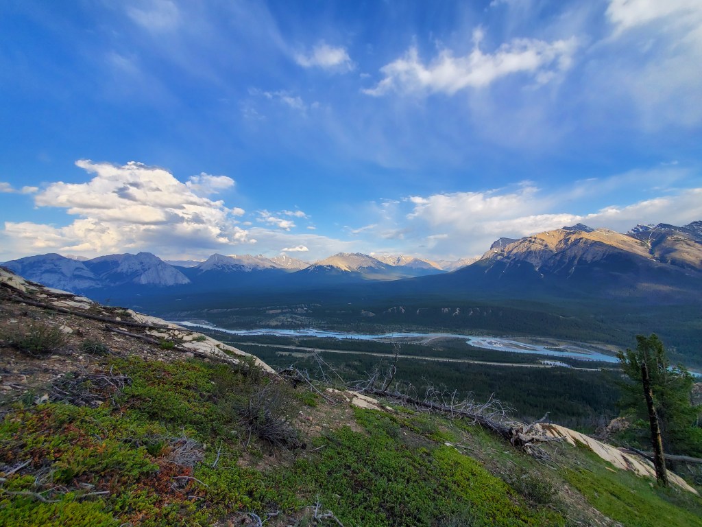
The view of Whirlpool Ridge from the roadside pullout. An old gravel quarry to the right leads to an obvious trail up to the crag. The climbing crag occupies a notch within the the ridge. The scramble route passes through the same notch and then ascends from the left side of the ridge.The ridge can be gained anywhere past the notch, but is probably easiest about 200 m past the notch (Look for a trail). Once on the ridge, the terrain is easy like in this photo until the push to the near peak.Looking West towards Saskatchewan Crossing. The toe of Tessa Peak is to the right with The Gates Of The David Thompson poking out above it. The impressive Wilson Icefield is further back still.After a pleasant walk along the treed ridge, the scramble portion of Whirlpool Ridge leads to the peak. This isn’t an official peak, just a local maximum. It is never beyond easy scrambling.We reached the nearer highpoint of Whirlpool Ridge in 3 hrs. This part is popular and we were kept company by other hikers. Mount Peskett and Mount Loudon (just right of center) dominate the horizon. The peak just left of center is Siffleur Mountain.Iron Man paused for a photo at the peak of Whirlpool Ridge before continuing along with me to the peak of Mount Frank.Continuing along the ridge toward Mount Frank. If bypassing the ridge, one would want to lose elevation before this. The hikers turned back here.The ridge becomes slabby and increasingly steep. Mount Frank comes into view in the distance.Looking back at the spectacular Kootenay Plains Ecological Reserve. If bypassing the ridge, we would be closer to treeline here, to the right.I pause to pick a route through a slabby notch in the ridge. Mount Frank rises in the background. Tuff Puff is the ridge to the right which ends at a seemingly impassable face near the summit of Mount Frank.Skirting around a steep, slabby notch. Dan wasn’t too fond of this next section.Looking back at Dan downclimbing smooth slab along the ridge. The slab extends far down and offers no good escape routes if wanting to switch lines here. Falls from this point would be very high consequence to either side of the ridge, hence the difficult rating.This downclimb is probably the crux of the route. To the left is a drop-off and to the right is smooth, steep slab. The hands and feet naturally guide one in a traversing downclimb, from left to right. It took a bit of persuasive coaching on my part to convince Dan of this!Looking back at the slabby section we just passed. The rock is reasonably solid and the moves are fun, but the route is committing.The rest of the route up Mount Frank is obvious from here and is moderate scrambling. I am the spec on the ridge in front of the snow patch. The bypass route meets up with the ridge route where I am standing.I continue up the ridge. The peak is still a good slog from here.At the peak of Mount Frank at last! We reached the top in just under 6 hrs, measured from the road.Gazing out over Landslide Lake and Mount Hensley.We were surprised to run into a few other scramblers at the peak. I really liked the way this lad’s orange coat popped against the background and I told him he has to go in my trip report! The double-peaks of Mount Ernest Ross can be seen to the right. Also visible is the ridge walk to Bridge Peak (Bridge Peak is just left of this scrambler’s head). Mount Elliot towers above his head.Looking back at the ascent route and Kootenay Plains.Descending from the peak on slab. This section is easier than the ridge, only moderate scrambling.Looking back at the peak, reaching the cross-roads between our two descent route options. Instead of returning the way we came, we chose to descend below the ridge and side-hill back.Looking forward at the bypass route. We side-hilled above treeline until the nose at the left, where we regained the ridge (below the first peak of Whirlpool Ridge). The side-hilling is easy with decent game trails to follow most of the way.Regaining the ridge. The North Saskatchewan River, seen here, winds its way through Kootenay Plains before continuing on to Edmonton.
Once back on easy trail, we meandered back to the road whilst checking each other for ticks. We flicked three ticks off of me, thankfully before they could burrow in. Surprisingly, Dan was shunned by the ticks on this occasion, though he really had more than his share at Windy Point a few weeks prior. We made it back to the road in 10 hrs.