Notes: Mostly easy scrambling with one section of moderate scrambling.
Trip Report
This was my second time enjoying a scramble up Roche à Perdrix. The first time was several years ago in poor visibility and I had stuck closely to the route indicated on GPS mapping, which worked but was slightly more exposed. In good visibility the easiest route is obvious; it keeps slightly more left for the last 100 m.
Shanna and I spotted a window of perfect autumn weather in the forecast and decided to take a day trip to Jasper to scramble Roche à Perdrix. We parked at a pullout just outside of the park gates. A vehicle with 4×4 can drive off the highway on a rough gravel road, but it saves less than 100 m of walking and isn’t really worth it.
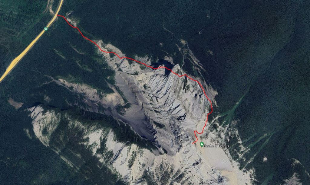
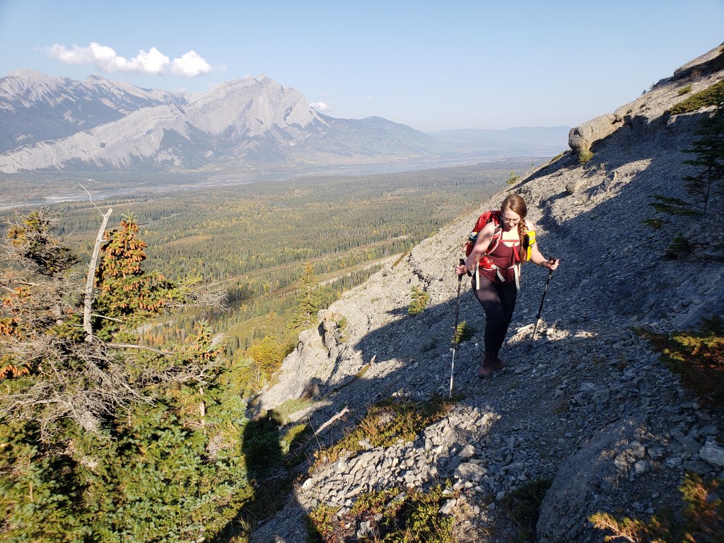
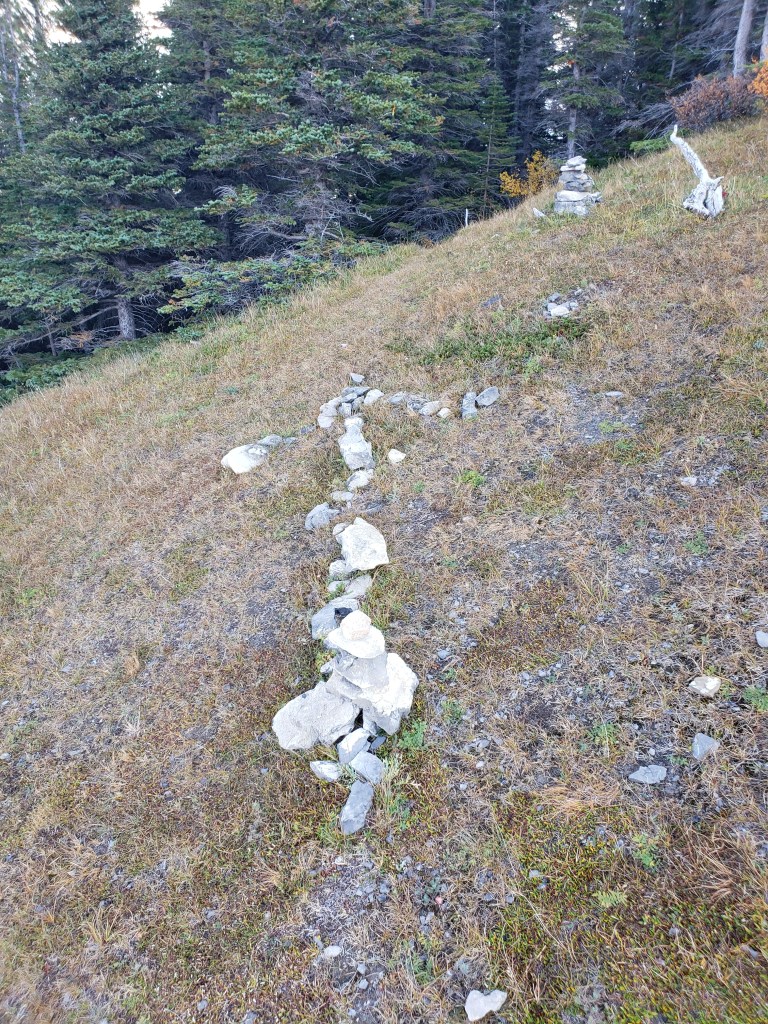
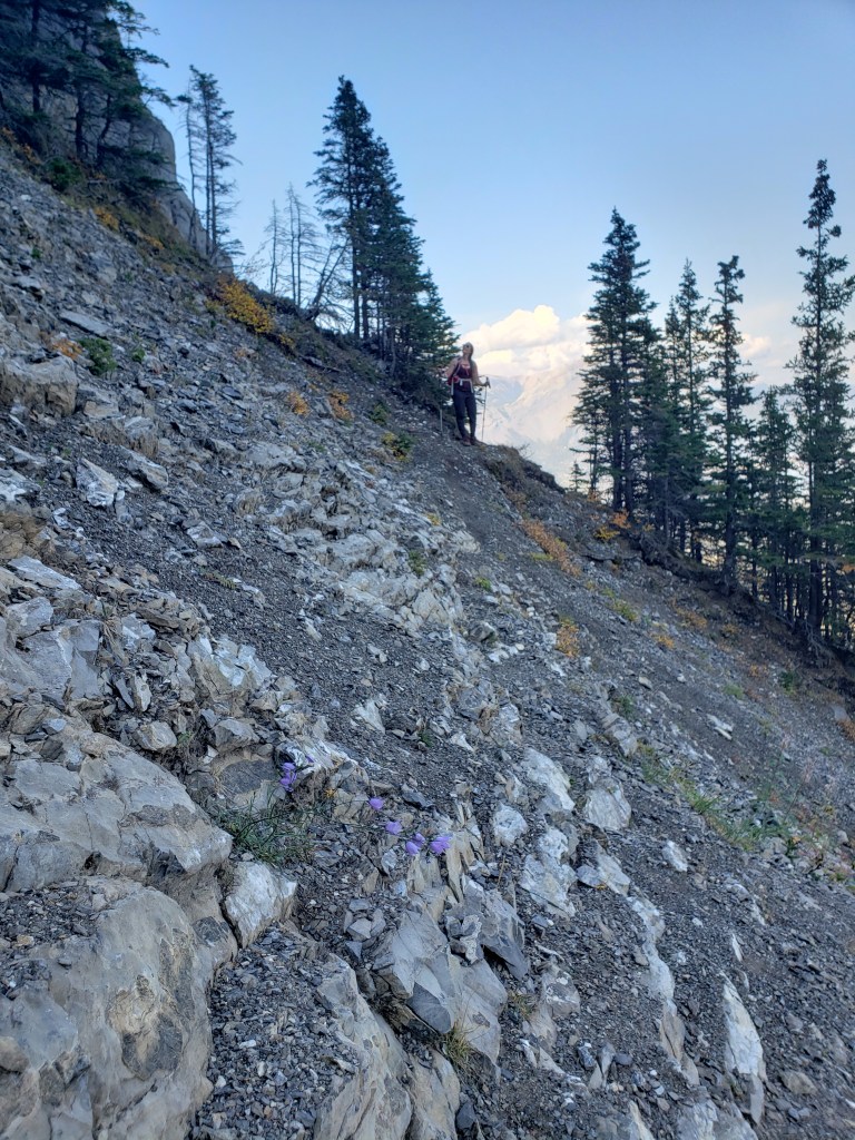
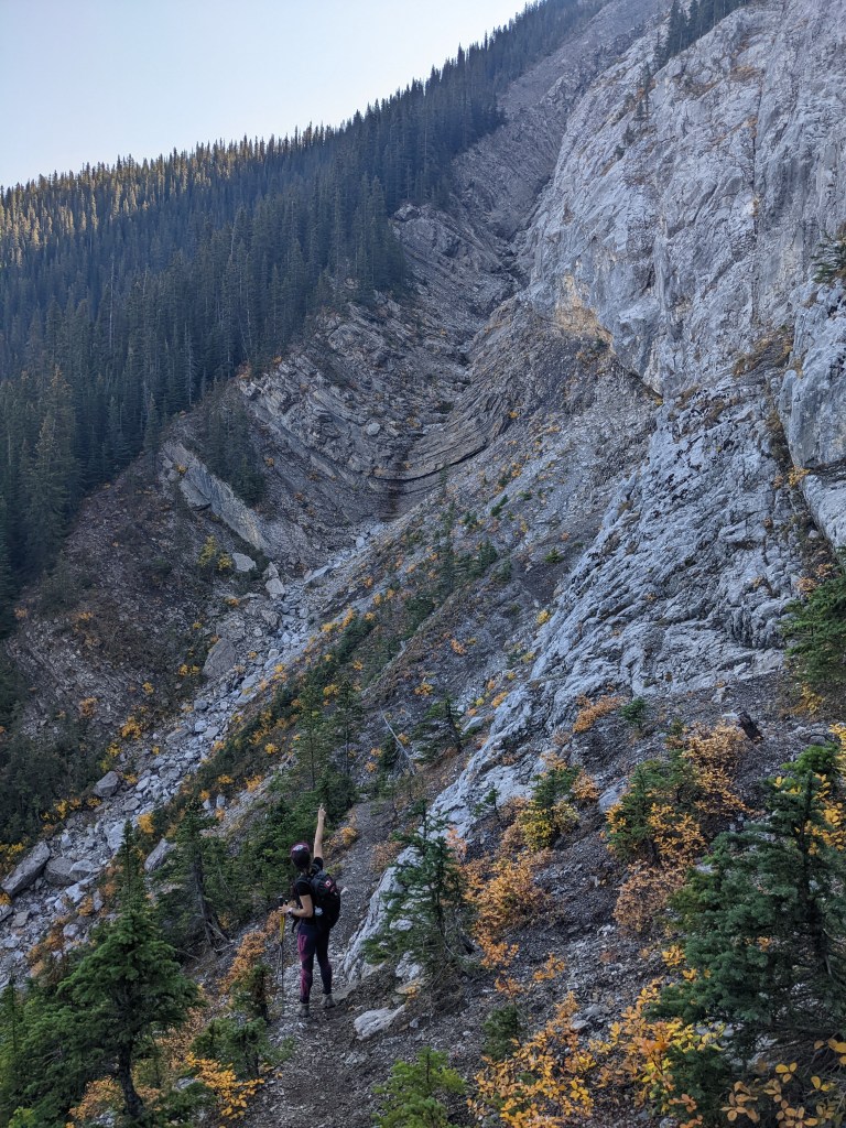
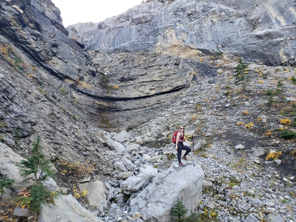
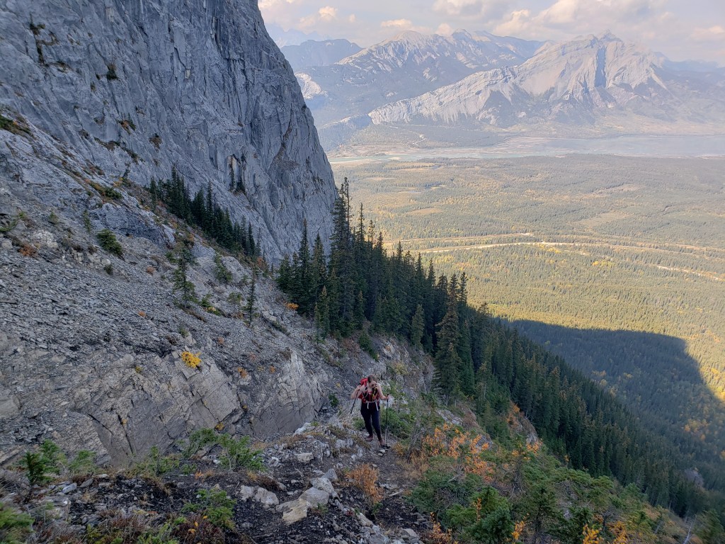
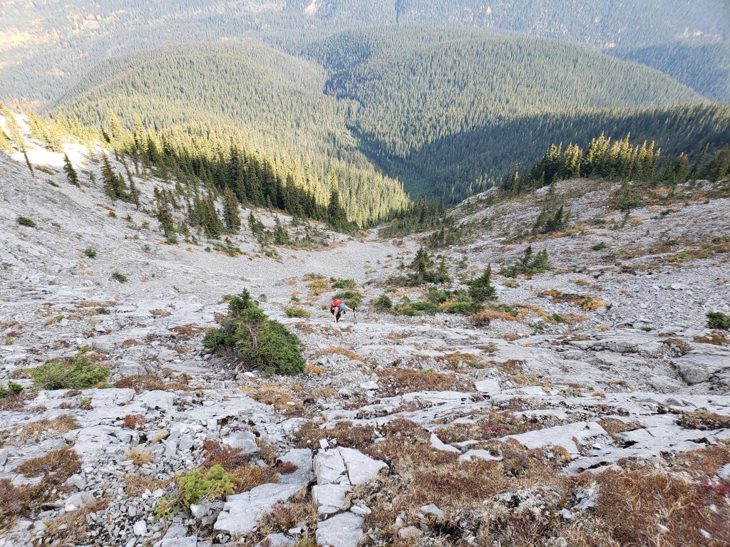
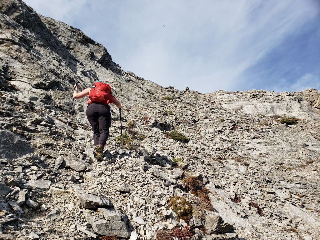
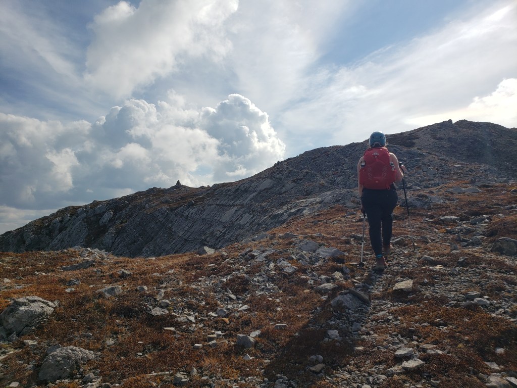
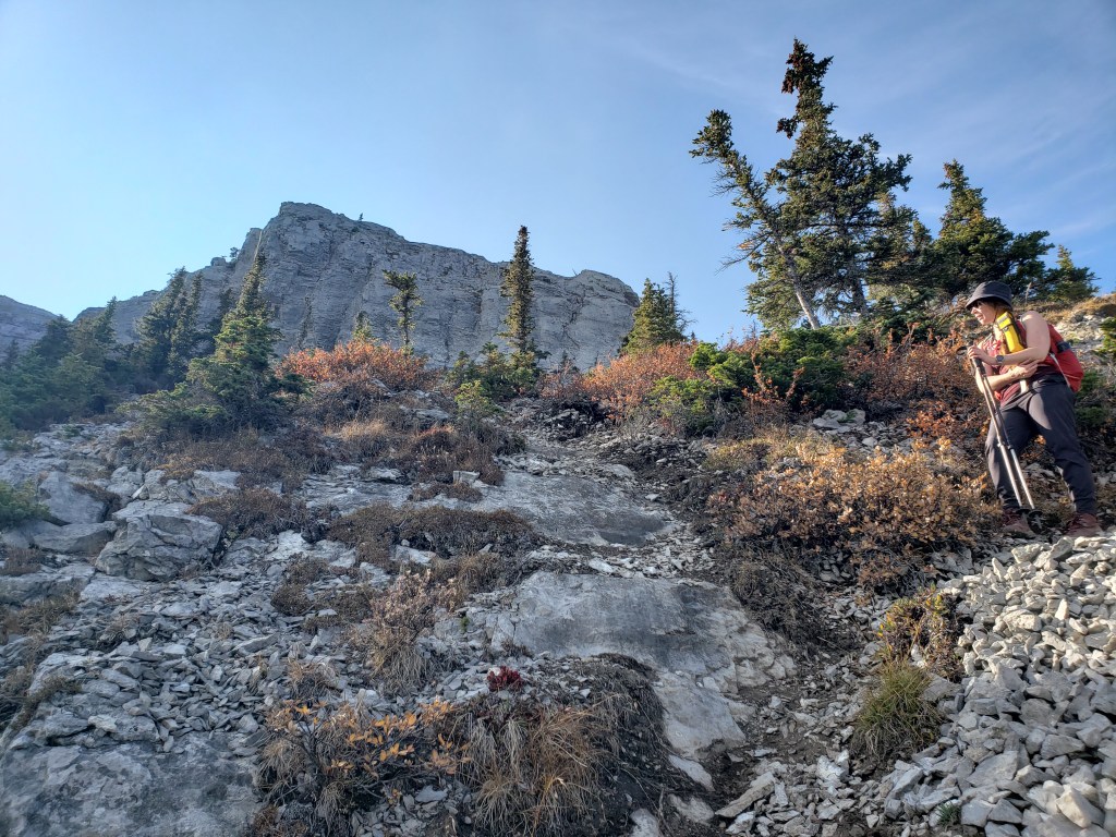
We followed the gravel road as far as the toe of the ridge, where we easily picked up a good trail gaining the ridge from the right (southwest).After following the ridge for roughly 40 min, the left turn into the trees was marked by this huge rock arrow. The left turn leads to the north side of the ridge.We followed the trail below the base of the cliffs, around the north side of the mountain.Here we are arriving at the major watercourse with notable U-shaped folds described by Kane. The ascent route climbs the left shoulder of this gully.Another shot of the interesting rock folds. Similar rock folds occur in the summit of neighbouring Folding Mountain.A trail leads up the shoulder. This section is visible from the road and is good to have a look at before starting as this North slope tends to hold snow.Above the gully the trail turns right to face the peak. There seem to be a few route options up this final slope, which is how I ended up on a different line last time. We kept an eye out for flagging tape and generally kept to the left this time.Trending slightly left led us up this easy bowl. In good visibility the easiest line was obvious.A few meters below the top of the bowl the trail makes a sharp right, avoiding the steepest top section and allowing us to simply walk the rest of the way up.Once above the bowl, it’s merely a walk across the summit plateau to the cairn.The summit overlooks the distinctly U-shaped Bedson Ridge (left) and Brûlé Lake (center) to the North.To the South, views are of the unique partridge (or perdrix) feathers of the ridge.After soaking in a bit more sunshine at the peak, we returned to the same north bowl we had ascended.This is the section of moderate scrambling (which is part of the ascent route as well). The hands and feet feel solid, provided the rock is dry.Another shot looking up at the crux section of moderate scrambling.Arriving below the bowl, taking a break before returning to the shoulder of the gully. The line we took was to the left of the cliff seen at the top of this photo. My previous trip was a few years prior, but I think I followed my GPS to the right here.One last glimpse of the summit block as we make our way back down the toe of the ridge.
We arrived back at our vehicle in 5 1/2 hours. The drive back to Edmonton is relatively short from the park boundary, leaving us with plenty of time to stop for gourmet poutine in The Green Square (the grassy area around the Hinton Visitor Information Center where all of the best food trucks park in summer). I’m glad I went back to repeat this one in better conditions. It’s a fun little trip!