I’m surprised Bridge Peak hasn’t gained more popularity. A section of the ridge is bright orange and pink, like neighbouring Tuff Puff, only without the crowds. If already summitting Ernest Ross, Bridge Peak only adds 4 hrs.
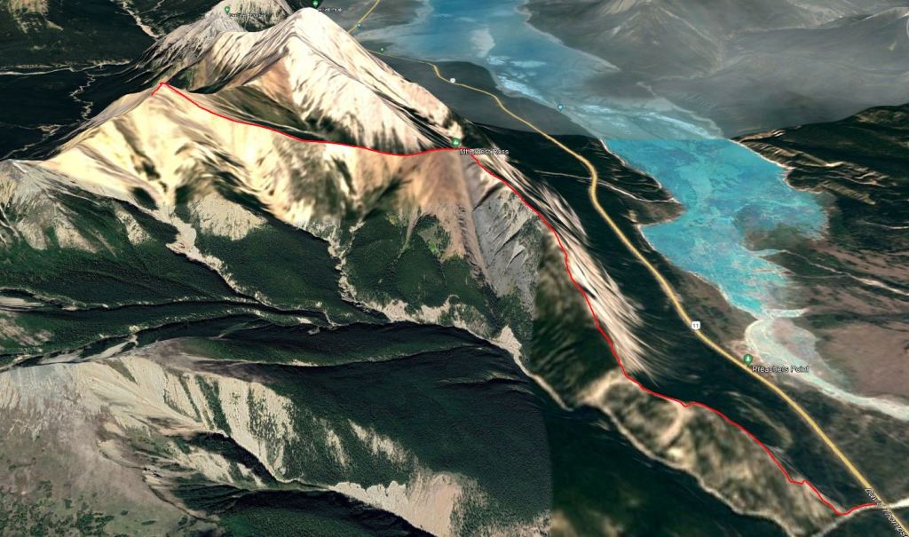
The route starts from a pullout on the north side of the highway, just past Preacher’s Point. The pullout only has room for a few vehicles and is shared with Bridge Creek Trail, but we didn’t see anyone else this day. The nearest outhouse is at Preacher’s Point.
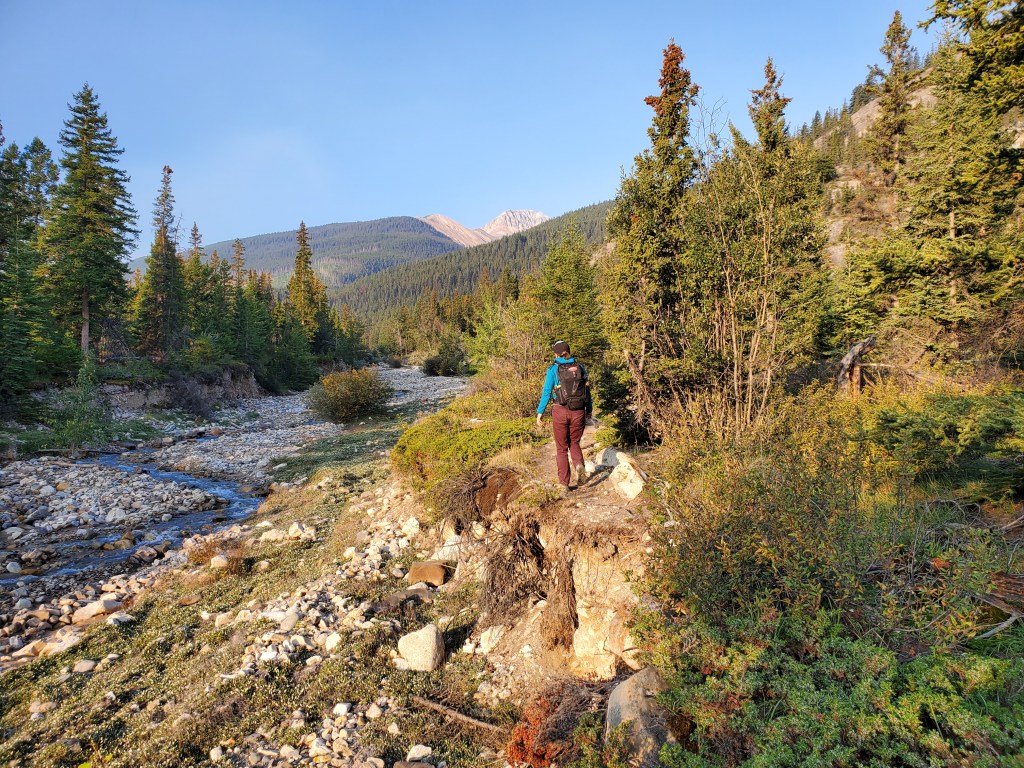
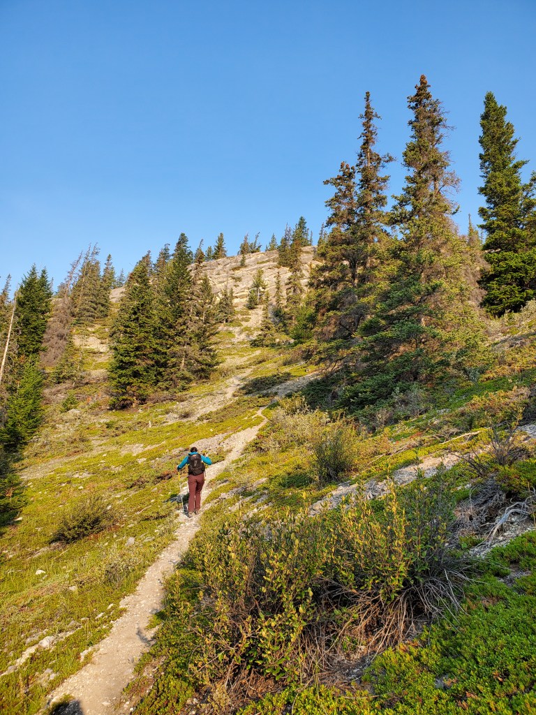
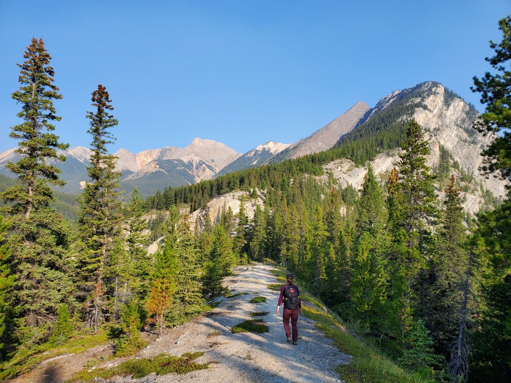
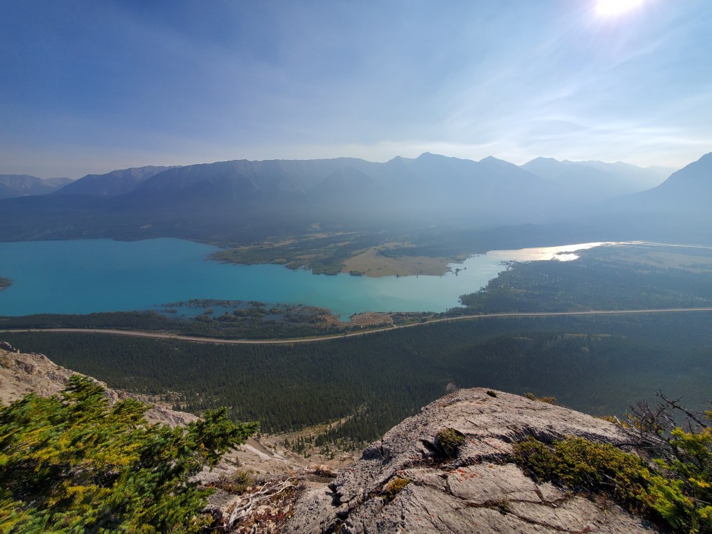
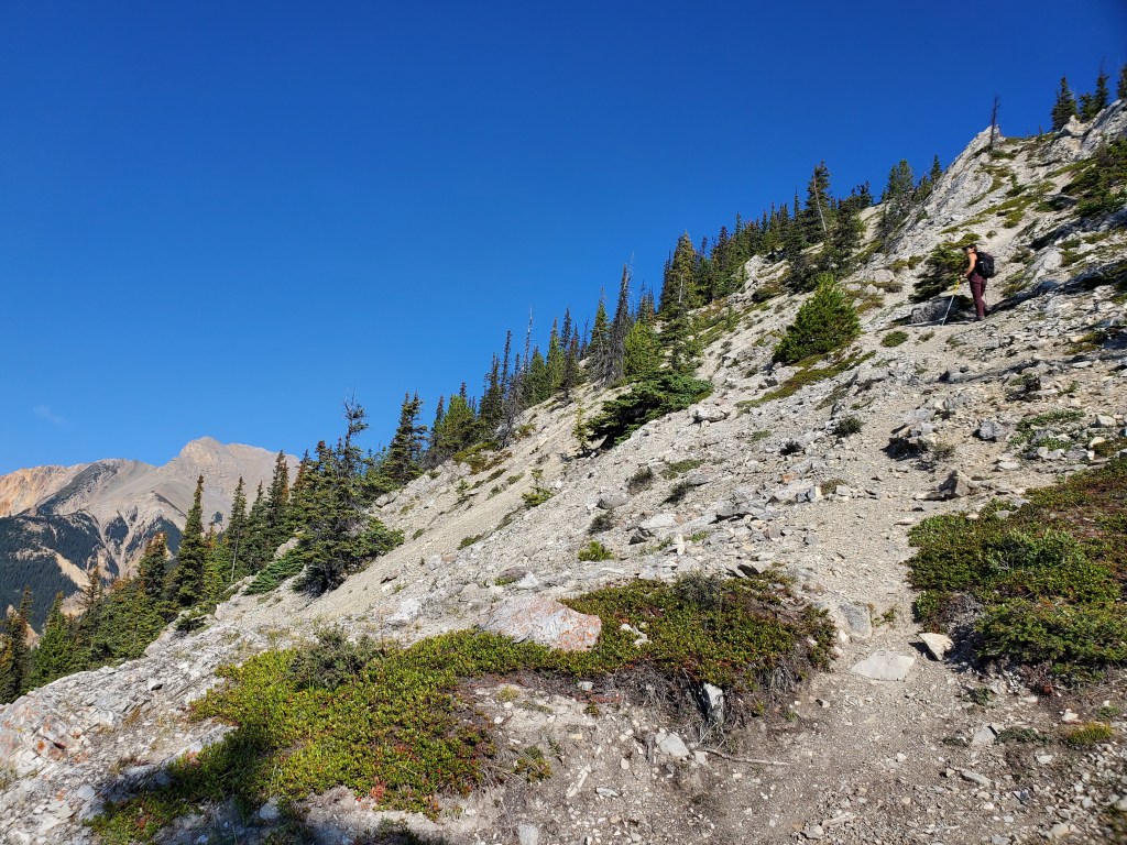
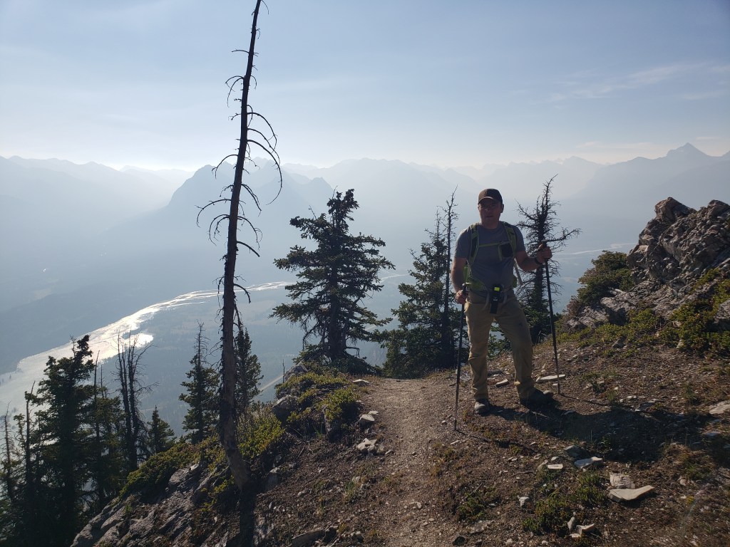
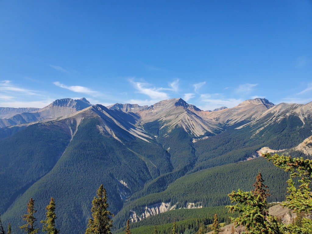
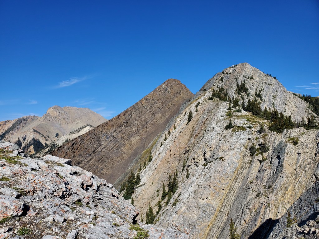
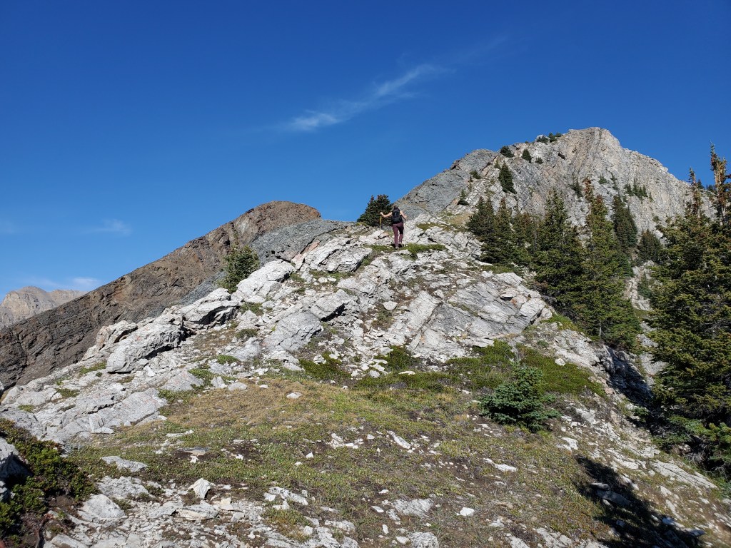
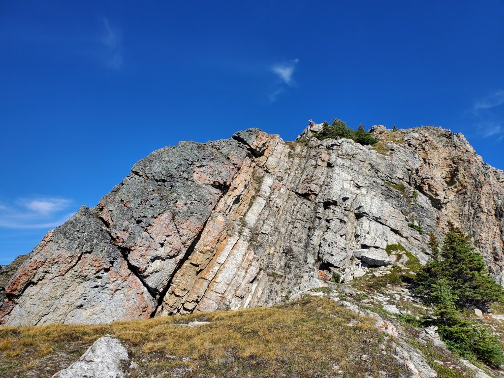
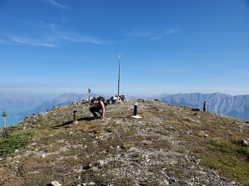
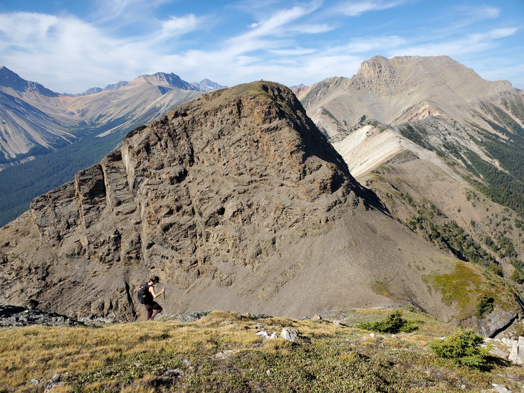
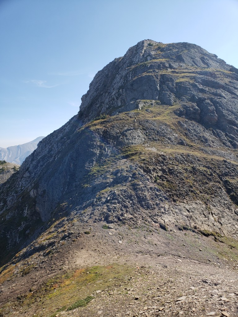
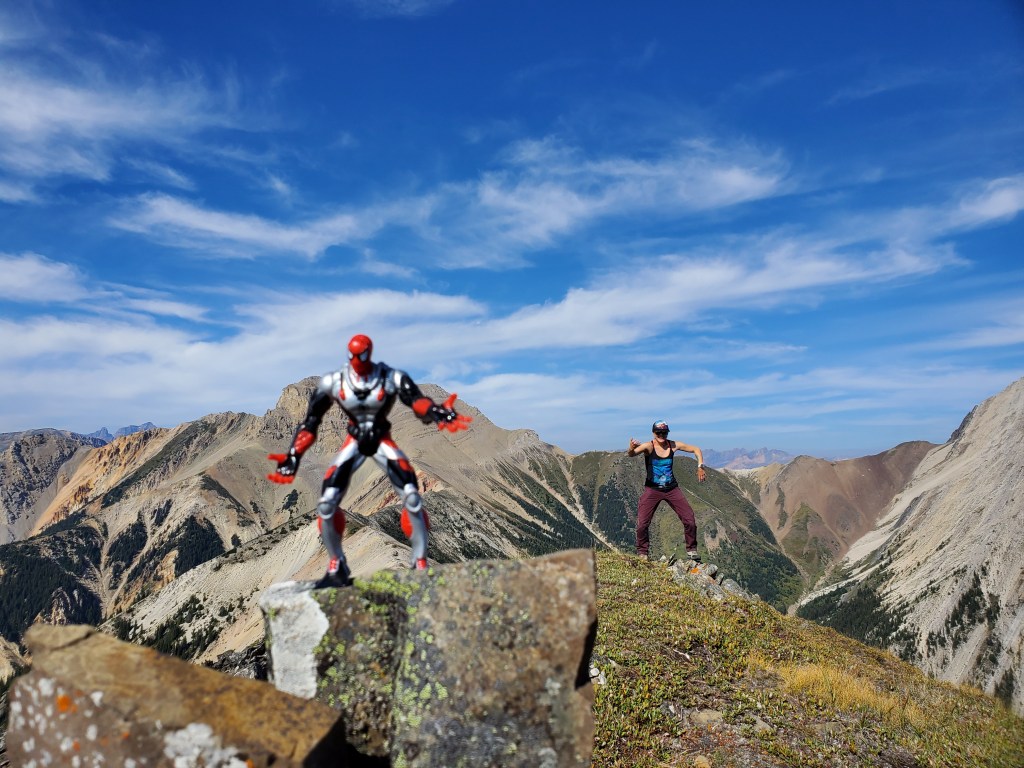
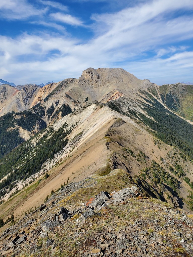
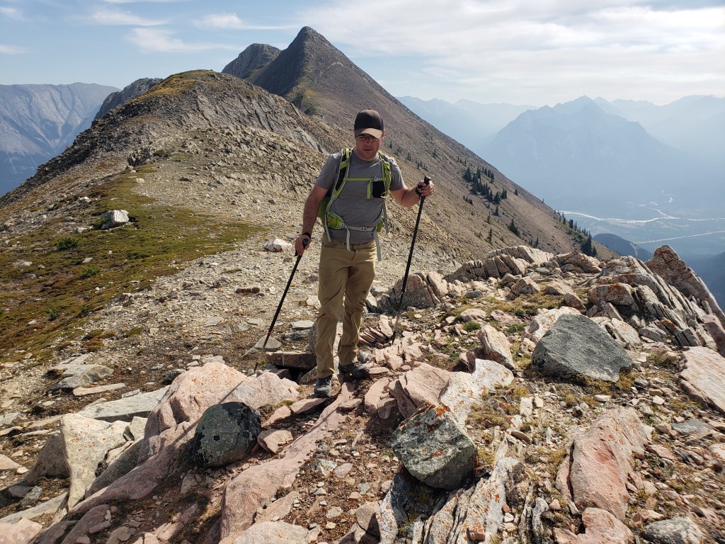
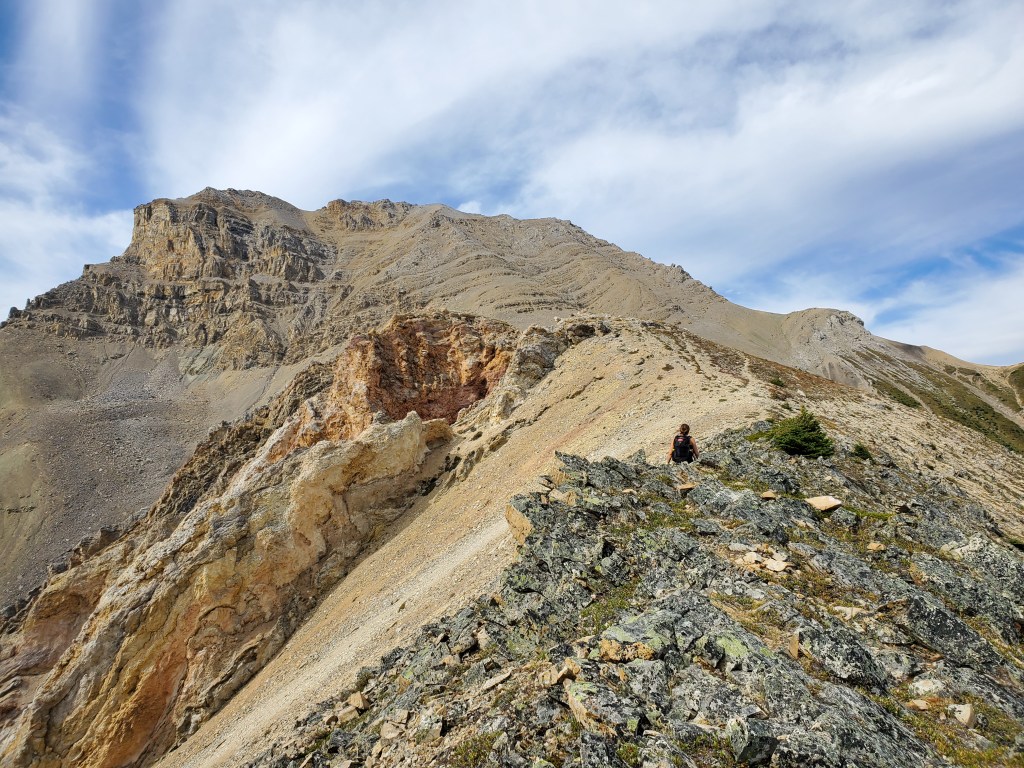
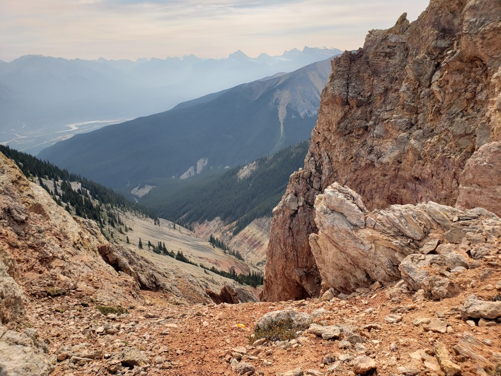
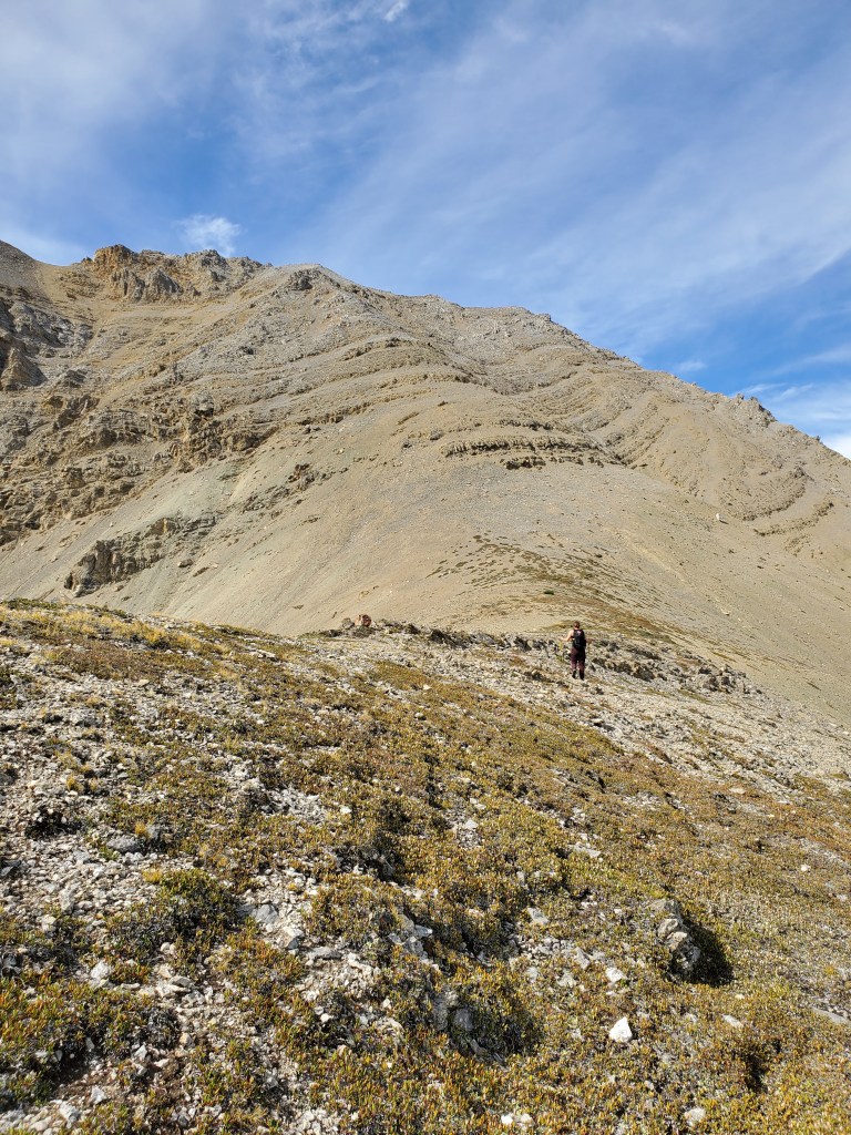
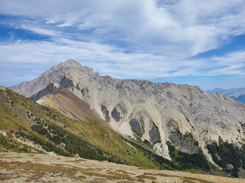
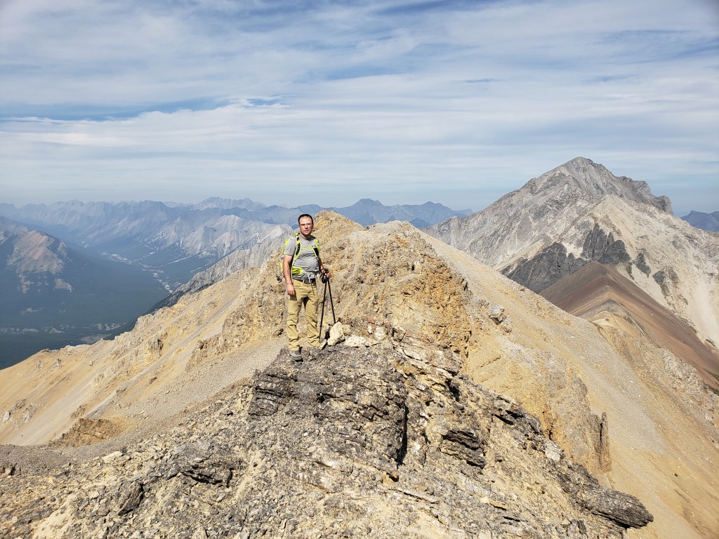
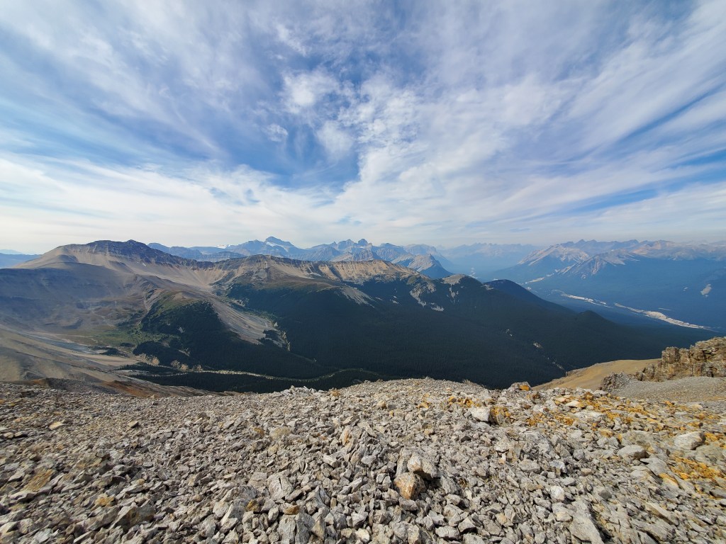
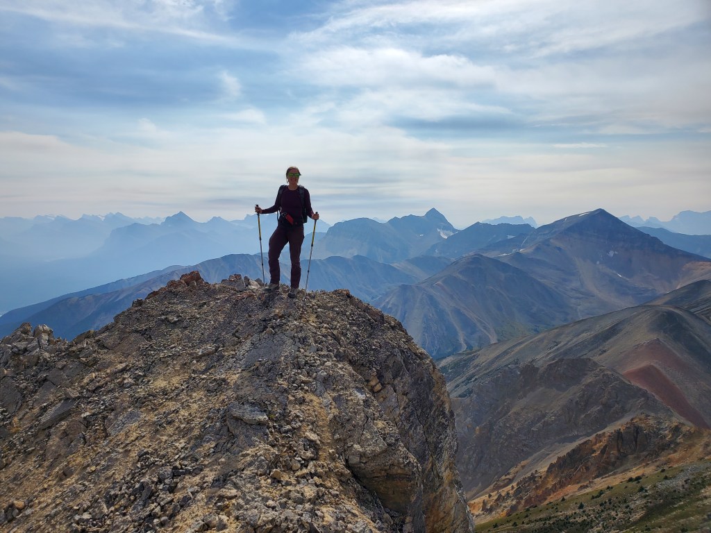
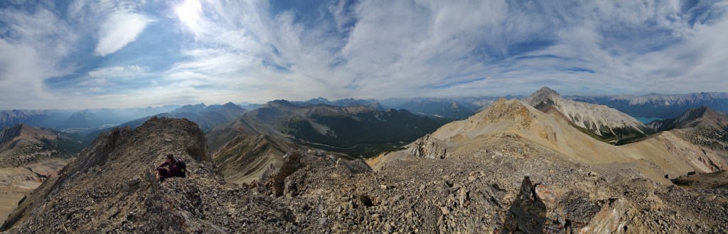
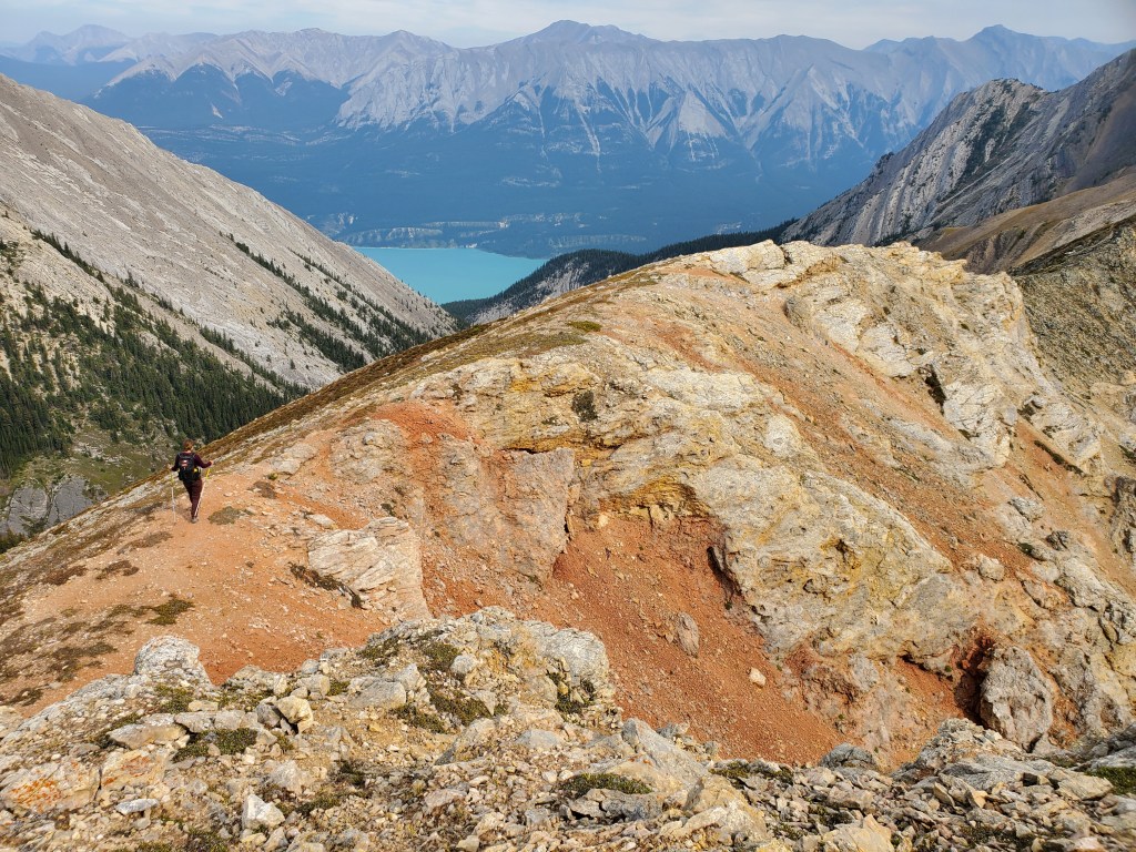
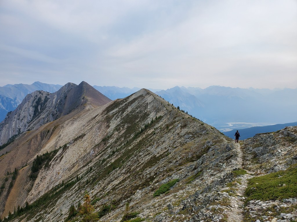
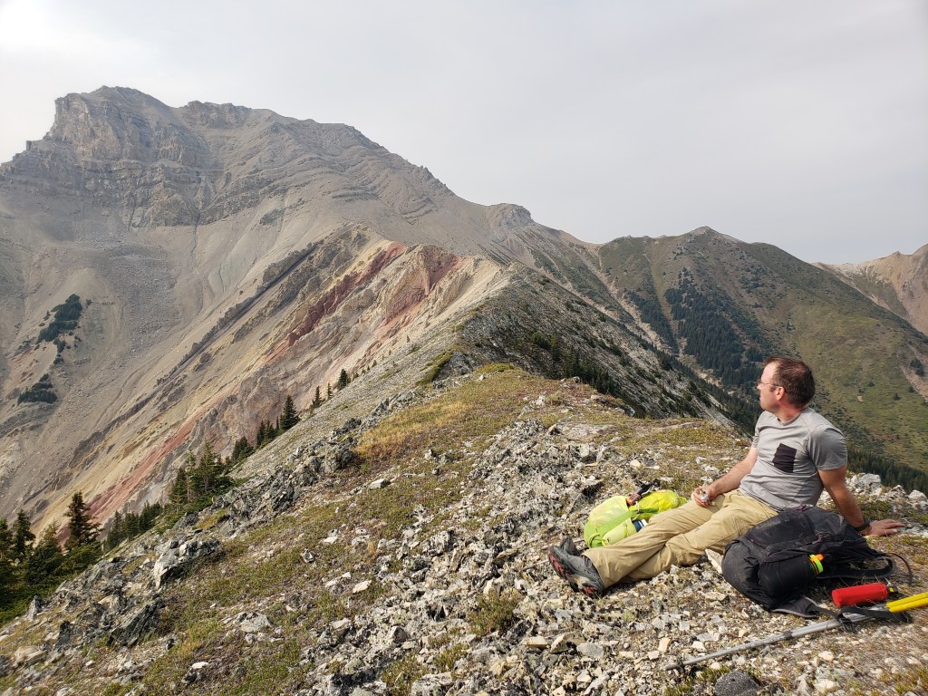
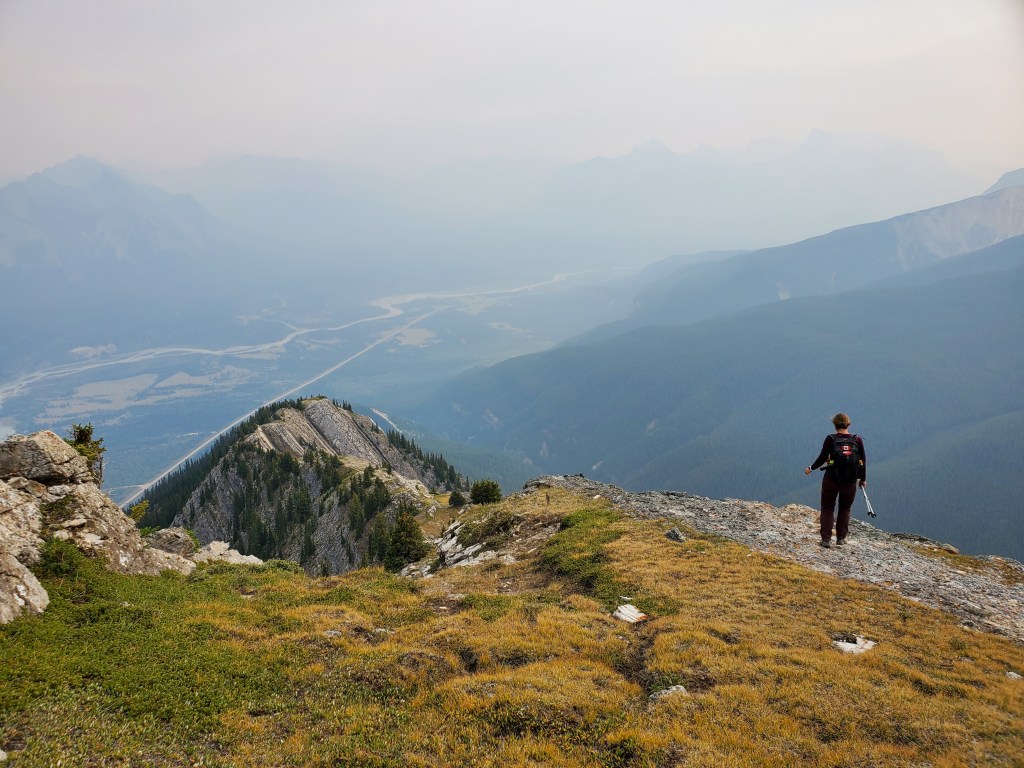
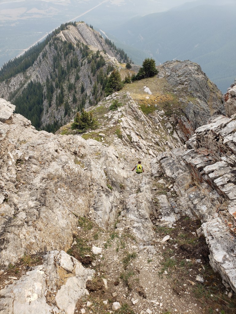
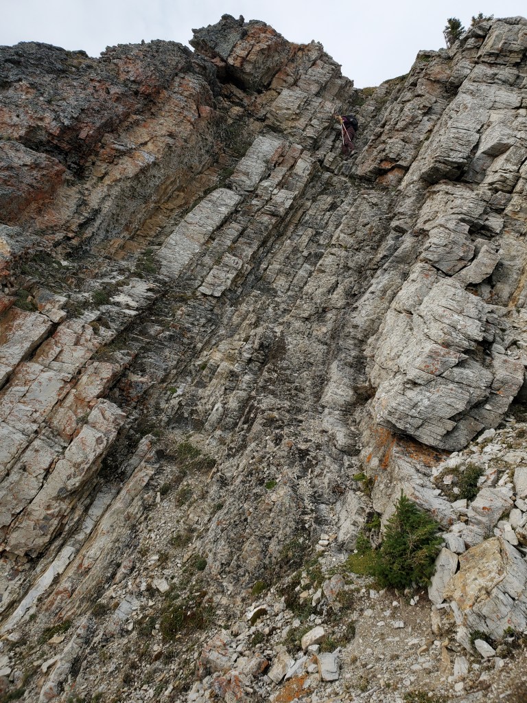
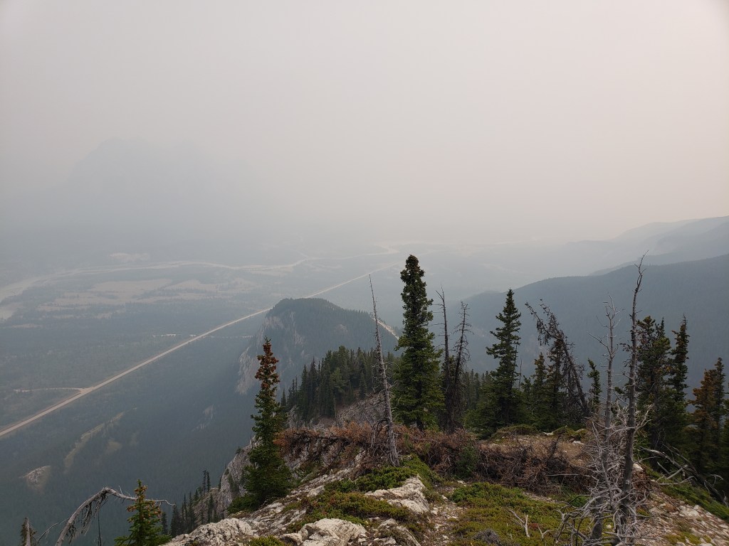
The day begins on a trail along the creek.Within a few minutes a slope to the right offers easy access to gain the toe of the ridge to Ernest Ross. The game trails make travel easier much of the way up the ridge. However, there are many braids and they don’t necessarily lead in the desired direction, so some attention must still be given to overall route choice. Keep an eye out for flagging tape along the way.Gaining the shoulder of the ridge, the way up comes into view. Ernest Ross’ double peaks can be seen to the right. Bridge Peak still looks far away at center.Views expand over Abraham Lake as elevation is gained. We noted that the water was higher than usual in the reservoir on this day.The terrain grows steeper but remains as hiking or easy scrambling until just below the first peak.Conditions grew smokier as the day progressed due to the Chetamon Wildfire in Jasper. Ex Coelis group to the southeast can just be made out in the distance through the smoke.To the southwest are views of Two O’Clock Ridge, Two O’Clock Peak, and Landslide Peak. Tuff Puff can be seen behind Two O’Clock Ridge, with Mount Frank (aka Whirlpool) just peeking out at its apex.The final portion of the route to the first peak of Ernest Ross follows a traverse off to the right here before leading to a few moves of moderate scrambling up a chimney just below the peak.The gently rising traverse.The crux of the day was this section of moderate scrambling. I stand at the top of the chimney, beckoning Dan to follow. The slope to the left (below the chimney) is steep. However, the chimney looks more exposed than it is. We gathered a few extra photos on the way back out to illustrate.The first peak of Ernest Ross has an interesting collection of registers plus a tiny Canadian flag. The two peaks looked equivalent in height, but views over the lake were better at the first peak.Summit panorama from the first peak of Ernest Ross.Next, we dropped down behind the first peak and continued on to the second peak.The route up the north side of the second peak was mostly loose shale – not that fun, but never beyond easy scrambling.We ran into Spiderman at the second peak!The route down the back of the second peak and across to Bridge Peak is a gentle ridge walk.Looking back at the two peaks of Ernest Ross.A patch of bright orange and pink ridge lies ahead, just before Bridge Peak. To this point, almost an hour had passed since descending the second peak of Ernest Ross.Looking down to the left, the pink rock can be seen to also frame Bridge Creek below. The final push up Bridge Peak is mostly a scree slog straight up. The cliff bands were easy to avoid and presented no problems.Stunning views of Elliot Peak to the north.Bridge Peak also seemed to have two peaks, so we tagged both. The north peak lies behind Dan in this photo. Elliot Peak dominates the view to the right and the Cline River meanders in from the left.Looking West from Bridge Peak. Across the middle of the photo is the ridge topped by Landslide Peak (hidden behind which is Landslide Lake). Peaks behind this include Resolute Mountain, Dasent Peak and Gruff Peak.Bridge’s south peak offers views of Two O’Clock Peak (right) and Mount Frank (aka Whirlpool, at center).Summit panorama on Bridge Peak.After enjoying our time at the peak, we returned the way we came, back over the orange/pink ridge. Abraham Lake can be seen in the distance. The ridge walk is an easy hike on a game trail.Stopping for a snack while admiring the impressive colours of the ridge below Bridge Peak.Passing back over the first peak of Ernest Ross. The second peak can be bypassed, but not the first.Returning back down the crux of Ernest Ross. The terrain becomes much gentler once on it and can be seen from above to be only moderate scrambling.Another shot of the crux. From below it looks harder and more exposed than it is.By the time we passed the crux, Ex Coelis group to the southeast could no longer be made out through the thick smoke.
We arrived back at the highway in 9 hrs 20 min. Bagging two peaks made for a satisfying day. The interesting colours of the ridge were a fun little surprise and the views from Bridge Peak were spectacular. If Bridge Peak were better known, I’m sure it would be as popular as Tuff Puff. It’s a must-do for the area.
2 thoughts on “Mount Ernest Ross (2454 m) and Bridge Peak (2692 m)”
I was intending to bag Bridge peak on May 26 but there was too much snow up there still between the summits of Ernest Ross as well as the east face of Bridge. You have a picture of yourself in front of the final push to the summit of Bridge and I was curious if you can email me the pic with the approximate route up the east face!
Hi Brian, it sounds like you made the right call turning back. It has been a late snow pack this year! For the final push up the east face a few lines are possible. On the way up we visited the north peak first, so we took a line trending more to the right side of the photo. On the way down, we took a more direct line down the obvious shoulder in the middle. We avoided the steeper terrain to the left.


I was intending to bag Bridge peak on May 26 but there was too much snow up there still between the summits of Ernest Ross as well as the east face of Bridge. You have a picture of yourself in front of the final push to the summit of Bridge and I was curious if you can email me the pic with the approximate route up the east face!
Kind regards,
Brian
LikeLike
Hi Brian, it sounds like you made the right call turning back. It has been a late snow pack this year! For the final push up the east face a few lines are possible. On the way up we visited the north peak first, so we took a line trending more to the right side of the photo. On the way down, we took a more direct line down the obvious shoulder in the middle. We avoided the steeper terrain to the left.
LikeLike