Notes: Thriving tick population. It’s possible to bypass The Buckle, which would reduce the trip to upper-moderate scrambling. There may even be a moderate line up The Buckle (unconfirmed).
Trip Report
The crags around Windy Point have a reputation with climbers for their fierce tick population. In one April 2023 day at Waterknot Wall, Dan and I managed to pick up 10 ticks between the two of us. Thankfully the ticks weren’t interested in us in September 2022, the day of this trip report.
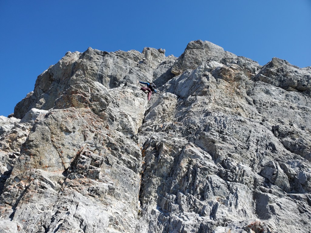
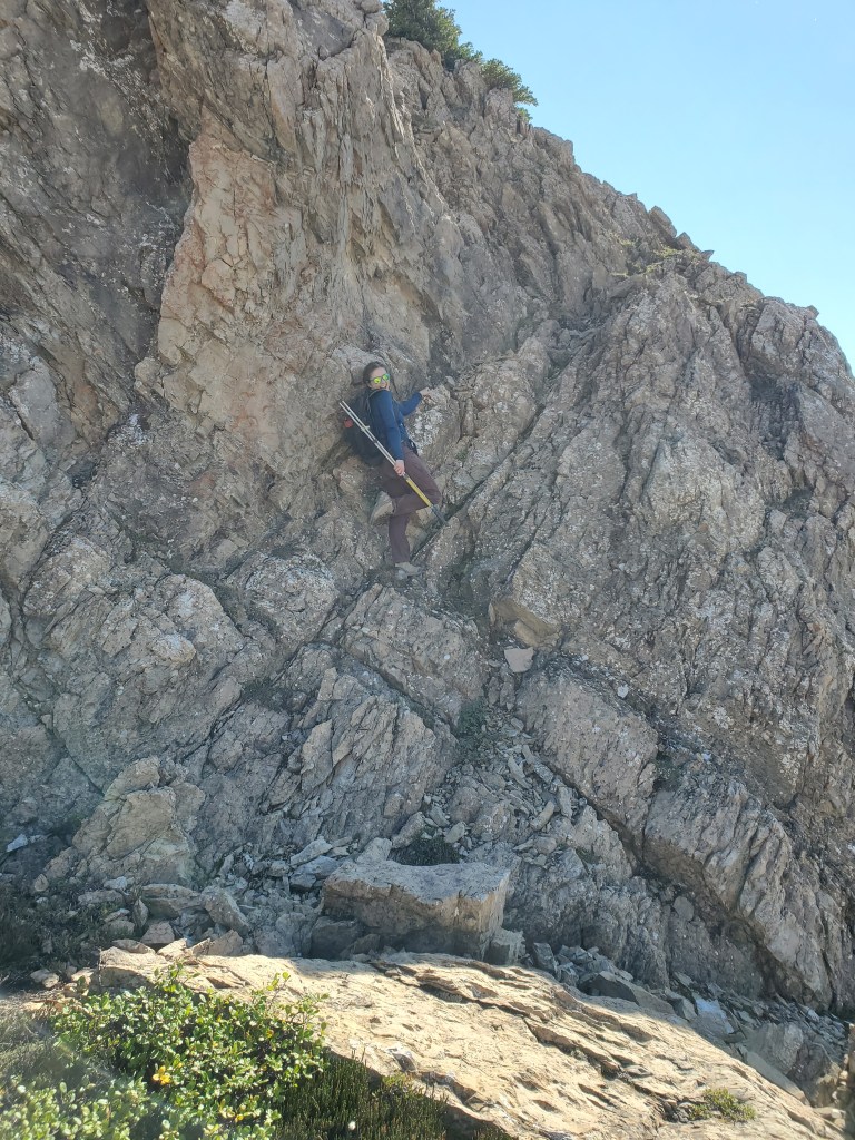
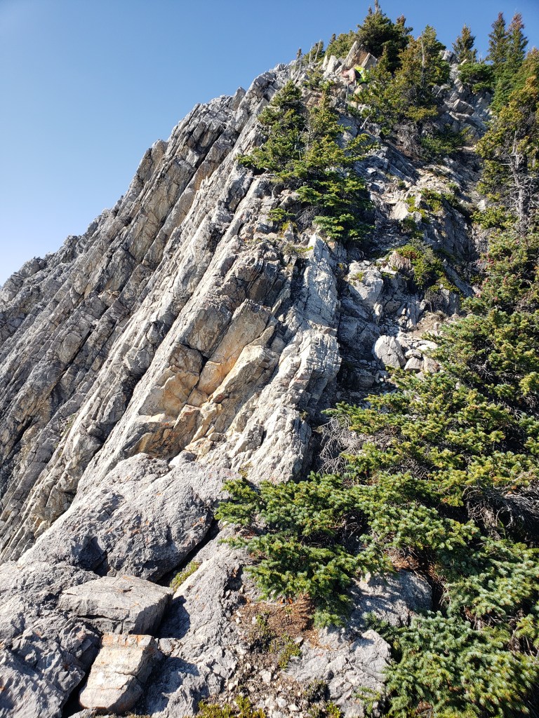
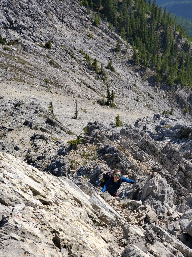
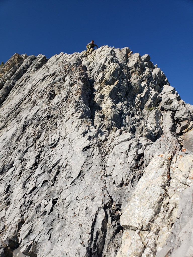
The optional scramble up The Buckle is difficult and exposed. Without this section, the route still has several moves of moderate scrambling, though the moves are a fun combination of slab climbing and stemming through corner features.
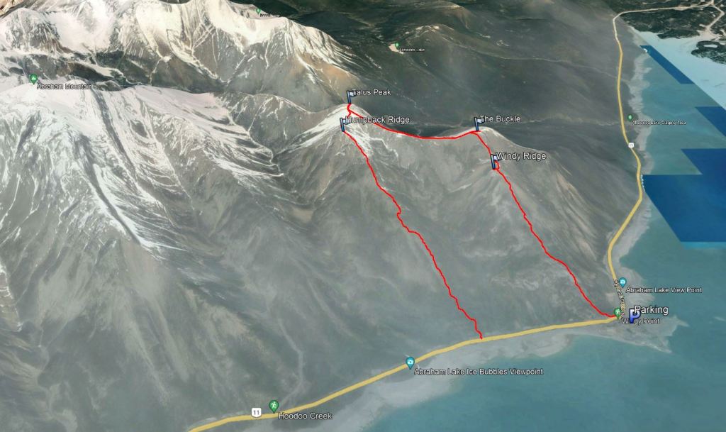
There is a large parking lot south of the highway at Windy Point. However, crossing the highway might be the most dangerous part of the day as the highway makes a blind corner through a narrow passage cut into the rock here. The shoulder of the highway at Humpback Ridge is wide enough for parking and may have been a better choice.
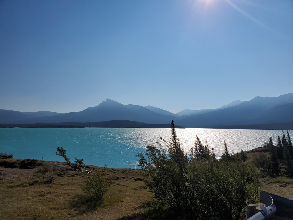
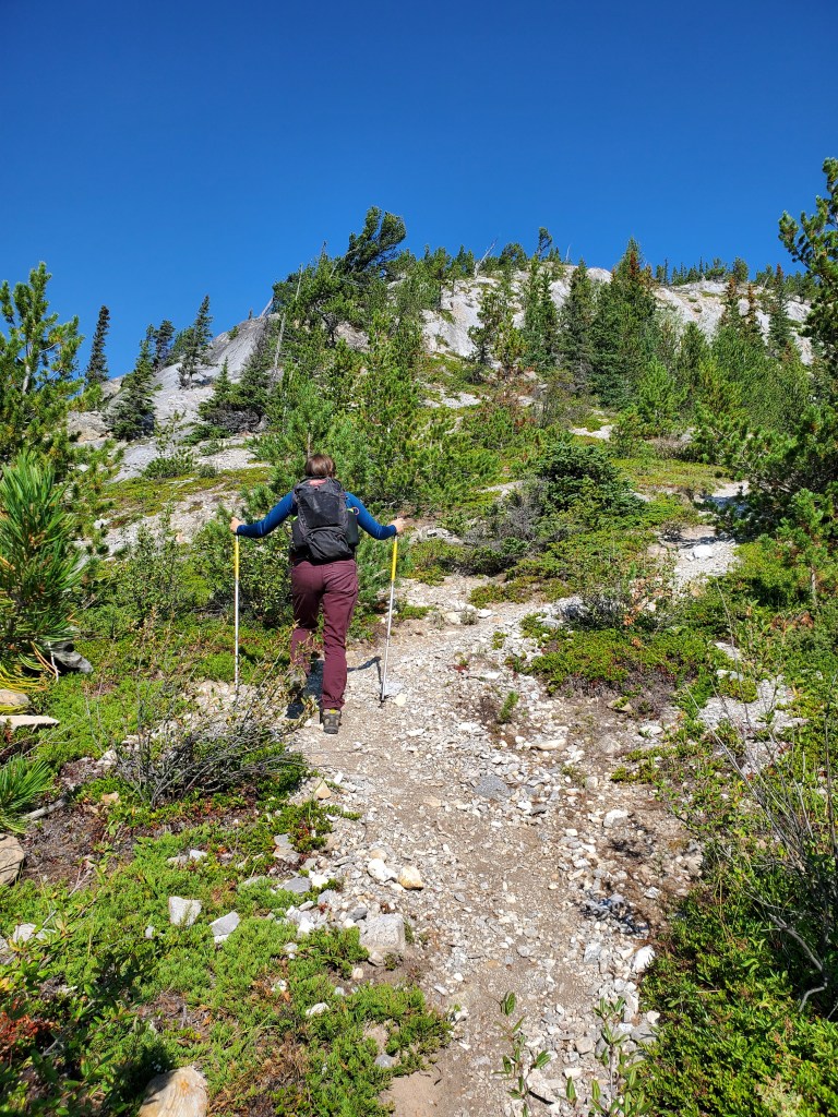
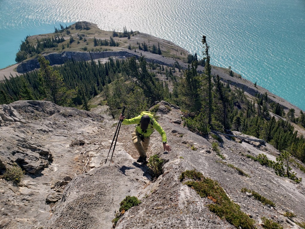
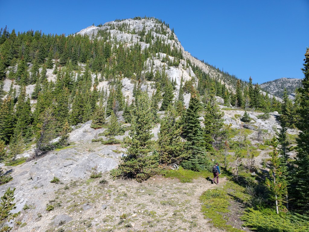
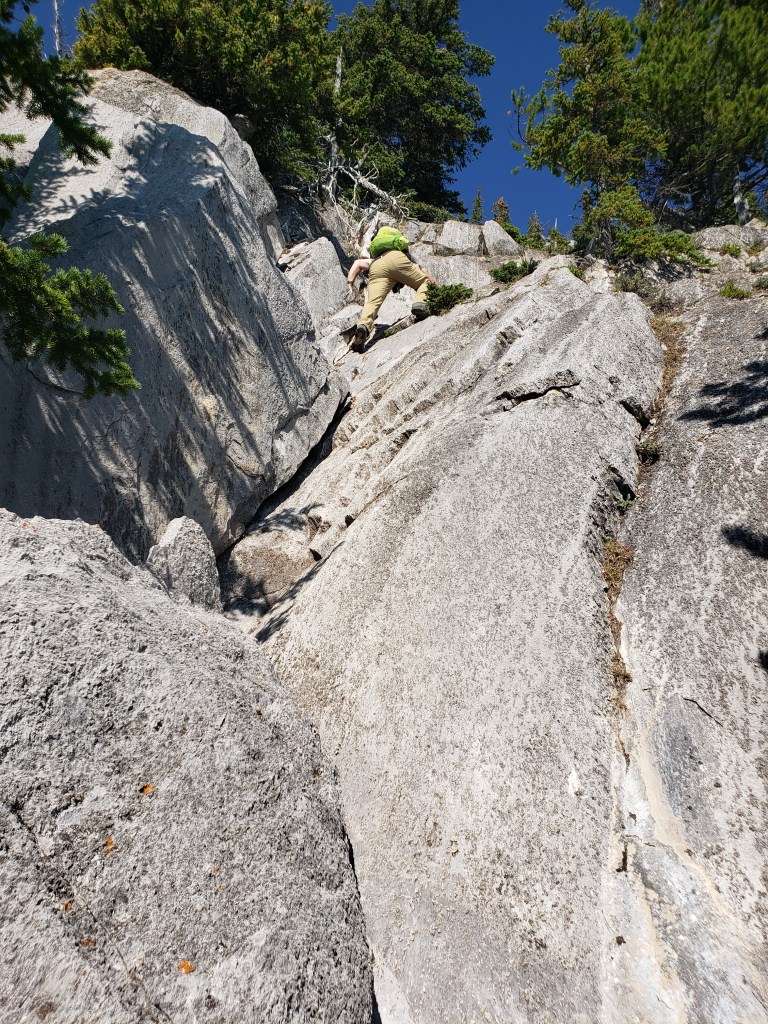
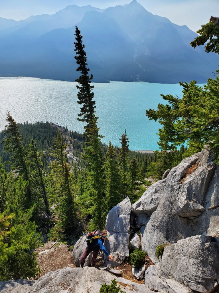
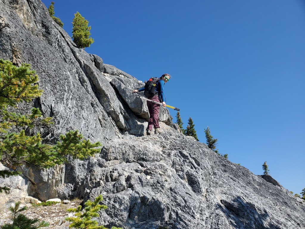
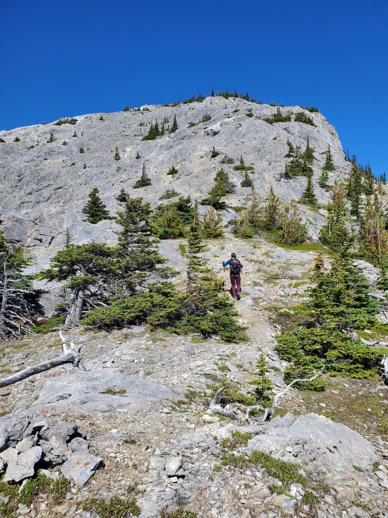
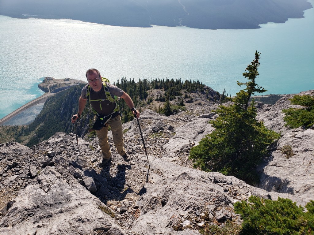
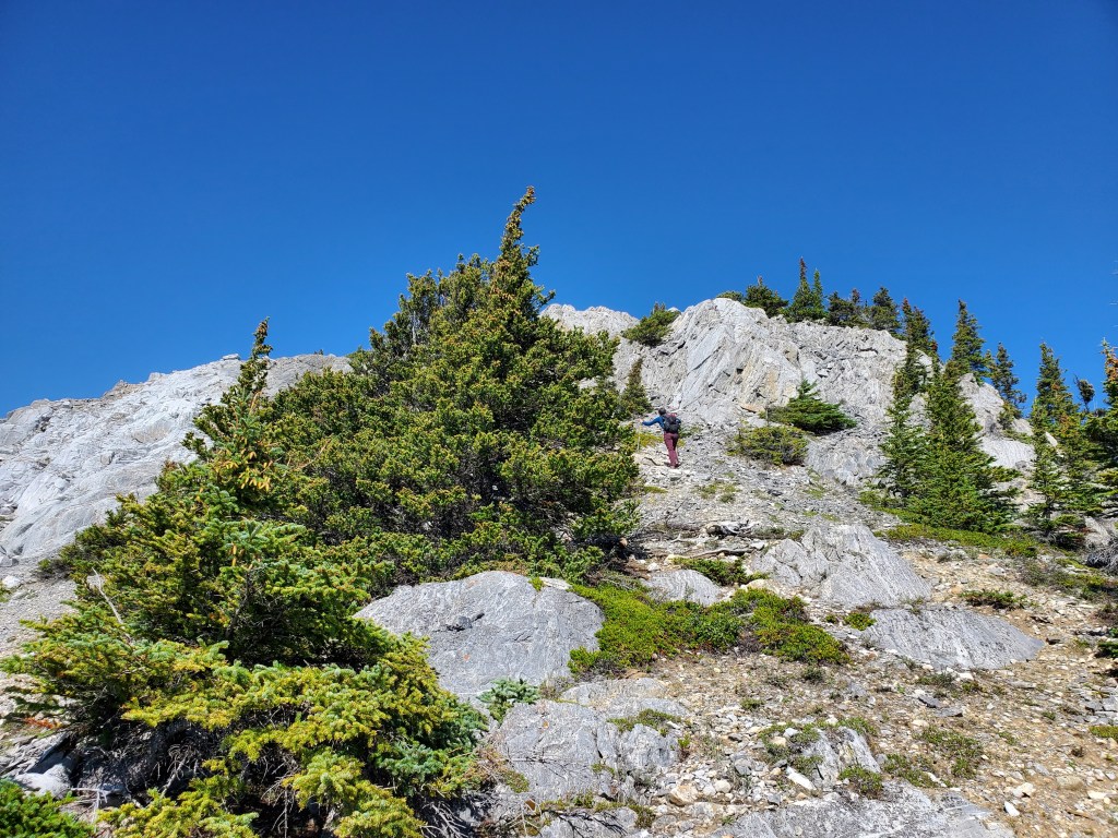
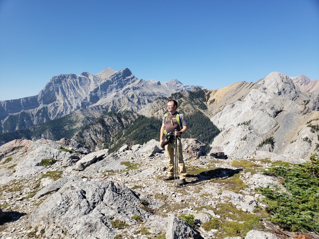
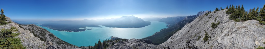
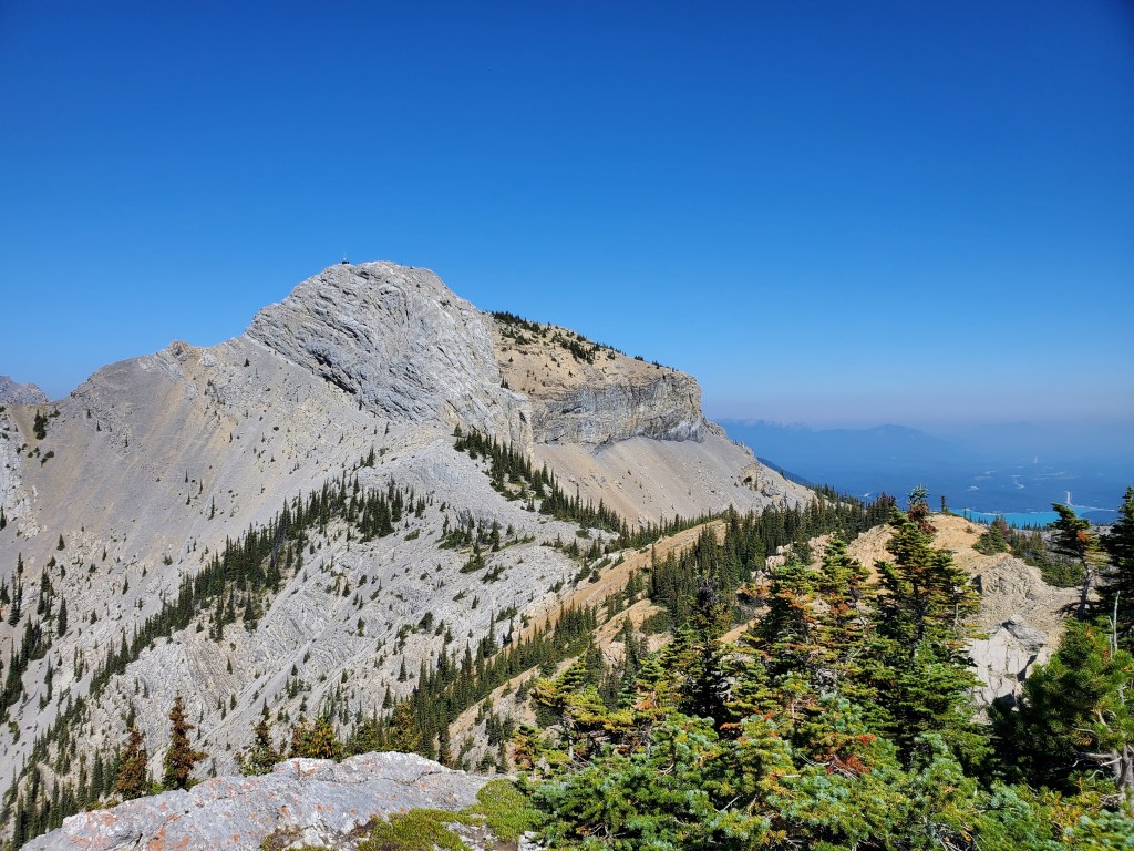
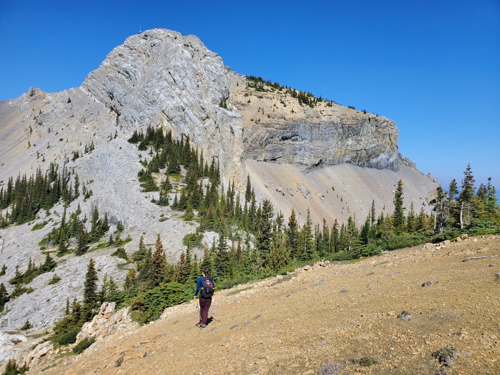
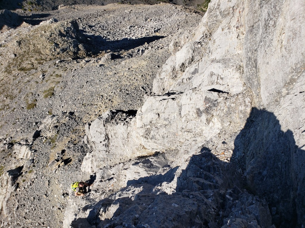
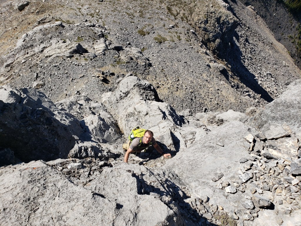
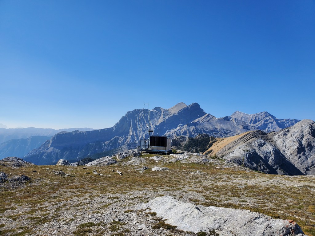
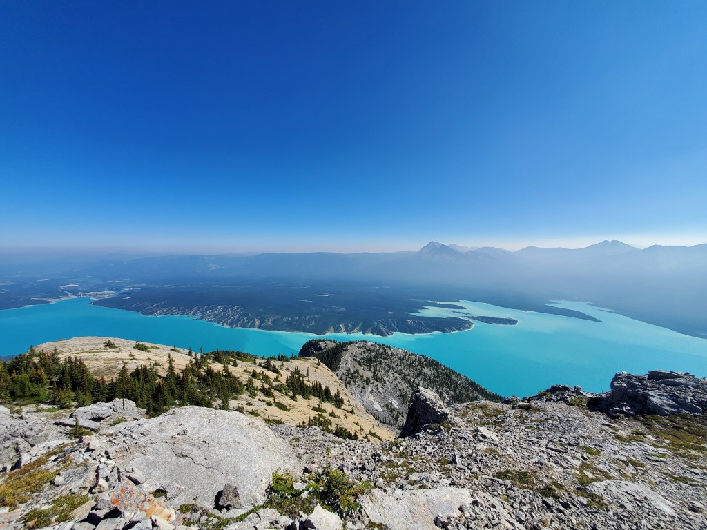
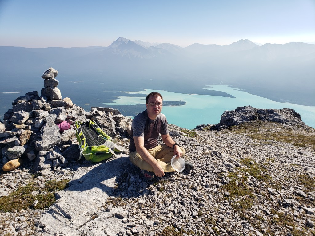
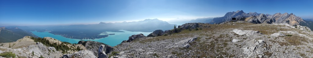
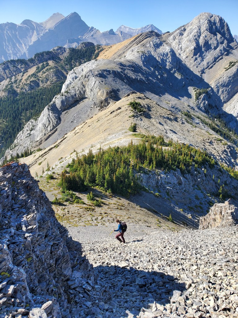
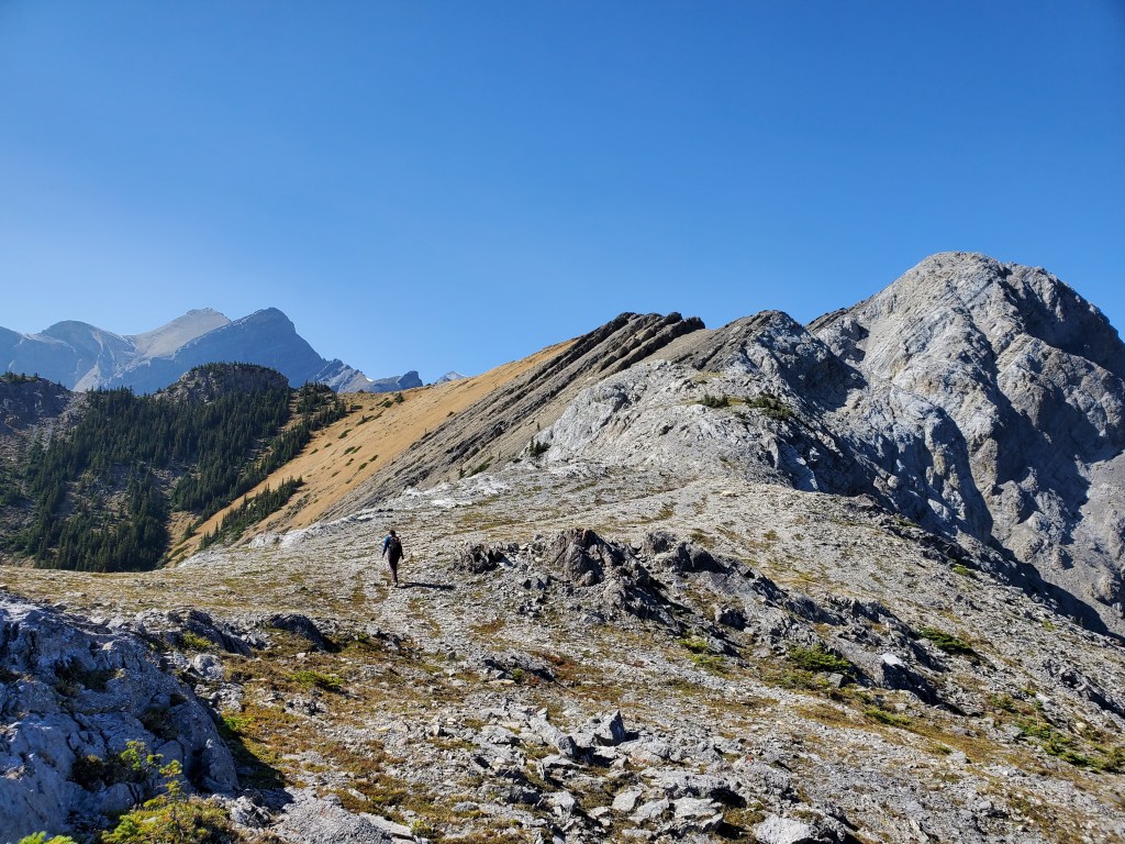
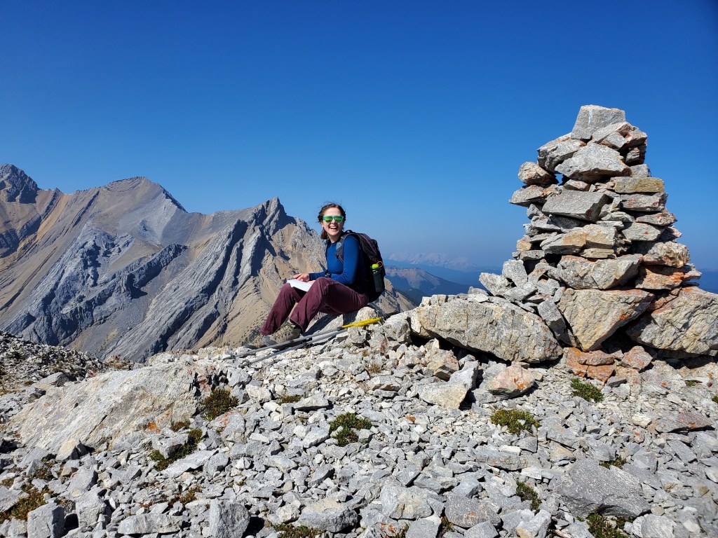
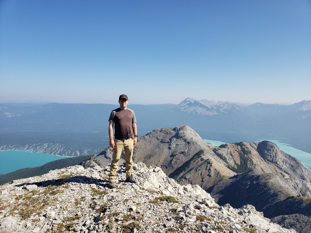
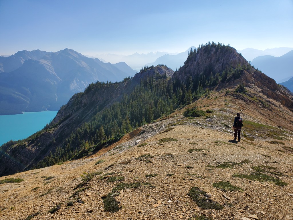
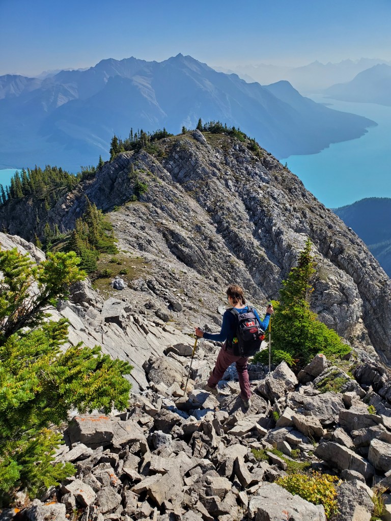
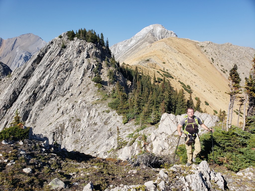
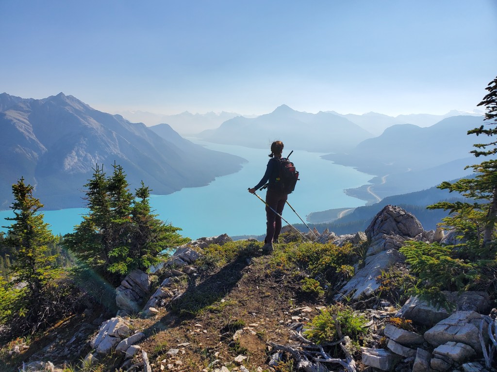
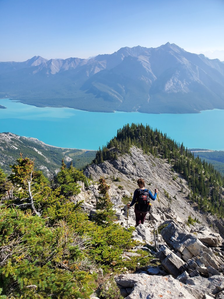
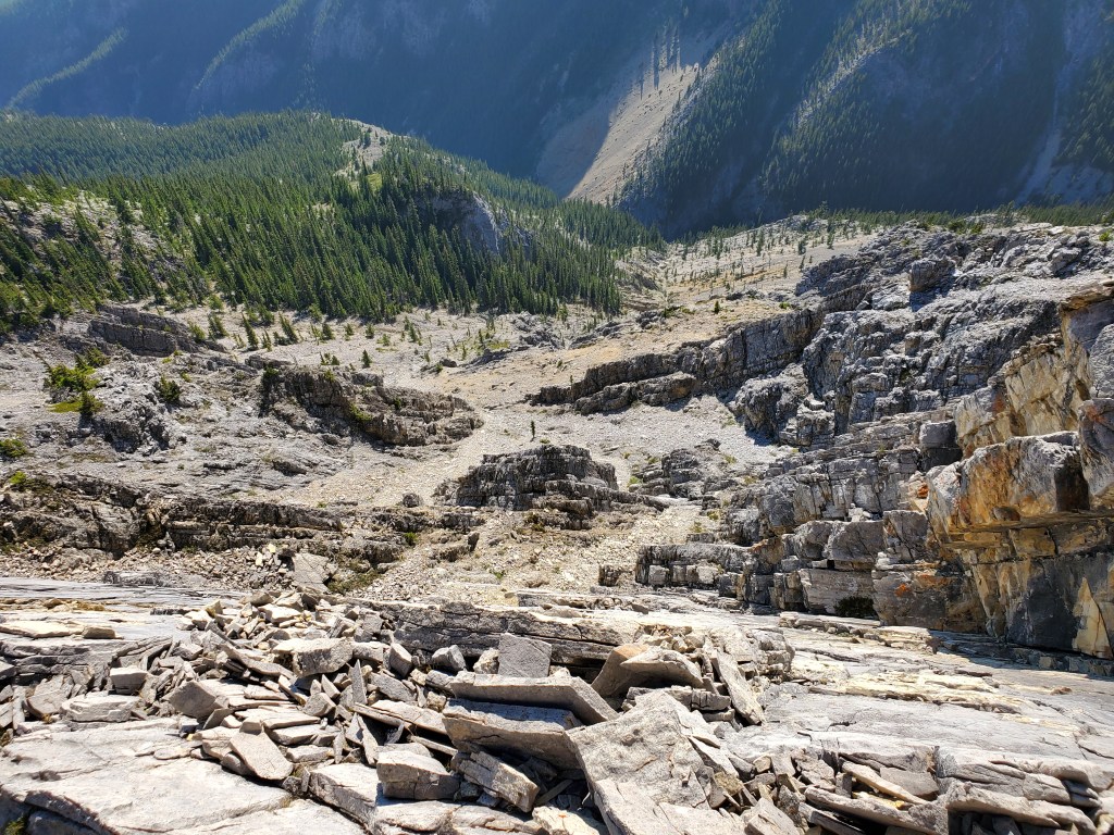
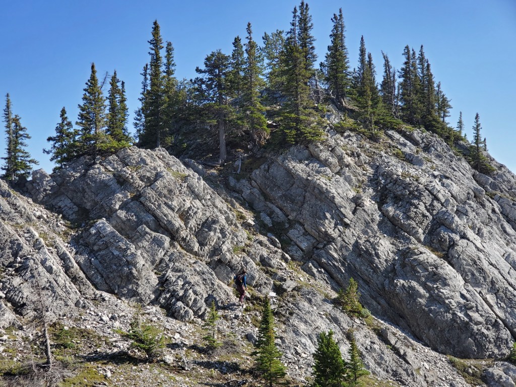
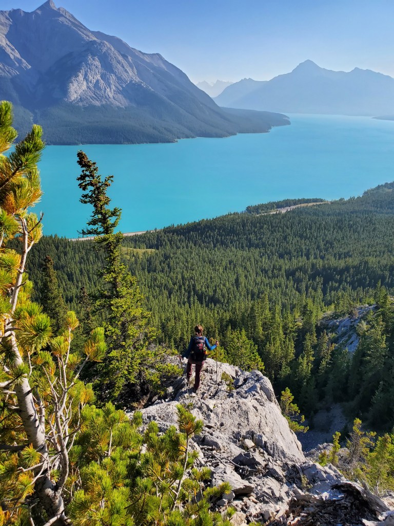
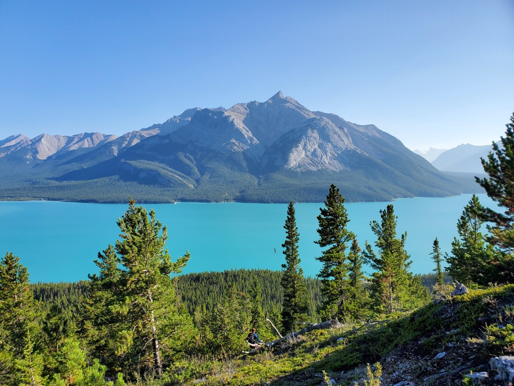
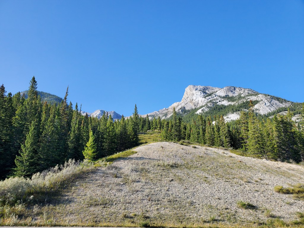
The view of Abraham Lake from the parking lot. Windy Point lives up to its name!Beginning up Windy Ridge. We picked up a trail across the highway from the driveway to the parking lot.There is no bushwhacking on the Windy Ridge portion of the loop. We were immediately scrambling up the steep ridge. The parking lot can be seen across the highway. Approaching the second hump of the ridge. There are a few moderate lines to choose up the slab and they all looked fun. It’s plain to see why there are so many climbing crags around Windy Point.We chose a line stemming up a fun corner feature.The path to this line looks well-trodden, though not necessarily by humans. All of the trees along this sheep trail are likely to hold ticks in Spring.Continuing the walk up sla-aa-ab.Dan following on some easy to moderate scrambling. The steep nature of the ridge means Abraham Lake provides an impressive backdrop for all of the photos.Approaching the third hump in Windy Ridge.Trails zig-zag through the slab making travel easier.Almost at the high point of Windy Ridge, scouting out the best line.Reaching our first peak of the day: Windy Ridge. Abraham Mountain is the large peak in the background.Summit panorama from Windy Ridge.Continuing on to The Buckle, which is the high point in this photo. A communications repeater station is barely visible. We’ll be traversing around the bottom of the summit block to the left and then climbing the left side of the face.The path traversing around the left of The Buckle becomes obvious once close.The traverse was across a much gentler slope than our initial impression had us believing.Scrambling the difficult line up The Buckle. It’s worth noting that I have been rock climbing for several years and this line is well within the grade I am confident climbing. Not everyone should feel comfortable on this terrain, and that’s OK. Unconfirmed reports indicate that there may be an easier line much further left, behind the peak. It’s also possible to simply skip this peak and continue straight on to Talus Peak.Dan follows me up the difficult scramble.You can almost pinpoint the instant he realizes he married a goat, not a woman.Reaching our second peak of the day: The Buckle. Taking in the scenic view of mobile radio equipment framed by Abraham Mountain. This is not a cell tower. Dipole antennas like these would typically be used for radio by first responders such as fire fighters or SAR.Sublime views over the intensely turquoise waters of Abraham Lake.The wind did not let up; in fact it stole the lid to Dan’s sandwich container! With it the wind carried in smoke from the Chetamon Wildfire in Jasper.Summit panorama from The Buckle.Downclimbing The Buckle via the same line we had ascended.Glancing back up at Dan as he follows the difficult downclimb of The Buckle.Continuing on to Talus Peak (right).As we grew closer, the walk up to the peak came into view. The terrain up Talus Peak was all easy.Reaching our third peak of the day: Talus Peak. Reviewing the summit register, this peak sees a few parties per year.Summit panorama from Talus Peak.Dan stands on Talus Peak. In the background is The Buckle (center) and Windy Ridge (right). It can be seen where an alternate ascent route might exist up the back of The Buckle. In the distance, on the other side of Abraham Lake, is Kista Peak. Continuing on to Humpback Ridge. I expected this last part to be somewhat of a dull bushwhack, but it might have been the best scrambling of the day. There’s a lot of variety to this ridge!Feeling cute, might delete later.Crossing over the first hump and continuing down to the next one.Looking back at the first hump, presumably the peak of Humpback Ridge (and our fourth peak of the day).Views over Abraham Lake were largely unobscured by trees. There was less bushwhacking than I expected.I casually continue down the next hump.Glancing down the side of Humpback Ridge. The route won’t take us this way – we’ll continue along the ridge.Looking back up as Dan follows me down the ridge.I near the bottom of this hump.Glancing back up at Dan. The line appears much steeper from below. The previous photo better shows the actual terrain.Making our way over and up the next hump of the aptly-named Humpback Ridge.Looking across our circuit at The Buckle (left) and Windy Ridge (right).Downclimbing another hump (I’ve lost track of how many this is). It’s not as steep as it looks – slugform is just my natural climbing style.Hiking over the last hump before descending back to the valley.Leaving Humpback Ridge and entering the trees. There is about 400 m of bushwhacking still to get back to the highway, but it was reasonably intuitive to follow the slope downhill and a few clearings along the way made it easy to keep our bearings.Looking back up at the bushwhack. We came from the treed hump at the left.
This might be my favourite trip in the David Thompson Corridor. It caught my interest due to the high peak count, but ended up being quality scrambling on varied terrain with stunning views over Abraham Lake. Windy Ridge made a great autumn trip. I am not disappointed to have missed the early season ticks.


One thought on “Windy Ridge (2020 m) The Buckle (2180 m) Talus Peak (2300 m) and Humpback Ridge (2190 m)”