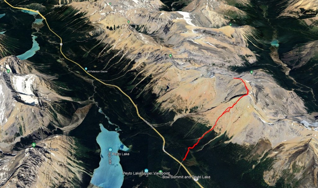
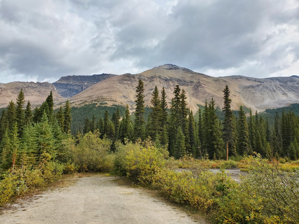
Observation Peak is a beautiful scramble along the Icefields Parkway, with views overlooking Peyto Lake throughout the day. The surroundings are similar to neighbouring Cirque Peak, but the crowds are much thinner. Our day started out on an old gravel road across from the Peyto Lake Upper Viewpoint.
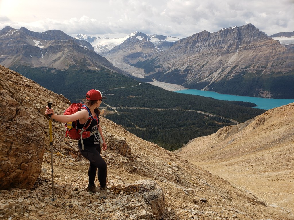
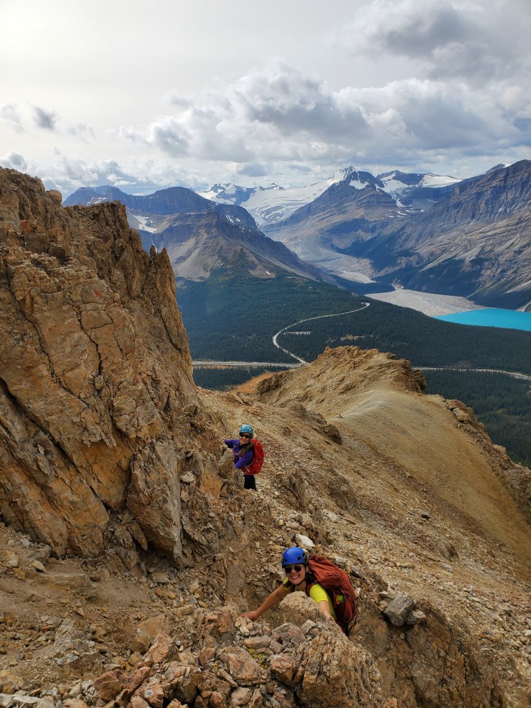
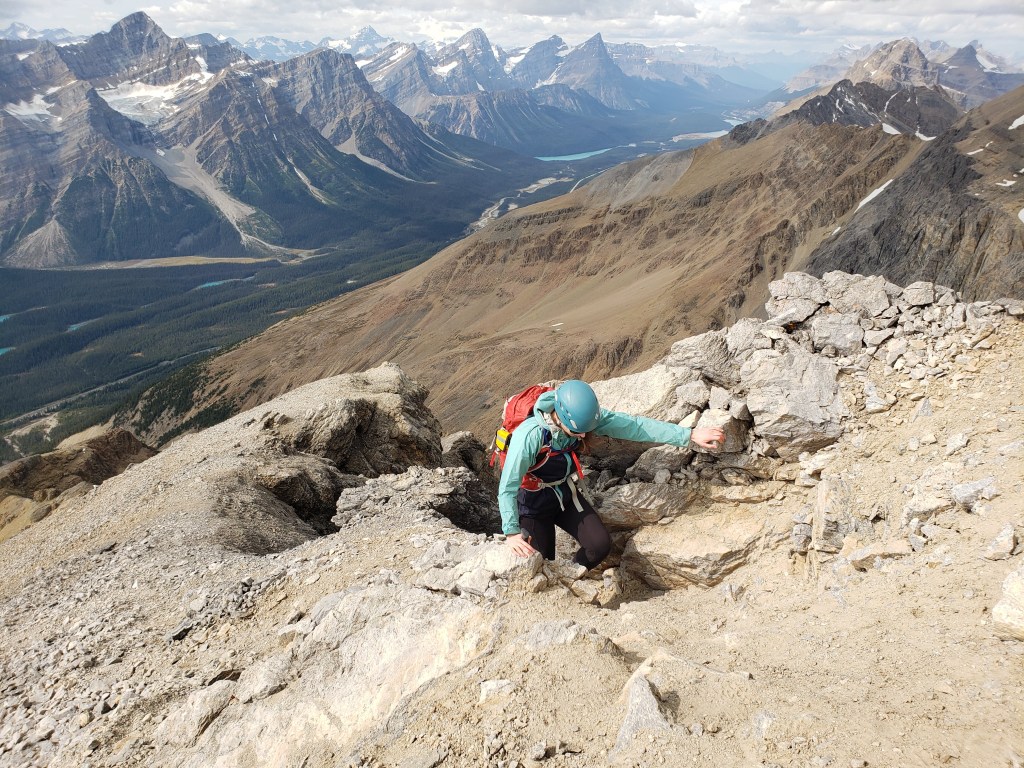
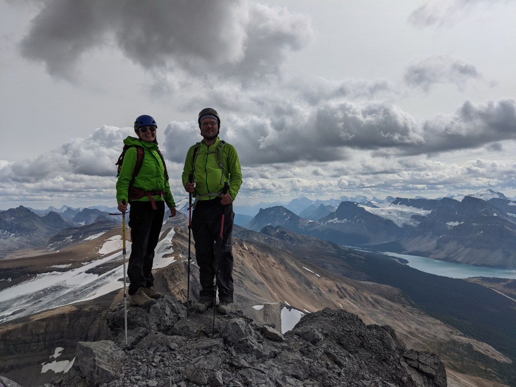
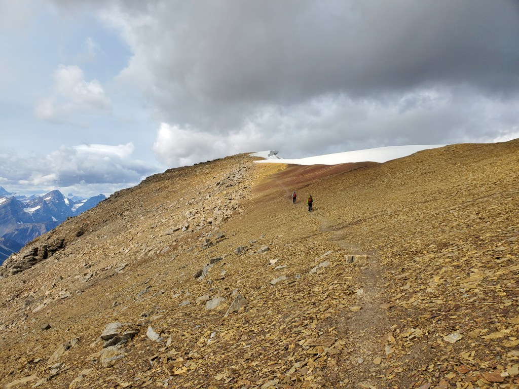
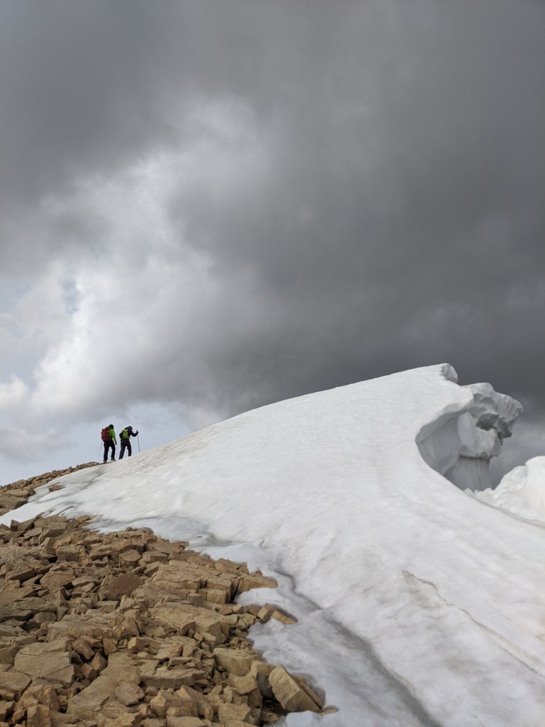
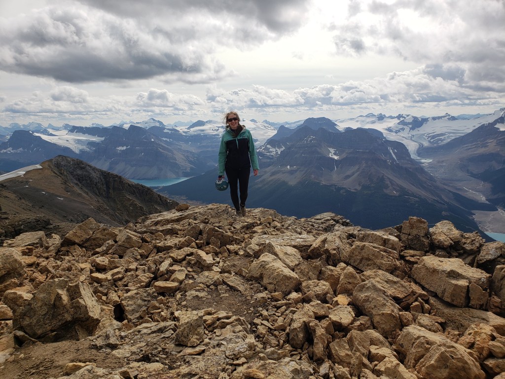
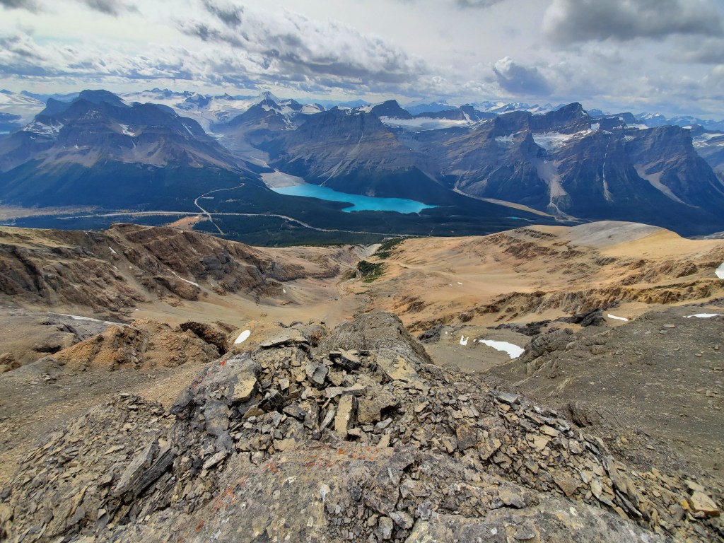
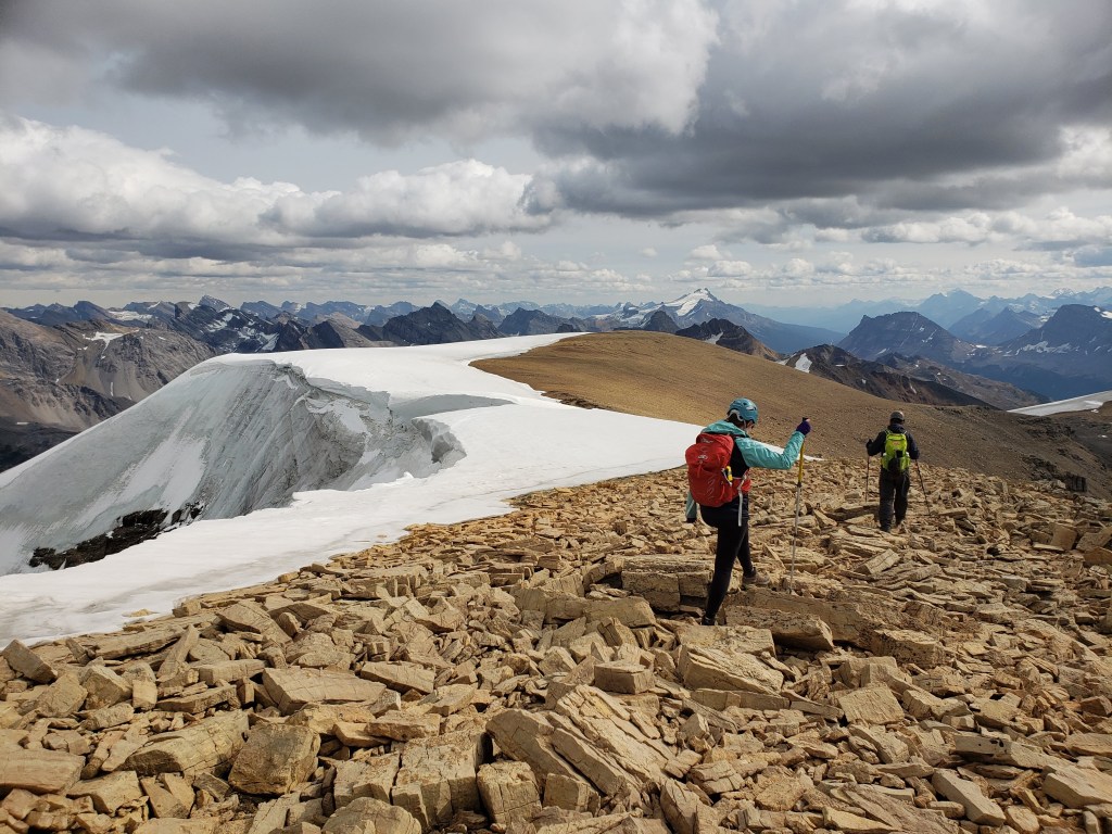
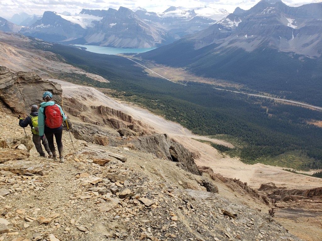
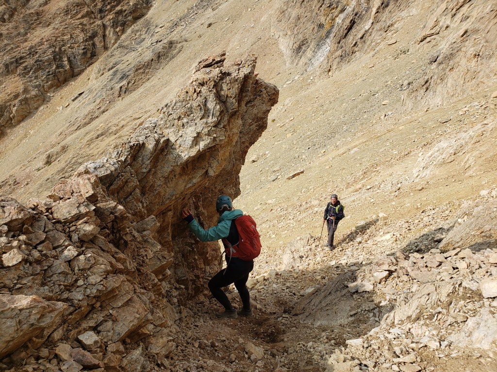
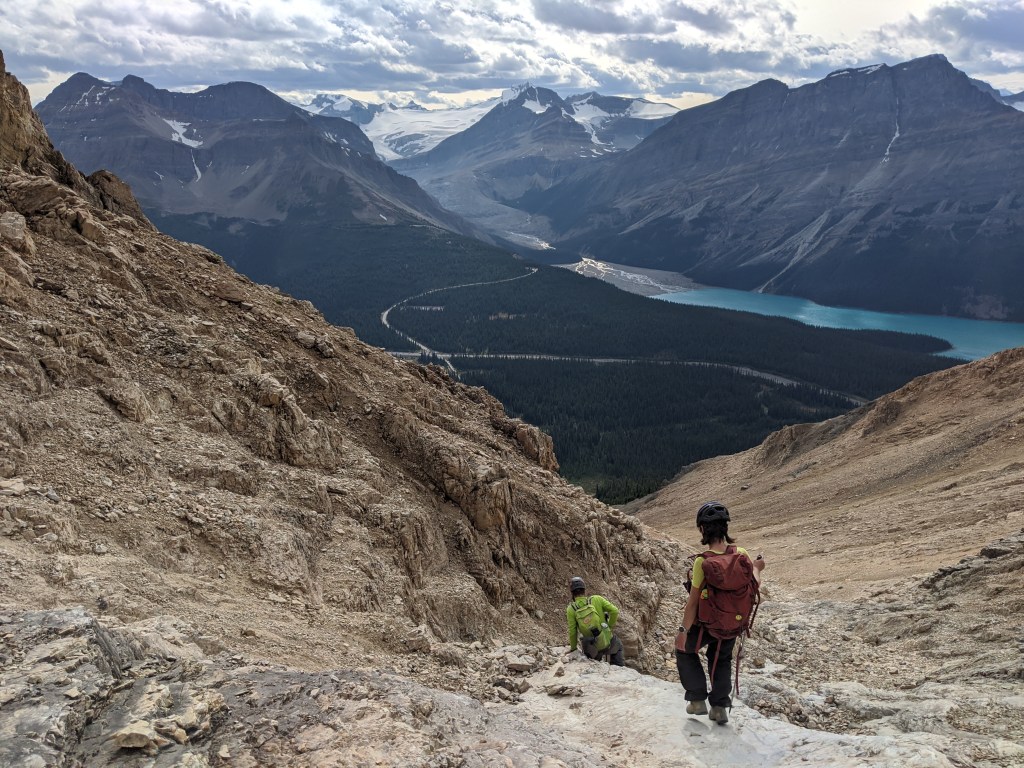
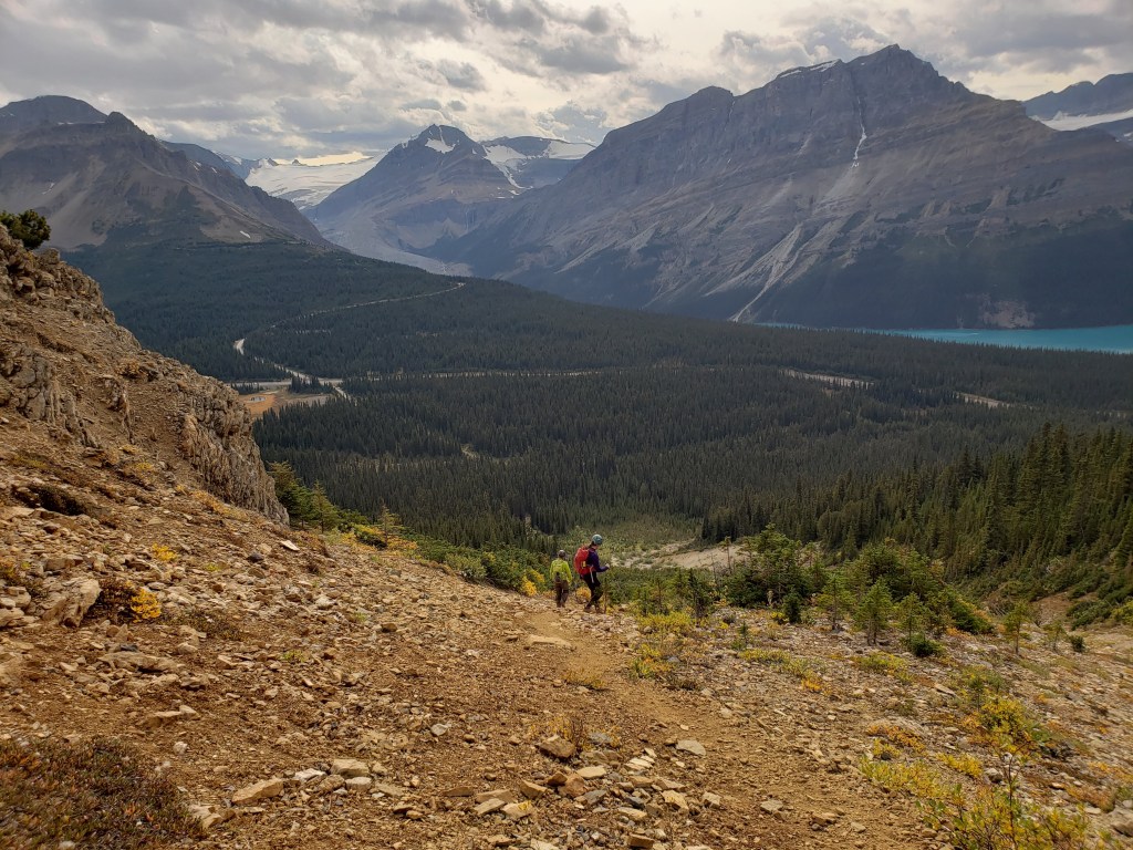
Looking upward from the end of the road, the ascent gully can be spotted. A well-worn trail leads up along the edge of the gully until the cliff band is reached. The cliff band looks worse than it is and the scrambling was never beyond moderate. After passing the false summit at center, we’ll eventually end up at the true summit, further back at the left.Making our way up the drainage and looking back at Peyto Lake. In the background, the road winding up from the highway leads to the Peyto Lake Viewpoint, a popular stop for tourists along the Icefields Parkway.This peak is busy enough for rockfall to be concerning. We donned our helmets and chose a line offset from the group ahead of us. Many ascent lines up the cliff band exist and all are moderate scrambling.Topping out on the summit ridge, fully taking in our spectacular surroundings. The distinctive shark-fin shape of Mount Chephren stands right of center, above Chephren Lake.The views at the false summit may have been even finer than the true summit! To the right the Crowfoot Glacier is perched above Bow Lake. Cirque Peak (behind me) is significantly more impressive looking when viewed from the north.The route along the summit ridge is little more than a flat trail. Even in September though, fierce cornices lined the ridge. The cornices were no concern on this day with plenty of room to bypass behind them on broad, solid ridge.A closer look at the massive cornices along the summit ridge.Reaching the summit! In the background Mount Jimmy Simpon stands between Bow Lake (left) and Peyto Lake (right). The Wapta Icefield can be seen in the distance.Stunning views of Peyto Lake from the summit of Observation Peak.We returned the way we came, again avoiding the impressive cornices along the summit ridge. Distant Mount Hector (center-right) can be seen towering above all other mountains in the shot.Once below the false summit, we made our way down the cliff band and back to the ascent drainage. With no other groups around this time, we took a slightly different line. Our descent line may have been slightly easier, but was still moderate scrambling. Taking advantage of the hand-railing offered by this shark-fin.Back in the drainage, we picked our way down smooth slab. We hiked back out along the drainage, trending left into the trees near the bottom. The old gravel road where we parked is ahead at the left.
We made it back to our vehicle in 6 hrs 15 min, leaving plenty of time for a relaxing evening by the campfire. Observation Peak was a rewarding day out with views even more beautiful than expected.