Notes: This route is no longer included in 105 Hikes In and Around Southwestern British Columbia, but can be found in older revisions (103 Hikes). This approach is from the Cultus Lake side. There is a short section of easy scrambling just before the peak.
Trip Report
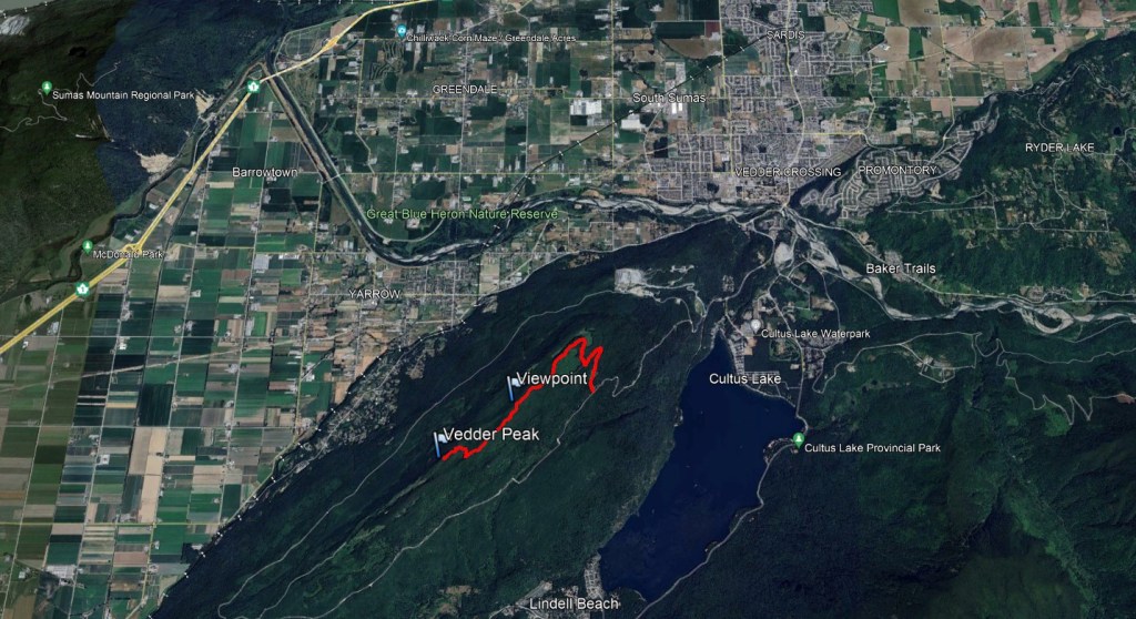
Vedder Mountain sits to the south of my childhood hometown and offers a few charming viewpoints. If hiking in Summer, nearby Cultus Lake makes for excellent swimming. I hiked this mountain in the 5th grade on a field-trip. Back then we started at the Majuba Hill trailhead, hiked across the mountain, and then headed down to our waiting bus at Cultus Lake. Private property has impacted the Majuba Hill trailhead and may not be reliable access. Instead, today, Vedder Mountain tends to be accessed from the Cultus Lake side. This hike is detailed in old copies of 103 Hikes in Southwestern British Columbia, but those without the book should have no trouble finding the the start of the route, at the point where a steep ungraded road turns off from Vedder Mountain FSR. The signed trailhead is 800 m up the rough road, but it is probably too risky for most passenger vehicles. Instead, the forestry road is wide enough at various points to pull to the side of for parking, with the extra 800m taken by foot.
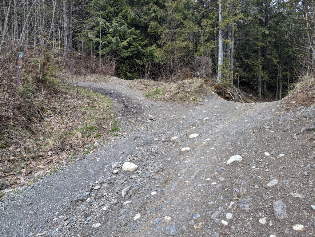
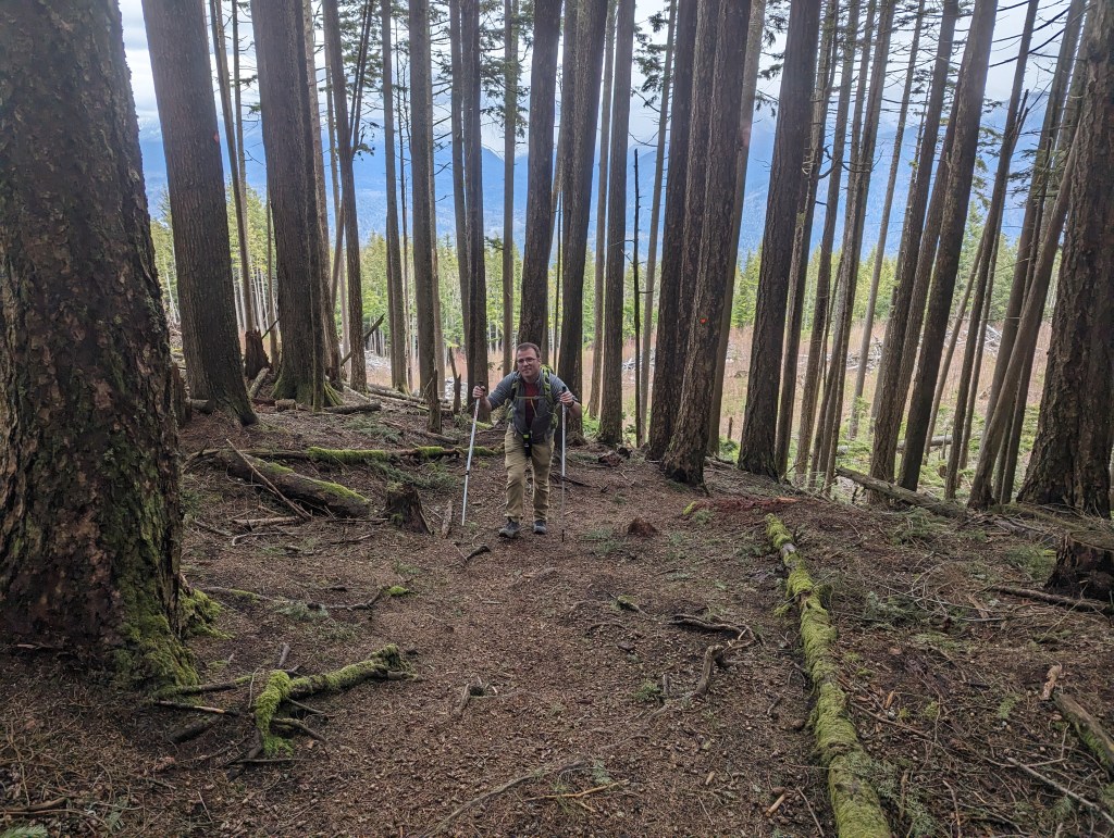
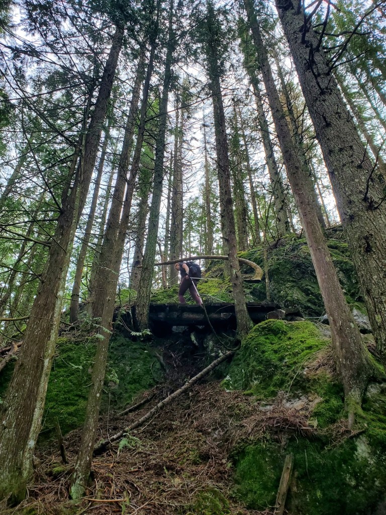
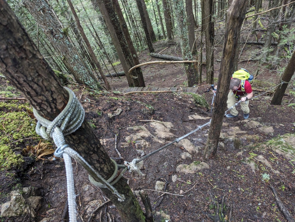
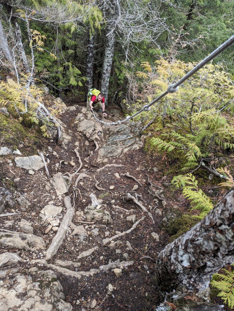
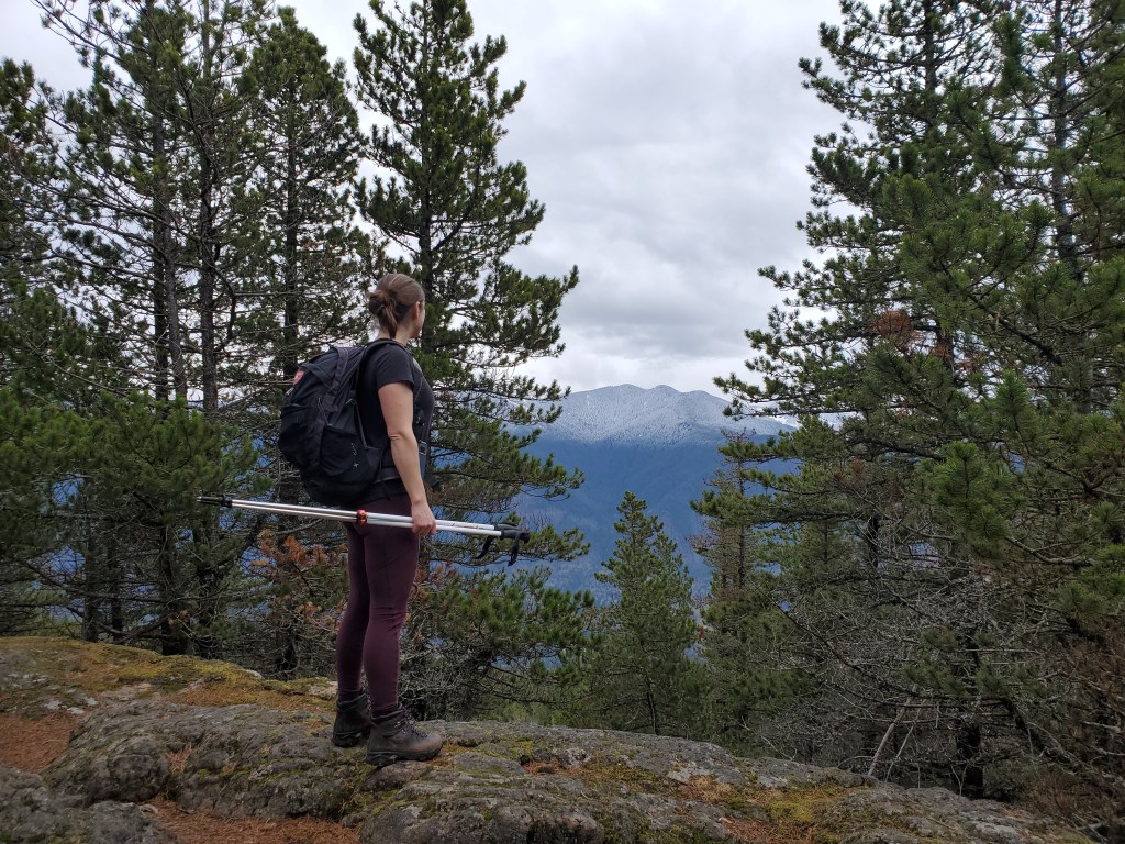
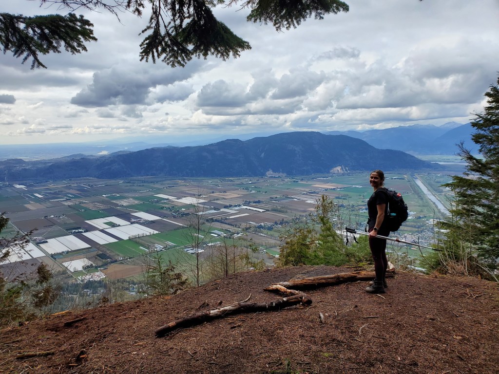
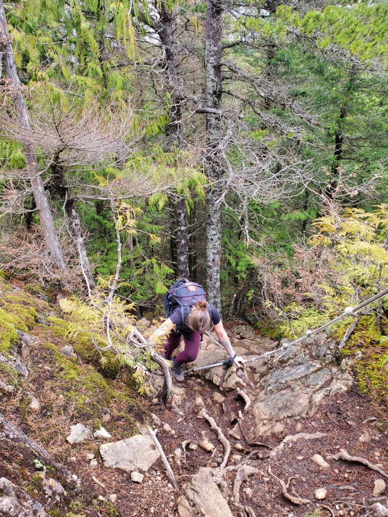
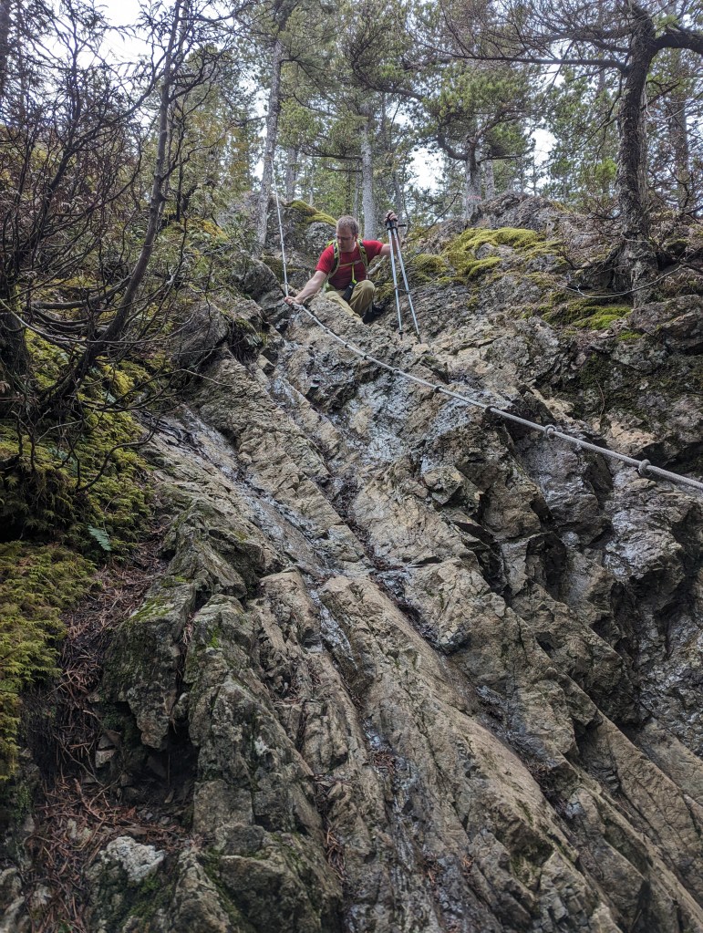
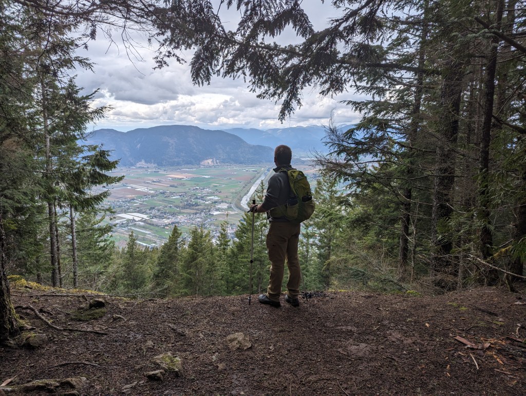
A small sign-post (left) marks the turn-off from the ungraded road to the start of the trail. The short walk up the road might be the most tiring part of the day!After hiking up two switchbacks the ridge trail is easily gained. The ridge is densely treed with only a few viewpoints. The first one, at ~3.5 km, is centered nicely above the Yarrow townsite.The ridgeline trail has a few hills, but is very simple up until the summit block – pointed to by Dan. A short, steep trail winds around the left and requires a few moves of easy scrambling. I don’t recall doing this last section on our 5th grade field trip.Looking at the start of the route up the summit block. Metal grips on the wood slats help with footing, and there is also a chain bolted into the rock for hand support; but this is easiest when fully dry.The first of two rope sections. Though only easy scrambling, we appreciated the rope for this day’s muddy conditions.The second rope section is slightly steeper, but was drier too, thankfully.The peak itself is mostly treed with only a narrow view southeast over Cultus Lake and Lindell.Signage to a north viewpoint led us to our best views of the day. Below lies Sumas Prairie framed by Sumas Mountain to the north (center) and the Vedder Canal to the East (right). The former Sumas Lake would have been roughly at the center of this photo for most of the year, but could extended across all of Sumas Prairie during flood season. The lake was drained in the 1920’s.We returned the way we came and downclimbed the rope section.A shot look back up at the upper rope section.Looking up at the lower rope section. In dry conditions I don’t think the rope would be needed.On the way out we again passed the viewpoint overlooking the Yarrow townsite. A lot has changed since I was a child, but there are still plenty of spots I recognize!
We made it back to our vehicle in 3 hrs 15 min. Aside from the summit block, this hike is very easy, suitable for an average child. Continuing to the summit doesn’t significantly improve the views, but makes for a quick peak to bag for the beginning scrambler.