Notes: Annual area closure to protect Dall’s Sheep: May 1 to June 15. Keep at least 50 m away from sheep all year.
Trip Report
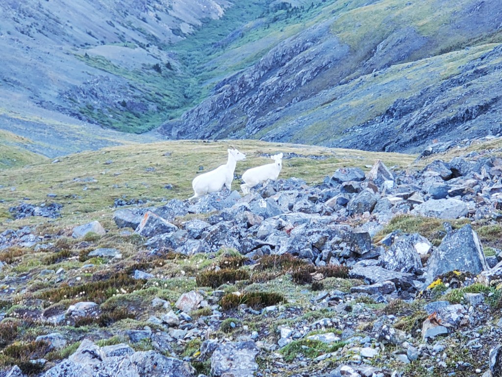
Thechàl Dhâl, also called Sheep Mountain, is a popular hike in Kluane National Park and Reserve and is well-known for its Dall’s Sheep. I was excited for the experience and very much hoping to catch a glimpse of one sheep. We ended up hiking past well over one hundred Dall’s Sheep! Try as we might to plot a course well around the larger flocks, individual sheep showed up everywhere we turned (becoming a mild nuisance to navigate around). The sheep usually favour the south slopes of Thechàl Dhâl, but I suspect a storm the previous day had sent them to the sheltered north slopes where we were hiking.
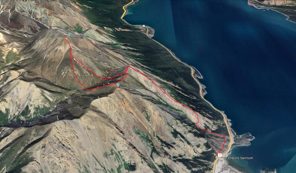
This hike can be done as an out-and-back or as a through-hike with vehicles parked at either end. We didn’t have a second vehicle, so elected for the former. Neighbouring Mount Wallace can be added on to the trip but is not described in the book and requires a bit of route finding. There are two possible starting points from the east end of Thechàl Dhâl. We kept to Marjanovic and Marjanovic’s description and started at the Soldier’s Summit trailhead. This is described as being the slightly harder option, but we still found it quite easy. We were careful to watch for our turn-off on descent, as the trail continuing straight down to the alternate trailhead is more obvious when returning.
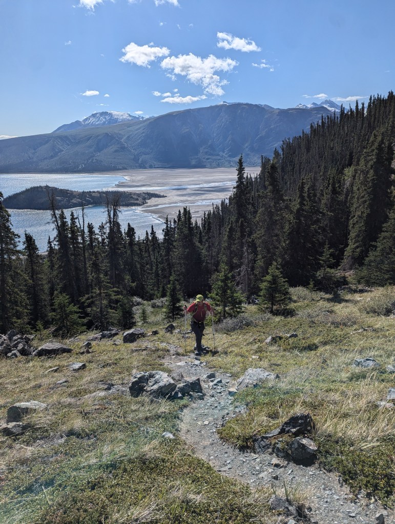
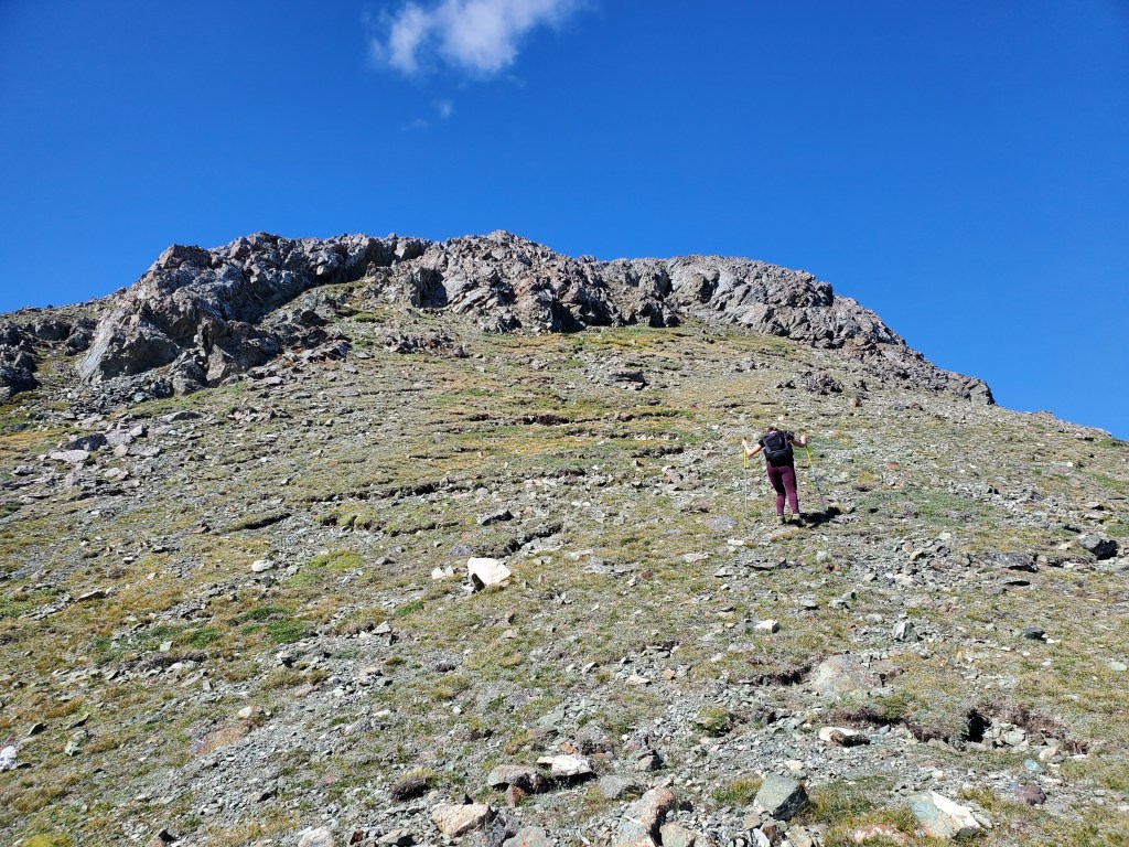
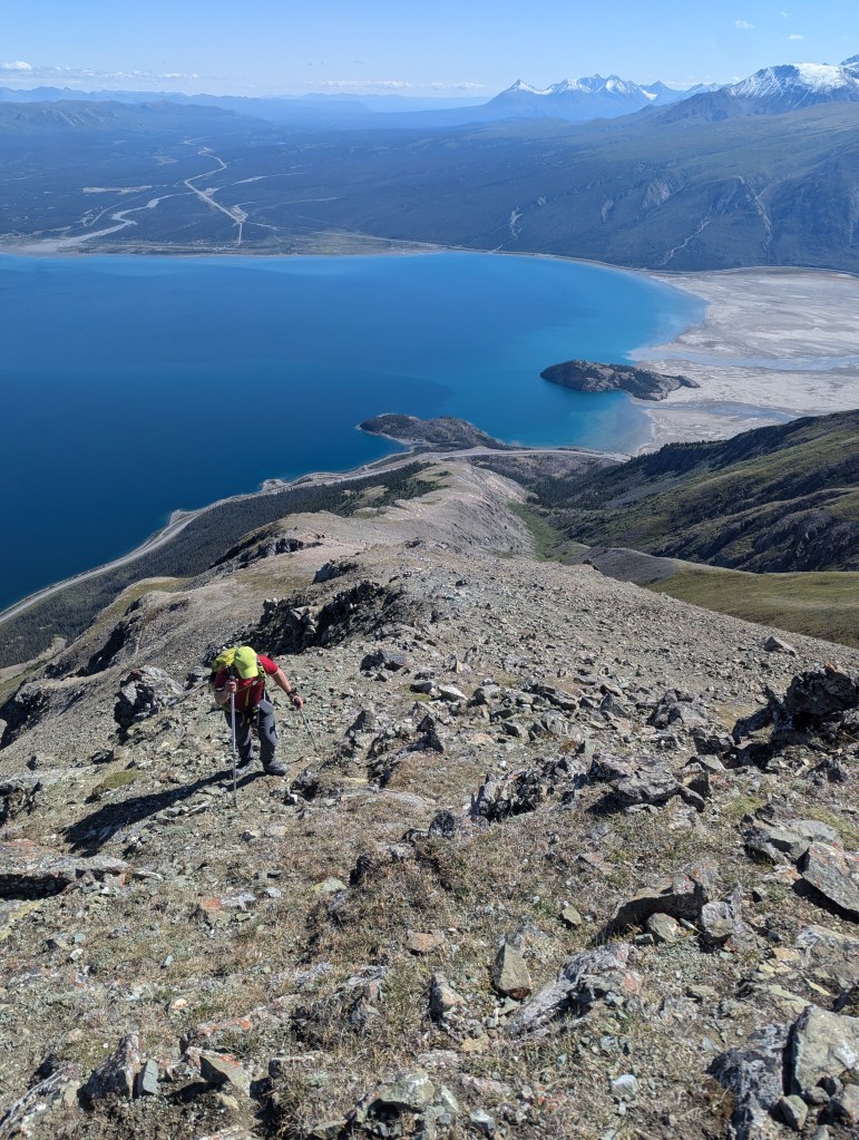
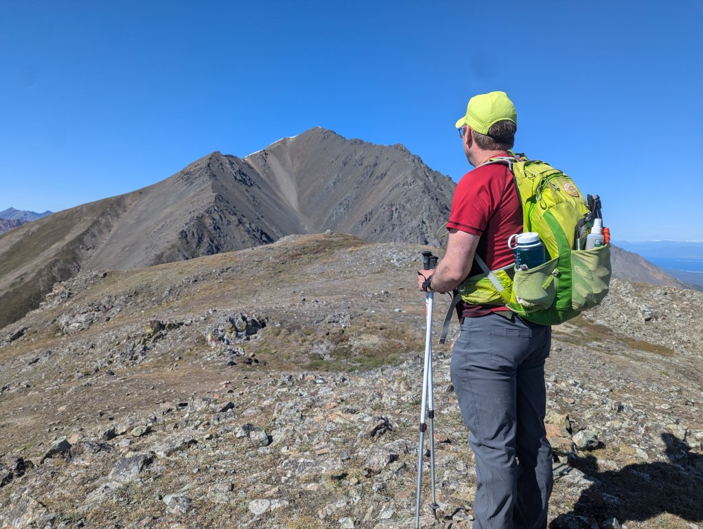
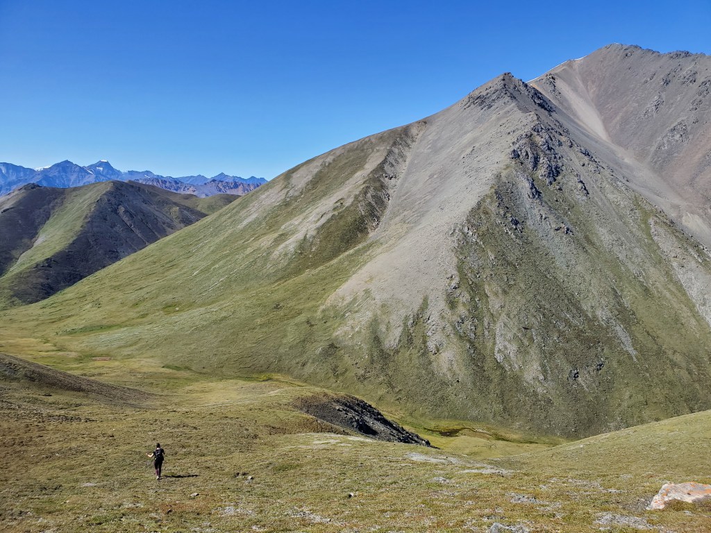
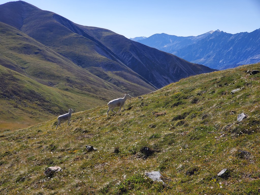
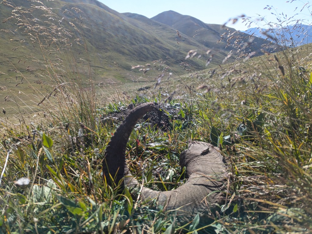
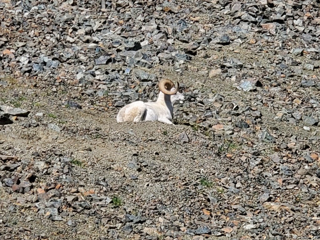
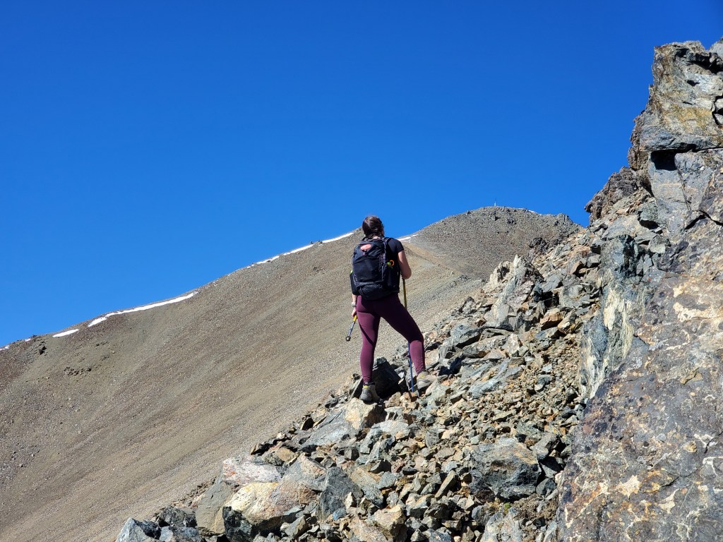
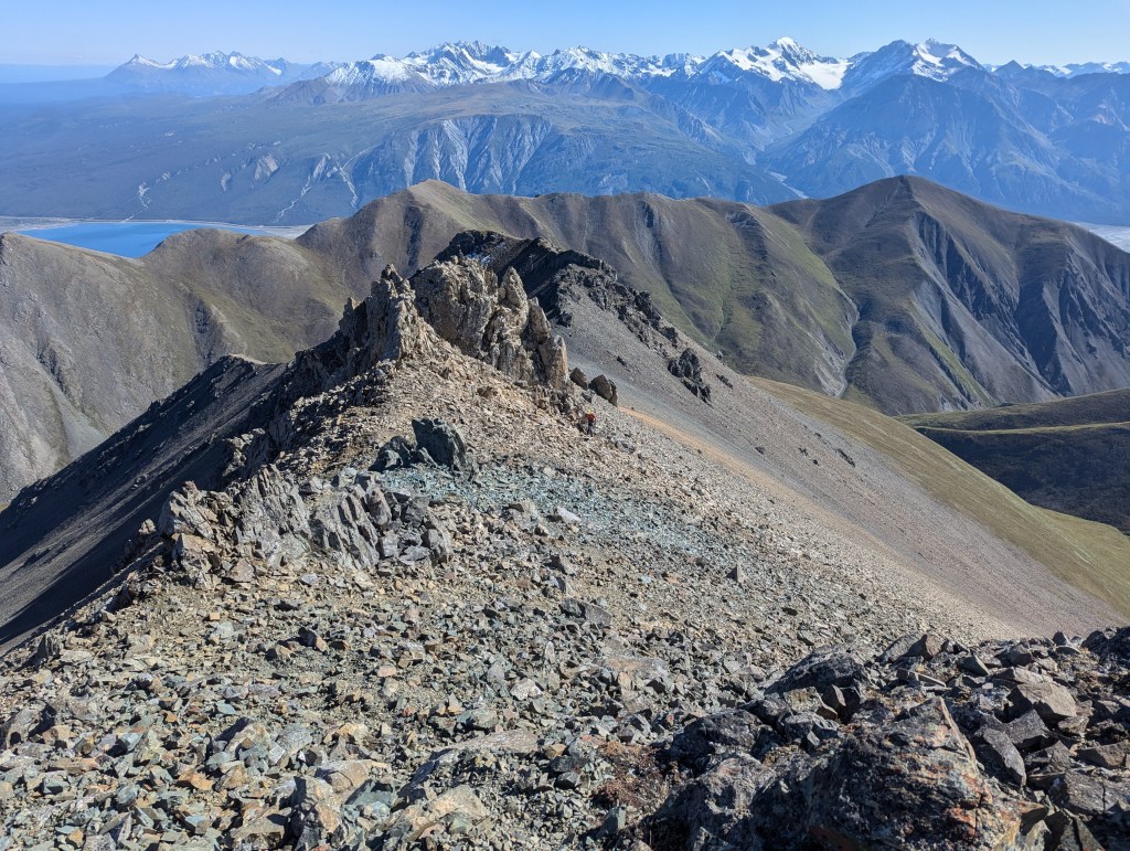
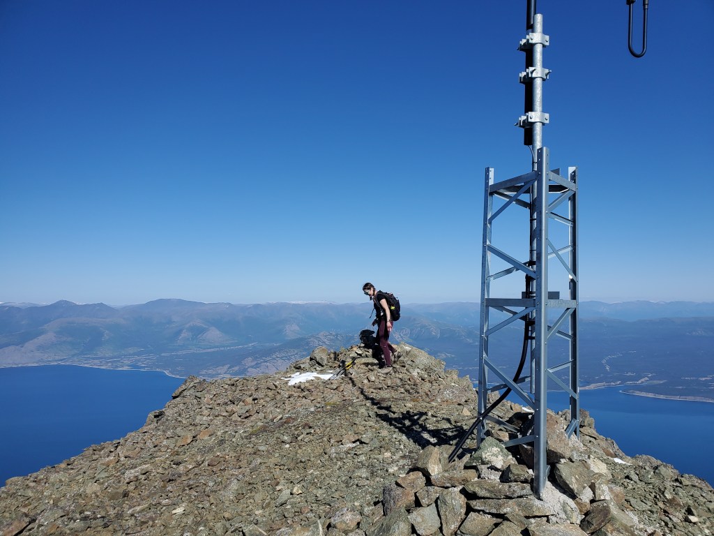
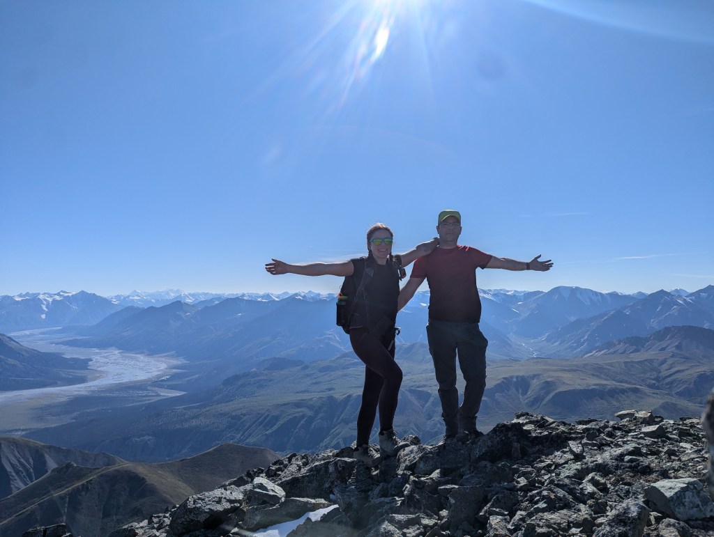
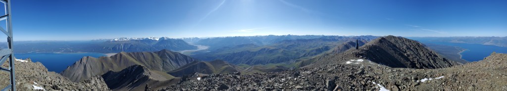
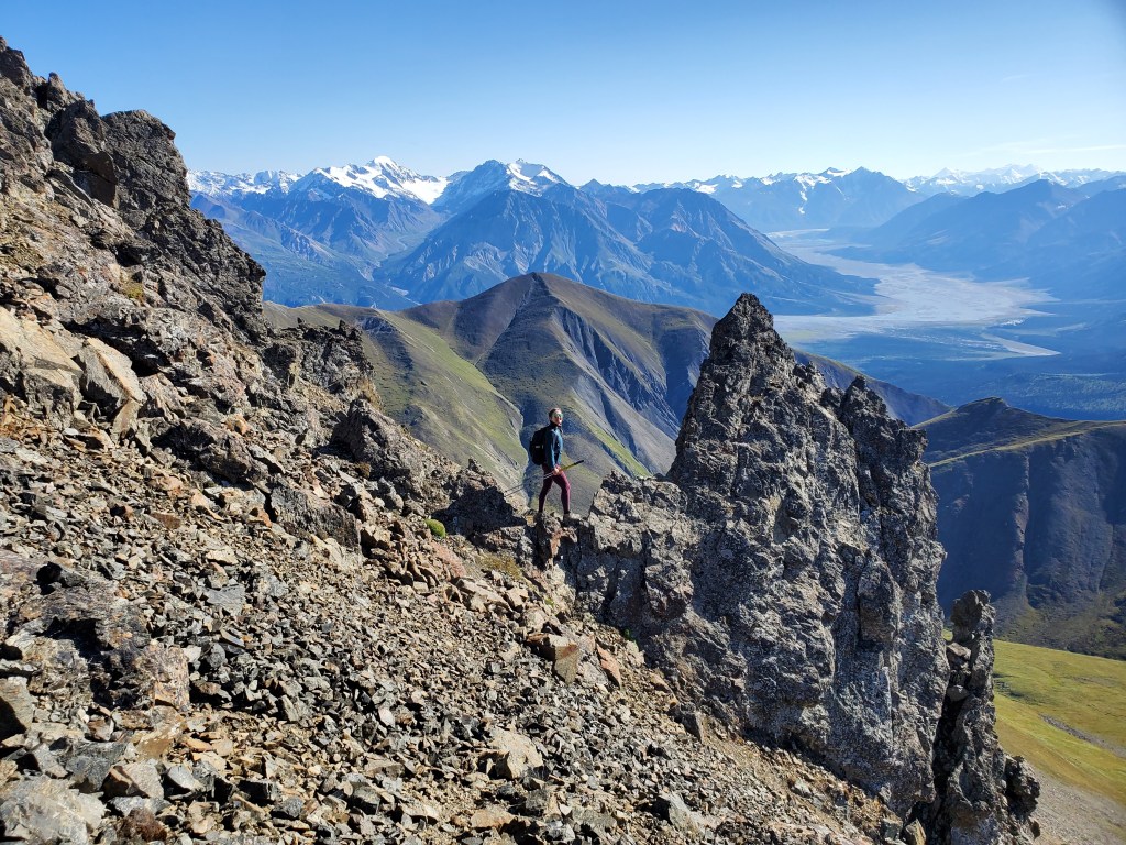
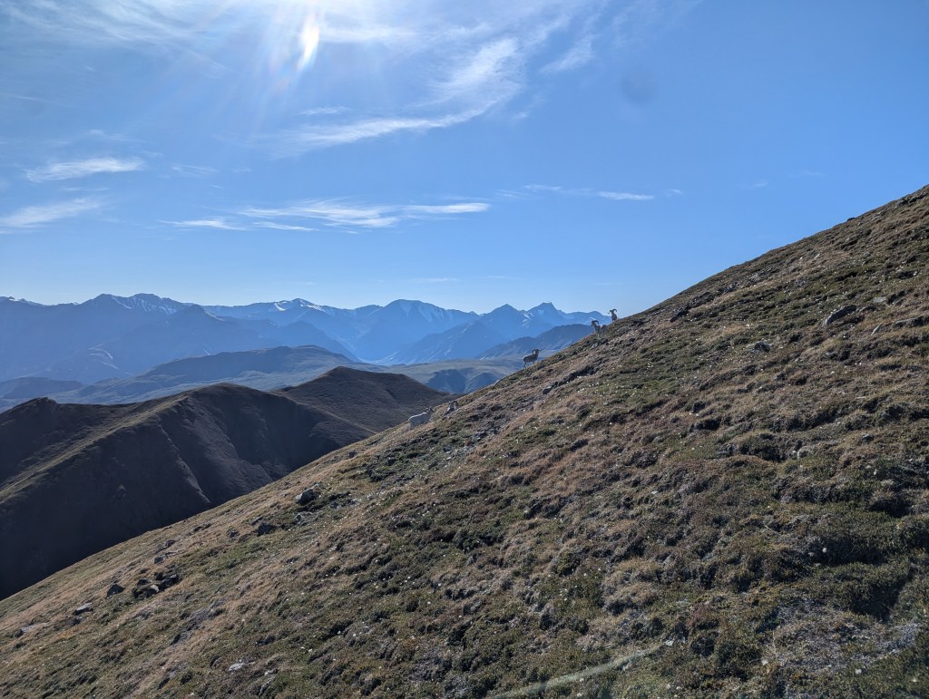
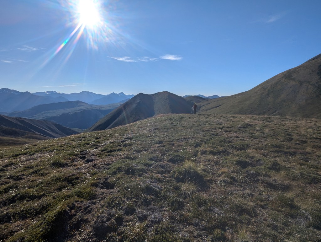
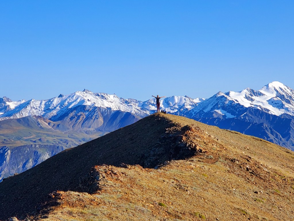
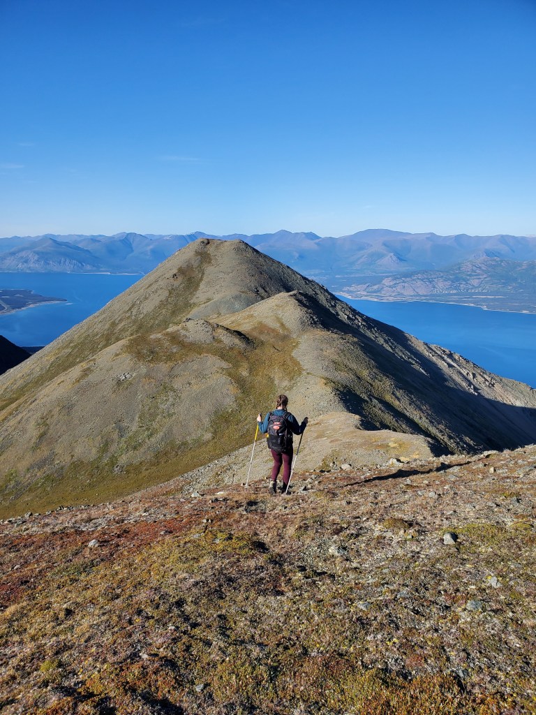
The south face of Thechàl Dhâl is closed all year, but you can still admire the Dall’s Sheep using the binoculars mounted at the base of the mountain, on the patio of the tourism center. Our route begins at the right side of this map, roughly following the line where red and yellow meet. We will detour north to Mount Wallace before returning to the yellow area and then hiking out the way we came. The first part of the trail is shared with Soldier’s Summit Trail and follows the original Alaska Highway. The modern Alaska Highway is now just to the right and below this, along the shores of Kluane Lake.We kept an eye out for our left turn off of the old highway and easily spotted this trail. There is a small attempt at a cairn marking the turn, but it’s not really needed.The route up the east side of Thechàl Dhâl follows many sheep trails, winding through short cliff bands and steadily gaining elevation.Looking back at our ascent slope, overlooking Kluane Lake.We reached the top of the ridge in 3 hrs. Rather than turning left and continuing to the peak of Thechàl Dhâl, we will first head north to Mount Wallace (center).About 250 m of elevation is lost before starting up the slopes of Mount Wallace. Spotting a large flock of sheep on the easier-looking grassy ridge at center-right, we chose to instead follow the drainage up.We were careful to follow Parks’ recommendation to keep at least 50 m away from the sheep. The sheep don’t seem to have received the same briefing; this pair easily walked up behind us on the slopes of Mount Wallace. Pictured is their get-away trot, after having been spotted.I nearly walked over this beautiful ram’s horn. Unlike antlers, horns are not shed. They grow with the sheep for life. We left this special find where it lay, for others to enjoy.The drainage was stable rock, making for easy travel. We certainly still felt the significant elevation loss and re-gain accumulated over the day though.A nearby ram, sunning while chewing his cud.Instead of gaining the summit ridge, we circled around to the back side, picking up easy sheep trails. From the top of the drainage, look for a pinnacle where the trail starts.The sheep trail avoids any difficulties along the ridge, eventually gaining the ridge just below the summit. Looking back as Dan rounds the last pinnacle.We reached the peak in 5 1/2 hours from the trailhead. The peak of Mount Wallace holds a few pieces of communications equipment. Another high point to the northwest on the mountain looked almost equivalent in elevation to this spot, but mapping indicates that this is the peak.The communications equipment proved handy for setting up my phone camera. The remnants of Ä’äy Chù (Slims River) can be seen to the left (south).Summit panorama on Mount Wallace.We returned the way we came, keeping to easy sheep trails.We descended down Mount Wallace’s grassy slopes, giving the sheep flock a wide berth. The peak of Thechàl Dhâl is to the left. Looking ahead, we spotted two large groups of sheep on the north slopes of Thechàl Dhâl and chose a line to avoid them.Our circuitous route to avoid sheep sent us towards this group of five rams. Clearly unimpressed with us, they shot us a few stern looks before joining the rest of their group.Navigating around many more sheep eventually brought us to the top of Thechàl Dhâl. Looking back at Dan, with the slopes of Mount Wallace in the background (right).We reached the peak of Thechàl Dhâl 7 hrs 20 min from the trailhead. Summit panorama from Thechàl Dhâl.Looking out over what remains of Ä’äy Chù (Slims River), the source of Kluane Lake. The river is reported to have rerouted in 2016, attributed to human-caused climate change.We returned the way we came. Our ascent slope from earlier is the ridge in profile at the right.We passed one last pair of Dall’s Sheep on our way out. This mama was surprisingly patient with her not-so-little-lamb’s assertive feeding and head-butting.
We returned to the Soldier’s Summit trailhead in 9 1/2 hrs. The Mount Wallace add-on added about four hours to the day. If doing Thechàl Dhâl only, I would allow 5 1/2 to 6 hrs. This was the only good-weather day of our too short trip and we left satisfied to have made the most of it. We fell asleep dreaming of all of the remaining peaks we will visit on future trips to the Yukon.


wow what an adventure – I’ll try and get up here sometime – thanks for sharing
LikeLiked by 1 person