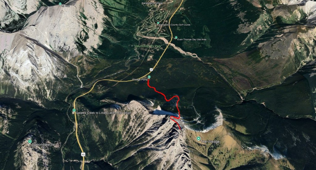
The Wedge is an eye-catching peak just south of Kananaskis Village on Highway 40. There is only one section of difficult scrambling, but the exposure is very real. The route is true to the grade.
2024 was a busy year, but thankfully an unseasonably warm September gave Shanna and I one last chance to squeeze in a trip together. The route starts from Wedge Pond, which has a good sized parking lot and outhouses. The pond grew quite busy in the afternoon, but it was nearly empty when we parked at 10 AM.
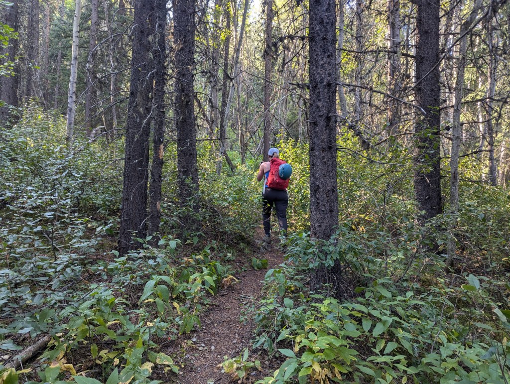
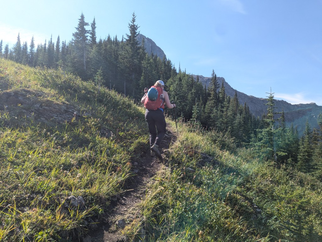
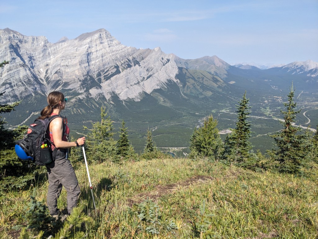
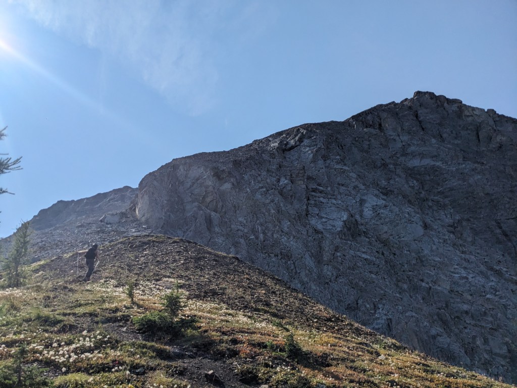
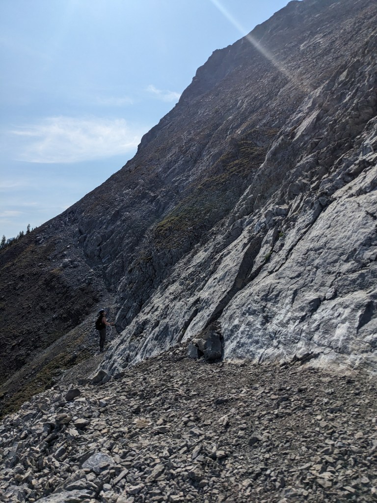
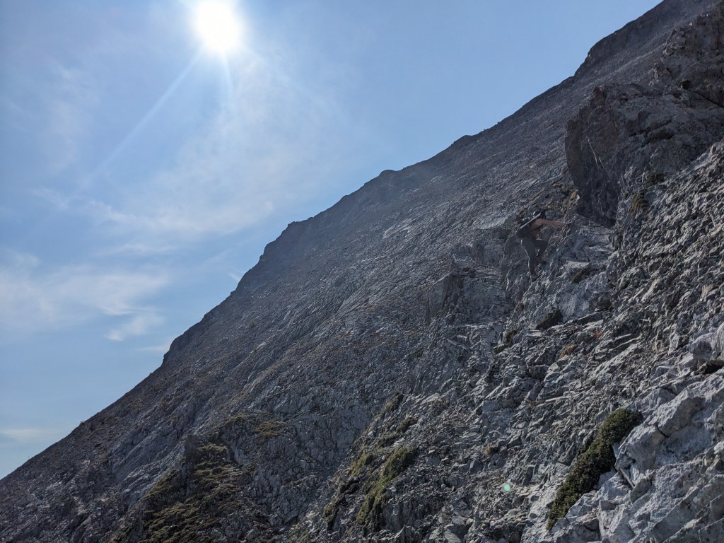
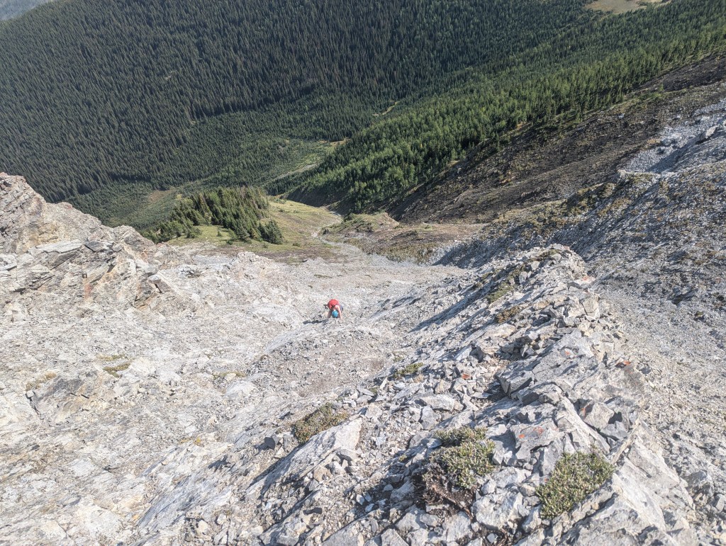
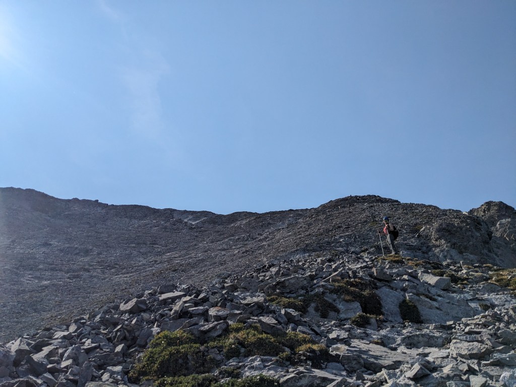
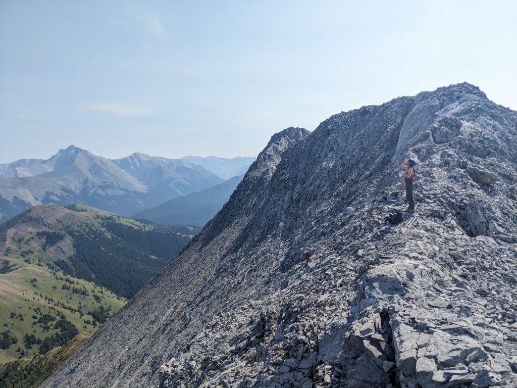
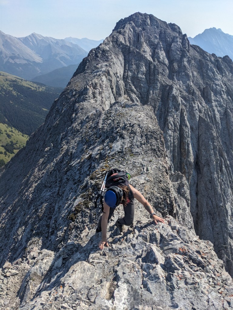
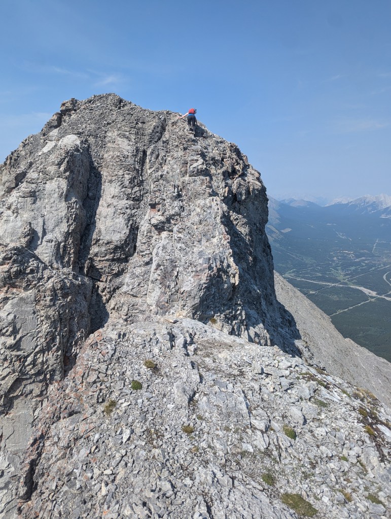
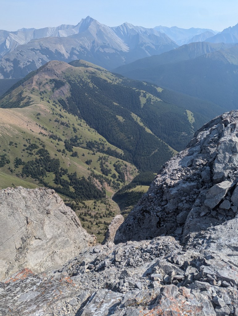
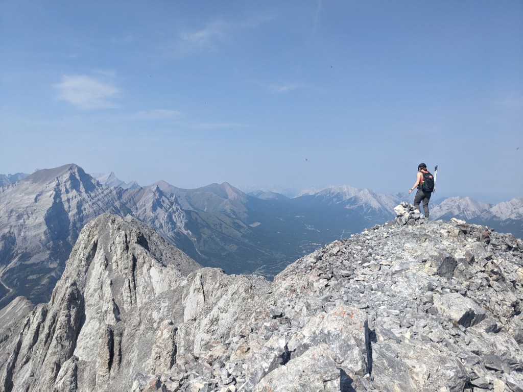
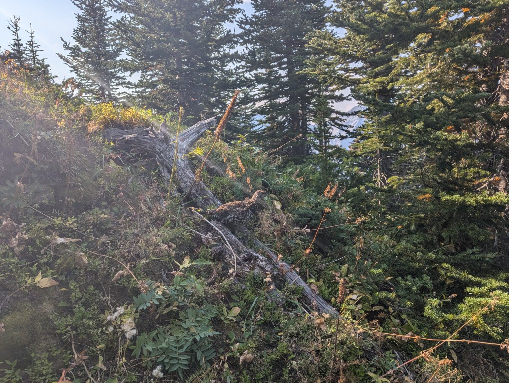
A few trails branch out from the east side of the parking lot and GPS mapping was handy for starting out on the correct one. Once on the obvious trail, the rest of the way was intuitive.The first hour is spent on a steep trail up through forest, gaining 500 m of elevation. Beyond this the trail eases slightly as it curves around to the right. Ahead, The Wedge begins to come into view (center-left). To the right is Limestone Ridge.Looking back across Hwy 40 at Mount Kidd and Kananaskis Village.We reached the base of the rocky slope in 2 hrs 20 min, having already gained 900 m of elevation. The final 200 m of elevation gain will be much slower progress, however.Many possible lines exist up the rocky slope and we picked a line starting just to the right of a small gully, roughly where I am standing. The start is a bit steep, but it eases further up and the scrambling is never beyond moderate. All lines looked to trend to the right eventually, ending on an easy trail at the top.Starting my way up the slope (right, wearing grey). I had hoped this slope would benefit from “the Kane effect” and be worn smooth by now, but there was still plenty of loose rock. A helmet is a must.Looking back at Shanna. Our ascent line came up through the patch of trees at the left.Near the top the slope eased and a good trail formed.The summit ridge is fairly short, but holds plenty of good, fun scrambling on interesting features. The crux is reached a few minutes in. But first, snacks.Looking west across The Fortress, Mount Galatea, and many other popular Kananaskis peaks.Reaching the top of the crux and studying the route down. The peak can be seen just ahead.Beginning the downclimb of the crux. The line is exposed to both sides, particularly the right side of this photo, but it didn’t feel sketchy. I took my time, tested holds, avoided the loose ones, and moved through with relative ease.Looking up as Shanna begins to downclimb the crux. The climb is foreshortened from this angle and is probably closer to 45 degrees.The rest of the ridge is a fun ridge walk. This photo is looking back at Shanna and the way we came.The final push to the summit is an easy walk up a scree ramp. We reached the peak in 4 hrs.Summit panorama.Looking east to Fisher peak.The healthy population of summit flies took a liking to me, in particular, and I hastily retreated back to the ridge. The crux can be seen at the left side of this photo. The exposure is better appreciated from this angle.We returned the way we came, again taking in the fun scrambling along the summit ridge.We stumbled upon a group of ptarmigans on our way out. They certainly have a knack for camouflaging in with their surroundings, when they’re not sitting on the trail directly in front of you, of course.
We made it back to the parking lot in 6 hrs 40 min. By this point in the afternoon Wedge Pond was bustling with picnickers, paddle boarders, and everything in between. Still having a long drive ahead of us, we skipped the crowds and set off for home. The Wedge is a fun scramble. I would recommend it to a friend experienced on moderate terrain that wants to venture out of their comfort zone a bit. The views are about the same from the north and south summit, so it’s no real loss if someone decides the crux isn’t for them.
Looks like perfect weather and a great day. I liked this one for the view of Fortress and Mt Kidd. It has challenging moments i guess but too much loose rock. Then again all of them do! Good get


Looks like perfect weather and a great day. I liked this one for the view of Fortress and Mt Kidd. It has challenging moments i guess but too much loose rock. Then again all of them do! Good get
LikeLiked by 1 person
Agreed, the ramp up is so loose!
LikeLike