Notes: Kananaskis Conservation Pass Required. Avalanche terrain when snow is present.
Approximate route, hand sketched for information only.
Trip Report
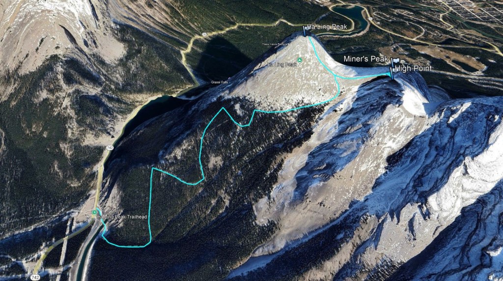
After months of recovering from an ankle injury, I was itching to get out scrambling. Thanks to trail improvements in 2019, the wide trail up Ha Ling is now quite stable for ankles. A warm February day with a low avalanche forecast offered me an opportunity to get in a quick lap! Before heading out on the trail though, there is an opening about half a kilometer further down Highway 742 where one can get a look at the upper slopes on Ha Ling to ensure they are snow-free. The trailhead itself starts from the Goat Creek parking lot, the same parking as for the East End of Rundle (EEOR). The lot is fairly large, with outhouses, but does tend to fill up in summer.
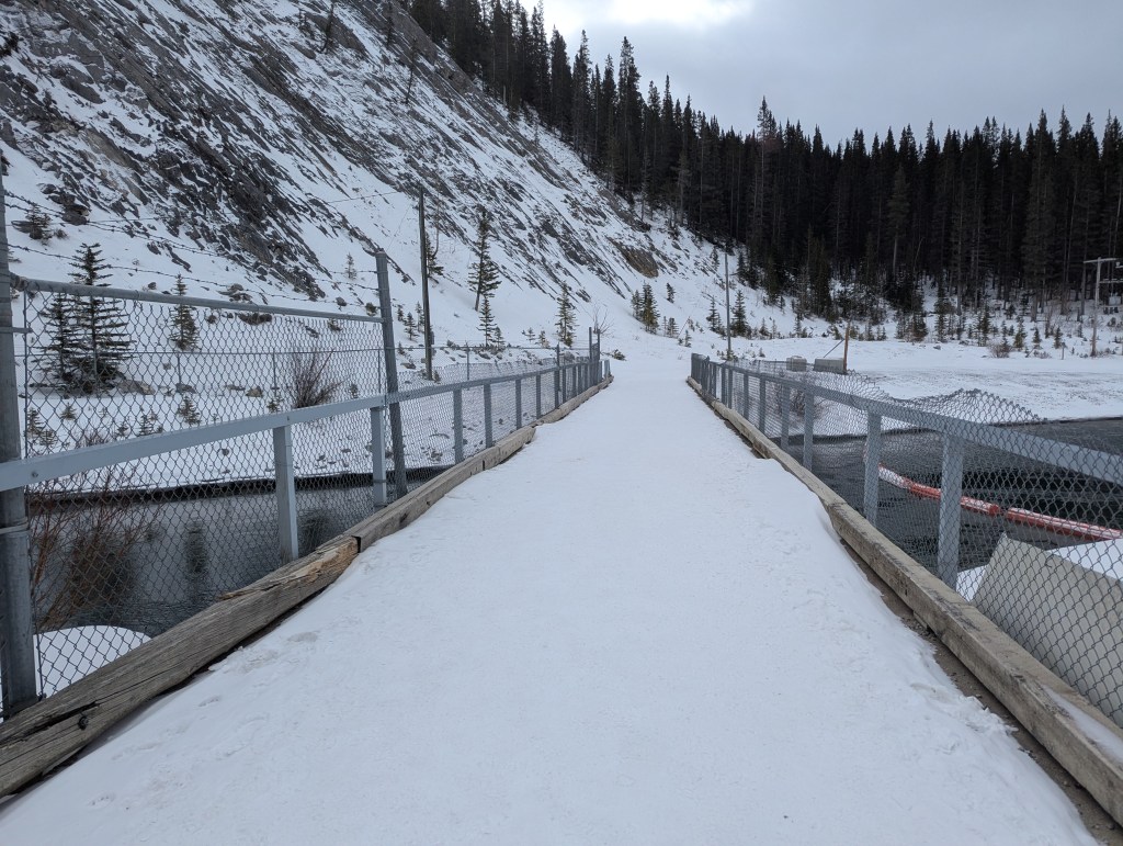
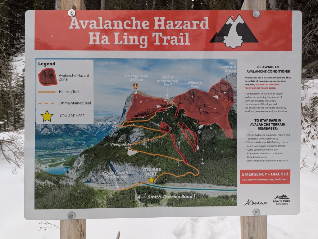
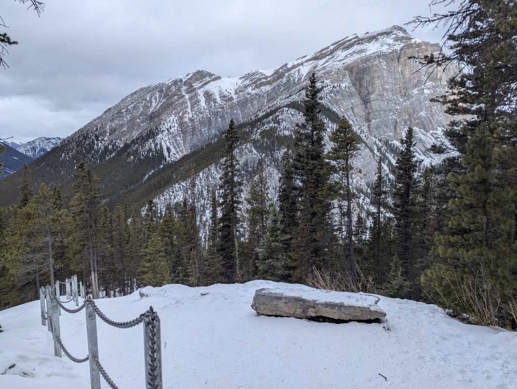
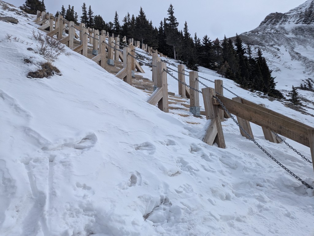
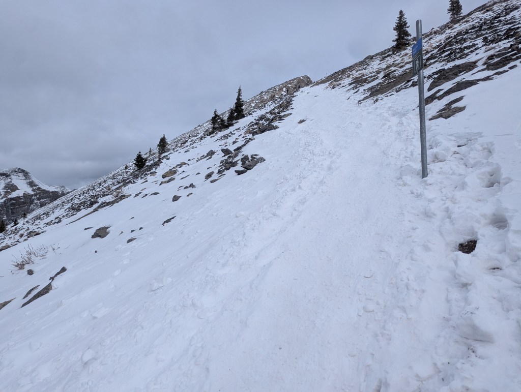
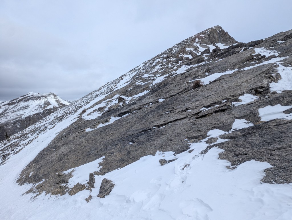
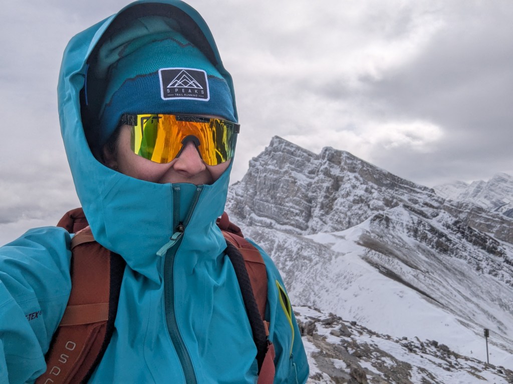
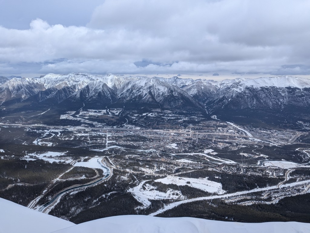
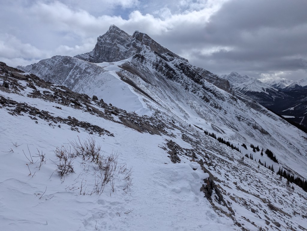
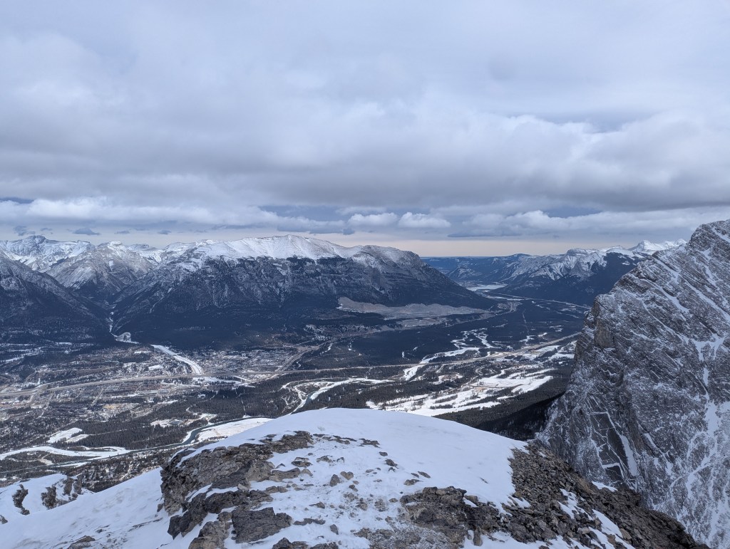
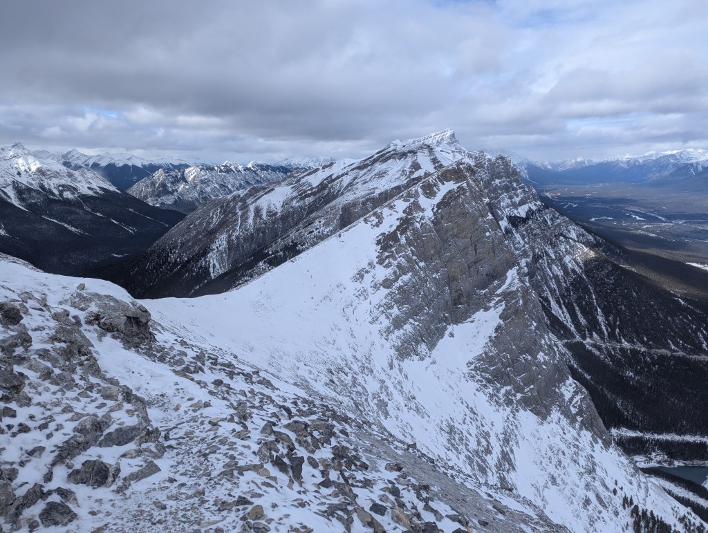
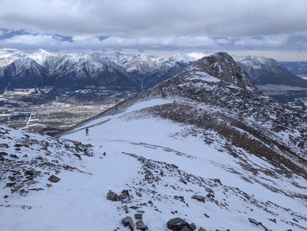
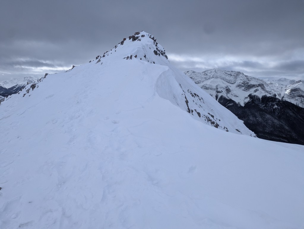
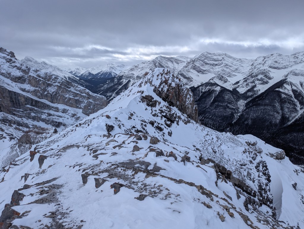
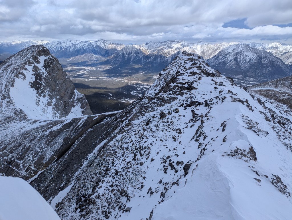
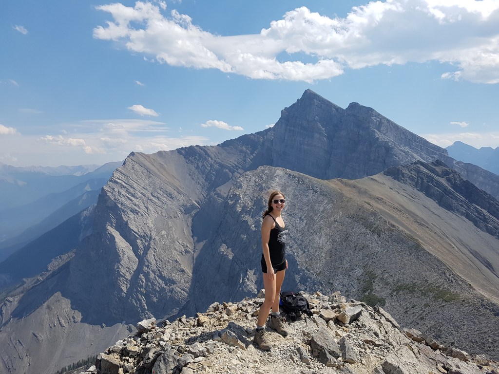
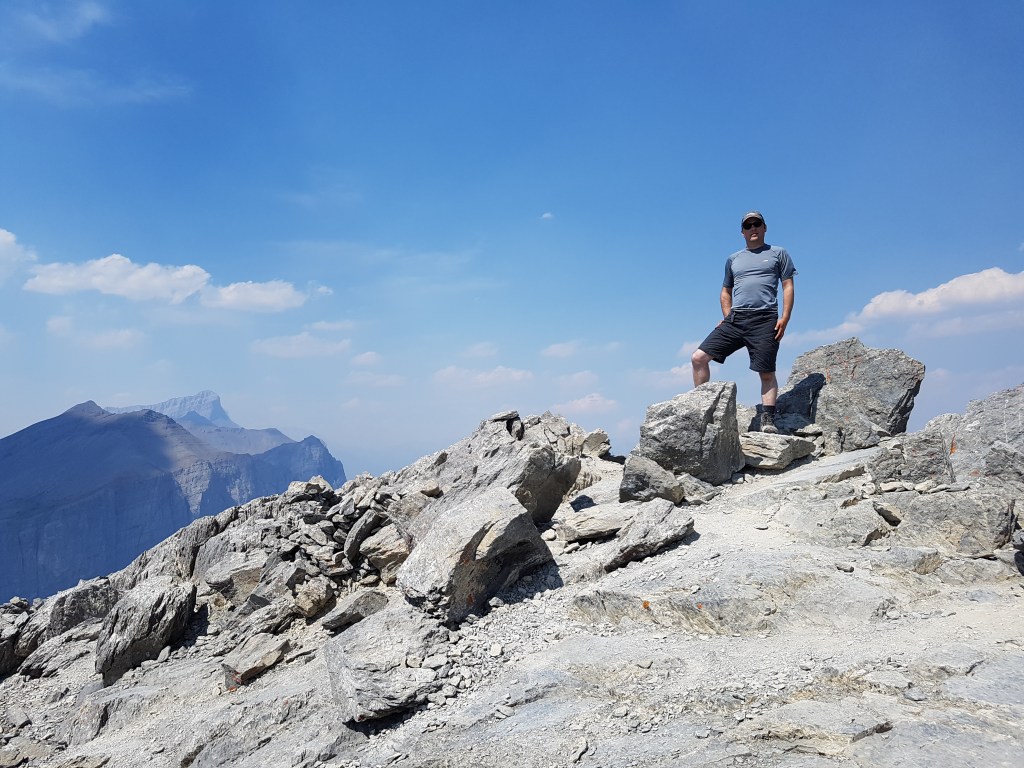
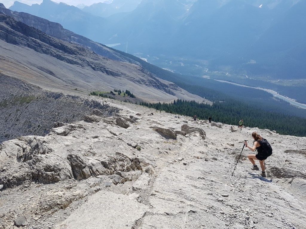
After crossing the highway and walking up a gravel driveway, the trail crosses a small canal before turning into the trees.Alberta Parks has added this informative sign where the trail turns into the trees, highlighting exposure to overhead avalanche terrain along the trail.Recent improvements to the trail include this charming rock bench at a viewpoint overlooking EEOR.Prior to the improvements, the upper slopes on Ha Ling had some trail-braiding and loose rock. This stair case (or cable ladder) now provides easier travel up on one obvious line.Approaching the col between Ha Ling and Miner’s Peak, the upper slopes were mostly snow-free. The supportive, frozen terrain actually made for very easy travel!Ha Ling Peak can be seen just ahead. The wind was painfully cold on this day, as is often the case on this peak. On a windless day in summer I would expect these slopes to be bustling with hikers, taking their time enjoying a snack while feasting on the views from the top. Today, however, I only saw a handful of other groups, and no one stopped for a snack break.I reached the top of Ha Ling Peak in about 1 hr 40 min. Kane lists this peak as 2408 m, however my GPS watch measured it to be ~2460 m. In the background, Mount Lawrence Grassi stands above Miner’s Peak. I grabbed a quick selfie before returning to the col – and, I am smiling.Looking across the Bow Valley at the snowy peaks surrounding Canmore.The route to Miner’s Peak from Ha Ling follows the col, requiring care to avoid the cornice to its left and the overhead avalanche hazard to its right. The named high point on Miner’s Peak is to the left, but higher points on the right also make for popular stops. A good trail was already broken on the day I went out and I was lucky enough to spot another group starting up just ahead of me. The ridge to the named peak on Miner’s Peak felt particularly narrow on this windy day. To the East, Grotto Mountain (center) dominates the view across the Bow Valley.Looking back the way I had come. Ha Ling Peak is the high point directly ahead (northwest), with several of Rundle’s peaks visible further back.The wind kept me from lingering at the named peak and I promptly made my way onward to the high point on Miner’s Peak. This shot is looking back as the other group makes their way up the named peak.Starting up the route to the high points. The first part was quite snowy, but thinned out upon gaining the ridge.Pausing along the way for a shot along the ridge, with Mount Lawrence Grassi in the background. I look happier in this photo, no?There were two high points close together and I tagged both. This second one (pictured) was a bit scrambly, at least with snow present, and I’m not convinced it was any higher. To keep the grade at hiking, this one should be skipped.Looking back at the previous high point, it looks just as high. My GPS watch measured them both to be ~2470 m, roughly 10 m taller than the named peak.
Having had my fill of this windy day, I made my way back to the col, and then returned down the Ha Ling Peak Trail. I made it back to the parking lot in just under 3 1/2 hours. The detour over to Miner’s Peak accounted for about 45 min of the day.
Appendix
A few photos from July 30, 2017, prior to trail improvements and in snow-free conditions.
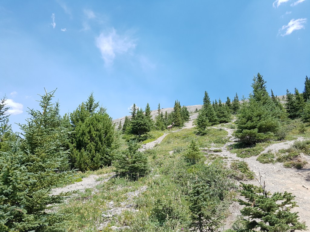
A lonely goat stands in a clearing near the upper slopes. Some trail braiding can be seen in this photo, which hopefully will be lessened now thanks to the trail improvements.Looking southeast from Ha Ling Peak, the named peak of Miner’s Peak is just above my head and the high points are to the right. The tallest peak in the background is Mount Lawrence Grassi.Looking northwest to EEOR and other high points on Mount Rundle.Returning down Ha Ling Peak. This extremely popular objective has several trails zig-zagging across the upper slopes, making what would normally be a scree slope fairly easy and never more than hiking.


One thought on “Ha Ling Peak (2408 m) and Miner’s Peak (~2450 m)”