Notes: Kananaskis Conservation Pass Required. Can be accessed from the Ha Ling trailhead or the Ship’s Prow trailhead (identified below as an Alternate Start).
Trip Report
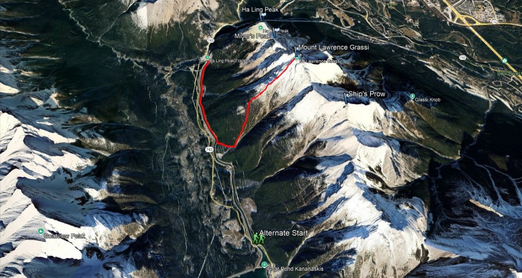
Mount Lawrence Grassi is the highest peak on the Ehagay Nakoda massif, which also boasts the popular objectives of Ship’s Prow, Ha Ling, and Miner’s Peak . It is worth noting that there is no easy scramble route traversing all four peaks, though more technical routes have been reported by others. The turn-off to the trail directly ascending Mount Lawrence Grassi is separated from the highway by a canal, but can be accessed by a walk or bike in from either side – it’s roughly 2.5 km either way. We chose to start from the Goat Creek parking lot, which is the Ha Ling trailhead.
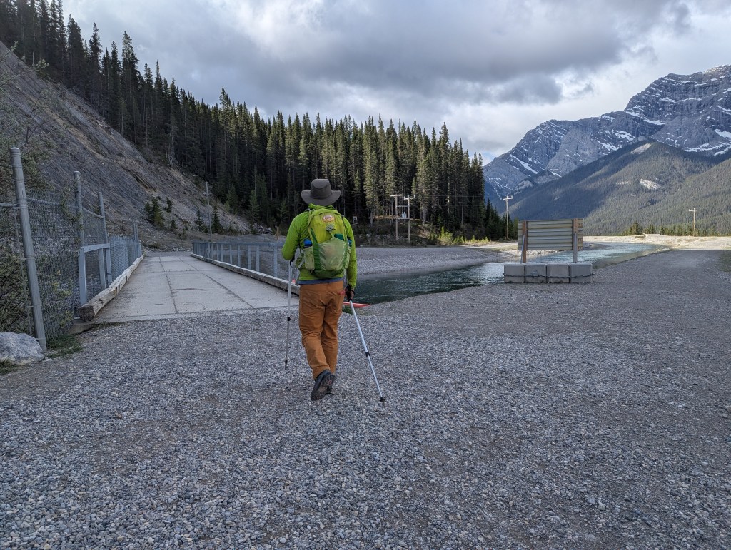
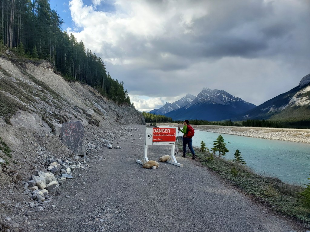
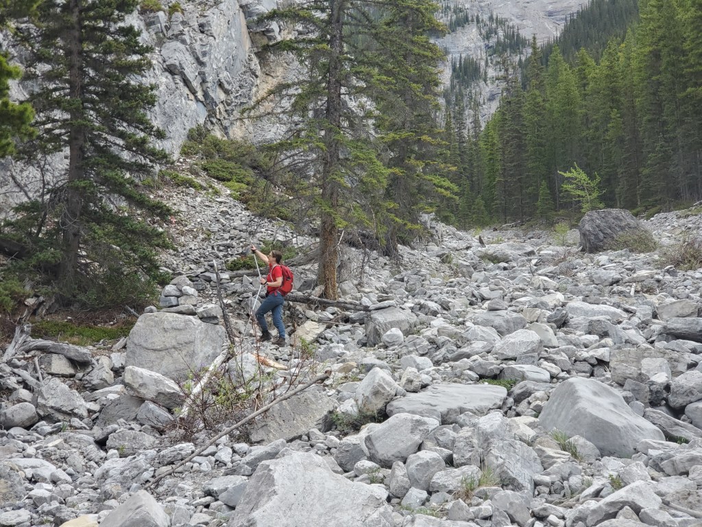
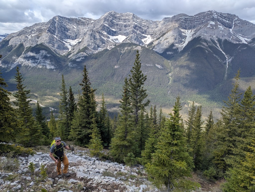
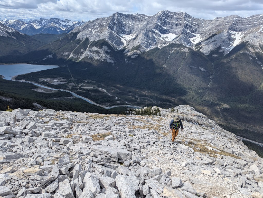
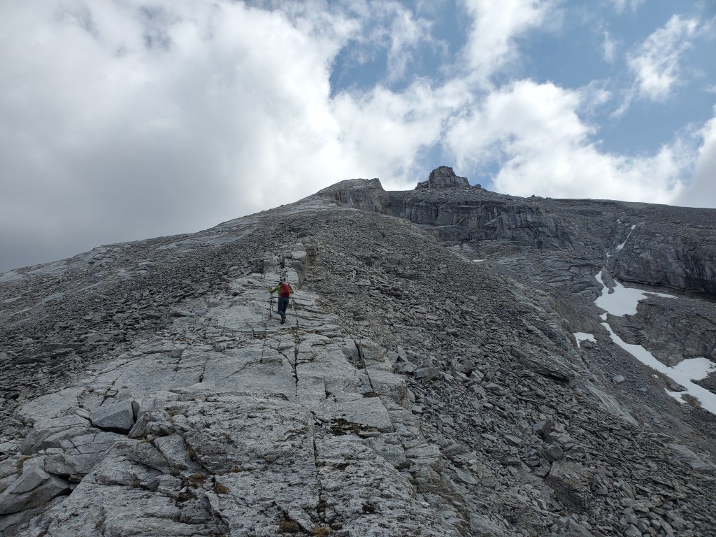
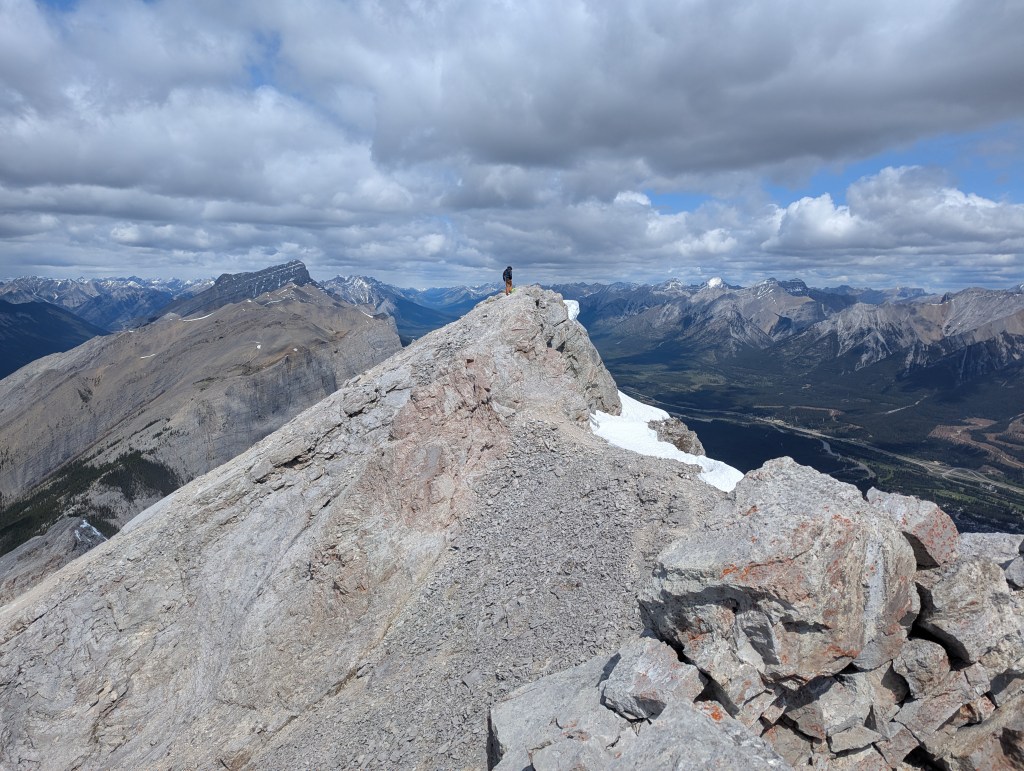
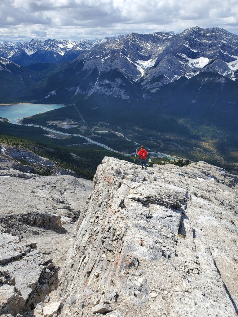
The first 200 m of the approach is shared with Ha Ling, but where the Ha Ling trail turns into the trees after crossing the bridge ahead, we continued along the far side of the canal.A portion of the road along the canal was barricaded off due to rockfall hazard. This section could be avoided by beginning at the alternate start.We reached the turn-off 30 min from the trailhead, exactly as Kane indicated. My GPS watch measured this point to be 2.3 km in, rather than the 2.5 km expected, but this may just be my watch. The trailhead was marked with a small cairn and one piece of flagging tape. The more obvious landmark to look out for, at least as of 2025, is the concrete blocks barricading the road with signage indicating rockfall hazard. Hiking in from the Ha Ling trailhead, the turn-off is just past the end of the closure.A good trail led up through the trees for 10 min before meandering over to this nearby drainage. We hiked up this drainage for only 3 min before a sea of cairns alerted us to look for the trail, which turned back into the trees here to climber’s left. Once this turn was made, the rest of the navigation was completely straight-forward along well worn trail marked with occasional cairns and flagging.We continued up, zig-zagging through the trees on a good trail and gaining elevation quickly. Views of Goatview Peak to the west opened up behind us as we neared tree line.Above tree line the terrain became more slabby, but was never beyond easy scrambling to the peak. The summit block ahead at center is the south summit. The less prominent block to its left, which looks lower from this angle, is the peak.Looking back over Goatview Peak and Goat Pond (left).The steep grade for the final portion felt relentless, particularly with the dusting of loose gravel on slab, but only ended up taking roughly 30 min. The south summit (right) continues to appear deceptively as if it is the true peak!We reached the peak in about 3 hrs and were even welcomed with warm, sunny skies. I took a detour of a few minutes to scramble over to the south summit. This detour was the only moderate scrambling of the day and is completely optional. My GPS watch measured this point to be about 5 m shorter than the peak, but that difference is within the error margin of my watch, so take it with a grain of salt.Looking back at Dan from the south summit as he stands on the peak. The peak looks visibly taller from the south summit.We returned the way we came. The spot shown here was the narrowest portion of the route and I didn’t find it bad at all, definitely only easy scrambling.
We made it back to the parking lot in 5 hrs 20 min. Kane grades this as a moderate scramble but I never found the scrambling to be beyond easy, with the exception of the optional south summit. Perhaps this is a historical grading and the route has changed, but as of 2025 I am grading this as an easy scramble. Mount Lawrence Grassi offers a nice alternative to Ha Ling Peak with almost the same views, but without the crowds and stair cases – a fine choice for a shorter day out!
A great hike (better than Haling) and I agree with your rating except if there is snow or ice on the crux (narrow slopped slab near the summit. I can personally confirm in those conditions it is harrowing and dangerous. An ice ax or spikes are useless on the slab. Avoid this peek if there is snow or ice near the summit. Have you been up Middle Sister via the Orphan?
Agreed, planning for a mountaineering objective in winter is sage advice for nearly any mountain in the rockies. Middle Sister is still on my to-do list!


A great hike (better than Haling) and I agree with your rating except if there is snow or ice on the crux (narrow slopped slab near the summit. I can personally confirm in those conditions it is harrowing and dangerous. An ice ax or spikes are useless on the slab. Avoid this peek if there is snow or ice near the summit. Have you been up Middle Sister via the Orphan?
LikeLike
Agreed, planning for a mountaineering objective in winter is sage advice for nearly any mountain in the rockies. Middle Sister is still on my to-do list!
LikeLike